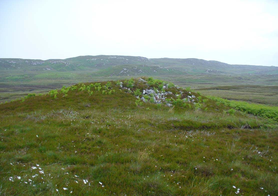
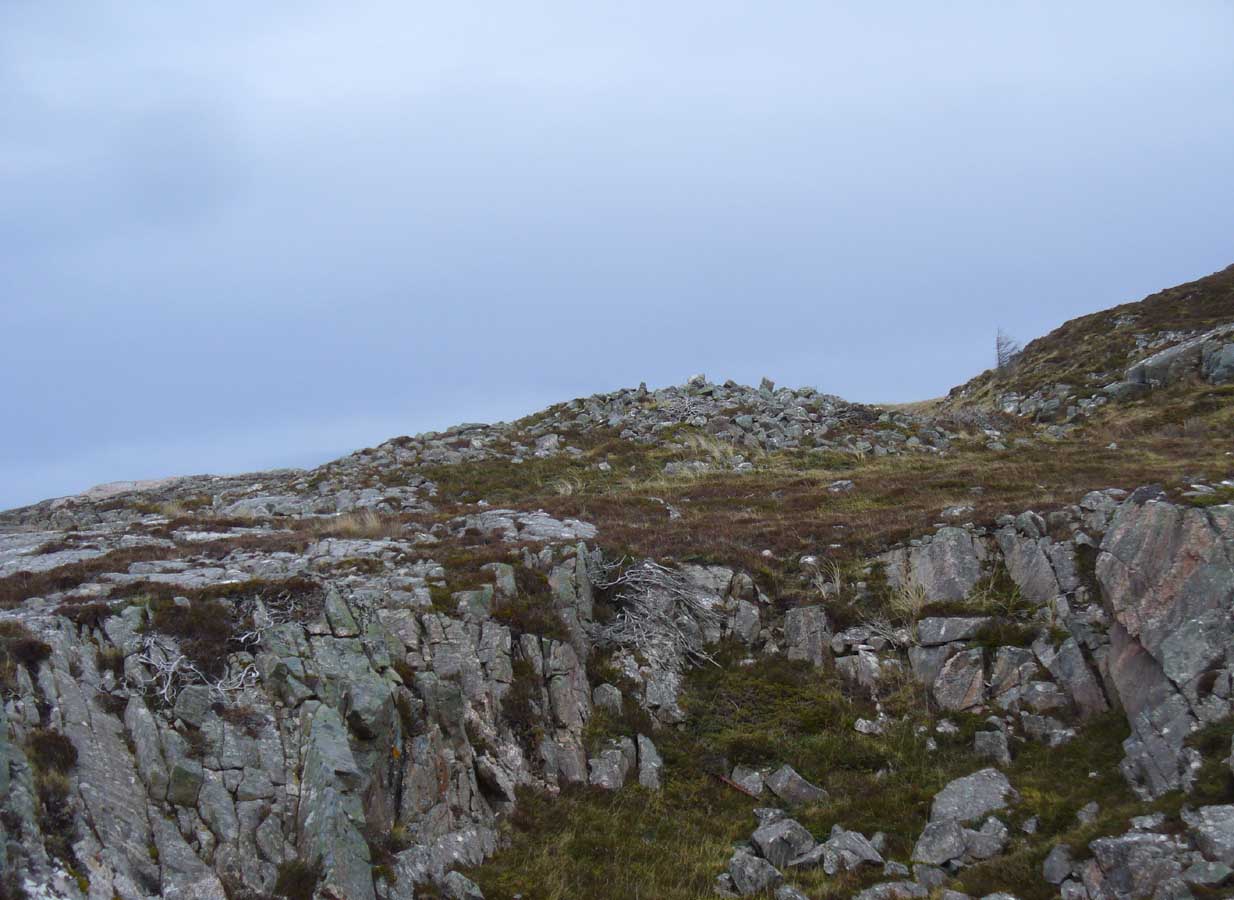
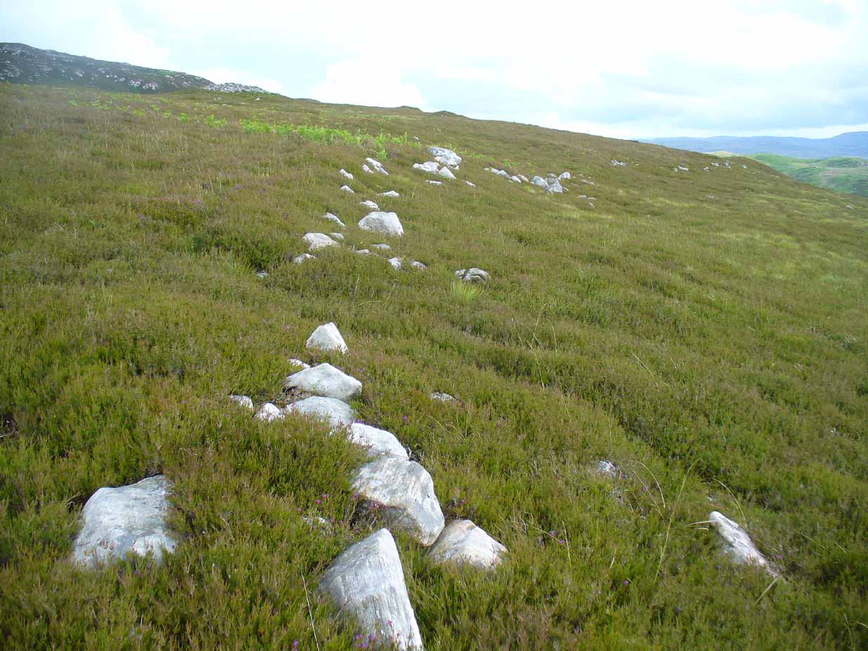
Along the A836 road a mile east of Bettyhill, a track goes south onto the moors just before Loch Salachaidh. Walk along here for several miles, past the windmills, past a small quarry on your left, and a hundred yards or so along, to the right of the track, you’ll notice a rounded hillock covered in stones and rock on the top (aswell as bracken in the summer and autumn). That’s the spot!
Archaeology & History
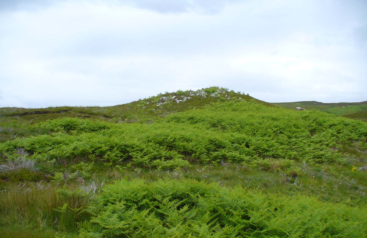
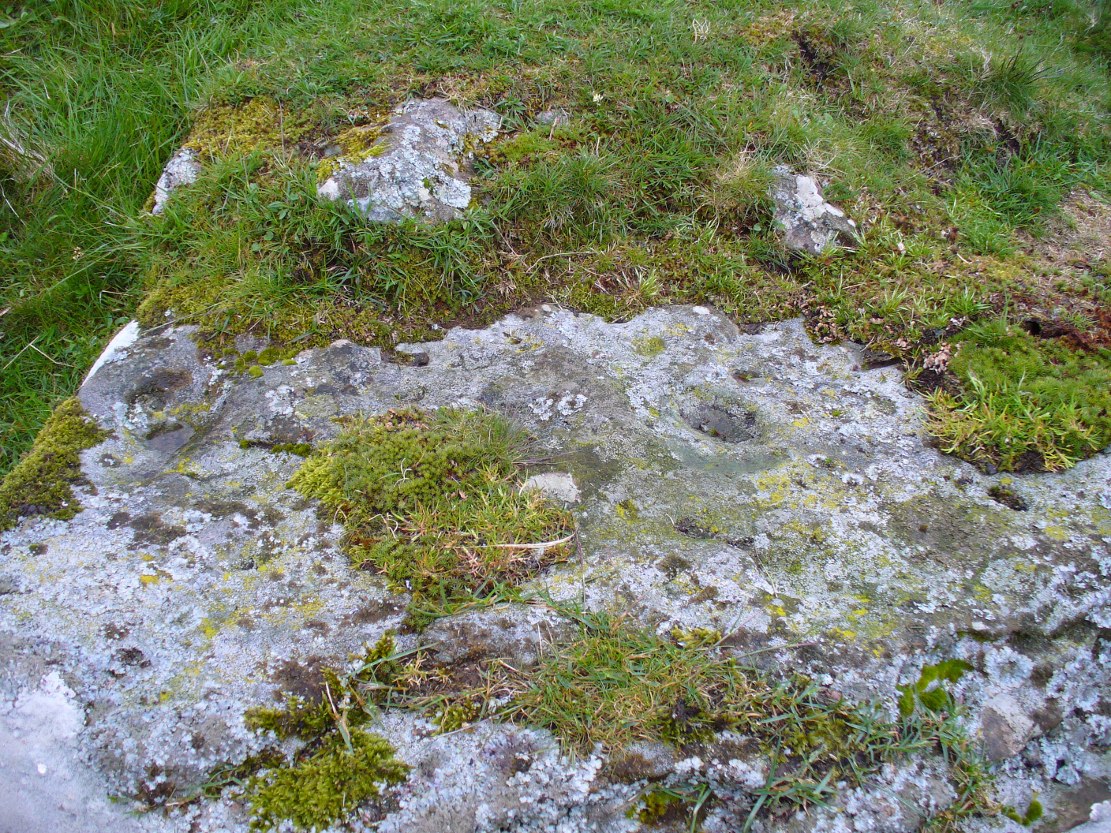
Achadh Thaibstil cairn
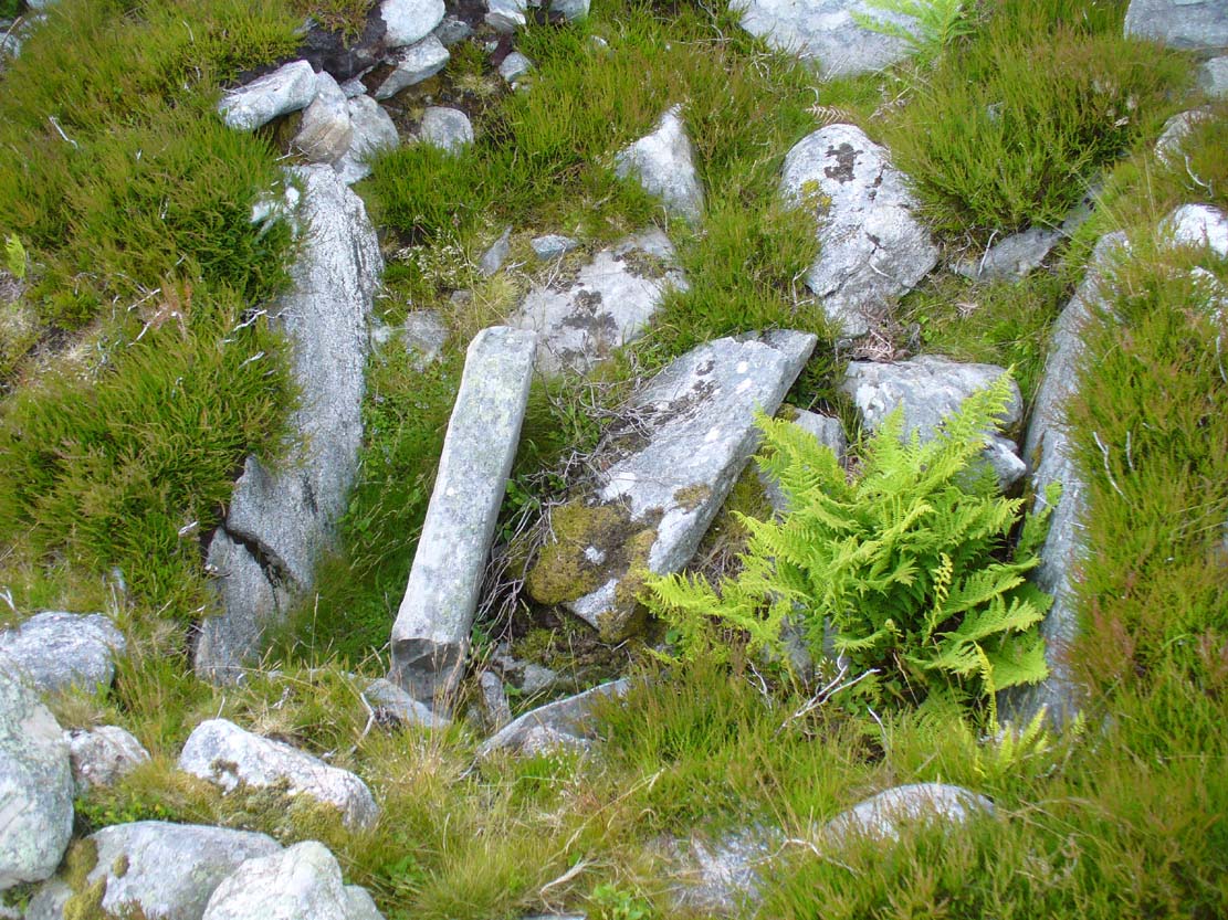
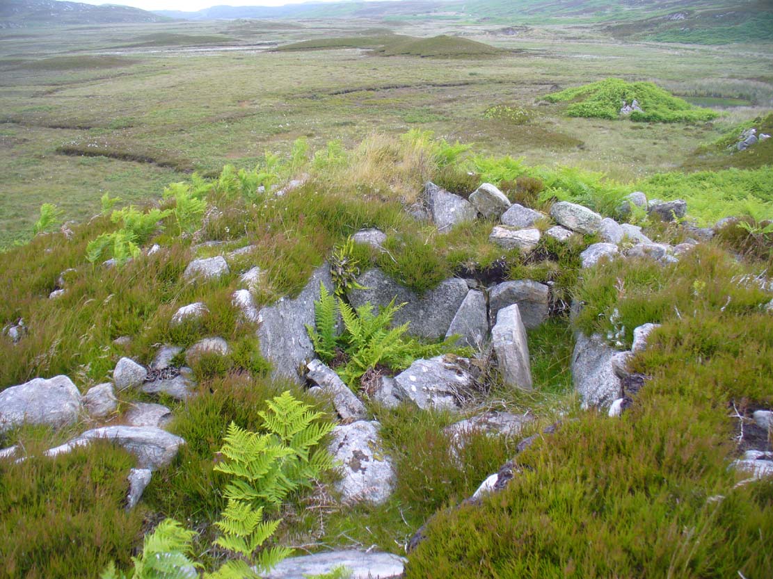
This little-known cairn, close to the prehistoric hut circles on the other side of the track, is a medium-sized Neolithic or Bronze Age monument. Not included in Audrey Henshall’s (1995) survey of the region, the tomb was built upon a small natural rise with the usual thousands of small and medium-sized stones rising up 4-5 feet high. Near its crown we find an exposed chamber, typical of chambered tombs, measuring more than a yard across and two yards long, with flat slabs defining its sides. It appears that the inner ‘chamber’ may have been split into two sections, as an oblong slab of stone runs parallel down the central ‘chamber’ a third of the way across. The Canmore account simply tells how the cairn is on low knoll and
“measures about 10.5m in diameter and 1.0m high. It has been opened and a centrally placed slab lined cist revealed, the southern side of which is missing. The cist measures 1.4m east-west, with the east and west slabs 1.2m long and 0.6m high.”
Looking down into the chamber
From the chamber, looking N
On the horizon to the far north, the peak of the giant tomb known as Fiscary 2 rises up, indicating the cardinal direction. This may have had geomantic significance, as ‘north’ signifies Death and darkness: the symbolic point where light never emerges; the point linked to the North Star, Alpha Draconis in the neolithic era, or Polaris in our present Age: the point to and from which shamans travel into the Land of the Gods. These elements may or may not have been relevant here.
References:
Henshall, Audrey S. & Ritchie, J.N.G., The Chambered Cairns of Sutherland, Edinburgh University Press 2005.
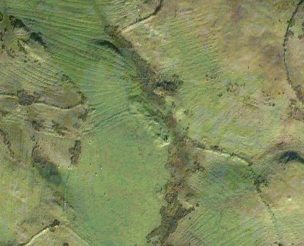
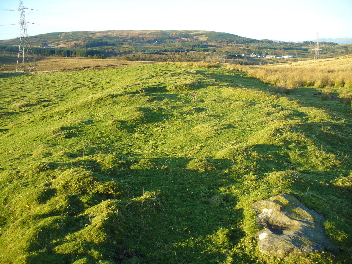
Take the A809 road several miles north out of Glasgow, between Bearsden and Drymen. Once out of the suburban sprawl, passing Milngavie, you’re heading to the famous Carbeth hutters. Before this, note the gold course on your right (east). Park here and cross the road where a gate and overgrown footpath takes you onto the grassy hills. Keep to the fence-side for about 700 yards until it veers downhill. Don’t walk downhill! Keep in the same direction into the short grasses and, veering gradually left, downhill for a couple hundred yards ahead and, across a small boggy area, you’ll note some large upright stones in front of a mound. That’s it!
Archaeology & History
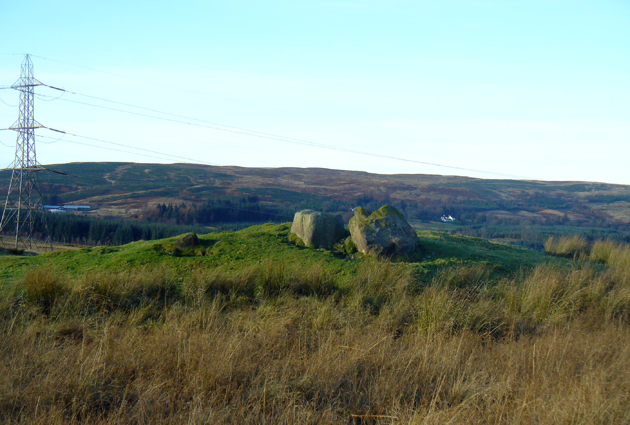
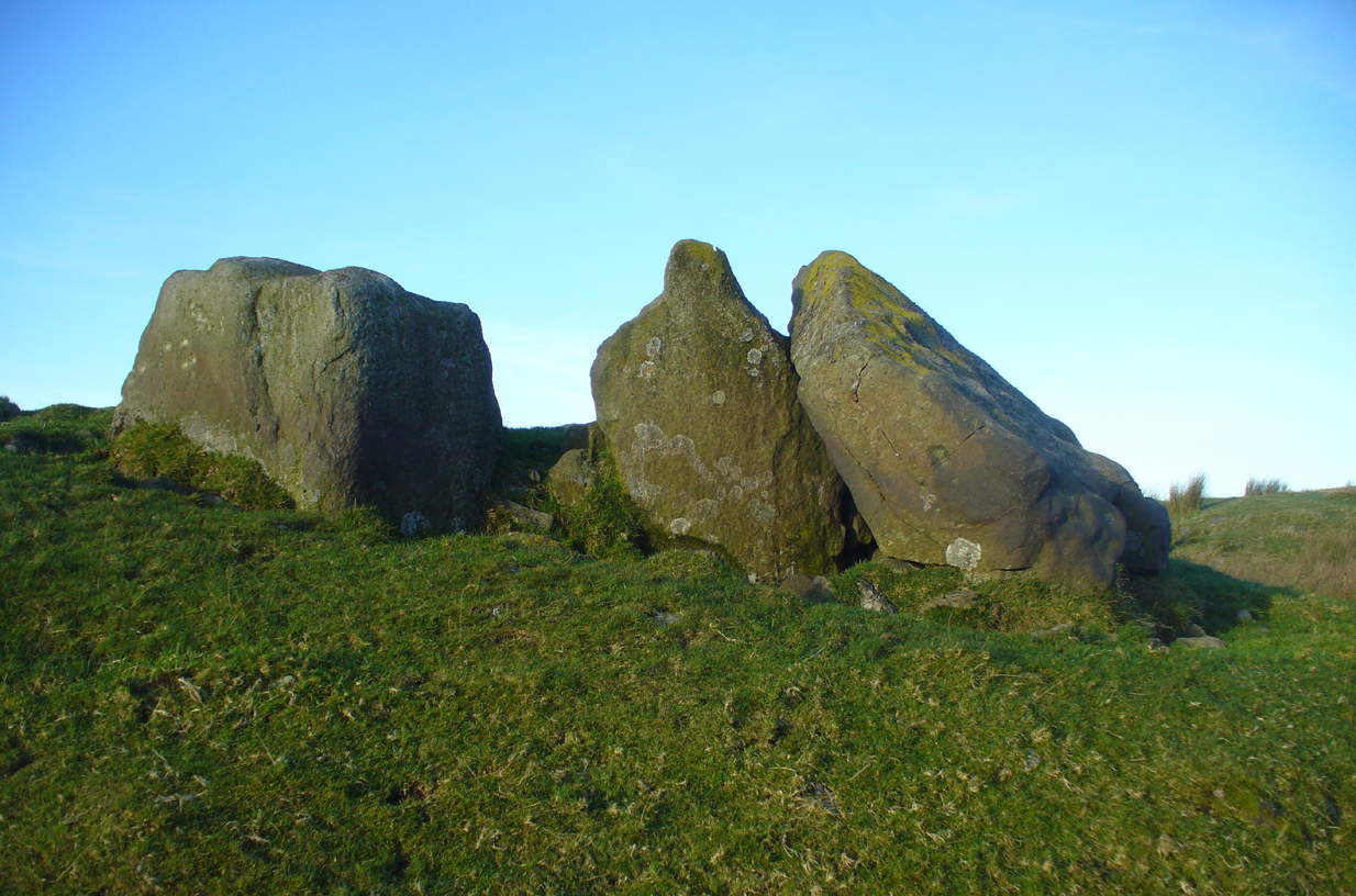
The SE stone ‘entrance’
There is no previous reference to this site which was found, quite fortuitously, by Nina Harris of Organic Scotland a few years ago. She visited the site a number of times, puzzling over the curious line of possible standing stones at the edge the grass-covered mound—wondering if it was anything at all. A few months ago she took us to see the place…
Modern gunshot cup-marks on entrance stone
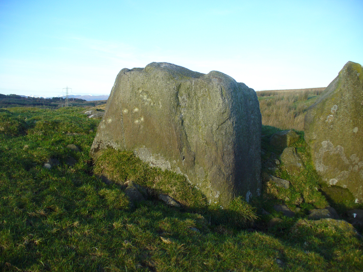
The site has been damaged and elements of it have been stripped for walling that are visible all around here. The cairn is more than 55 yards in length, running from its southeastern stone ‘entrance’ to the gradually diminishing northwestern edges. At its widest it is 14.6 yards (13.5m) across, near its southeastern end. The main three standing stones at its entrance are four-feet tall at the highest, with one of them leaning upon another; an adjacent fourth stone, smaller than the main three, is more embedded into the cairn mass a couple of yards away. Cup-marks on one of the three larger uprights here are recent gunshot marks; whilst the possible cup-marks on the largest upright are natural.
Line of ancient wall runs up and over the cairn
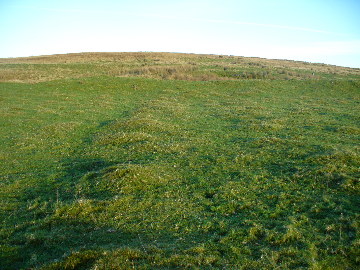
Looking NW along the cairn mass
In standing on top of the long cairn, just above the large stones, you can see how sections of it have been stripped away. Just beneath the surface is a line of internal walling, with what seems to be another one running parallel. These run for a few yards until we reach a large circular depression within the overall cairn mass, a yard deep and 6-7 yards across; on the northern edge of which we can clearly see a section of walling beneath the surface. When we look at the aerial view of this on Google Earth, we can clearly see how this walling actually begins way outside of the cairn mass itself, as a much denuded line of it (probably medieval in origin, though possibly Iron Age) curves across the grasslands from the west, crosses the long cairn and re-emerges on the other side of the adjacent boggy ground at its southeastern edges and continues on its way: indicating that the cairn mass beneath the wall is much older than the walls running across it.
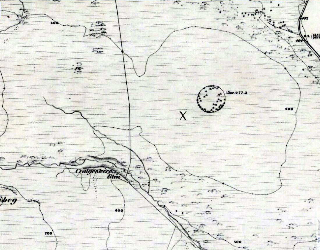
“X” marks the spot!
The main three ‘entrance’ stones
Audrey Henshall (1972) described the existence of another prehistoric chambered tomb like this one at Cairnhowit 1.95 miles (3.14km) southwest, and we find the Stockie Muir long cairn 3.12 miles (5.02km) to the northwest, clearly showing that the incidence of this monument is not an isolated one. Others can be found not much further away. The existence of the raised geological plate known as Carneddans Wood just over a mile south may have once been home to another chambered cairn.
Please note that the grid reference for this site fixes on the southeastern section of the cairn, where the upright stones are.
References:
Henshall, Audrey S., The Chambered Tombs of Scotland – volume 2, Edinburgh University Press 1972.
Acknowledgements: First and foremost to Nina Harris, for unknowingly finding the place; also to Paul Hornby and Marion Woolley for visits to the site.
Long Barrow (destroyed): OS Grid Reference – TL 086 268
Archaeology & History
Aligned east-west, a large neolithic long barrow could once be seen to the west of Galley Hill, on where now we find a golf course. It was sadly destroyed sometime around 1900 AD and its demolition was witnessed by a Mr A. Cumberland of the Dartford Antiquarian Society, who reported there being no archaeological finds of note in the tomb. Curious…
Equally curious was the view of archaeologist James Dyer (1964) in his assessment of the site, who wrote how
“Air photographs suggest that the barrow was 300 ft long, but this is much larger than normal in the Chilterns, and 150 ft is more reasonable.”
The neolithic and Bronze Age burial specialist Paul Ashbee (1984) maintained the “300 feet” measurement.
Other tumuli can still be seen on the slopes either side of Galley Hill a few hundred yards to the east; and a henge monument has also be found in the area.
References:
Ashbee, Paul, The Earthen Long Barrow in Britain, Geo: Norwich 1984.
Dyer, J.F., “A Secondary Neolithic Camp at Waulud’s Bank, Leagrave,” in Bedfordshire Archaeological Journal 2, 1964.
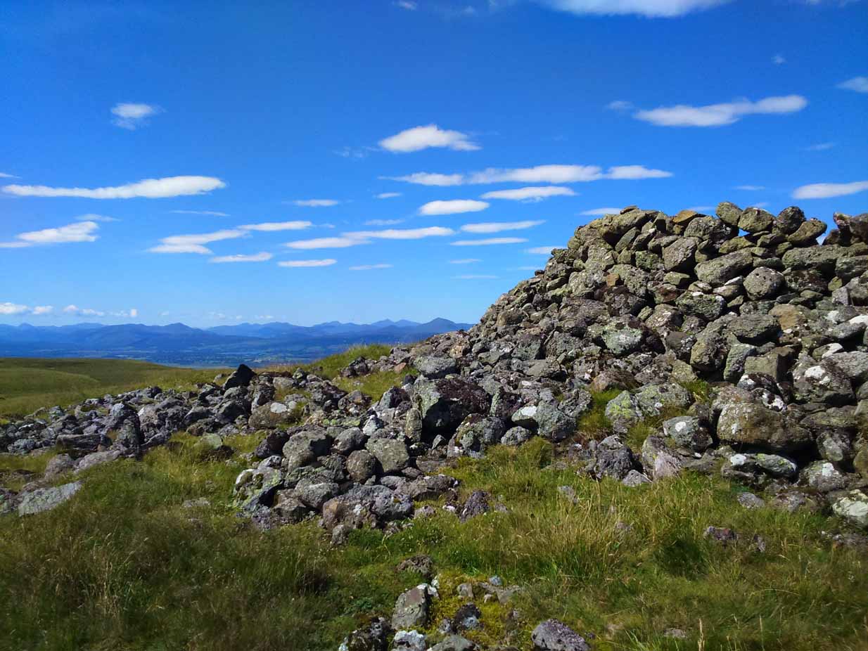
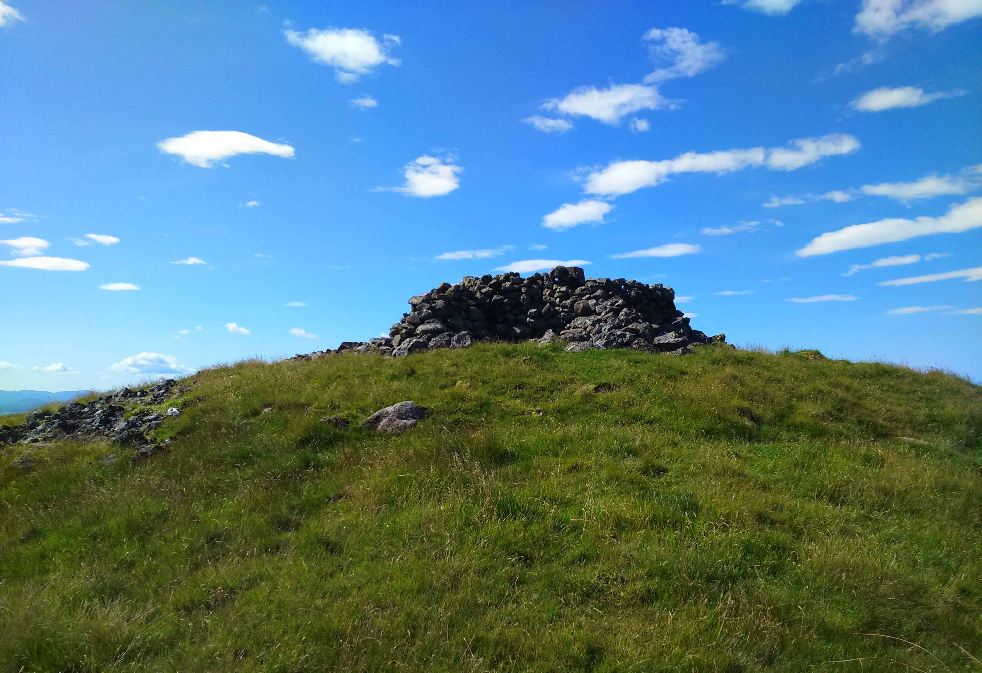
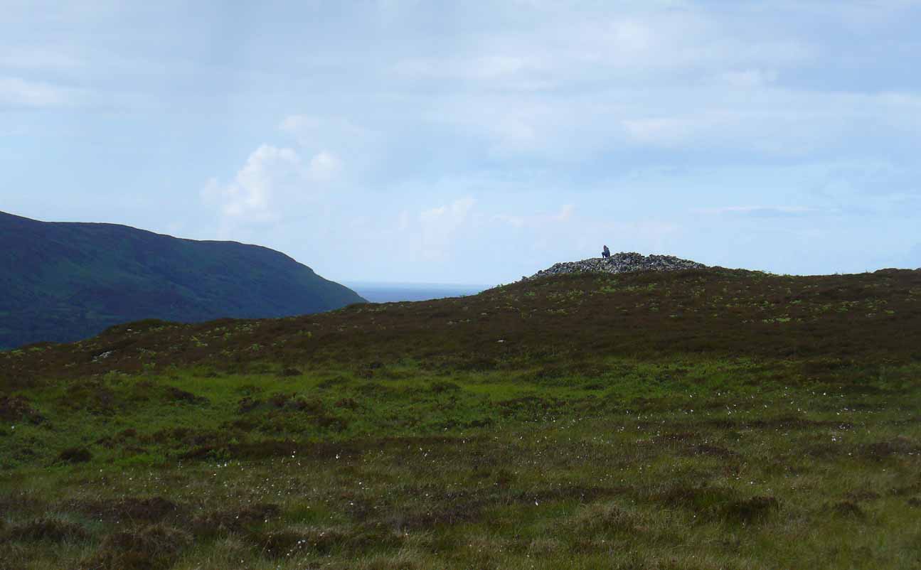
The quickest way here is still a long one. From Gargunnock village, take the road west towards the A811, turning left just before the bend down to the main road, and up through what looks like private estate gates. Walk all the way along this road as if you’re visiting the Leckie broch and its carvings, but keep going, until it becomes a track. Continue into the woods, uphill and out the other side until you have the Gargunnock cliffs rising a few hundred yards ahead of you. On your right a few yards up is a long straight length of walling running to the first set of cliffs. Go up it and up the next rise and the next. When you’re on top of the moors, look for the highest spot close by. You can’t miss it!
Archaeology & History
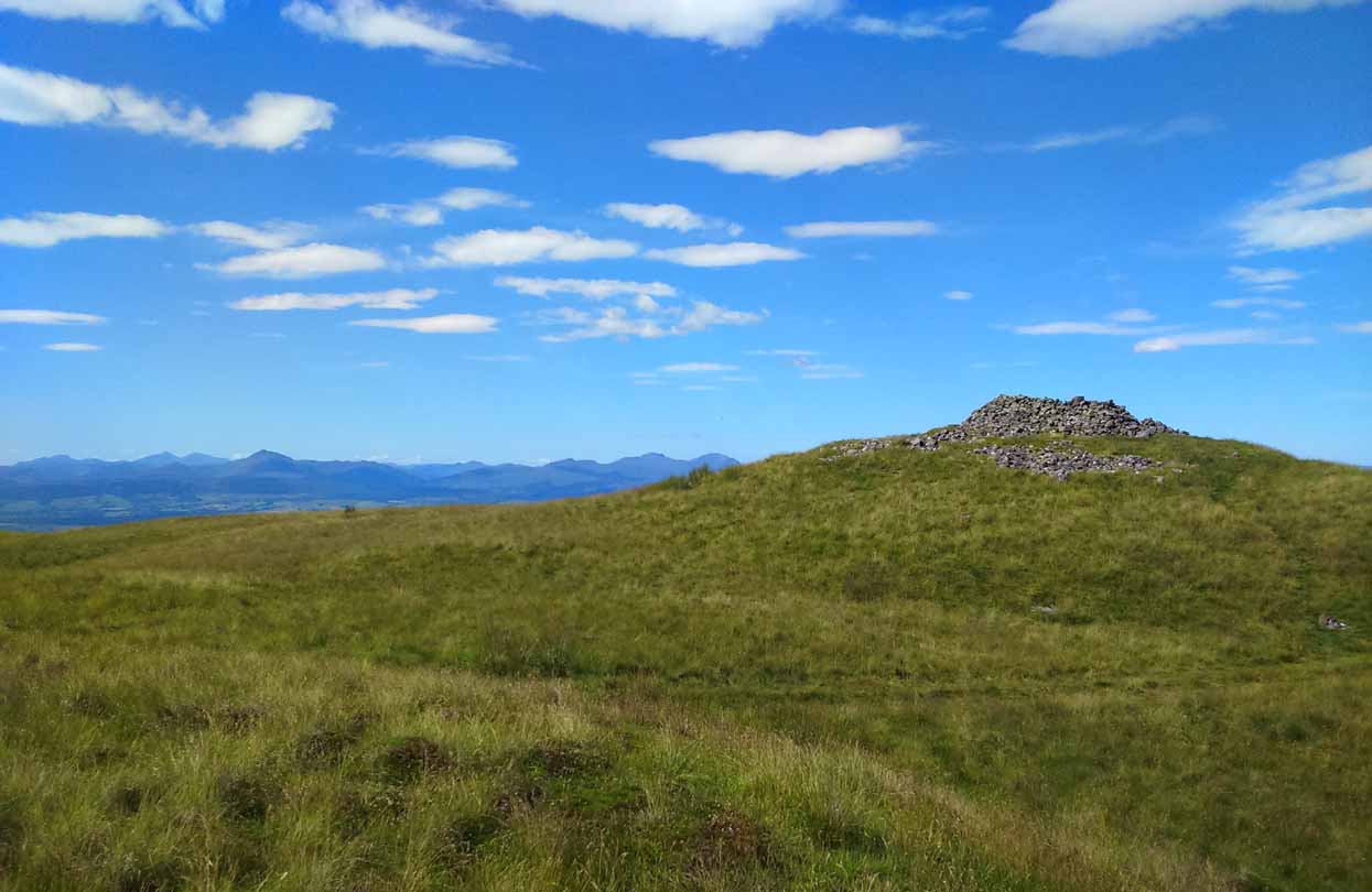
Cairn-edge, looking NW
Nearly 1600 feet above sea level, this seemingly isolated giant cairn sits on the highest point of the Gargunnock Hills, giving a truly fantastic 360º view, looking across a diameter of perhaps 100 miles on a clear day—which is what I was greeted with when I visited. Giant cairns scatter hilltops all across the British Isles, many of them peopled with creation myths of giants, devils and thoroughly animistic creatures! But I can find no such tales here… Equal lackings are in the archaeological texts which, it seems, only catalogued the site in recent years.
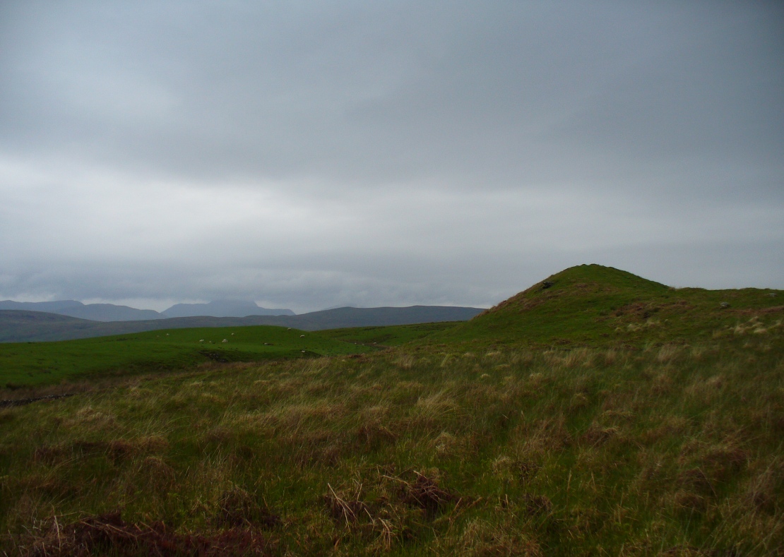
Caerlatheron, looking SE
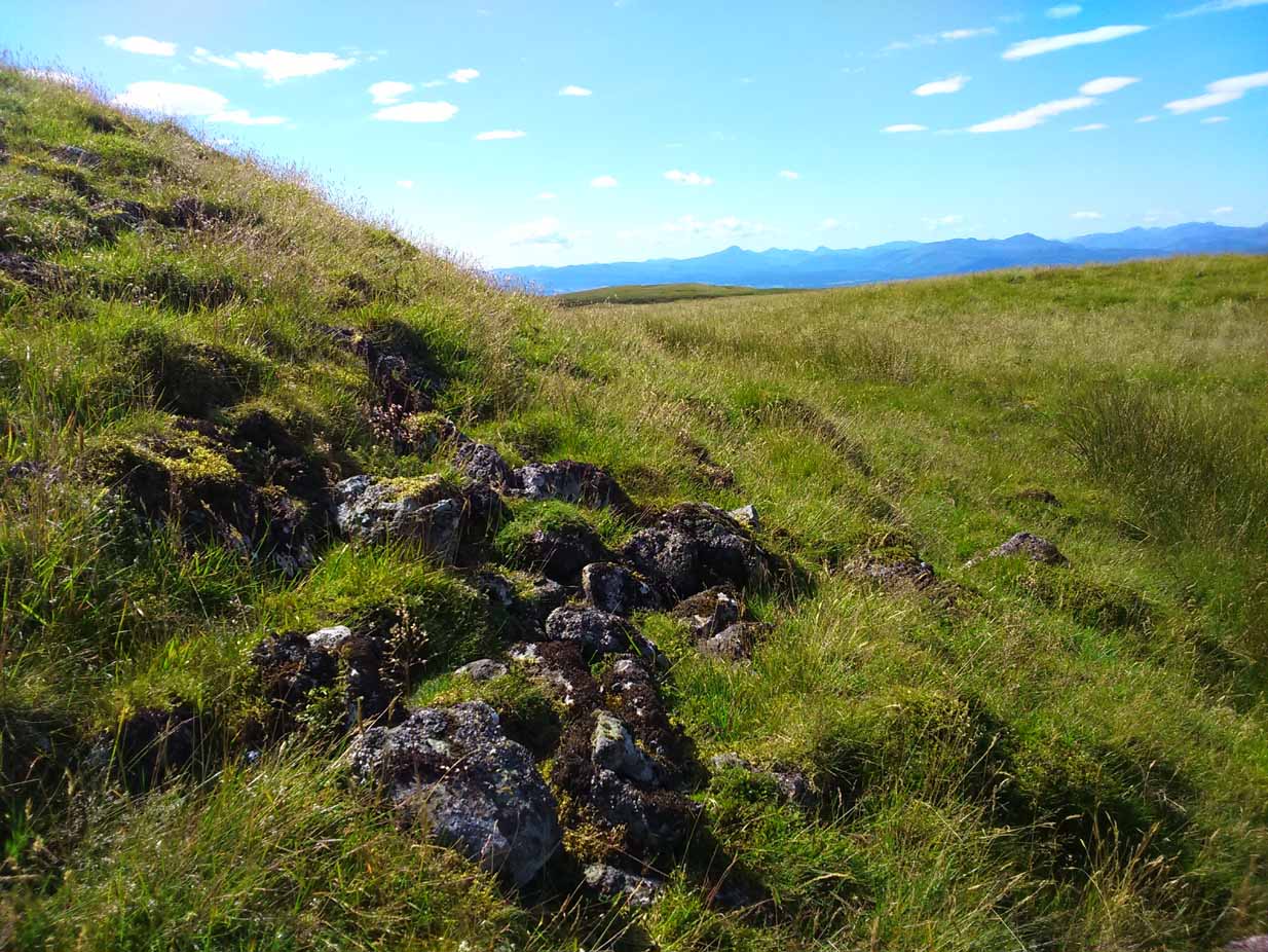
The name of the site is intriguing. The element caer is a fort, but no such ‘fort’ seems to be here. But we’ll come back to that shortly. The element latheron and its variants apparently relates to a mire or swamp (Watson 1926), whose existence to the immediate south and west is considerable (a small loch was once hereby, but its size has decreased over the last 150 years), and it is very boggy across the tops here. When I visited, it was a scorching day (I was fucked by the time I got here!), but in many places the ground was very dangerous to walk over. It was superb! So it seems that the place-name indicates Caerlatheron was ‘the fort by the swamp’. It works perfectly, except that this is listed as a cairn – and it’s a large one at that!
Note the overgrown raised embankment (lower centre)
The cairn sites on top of a large mound. This mound seems to be artificial and is between 10-12 feet high. The cairn and mass of rocks on top of the mound (within which is a triangulation pillar) is itself 4-5 feet high—although much of this relates to Ordnance Survey and walkers piling up many of the loose stones to create an enclosure or wind-break to protect any traveller up here in stormy weather. The cairn-pile is 20 yards across at the top, and as you walk around it you become aware that this appears to be slightly raised on top of its parent mound with an evident ’embankment’, particularly on the eastern side. As you follow this round, you lose sight of it completely on the southern edges, which is covered by the extended cairn-mass; but some of it seems in evidence on the northwest and northern side. A number of stones marking this out would seeeem to be in evidence. A few larger flat stones on the south and western top of the cairn might suggest that it was once a chambered cairn – but this is highly speculative. The late great Audrey Henshall never got here; and I don’t know whether the great local archaeologist, Miss Christian MacLagan, ever got her fingers here either, so we don’t have their expertise to help us out.
Caerlatheron, looking ECairn-mass of the huge mound
The mound upon which the ‘cairn’ sits is also intriguing. When walking round and around the bottom of it, you note the unmistakable substantial mass of overgrown rocks, particularly around from the northwest, to north, to northeast, both on the slopes and at the bottom, seeming to imply that the entire mound is artificial. I kept walking up and down and around it, to see if these had simply fallen from the top, but wasn’t 100% sure and wished there was a geologist at hand to tell me, one way or the other. In truth, the shape of the mound from the bottom, from most angles, reminded me of an overgrown broch and not a cairn. And there are a few brochs nearby—the closest of which is just at the bottom of the hill from here: the Leckie broch (I aint done the site profile for it yet, soz….). It was only when I got home and looked for the meaning of Caerlatheron that the ‘broch’ idea came back to me with a little more fortitude, perhaps making sense of it as a ‘fortified structure by the bogs and swamps’. Perhaps… Without an excavation, we may never know for sure.
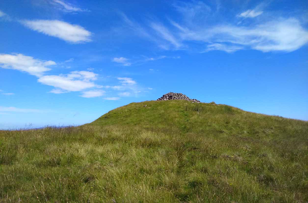
Singular cairn, 350yd NNW
About 350 yards northwest, across truly dodgy swampy ground (walk up here at night and it’ll probably be the last thing you ever do!) is another small singular cairn, made up of quite large rocks, with a few smaller ones filling it up. It looks to be either a shepherd’s cairn, or one for his sheepdog perhaps, a few centuries old. I can find nothing about it in any local history or record-books.
The place is well worth visiting—but it’s a full day out and you’ll be knackered when you get back. However, from here Nature grants us a stunning view of these tiny parts of Her body. It’s well worth the effort!
References:
Watson, W.J., Celtic Placenames of Scotland, William Blackwood 1926.
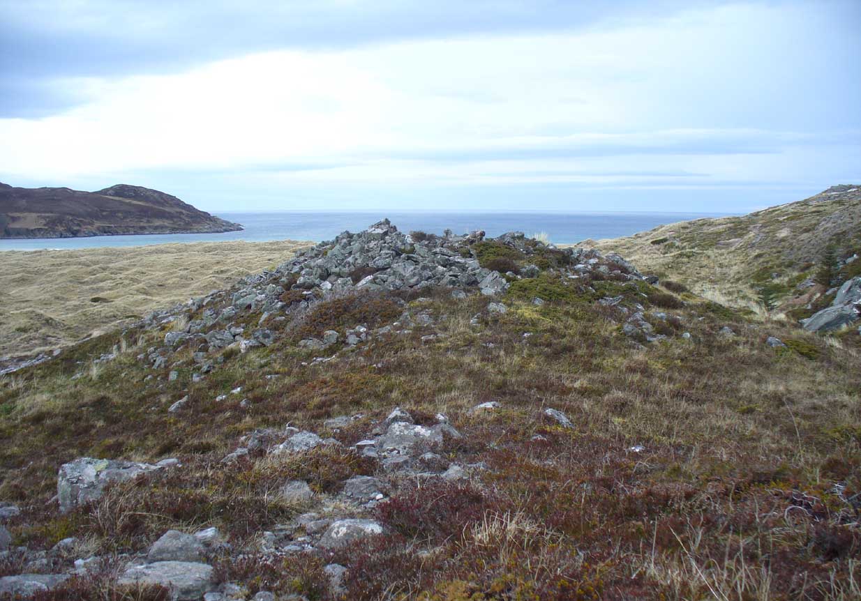
Along the A836 road between Bettyhill and Tongue, keep your eyes peeled for the turning down to Borgie and Skerray. Go along here for 1.8 miles (2.9km) until, just past a tiny road on your left, a small parking spot with a tourist board is by the roadside. Walk down hill and over the River Borgie below and follow the footpath round until your reach the edge of Torrisdale Beach. From here, walk right, uphill, across overgrown sand-dunes to the stone escarpment 400 yards or so to the east. A large scattered mass of rocks on top of one of the first rocky knolls is what you’re looking for. You can’t really miss it.
Archaeology & History
Dun Riaskidh, looking north
This is worth the journey for the scenery of Torrisdale Bay alone: one of the most beautiful places in all Scotland. …Not far from the legendary Ringstone and the carving above, this collapsed mass of scattered rocks was said, in local lore, to have been the remains of an old broch—or that’s what Hew Morrison told the Royal Commission (1911) lads about it when they surveyed the area more than a century back. Their description was short:
“About ½-mile E of the footbridge across the River Borgie, near Torrisdail, and on the W. side of Druim a’ Chleibh, are the remains of a broch. No outlines of walls are visible. The site is indicated by a structureless heap of stones.”
It seems at first to be in an unusual position for a chambered cairn: built onto solid rock instead of soil. Yet we find this geocentric structuralism echoed at the Borgie chambered tomb 1½ miles to the southeast. When you reach the place, a large mass of stones—hundreds of them piled-up several feet high—is strewn across the rocky surface and reaching onto more typical moorland ground. On top are a number of large stones, some laid down, some half-upright appearing, perhaps, to have played some part in an internal cist or chamber. On the eastern side the rocky mass falls down a natural steep slope, with many of the fallen stones covered by centuries of vegetation. As you walk around it, cairn-scatter seems to extend southwards towards another natural rocky knoll 20 yards to the south, giving the impression of a second cairn (much like the Fiscary 1 and 2 cairns 2.8 miles to the east), but this is improbable.
The first detailed archaeological account of the site was by Audrey Henshall (1972), who told us:
“…The cairn is about 4ft high, consisting of a mass of angular stones. On the S side the edge can be traced, and the indications are that the diameter was about 57ft. The edge on the N side is rather vague and may have been flattened in plan. On the E and W sides, where there are steep drops, the stones have evidently spread downhill, though on the E side parts of a roughly built edging can be seen.
“Many large slabs lie about the site, probably mainly displaced corbels and roofing stones. Much of the chamber structure probably exists, and a few visible orthostats are probably in situ. The entrance has probably been from the N or seaward side. A slab towards the S side, aligned E-W, projects 1ft 6in, and is likely to be the back-slab. The E side of the chamber is represented by a slab 4ft 6in to the N, aligned N-S, which is just visible. On the W side of the chamber there are a number of large slabs, one over the other wide their E edges aligned vertically, and laid declining to the W, which appear to be corbel stones only slightly displaced. To the N of them, a stone set transversely to the axis of the chamber, 10ft 3in N of the back-slab, might be a portal stone. Another upright stone seemingly firmly set but obstructing the probable position of the entry into the chamber, is presumably displaced.”
More than twenty years later however, Miss Henshall (1995) revisited Dun Riaskidh and altered her initial diagnosis of it as a chambered cairn, suggesting it to be something completely different, telling:
“The cairn-like structure…has an overall spread of about 17m including stone displaced downhill, and a height of 1.6m on the S side. On the summit a group of upright slabs protrudes up to 0.35m, and forms a rough oval 5.5m E to W, by 4.5m N to S. They seem to be on the inner side of a ring of stony material about 2.5m thick. In the interior is a disorganised mass of lintel slabs and three earthfast upright slabs. The structure appears to be a house with spaced uprights in the inner face of the wall, and with a series of uprights which helped to support a partly lintelled roof. A hollow on the N or seaward side probably indicates the position of the entrance.”
Top of the cairn, looking W
Now woe am I to go against the words of a giant like Miss Henshall, but having slept in numerous derelict houses and seen countless numbers of them in the hills, this structure does not seem to have such properties. The category that is continued by Canmore and Ordnance Survey re Dun Riaskidh is still a “chambered cairn”; but, perhaps, if Miss Henshall is correct in saying that it is not a cairn, then maybe the words of local tradition may have been right all along (again!) and this is a collapsed broch? Who knows for sure…?
Whatever its original nature and function, this vestige of antiquity is enveloped within another one of Nature’s incredible domains…
References:
Henshall, Audrey S., The Chambered Tombs of Scotland – volume 2, Edinburgh University Press 1972.
Henshall, Audrey S. & Ritchie, J.N.G., The Chambered Cairns of Sutherland, Edinburgh University Press 1995.
Mercer, R.J. & Howell, J.M., Archaeological Field Survey in Northern Scotland – volume 2, University of Edinburgh 1981.
Royal Commission on Ancient & Historical Monuments, Scotland, Inventory of Monuments and Constructions in the County of Sutherland. HMSO: Edinburgh 1911.
Acknowledgments: Huge thanks to Donna Murray, for putting me up in this part of Paradise. Cheers Donna.
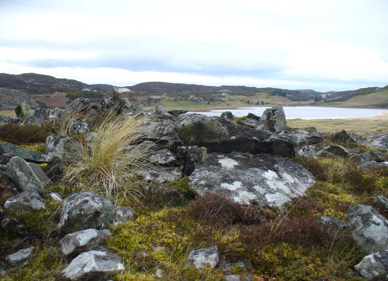
Very difficult to find under the herbage, but – along the A836 road between Tongue and Bettyhill, turn down at Borgie Bridge towards Skerray. A few hundred yards along, past the third house on y’ right, a path through the gate on the left takes you up the slope. Once you meet the deep-cut dike, follow it north-ish for 200 yards, over the fence; then walk 150 yards towards the eastern edges where the mass of gorse meets with the rocky escarpment. You’re damn close!
Archaeology & History
These days, much of the remains of this neolithic chambered cairn are inaccessible, as it is covered with the spindly-killer-bushes that are the yellow gorse (Ulex eurapæus). A pity. …Just like its fellow chambered tomb of Dun Riaskidh precisely 1½ miles NW, this was also built upon the edge of a natural rocky escarpment with some of the rocks making up the tomb falling to the edges (I nearly fell in and spined misself meandering around its edges!).
Little has been written about it in archaeo-tomes, despite it being first listed in 1947. Presumably neolithic in age, it was first classed as a ’round cairn’ and has subsequently been described by Canmore as,
“a severely robbed, chambered cairn. It is about 15.0m in diameter, with a maximum height of 0.6m in the centre; elsewhere the cairn is reduced to a stony rim and scattered stones. In the centre a chamber is indicated by two opposing earthfast boulders 1.1m apart and protruding up to 0.6m through the cairn material.”
References:
Gourley, Robert, Sutherland: An Archaeological Guide, Birlinn: Edinburgh 1996.
Acknowledgments: Huge thanks to Donna Murray, for putting me up in this part of Paradise. Cheers Donna.
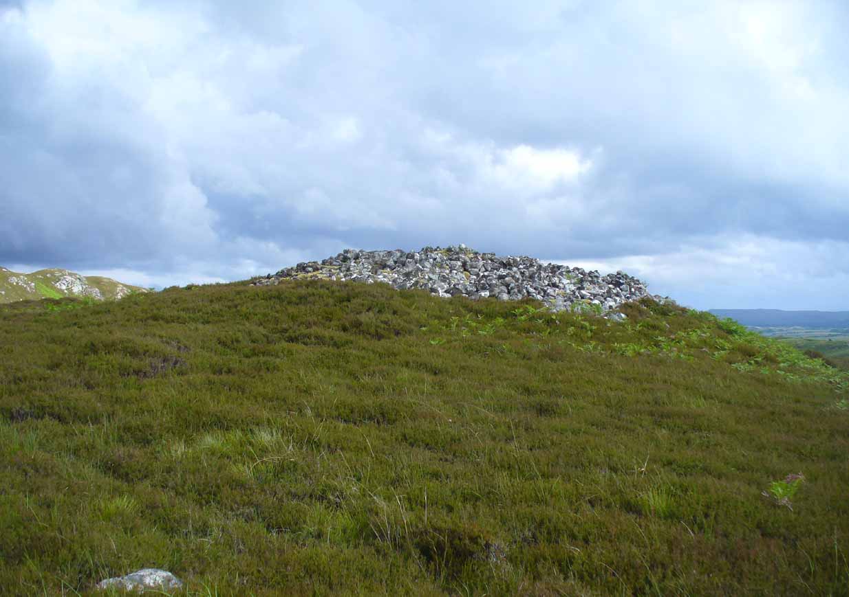
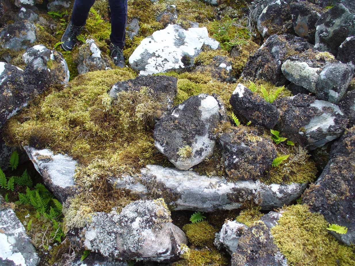
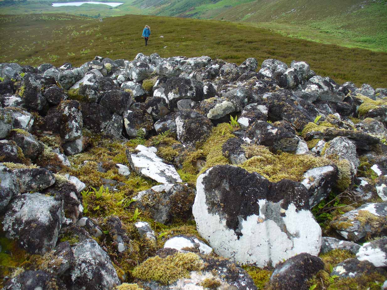
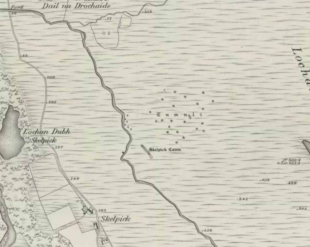
From Bettyhill village, take the road east towards Tongue and Durness. A half-mile out of the village, at the bottom of the hill, just before you cross the small metal bridge across the River Naver, a very minor road, left, takes you to Skelpick. Go down here and follow the directions to reach the giant long cairn of Skelpick Long. Once there, walk east up the moorland hill (there are no footpaths) for about 150 yards. Once on top of the rise, the moorland levels out a little and there, before you, amidst the small overgrown undulations of many old cairns, a giant one rises up to greet you about 100 yards away. Y’ can’t really miss it!
Archaeology & History
Neolithic in nature, this giant circular cairn, standing on the ridge above the hugely impressive chambered long cairn of Long Skelpick, isn’t quite as grandiose as its neighbour below, but it’s still an impressive feature in this beautiful moorland landscape. Comprised of tens of thousands of small stones raised to a height of 10 feet above the moorland peat, several ‘pits’ have been dug into the top of this undoubted tomb of regal nature; but whether it was originally the burial-place of a single person, to which were later added members of the same family, is simply unknown.
Moss-covered capstoneDepression atop of cairn
On the top of the cairn, at least one of the so-called ‘pits’ that drop into the centre is covered by a large heavy tombstone with a small upright monolith at its side. Although the late great Miss Henshall (2005) thought no ‘chamber’ was here, it is quite possible that a chamber might be found beneath this large moss-covered flat rock (see photo). When we visited here, it looked as if there was a hollow beneath it, but only an excavation would tell us for sure.
Mass of sites on 1878 map
Highlighted on the earliest Ordnance Survey map, it was shown to be just one cairn amidst the mass of other smaller surrounding tombs—most of which were probably built for people from the same tribal group. None of these small cairns have been excavated, but they were probably built after the construction of the major Queen’s Cairn.
The Royal Commission lads visited the site in 1909, but said very little of the place (probably over-awed by Long Skelpick, Coillie na Borgie and other nearby giants!), merely that this large circular cairn has
“a diameter of about 54′. It is about 8′ high, and though the stones have been pulled about here and there on the top, it does not appear to have been excavated.”
Queen’s Cairn, looking N
And so it remains to this day—although the cairn is slightly larger than the dimensions given by the Commission boys. Beneath the encroaching heather, the cairn is closer to 67 feet (10.23m) across, with a circumference of 210 feet (64.25m).
Line of ancient wall nearby
The monument sits on a plateau immediately above the giant Long Skelpick cairn—although neither can be seen from each other. But if you walk only a short distance from the Queen’s Cairn towards the long cairn below, a very notable and extensive line of ancient walling runs along the edge of the geological ridge separating the two tombs, as if deliberately keeping them apart. Other lines of ancient walling run closer to the cairn, seeming to indicate that a settlement of some form was also apparent on this ridge, in close connection with the group of smaller burial cairns.
It’s a gorgeous arena with many prehistoric sites and puzzles to behold, and plenty of unrecorded ones nestling quietly in the heather. It’s bloody superb to be honest!
References:
Gourlay, Robert, Sutherland: An Archaeological Guide, Birlinn: Edinburgh 1996.
Henshall, Audrey S. & Ritchie, J.N.G., The Chambered Cairns of Sutherland, Edinburgh University Press 2005.
Royal Commission Ancient & Historical Monuments, Scotland, Inventory of Monuments and Constructions in the County of Sutherland, HMSO: Edinburgh 1911.
Along the A84 road between Doune and Callander, take the tiny country lane up to your right to Drumloist (if you’re coming from Doune) or up the tiny unmarked road past Keltie Bridge on your left (if you’re coming from Callander). Uphill for several miles, you eventually emerge from the trees and are on the top of the tiny road. Once here, keep your eyes peeled for Drumloist farm. Best thing to do is walk up the track and ask at the farm. The fella there is a superb old Highlander who’ll point you to the place on the hill above.
Archaeology & History
A site that was never explored by that giant of chambered tomb research, Audrey Henshall. A pity, as it has a lot of potential and seems to have a lot more to say about itself than the meagre findings reported by the Scottish Royal Commission doods.
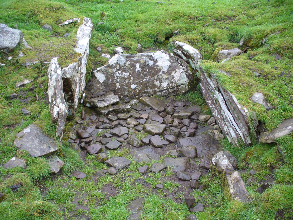
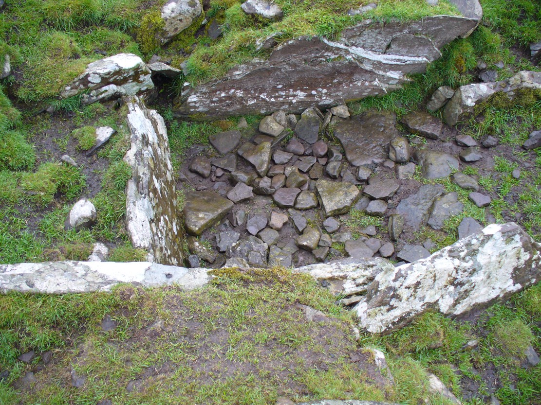
Curious fairy mound to rearOne of two main chambers
Although there’s a very notable “fairy hill” eminence close by which strongly draws your attention, the actual hillock upon which this chambered tomb was constructed is in front of this, closer to the farm. A couple of rows of ancient walling—Iron Age by the look o’things—run up the hillside, with one of them running into the eastern sides of the huge mound which this tomb plays a part in. The mound itself is about a hundred feet across, although seems to have been damaged over the centuries. Although it is probably neolithic in origin, sections of the monument seem to have been altered and re-used for other purposes, giving it that distinctly multi-period look.
The farmer informed us how some of the stones from the mound had been robbed and used in some of the walling in the past. He also told us how there are so many other archaeological features upon the moors above here that remain to be “officially” recorded, despite the efforts of some who swept the region for remains a few decades ago.
Looking into the main cistNature’s faded cup&ring
The main prehistoric section of the tomb that can be seen are the two opened cists, or stone-lined graves, to the top north-western edges of the mound. They align together, NE to SW, with a gap of about three yards between the two open tombs. The more northerly of the two is much more overgrown; whilst the southwestern grave comprises of three large flat upright stones, forming a traditional ‘box’ with smaller flat stones lining the floor. But these two separate tombs (if indeed they were originally separated) point directly to the large, very prominent “fairy mound” about 100 yards north-east, on the north side of the Drumloist Burn. The alignment seems very deliberate.
Walking over the boggy ground to the (unnamed) fairy mound, a natural ‘platform’ of rocks sticks out on its south-easterly side, and upon this are what I initially thought were two cup-markings, with the more easterly one of the two seeming to have a carved arc along its edge; but subsequent visits here at different times of day has shown that they are Nature’s handiwork. Anyhow, looking from this mound, back across to the Ballachraggan tomb, the open flat landscape heading south-west is held where the sunset falls. Sadly on the day we visited, Nature greeted us with grey cloud and the drizzle of light rain all afternoon, so we couldn’t make out if there was something, far away, which the tomb was truly aligned with… A damn good site though!
Chambered Cairn (destroyed): OS Grid Reference – NS 58 76
Also Known as:
Blochairn 2
Canmore ID 44421
STR 3 (Henshall)
Archaeology & History
Close to the ruined Craigmaddie Muir cairn could once have seen a companion, of roughly the same size and structure and made up of thousands of small stones, covering a long internal chamber. It was described in David Ure’s (1793) early history work on the area which, even then, thanks to “frequent dilapidations, will soon be annihilated.” The cairn was included in A.S. Henshall’s (1972) magnum opus in which she wrote:
“There was a second cairn in the vicinty of Craigmaddie Muir I. It was also ‘of an elliptical shape.’ Writing in 1793, Ure says that it ‘was laid open last year, and, though not so large as the other, was of the same construction, which seems to be Danish. Some of the stones placed in the rows at the bottom are considerably large… Among the contents, upon opening…were urns… One of the fragments of an urn is ornamented, near the mouth, with two shallow grooves. The diameter of the circle of which it is a segment seems to have been at least 20in.”
Fragments of human bones were also found within the site, but the entire cairn was sadly destroyed a long time ago. In the Stirlingshire Royal Commission report (1963:1) it was speculated that the urn found herein,
“must have been either a neolithic vessel or a cinerary urn. In view of the method of construction of the chamber it may be assumed that both cairns were related to the Arran or Clyde-Carlingford types.”
References:
Henshall, Audrey Shore, The Chambered Tombs of Scotland – volume 2, Edinburgh University Press 1972.
Royal Commission on the Ancient & Historical Monuments, Scotland, Stirlingshire – volume 1, HMSO: Edinburgh 1963.
Ure, David, The History of Rutherglen and East Kilbride, Glasgow 1793.
Chambered Cairn (destroyed): OS Grid Reference – NN 830 127
Archaeology & History
References to this site are few and far between. I wandered past the place the other day on my way back from the megaliths of Dunruchan and Comrie without knowing anything about the place; but was, for some reason, drawn up the grassy hill slope towards the forestry plantation, where the scattered old walling implied (to me at least) the presence of some old prehistoric ruin… But as the daylight hours were fading, I had to head for home, wondering what it was that was pulling my nose to this place I’d never visited before.
The following day when I was searching for information about the prehistoric archaeology of the area, I came across Audrey Henshall’s (1972) description of some giant cairns that once stood here, upon the hilltop – exactly where my nose had led me! Sadly however, they have been all-but destroyed.
At least two prominent prehistoric cairns were to be found in relative proximity to each other hereby, each with their own name. The site was first described in A. Gordon’s 1726 work, Itinerarium Septentrionale, where he wrote the following:
“On the hill above the moor are two great heaps of stones, the one called Cairnwochel, the other Cairnlee: the former of these is the greatest curiosity of its kind that I ever met with; the quantity of great rough stones lying above one another almost surpasses belief, which made me have the curiosity to measure it, and I found the whole heap to be about 182 feet in length, 30 in sloping height, and 45 in breadth at the bottom. That at Cairnlea is not near so considerable as the former.”
Nearer to the end of the 18th century, Cairnwochel was mentioned again – this time in the Old Statistical Account (1793), where a description was given of some dig into the giant cairn, to see what lay beneath the mass of rocks. The report told that,
“there was found a stone coffin, in which there was a skeleton 7 feet long. The cairn lay from north to south and the coffin was nearly in the middle of it, with the head to the east. Most of the stones have been carried away to inclose the neighbouring farms; but the coffin, with a few large stones around it, has, by the order of Sir William Stirling, been preserved.”
When Miss Henshall explored the site in the 1960s, she found very little left of this once superb tomb, simply, “the only sign of any structure (were) a few laid stones on its S side, possibly part of a revetting wall-face.”
The sheer size of the cairn implies that it was probably Neolithic in origin (its description reminded me of the King’s and Queen’s Cairns near Skipton, Yorkshire). We have hardly any information about the nearby Cairnlea site. The intrusion of the forestry commission here has probably covered over a number of other important Neolithic and Bronze Age remains, but if anyone has further information on this site it would be hugely welcome.
References:
Henshall, Audrey, The Chambered Tombs of Scotland – volume 2, Edinburgh University Press 1972.