For those who may not know, the terms ‘cairns’ and ‘tumuli’ are just prehistoric tombs. Another word we find as we move further north into Scotland is ‘cist’, which has a similar affiliation. A cairn is a pile of loose rocks and stones, which tends to be erected over a single or multiple burial or cremation – though without excavation we can never be sure which one it’s gonna be! A tumulus meanwhile (‘tumuli’ is the plural) is a heap of earth piled up over a burial or cremation. Small cairns and tumuli tend to cover single graves; whilst larger ones can have multiple burials therein. However we sometimes find that huge tombs have only one or two burials/ cremations inside. In such cases it’s likely that the people entombed there were of considerable importance: perhaps a tribal chief, a king, a queen, or powerful shaman. In many places across northern Britain, where there’s a profusion of cairns/tumuli we tend to find a good examples of prehistoric rock art, or cup-and-ring stones.
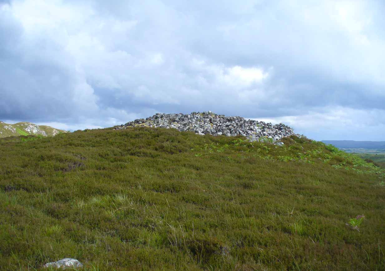
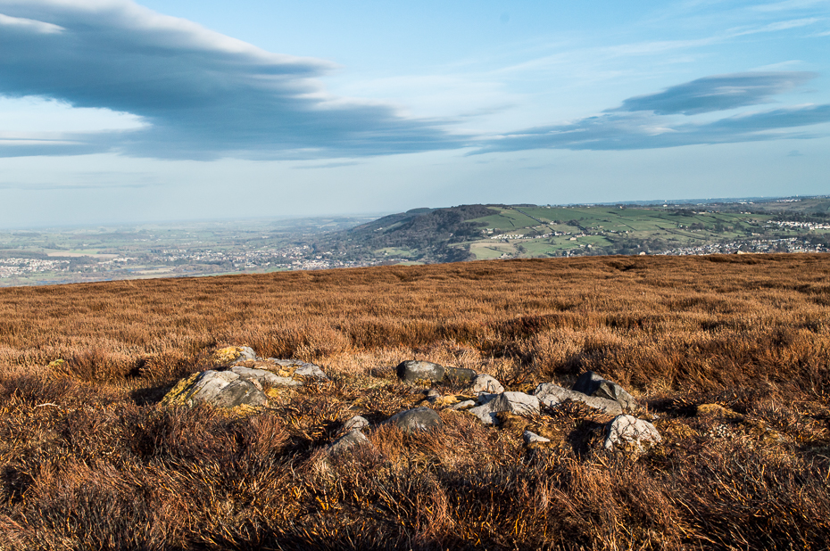
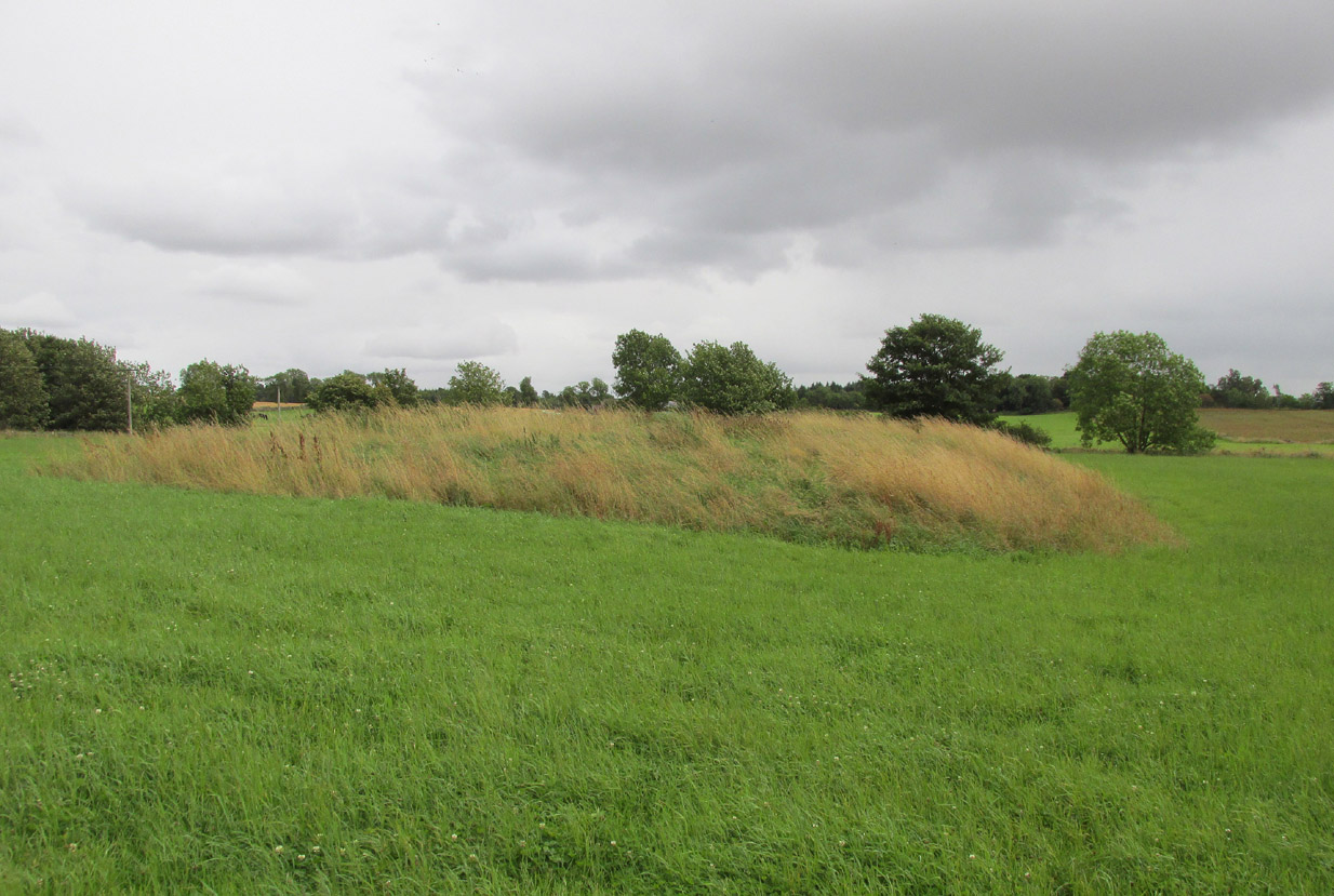
From Bettyhill village, take the road east towards Tongue and Durness. A half-mile out of the village, at the bottom of the hill, just before you cross the small metal bridge across the River Naver, a very minor road, left, takes you to Skelpick. Go down here and follow the directions to reach the giant long cairn of Skelpick Long. Once there, walk east up the moorland hill (there are no footpaths) for about 150 yards. Once on top of the rise, the moorland levels out a little and there, before you, amidst the small overgrown undulations of many old cairns, a giant one rises up to greet you about 100 yards away. Y’ can’t really miss it!
Archaeology & History
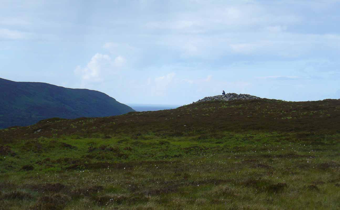
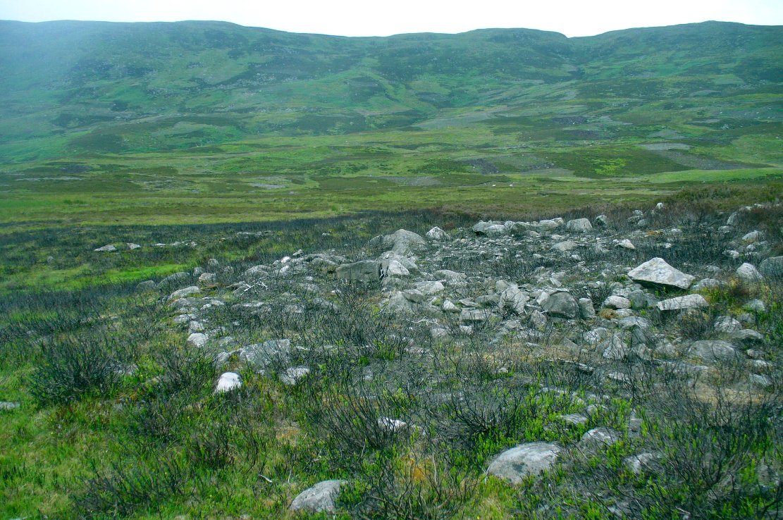
Neolithic in nature, this giant circular cairn, standing on the ridge above the hugely impressive chambered long cairn of Long Skelpick, isn’t quite as grandiose as its neighbour below, but it’s still an impressive feature in this beautiful moorland landscape. Comprised of tens of thousands of small stones raised to a height of 10 feet above the moorland peat, several ‘pits’ have been dug into the top of this undoubted tomb of regal nature; but whether it was originally the burial-place of a single person, to which were later added members of the same family, is simply unknown.
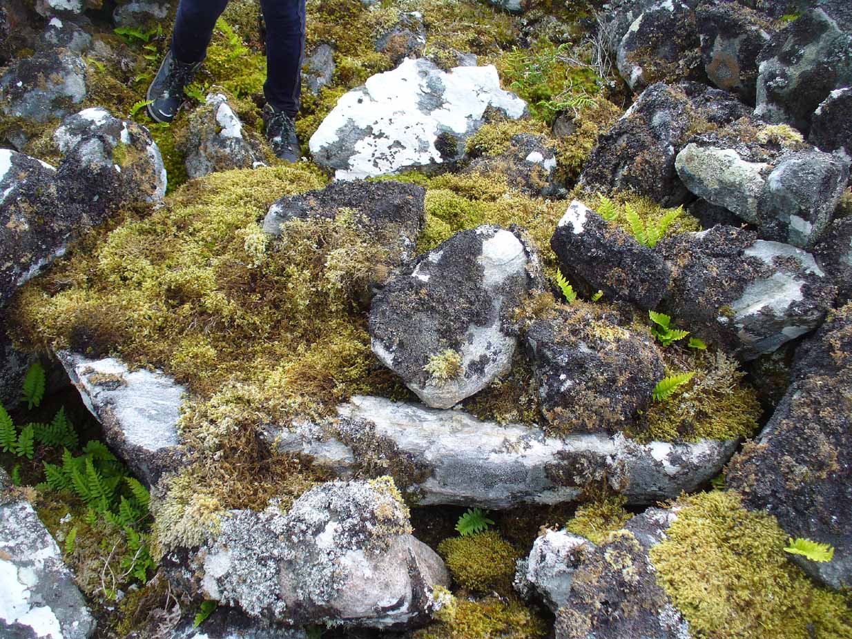
Moss-covered capstoneDepression atop of cairn
On the top of the cairn, at least one of the so-called ‘pits’ that drop into the centre is covered by a large heavy tombstone with a small upright monolith at its side. Although the late great Miss Henshall (2005) thought no ‘chamber’ was here, it is quite possible that a chamber might be found beneath this large moss-covered flat rock (see photo). When we visited here, it looked as if there was a hollow beneath it, but only an excavation would tell us for sure.
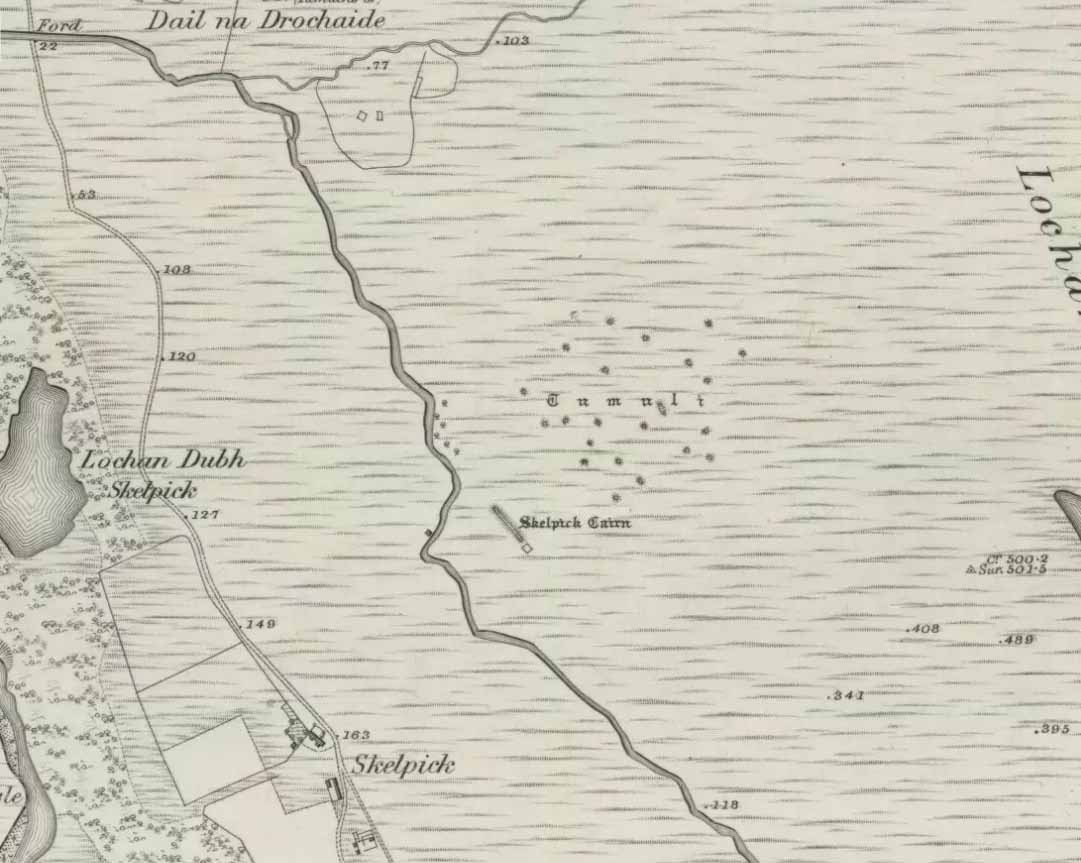
Mass of sites on 1878 map
Highlighted on the earliest Ordnance Survey map, it was shown to be just one cairn amidst the mass of other smaller surrounding tombs—most of which were probably built for people from the same tribal group. None of these small cairns have been excavated, but they were probably built after the construction of the major Queen’s Cairn.
The Royal Commission lads visited the site in 1909, but said very little of the place (probably over-awed by Long Skelpick, Coillie na Borgie and other nearby giants!), merely that this large circular cairn has
“a diameter of about 54′. It is about 8′ high, and though the stones have been pulled about here and there on the top, it does not appear to have been excavated.”
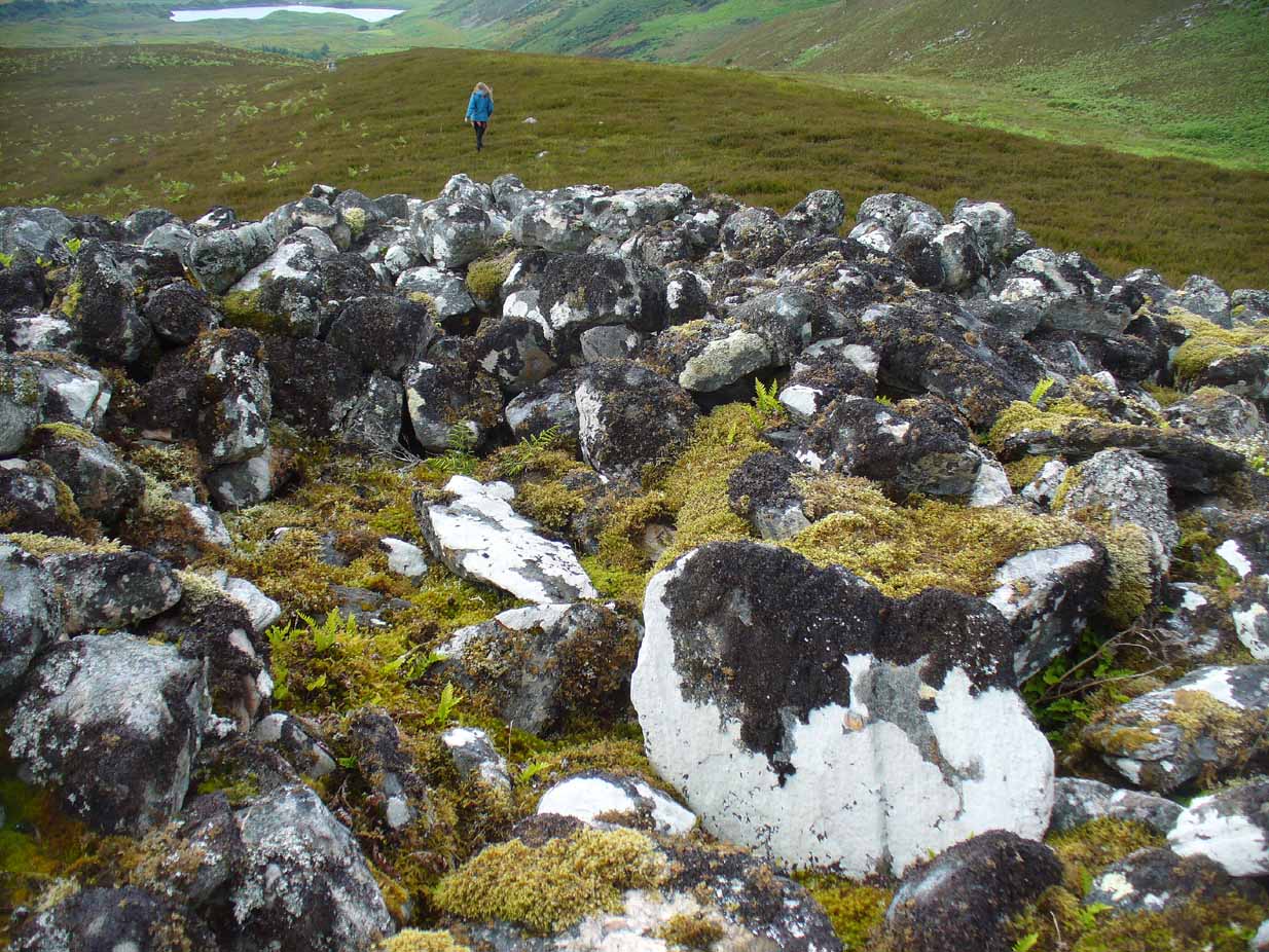
Queen’s Cairn, looking N
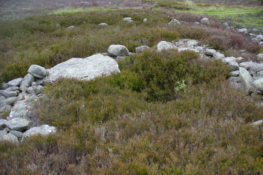
And so it remains to this day—although the cairn is slightly larger than the dimensions given by the Commission boys. Beneath the encroaching heather, the cairn is closer to 67 feet (10.23m) across, with a circumference of 210 feet (64.25m).
Line of ancient wall nearby
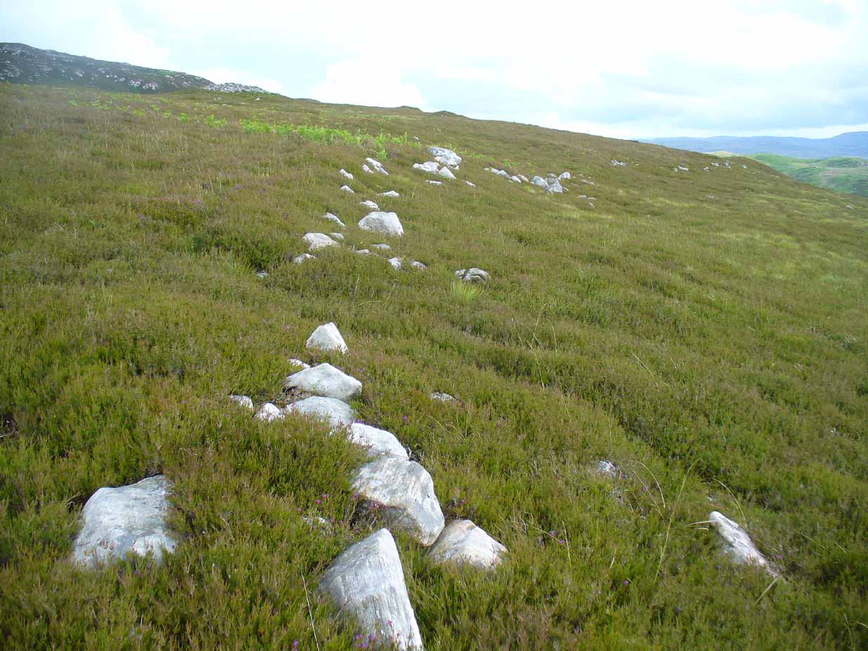
The monument sits on a plateau immediately above the giant Long Skelpick cairn—although neither can be seen from each other. But if you walk only a short distance from the Queen’s Cairn towards the long cairn below, a very notable and extensive line of ancient walling runs along the edge of the geological ridge separating the two tombs, as if deliberately keeping them apart. Other lines of ancient walling run closer to the cairn, seeming to indicate that a settlement of some form was also apparent on this ridge, in close connection with the group of smaller burial cairns.
It’s a gorgeous arena with many prehistoric sites and puzzles to behold, and plenty of unrecorded ones nestling quietly in the heather. It’s bloody superb to be honest!
References:
Gourlay, Robert, Sutherland: An Archaeological Guide, Birlinn: Edinburgh 1996.
Henshall, Audrey S. & Ritchie, J.N.G., The Chambered Cairns of Sutherland, Edinburgh University Press 2005.
Royal Commission Ancient & Historical Monuments, Scotland, Inventory of Monuments and Constructions in the County of Sutherland, HMSO: Edinburgh 1911.
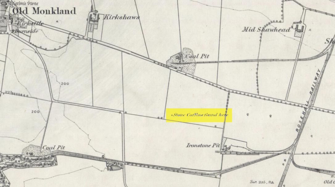
On the flat meadowlands below the slopes of Old Monkland, half-a-mile southeast of the legendary Pilgrim’s Stone, an old mound once lived. It may have been here for thousands of years but, with the encroachment of the toxic Industrialists, its time was coming to an end. The mound was levelled in 1832 and, beneath it, relics from a truly ancient past were unearthed – and destroyed of course. The account of its demise was told in the Glasgow Evening Post of May 26 that year. Many years later, the Royal Commission (1978) lads unearthed the information and included the site in their inventory for prehistoric sites in Lanarkshire. They told:
“In 1832 four cists were discovered during the levelling of a small mound 900m SE of Old Monkland Church. The cists, which measured about 1m by 0.6m, contained the remains of crouched inhumations, two of them double burials with the skulls at opposite ends of the cists. A stone hammer-head and a coin were found in one cist, the latter no doubt indicating subsequent disturbance. There is now no sign of the site, and it is not certain from the report whether the cists were inserted into a small natural mound or were covered by a barrow.
“The present farmer states that his father discovered a single cist during ploughing in the same field; it contained a pottery vessel which the landowner, Mr Sholto Douglas, was thought to have presented to a museum, but it cannot now be traced.”
References:
Royal Commission on the Ancient & Historical Monuments of Scotland, Lanarkshire: An Inventory of the Prehistoric and Roman Monuments, HMSO: Edinburgh 1978.
Take the same directions as if you’re visiting the Great Skirtful of Stones giant cairn on the boundary of Burley and Hawksworth. Cross the wire fence on its southern-side and, cross the (usually overgrown) prehistoric trackway 50-60 yards away. Keep in the same direction onto the pathless moor for about the same distance again, zigzagging back and forth, keeping your eyes peeled for some small overgrown rocky rises. You’ll find ’em.
Archaeology & History
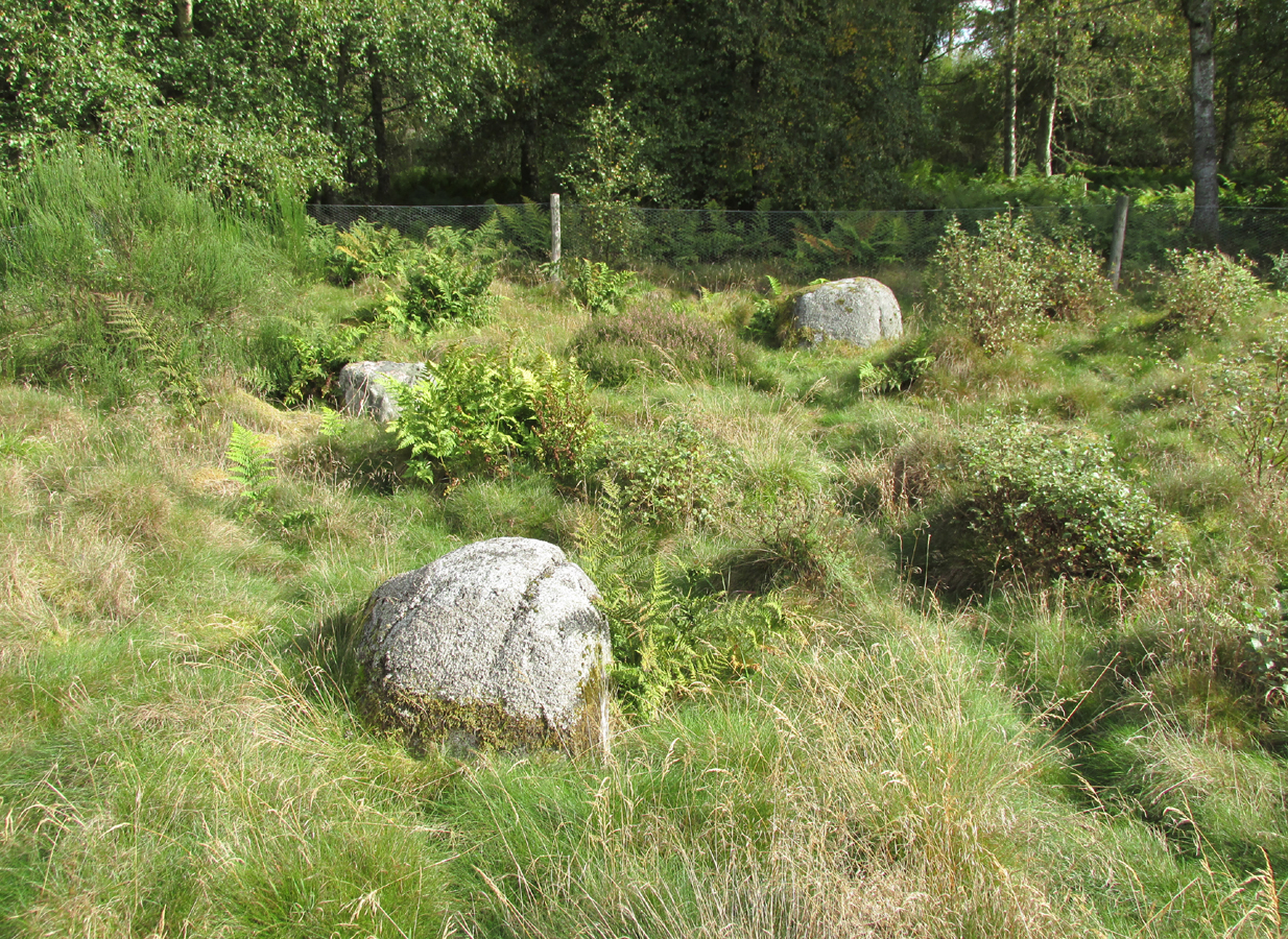
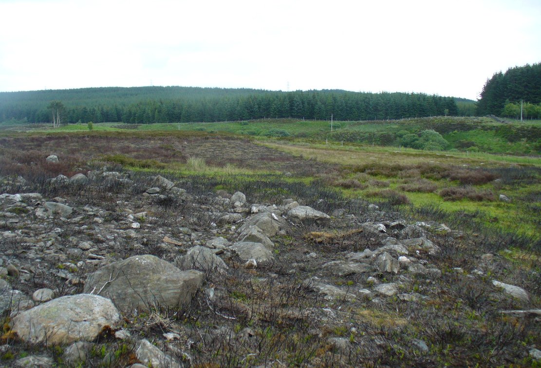
Not to be confused with the much larger Bronze Age graveyard further south on the same moorland, this little-known prehistoric cemetery has had little of any worth written about it since the 19th century and—like many sites on these moors—has received no modern archaeological attention.
Close-up of one of the cairnsTwo of the cairns, looking NW
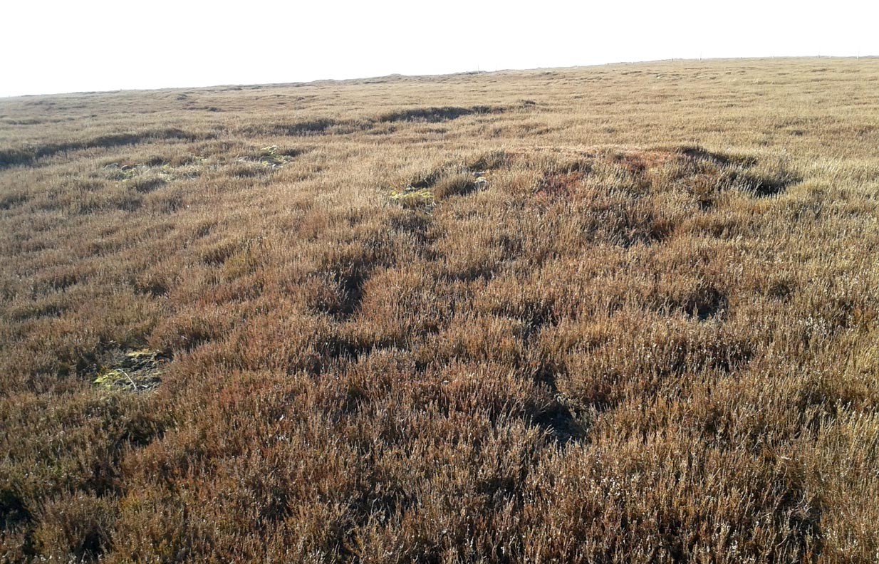
On my last visit to this site with James Elkington in 2015, only four of the heather-clad cairns were visible; but if you explore here after the heather has been burned away, a half-dozen such tombs are found in relatively close attendance to each other. They are each about the same size, being roughly circular and measuring between 3-4 yards across, 10-12 yards in circumference and a yard high at the most. As you can see in the attached images, they are quiet visible even when the heather has grown on them.
Another cairn in this group
This small cairnfield may stretch across and link up with the secondary cairnfield a half-mile to the southwest. More survey work is required up here.
As with the circle of Roms Law and the Great Skirtful of Stones, this relatively small cluster of cairns seems to have had a prehistoric trackway approaching it, running roughly east-west. A short distance west are the much-denuded waters of the Skirtful Spring.
References:
Bennett, Paul, The Old Stones of Elmet, Capall Bann: Milverton 2001.
Faull, M.L. & Moorhouse, S.A. (eds.), West Yorkshire: An Archaeological Guide to AD 1500 (4 volumes), WYMCC: Wakefield 1981.
Wardell, James, Historical Notes of Ilkley, Rombald’s Moor, Baildon Common, and other Matters of the British and Roman Periods, Joseph Dodgson: Leeds 1869. (2nd edition 1881).
Acknowledgements: Huge thanks to James Elkington for use of his photo in this site profile.
At Kirkton of Airlie, park next to the church and walk north eastwards along the track, past the houses Crabra and Cleikheim, and cross the burn by the small bridge and the mound will be seen ahead of you in the field.
Archaeology & History
A largely flat topped, rectangular mound, measuring, according to Canmore, 28 metres by 22 metres, 2.2 metres high on the west side and about ½ metre high on the east side. There is a quantity of rubble strewn on the top among which are two stone slabs, described in 1958 as being possible cist cover stones. The site has clearly suffered considerable disturbance.
The site highlighted in red on the 1865 6″ OS Map.The site from the north
Andrew Jervise, writing of the site in 1864 described it as having been 300′ in circumference and 6-7′ high before the owner started to remove it for agricultural ‘improvements’ around 1859. He described it as being sometimes known as the ‘Battle Cairn’. As part of the demolition of the mound, agricultural workers in October 1859 unearthed a large cinerary urn half filled with human bones and protected by a large sandstone flag. Jervise writes:
“After the urn was found, care was taken removing other parts of the hillock; and on further reducing the surface, the top of a large boulder was exposed, upon and around which the mass of loose stones and earth appear to have been raised which composed the mound. The boulder, as far as ascertained, measures about 6 by 7½ feet; and the urn was found about four feet to the north east of the stone. At the distance of about four yards from the spot where the urn was found, there appeared to be a separate circle, rudely constructed of stones and earth – stones predominating. In this circle, at pretty regular distances, deposits of human and animal bones were found; and each of these deposits appeared to have been protected by two flat stones set up in a triangular form, resembling (an inverted letter V)…none of the deposits was more than 8″ below the surface”. In February 1861, “..a stone cist was found a little to the south east of the boulder….it was 5 feet long by 2 in breadth. The lid, a single slab, was upwards of 6 feet in length…the depth of the cist was 2 feet….It was nearly empty, but one could see, from the soft, black, unctuous earth that was taken out of it, that it had contained a body.”
Jervise continues:
“The name of St. Medan’s Knowe is certainly significant, but, whether it would imply that the place had been that of his burial, or one of those of his ministry, and so been the original place of worship at Airlie – are interesting particulars upon which history and tradition are silent”.
Stone slabs on top
The Ordnance Survey Name Books, and the 25-inch OS map of 1865 record the finding, 20 yards to the west of the knowe, of a bronze spear head, which was at that time in the possession of a Mr Dixon, a merchant of Kirriemuir, which may go some way to explaining the alternative name of the site as ‘Battle Cairn’. The Name Books further record the testimony of a William Duncan that, ‘there have been 7 or 8 stone coffins and an urn found in the knowe, and that he believes a number more might be found if sought for, as the half of it is not yet excavated‘.
From the surviving evidence, it is very likely that Kirkton of Airlie was the centre of a cult of St. Madden (also known as ‘Medan’ and ‘Madan’), with the adjacent Holy Well, the (now destroyed) hamlet of St. Madden’s, and a Dewar’s land occupied by the hereditary custodians of St. Madden’s Bell. This site has no connection with St Medan’s Well at nearby Kirkton of Kingoldrum, that St Medan probably being a St Medana.
References:
Andrew Jervise, Notice of Antiquities in the Parish of Airlie, Forfarshire, Proceedings of the Society of Antiquaries of Scotland, June 1864.
Royal Commission on the Ancient and Historical Monuments of Scotland, The Archaeological Sites & Monuments of Central Angus, Angus District, Tayside Region, HMSO: Edinburgh 1983.
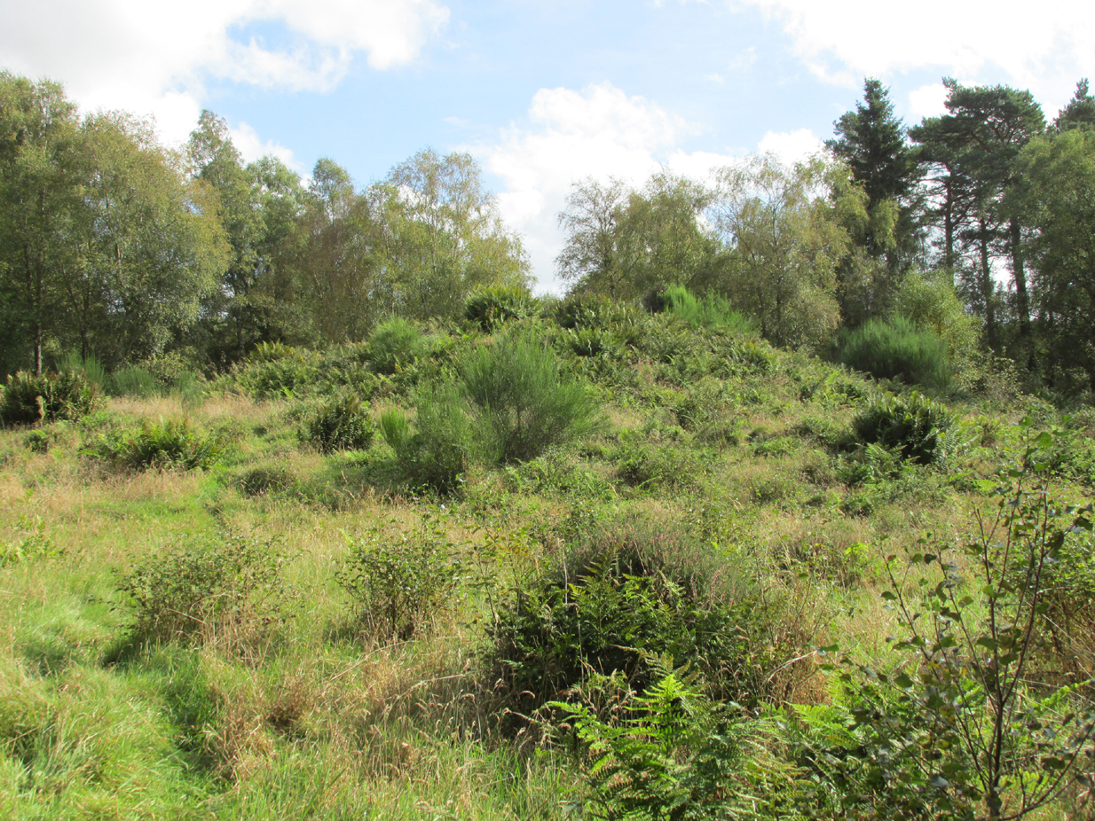
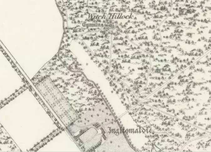
Travelling north on the Bridgemill to Fettercairn road, park at the layby just before the junction with the minor road (left) through the Forestry Commission’s Inverury Wood. Go through the gate and walk along the track to the end where it joins another track and turn right. About 300 yards along, the Hillock is in a fenced enclosure to the right, accessible over a stile.
Archaeology & History
The site was not mentioned in the Statistical Accounts, nor is the origin of the name recalled, from which it is reasonable to assume that ‘witches’ (howsoever that term was interpreted in the days of persecution by the Kirk Sessions) met there. This is reinforced by there being a plot of land due west called ‘Witchfield’. The Canmore report describes the mound as being,
“situated near the edge of a low natural escarpment..measuring about 18m. in diameter and 2m. high.”
The Ordnance Survey reported in the mid-1860s that the Hillock was,
“An artificial mound….a remarkable looking object….enclosed with ornamental wire fencing, the name is well known in the district, but is not mentioned in the Statistical account nor any other document in the possession of the authorities. James Glenny, Gardener at Inglismaldie states that he assisted to open this, under directions from the Earl of Kintore, about Seven years ago, and that after clearing away the top soil there were found several stone coffins containing human bones and a clay urn containing what appeared to be calcined human bones….”
The site shown at the top of the 1865 6″ OS Map.The Hillock with 3 stones in the foreground
Another remarkable feature of the Hillock enclosure is an arc of three large earth fast boulders to the north-west of the mound. It has the appearance of being an incomplete, possibly four poster circle. The stones are not listed by Aubrey Burl (2000) as being part of a circle, and if indeed it was a circle there doesn’t seem to be any evidence of the fourth stone, which would have been positioned nearest to the Hillock. Unless the Hillock was imagined to be the ‘missing’ fourth stone.
Three stones – once part of a circle?
A ‘well’ is shown on the modern OS map in the corner of the enclosure nearest the stile, but there was no evidence of this on the day of my visit.
Despite its rather remote location, it was noticeable by the well trodden state of the long grass on the day of my visit that the site receives quite a few visitors – a venue still for witches?
References:
Burl, Aubrey, The Stone Circles of Britain, Ireland and Brittany, Yale University Press 2000.
Royal Commission on the Ancient and Historical Monuments of Scotland, The Archaeological Sites & Monuments of South Kincardine, Kincardine and Deeside District, HMSO: Edinburgh 1982.
Close to the ancient boundary of north Lanarkshire—if not actually on it—and looking down on the River Clyde, was once a prehistoric burial mound, probably Bronze Age in nature. Described first of all in David Ure’s (1793) early survey of Rutherglen, he told that:
“A tumulus of earth, supposed to have been originally a burying place, was lately demolished in the estate of Shawfield, a few yards from Polmadie; and the place where it stood converted into a mill-dam. None of its contents attracted the particular attention of the workmen employed in removing it.”
The site was subsequently referenced in Hugh MacDonald’s (1860) excellent work, but no remains of it now exist.
From Kenmore, take the minor road on the south-side of Loch Tay for 1½ miles (2.4km) until you reach the hamlet of Acharn. From here take the track uphill for ½-mile past the Acharn waterfalls and when you come out on the east-side of the trees, keep walking uphill parallel to the trees and burn until the land levels-out and the track heads away, east. 200 yards ahead, on the left-side of the track, you’ll see the large fairy-mound.
Archaeology & History
The tumulus looking NE
First reported in archaeological circles in the Discovery & Excavation Scotland mag in 1964, this archetypal fairy-mound or tumulus sitting on the grassy plain overlooking the eastern end of Loch Tay and district would have been known of by local people in older times, but I can find no early accounts of it, nor its traditions. When Bob Money (1990) came here, he told of the grand vista stretching into the distant mountains:
“From here the views…are superb, and the little mound, which is an ancient tumulus, or burial mound, has sat here undisturbed for several thousand years, guarding the secret of its once important occupant.”
Circular in structure and measuring 20 feet across, the mound rises nearly four-feet high and is probably Bronze Age in origin. Although mostly covered in grass, there are some loose stones visible on the side of the mound, seeming to indicate that it may be a covered cairn. No excavation have yet taken place here.
References:
Money, Bob, Scottish Rambles – Corners of Perthshire, Perth 1990.
Acknowledgements: Many thanks to the unholy bunch who helped travel, locate, photograph and take notes on the day of our visit here, including Aisha, Lara & Leo Domleo; Lisa & Fraser; Nina and Paul. Let’s do it again and check out the unrecorded stuff up there next time!
The location of what was, in all likelihood, a small Bronze Age burial on the edge of old Shotley Bridge (as it was in the mid-19th century) remains a mystery. It’s likely that the position of the site is now beneath someone’s house in the town. Its existence was thankfully recorded in correspondence between a “Mr. John Dixon, of the Engineer’s Office, Consett Ironworks,” and the great John Collingwood Bruce. Dixon’s letter dated October 13, 1856, told:
“I take the liberty of informing you of the discovery of a coffin, of some description or other, in a field near ShotleyBridge. I have visited the place and enclose a sketch² made on the spot as it appeared when I saw it. Some workmen were excavating sand and came upon it about a foot beneath the surface. The only remains that we can ascertain to have been in it, are a few pieces of bone, barely recognizable as such, and now in the hands of Dr.Renton. I have not yet seen them. He tells me that one fragment resembles a portion of a skull, but that they are in such small pieces it is difficult to say what they are. I shall endeavour to get a piece — as, if the surface remains, I apprehend we shall be able to say whether they are human or not. Possibly it may never have been a human coffin —though from the paved bottom and the appearance of great age the stones possess, and also the bearing NW and SE, I am inclined to think it must be one. The dry situation — a sloping hillside — would tend to preserve the remains of bones. I cannot hear of any urns, or the fragments of any, having been found in it. They may, if ever there were any, have been destroyed. The coffin may have been opened before, and rifled — say hundreds of years ago. It seems unaccountably short — as I believe the older ones are generally distinguished by their great size; but it may have been, and probably was, merely a receptacle for burnt remains, either in urns or not. The paving I mentioned had all disappeared when I saw it. As it consisted of small stones, they had doubtfully been carried away. Not being an antiquarian, or skilled in antiquarian lore, I cannot do more than form an idea about it, but shall be glad to hear your opinion at any time you may find it convenient.”
In a second letter, replying to Mr Bruce’s enquiries, Dixon added that a piece of flint had been found amongst the debris which, he thought,
“might possibly turn out to be part of an ancient weapon; and if so, might lead to some solution of the question.”
As Dr. Bruce pointed out: many ancient British graves were not uncommonly as short as three feet. In so called “rude times it would seem that a grave was made much shorter than the body—which was doubled up, and thrust in.” It was his opinion that the grave here was prehistoric. We have to agree with him. But where exactly was this place? Does anyone know…?
References:
Anon., “Discovery at Shotley Bridge,” in Proceedings Society of Antiquaries Newcastle-upon-Tyne, volume 1, no.22, 1856.
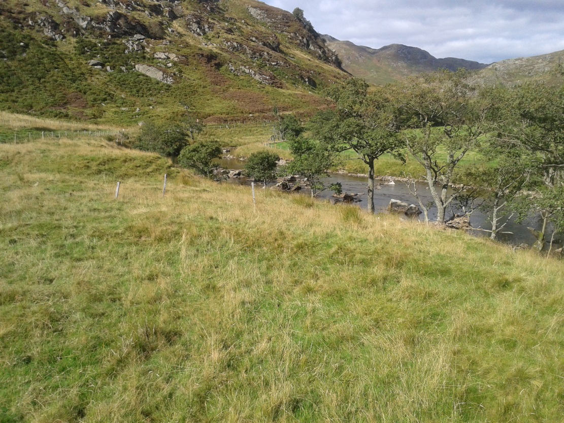
There are two ways into this glen by road. Whichever route you take (from Crieff side, or via the long Dunkeld route), when you hit the flat bottom of it, where the green fields are right by the roadside, walk along till you find the road meets the river’s edge. On the south-side of this small roadside section of the river, you’ll see a single large boulder 10-20 yards away. That’s the spot!
Archaeology & History
Described in some of the archaeology texts as just a ‘cist’, this giant stone is obviously the remains of much more. For a start, as the 1834 drawing illustrates here (coupled with several other early descriptions of the place), other visible antiquarian remains were very much apparent at Ossian’s Stone before a destructive 18th century road-laying operation tore up much of this ancient site. A marauding General Wade of the English establishment was cutting through the Scottish landscape a “military road”, to enable the English to do the usual “civilize the savages”, as they liked to put it. This curious “Giant’s Grave” was very lucky to survive.
Skene’s 1834 sketch, showing surrounding ringOssian’s Stone in the Sma’ Glen
The earliest description of events surrounding the site, as well as the attitude of the Highlanders when they saw the disrespectful English impose their usual disregard, is most insightful. In a series of letters written by a Captain Edward Burt (1759) in the first-half of the 18th century to the english monarch of the period, we read a quite fascinating account which must have been very intriguing to witness first-hand.
General Wade and his band of marauders had reached the Sma’ Glen at the end of Glen Almond and were about to continue the construction of their road. Burt (1759) wrote:
“A small part of the way through this glen having been marked out by two rows of camp colours, placed at a good distance one from another, whereby to describe the line of the intended breadth and regularity of the road by the eye, there happened to lie directly in the way an exceedingly large stone; and, as it had been made a rule from the beginning, to carry on the roads in straight lines as far as the way would permit, not only to give them a better air, but to shorten the passenger’s journey, it was resolved the stone should be removed, if possible, though otherwise the work might have been carried along on either side of it.
“The soldiers, by vast labour, with their levers and jacks, or hand-screws, tumbled it over and over till they got it quite out of the way, although it was of such an enormous size that it might be matter of great wonder how it could ever be removed by human strength and art, especially to such who had never seen an operation of that kind: and, upon their digging a little way into that part of the ground where the centre of the base had stood, there was found a small cavity, about two feet square, which was guarded from the outward earth at the bottom, top, and sides, by square flat stones.
“This hollow contained some ashes, scraps of bones, and half-burnt ends of stalks of heath; which last we concluded to be a small remnant of a funeral pile. Upon the whole, I think there is no room to doubt but it was the urn of some considerable Roman officer, and the best of the kind that could be provided in their military circumstances; and that it was so seems plainly to appear from its vicinity to the Roman camp, the engines that must have been employed to remove that vast piece of a rock, and the unlikeliness it should, or could, have ever been done by the natives of the country. But certainly the design was, to preserve those remains from the injuries of rains and melting snows, and to prevent their being profaned by the sacrilegious hands of those they call Barbarians, for that reproachful name, you know, they gave to the people of almost all nations but their own.
“…As I returned the same way from the Lowlands, I found the officer, with his party of working soldiers, not far from the stone, and asked him what was become of the urn? To this he answered, that he had intended to preserve it in the condition I left it, till the commander-in-chief had seen it, as a curiosity, but that it was not in his power so to do; for soon after the discovery was known to the Highlanders, they assembled from distant parts, and having formed themselves into a body, they carefully gathered up the relics, and marched with them, in solemn procession, to a new place of burial, and there discharged their fire-arms over the grave, as supposing the deceased had been a military officer.
“You will believe the recital of all this ceremony led me to ask the reason of such homage done to the ashes of a person supposed to have been dead almost two thousand years. It did so; and the officer, who was himself a native of the Hills, told me that they (the Highlanders) firmly believe that if a dead body should be known to lie above ground, or be disinterred by malice, or the accidents of torrents of water, &c. and care was not immediately taken to perform to it the proper rites, then there would arise such storms and tempests as would destroy their corn, blow away their huts, and all sorts of other mis-fortunes would follow till that duty was performed. You may here recollect what I told you so long ago, of the great regard the Highlanders have for the remains of their dead…”
Ossian’s Stone in his landscape
We can rest assured that the ‘Roman officer’ idea proclaimed by our early narrator is most probably wrong and that the nature of this site, when seen at ground-level even today and moreso by referencing Skene’s 1834 drawing of the place, above (which shows a more complete low surrounding ring of stones) indicate this to be of prehistoric provenance. Of intrigue to me, is the ritual of the incoming Highlanders, who took the relics onto another place and re-interred them in their own customary manner. We do not know where the Highlanders moved these (probable) prehistoric relics and I can find no supporting folklore to show precisely where they went—but a likely site would be the prehistoric cairn on the mountaintop southwest of here (at NN 8899 3018), or a site that has sometimes been confused with Ossian’s Stone a short distance to the south in the Sma’ Glen, known as the Giant’s Grave (at NN 9050 2956). This latter site would seem more probable.
Anyway…. many years after Edward Burt’s initial Letters defined the site for outsiders, one Thomas Newte (1791) came a-wandering hereby. He found that the account of General Wade’s intrusion was still on the tongues of local people, along with additions of further giant-lore and Fingalian tales, typical of the Creation myths of our early ancestors. In typically depreciative English manner Newte told:
“In that awful part of Glen Almon, already mentioned, where lofty and impending cliffs on either hand make a solemn and almost perpetual gloom, is found Clachan-Of-Fian, or monumental Stone of Ossian. It is of uncommon size, measuring seven feet and an half in length, and five feet in breadth. About fifty years ago, certain soldiers, employed under General Wade in making the Military Road from Stirling to Inverness, through the Highlands, raised the stone by large engines, and discovered under it a coffin full of burntbones. This coffin consisted of four gray stones, which still remain, such as are mentioned in Ossian’s Poems. Ossian’s Stone, with the four gray stones in which his bones are said to have been deposited, are surrounded by a circular dyke, two hundred feet in circumference, and three feet in height. The Military Road passes through its centre.”
Cole’s 1911 plan of stone & surrounding ringOssian Stone by Fred Cole
From hereon, many other writers and travellers came to see this great legendary stone within the depleted remains of its embanked circle—and thankfully it hasn’t been disturbed any further, still being visible to this day. The greatest ‘archaeological’ attention the site has received was from the early pen of great antiquarian Fred Coles (1911). On his journey here, after travelling past a large white stone which was mistakenly named as Ossian’s Stone by the usual contenders, he and his friend reached the right place:
“close to a strip of ground where the river and road almost touch each other, and immediately below the steepest of the crags of Dun More on the eastern side and the debris slopes of Meall Tarsuinn on the west, a most impressive environment, be the stone a prehistoric monument or not! The spot is interesting for itself, apart from all legend; and the remains consist of a mighty monolith…and a narrow grassy mound…to its east, with a few earthfast blocks set edgewise near its eastern extremity. Close to the roadside, but at the same level of 690 feet above the sea, there is a slab-like stone set up, measuring 3 feet in width, 1 foot 3 inches in thickness, and about 2 feet 6 inches in height. A space of 63 feet separates this block…from the huge rhomboidal mass called Ossian’s Stone. Five feet east of the latter is the base of the grassy mound which measures about 12 feet in length, 4 feet in greatest breadth, and 3 feet 10 inches in height. To the north and the south in a slightly curving line are set the six small slabs shown. There seems also to be a vague continuation of this strange alignment in both directions. All over the ground between A and B, are many strangle low parallel ridges of smallish stones having a general direction of nearly north and south. The rest of the ground is grassy, and here and there a little stony. In the plan all the stones are drawn larger than exactly to scale.
“The great stone is 8 feet high and has a basal girth of 27 feet. Several small stones lie near it. Such are the facts as at present to be observed on the ground.”
Section of outlying grass-covered low ring, just visibleGeological cup-marks?
There are two small conjoined cup-marks on top of the stone, but these seem to be geological in nature. The precise nature of the site is difficult to ascertain without excavation; but the Royal Commission lads reckon it to be a prehistoric ‘cist’ or grave in their own analysis, based mainly on the quoted literary texts. The surrounding ‘ring’ of small stones doesn’t seem to have captured their attention too much; but the site needs contextualizing within this damaged circular enclosure, which appears to have been a cairn circle initially, of some sort, with Ossian’s huge stone resting over the grave of one late great ancestral character, probably placed here thousands of years back in the Bronze Age… A truly fascinating place in truly gorgeous landscape.
Folklore
The glen itself has a scattering of giant lore associated with Finn and/or Ossian. A nearby cave was one of the places where this legendary character, and subsequent bards, were said to have spent time.
There are a small number of heavy rocks presently placed on top of Ossian’s Stone. These may be due to the site being used as a “lifting stone”: a sort of rite of passage found at a number of sites in the Perthshire mountains and across the Highlands to indicate a boy’s strength before entering manhood. Not until they have lifted and deposited a very heavy rock onto the boulder can they rightly become chief or leader, etc.
The poet William Wordsworth wrote about Ossian’s Stone, calling it “Glen Almein, or The Narrow Glen”:
In this still place, remote from men,
Sleeps Ossian, in the Narrow Glen;
In this still place, where murmurs on
But one meek streamlet, only one:
He sang of battles, and the breath
Of stormy war, and violent death;
And should, methinks, when all was past,
Have rightfully been laid at last
Where rocks were rudely heaped, and rent
As by a spirit turbulent;
Where sights were rough, and sounds were wild,
And everything unreconciled;
In some complaining, dim retreat,
For fear and melancholy meet;
But this is calm; there cannot be
A more entire tranquillity.
Does then the Bard sleep here indeed?
Or is it but a groundless creed?
What matters it? I blame them not
Whose Fancy in this lonely Spot
Was moved; and in such way expressed
Their notion of its perfect rest.
A convent, even a hermit’s cell,
Would break the silence of this Dell:
It is not quiet, is not ease;
But something deeper far than these:
The separation that is here
Is of the grave; and of austere
Yet happy feelings of the dead:
And, therefore, was it rightly said
That Ossian, last of all his race!
Lies buried in this lonely place.
References:
Anonymous, Tourists Guide to Crieff, Comrie and the Vale of Strathearn, Crieff
1874.
Take the A826 road south out of Aberfeldy, uphill – and uphill. Several miles up, past the roadside Loch na Craige, and past the solitary farmhouse of Scotston, you’re getting close. A few hundred yards past here watch out for the small bridge over the small burn; and literally another half-mile past this, keep your eyes peeled for the small track on your right, onto the moors. Walk 70 yards on the track and there, on your left, it rises from the heather!
Archaeology & History
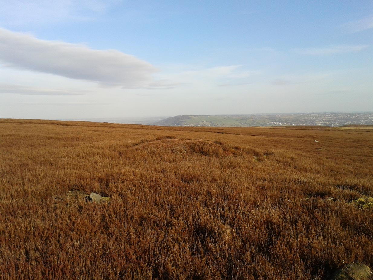
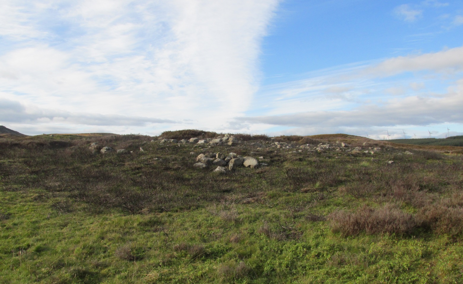
Carn Ban, Glen Cochill (photo credit, Paul Hornby)
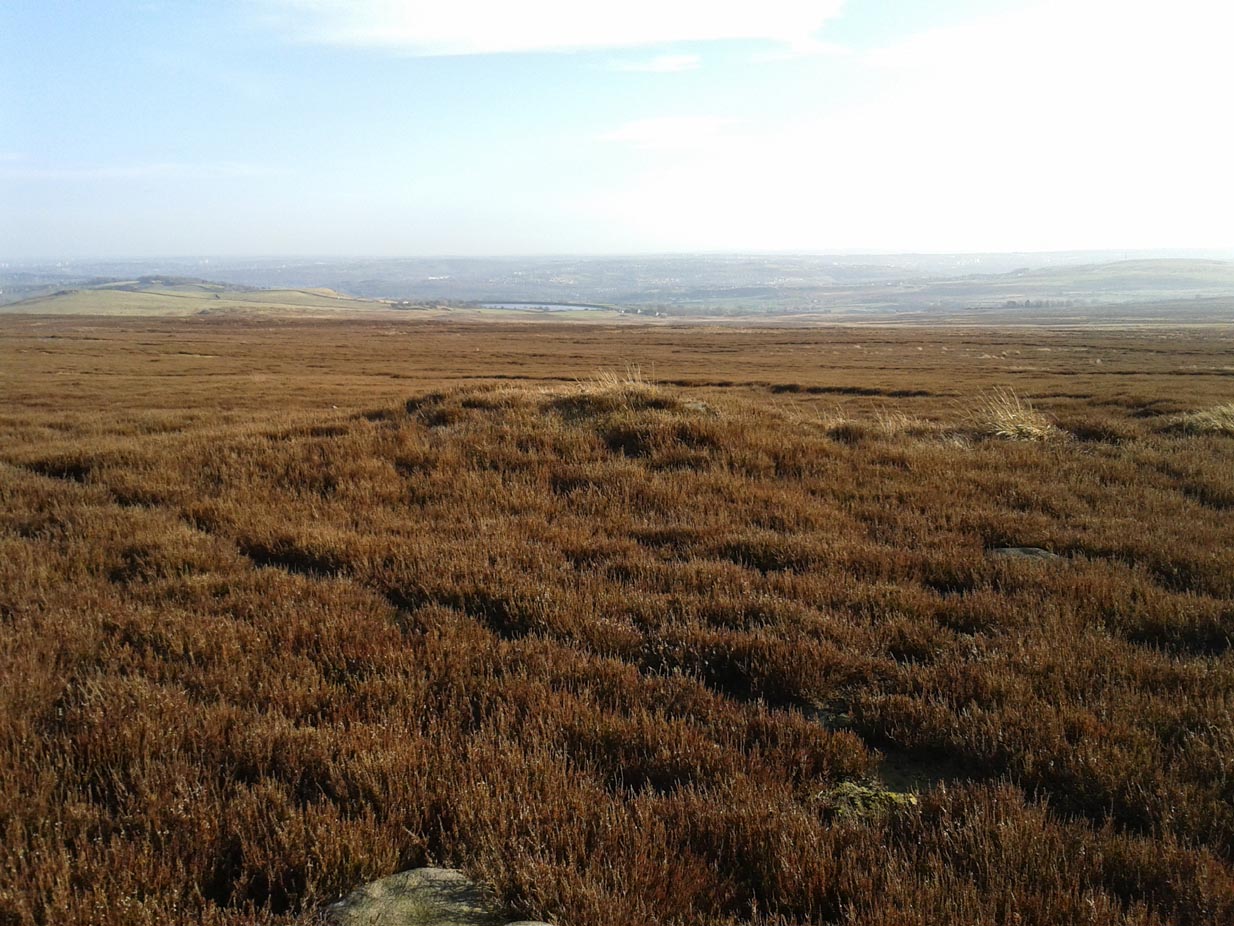
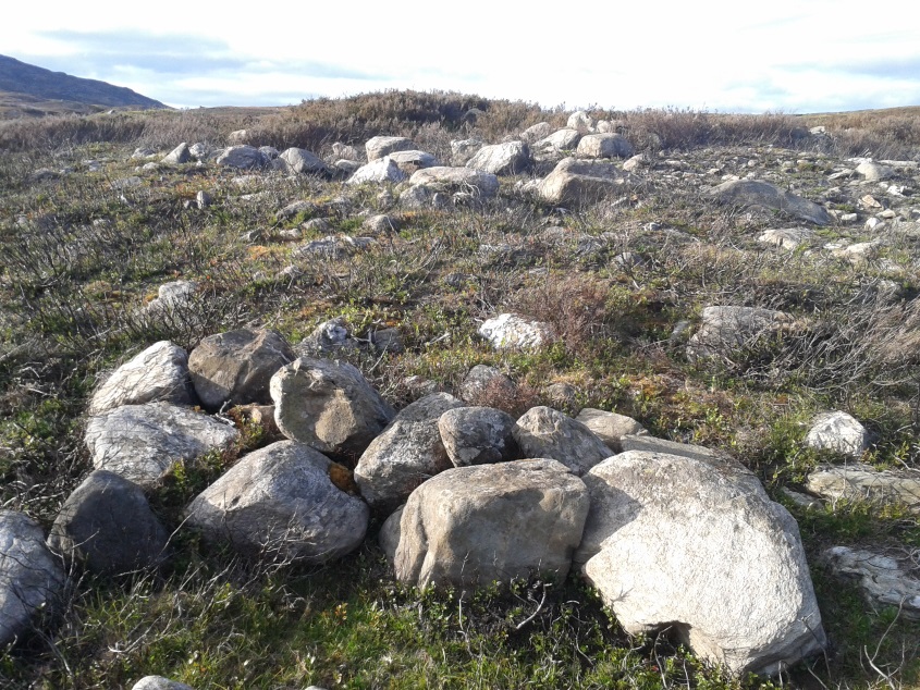
This giant neolithic tomb in the middle of a beautiful nowhere is perhaps the tomb of an ancestral King or Queen, later idolised into creation myths by our heathen ancestors who, we know, lived across this huge moorland plain for countless centuries. One account tells that “a circle of free-standing boulders set at irregular intervals” used to surround the cairn, but this seems to have gone.
Southeastern quadrant
Measuring 21 yards (19.2m) across east-west, and just over 21 yards (19.3m) north-south, this is quite a large construction made up of thousands of small stones in a near-perfect ring that measures 68 yards (62m) in circumference. The cairn seems to have been built in three layers, with its outer defining ring of medium-sized rocks, upon which a layer of typical cairn-spoil stones were laid. A couple of yards within this, a second internal ring has been set consisting of much larger stones, more typical of those found in small stone circles or average ring-cairns. Within this, the cairn seems to have been raised again and another large deposit of countless stones were scattered, with many pieces of white quartz (very common in this area) incorporated in the construction.
Capstone and outer ringSection of internal ring
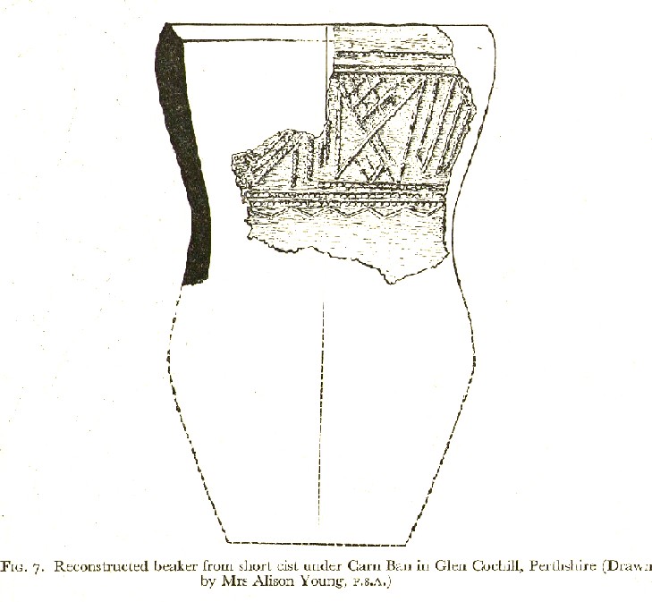
At the very centre of the cairn, at least one large central ‘tomb’ or cist is clearly evident. Within this cist were found the severely damaged ruins of a small decorated beaker, in which, perhaps, the ashes of the dead might have once been found. A very large and heavy capstone that covered the central tomb, has been rolled over and lays just off-centre. No rock art seems visible on this capstone, but we were unable to check its underside. When standing here at the middle of the tomb, you are four feet above the average ground-level of the surrounding moorland.
Section of cairn edgeImaginative reconstruction of beaker in central tomb
Curiously and erroneously reported by Margaret Stewart (1961) to have “been completely removed”, this large and very visible monument lives near the middle of a very large and extensive prehistoric enclosure, whose walled remains extend for some distance all round this section of the moors. Within this arena we find large numbers of other architectural features, including many smaller cairns, some hut circles and additional lines of internal prehistoric walling. Just a few yards south of the tomb itself, we can clearly see a length of walling running east-west and another seemingly reaching up to the White Cairn. Whether these were built at the same time, or later, is difficult to say.
In the event that you visit this site, take your time! All round here, mainly to the north and west, you will find masses of prehistoric remains, none of which has been adequately excavated. A few hundred yards north is an extended necropolis that doesn’t appear to have been surveyed.
References:
Stewart, Margaret E.C., “Strath Tay in the Second Millenium BC – A Field Survey”, in Proceedings Society Antiquaries Scotland, volume 92, 1961
Acknowledgements: Huge thanks again to Paul Hornby for his assistance with site inspection, and additional use of his photos.