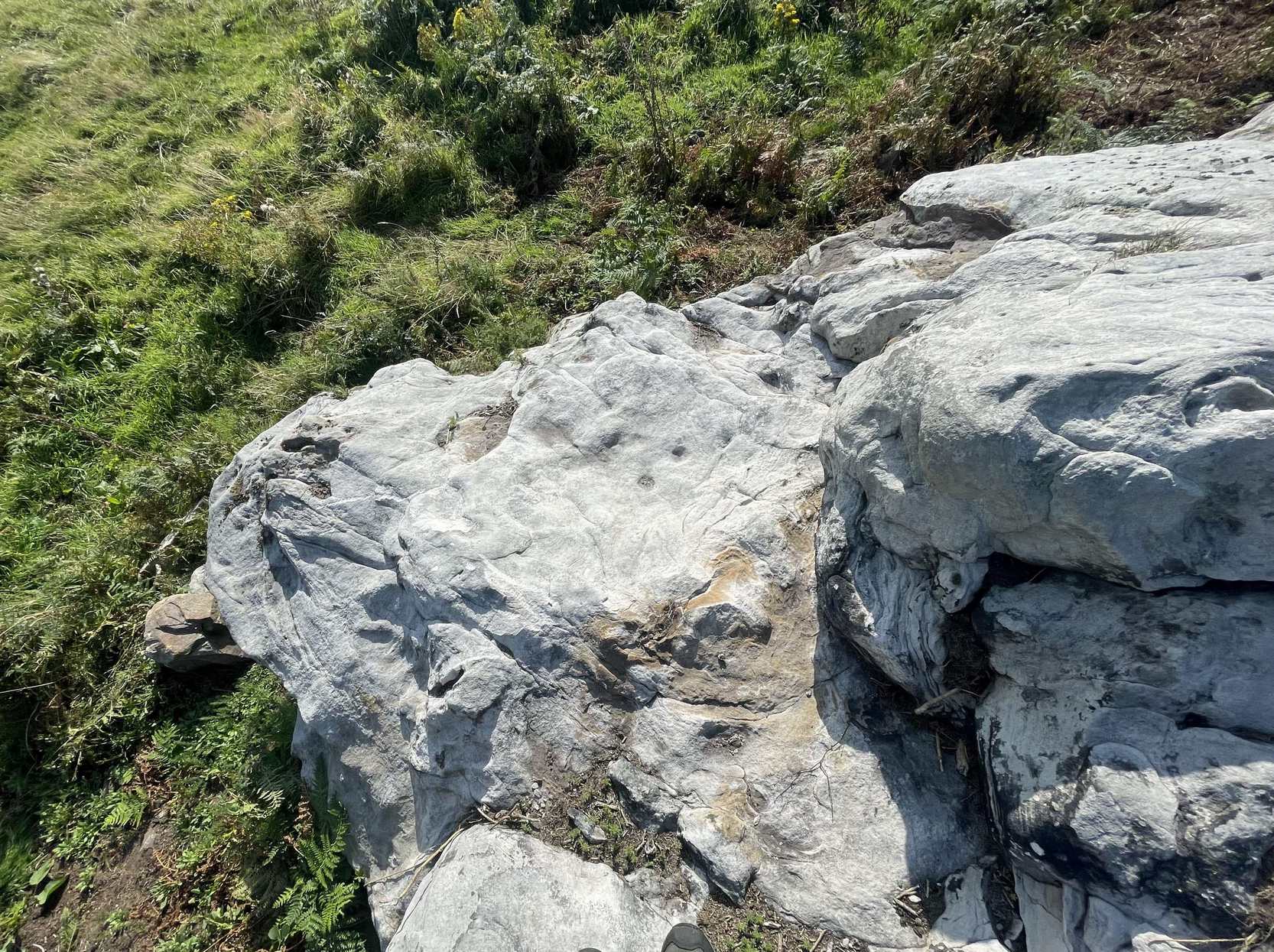
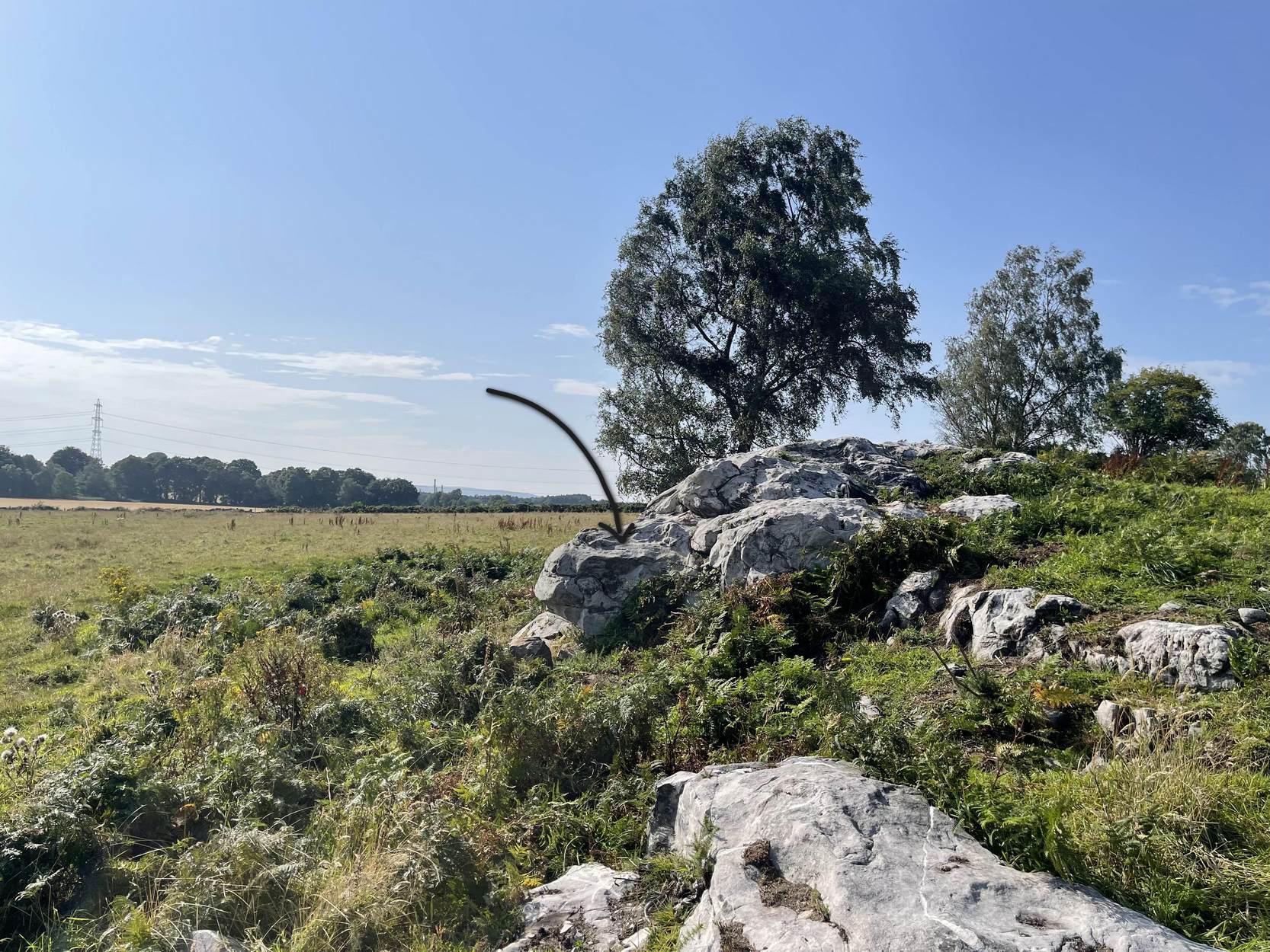
Follow the directions as if you’re visiting the impressive multi-ringed design of the Castleton (10) carving. Once there, walk south-east along the geological ridge for 45 yards where the small cliff drops down to the field. Just where this drop occurs, on a lower horizontal level of the rock face (only a small section) you’ll notice two distinct “cups”. You can’t really miss it!
Archaeology & History
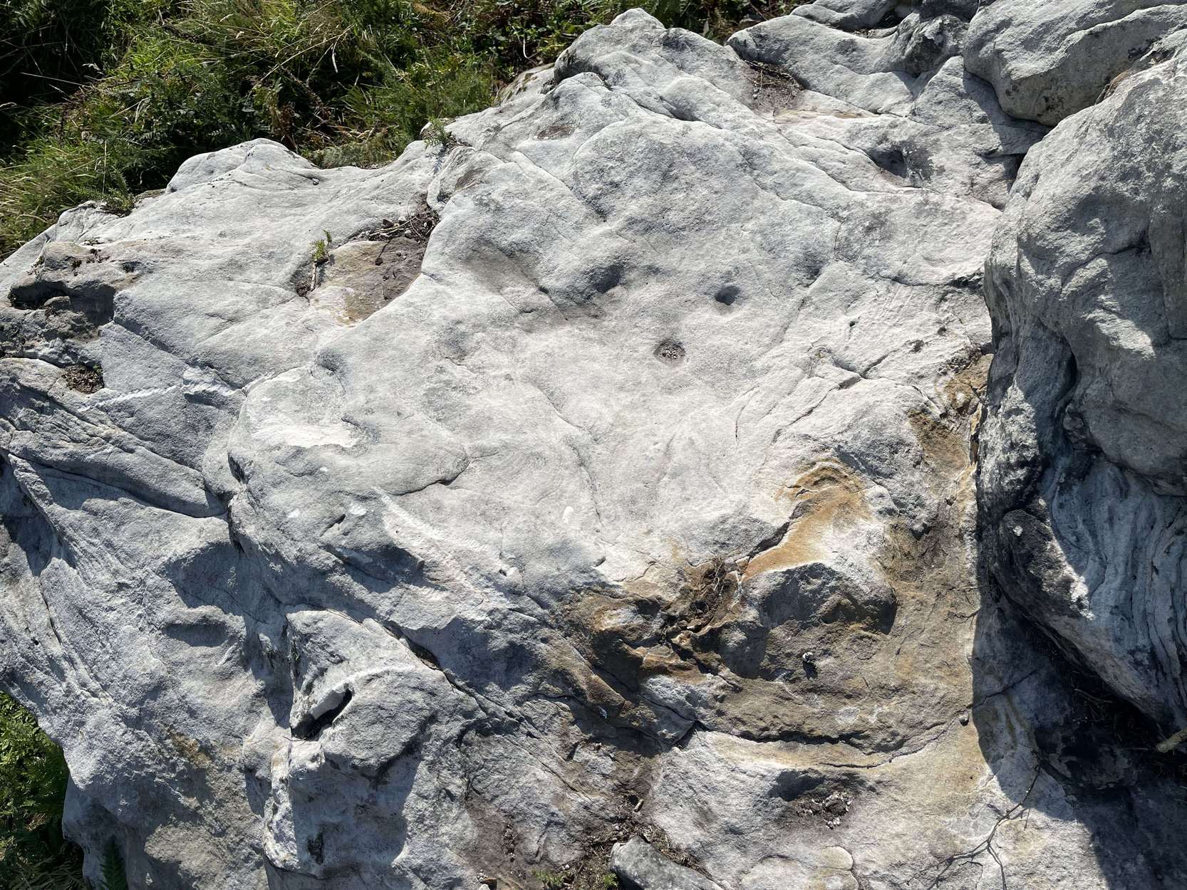
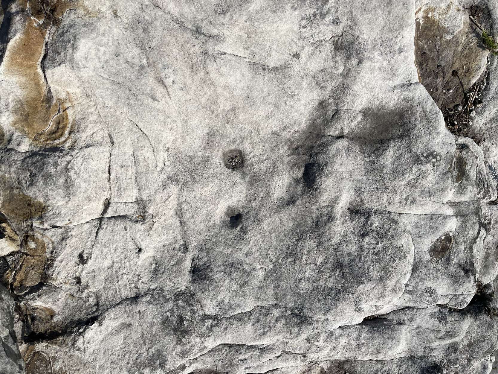
This very basic cup-marked stone was, until recently, covered in dense gorse, making access to the site almost impossible. But following a fire that happened here not too long ago, the smoldering remains needed to be cleared and, once the job was done, we were able to see the two distinct ‘cups’ that were first described in Maarten van Hoek’s (1996) survey. But the cups that he described are, most likely, little more than Nature’s handiwork. I’m somewhat skeptical of them as being the real deal. In the same survey, he added another site, which are just natural bowls in the rock just over 100 yards southwest of here as being cup-marks — which they’re not!
References:
van Hoek, M.A.M.,”Prehistoric Rock Art around Castleton Farm, Airth,” in Forth Naturalist & Historian, volume 19, 1996.
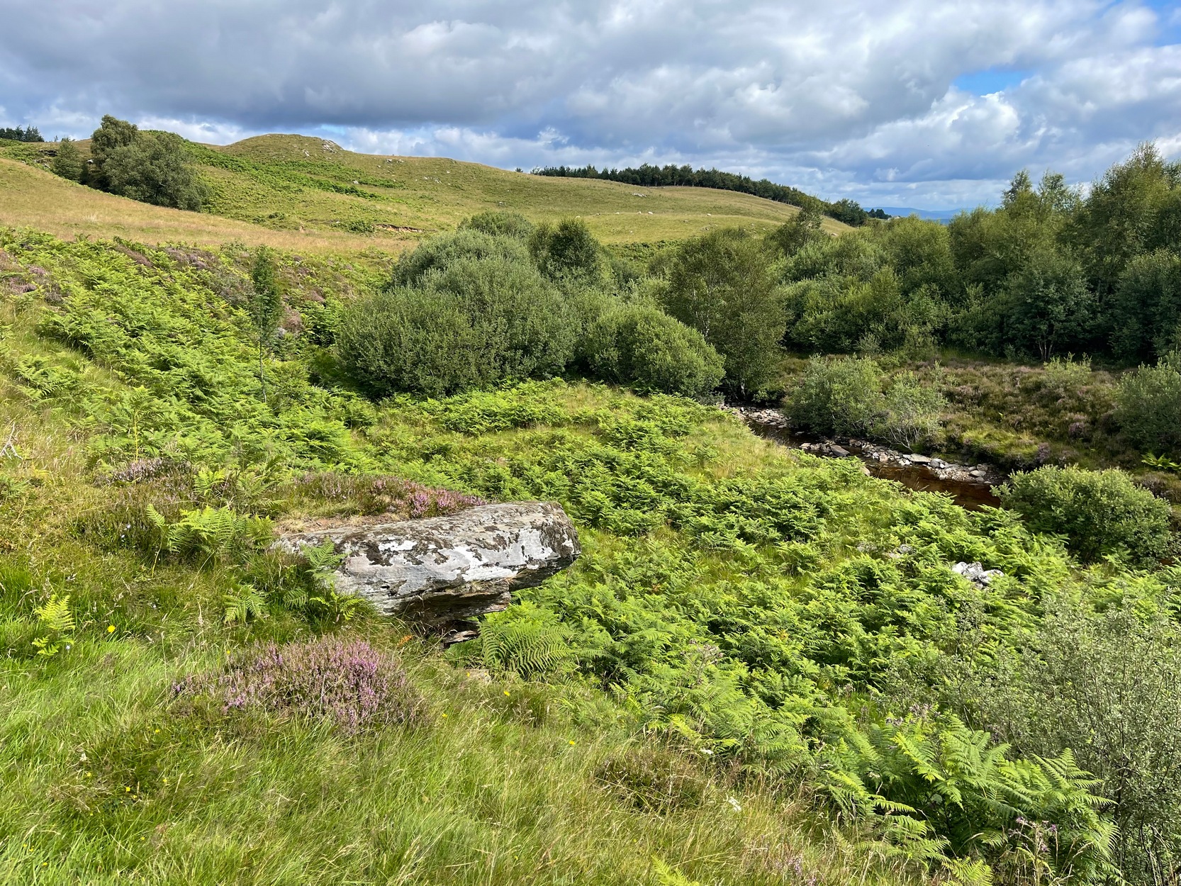
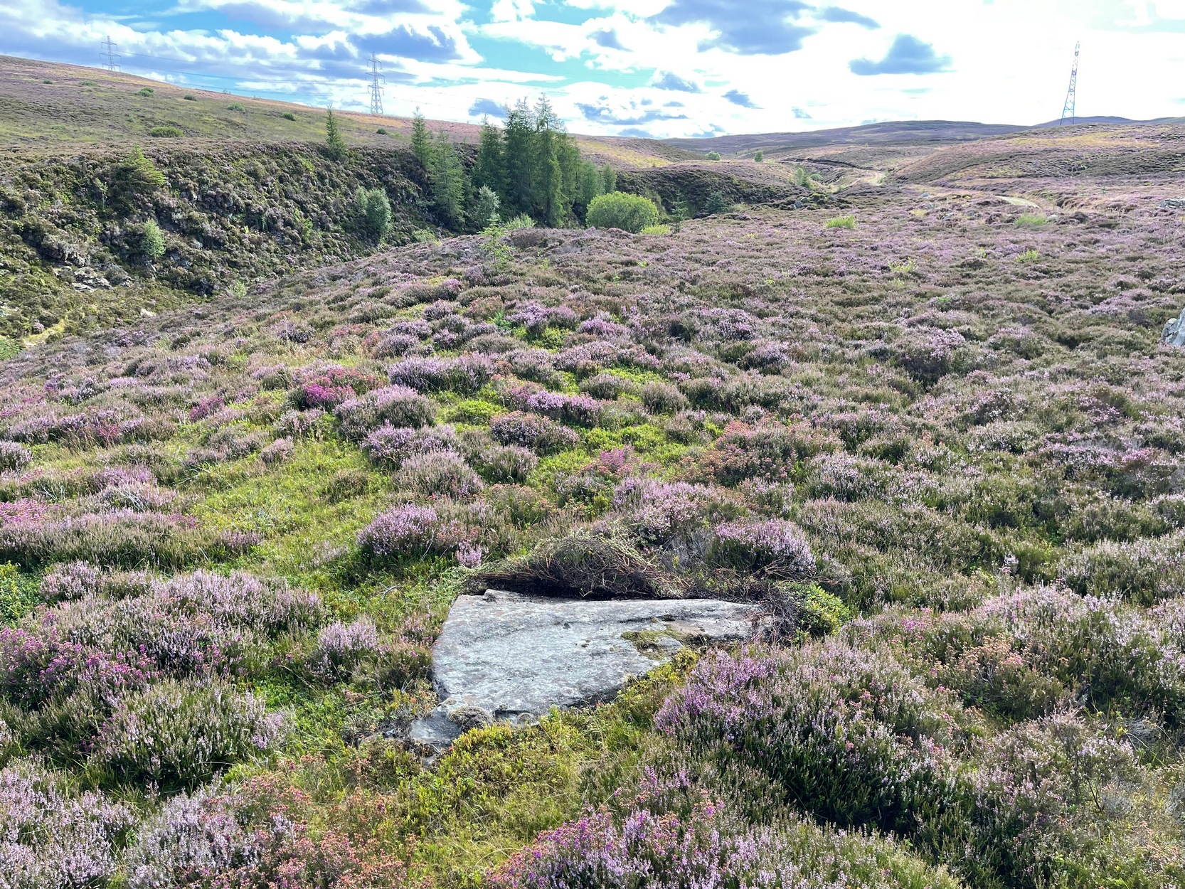
Take the A826 Crieff Road uphill for 275 yards then turn right up the Urlar Road. It’s a long uphill walk from here, up the private road, through and past Urlar Farm and along the track; making sure you keep to the west-side of the burn – don’t cross over it! Beyond the farm, the fields open up ahead of you into the distant hills. Keep along the track until, after a few hundred yards, on the left by the waters, the first small copse of trees appears. (if you reach the bothy, you’ve gone way to far) Here, walk towards the waters and you’ll see good-sized boulder sticking out of the ground and overlooking the burn below. That’s it.
Archaeology & History
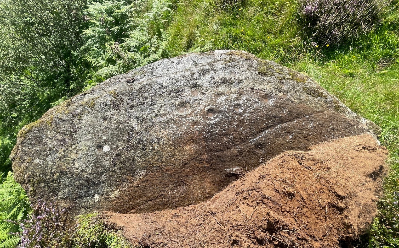
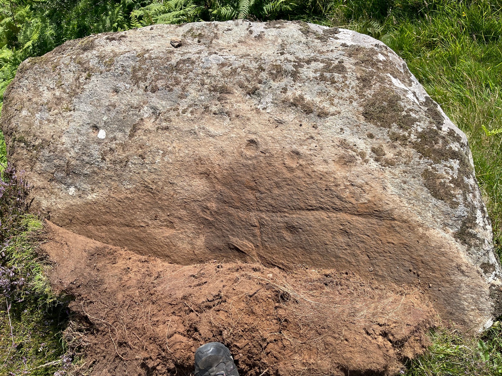
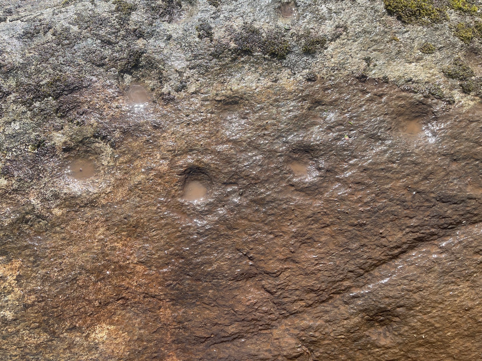
This faded but decent cup-and-ring design, cut into an overhanging rock where you’d sit and dangle your legs, was first described by George Currie (2009) who, in his typically minimalist style told that it “bears 17 cups, 4 of which have single rings.” There may be more to it, but some of the stone is heavily covered in vegetation and on my visit here, the summer heat overwhelmed my ability to gain a complete picture of the surface.
The Urlar Burn (4) carving
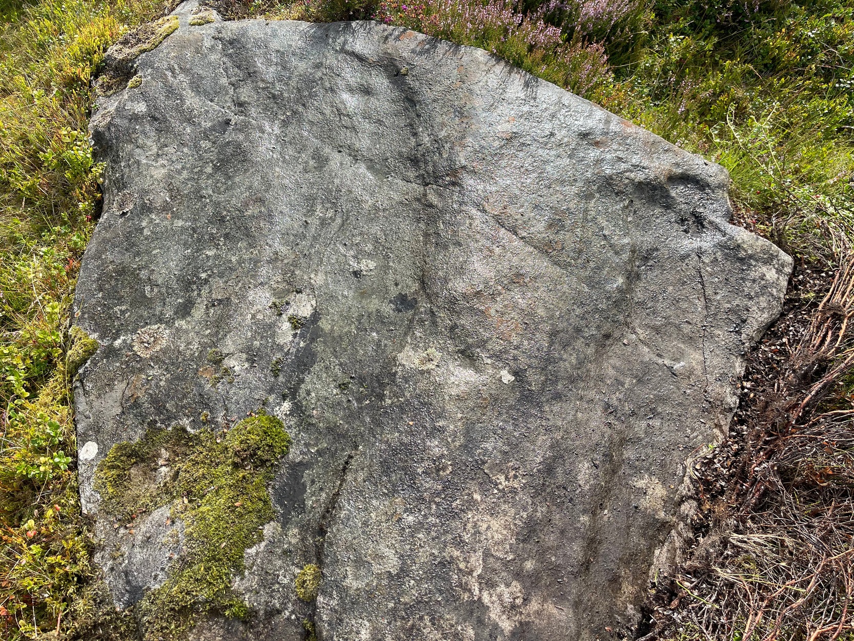
Faded design in bright sun
Most of the design is near the western earthfast end of the stone. A long natural scratch in the rock, seemingly enhanced by the hand of man, separates at least three shallow cup-marks on one side (north) from the greater mass of the design on the other —which is where all the cup-and-rings can be seen. One of the rings is incomplete, whilst another has a natural crack running up to its outer edge, which may have been played around with slightly when the carving was first made.
I liked it here – and spent an hour or so under the bright sun before the heat pushed me away, to bathe in the pool below for a while…. Check it out when you’re looking at the other carvings in the neighbourhood
Folklore
Some cup&rings close-up
Although there’s nothing specific about this stone, the burn to the side of the carving was haunted by an old urisk in times gone by: an elemental creature from Scottish fairy lore who inhabited lonely streams and waterfalls. The urisk of Urlar Burn was known as Brunaidh an Easain (his brother, Peallaidh, of greater renown, lived in the gorge of Moness close to Aberfeldy) and this spot may have been one of his abodes. Urisks are associated in some places with cup-marked stones, in which offerings of milk were given to placate them — and this is a good site for any urisk to look over his winding waters….
References:
Currie, George, “Perth and Kinross: Dull: Urlar Burn 1-4,” in Discovery & Excavation Scotland (new series), volume 10, 2009.
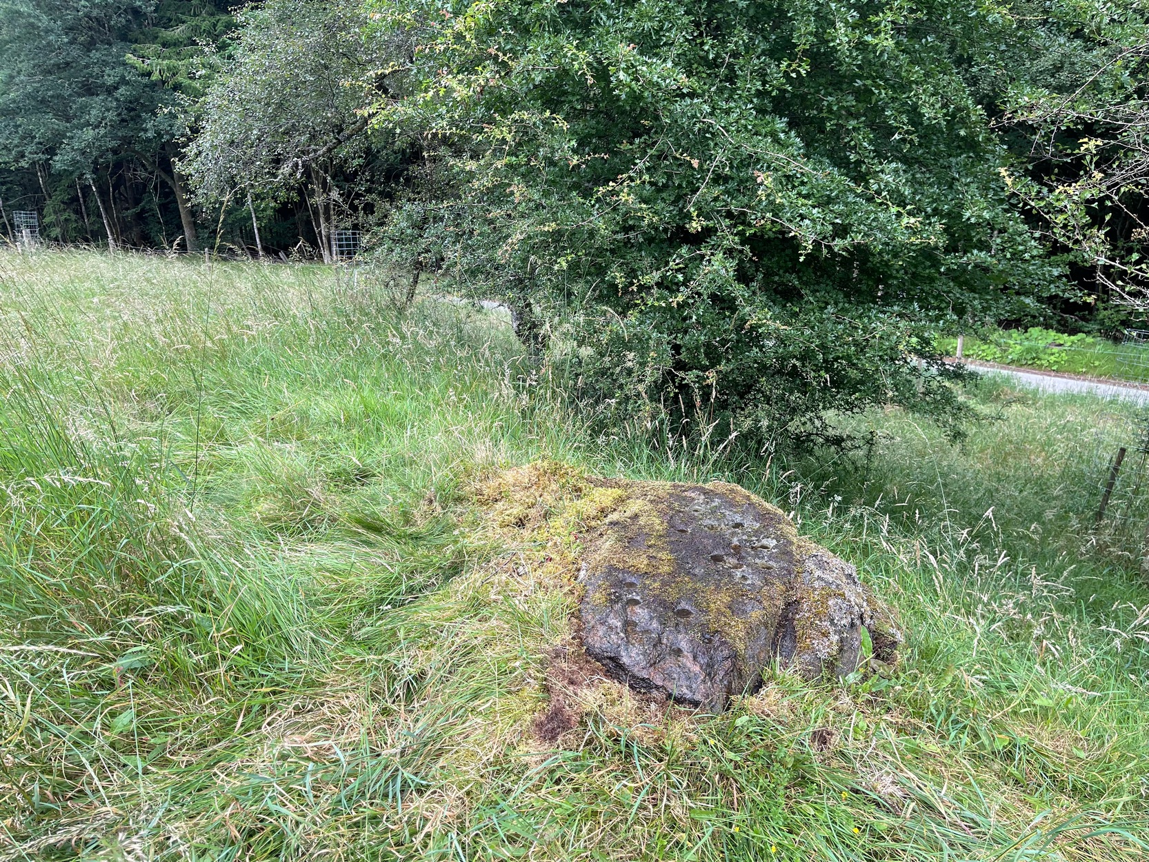
Take the A826 Crieff Road uphill for 275 yards then turn right up the Urlar Road. It’s a long uphill walk from here, up the private road, through and past Urlar Farm and along the track (keeping to the west-side of the burn), past the impressive Urlar Burn (8) carving, until you eventually reach the bothy, 3¼ miles (5.2km) up from where you first turned off the A826. Walk 70 yards past the bothy then into the heather on your left where a large couch-shaped boulder stands. The carved rock is a couple of yards on the floor in front of you.
Archaeology & History
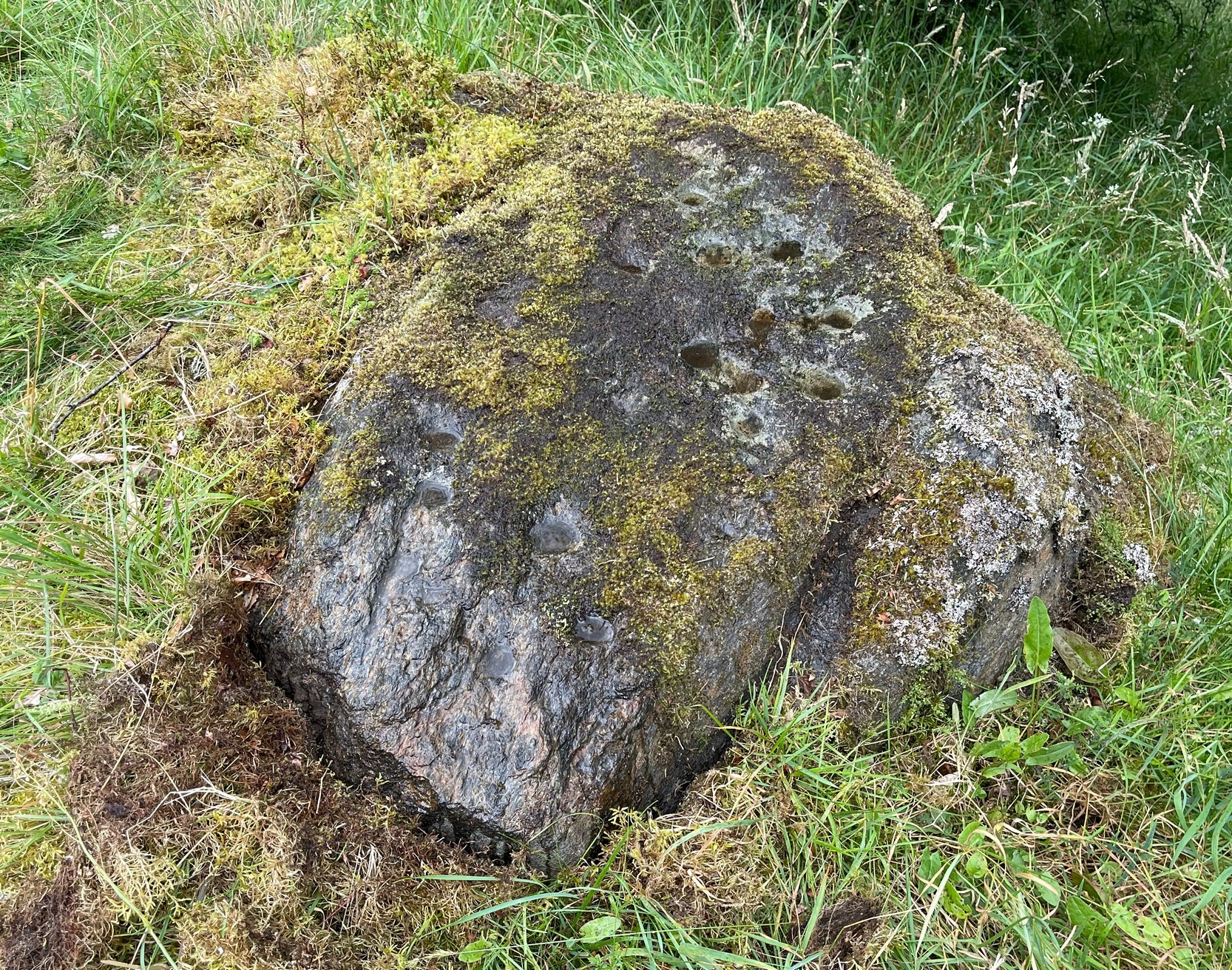
An unimpressive faint cup-marked stone consisting of between two and five shallow cups that are difficult to make out unless lighting conditions are good – and even then they’re troublesome! It was first noted by George Currie (2009) how described it simply as: “a rock 2.0 x 1. x 0.2m between Urlar Burn and Hill Park track bears five cup marks.” There are much more impressive carvings in this neck o’ the woods that you’ll want to see ahead of this one!
Folklore
Shallow cups: top-middle; centre-middle
Although there’s nothing specific about this stone, the burn to the side of the carving was haunted by an old urisk in times gone by: an elemental creature from Scottish fairy lore who inhabited lonely streams and waterfalls. The urisk of Urlar Burn was known as Brunaidh an Easain (his brother, Peallaidh, of greater renown, lived in the gorge of Moness close to Aberfeldy) and was likely to have lived further downstream from here. They are associated in some places with cup-marked stones, where offerings of milk were given to placate them.
References:
Currie, George, “Perth and Kinross: Dull: Urlar Burn (3),” in Discovery & Excavation Scotland (new series), volume 10, 2009.
Roughly halfway between Blair Atholl and Pitlochry on the B8079 road is the village of Killiecrankie where, at the junction, you should take the road which leads you over the River Garry. Crossing the river, follow the minor road swerving to the right and after nearly 200 yards bear left up the very minor road. 200 yards up there’s a hairpin bend; keep going up for about another 150 yards then walk into the overgrown grassland on your right where, just above an old hawthorn, a single notable rock protrudes. Y’ can’t really miss it!
Archaeology & History
Some of the cups visible in poor light
On my visit here recently, the day was grey and overcast which, in tandem with there being a reasonably decent cover of mosses living on the stone, prevented me from seeing the complete design of this petroglyph. I was thankful that it’s not an overly impressive one, so couldn’t be too disappointed. It was was rediscovered in recent years by George Currie (2005) on one of his many forays, which, in his typically evocative language, he described as: “Rock, 1.5 x 0.9 x 0.7m, a few metres W of the Tenandry road; 24 cups, largest 50 x 18mm.” Most of the cup-marks are a good depth and easy to see when you’re stood next to it. Sadly my photos didn’t manage to capture them too well.
A notable hut circle can be seen a short distance away up the slope, barely visible in the summertime. The carving may have been executed by the people living there. This is the only recorded cup-marked stone anywhere near here which, as rock art junkies will tell you, is unusual. Where there’s one, others tend to be living close by. Happy hunting!
References:
Currie, George, “Perth and Kinross: Balrobbie,” in Discovery & Excavation Scotland, volume 6 (New Series) 2005.
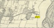
Acknowledgements:Huge thanks for use of the Ordnance Survey map in this site profile, reproduced with the kind permission of the National Library of Scotland.
In Miss Maitland’s (1935) article on the Ledard Stone carving, she also made a brief mention of “another cup-marked stone (that) lies on the edge of the burn, beyond the one described, above Loch Ard.” She gave no further information about this second stone. It remains lost and sounds to be only a short distance further uphill and on the west-side of the burn. If any local explorers are able to find this carving please let us know and, if possible, add some info and photos of it on our Facebook page. (the grid-reference for this site profile is an approximation)
References:
Maitland, Mrs, “Cup Marked Stones”, in The Scottish Country Woman, 1935.
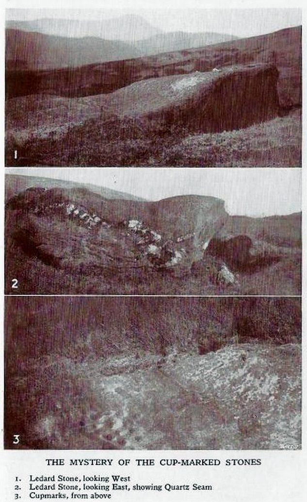
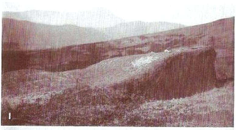
This carving hasn’t seen the light of day, seemingly, since it was first reported by a local lady, a Miss Maitland in the 1930s—and who, it transpires, uncovered a number of petroglyphs in this neck of the woods. She found it on one of her many forays in the mountains hereby and took some old photos of it—although they’ve not reproduced too well for the sake of the site profile. (apologies)
Since Miss Maitland’s days, the hillside has been covered in forestry plantation, making it extremely difficult to locate the carving. However, due to the reasonably large size of the stone, it should still be there (smaller cup-and-ring stones have been damaged and destroyed by forestry over the years); and as we can see in the middle photo, a long thick vein of quartz runs roughly along the middle of the stone—an ingredient which may have been significant for the people who carved the stone. In her article in the Scottish Country Woman magazine, Miss Maitland told:
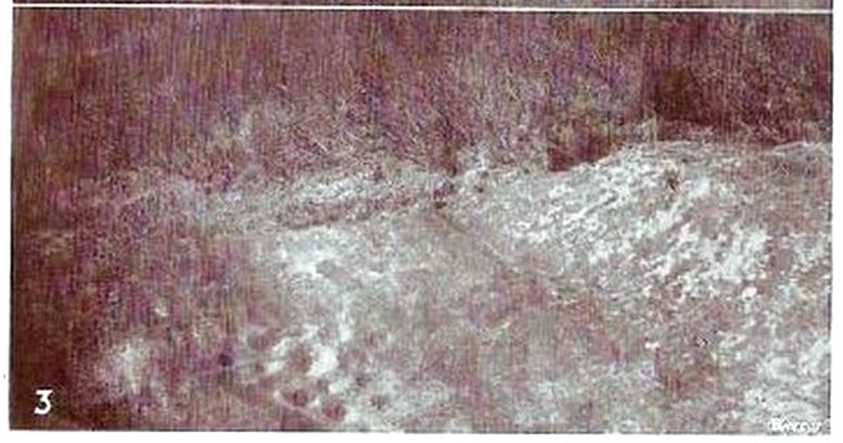
cup-marks, bottom left
Ledard Stone
“On the hill directly behind Ledard, on the north side of Loch Ard, a little to the west of the burn and a little to the east of the first grouse-butt, exactly 700 feet above sea level, lies a large boulder. Ice has smoothed and fashioned it and on the worn surface may be seen twenty-one, or so, small round hollows, varying in size and depth. The pattern made is roughly diamond-shaped, pointing directly east and west. I saw them for the first time as the sun was setting on New Year’s Eve, 1932. It was a solemn moment, for as far as I know no one else had looked upon them with such joy, and even awe, for perhaps a thousand years!”
She may have been right. And by the sound of her words, she’d certainly caught the petroglyph bug!
Anyhow, the carving doesn’t appear to have been seen since then. A “cup-marked boulder” was noted in the Royal Commission’s (1979) listings, but with no further details. We assume it must be the same carving, although they never visited it. It’s also possible that they were referring to another lost cup-marked stone a short distance further up the hill from here. If any local explorers are able to re-locate the carving, please let us know, and maybe add some info and photos of it on our Facebook page.
References:
Maitland, Mrs, “Cup Marked Stones”, in The Scottish Country Woman, 1935.
Royal Commission Ancient & Historical Monuments of Scotland, Archaeological Sites and Monuments of Stirling District, Central Region, Society of Antiquaries of Scotland 1979.
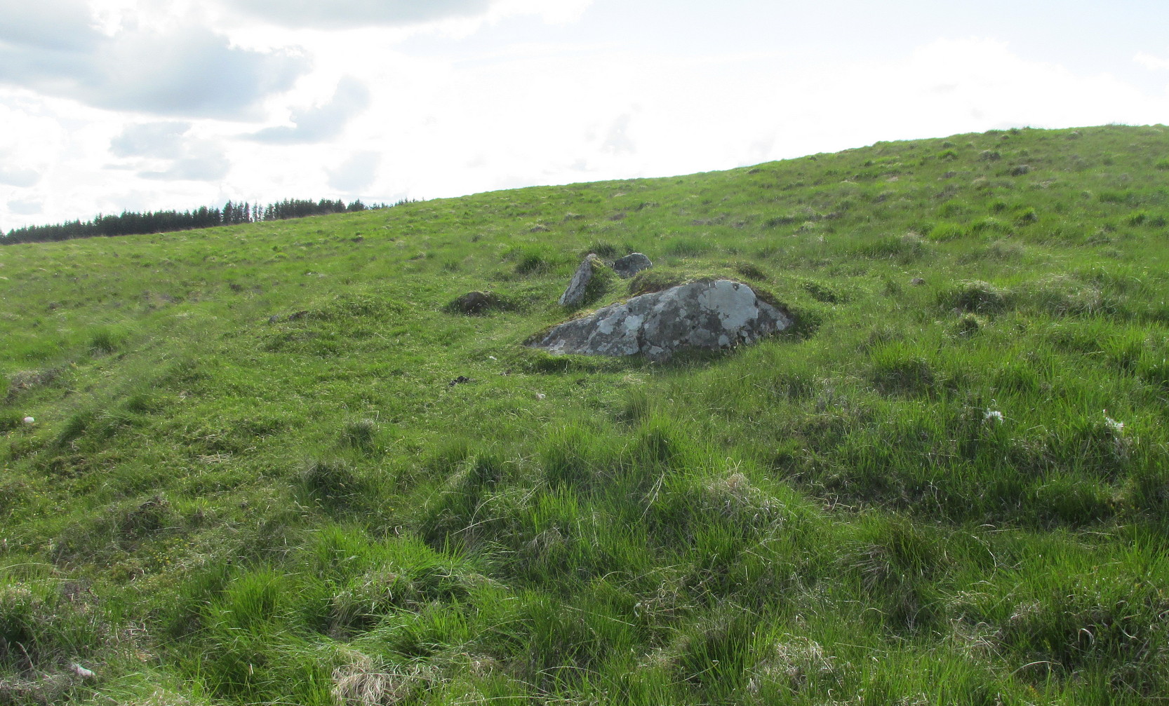
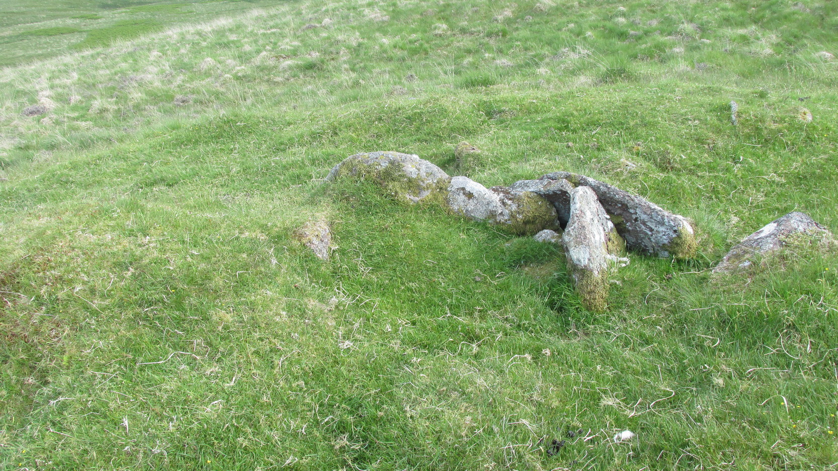
Along the A84 road as you’re heading into Callander, just 300 yards before you reach the the Keltie Bridge caravan park, take the tiny road on your left (north) and barely 100 yards along where a small crossroads can be said to exist, go straight forward up the tiny single-track road ahead of you. Keep all the way up for a mile until you reach Bracklinn Farm (when you meet a split in the road, keep left – and make sure you have parked way further down track of here). Walk up the track past Bracklinn Farm for just over a mile (1.85km), until where the track and the large burn runs roughly alongside each other (past the small Eas Uilleam cairn up to your right) and go through the gate. From here, go immediately left (SW) and walk alongside the dead straight fence for just over 300 yards, then slowly zigzag up the sloping hill. If you reach the derelict walling, you’ve gone too far.
Archaeology & History
West Bracklinn from below
For a site marked as ‘Chambered Cairn’ on the OS-maps, you might be expecting a little bit more when you get here. Sadly, it’s not what it once was. Much of the covering stones from the cairn have been severely robbed and obviously used in the old and curiously-named ruin of Bothan na Plaighe below, and the large sheep-fold structures barely 50 yards to the north. All that’s really left to see here is the internal chamber, aligned roughly east-west, which seems to have originally been split into two sections. The remaining overgrown edges of the monument, barely two feet high at the most, measures roughly 8 yards by 9 yards, but is much denuded and can really only be noticed when you’re almost stood on top of it!
The landscape reaching out from here takes the eyes way way into the distance along the fading horizon, from north-east to south-east. This expansive view, this reaching landscape, may have been an important element in the placement of the tomb – and it’s certainly something to behold on a good day. It might be a bit of a walk to get here, but if you want some good countryside, scenery and a bit of ancient history, this is one helluva good place to go!
References:
Royal Commission Ancient & Historical Monuments of Scotland, Braes of Doune: An Archaeological Survey, RCAHMS: Edinburgh 1994.
Acknowledgements:Huge thanks for use of the Ordnance Survey map in this site profile, reproduced with the kind permission of the National Library of Scotland.
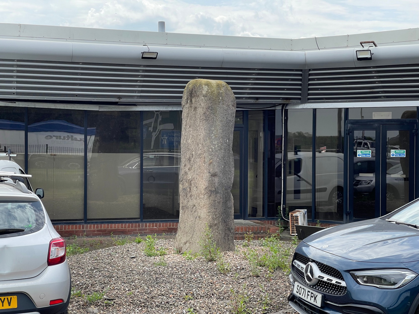
Coming out of Edinburgh along the main A8 Glasgow road, literally yards before you join the M9 near Ratho Station, on the left-side of the road where the last building stands (a company called Element), you need to look through their high metal fence. Just in front of the large windows, you’ll see this tall standing stone (if you’re coming here via public transport, there’s a bus-stop less than 100 yards away on both sides of the dual carriageway). Y’ can’t really miss it!
Archaeology & History
A prehistoric site which, today, has lost all value in terms of its original ambience. The traffic and aircraft noise here is non-stop and prevents all forms of quietude and refection. Added to this is the fact that it’s behind the high fencing of the warehouse, stopping you getting close to it. But, I suppose, at least it’s still standing after all these centuries. In many other parts of Britain, it would have been destroyed long ago…
It seems to have been mentioned for the first time, albeit briefly in John Smith’s (1862) early survey of the local prehistoric sites. He told it to be a,
“large standing stone…of coarse greenstone,” which “bears no inscription or sculpturing of any kind, and measures about 10 feet in height from the surface of the ground.”
Old stone, new home
Many years later when the Royal Commission (1929) this way ventured, they weren’t much more descriptive, but postulated, not unreasonably I might say, that it functioned as a deliberate outlier from the impressive Newbridge megalithic complex 350 yards to the west. They may be right. “In shape it is an irregular four-sided prism,” they wrote, “measuring 9 feet 3 inches in height and 10 feet 6 inches in girth.” The local megalith surveyor Adam MacLean (1977) pointed out that, relative to the prehistoric complex 350 yards away, “it is in the right position to act as an equinox sunrise marker.”
References:
MacLean, Adam, The Standing Stones of the Lothians, Megalithic Research Publications: Edinburgh 1977.
Royal Commission Ancient & Historical Monuments of Scotland, Inventory of Monuments and Constructions in the Counties of Midlothian and West Lothian, HMSO: Edinburgh 1929.
Swarbrick, Olaf, A Gazetteer of Prehistoric Standing Stones in Great Britain, BAR: Oxford 2012.
Acknowledgements:Huge thanks for use of the Ordnance Survey map in this site profile, reproduced with the kind permission of the National Library of Scotland.
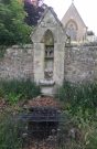
On the west-side of the River Spey from Fochabers, follow the road-signs taking you south on the B9015, and near Inchberry is a tiny road on your right (careful not to miss it). Go along here to the end of the long straight road and turn right, down the track. When you reach the trees, bear left along the track to St Mary’s, Orton, marked “Private road”. 🙂 Parking is limited to one car only but very quiet.
Archaeology & History
St Mary’s Well, Inchberry (21st Century Pict)
Set in a stunning location next to the river Spey with a magnificent view of Ben Aigan to the south, St Mary’s Holy Well and Pool is easy to find behind the Chapel / Mausoleum wall, dedicated to the Duff Family. There is a small stone basin in the wall which may have been the Chapel font. At the time of my visit the weather has been dry and sunny for some time. The pool below the iron grate has been recently cleared of leaves before my visit, with no standing water but the stones on the bottom of the pool looked damp. And with the cemetery above and behind the wall, perhaps it was for the better.
It was clear and running, said J.F.S. Gordon (1880) at the end of the 1700s, but when he came to write about it the flow “has ceased for many years, and is now only a feeble, filthy, stagnant Driblet for the use of cattle.” Pilgrimages were made here on the first Sunday in May, and water collected from the site was kept for a year, in return for an offering (usually a stone or other inanimate object) that enabled the magickal spirit of the well to enact cures.
Folklore
A site described by Watson (1868) as being “long held in superstitious reverence”, the well was said to cure whooping cough, eye problems and joint conditions. It had thoroughly un-christian shennanigans practised here by local folk, much to the consternation of the usual culprits! Visited extensively by people from far and wide, Mr & Mrs Morris (1981) told,
(21st Century Pict)
“The visits displeased the Kirk and there were various summonses to the Session for “going supersticiously to a Vell at Speyside” and of persons who “kneillit about the chappell and drank the water.” The minister at Ruthven reported that a large number had gone to the chapel well “thrie Saturdays before Lambas and thrie efter called the six silie Saturdayes, and that the conventions wer on the night or before day in the morning.” And “quhairas zierlie about Lambnes, the ignorantes repaired to ane wel at this kirk, called Our Ladie Wel, superstitiouslie, and kneeled about the said kirk, it is reportit that the evil is removed.” This may be the well associated with the White Witch, Dame Aliset, who cured a fairy child with simples and the well water.”
References:
Bord, Janet, Holy Wells in Britain – A Guide, HOAP: Wymeswold 2008.
Watson, J.& W., Morayshire Described, Russell & Watson: Elgin 1868.
Acknowledgements:Huge thanks for use of the Ordnance Survey map in this site profile, reproduced with the kind permission of the National Library of Scotland.
Take the same directions as if you’re visiting the Tormain (1) carving (the best one of the bunch here), but about five yards before reaching it, to your immediate left, just at the edge of where the hill drops down slightly, you’ll see a small flat rock poking out of the ground that may have been cut and quarried at some time in the past. That’s the one!
Archaeology & History
This small compact design looks like a typical cup-marked stone with the usual scatter of cups in no seeming order—until, that is, you walk around it and look at it from different angles, whereupon you’ll notice that a couple of distinct deep carved lines have been cut in a cross formation, with cup-marks at the ends of the crucifix. My view of this is that cup-marks were done first, probably in the standard Bronze Age period, and the ‘cross’ was cut into the stone at a much later date, probably during the early christian era. The depth of the lines which create the ‘cross’ is deep and thin at the bottom, suggesting a metal tool, which seems to have been cut into an natural crack. Visitors here will notice a small drill-hole near the edge of the stone which seems to have been done by local quarrymen, probably in the 19th century.
It was first described in Romilly Allen’s (1882) article on the Tormain stones. He called it ‘Stone E’ and told that it
Location of Tormain 5
Cups, lines & cross form
“is situated about half-way between stones A and D, and is furthest to the east. It measures 1 foot 4 inches by 1 foot 9 inches, and projects 1 foot above the turf. Its upper surface is flat, and on it are carved eight cups varying in diameter from 1 to 2½ inches. There are two connecting grooves between three of the cups, forming a rude cross. Another cup has a channel leading over the edge of the stone.”
In November 1927, the Royal Commission dudes visited the carving (and its companions), but they had to roll back the turf to see it clearly. On the stone they saw that “at least nine or ten cup-markings, in some cases with connecting gutters, are still more or less clearly outlined.”
Carving highlighted (Morris ’82)
Ron Morris’s old photo
When Ron Morris (1981) visited here, he highlighted the carving in chalk to get a decent impression of the design, as the attached photo here shows. Many traditional cultures ritually paint their carvings at set times of the year, in traditions that go back many centuries—perhaps even millenia. In all probability the same thing was done at some of the British petroglyphs, although there are no remaining traditions. Anyhow, Morris described it succinctly as:
“½m square, ¼m high…on which are: eight cups up to 7cm (3 in) diameter and 4cm (1½ in) deep and some grooves, to of which connect some of the cups to form a well-defined Cross.”
The stone was looked at by the great rock art explorer Kaledon Naddair of Edinburgh, but sadly I’m unable to locate his report and the fine illustrations that always tended to accompany them. If you’re reading this sir, give us your valuable input!
Beckensall, Stan, Rock Carvings of Northern Britain, Shire: Princess Risborough 1986.
Beckensall, Stan, British Prehistoric Rock Art, Tempus: Stroud 1999.
Feachem, Richard, Guide to Prehistoric Scotland, Batsford 1977.
Hadingham Evan, Ancient Carvings in Britain: A Mystery, Garnstone: London 1974.
Morris, Ronald W.B., “The Cup-and-Ring and Similar Early Sculptures of Scotland; Part 2 – The Rest of Scotland except Kintyre,” in Transactions of the Ancient Monuments Society, volume 16, 1969.
Morris, Ronald W.B., The Prehistoric Rock Art of Southern Scotland, BAR: Oxford 1981.
Royal Commission Ancient & Historical Monuments of Scotland, Inventory of Monuments and Constructions in the Counties of Midlothian and West Lothian, HMSO: Edinburgh 1929.
Acknowledgements: Huge thanks to Jan Carrington for use of her photos. 🙂