Ravenswood Avenue, Liberton, Edinburgh, Midlothian

Standing Stone:  OS Grid Reference – NT 28282 70502

Also Known as:

  1. Canmore ID 52108
  2. Craigend
  3. Greenend

Getting Here

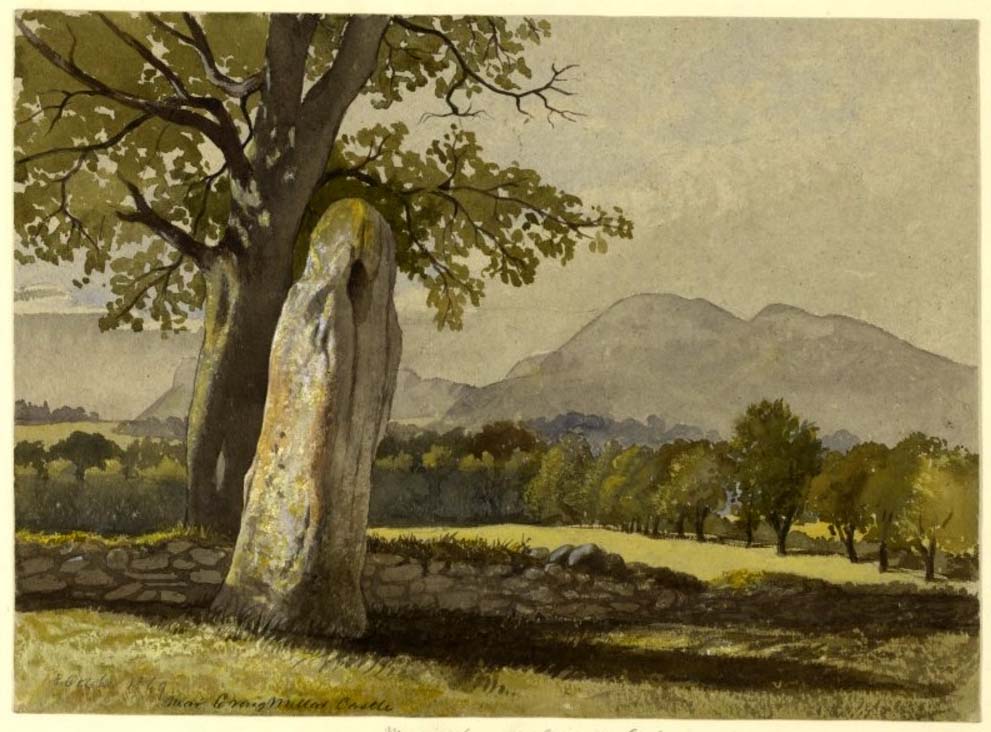
The stone in the 19th century

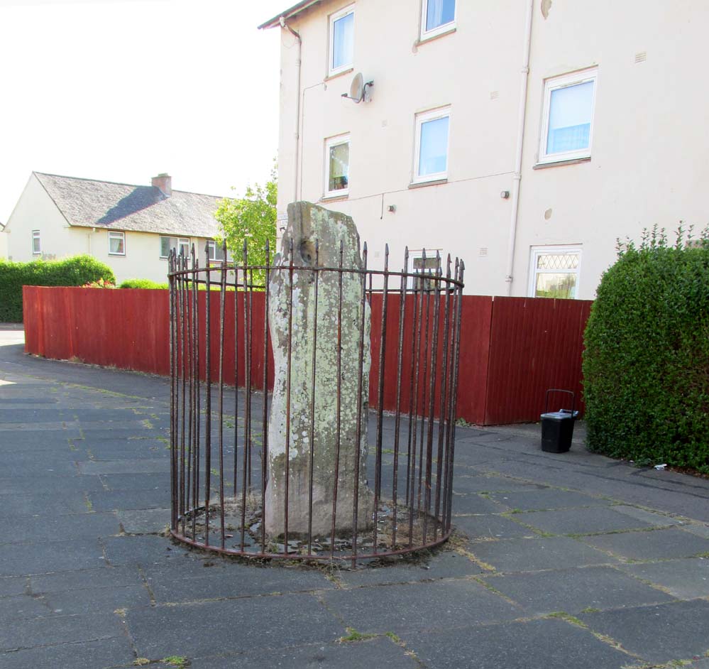
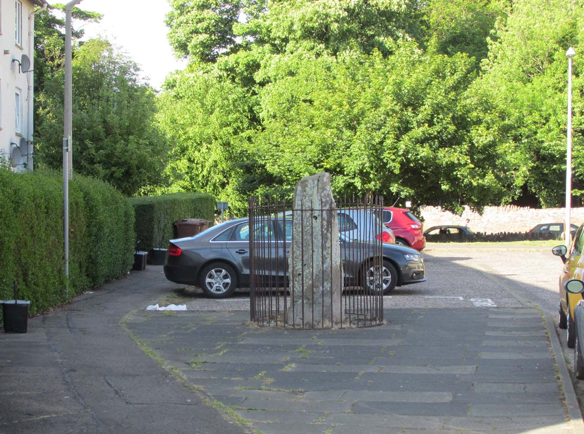
Take the A7 road south from Edinburgh central (off Princes Street) for several miles.  It becomes known as the Old Dalkeith Road eventually, just as it passes the huge wooded ground of Craigmillar Castle on your left (east) and the Inch estate on your right. Walk along here, keeping your eyes peeled for the small path that takes you onto Ravenswood Avenue.  Barely 30-40 yards from the main A7 road, the standing stone is there surrounded by railings.

Archaeology & History

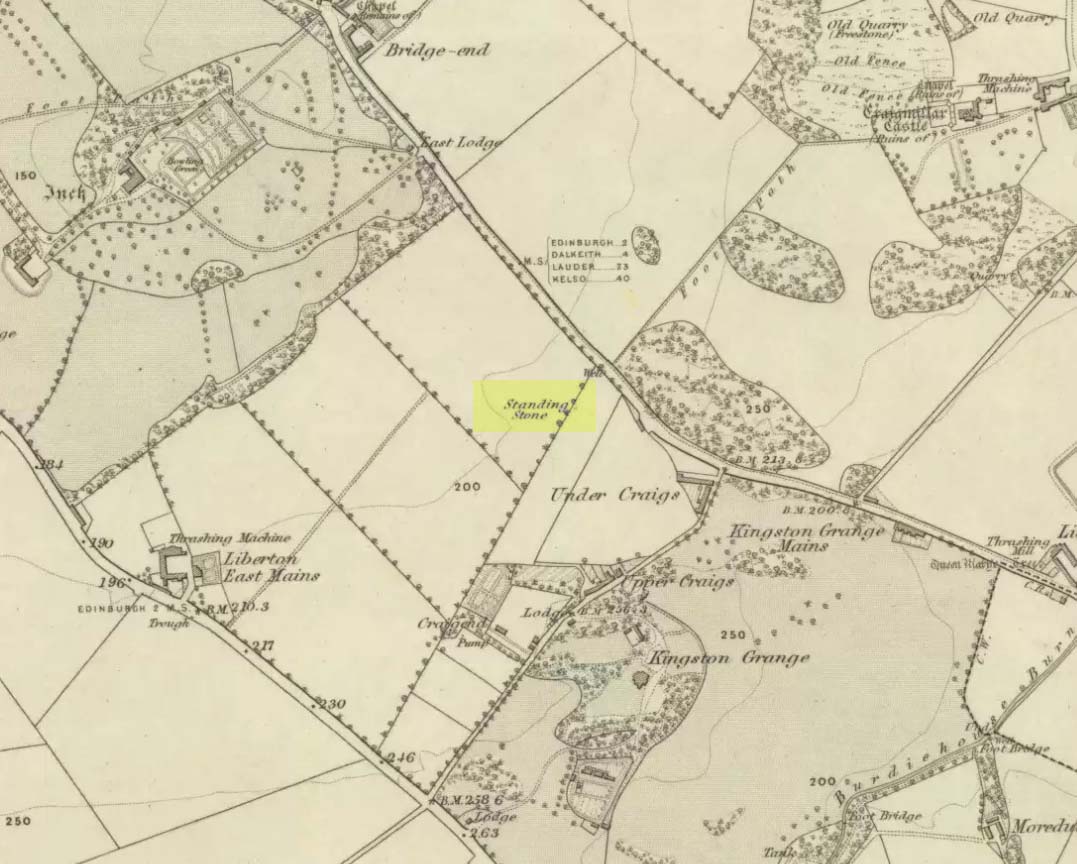
A curious place to find a standing stone – especially one that’s still alive!  But that’s what we find on the Inch housing estate, thankfully.  Highlighted on the 1855 Ordnance Survey map, it was one of a number of standing stones described in George Good’s (1893) fine survey on Liberton parish, which he thought commemorated ancient battles.  When he wrote about it, the monolith was “built into the wall on the public road to Greenend”, just as shown on the OS-map.  He told how the

“stone was taken down in the beginning of the present century (c.1801), when the road was widened, and it long lay in the field opposite, but was restored to its original place in 1891.”

When the Royal Commission (1929) lads came here many years later, they gave their own archaeocentric description, telling:

Site shown on 1855 map
The old stone in its cage

“About 40 yards from the main road near Little France…is a standing stone, which is set up without packing, with its main axis almost due north and south, but with a slight inclination towards the east. It stands 6¾ feet above ground, and has a girth of 6 feet 5 inches at 3 feet from the base.  It is of grey sandstone, badly weathered on two sides and without traces of any artificial markings or design.”

The monolith was included in Adam McLean’s (1977) megalithic survey of the area, where he rightly said how the iron fence that surrounds the stone destroys any atmosphere that might once be had here.  Still, at least it’s still standing and is worth checking out if you’re in the area.

Folklore

The Ravenswood Stone

An old footpath that runs dead straight from Craigmillar Castle towards the stone was long ago said to be the pathway taken by the ghost of a white lady.

In days prior to the housing estate being built, local folk had annual bonfires here between Samhain (Halloween) and Guy Fawkes Night (Oct 31 – Nov 5).

References:

  1. Good, George, Liberton in Ancient and Modern Times, Andrew Elliot: Edinburgh 1893.
  2. McLean, Adam, The Standing Stones of the Lothians, Megalithic Research Publications: Edinburgh 1977.
  3. Royal Commission on the Ancient & Historical Monuments of Scotland, Inventory of Monuments and Constructions in the Counties of Midlothian and West Lothian, HMSO: Edinburgh 1929.

© Paul Bennett, The Northern Antiquarian


Our Lady’s Well, Straiton, Loanhead, Midlothian

Holy Well (destroyed):  OS Grid Reference – NT 2728 6669

Archaeology & History

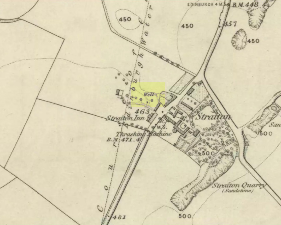
Our Ladys ‘Well’ on 1855 map

This is another all-but-forgotten holy well once dedicated to the Virgin Mary, close to the south-side of Edinburgh’s outer ring-road.  It would seem to have been one in a cluster of sacred wells not far from each other (with the two Jacob’s Wells and St. Margaret’s Well at nearby Pentland), whose traditional stories have fallen prey to the incredulity of ‘progress’.  I can find very little about the site, other than the note given it in George Good’s (1893) Liberton survey where, in stepping south towards the old hamlets of Broomhill and Straiton, he told:

“A little to the west of the hamlet, and near what was called Straiton Green, is an old draw-well dedicated to the Virgin, and known by the name of Our Lady’s Well. There may possibly have been a cell or chapel near this well, but no tradition or history regarding it is extant.”

We can only presume that the ‘Well’ which is highlighted on the first OS-map in 1855, maybe 20-30 yards west of the old road on what looks like a small park or ‘Green’, would be the ‘Lady Well’ in question. (another ‘Well’ is shown at Broomhill Cottage, which is unlikely to be the contender)

References:

  1. Bennett, Paul, Ancient and Holy Wells of Edinburgh, TNA 2017.
  2. Good, George, Liberton in Ancient and Modern Times, Andrew Elliot: Edinburgh 1893.

© Paul Bennett, The Northern Antiquarian


Our Lady’s Well, Liberton, Edinburgh, Midlothian

Holy Well:  OS Grid Reference – NT 2640 7008

Also Known as:

  1. Canmore ID 52100
  2. Lady’s Well

Archaeology & History

In Thomas Whyte’s (1792) lengthy survey of Liberton village, as it was in the 1790s, we come across what seems to be the earliest description of this long-lost sacrede site on the northwest side of the parish.  In writing of the beauty of the countryside hereby in those times, he told how,

“on the north by the rivulet called Braid’s-burn, near which there is a well which has the appellation…of the Lady’s or Virgin Mary’s well, famous for its large current, and the salubrity and lightness of its waters.”

Site of Our Lady’s Well

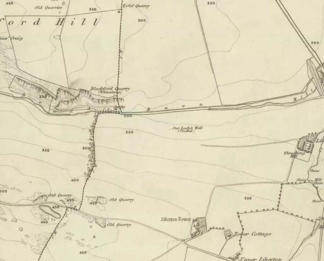
Our Ladys Well on 1855 map

Mr Whyte believed that its dedication to Our Lady went way back, probably before Liberton parish was given to St. Cuthbert in the 11th or 12th century (whose own holy well could once be found several miles north, near Leith).  Generally, wells that are dedicated to ‘Our Lady’, refer to the Virgin Mary; but prior to any christian affectation, the animistic genius loci of the waters would have been a local spirit.

It was visited and described by the Ordnance Survey lads in the Name Book of 1851, in which they said that Our Lady’s Well was,

“The site of a celebrated well situated in a hollow on the farm of Liberton Tower Mains, and dedicated to St. Mary, as it and the field is well known to be called to this day, “The lady’s Field” & Well”.  This well however about 50 years ago underwent a drainage during some improvements that were making on the land.  In its covered condition it takes a S.E. course till its Confluence with the Braid Burn where it is shown to this day as the water coming from the Lady’s Well, and from which a body of crystalized water flows copiously. It was supposed that a chapel was somewhere Convenient which gave rise to the name, but all traces have long since disappeared….”

“There is no tradition recorded among the County people as to whether this was a holy well, or resorted to for superstitious purposes. But it is well ascertained to have been once a remarkable well & an object well known and though now covered-in, the place is still well known, as is also the name.”

Although this holy well was shown on early and late 19th century OS-maps as ‘covered’,  trying to find its exact position today has proven difficult.  When Paul Hornby and I visited the site after some heavy rains in June, 2017, we found a large pool of water in the field exactly as shown on the old map.  This was, however, misleading, as the owner of the land and the Blackford Glen Western Riding school—a Mr John Fyfe—told us that they had, for years, always wondered about its exact position, but been unable to ascertain it with any certainty.  The pool in the field always appeared after the rains, he said.  He did tell us however, that many years ago when he was digging in order that the Braid Burn stopped flooding his property, he came upon a length of ancient piping running in the direction of the burn, some 5 or 6 feet down, whose use he could not ascertain—but which might have once conducted the waters from the Lady Well away.  No water was running through it though.

Near the middle of Liberton village a century or so ago, another holy well of the same name could once be seen less than a mile to the east.

References:

  1. Bennett, Paul, Ancient and Holy Wells of Edinburgh, TNA 2017.
  2. Good, George, Liberton in Ancient and Modern Times, Andrew Elliot: Edinburgh 1893.
  3. Walker, J. Russel, “‘Holy Wells’ in Scotland,” in Proceedings of the Society of Antiquaries of Scotland, vol.17 (New Series, volume 5), 1883.
  4. Whyte, Thomas, “An Account of the Parish of Liberton in Mid-Lothian, or County of Edinburgh,” in Archaeologia Scotica, volume 1, 1792.

Acknowledegments:  Huge thanks to John Fyfe and his wife for their help when we were exploring this site.

© Paul Bennett, The Northern Antiquarian


Law Knowe, Niddrie, Edinburgh, Midlothian

Tumulus (destroyed):  OS Grid Reference – NT 3076 7177

Archaeology & History

Long since gone, this little-known burial mound could once be seen not far from the old mansion of Niddrie House.  The only reference I’ve found of it is in Thomas Whyte’s (1792) early essay on the parish of Liberton, where he told:

“East from the house and plantations, and on the north side of the public road, is a rising ground, or tumulus, called the Law Know, where, in more early times, judgment was dispensed, and where, probably, certain acknowledgments were made, by those who held of the baron or family.  It is of a circular form.  And this is the cafe with all places of the same kind. For they were considered as emblems of the sun, that great object of Druidical worship.”

The site appears to have been destroyed when the Industrialists blasted their quarry here and, as historians well know, quarrymen are dreadful when it comes to making notes of anything!  Any additional info on this place would be good….

References:

  1. Whyte, Thomas, “An Account of the Parish of Liberton in Midlothian, or County of Edinburgh,” in Archaeologica Scotica, volume 1, 1792.

© Paul Bennett, The Northern Antiquarian


Wells o’ Wearie, Duddingston, Edinburgh, Midlothian

Sacred Wells (destroyed):  OS Grid Reference – NT 2741 7241

Also Known as:

  1. Wells o’ Weary
  2. Well of Wery

Archaeology & History

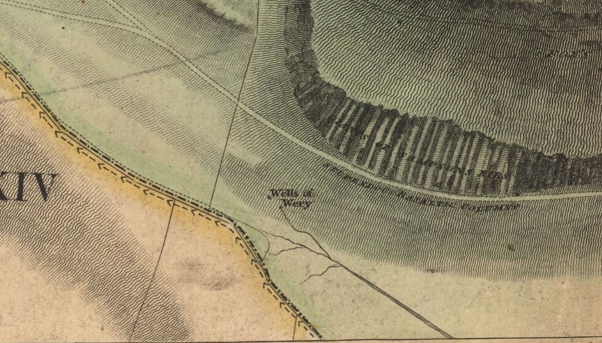
The precise spot for these “wells” is difficult to say today with any certainty, which is unfortunate as it was a renowned spot for a variety of reasons.  The wells were apparently disrupted and fell back into the Earth when the Industrialists dug their train-line into the south-side of Arthur’s Seat.  On the early maps, we can see several ‘troughs’, ‘pumps’ and ‘wells’—one or more of which are said to be the site (and which we base the OS grid-reference on, above).

Site on 1821 Kirkwood map
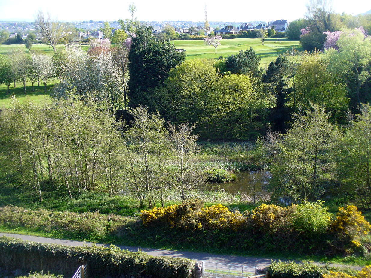
Wells o’ Wearie ponds

The Wells of Wearie were one of nearly a dozen sacred and healing wells surrounding legendary Arthur’s Seat at the edge of Edinburgh, and whose waters were also said to have supernatural properties.  Shown on James Kirkwood’s 1821 map of Edinburgh (left) as the ‘Well of Wery’, this curiously named site was renowned in earlier centuries as an excellent water supply for the local people — “to cure the weary traveller” for one.  Today, all we have left of them are the small ponds immediately below the road, next to the converted railway line path, just as you come out of the long tunnel.

Folklore

In Henderson & Cowan’s (2007) fine work on Scottish fairy lore, they outline the witchcraft trial of a local woman, Janet Boyman, who was said to have performed ritual magick at the Wells of Wearie.  They told:

“Jonet Boyman of Canongate, Edinburgh, accused in 1572 of witchcraft and diabolic incantation, the first Scottish trial for which a detailed indictment has so far been found. Indeed, it is one of the richest accounts hitherto uncovered for both fairy belief and charming, suggesting an intriguing tradition which associated, in some way, the fairies with the legendary King Arthur.  At an ‘elrich well’ on the south side of Arthur’s Seat, Jonet uttered incantations and invocations of the ‘evill spreits quhome she callit upon for to come to show and declair’ what would happen to a sick man named Allan Anderson, her patient.  She allegedly first conjured ‘ane grit blast’ like a whirlwind, and thereafter appeared the shape of a man who stood on the other side of the well, and interesting hint of liminality.  She charged this conjured presence, in the name of the father, the son, King Arthur and Queen Elspeth, to cure Anderson.  She then received elaborate instructions about washing the ill man’s shirt, which were communicated to Allan’s wife.  That night the patient’s house shook in the midst of a huge and incomprehensible ruckus involving winds, horses and hammering, apparently because the man’s wife did not follow the instructions to the letter.  On the following night the house was plagued by a mighty din again, caused, this time, by a great company of women.’”

The Wells were, in earlier centuries, a site where lovers and wanderers came to relax and dream. It was a traditional gathering spot — not just for witches! — and poetry was written of them – including this by A.A. Ritchie:

“The Wells o’ Wearie — 

Sweetly shines the sun on auld Edinbro’ toun.
And mak’s her look young and cheerie;
Yet I maun awa’ to spend the afternoon
At the lanesome Wells o’ Wearie.

And you maun gang wi’ me, my winsome Mary Grieve,
There’s nought in the world to fear ye;
For I hae ask’d your minnie, and she has gien ye leave
To gang to the Wells o’ Wearie.

O the sun w-inna blink in thy bonny blue een.
Nor tinge the white brow o’ my dearie.
For I’ll shade a bower wi’ rashes lang and green,
By the lanesome Wells o’ Wearie.

But Mary, my love, beware ye dinna glower
At your form in the water sae clearly,
Or the fairy will change ye into a wee wee flower,
And you’ll grow by the Wells o’ Wearie.

Yestreen, as I wander’d there a’ alane,
I felt unco douf and drearie,
For wanting my Mary a’ around me was but pain
At the lanesome Wells o’ Wearie.

Let fortune or fame their minions deceive,
Let fate look gruesome and eerie ;
True glory and wealth are mine wi’ Mary Grieve,
When we meet by the Wells o’ Wearie.

Then gang wi’ me, my bonny Mary Grieve,
Nae danger will daur to come near ye.
For I hae ask’d your minnie, and she has gien ye leave
To gang to the Wells o’ Wearie.”

References:

  1. Baird, William, Annals of Duddingston and Portobello, Andrew Elliot: Edinburgh 1898.
  2. Bennett, Paul, Ancient and Holy Wells of Edinburgh, TNA: Alva 2017.
  3. Carrick, John D. (ed.), Whistle-Binkie, or the Piper of the Party – volume 2, David Robertson: Glasgow 1878.
  4. Colston, James, The Edinburgh and District Water Supply, Edinburgh 1890.
  5. Henderson, Lizanne & Cowan, Edward J., Scottish Fairy Belief: A History, John Donald: Edinburgh 2007.
  6. Ramsay, Alexander, On the Water Supply of Edinburgh, Neill & Co.: Edinburgh 1853.

© Paul Bennett, The Northern Antiquarian


Tod’s Well, Comiston, Edinburgh, Midlothian

Healing Well (destroyed):  OS Grid Reference – NT 239 692

Also Known as:

  1. Three Foxes Well

Archaeology & History

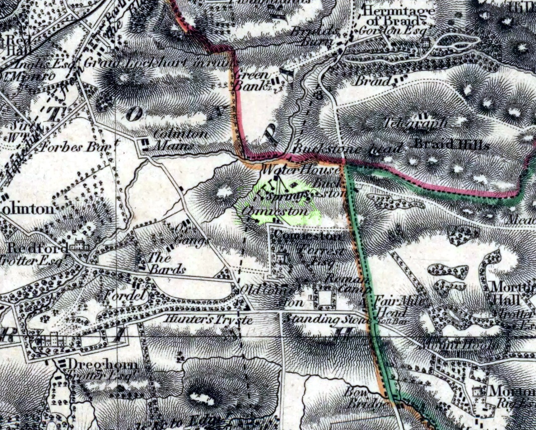
Springs at Comiston, 1632 map

Springs at Comiston, 1832 map

A renowned site of once clear running water, the Tod’s Well got its name from being the abode of foxes many centuries ago.  It was one of the five well-known ‘Comiston Springs’ as they were known—each dedicated to a certain animal—but the eternally present water in this venerable landscape was corrupted from Nature’s course by the usual Industrialists as early as 1681, so as to feed the polluting edifice of Edinburgh city.  James Colston (1890) told how,

“The Town Council entered into a contract with a Dutchman, named Peter Bruschi (aka Peter Brauss) for the sum of £2,900, “to bring the water of Tod’s Well (Anglice fox) at Comiston to Edinburgh, in a leaden-pipe of a three-inch bore, to be laid one foot deep in the ground.””

When the local council upgraded the water supplies in 1820, this piping was replaced to feed the ever-needy merchants and marketeers.  In Hope & Telford’s (1813) survey, the water from here was described as “constantly pure” and “excellent.”

References:

  1. Bennett, Paul, Ancient and Holy Wells of Edinburgh, TNA: Alva 2017.
  2. Colston, James, The Edinburgh and District Water Supply, Edinburgh 1890.
  3. Harris, Stuart, The Place-Names of Edinburgh: Their Origins and History, Gordon Wright: Edinburgh 1996.
  4. Hope, Thomas C. & Telford, Thomas, Reports on the Means of Improving the Supply of Water for the City of Edinburgh, A. Constable: Edinburgh 1813.

© Paul Bennett, The Northern Antiquarian


Harlaw Stones, Balerno, Midlothian

Standing Stones (destroyed):  OS Grid Reference – c. NT 178 655

Archaeology & History

We are uncertain about the nature and form of what was once known to be “a group of five standing stones” near the destroyed giant cairn of Harlaw, west of Balerno (which was probably built near the old trig-point at NT 1783 6594).  This cluster of standing stones may have been the remains of a stone circle or a possible megalithic stone row, and it’s even been postulated as a line of possible boundary stones—but this is most unlikely.

The only known reference of the site comes from the New Statistical Account in 1845 which told:

“About a quarter of a mile to the south of the large cairn were five very tall and large stones set perpendicularly in the Earth.”

They were destroyed around the same time as the cairn in the early 1800s. Until we find further information, its exact status remains unknown. (Kaledon Naddair – are you out there?)

References:

  1. Baldwin, John & Drummond, Peter, Pentland Place-Names, FotP: Edinburgh 2011.
  2. Dixon, Norman, The Place-Names of Midlothian, University of Edinburgh 1947.
  3. Harris, Stuart, The Place-Names of Edinburgh: Their Origins and History, Gordon Wright: Edinburgh 1996.
  4. McLean, Adam, The Standing Stones of the Lothians, Megalithic Research Publications: Edinburgh no date (c.1978).

© Paul Bennett, The Northern Antiquarian


Crawley Spring, Glencorse, Midlothian

Healing Well (covered):  OS Grid-Reference – NT 23894 63346

Archaeology & History

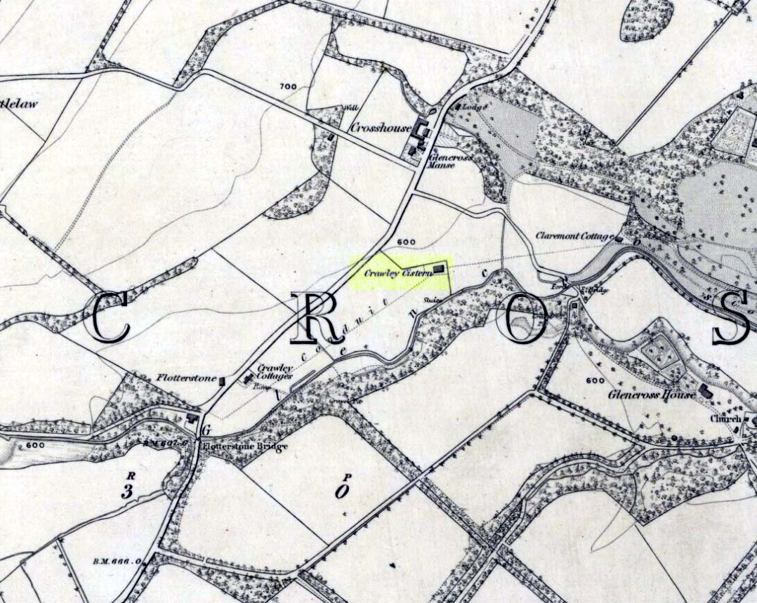
Site of Crawley Spring on 1854 map

Site of Crawley Spring on the 1854 map

Once found flowing freely beneath the shadow of the prehistoric hillfort of Castlelaw, this all-but-forgotten site was thankfully recorded in Hope & Telford’s (1813) survey of Edinburgh’s natural water supply.  Mr Telford said how “This noble spring rises from the bottom of a bank, at the foot of the Castlelaw Hill, at the edge of a small, low, almost marshy meadow close by the Glencorse Burn, a little way below the bridge.”  Twelve years after writing this, the well had been blocked and a cistern built over it.

It was proclaimed by local people to be medicinal (though to what ailments, I cannot find), but there was an effective confirmation of some medicinal qualities in the waters following an analysis in 1810 when very tiny mineral elements were found.  Mr Telford (1813) explained:

“The water is perfectly transparent and colourless, free from every smell and taste and is of excellent quality.  It has, as is the case with almost all spring water, some matters dissolved in it, though in smaller quantities than common… This foreign matter consist of carbonate of lime, muriate of soda, and sulphate of lime, with an excessively minute portion of magnesium salt. The proportions of these ingredients, in each pound, are nearly:

Carbonate of Lime – 0.43 of a grain
Muriate of Soda – 0.10 of a grain
Sulphate of Lime – 0.90 of a grain
Sulphate of Magnesia – 0.05 of a grain

The carbonate of lime is dissolved by means of carbonic acid, which is not in greater quantity than is barely sufficient for the purpose.  All of these ingredients are in themselves innocent to the human body; and in the quantity in which they are present in the water, do not affect its goodness.  The water is perfectly soft and fit for washing, infusing tea and other domestic purposes.  The water, therefore, is exceptional in every respect.”

When it came to the Crawley Spring waters being used to feed the habits of Edinburgh city, there was considerable opposition by the land-owner and local people who were, correctly, concerned that that ecosystem here would be adversely affected if the waters were to disappear.  And so it was that Earth’s blood was taken from the land and the people and the animals, to benefit and feed the religion of Industrialism and ‘progress’ once more…

References:

  1. Bennett, Paul, Ancient and Holy Wells of Edinburgh, TNA: Alva 2017.
  2. Hope, Thomas C. & Telford, Thomas, Reports on the Means of Improving the Supply of Water for the City of Edinburgh, A. Constable: Edinburgh

© Paul Bennett, The Northern Antiquarian


Gormyre, Torphichen, West Lothian

Standing Stone (destroyed):  OS Grid Reference – NS 9836 7315

Also Known as:

  1. Canmore ID 47916

Archaeology & History

A couple of fields east of one of Torphichen’s Refuge Stones (a prehistoric thing by the look of it!), another standing stone could once be seen.  It wasn’t a particularly big fella, and its existence may have completely fallen out of history were it not for the Scottish Royal Commission (1929) lads who visited and described the place thus:

“In the fourth field north-east of Gormyre Farm is a narrow, upright, pointed boulder of schist, 3 feet 10 inches high and 1 foot 6 inches wide at base, which is roughly pentagonal.  The greatest width on the east face is 20 inches, on the west face 8 inches; but the faces die into each other at the upper part till the section becomes triangular.”

A few years after the Royal Commission boys had been here, the land-owner saw fit to uproot the stone and dump it at the side of the field.  In the 1980s, when the Royal Commission lads came to visit the site again, they reported that the “standing stone no longer exists”—probably meaning that the land-owner had destroyed it.  Some idiotic land-owners do this sort of thing.

When we visited the arena a few weeks ago, Frank Mercer and I found a couple of stones at the side of the adjacent field which may have once stood upright, but if the early accounts of its position are correct, we were looking in the wrong place.  Another visit is required to see if we can find it in the undergrowth along the field edges.  If not, another one has bit the dust, as they say…

References:

  1. Mackay, P.H.R., Sanctuary and the Privilige of St. John, WLHAS: Edinburgh n.d. (1976?).
  2. Royal Commission Ancient & Historical Monuments Scotland, Inventory of Monuments & Constructions in the Counties of Midlothian and West Lothian, HMSO: Edinburgh 1929.

© Paul Bennett, The Northern Antiquarian


Glesart Stanes, Glassford, Lanarkshire

Standing Stones:  OS Grid Reference – NS 73609 46916

Also Known as:

  1. Avonholm
  2. Canmore ID 45595
  3. Glesart Stones
  4. Struthers Burial Ground
  5. Three Stones

Getting Here

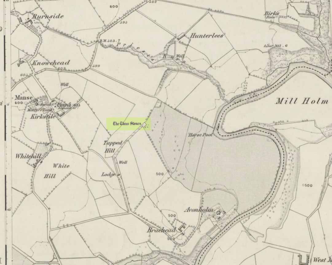
Glesart Stones on 1864 map

From the roundabout in Glassford village, head west down Jackson Street along the country lane of Hunterlees Road.  About 600 yards on, turn right at the small crossroads (passing the cemetery on yer left) for about half-a-mile, before turning left along a small track that head to some trees 400 yards along.  Once you’ve reached the trees, walk uphill and follow the footpath to the right, keeping to the tree-line.  It eventually runs to a small private graveyard. You’re there!

Archaeology & History
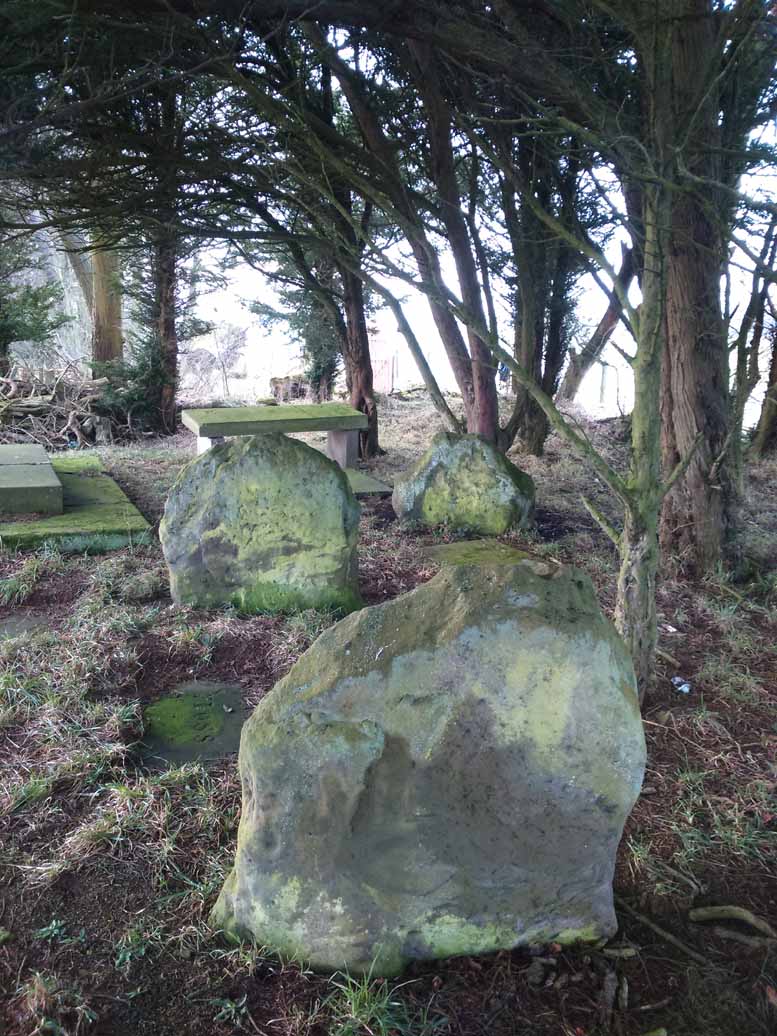
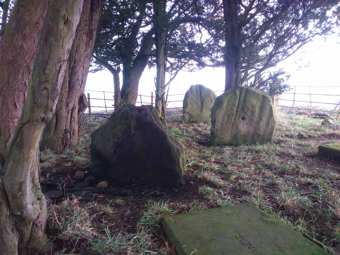
Glesart Stones,
looking west

In the little-known private graveyard of the Struthers family on the crest of the ridge overlooking the River Avon and gazing across landscape stretching for miles into the distance, nearly a mile east of Glassford village, several hundred yards away from the Commonwealth graveyard, a cluster of yew trees hides, not only the 19th century tombstones, but remnants of some thing much more archaic.  Three small standing stones, between 2½ and 4 feet in height, hide unseen under cover of the yews, at the end of a much overgrown ancient trackway which terminates at the site.  They’re odd, inasmuch as they don’t seem to be in their original position.  Yet some form of archaic veracity seems confirmed by the weathered fluting: eroded lines stretching down the faces of two of the taller stones and, more importantly, what seem to be cup-markings on each of the monoliths.
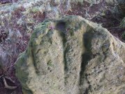
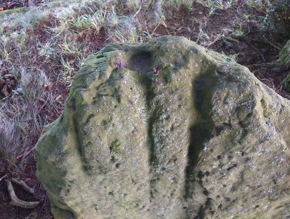
Cup-mark atop of east stone
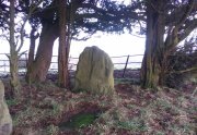
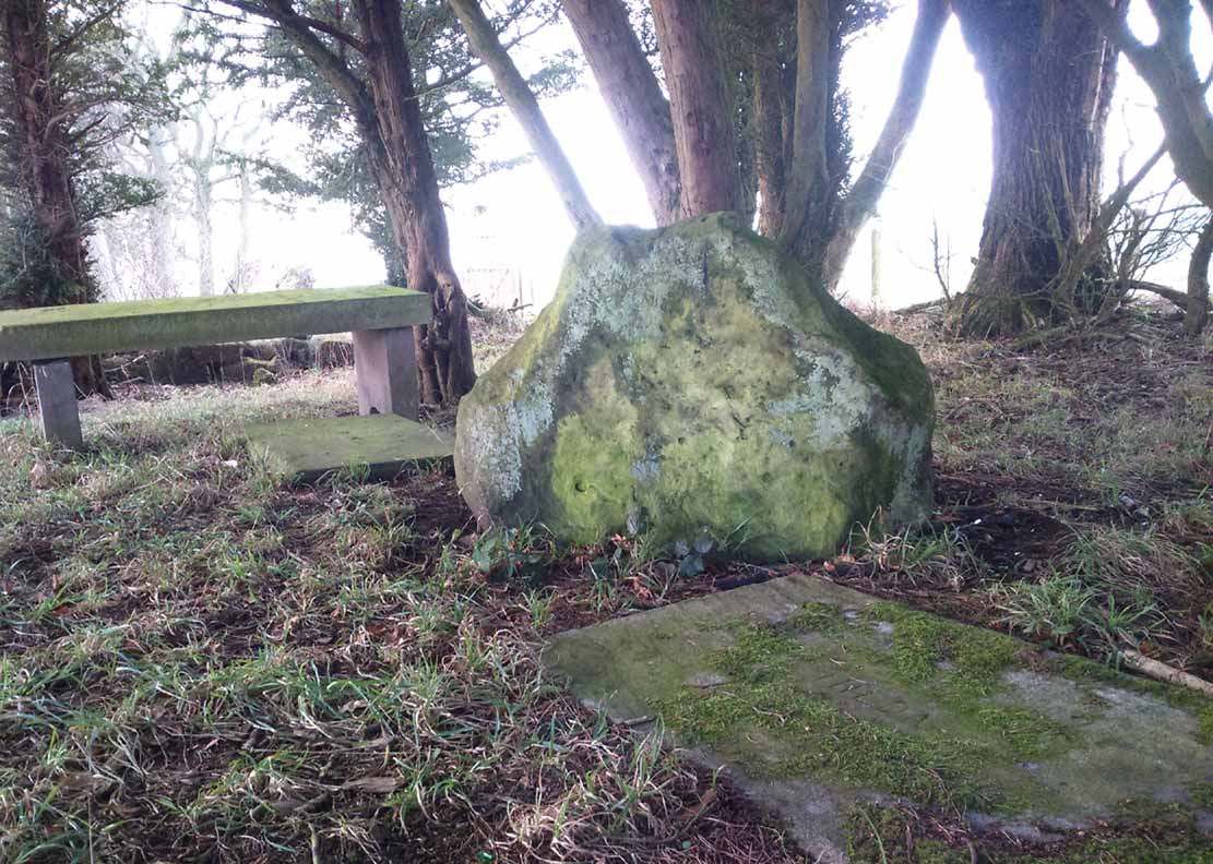
Easternmost stone

The tallest stone at the eastern end of the graveyard has a deep cup on its crown.  This may be the result of weathering; but we must exercise caution with our scepticism here.  Certainly the eroded lines that run down this stone are due to weathering – and many centuries of it; but the peculiarity is that the weathering occurs only on one side.  This implies that only one side of the stone was open to the elements.
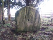
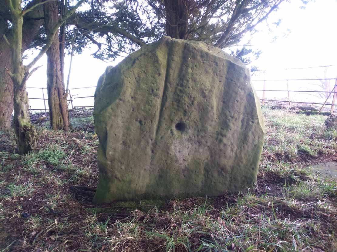
Central cup-marked stone
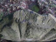
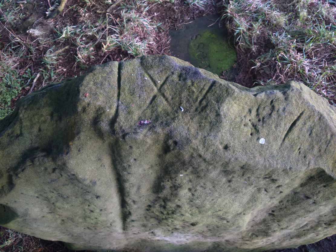
‘X’ carved atop of central stone

The second, central stone of the three, is slightly smaller than the first.  Unlike the eastern stone, its crown has been snapped off at some time in the past century or so, as evidenced in the flat smooth top.  But along the top are a series of small incised marks, one of which includes a notable ‘X’, which may have been surrounded by a circle.  A second fainter ‘X’ can be seen to its side, and small metal-cut lines are at each side of these figures.  Another small section of this stone on its southern edge has also been snapped off at some time in the past.  The most notable element on this monolith is the reasonably large cup-mark on its central west-face.  It is distinctly eroded, measuring 2-3 inches across and an inch or more deep.  Its nature and form is just like the one in the middle of the tallest of the standing stones at Tuilyies, nearly 31 miles to the northeast.
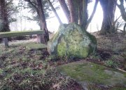
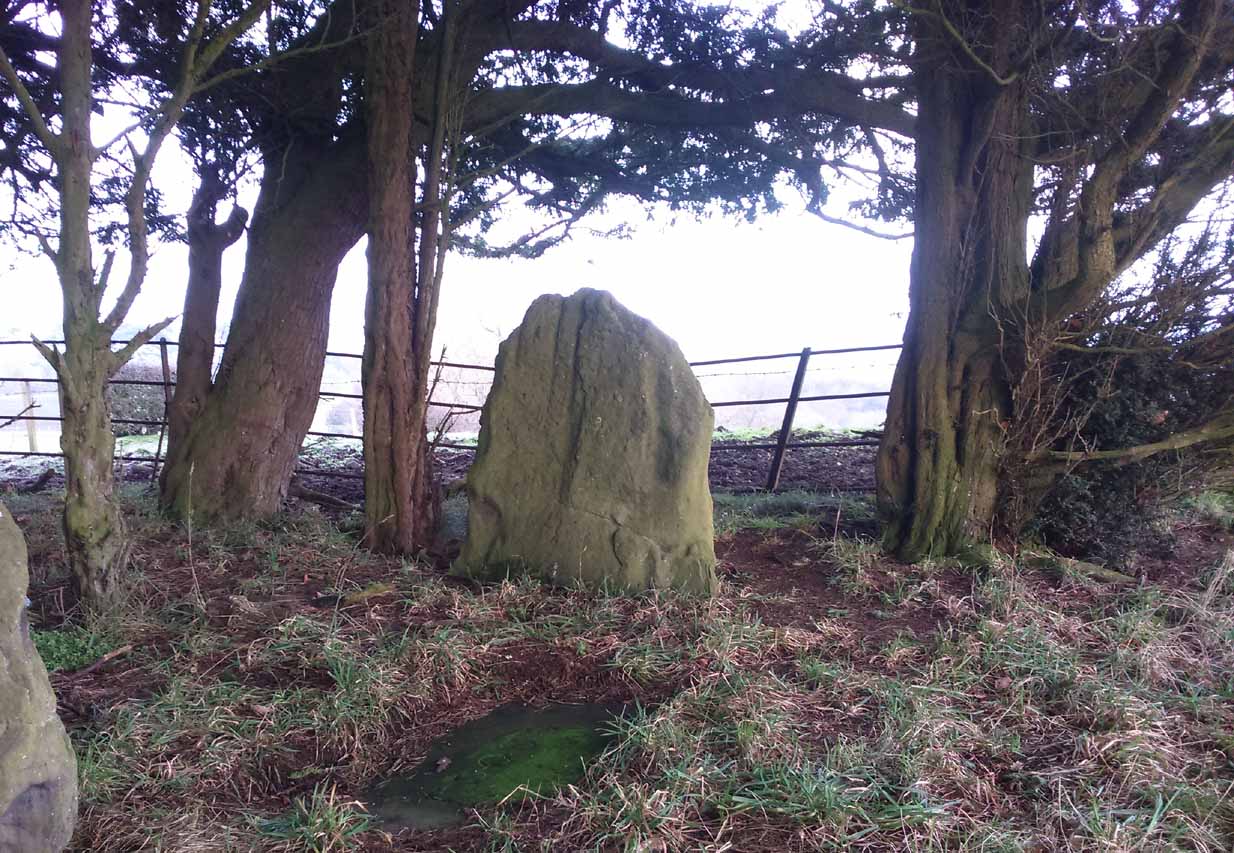
Western smallest stone
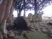
The Three Stones

The smallest of the three stones is just a few feet away from the central stone.  To me, it seemed oddly-placed (not sure why) and had seen the attention of a fire at its base not too long ago.  On its vertical face near the top-centre of the stone, another cup-marking seems in evidence, some 2 inches across and half-an-inch deep—but this may be natural.  The Glasgow archaeologist Kenneth Brophy reported that on a recent visit, computer photogrammetry was undertaken here, so we’ll hopefully see what they found soon enough.

There is some degree of caution amongst some archaeologists regarding the prehistoric authenticity of the Glesart Stanes – and not without good cause.  Yet despite this, the seeming cup-marks and, particularly, the positioning of the stones in the landscape suggest something ancient this way stood.  The stones here are more likely to be the remains of a once-larger monument: perhaps a cairn; perhaps a ring of stones; or perhaps even an early christian site.  At the bottom of the hill for example, just 350 yards below, is a large curve in the River Avon on the other side of which we find the remains of an early church dedicated to that heathen figure of St. Ninian (his holy well close by); and 300 yards north is the wooded Priest’s Burn, whose history and folklore seem lost.

The Glesart Stanes were the subject of an extended article by M.T. M’Whirter in the Hamilton Advertiser in 1929 (for which I must thank Ewan Allinson for putting it on-line).  He wrote:

“Situated on the highest hill-top on the estate of Avonholm, north to the house of that name, is the private burial ground of James Young Struthers… Situated within the burial ground are three upright flagstones of a dark brown colour, rough and unhewn,  Each stone is facing the east, and placed one behind the other, though not in a straight line, and the space between the eastern and the middle stone is eight feet, and the space between the middle and the western stone is seven feet.  The stone flags vary in measurement, the eastern stone being the greater, standing four feet three inches high, three feet eight inches broad, and one foot thick.  The middle stone is three feet high, three feet ten inches broad, and nine inches thick; and the western stone is three feet high, four feet broad and ten inches thick.  The two outer stones bear no letters, figures or marks, but the centre stone has rudely sculptured on the top-edge the Roman numerals IX, and on the western side of the stone there is a cup-shaped indentation about two inches in diameter.  A groove 26 inches in length extends from the top of the stone to below the level of the cup indentation.  The groove is deeper at the top, but gradually loses in depth towards the bottom end.  I have seen grooves similar to above by the friction of a wire rope passing over a rocky surface.  The numerals, cup indentation and groove do not appear to be part of the original placing of the stones and, if a cromlech, then in the centuries that have gone, the stones becoming exposed to view by the removal of the mound, would invariably have led to a search for stone coffins or urns, yet no discovery of either has ever been recorded.”

Indeed, Mr M’Whirter was sceptical of them being part of a prehistoric burial site, preferring instead to think that a megalithic ring once stood here.  He continued:

“From an examination of the three stones, I am convinced that they form a segment of a circle, and assuming that nine additional stones complete the circle, it would enclose a space of roughly one hundred feet in circumference, with each stone facing an easterly direction.”

But we might never know for certain…. The only other literary source I have come across which describes the site is that by the local vicar, William Stewart (1988), who told us that:

“The stones stand erect, six feet apart, three rough slabs of coarse-grained sandstone, three feet high, three feet broad and six inches thick, free of any chisel marks.  Two have their back to the east, the third, oblique to the others, has its back to the south-east, thus there is no suggestion of a stone circle.  There are vertical grooves on two of the stones, while the centre stone has a cupmark, below which is a faint circle, one foot in diameter.  They stand at the end of a long narrow strip of land with low earthen walls on either side, perhaps an old agricultural field division, and they gave their name ‘Three Stanes’, to a now partly-lost road which eventually reached The Craggs and ended as Threestanes Road in Strathaven…”

The Three Stones

The “faint circle” described by Mr Stewart is barely visible now.  And the idea that these “three stones” gave their name to the farmhouse and road of the same name at the other side of Strathaven, three miles west, seems to be stretching credulity to the limits.  Surely?

Folklore

In 1845, Gavin Laing in the New Statistical Account for Lanarkshire told that:

“These stones are known simply as the “Three Stones”. There is a tradition in the neighbourhood that three Lords were buried here, after being killed while looking on at a Battle. The stones are about 3½ feet high and about as thick as flag stones. They stand upright being firmly fixed in the ground.”

The stones and their traditional origin were also mentioned in Francis Groome’s Ordnance Gazetteer (1884), where he echoed the 1845 NSA account, but also added:

“Three tall upright stones are here, and have been variously regarded as Caledonian remains, as monuments of ancient noblemen, and as monuments of martyrs.”

Then at the end of the 1850s, when the Ordnance Survey lads came here, they reported,

“Three high stones stand upright on a small eminence upon the lands of Avonholm, respecting their origin there are various opinions. They are probably the remnants of Druidical superstition.”

References:

  1. Groome, Francis H., Ordnance Gazetteer of Scotland – volume 1, Thomas C. Jack: Edinburgh 1884.
  2. M’Whirter, M.T., “The Standing Stones at Glassford,” in Hamilton Advertiser, 1929.
  3. Stewart, William T., Glasford – The Kirk and the Kingdom, Mainsprint: Hamilton 1988.
  4. Wilson, James Alexander, A Contribution to the History of Lanarkshire – volume 2, J. Wylie: Glasgow 1937.

© Paul Bennett, The Northern Antiquarian