From East Morton village, take the moorland road, east, and up the steep hill. Where the road levels out there’s a right turn, plus (more importantly!) a trackway on your left which leads onto the moor. Go up this track for a few hundred yards until you’re on the moor proper (by this I mean the track’s levelled out and you’re looking 360° all round you with all the moor in front of you). Just before the track starts a slight downhill slope, go into the heather on your right, for about 80 yards. You’re damn close!
Archaeology & History
I first came here many years back in my mid- to late-teens with an old school-friend Jon Tilleard, wandering about adventurously, occasionally stopping here and there when I found some stupid cup-mark or other seemingly innocuous scratch on the rocks, gerrin’ all excited and jumping about like a tit! But when we visited the place again a few days back my response was somewhat different. I was worse! But for good reason…
Primary features of CR-107Close-up of main features
The potential variations visible in this carving are peculiar, to say the least. Ones first impression shows a carving similar in many ways to that shown in Hedges (1986) fine survey; but upon closer inspection a number of initial visual responses begin to look murky. A seeming cup-with-double-ring aint what it seems! To me at least (sad fella that I am!), it’s far more intriguing and far less certain, with a number of oddities still left.
The central feature of the carving is the lovely near-cup-and-double-ring! As we can see in the photo here, there are some insecurities in the top-right of the outer ring. To the upper right of this is another cup-with-partial-ring that was not included in the Hedges (1986) survey, nor Boughey & Vickerman’s (2003) updated work. There are some obvious pecked carved lines — whose specific definition yet remains unclear — in and around this area of the petroglyph; but in the “official” illustration these elements or ingredients were somehow missed.
Eclipse Stone, looking west
When we visited the stone the other day, the naturally eroded lines on the rock seemed pretty obvious; but the more we looked, the less secure we were about some of them. Thankfully the light kept changing about, allowing us to get different perspectives — and with the low sunlight of evening casting itself across the rock, some additional features seemed obvious. In particular, what seemed like two natural “scratches” on the stone turned out to have been pecked and carved and the straight lines ran into the double cup-and-ring on the left-side. One of these — the lower and shorter of the two — seems to run into the central cup, but this aint certain. The longer top line has an even more circuitous venture: entering the outer ring, it passes onto the top-inner ring and then bends along its edge, before exiting again on the right-hand side, through the outer ring and heading out towards the large natural eroded cutting a few feet away (see my crappy drawing to get an idea). Other faint aspects on this stone may have the hand of man behind them…
My shit sketch!Hedges 1986 sketch
There are certainly a few other cups on the stone: one with a near semi-circle on its lower and right-hand side. The long nature-worn cut, right-of-middle, may have had the hand of man cutting into the cup at the bottom; and another couple of “is it? — isn’t it?” enhanced natural cups seem possible on the left side of the rock. There is also what looks like a distinct single cup-marking on the west-facing vertical face of the stone (you walk towards it from the track). It looks pretty decent, but I’ll let them there “professionals” assess the validity or otherwise of that one! But the other unmistakable and very curious ingredient is the deep, worn arc beneath the primary double-ring feature. This is, as the photo shows, separated by a long natural crack running halfway down and along the stone, above which possibly the double-ring feature touches. This large ‘arc’ feature gives the distinct impression of being a big smile! However…
Turn the image of the central feature upside down and you get a very different effect indeed. A rainbow above the surface of the Earth, with (perhaps) a pool in which the sun has reflected? Or an underworld venture? Looking at it from a few angles gives the impression of a comet moving across the sky, aswell as an eclipse with the diamond-ring effect. But as with cup-and-ring in general, there are plenty of other potentials! Which also begs the question: was it to be looked from the top or bottom (or left or right for that matter)?
I could waffle about this particular carving for much longer, showing that it had quite an effect on me. Check it out and sit with it for a while… It’s superb!
References:
Boughey, Keith & Vickerman, E.A., Prehistoric Rock Art of the West Riding, WYAS 2003.
Hedges, John (ed.), The Carved Rocks on Rombalds Moor, WYMCC: Wakefield 1986.
From East Morton village, take the moorland road, east, and up the steep hill. Where the road levels out there’s a right turn, plus (more importantly!) a trackway on your left which leads onto the moor. Go up this track and keep walking till you hit a moorland ‘footpath’ signpost. Just before this walk due west (your left) into the heather for about 10 yards. Look around! (if the heather’s long and overgrown, you might have trouble finding it) If you find carved stone 109, you’re less than 10 yards off this one!
Archaeology & History
First reported by Stuart Feather and described in a short note of the Yorkshire Archaeological Register* of 1977. This was one of two small carved stones next to each other amidst the “denuded remains of a cairn 3m in diameter and 0.35m high.” The stone we can still see here is a small one, seemingly near the very centre of the cairn, with its carved face looking northwards. The carving is a simple double-ring surrounding a central cup: an almost archetypal cup-and-ring stone.
Crap photo of the double-ring
The other ancient carved stone that was once seen next to this (catalogued as carving 111) has in recent years been stolen by an archaeological thief no less! Any information that anyone might have telling us who’s stolen this heritage piece, or where it might presently reside, can be emailed to me in confidence. Or…the thief who’s taken it can return the carving to the site and put it back where it belongs before we find out where you live. Simple as!
(Soz about the poor photo of this carving. For decent ones of this stone you need to get here when the sun’s in a better position. I’ll hopefully get some better images next time we’re up there when the light’s better.)
References:
Boughey, Keith & Vickerman, E.A., Prehistoric Rock Art of the West Riding, WYAS 2003.
Hedges, John (ed.), The Carved Rocks on Rombalds Moor, WYMCC: Wakefield 1986.
Moorhouse, S. (ed.), “Yorkshire Archaeological Register: 1977,” in Yorkshire Archaeology Journal, volume 50, 1978.
* Does anyone have any idea who you report such new discoveries to so that they can be reported in Yorkshire Archaeology Society’s ‘Register’? I’ve asked ‘em several times about a number of previously unrecorded sites that we’ve located, so that they can make a record of them, but I never get a reply.
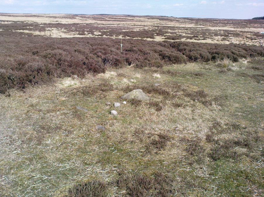
Takes a bitta finding this one. From the Twin Towers at the top of the moors (Whetstone Gate), walk east along the footpath, past the towers for about another 100 yards, looking out on the other side of the wall until you meet with some walling running downhill onto Morton Moor. Follow this walling for a few hundred yards till it drops down a small valley; then follow the valley down, keeping to its left-hand side, swerving a little round Black Knoll above you. Cross the dried-up stream and about 100 yards ahead of you (southeast), heading towards the Sweet Well, zigzag about (once the heather’s grown back here, this’ll take some finding!). Good luck!
Archaeology & History
Cup-markings, looking north
There’s no previous history to this site and archaeological records indicate no prehistoric remains in this region. However, we (that is Dave, Mikki and me) found this and a number of other sites yesterday in a bimbling wander, to and fro, through boggy-heaths and deep heather. It’s a previously unrecorded cup-marked stone, with what seems like an attached burial cairn right by its side (yet again!). The cairn is 3 yards by 2 yards across. Two very distinct cup-marks can clearly be seen near the top of the small stone, with a possible third just below. A curious though natural yoni-like erosion can be seen on the lower side of the stone which may have some significance to people into that sorta thing! Whether it had owt to do with the cup-markings is another thing altogether!
From East Morton village, take the moorland road, east, and up the steep hill. Where the road levels out there’s a right turn, plus (more importantly!) a trackway on your left which leads onto the moor. Go up this track and keep walking till you hit a moorland ‘footpath’ signpost. Just before this walk due west (your left) into the heather for about 10 yards. Look around! (if the heather’s long and overgrown, you might have trouble finding it)
Archaeology & History
Thought to be one of several carvings that were first reported by Stuart Feather and described in the Yorkshire Archaeological Register* of 1977: near the “denuded remains of a cairn” (there are in fact two here) is “a further cup-marked rock adjacent.” This is thought to be the one registered in John Hedges’ (1986) survey as ‘stone 91’. It’s a cute little thing, about 10 yards south of carving 110 (itself sited near the centre of a much-denuded burial cairn).
Carving 109, when wet!and when dry!
Similar in design to some of the Baildon Moor cup-marked stones (see carving no.126), the primary design here is a simple one: five cup-markings run along the edge of the small stone, with a small carved “line” running between two of the cups, as if denoting separation; whilst on the lower middle part of the stone is another, single cup, a little more worn than the others. It seems likely that this carving, like its double-ringed companion a few yards away (and others on this part of the moors) was in some way associated with the nearby prehistoric cairns.
References:
Boughey, Keith & Vickerman, E.A., Prehistoric Rock Art of the West Riding, WYAS 2003.
Hedges, John (ed.), The Carved Rocks on Rombalds Moor, WYMCC: Wakefield 1986.
Moorhouse, S. (ed.), “Yorkshire Archaeological Register: 1977,” in Yorkshire Archaeology Journal, volume 50, 1978.
* Does anyone have any idea who you report such new discoveries to so that they can be reported in Yorkshire Archaeology Society’s ‘Register’? I’ve asked ’em several times about a number of previously unrecorded sites that we’ve located, so that they can make a record of them, but I never get a reply.
From Bingley, head up to Eldwick (either road, it doesn’t matter) until you hit the crossroads at the top where you go up Heights Lane onto the moors (ask someone if you’re struggling). Right at the top where the lane meets the moorland road, straight across is a dirt-track onto the moor. You’re going up there! Walk up for about 350 yards, then go into the heather on your left. About 20-30 yards in, keep your eyes peeled for the stone in the photo. It’s low down, a few feet across either way, but easily missed when it gets covered in heather.
Archaeology & History
Todmoor carving’s cup & lines
Up here again today — Mikki Potts, Dave and me — this was first carving we came to. It was first discovered by the late great Stuart Feather (1961) on one of his many forays onto these moors. It’s a bittovan odd carving: deep wide grooves, seemingly carved out by humans, in which some other cups have then been carved; plus an odd scatter of other singular cup-markings, what looks like a double-cup, and a long winding line running from near the middle to the stone’s western edge. All the carved elements have been etched onto the southern half of the stone. The lovely little Todmor standing stone is about 50 yards northwest of here.
References:
Boughey, Keith & Vickerman, E.A., Prehistoric Rock Art of the West Riding, WYAS 2003.
Feather, Stuart, “Mid-Wharfedale Cup-and-Ring Markings. Nos. 5 & 6,” in Cartwright Hall Archaeology Group Bulletin, 6:7, 1961.
Hedges, John (ed.), The Carved Rocks on Rombalds Moor, WYMCC: Wakefield 1986.
From the back of Moor End Farm on the south-side of Langbar village, follow the Long Ridge footpath up onto the moor. Walk along the path until its starts dipping down again, onto the moor proper and where another footpath crosses and goes down into the small valley of the Dryas Dike stream: follow it down, crossing the stream and up the small slope till you’re on the next level of ground. Stop here and walk right, off-path and up the gentle slope towards a small fenced-off piece of moor. About 30 yards before the fence, check out the rocks under your noses. You’re damn close!
Archaeology & History
If you’re gonna come up this region, this is the carving you’ll most wanna check out. It’s the most ornamented of all the cup-and-ring stones at the top of Delves Beck. Comprising at least five full cup-and-rings and a number of single cups, carved on a roughly square flat rock, it was first found by Stuart Feather in the mid-1960s. It sits amidst a cluster of many other carvings on the same ridge. This (for me at least) is something of a curiosity, inasmuch as we have a seeming lack of other prehistoric remains in attendance.
Carving 448 with paint damage…and again, with paint damage
On the other side of the Wharfe valley above Ilkley, aswell as where we find cup-and-ring clusters on the Aire valley side at Baildon and East Morton, a preponderance of burials tend to cluster around clusters of rock art; but this doesn’t, initially, seem evident here. A possible cairn is located on the northern side of this small ridge, and there is distinct evidence of another cairn down the slope on the other side of the Dryas Dike stream (by stone 440) just 100 yards away, but that’s it. A more thorough examination of this region is required to see if other burial remains were in evidence hereby in the past. I have photos of seemingly cairn-scatter material, and ancient walling in is clear evidence on the northern side of Dryas, but much more work needs doing. Obviously much of this would require full surface excavation, which means we’re gonna need quite a bit of work and effort to see if the rock-art/burial patterns found elsewhere are echoed here. It’s likely, it’s gotta be said.
…On a slightly more disturbing note: when me and Dave were up here last week, this carving and several others with more ornate designs on this ridge (carvings 446, 453 and others) had been painted over in some black substance. You can see this clearly in the photos we took, above. Whoever did it appears (word gets to me that a arty-dood called Paul did it) has done so to highlight the carvings so they stand out very clearly. If you wanna highlight carvings for better images or photos, there are much better ways of bringing out the designs than the methods you employed there: chalk for one!
References:
Boughey, Keith & Vickerman, E.A., Prehistoric Rock Art of the West Riding, WYAS 2003.
Feather, Stuart W., “Mid-Wharfedale Cup-and-Ring Markings: Nos 43 & 44, Middleton Moor,” in Cartwright Hall Archaeology Group Bulletin, 11:4, 1966.
Follow the same directions to find the Middleton Moor carvings of 441, 445, or others close by. If you can get to carving 445, then you’re about 20 yards northeast away from this one! A bittova upright stone, with another undecorated smooth flat rock about one-foot away.
Archaeology & History
Amidst the clump of other carvings on top of the ridge at the head of Delves Beck on the southern side of Dryas Dike, is this small standing-stone-like rock, which has a distinct single cup-marking right on the topmost part of the stone. In certain lighting conditions it seems that there may have been a partial surrounding-ring on its top, or perhaps a smaller faded cup by its side. It’s hard to tell — so let’s play safe and just stick with it being a single-cup stone for the time being!
References:
Boughey, Keith & Vickerman, E.A., Prehistoric Rock Art of the West Riding, WYAS 2003.
Follow the same directions to find Middleton Moor’s 441 carving. Then, go across the small stream a bit further down the slope and up up the slope until you’re on the level. Once on this small rise in the land, look up the slight slope where approaching the the fenced area. You’re close!
Archaeology & History
Middleton Moor carving 445
On the Middle Ridge between the streams of Delves Beck and Dryas Dike, this small rounded triangular-shaped carved stone has eight simple cup-markings eroded, but notable on its smooth surface. Boughey & Vickerman (2003) suggest some may be gunshot marks, which has to be considered at several of the seeming ‘cup-markings’ on this moor. (particularly at Carving no.440 less than 100 yards away) Archaeo-astronomers amongst you will note the Cassiopeia-like central design on this design — though this is probably coincidental (it might have tickled mi fancy when I was going thru my astroarchaeology phase many years back, but not anymore).
References:
Boughey, Keith & Vickerman, E.A., Prehistoric Rock Art of the West Riding, WYAS 2003.
Cup-and-Ring Stone: OS Grid Reference – NZ 0774 7048
Archaeology & History
1928 photo of carving
Found inside a prehistoric tomb that was excavated in the late 1920s “by Messrs R.C. and W.P. Hedley at Pike Hill, near Stamfordham,” this fascinating-looking carving was found on a stone that “was overlying the primary burial” cist in the middle of the tumulus, measuring “2 feet 9 inches long by 2 feet wide and 12 inches deep, with an orientation on the longer axis of NE.” As we can see in the old photo that accompanied Mr Hedley’s (1928) short article in Antiquity journal, four single cups are arranged in a rough square and are joined with each other by a single line, running from cup to cup, outlining a clear quadrilateral formation. Two other single cups are outliers on the left and right side of the ‘square.’
A second smaller cist was also found inside the same mound and on the central inner face of this was another, more simplistic carving described as “a very fine cup-mark 1½ inch in diameter and ¾-inch deep.” These carvings are no longer in situ (I think they’re in Newcastle Museum) and apparently this second single cup-marked stone can no longer be located.
References:
Beckensall, Stan, Northumberland’s Prehistoric Rock Carvings, Pendulum: Rothbury 1983.
Beckensall, Stan, Prehistoric Rock Motifs of Northumberland – volume 2: Beanley to the Tyne, Abbey Press: Hexham 1992.
Hedley, R. Cecil, “Ancient British Burials, Northumberland,” in Antiquity Journal, volume 2, December 1928.
This is an outstanding site visible for miles around in just about every direction – so getting here is easy! If you’re coming from Harrogate, south down the A658, turn right and go thru North Rigton. Ask a local. If you’re coming north up the A658 from the Leeds or Bradford area, do exactly the same! (either way, you’ll see the crags rising up from some distance away)
Archaeology & History
Almscliffe Crags – looking east
This giant outcrop of rock rises out from the meadowlands here like a miniature volcano, visible for many miles all round. The history and legends surrounding the aged edifice are prodigious and the view from its tops on a fine day is one to be remembered. It is likely, although there is little corroborative historical evidence, that is was an “omphalos”, or navel centre of the universe for the local people many centuries ago. A great cutting runs through its centre and “runs from nearly north to south, and forms the boundary between the townships of Rigton and Stainburn, so that a portion of the rock is in each township.” On the respective sides of this division are carved the letters “T.F.” and “E.L.”, being the initials of the families who owned the land here in olden days, Thomas Fawkes [of the legendary Guy Fawkes’ family] and Edwin Lascelles, of the ancient Harewood family.
Although Almscliffe Crags have been described in a great many local history books, it almost beggars belief to find it omitted from all the ancient mystery or “sacred sites” books ever written. Curious… Such lesser sites as Alderley Edge, the Cow and Calf rocks, Kilburn’s White Horse, Twelve Apostles stone circle, and many more, whilst having their respective virtues, don’t touch this place for ritual or sacred intent.
First described in the early 13th century records of Fountains Abbey, A.H. Smith (1961) thought the name of Almscliffe itself originally came from a hypothetical lady’s name, which seems an all-too-easy proclamation to make, instead of the humble option of “I don’t know”! But Smith wasn’t the only one to throw some curious ideas up about the etymology of Almscliffe. Said by some local etymologists to derive from the Celtic Al-, a rock or cliff, and mias, an altar, there are other attempts to bring its rocky form into a consensus meaning. The anglo-saxon Ael or El, being fire, and messe, or mass; and the Scandinavian Ormcliff, being the “cliff of the serpent”. In Jones’ History of Harewood (1859), he tells
“it to have derived its name from the distribution of almes, at certain times, agreeably to the tenor of legacies left to the chapel which stood there in the sixteenth century, and was at that time dedicated to the Virgin Mary.”
It’s difficult to say which one tells its true title. Many a druidic tale has also been carved into its form. Such is the nature of this site that Grainge (1871) wrote how,
“it would not be difficult to show, with the exception of the artificial temple or circle of stones, this place possesses all the accessories of that ancient worship as…typical of the worship of the sun.”
Simpson’s 1879 drawing of the Almscliffe ‘cromlech’
A remark that was even echoed by one of Yorkshire’s finest and most sober historians, Harry Speight. (1903) Grainge also pointed out that in his day there were three standing stones by the great Crags, one fallen, but “two of these rocks yet stand upright.” A few years later we find that the ranting christian writer, Henry T. Simpson (1879), described similar megalithic remains here, though his description was of a “cromlech.” (illustrated here) I can find no trace, nor further references to these relics; but think it reasonable to suggest that, perhaps, Simpson’s cromlech and Grainge’s standing stones may have been one and the same monument.
In the field 100 yards immediately north of the Crags (the one with the two rocks in it) there used to be seen the remains of some primitive early walling, suggestive of a small, early settlement site. Very little can be seen of these remains today and, as far as I’m aware, no archaeological survey was ever done of them. In all honesty, it’s highly probable that a number of other important prehistoric sites were once in evidence at varying distances around Almscliffe Crags…
Folklore
The creation myth of Almscliffe tells that, long long ago, the great giant Rombald — whose main place of residence tended to be Ilkley Moor — was having a fight with the devil upon his homeland heath. As is common in the myths of giants, the ‘devil’ picked up a great boulder and threw it at Rombald, but it missed and fell just short of the village of North Rigton, creating Almscliffe Crags. A variation of this tale tells that it was Rombald and his wife having the argument and she threw the stones to create the place. Several sites have been named as the place where the mythological argument occurred: the Cow and Calf rocks, the Great Skirtful and Little Skirtful of Stones all cited in the folktales of our Yorkshire peasants. Another variation of the tale tells that the devil was simply carrying some stones (as devils and giants are renowned to do in the folk-tales of the world) and he accidentally dropped them where the Crags now stand. Such rock-throwing tales are, once more, symptomatic of cailleach tales more commonly found in Ireland and Scotland.
There are a great many cup-markings on the top surface of these Crags, most of which seem natural, but it is not unreasonable to think that, perhaps, some may have been carved by human hands? (not sure misself) Eric Cowling (1946) sincerely believed the antiquity of some carvings here. One of them particularly, three feet across and eighteen inches deep, though seemingly natural, has for several centuries been known as the “Wart Well.” Its name is attributed to folklore that is more commonly found in Ireland and the Scottish highlands; that is, should you have a wart, prick it with a pin until a drop or two of blood drips into the water that gathers in the stone bowl, then dip your hand in afterwards. The wart is sure to vanish. Another method to achieve the same end is to merely wash the skin affliction in the water, and it will soon fade. (Interestingly, an old psychotherapist friend, afflicted with the damned things, did just this and they promptly vanished.)
A more minor creation myth tells that the stone bowls we see on top of the Crags here – including the Wart Well – was actually made when the giant Rombald stepped from his home onto the Crags and left his footprint embedded in the rock face. He was said to have made it in just one step, from the Giant Skirtful of Stones prehistoric cairn [where one legend reputes him buried].
Faerie folk were also long held to live here. On the northwest side of the Crags is the entrance to a small cave that was always known as the Faerie’s Parlour, as it was said to be an entrance to their supernatural world. In times past, many people have scrambled down into the cave, but never reached their Otherworldly paradise. William Grainge (1871) wrote how the little people “were all powerful on this hill and exchanged their imps for children of the farmers round about.” This is typical of old changeling lore! In outlying villages surrounding the Crags there is a particular excess of faerie and old heathen lore.
One very curious-sounding tale tells how a goose was sent down the hole and, after some considerable time, re-emerged 3½ miles away out from a well near Harewood Bridge. The goose is one of the many symbols of the sun and one of its primary symbolic attributes is that of winter. Interestingly perhaps, as the rock art writer Graeme Chappell has pointed out, the underground journey of the goose from Almscliffe to Harewood Bridge coincides closely with the rising of sun on morning of the winter solstice. This tale may simply be a folk remnant — and an archaic one at that — of just that event: ritualising winter solstice from these Crags. In Norse lore, shamans tell of geese carrying the great god Wotan across the skies at the coming of the Yule period.
Another ritual date that was celebrated here was Beltane, or May 1. Not only do we find many of the outlying villages possessed their own maypoles, but in 1879 Mr Simpson of Adel reported seeing Beltane fires atop of these rocks. Other meetings were made here as the Crags are spliced in half by the local boundary line, and perambulation records show that people came here during the ‘beating of the bounds’, as they used to be called. This boundary perambulation moot ingredient is what strongly implies the site to have had ritual importance. And the fact that a mass of folktales emerge from here adds to this. Then of course we have the physical situation of the Crags at the heart of the mid-Wharfedale landscape. All these ingredients combined, strongly suggest the site would have been, not just the ritual meeting place of tribal elders in pre-christian times, but an omphalos: it rises majestically from the land and all monuments gaze towards its giant form. Important giant prehistoric monuments from the hills miles away tell of myths that come and go from this proud mass of stone. Although we have other omphali just over the extended horizons from Almscliffe, this is where the World began in the creation myths of ancient times in mid-Wharfedale, at the heart of the ancient kingdom of Elmet.
But there is still more lore to be told of these rocks…
The centre piece of the Crags is known as the Altar Rocks. Upon its western side is carved the “figure of a large tree, which we take to be the monogram of the Celtic Jupiter,” says Grainge. This assumption is derived from an eighteenth century writer who, said Speight (1903), told that “Almnus and Alumnus are titles of Jupiter, to whom this high altar was dedicated.”
The highest part of the Crags, to the west, is known as Lover’s Leap where, in 1766, a daughter of a respectable Rigton farmer of the name Royston, having been disappointed in love, decided to kill herself. She jumped, so legend reputes, from a point some sixty feet above ground, but a strong wind blowing at the time caught hold of her dress and carried her through the air until she landed safely in an adjoining field with naught but a sprained thumb! The said lady realised the stupidity of her ways and was said to have lived out a long and fine life.
In recent years earthlights (UFOs) have been seen floating above and around the great outcrop. It is likely that these were the same things which, in days of olde, the people would call the faerie. I highly recommend visiting the place!
References:
Bennett, Paul, The Old Stones of Elmet, Capall Bann: Milverton 2001.
Bogg, Edmund, From Eden Vale to the Plains of York, James Miles: Leeds 1895.
Bogg, Edmund, Higher Wharfeland, James Miles: Leeds 1904
Cowling, E.T., Rombald’s Way, William Walker: Otley 1946.
Eliade, Mircea, Patterns in Comparative Religion, Sheed & Ward: London 1958.
Grainge, William, History & Topography of Harrogate and the Forest of Knaresborough, J.R. Smith: London 1871.
Jones, John, The History and Antiquities of Harewood, Simpkin Marshall: London 1859.
Simpson, William, Archaeologia Adelensis, W.H. Allen: London 1879.
Smith, A.H., The Place-Names of the West Riding of Yorkshire – volume 5, Cambridge University Press 1961.
Speight, Harry, Kirkby Overblow and District, Elliott Stock: London 1904.


")
")