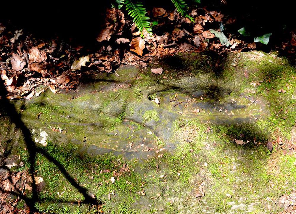
St Columbkille’s place in Irish history was considerable and, said Maghtochair (1867), he was said to have “founded more than one hundred churches and religious houses.” His feet, also, have been carved or burned into a number of rocks scattering the Irish landscape. Not to be confused with his ‘feet’ that are carved near Londonderry, the ones here have been classed in the archaeological inventories as a bullaun and, wrote Brian Lacy (1983) in the Donegal Archaeological Survey, can be found on,
“A 2m long ledge of rock outcrop containing two depressions, c.0.33m in diameter x ).1m deep. They are known locally as St. Columbkille’s footprints.”
As can be seen in the above photo, the ‘footprints’ seem to have been artificially outlined at some time long ago, to make them more notable.
References:
Lacy, Brian, Archaeological Survey of County Donegal, Donegal County Council 1983. p.307
Maghtochair, Inishowen – Its History, Traditions and Antiquity, Journal Office: Londonderry 1867.
Sconce, James, “Cup-Marked Stones,” in Transactions of the Edinburgh Field Naturalists, volume 5, 1907.
Swan, Harry Percival, The Book of Inishowen, William Doherty: Buncrana 1938.
Acknowledgements: Big thanks to Catherine, of the We Love Donegal website.
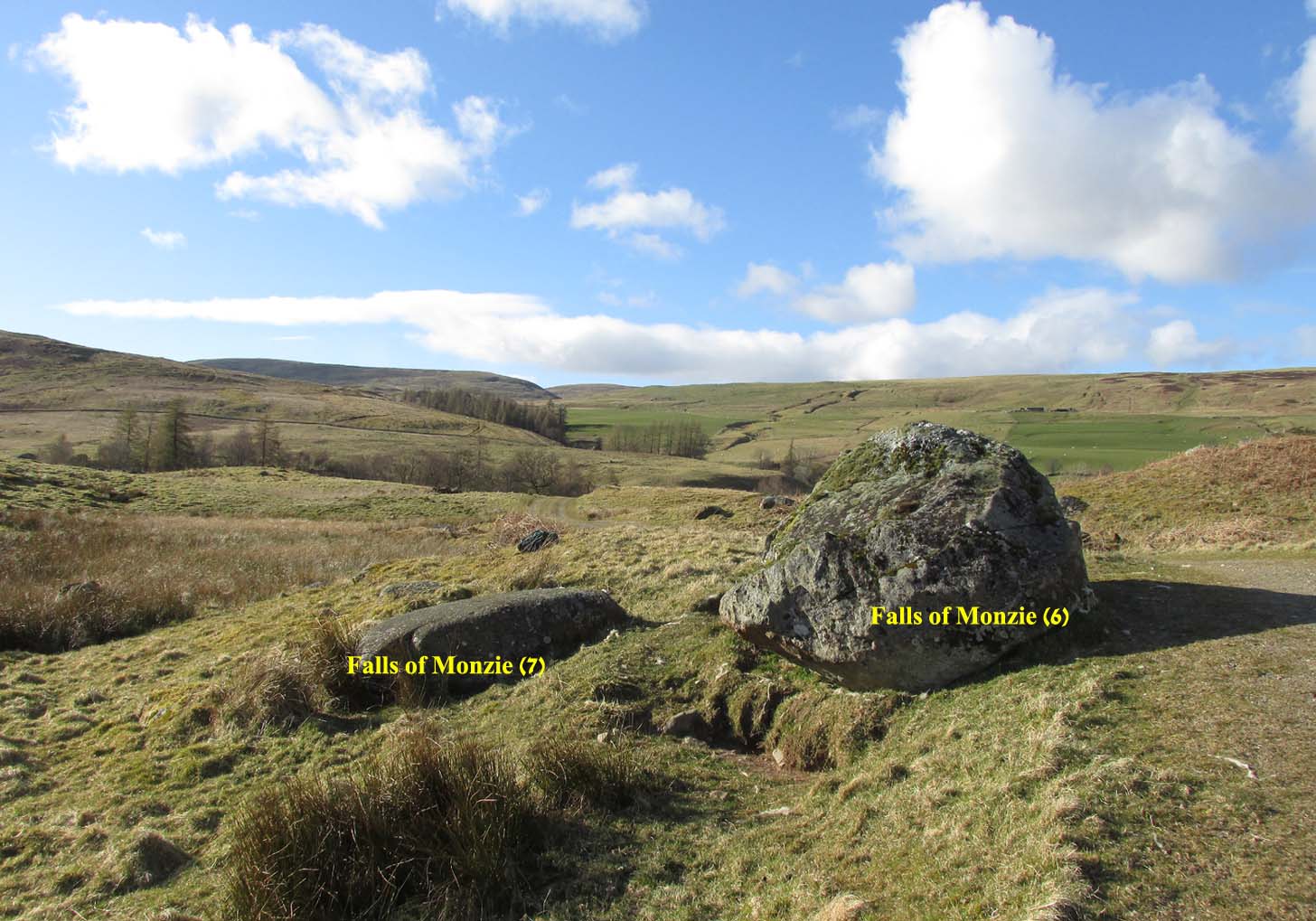
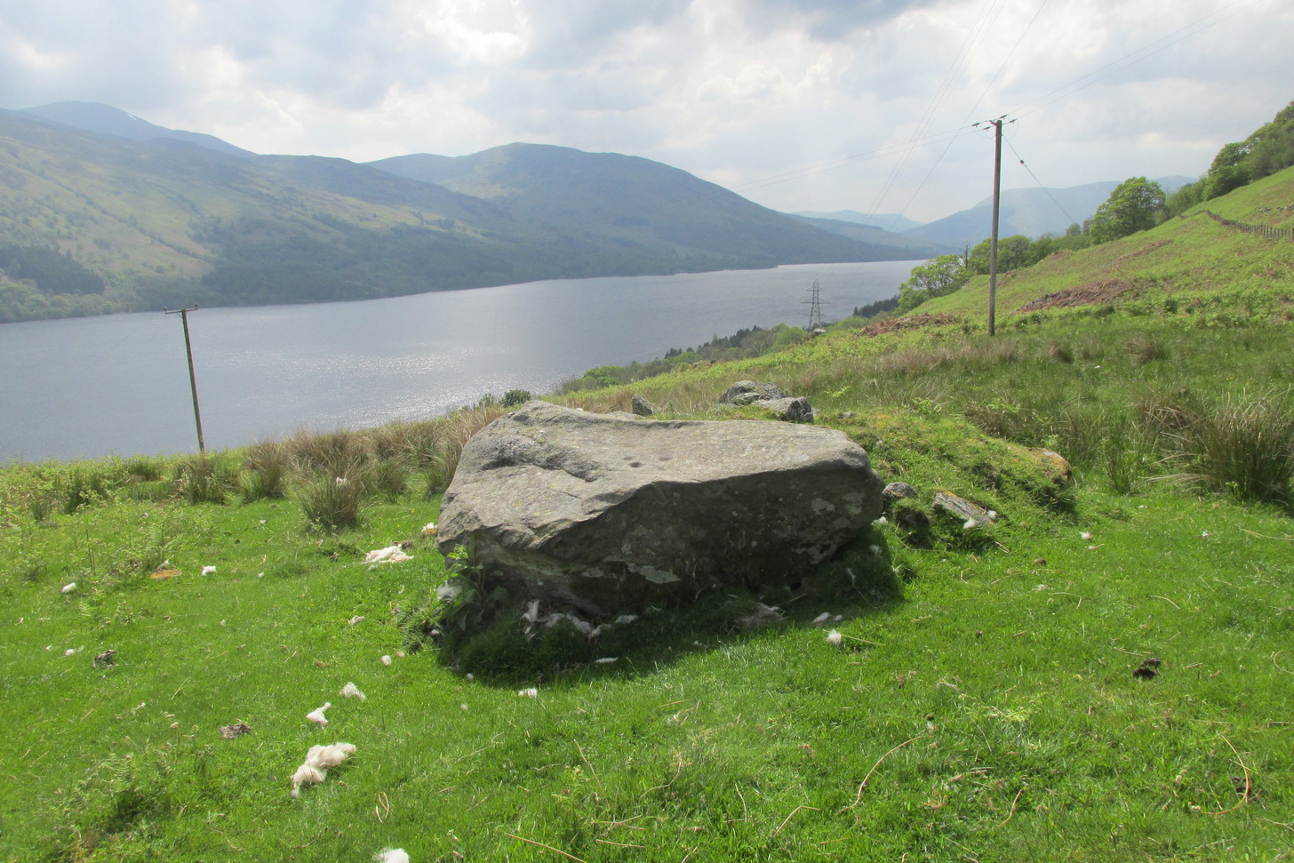
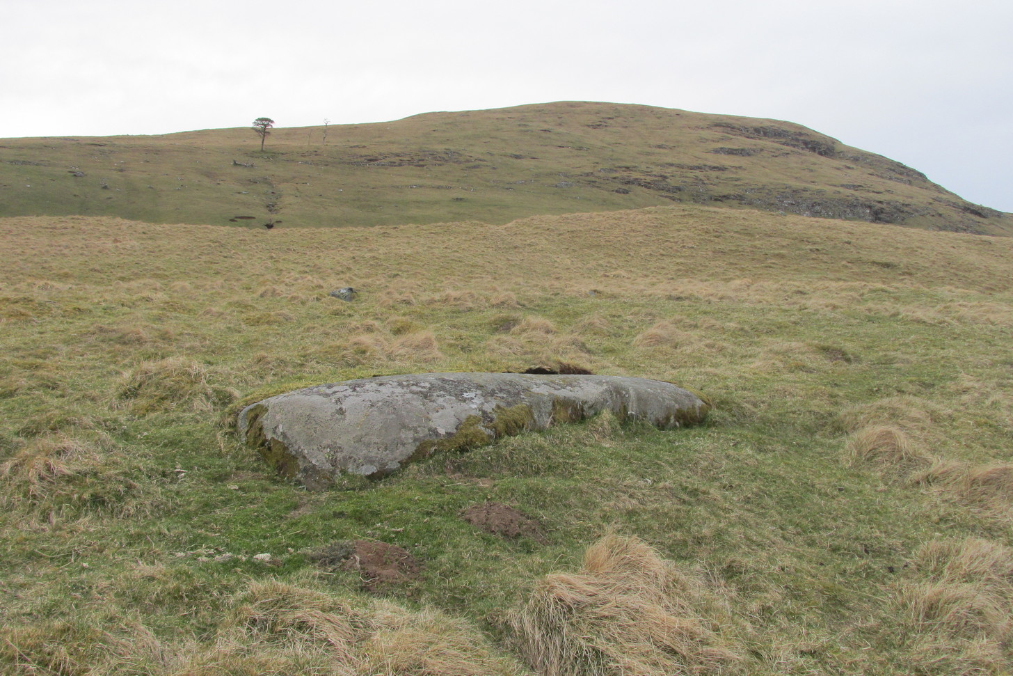
A couple of miles east of Crieff, take the A822 road from the Gilmerton junction towards the Sma’ Glen. After literally 1¾ miles (2.8km)—just 100 yards before the track up to Connachan Farm—you’ll reach a dirt-track on your left that leads into the hills. Go on here and after an easy walk of 400 yards or so, you’ll reach the conspicuous boulder known as the Falls of Monzie (6) stone. Two or three yards to its side is a large flat stone. That’s it!
Archaeology & History
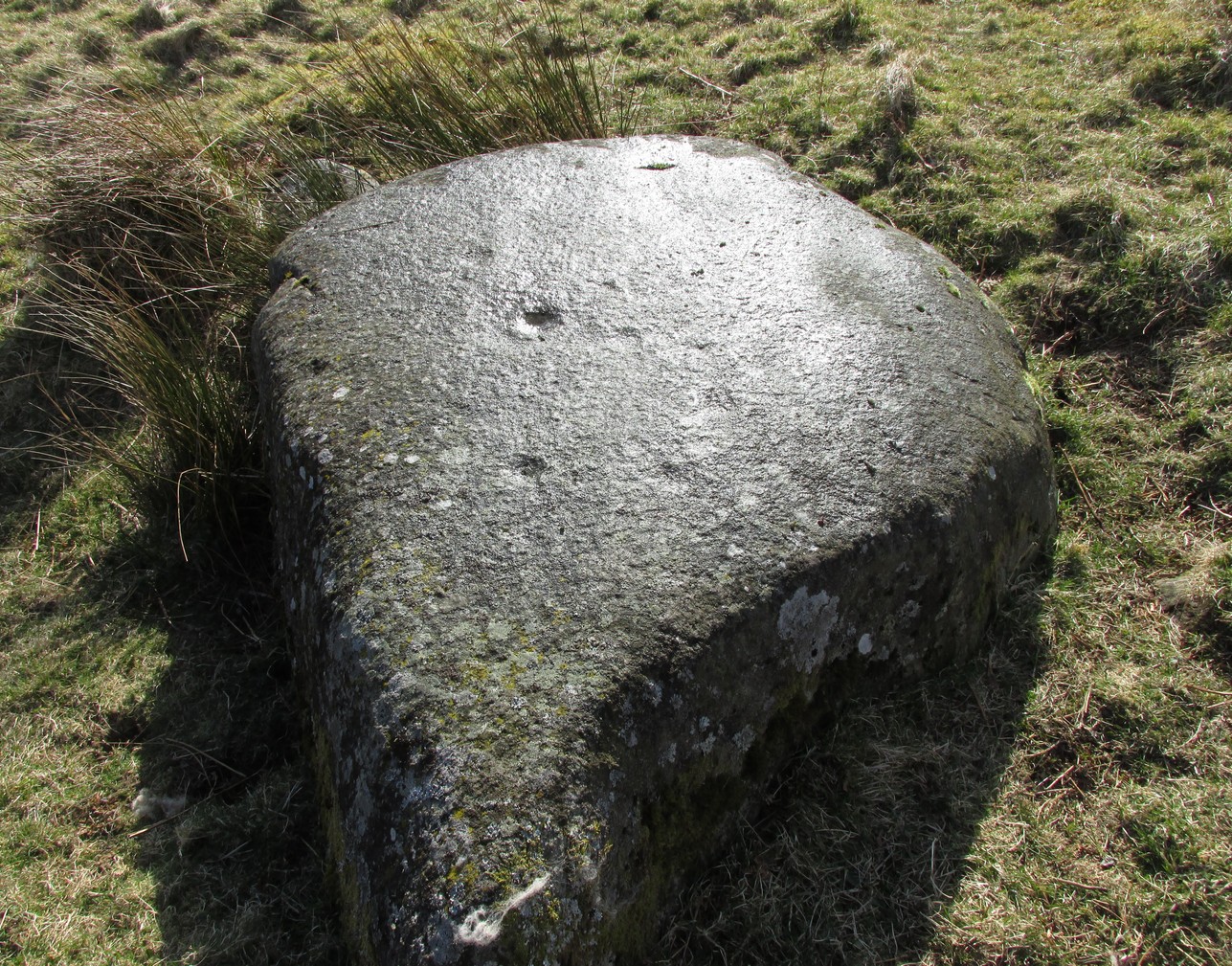
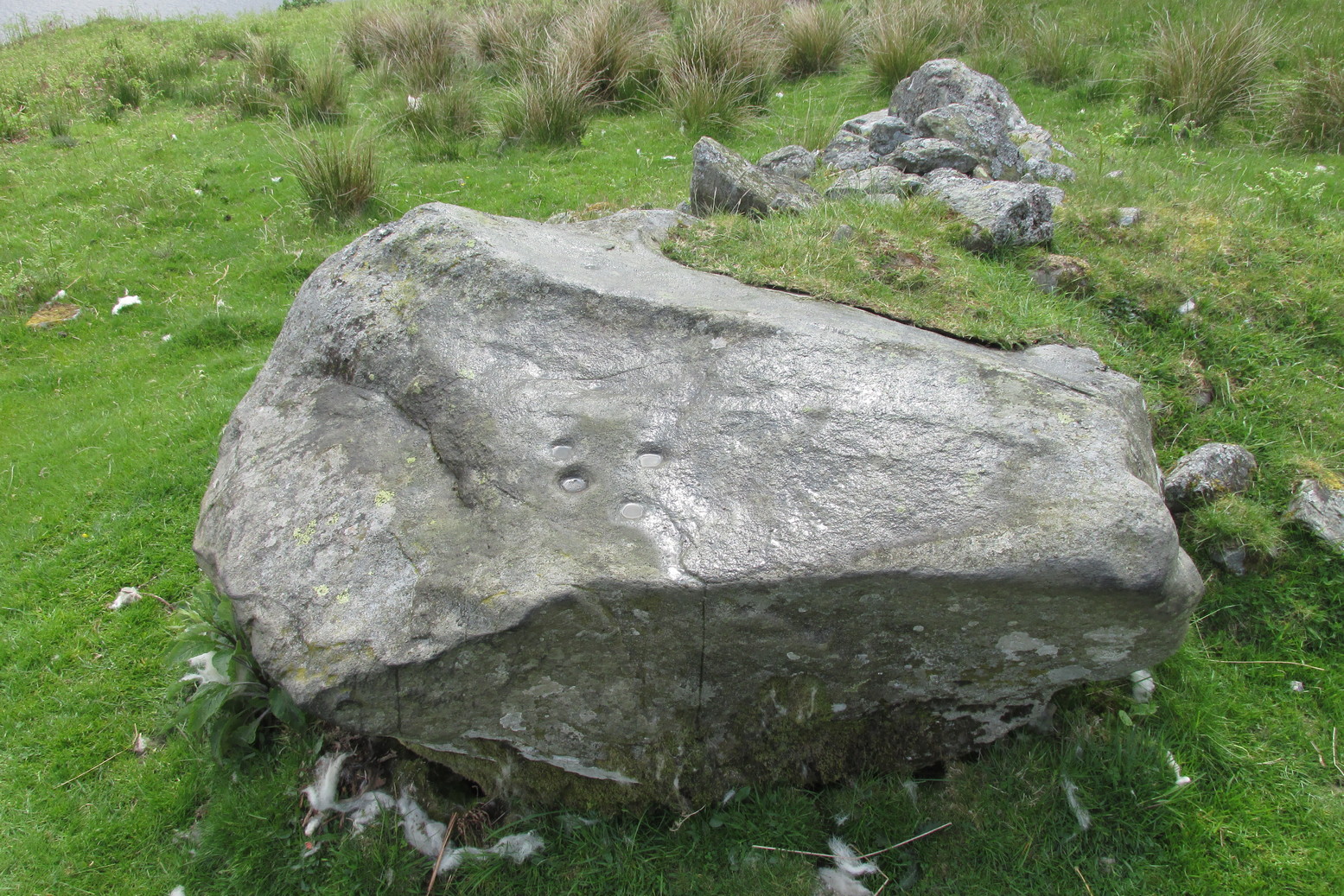
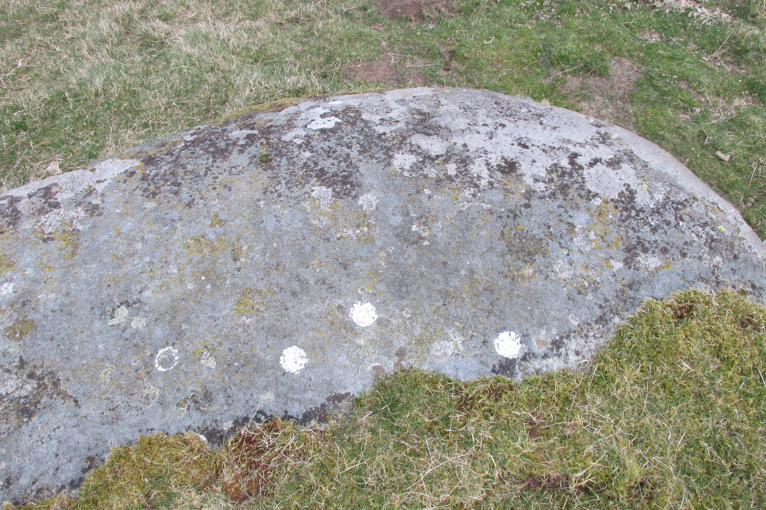
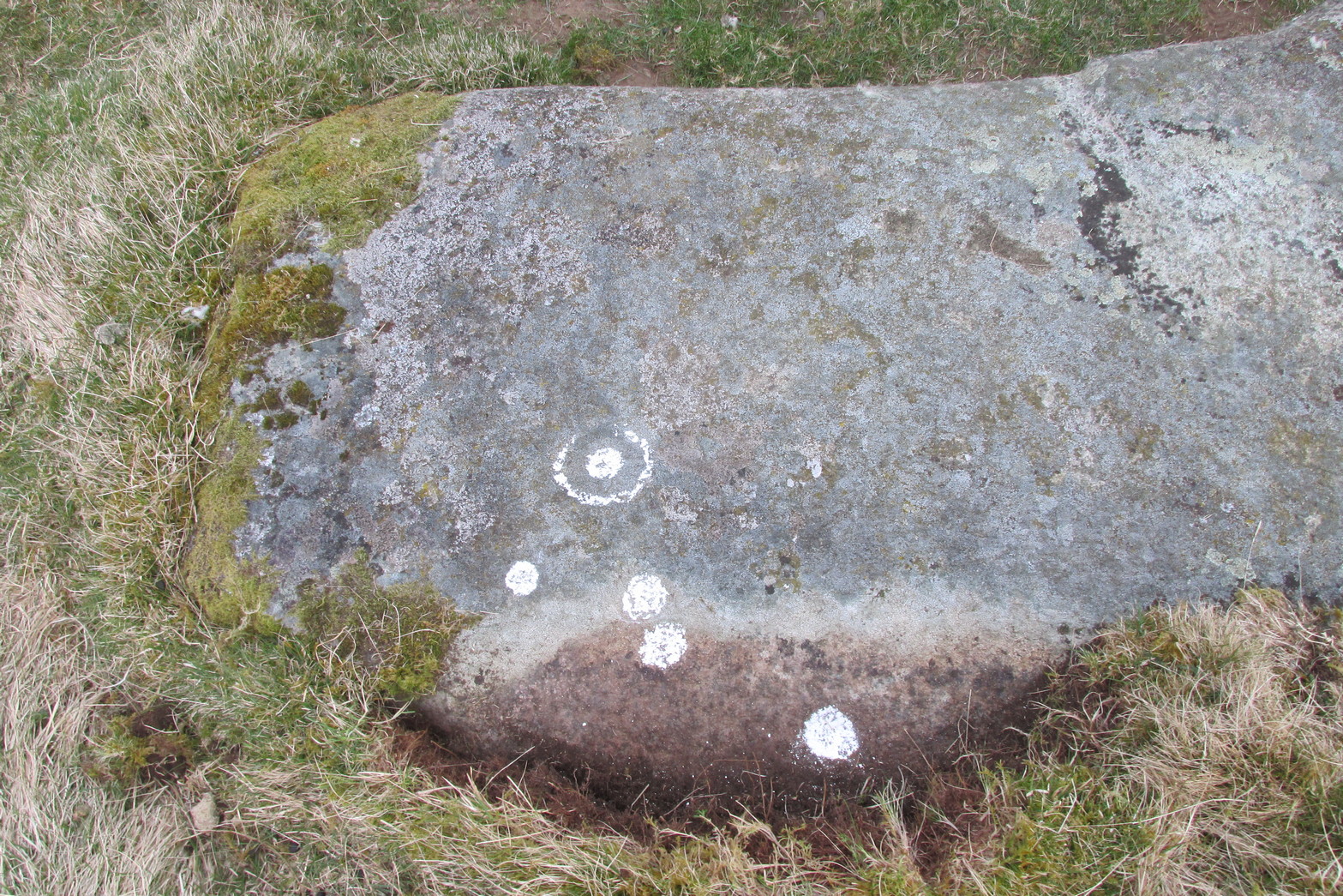
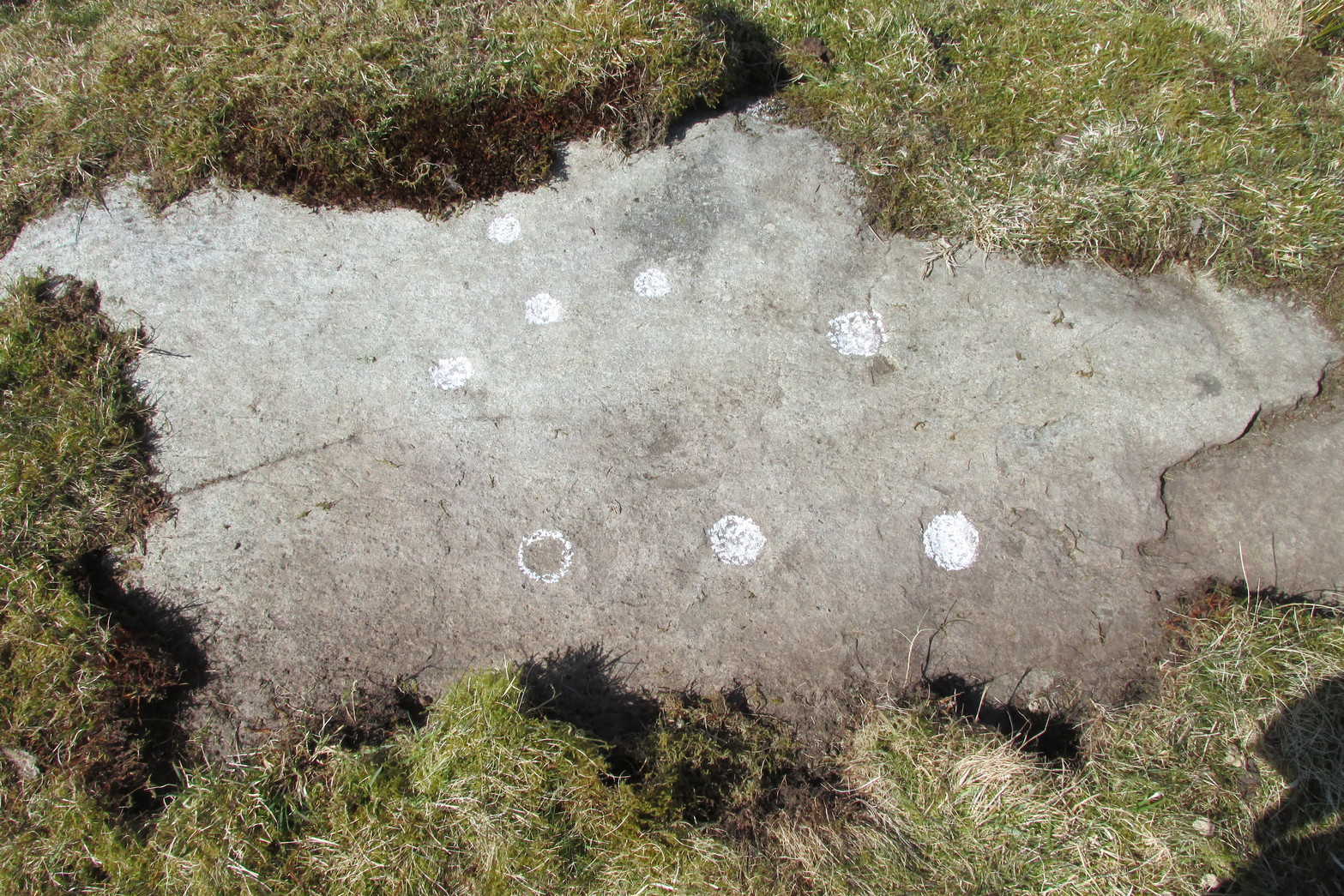
This large flat smooth earthfast rock, is possessed of a number of very faint cup-marks. Altogether there are at least nine cup-marks, most of which are closing in to the middle of the stone, with other single cups near the western and southern edges.
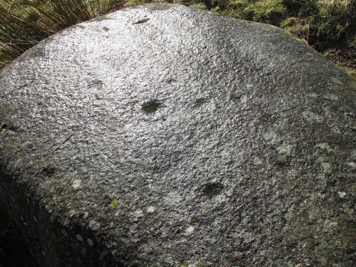
The faint cupmarksClose-up of cups
Near the middle of the rock, one cup has an equally faint semi-circular arc, just visible on the photos here. Close-up photos of this semi-circle seem to suggest it was more complete in ages gone by, but the erosion is such that it’s difficult to say with any certainty. (possibly the computer-tech kids could give us a bit more certainty). The nearest other carving with more definite cup-and-rings can be found on the Falls of Monzie (8) stone, about 200 yards to the west.
Follow the same directions as if you’re visiting the Wester Glentarken (1) carving, but some 10-15 yards before reaching it, you’ll notice this smaller rock with a series of curious naturally-eroded features on it.
Archaeology & History
This rounded stone has a series of natural deep cracks and undulating geological features on its surface, some of which look like elongated man-made cup-marks—but they’re not! The only man-made ingredient on this stone is the deep single cup-mark close to the centre of the stone, as you can see in the photo. That’s it—nowt else!
1½ miles out of St Fillans on the A85 road to Lochearnhead you’ll reach the boating marina by the lochside. A hundred yards or so past this, park up. Cross the road and walk 50 yards to your right then follow the dirt-track up into the trees. After ⅓-Mile (0.5km) turn left to the old house on your left and follow the green path around it, then around the right-side of the rocky knoll in front of you. Once you’re on the level ground around the knoll, walk forward for less than 100 yards. Y’ can’t really miss it!
Archaeology & History
4 of the 5 main cups
A simple design, but a clear one, of four deep cup-marks which can be seen on the eastern side of the stone, with a solitary one—much more faint—just over the rise on the more western section of the rock.
There are a number of other large sections of rock around the knoll with what appear to be cup-markings of various forms, but apart from perhaps one or two exceptions, the vast majority of them—as Currie (2005) also noted—seem to be natural.
References:
Currie, George, “Wester Glentarken, Perth and Kinross (Comrie parish), cup-marked rocks,” in Discovery & Excavation Scotland, vol. 6, 2005.
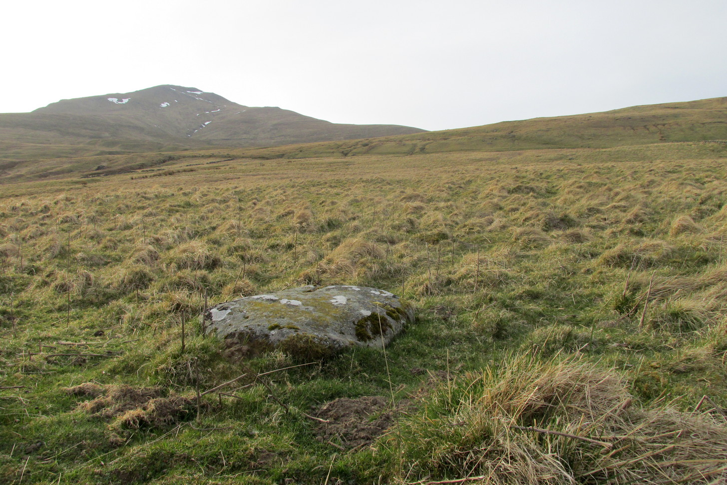
Take the directions to the Balnasuim (1) carving, then up and across to Balnasuim (2). From here, walk diagonally uphill to your right (NE) for about 150 yards and head to the the very top-corner of this field. You’ll see the large embedded rock emerging out of the ground, just ten yards away from a small stream. You’re there!
Archaeology & History
As Officer Barbrady likes to put it, “move along people, there’s nothing to see here!“—and that’s really the case with this, another of Balnasuim’s petroglyphs. This lichen-encrusted rock has just two simple cup-marks, barely visible when the daylight’s poor – and it’s almost as disappointing when the day is good! In all honesty, in wilfully visiting this site and its geographical compatriots, I can sincerely understand how people can tell us petroglyph-nuts that we “really have nothing better to do” with our time!
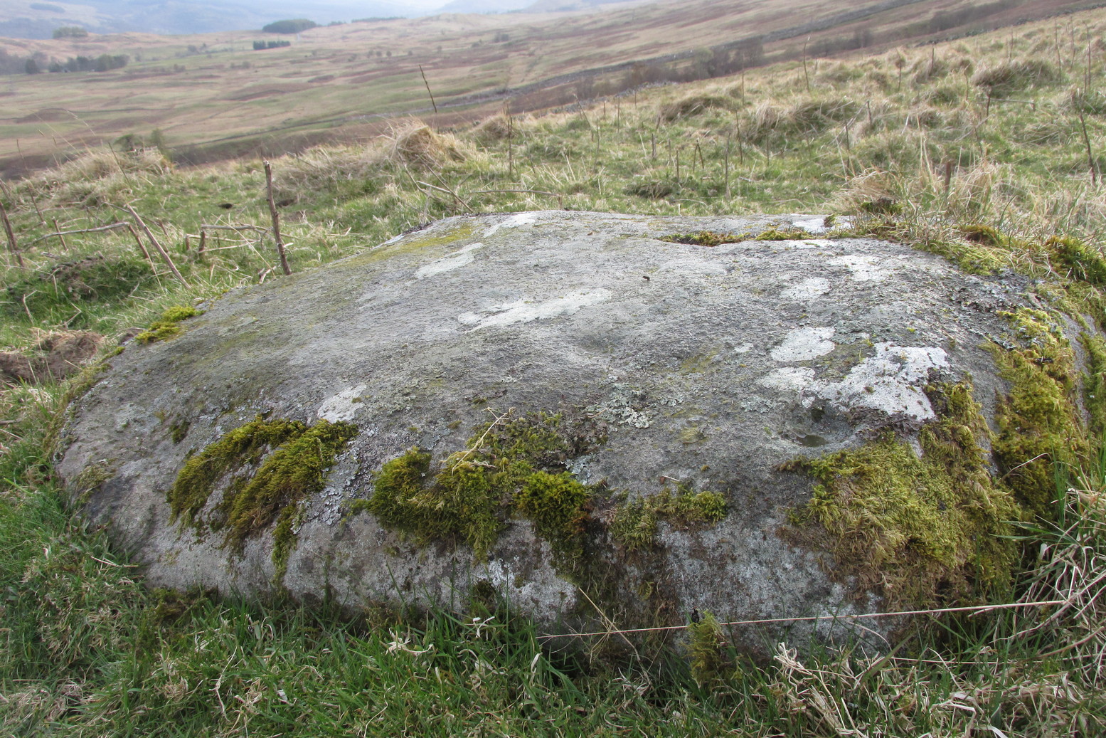
From Killin, take the A827 road to Kenmore. 6 miles along, on your right, is the track down to the Big Shed at Tombreck. Keep on the A827 for exactly ⅓-mile (0.53km), and opposite the driveway to Craggantoul is a small parking spot. A few yards on the road, over the burn, go thru the gate on your left. From here, follow the straight line of walling uphill and 20 yards before reaching Cragganester (9) carving, follow the line of fencing right (ENE) until you hit the wall more than 350 yards away. From here, follow the walling uphlil 350 yards where it turns a right-angle west. About 50 yards east of the right-angled wall, look around…
Archaeology & History
3 faint cups in an arc
As with the other carvings up here at Balnasuim, there is little to look at unless you’re one of the ardent petroglyphic crazies! On this small rounded stone, cushioned beneath the skylines of Ben Lawers and Meall Odhar, are at least three cupmarks in a rough arc running from the northern part of the stone, with the most pronounced of them being close to the northern edge of the rock. The others are very shallow and can be difficult to make out in poor sunlight. A possible fourth cupmark with a short protruding line may exist close to the SE part of the stone. The Balnasuim (2) carving is 305 yards (279m) to the NE.
From Killin, take the A827 road to Kenmore. 6 miles along, on your right, is the track down to the Big Shed at Tombreck. Keep on the A827 for exactly ⅓-mile (0.53km), and opposite the driveway to Craggantoul is a small parking spot. A few yards on the road, over the burn, go thru the gate on your left. From here, follow the straight line of walling up past Cragganester (9) carving, following the burn uphill parallel to the copse of trees until, after about 800 yards, you reach the wall. From here, walk towards the rounded hill of Meall Odhar and, after about 450 yards, you’ll notice it meets a line of walling that runs downhill. Keep walking along, past this, but after 150 yards, go into the field on your right and walk downhill for about 100 yards. Look around!
Archaeology & History
Despite the climb, plus its description as a ‘cup-and-ring’ stone, this petroglyph is somewhat of a disappointment. An elongated stone, half-covered in earth faces south towards Loch Tay and the mountains across, with a series of very eroded cup-marks.
Cup-marks on SW sideCup-and-ring on NE side
They are separated into two small groups. At the southwest side of the rock we can see three or four faded cup-marks. The middle of the rock seems devoid of anything, but on its more northeastern side we find four more cups in close attendance to a standard cup-and-ring motif. That’s about it! The Balnasuim (1) carving can be found 305 yards (279m) to the southwest.
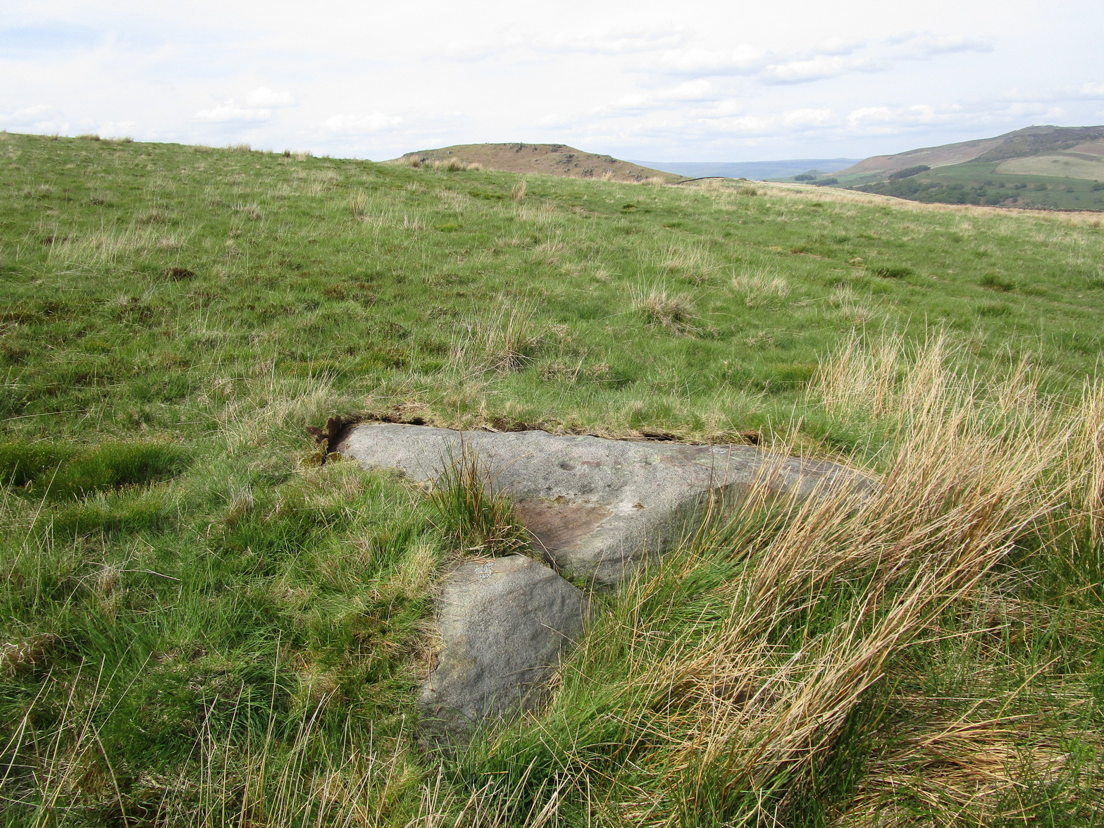
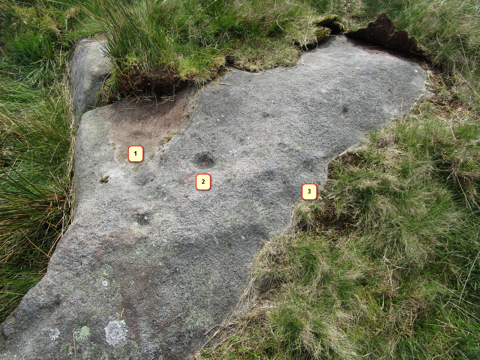
Follow the same directions as if you’re visiting the Falls of Monzie (2) carving; but instead of walking off the track to see that particular carving, keep to the track for about another 60 yards then go up the slight slope on your right. The stone is pretty much overgrown, but if you’re patient you’ll find it.
Archaeology & History
It is difficult to say with any certainty whether or not this petroglyphs has previously been reported. A somewhat confusing series of descriptions by several writers would indicate that is has not been recorded; but I’m happy to be shown otherwise… It’s nowt much to look at if truth be had. Heavily eroded by the elements, this elongated flat stone possesses seven very shallow cups, with a possible eighth, as you can see highlighted in the photo.
From Skipton head up the B6265 Grassington Road and after a short distance you will reach the Craven Heifer Pub on your left. About ¾-mile past the pub is a small turning on your left called Bog Lane. Go along here for about ¼-mile till you come to a sharp left bend and on the right you will see a gateway with room to park. Once here you’ll notice a sharp-pointed hill—and that’s Sharp Haw! Go through the gate, up the gravel track parallel to the wall on your left for 500 yards. Where the wall ends take the small path on your right and walk up here for ¾-mile where the path splits again. Take the right-hand path for 85 yards and the stone is on the left of the path.
Archaeology & History
Positions of cup-marks
Nowt special to look at, this is merely an elongated earthfast female stone that will be hard to find when the reeds grow high. The design consists of at least three cup-marks, with the most prominent one near the middle of the stone. A second one is shallow and on its northern side, near the middle; whilst the third one on its southern side was uncovered when we peeled back the vegetation; the peck marks are still visible. In the photo to the left I’ve placed numbers below the position of the respective cup-marks. In a cursory meander here, we found no other carvings – but that doesn’t mean there aren’t any!
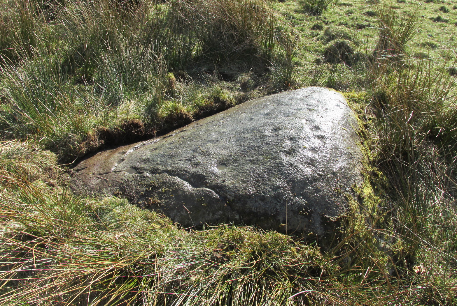
A couple of miles east of Crieff, take the A822 road from the Gilmerton junction towards the Sma’ Glen. After literally 1¾ miles (2.8km)—just 100 yards before the track up to Connachan Farm—you’ll reach a dirt-track on your left that leads into the hills. Go along here for 250 yards (230m) yards (the track has straightened out here) and then walk into the reeds on your right. About 15 yards in, look around!
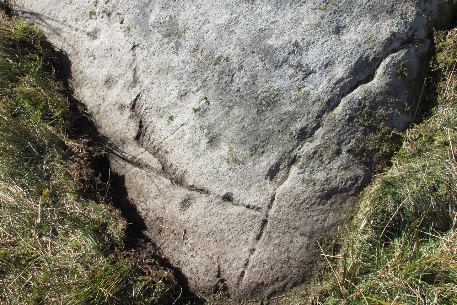
Archaeology & History
Another one of those fascinating carvings that had me here for an hour, maybe more, poring over more and more features as the light, shadow and rock gave more and more depending on how I looked at it. Tis the same with many petroglyphs, of course… But I liked this one.
On initial impression it didn’t seem up to much: maybe a few faint cups—some certain, others no so much. But the more attention we gave this stone, so more of those unlikely faint cups became much more real. At first there were a dozen; then 15 or more; but as we gave it more and more attention, so more of the petroglyphic design showed its original form. They do that, these stones! When George Currie rediscovered this carving in 2008 he found 17 cup-marks on the stone, but at least thirty of them go to make up this petroglyph. There may even be a very faint, albeit incomplete ring around one of them, but I’ll let the computer-tech kids work that one out!
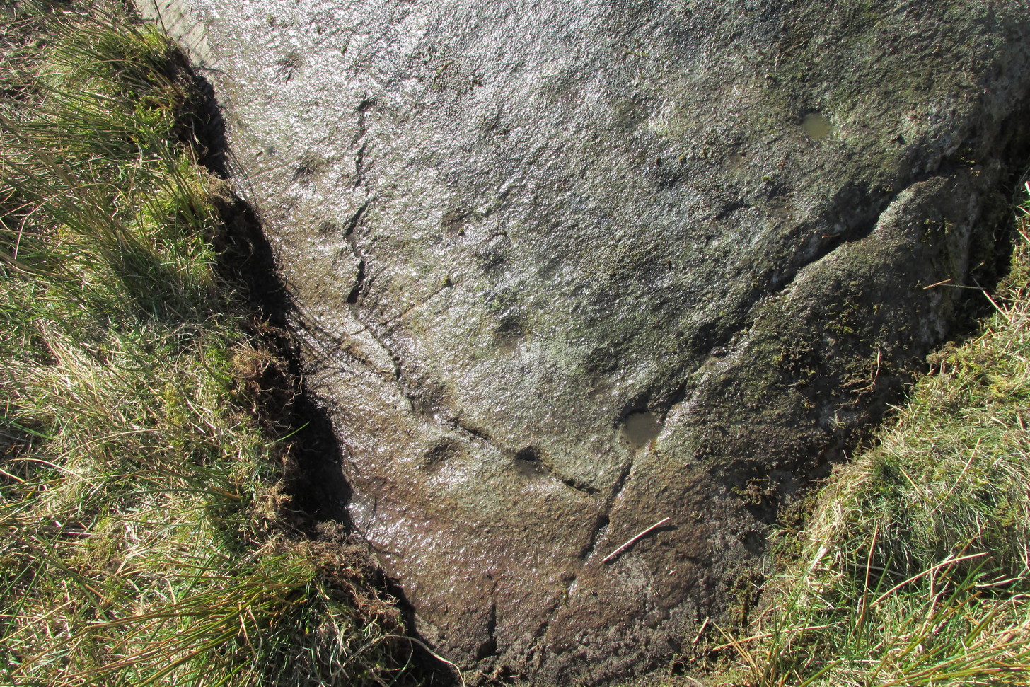
Natural cracks with cups & carved extensionsNatural cracks with cups & carved extensions
This carving has that peculiar and not-too-infrequent element of having some cups carved into the natural cracks in the stone. In this case, at least four of them can be seen etched into the large deep crack that runs along its more northern edge. They’re quite distinct once you get your focus on them. In this case—albeit it to a much lesser extent—this feature reminded me of the impressive West Strathan carving in Sutherland. But where this natural crack finishes, it has been artificially extended until it reaches the eastern edge of the stone. You’ll also notice in the photos highlighting this feature, that another artificial line has been carved at right-angles to it, heading south, until it meets another natural crack in the stone. It’s quite distinct. And along this second artificial line, you’ll notice another cup or three—one of which has been cut into the line. These two man-made extended cracks in the stone, give the simple impression of an early cross symbol. Features such as this, whilst seemingly trivial to the bog standard explorer, possess some very curious myths in some living traditions elsewhere in the world; but such things are beyond the remit of this site profile.
References:
Currie, G., “Falls of Monzie, Perth and Kinross (Crieff parish), Cup-marked rock”, in Discovery & Excavation Scotland (New Series) volume 9, 2008.