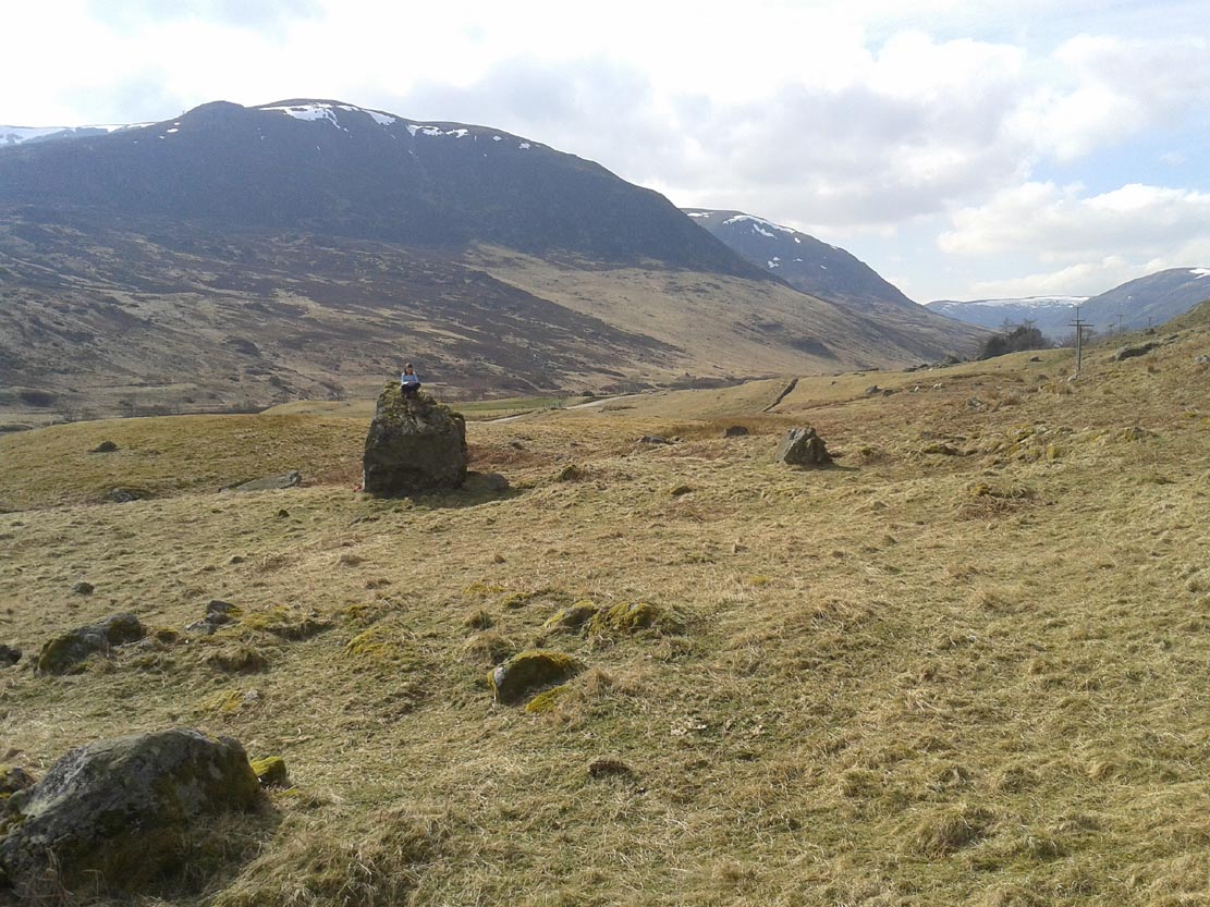
The only real way to get here is via Kirriemuir. Head north to the hamlet of Cortachy and past it, as you enter Glen Clova, where the road splits make sure you bear to the left-hand (western) side. Nearly 5½ miles along, keep your eyes peeled on your right where you can’t really miss it. The stone’s less than 100 yards into the field. …It may perhaps be a bit easier if you take the eastern road of the glen all the way to Clova village. Turn right from there, over the small river bridge and as it curves to go back down the glen, a half-mile along you pass Caddam house. Keep going for another 500 yards and you’ll notice it in the field.
Archaeology & History
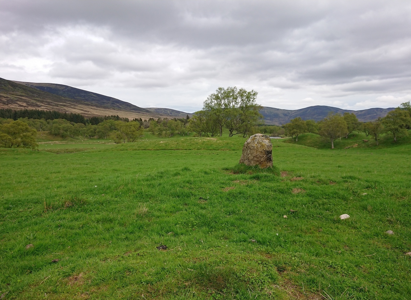
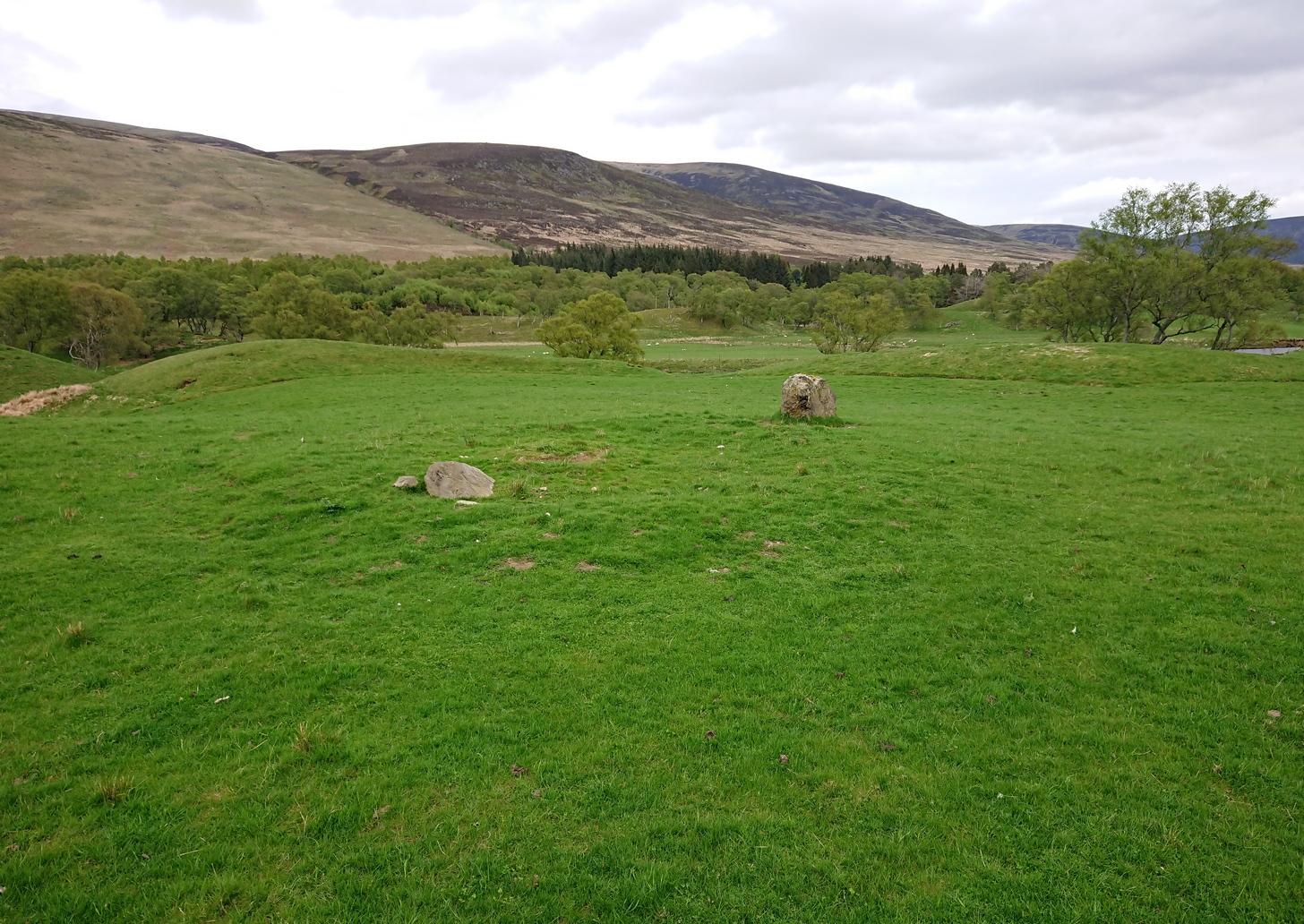
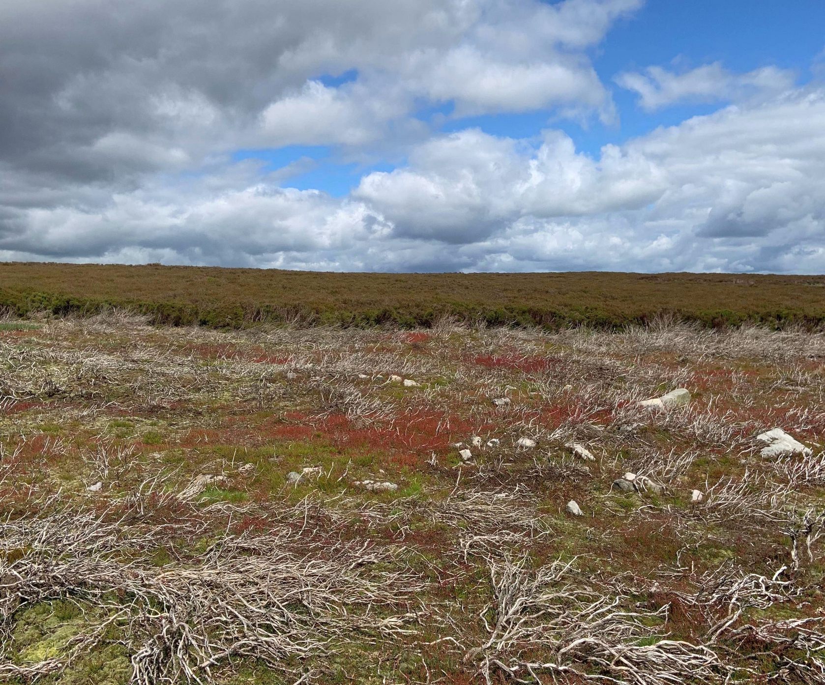
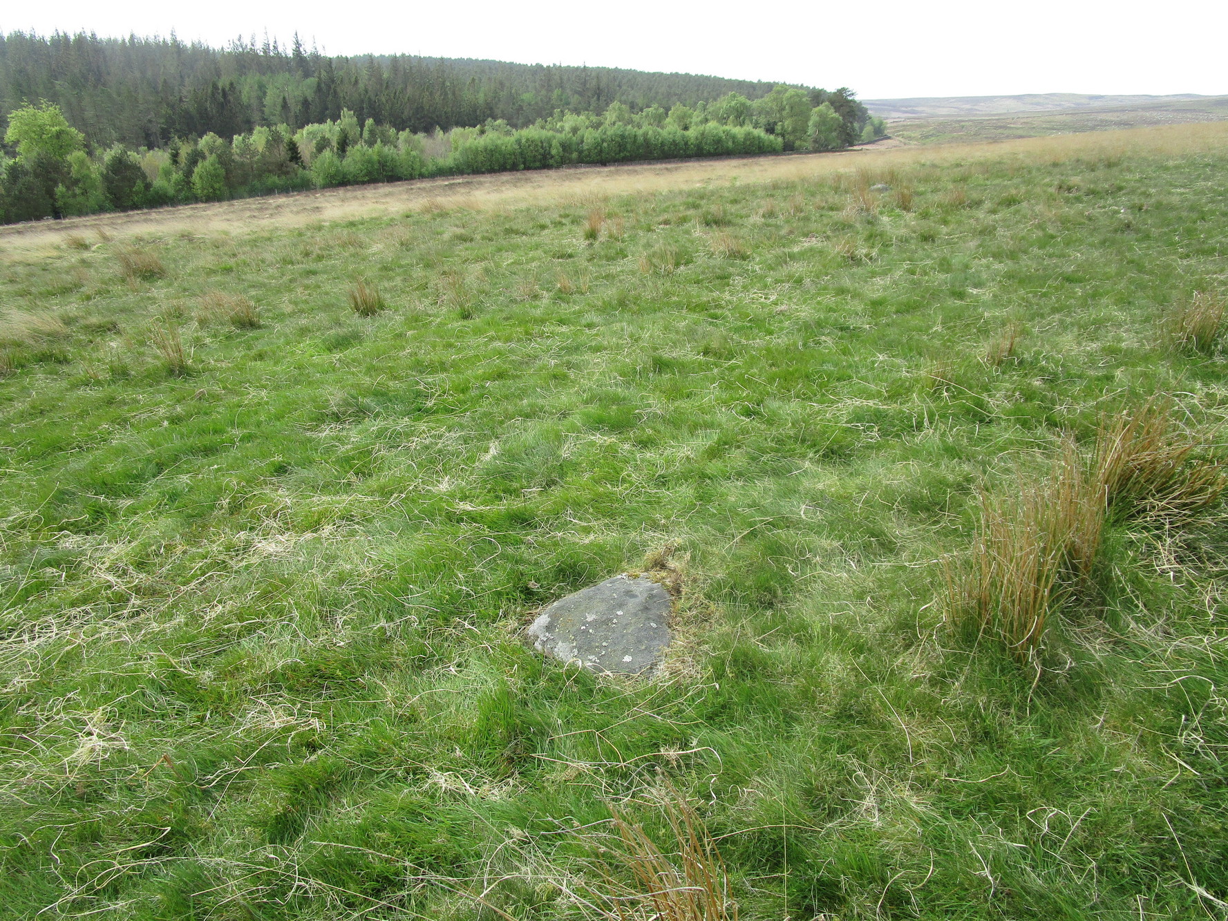
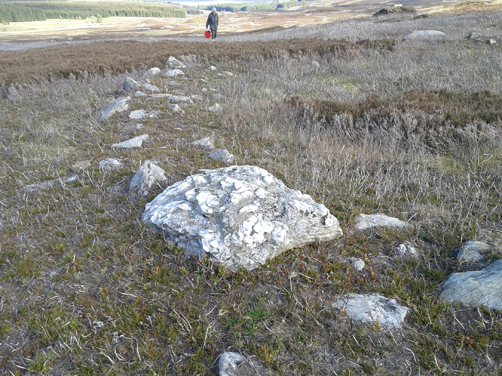
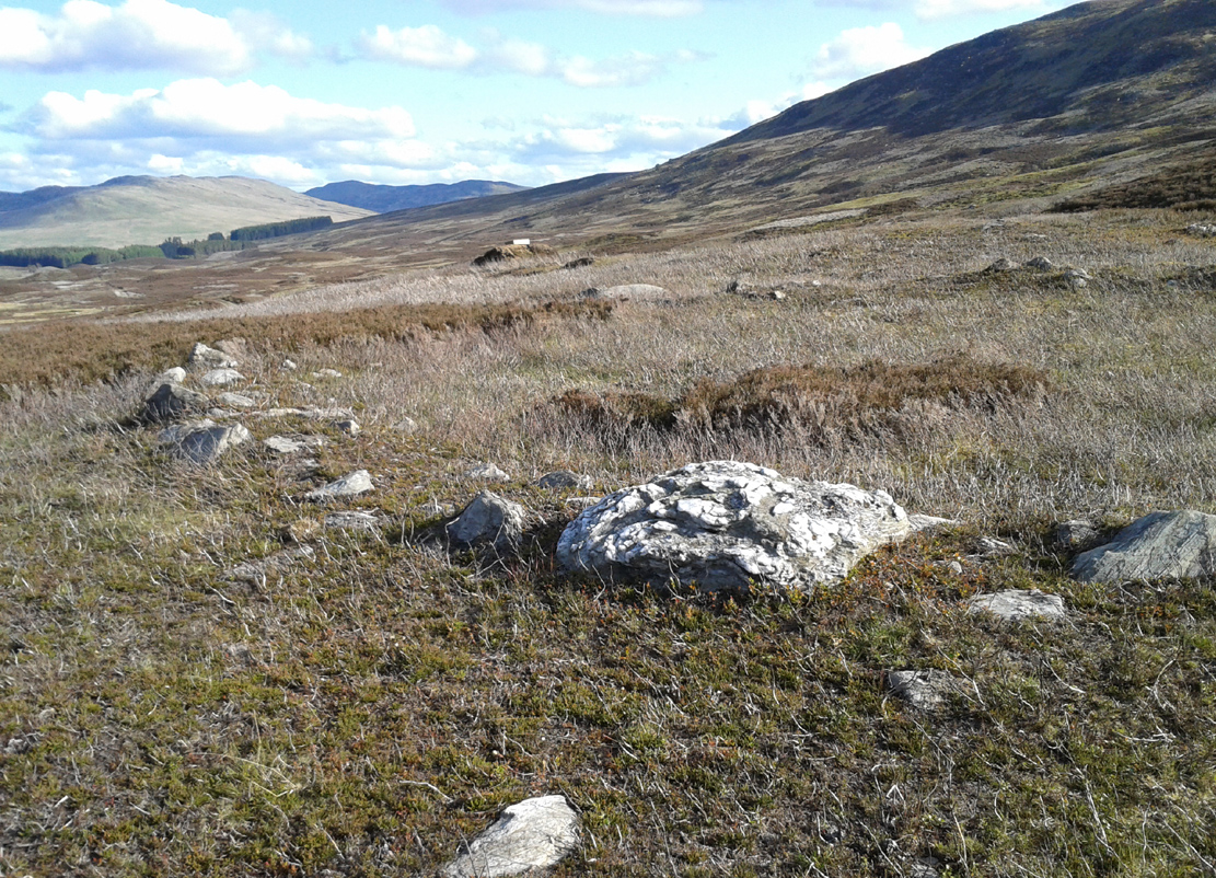
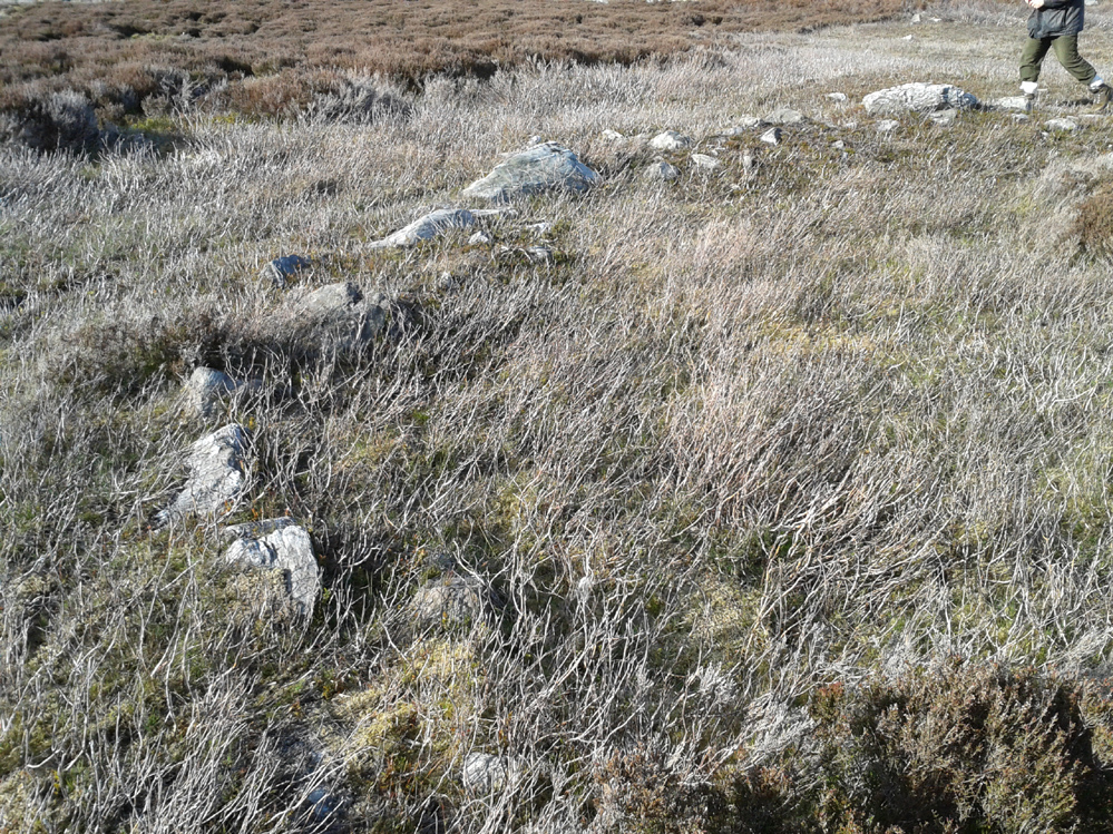
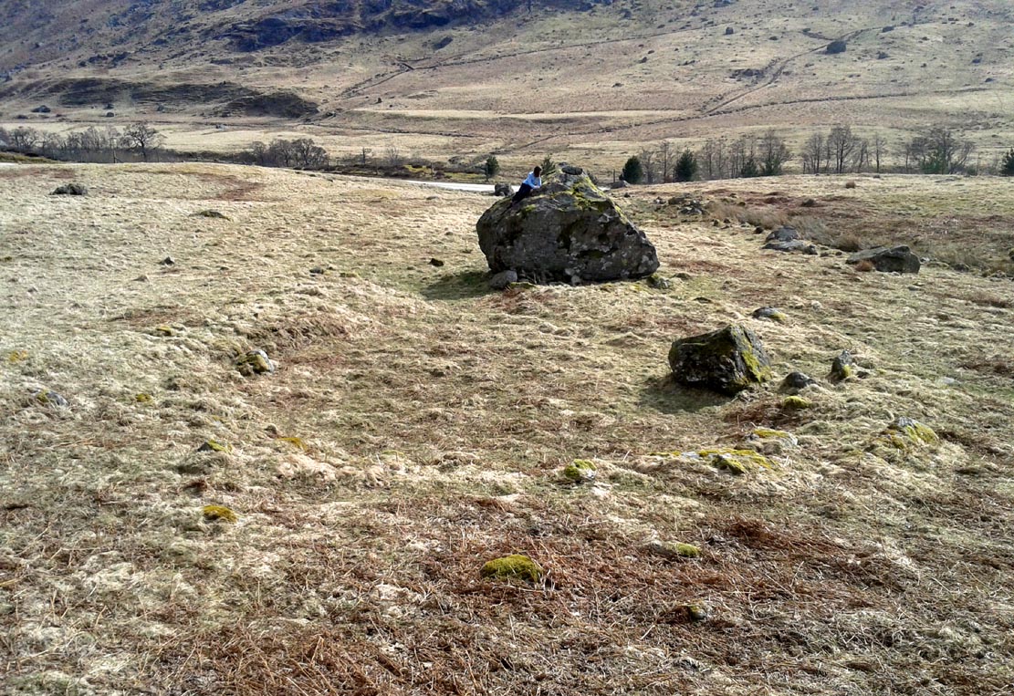
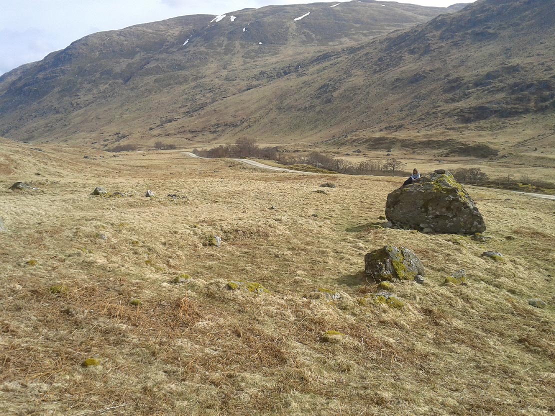
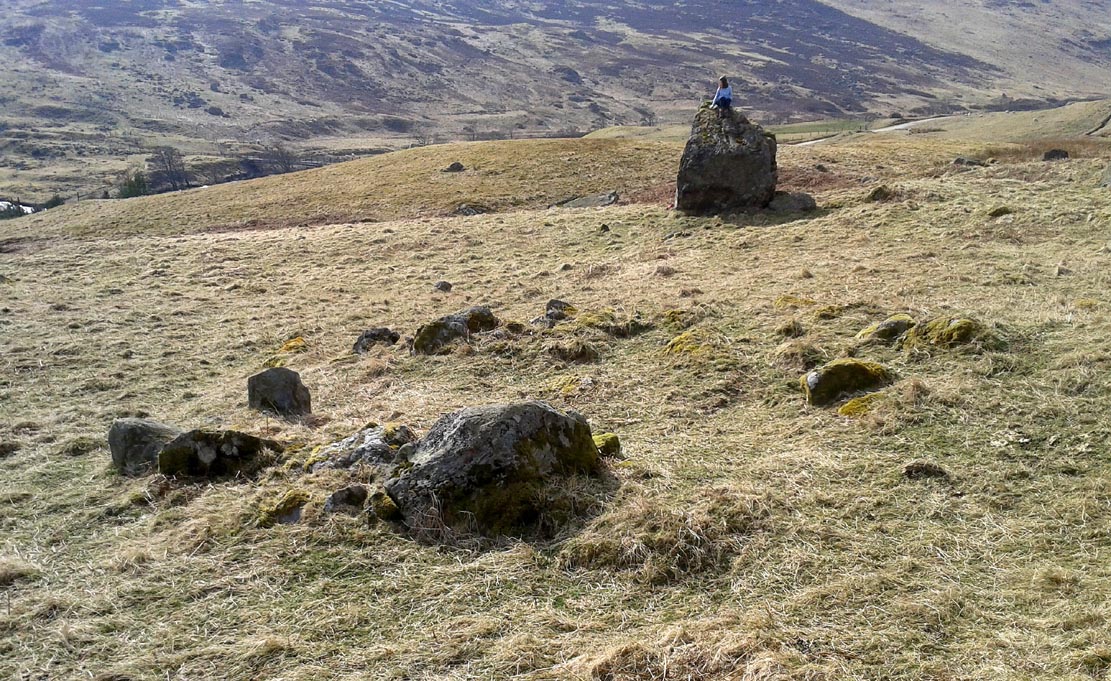
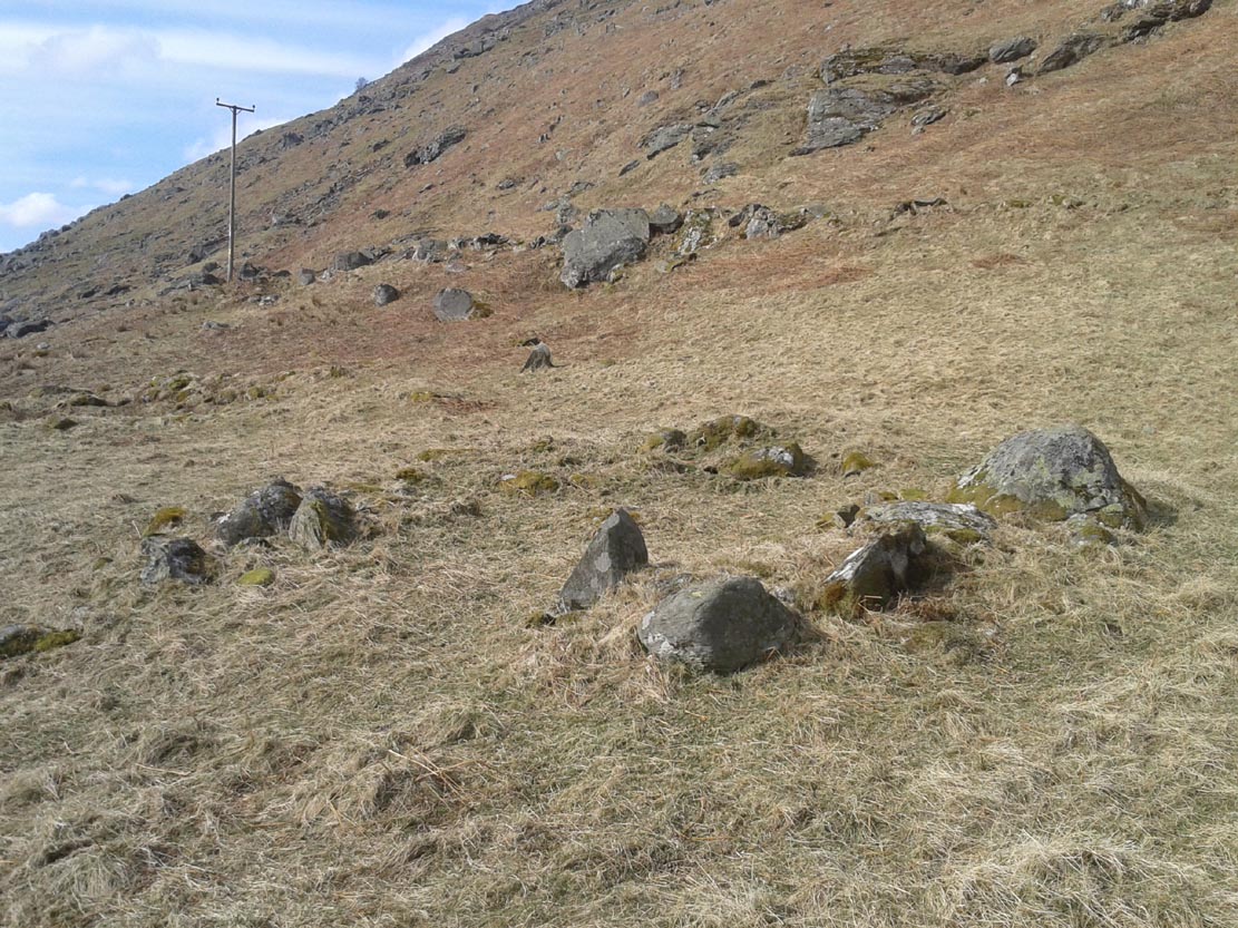
Stone and its hut circle
Not to be confused with the ruined stone circle of the same name 10 miles to the south, this small standing stone—only some three feet in height—is at the eastern edge of a small overgrown hut circle measuring some 3 yards by 4 yards across. You can just make out the overgrown low walling in the second photo (right). The stone probably had some architectural relationship with the hut circle, but without an excavation we can’t know for certain what that relationship might have been. A settlement of much larger hut circles can be found on the other side of the river, near Rottal, two miles southeast of here.
I add this brief site profile in the hope that we can clarify, one way or the other, whether the report of a stone circle described in a letter by G.W. Zealand to the Ordnance Survey in November, 1978, has any basis in fact. Zealand said that the structure comprised of “red stone, not very large” at Millden in Glen Esk. Perhaps local people or megalithic explorers who may visit this area could try locating it so we can confirm it as real, or strike it from the listings. It is included in the Canmore catalogues. I must point out that there were a large number of prehistoric sites in this area destroyed in recent centuries, meaning that this report may be authentic.
Along the only road that crosses Askwith Moor, park up at the single carpark on the east-side of the road. Walk up the road for 350 yards and through the gate on the left-hand (west) side of the road onto the moorland. Once through the gate, walk directly west into the heather immediately below the path for some 25-30 yards. Look around!
Archaeology & History
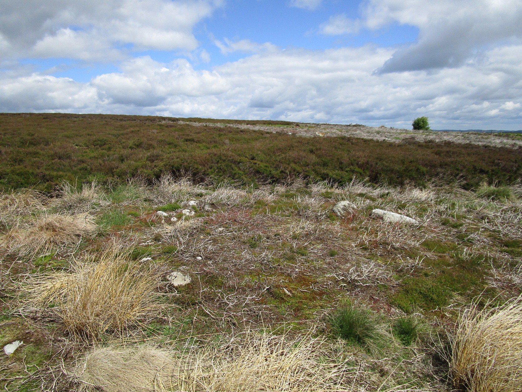
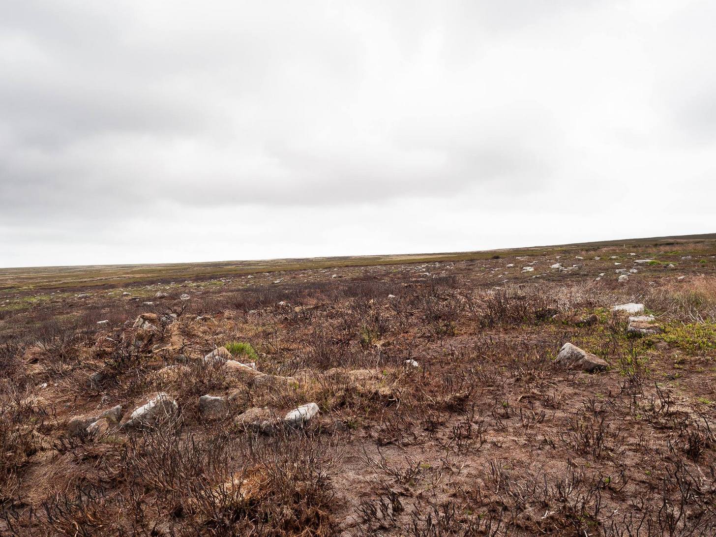
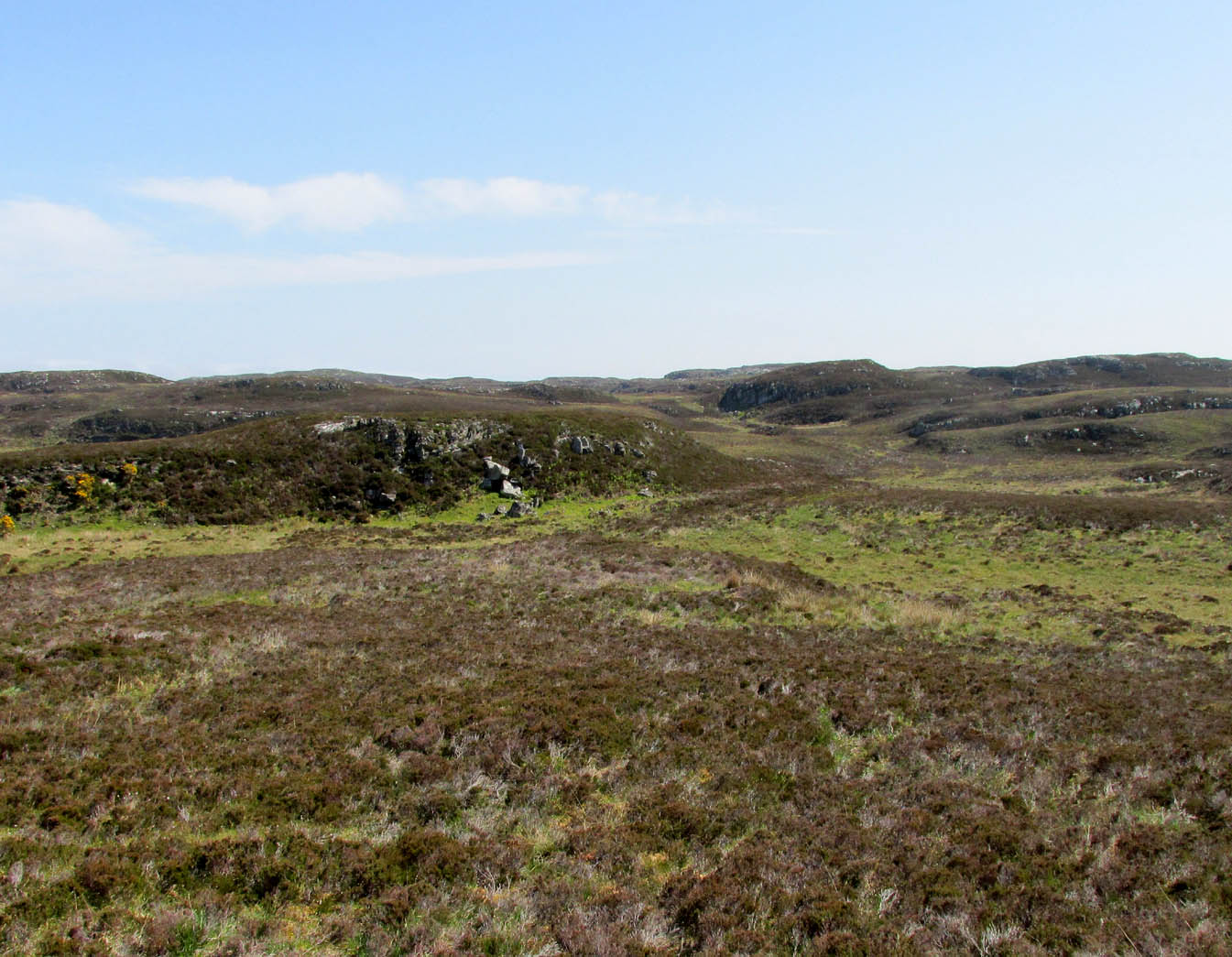
Rediscovered by Helen Summerton in May 2022 are at least two simple hut circles on this level piece of land close to the roadside, amidst this much wider and impressive prehistoric landscape.
The small ring of stones (SE 17430 50978) closest to the road is slightly more troublesome to make out due to it being more deeply embedded in the peat than its companion about 30 yards away. Comprising of typically small rubble walling, this first circle is only 4 yards across and would certainly have been fine for one person or, at a push, perhaps a small family.
Askwith Moor hut circle (2)Askwith Moor hut circle (2)
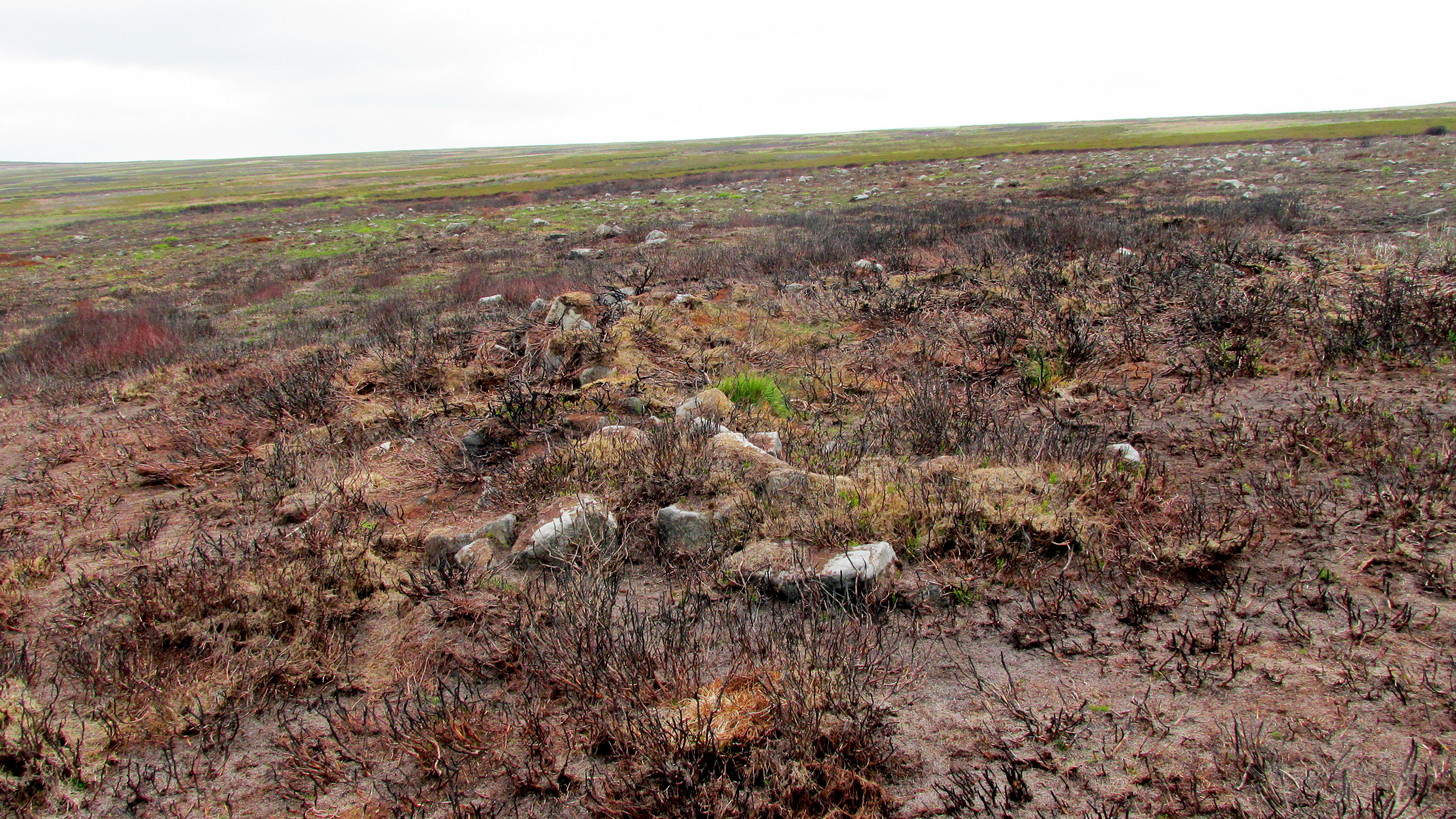
Its companion immediately west (SE 17401 50953) is somewhat larger and slightly more elongated in shape, being 10 yards along and 5-6 yards across, as well as being in a better state of preservation. This larger hut circle has been raised on a notable artificial earth-and-rubble plinth, being one or two feet higher than the surrounding peatland. A notable internal stretch of walling only a yard or two in length exists within the southeastern side of the construction, whose nature can only be discerned upon excavation: an issue we can say applies to the many prehistoric settlements and tombs across this small moorland. It’s very likely that other settlement remains will be found close to these two hut circles.
The remains of another hut circle can be found closer to Shooting House Hill, several hundred yards away; whilst five hundred yards southwest we find a small but impressive cairnfield. There are also a good number of petroglyphs close by and on much of the surrounding landscape.
Acknowledgments: Huge thanks to Helen Summerton (not Winterton) for finding these ‘ere remains – and for the photos accompanying this site profile.
Take the same directions as if you’re going to visit the Black Beck cairn. From here, walk through the heather northwest for about 60 yards. If the heather’s been cleared, you’ll see it low down, otherwise you’re pretty much screwed when it comes to finding this one!
Archaeology & History
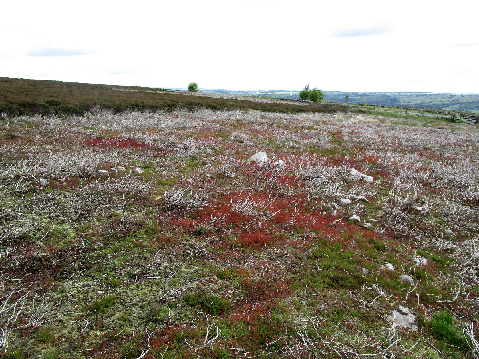
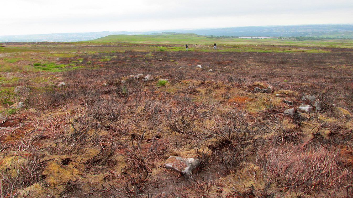
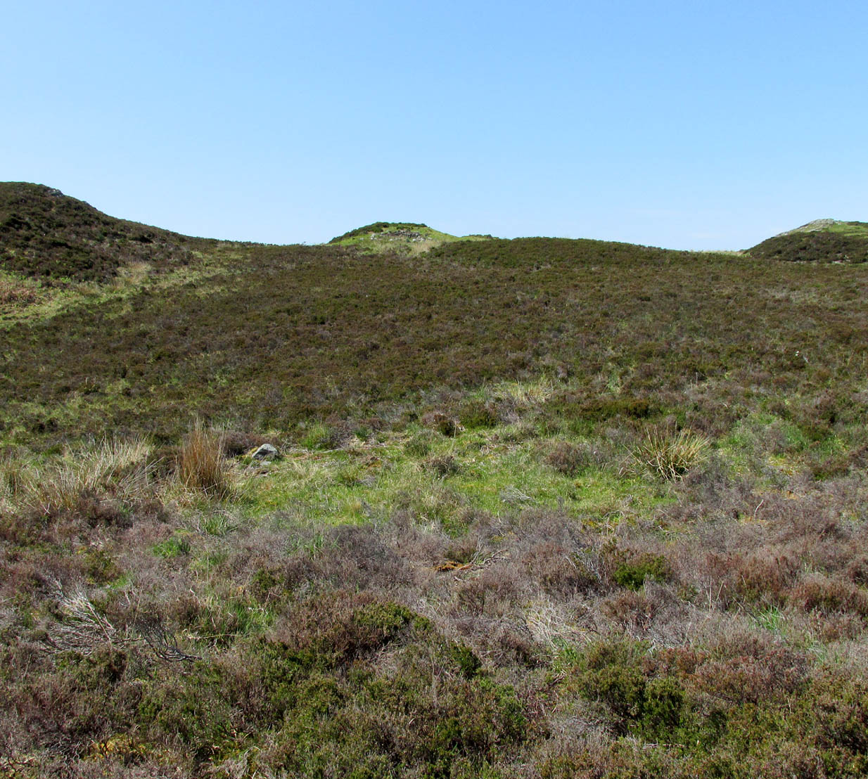
Seemingly in isolation, this low-walled, D-shaped hut circle is presently the only the structure of its kind known to exist on this part of Hawksworth Moor; although to be honest we should expect there to be such structures in the area when we consider the size and proximity of the associated cairnfields immediately north and southeast of here.
Southern arc of wallingNW section of walling; Black Beck tomb to rear
As with most hut circles, it’s nowt special to look at in all honesty. The south side of the structure is rubble walling typical of these structures, curving round as usual; but its more northern section straightens out, creating a D-shaped structure. This line of straight walling seems attached to another, outer parallel wall 3 feet away, creating its very outer edge. The rubble walls themselves average three feet across; whilst the hut circle measures 6-7 yards across. We assume that it was constructed during the same period as the adjacent prehistoric necropolis.
Acknowledgements: With huge thanks, as always, for James Elkington for use of his photos. Also to the evolving megalith and landscape explorer Mackenzie Erichs; and to Linzi Mitchell, for additional input…
It’s probably easiest to start from the Green Plain settlement, from here crossing the Sun Bank Gill stream and walking east through the scattered heather and grasslands for 450 yards to the right-angled edge of the woodland. Keep walking eastwards alongside the woods for about another 250 yards, then walk into the grasslands north for about 140 yards or so. Zigzag about – you’re damn close!
Archaeology & History
Only for the purists amongst you. This is a simple small triangular stone, with a single notable cup-mark near the middle. It would seem to be in isolation as we could find no others in the immediate vicinity. An early marker no doubt.
Acknowledgements: With thanks to Helen Summerton, who helped with location on this fine day.
Take the directions to find the unusual and impressive West Strathan petroglyph, and keep following the road up past the carving until you reach the dead-end. A footpath takes you down to the river, where a rickety bridge takes you to the other side. From here, a footpath to your right goes up the slope at an easy angle and into the wilds ahead. Just a couple of hundred yards up, keeps your eyes peeled some 10-20 yards above you, to the left. It is a little difficult to see, and perhaps is better looked at from above the footpath, then looking down onto it. If you’re patient, you’ll find it!
Archaeology & History
Stuck out on its own, way off the beaten track, this seemingly isolated ‘hut circle’—as it’s been officially termed—rests on a small level piece of land some 400 yards north from the ruins of Dalvraid’s chambered cairn. It’s nowt much to look at to be honest, and is probably only gonna be of interest to the hardcore antiquarians amongst you.
When I came here, the walling was mainly covered in dead bracken and internally is a veritable lawn!—but it was pretty easy to make out. Slightly ovoid in form, with its entrance on the southern side, the circle is 10 yards across; and the although the low walling is barely a yard high on three sides, on the eastern section the natural slope was dug into to create a higher wall on that side.
Take the same directions to reach the impressive Carn Ban prehistoric tomb. From here, walk along the winding track past the giant cairn onto the moors for about 350 yards, until the track goes dead straight and heads NNW uphill. Walk up here for another 350 yards keeping your eyes peeled on the rounded pyramidal hill with the large rock on top. The circle is 20 yards off the track as you head up to the pyramidal hill stone.
Archaeology & History
Although this site is mentioned in notes by the Scottish Royal Commission and highlighted by Ordnance Survey, information thereafter is pretty scarce. Which is surprising when you check this place out first-hand. It’s bloody impressive! David Cowley (1997) describes the area, but not in much detail.
Northern arc of walling
Eastern arc of walling
The circle seems to have been rediscovered first of all by the dowser J. Scott Elliott (1964), who thought it was a cairn circle – which is understandable. However, it has been classified by the Royal Commission lads as a “hut circle”, so we’ll stick with that for the time being.
An entrance to the circle doesn’t stand out. There may be one on the southeastern side, but this isn’t clear; and what looked like a possible entrance on its northern edge was discounted, as a larger stone blocked this on the outside. There was no immediate evidence of any internal structure, no hearth, no tomb – merely a small stone at its centre, deeply embedded in the peat. This may, however, cover a central cist – which would make this a cairn circle and not a large hut circle. But that’s guesswork on my behalf!
Arc of ring from east to southWNW arc of walling
Never excavated, what we’ve got here is a very well-preserved, large ring of stones, more typical of Pennine and Derbyshire ring cairns than any standard hut circles. But this is Scotland we’re talking about! This impressive ring measures outer-edge to outer-edge 12 yards in diameter (north-south), by 11 yards (east-west), with the stone walling that defines the ring being between 3 and 4 feet across all round, and between 1-2 feet high. And it’s in damn good nick! More similar in structure to the likes of Roms Law, a number of notably large stones define the edges, but many hundreds of smaller packing stones build up the ring walls. Of the larger rocks in the ring, the most notable one is a large white quartz crystal stone on its NNE side.
Quartz rock reflects the sun, looking W
It’s an impressive site whatever it may be! – in very good condition for its age (Bronze Age by the look of it) and, whilst still visible above the heather, well worth checking out if you like your stone circles and prehistoric rings. The small prehistoric graveyard 30-40 yards south and east, plus the extensive settlement systems all over these moors are all worth exploring if you visit this place.
References:
Cowley, David C., “Archaeological Landscapes in Strathbraan,” in Tayside & Fife Archaeological Journal, volume 3, 1997.
Scott-Elliot, J., “Kinloch House, Amulree,” in Discovery & Excavation in Scotland, 1964.
Scott-Elliot, J., Dowsing – One Man’s Way, Neville Spearman: London 1977.
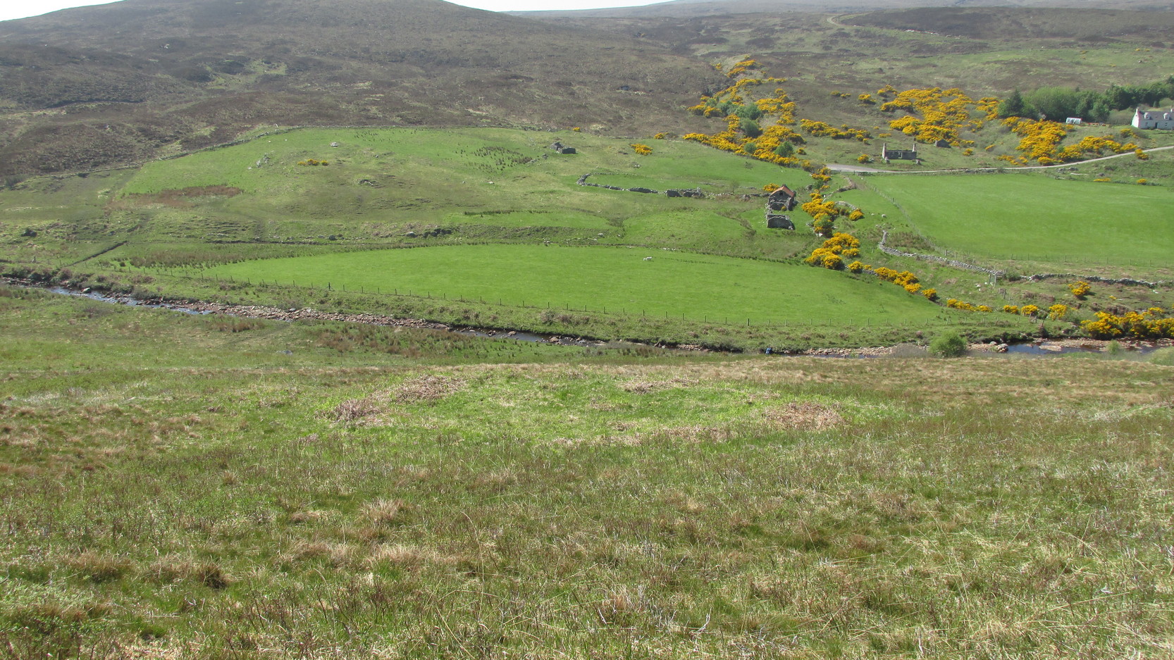
Park up and walk the long estate track up Glen Almond for nearly three miles until, on your left, you’ll see a small pond. From here, walk up the slope and, about 100 yards above you, note the large solitary boulder ahead, above the dyke of a small walled stream, where the land levels out. Just past the rock itself is the first of several remains.
Archaeology & History
First things first: the grid-reference cited here is centred upon the largest of several rings of stone found on this small grassy plateau, 150 yards north above the River Almond, just past the huge boulder. It’s an impressive site – and a previously unrecorded one.
The raised ring of Conichan
Looking southeast
At least three large hut circles can be clearly seen on this small ridge, amidst a sea of prehistoric sites scattered all down this lonely Scottish glen. When Paul Hornby, Lara Domleo and I meandered up here the other day (to visit the Clach na Tiompan megaliths), extensive prehistoric walling called my nose up the slopes to see if anything was hiding away—and a large prehistoric ring, more reminiscent of the Derbyshire stone circles and ring cairns than any hut circle, appeared before me.
The first and largest that I came across is the one immediately north of the huge boulder (which may have slight traces of ancient walling running up to it). The large ring is clearly raised onto a flat level platform, with an entrance on its southern edge. The ring itself measures, from outer-wall to outer-wall some 12 yards wide (E-W) and 11 yards N-S. The northernmost section of the walling or stone embanked structure is built into the sloping hill to the rear, with the east and western walls constructed simply onto the flat land. The walling itself is typical of prehistoric structures, comprising the usual mass of small stones packed within a number of larger upright stones; although much of it is very overgrown with centuries of vegetation. The walling that constitutes the ring itself is between 1-2 yards across and about two-feet high above the present ground-level.
Second circular remains
…and from another angle
To the east of this is a smaller, roughly circular construction of similar form. The rocks that make up this site are much more visible and may have been robbed and used in the more extensive walling above and the dykes below. It is unclear whether the nature of this site is the same as that of the more defined circular enclosure we have just described.
The remains of a third structure was clearly evident a short distance to the east of this, but I didn’t have much time here and another visit is needed to make further assessments. Iron Age walling and other undocumented prehistoric remains were also found close by.
Acknowledgements: Many thanks to the noses of little Lara Domleo and Prof. Paul Hornby for their bimbling aid to relocate this site – and one or two others that have been off the radar for many-a-century.
Faint outline of Modsary hut circle, across centre
Along the A836 between Tongue and Bettyhill—nearly 5 miles (7.75km) east of Tongue—take the minor road north to Modsary and Skerray. Some 1.75 miles along you’ll notice an inland loch to your right, and where the loch finishes, take the minor track up on your right to Modsary. Walk past the cottages, through the gate and walk diagonally left down onto the moor. A small cave is across in front of you. Head towards that, but on the flat-ish piece of heathland barely 50 yards before it, above the small burn, look around for the low circular walling.
Archaeology & History
This previously unrecorded prehistoric hut circle was rediscovered in May 2018 by Sarah Maclean of Borgie during a brief excursion here, looking at the ancient clearance village of Modsary (which appears to be Iron Age in origin). In walking onto the moor, shortly before leaving me to my own devices, she pointed out this low ring of barely discernible stones, wondering, “is this another hut circle?” (there are some on the western-side of the road from Modsary) It would certainly seem so!
Grass showing centre of hut circle
It is constructed upon what seems to be a natural platform of earth above the slow-running burn. A low ring of stone walling defines the construction: visible in parts, covered in vegetation for the most. With an entrance on its southeast, the ring measures roughly 9 yards by 10 yards in diameter; with its outer walls being less than 2 feet high all round; but the width of the walls in some places measures up to 3 feet across. It is certainly man-made and is certainly olde. It requires excavation to assess its original construction period, although based on others I’ve seen that have been dated, would seem to be Iron Age in origin.
From this to the small cave that I mentioned, a most peculiar rectangular stone construction is evident 2-3 yards below it; and heading 40 yards south, beneath a craggy hill, a line of ancient walling runs SE-NW, with a much overgrown semi-circular arc of large stones, seemingly artificial in nature. It would seem there is a lot more hiding beneath the heather hereby than official records suggest…
Acknowledgements: Massive thanks to Sarah Maclean for locating and showing me this site; and also to Donna Murray for giving me a base-camp. Huge huge thanks indeed.
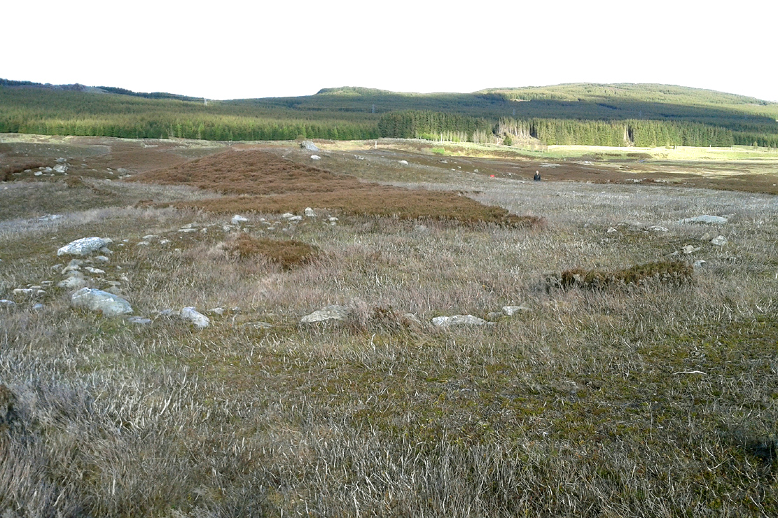
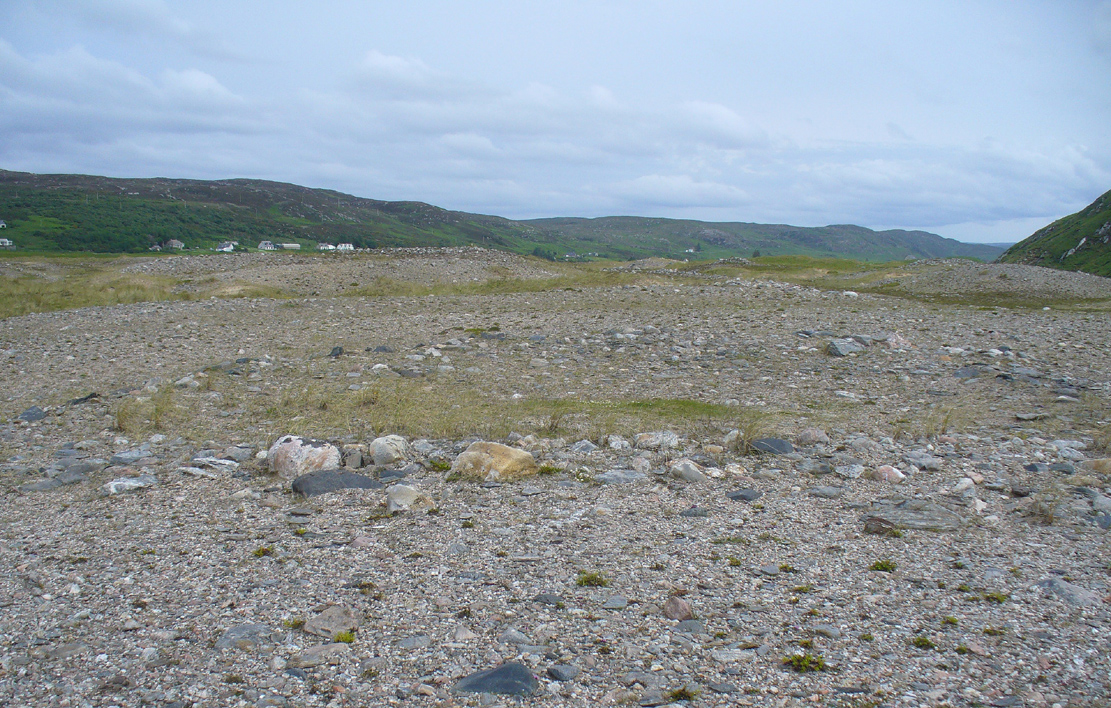
Take the A836 road west out of Bettyhill, down the road and cross the river on the tiny bridge. From here, go over the gate on the right-hand side of the road and follow the edge of the river towards the sea. Crossing the large extensive sands, you’ll reach a large sand and gravel rise ahead of you. Once on top of this natural feature, walk NNE for 550 yards (0.5km) until you reach one of many extensive sandy expanses in the grasses (and pass tons of archaeological remains as you walk!). You’ll get there!
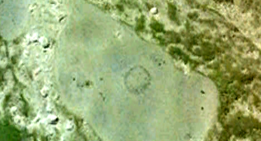
Archaeology & History
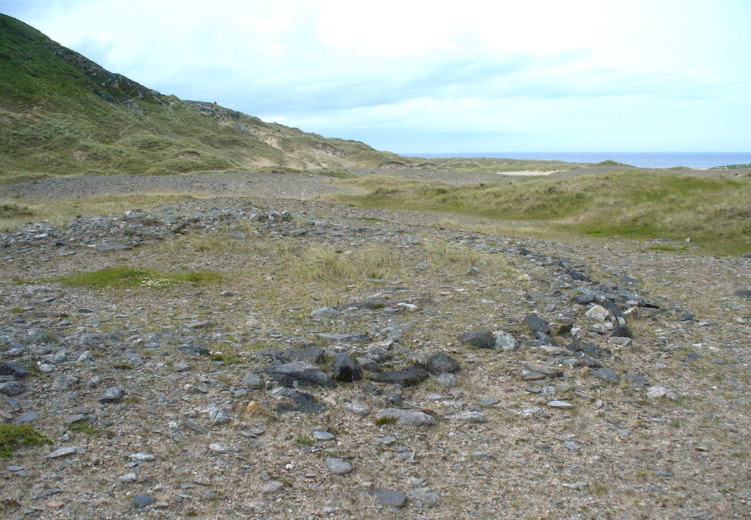
Arc of south, west & north walling
On this naturally raised sand-and-gravel platform at the edge of this beautiful sandy coastline in the far north of Scotland, walking in search of this particular enclosure, you’ll meander past a whole host of prehistoric sites and remains – some of which are plain to see, others hiding almost just above ground level, barely visible. But if you’re an antiquarian or historian, this plateau is a minefield of forgotten history!
The site is shown on the 1878 Ordnance Survey map of the region as a “hut circle”, which it may well have been—but this is a large hut circle and was more probably a place where a large family would easily have lived. When I visited the place the other week, there were no internal features visible. It is a large ring of stones made up of thousands of small rocks whose walls are low and scattered, barely a foot above present ground-level in places, and barely two-feet at the very highest. It has been greatly ruined or robbed of other architectural elements and an excavation is in order. My initial evaluation is that this structure is at least Iron Age in origin. In Angus Mackay’s (1906) venture here in the early 1900s, he suggested that this and the other “circular rings” were “cattle folds.”
Aerial view, looking straight down
Looking down from the broch above
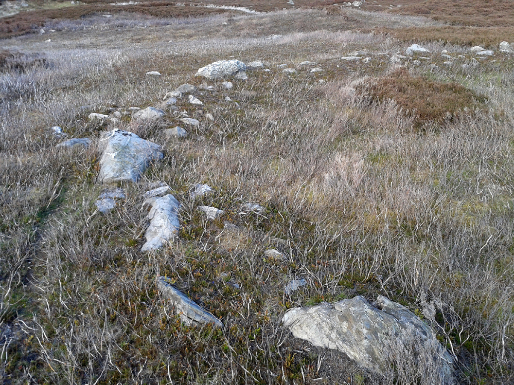
The enclosure measures, from outer-edge to outer-edge of the walling, 16.5 yards (15.1m) east-west by 18 yards (16.5m) north-south, and has a circumference of roughly 52.5 yards (4mm); although an accurate measure of its circumference is hampered by the scatter of spoilage from the collapsed walls stretching outwards. Only the western walled section remains in reasonably good condition.
Looking south, thru the enclosure
Close by are many cairns, some of which are prehistoric. A chambered cairn on the same ridge less than 200 yards away, with another enclosure of the same type yards away, clearly shows that people have lived and used this raised section of land for thousands of years. We know that people were still living here at the end of the 18th century which—for me at least—begs the question: what ancient traditions, customs and lore did these people know about, which may have dated back into truly ancient history? …And then the english Clearances destroyed them…
Royal Commission on Ancient & Historical Monuments, Scotland, Second report and inventory of monuments and constructions in the county of Sutherland. HMSO: Edinburgh 1911.