Holy Well (destroyed): OS Grid Reference – TL 2214 0449
Archaeology & History
An early reference by Nathaneal Salmon (1728) told that in the grounds of St. Mary’s church by the vicarage there was a well, which may or may not have been deemed as ‘holy’. He wrote:
“There is a Dale in Coppice belonging to the Manor of Potterels, from which, after a great Quantity of Rain, the Water comes through Veins of Chalk to the Vicarage Well, and is white.”
No well is shown on the early OS-maps at this place and we can only assume that it was either capped or had fallen back to Earth not too long after Salmon’s visit.
References:
Salmon, N., The History of Hertfordshire; Describing the County and its Monuments, London 1728.
Acknowledgements:Huge thanks for use of the Ordnance Survey map in this site profile, reproduced with the kind permission of the National Library of Scotland.
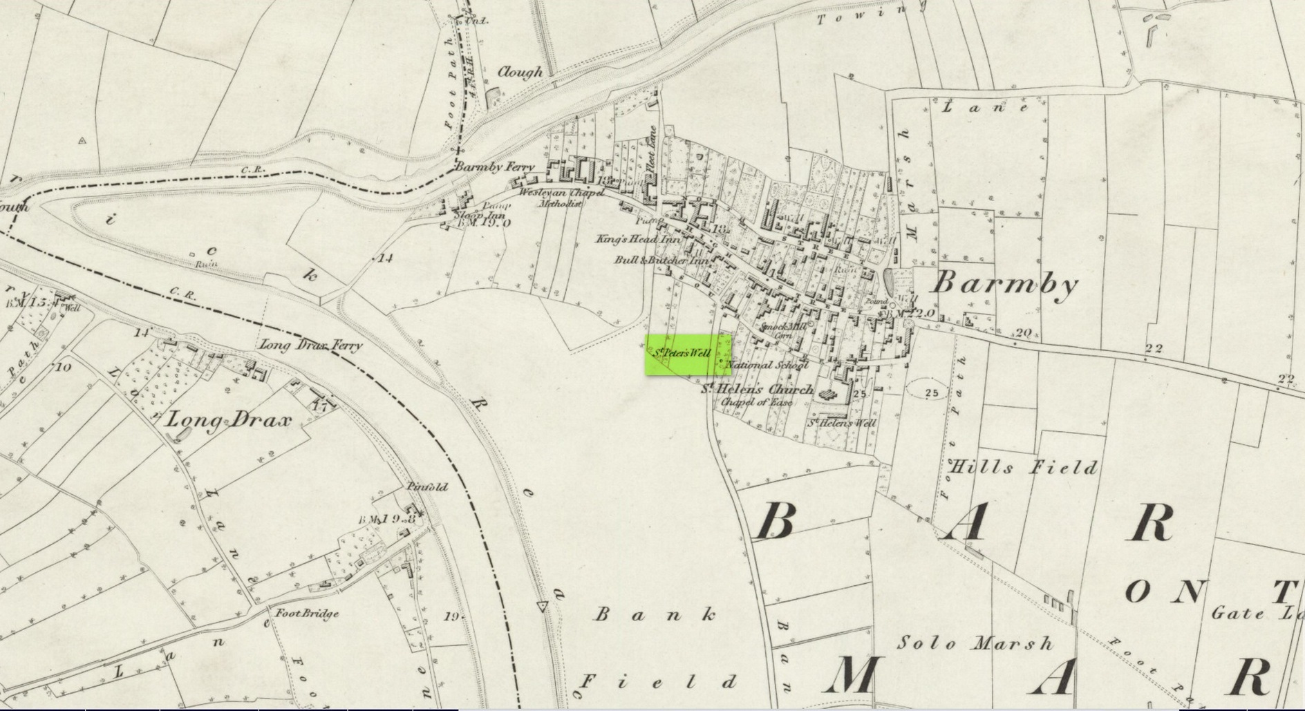
This holy well was one of two in the village of Barmby, neither of which seems to exist anymore — although, it has to be said, there are conflicting reports as to its demise from the word go. When it was first mentioned in Thomas Allen’s (1831) huge work on the history of Yorkshire he told us that,
“In this village are two extraordinary springs of sulphuric and chalybeate water, denominated St Peter’s and St Helen’s; the former possesses the rare virtue of curing scorbutic eruptions by external application. Both of these wells, within the last six years, have been wantonly filled up, and the site is only known to a few of the villagers.”
Their “extraordinary” waters however, were apparently found to be still flowing when the Ordnance Survey lads surveyed here in 1849, as they published it a few years later on the 1853 OS-map of the region, along with its nearby compatriot of St Helen.
Wet patch on 1907 mapSt Peters Well, Barmby 1853
Less than ten years earlier, Will White (1840) also spoke of St Peter’s Well, albeit briefly, telling that it “was said to possess medicinal properties”—but it seems that he never visited the site and was merely going on Mr Allen’s earlier description. Its exact whereabouts however, is somewhat of a curiosity. Although the Ordnance Survey lads mapped it as being SE 6885 2848 on the southwest side of the village, in William Smith’s (1923) survey of holy wells he gave us a very different location. “St Peter’s Well,” he wrote,
“is situated in an orchard about a hundred yards to the south-east of the church, and is reached by going through three fields. It is a pool about eight feet deep and fifteen in diameter, the spring now rising several yards from its original site. It flows clear and strong, and though attempts have been made to block it up, it always reappears. The water is soft and has never been known to freeze. It contains sulphur, as I can testify, having tasted the water. It is noted for curing scurvy and sore eyes, if applied externally, and half-a-century ago, people suffering from these ailments came long distances to apply the water as a remedy, and went away benefited. An eye-witness has said a man living far from Barmby, advised by his medical man, as a last resort visited the well and applied the water externally for the cure of scurvy, and so quickly did he lose the scales that fresh sheets for his bed were required each night…
“About a century ago, the owner of the orchard in which the well is situated had a son, a doctor, who commenced to practice in the district. The owner’s wife looked upon the spring as detrimental to the prospects of the son. So she said to her husband, “Tummus, we’ll hev that well filled oop. Foaks can cure thersens, an’ ther’ll be nowt fur poor Tummy ti dea.” Tummus was so convinced by his wife’s foresight that he did as she wished, and filled up the well.”
Naathen, on the very first OS-map of the village, the lads marked it at SE 6885 2848, as well as on subsequent surveys. This spot is 170 yards west of the village church wall. The location described by Smith has no “well” or spring marked on any maps, but, on the 25-inch scale map, 100 yards southeast of the the church walling we see marshland on the other side of a copse of trees in the very spot he told us about. Whether or not this was the actual spot, or whether the OS-lads had it right, we might never know. Field-name surveys may help; the existence and location of the orchard may help; other literary accounts might also be useful. But, one final query that may be important relates to Tom Allen’s (1831) words when he told us that “the site is only known to a few of the villagers.” By that, did he mean that the local folk kept its position quiet from outsiders? Even today, in our numerous inquiries with local people in the glens and mountains when seeking out lost or forgotten places, we still come across some olde local folk who are still quite hesitant, with that serious quizzical look in their eyes…
Folklore
St Peter’s day was celebrated on June 29. He was one of the so-called “major saints” due to him being one JC’s Apostles. His symbol was a key.
References:
Allen, Thomas, A New and Complete History of the County of York – volume 2, I.T. Hinton: London 1831.
Gutch, E., Examples of Printed Folk-lore Concerning the East Riding of Yorkshire, Folk-Lore Society: London 1912.
Harte, Jeremy, English Holy Wells – volume 2, Heart of Albion press: Wymeswold 2008.
Smith, William, Ancient Springs and Streams of the East Riding of Yorkshire, A. Brown: Hull 1923.
White, William, History, Gazetteer and Directory of the East and North Ridings of Yorkshire, R. Leader: Sheffield 1840.
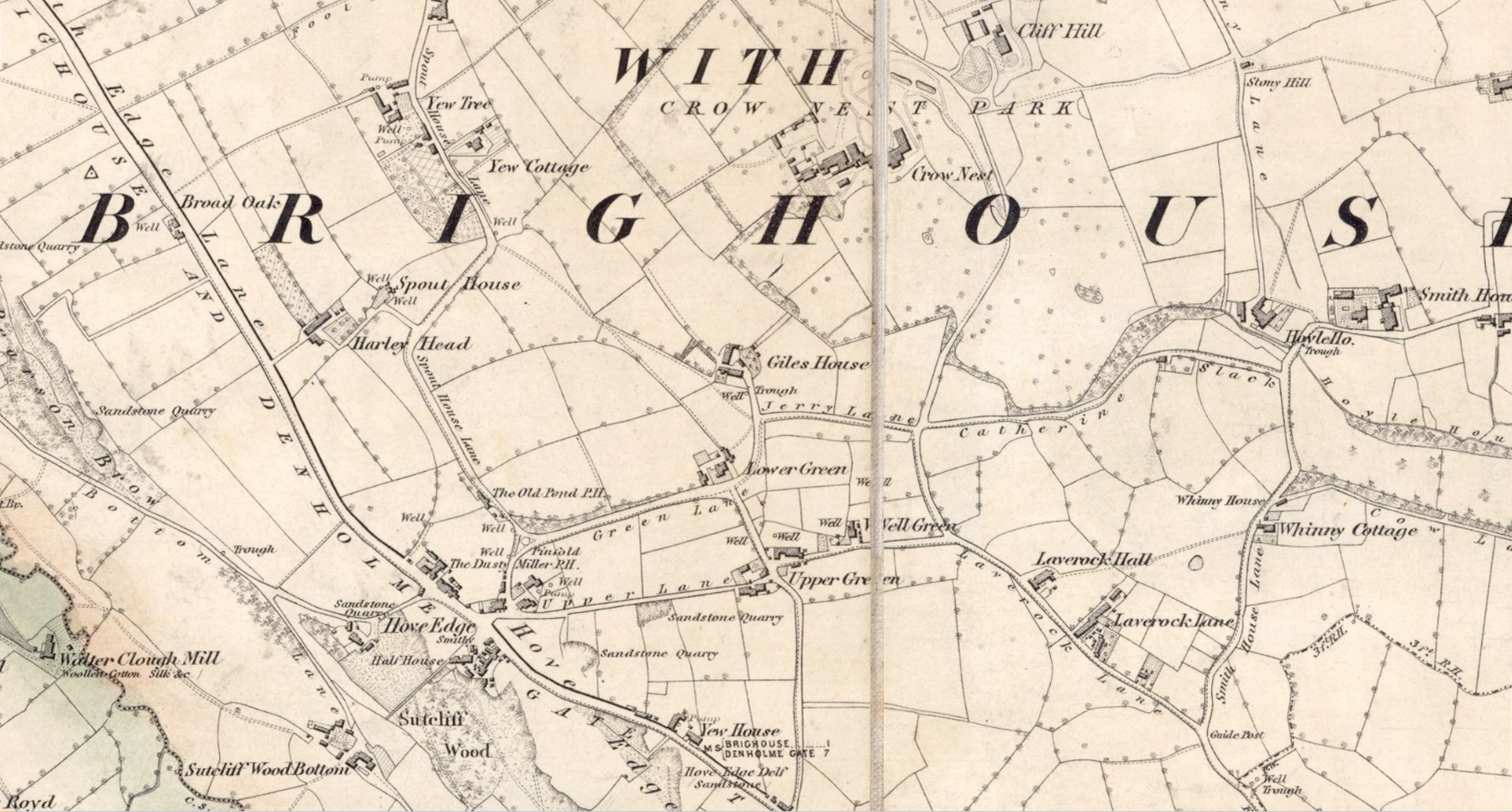
In times gone by there was a singular St.Giles’ Well in the old village of Lightcliffe, but the only reference we have of it is from one of James Parker’s works (1904) where, in his description of St. Giles’ House, he tells, “It derives its name from an ancient well, called ‘St. Giles’ Well,’ which once existed near to the house, and was dedicated to St. Giles”: an 8th century Greek prince who left everything to become a hermit. He lived on wild herbs and developed the ability to cure rheumatism (perhaps a curative aspect of the well), cripples and help beggars. He is the patron saint of woodlands and his symbol is the arrow gained after he healed a wounded doe shot by one (the mass of Robin Hood folklore in this area may have something to do with this symbolism). His date is September 1.
A.H. Smith (1963) cites the “local tradition that it is named from a well dedicated to St. Giles,” but thinks this attribution to be an unlikely one. As can be seen on the accompanying map, a great number of wells are in this area, none of them named, with one just below the said Giles House.
References:
Parker, James, Illustrated History from Hipperholme to Tong, Percy Lund: Bradford 1904.
Smith, A.H., The Place-Names of the West Riding of Yorkshire – volume 3, Cambridge University Press 1961.
Acknowledgements:Huge thanks for use of the Ordnance Survey map in this site profile, reproduced with the kind permission of the National Library of Scotland.
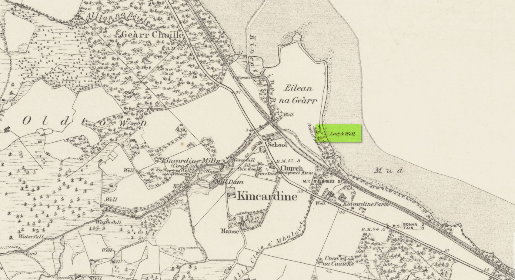
Holy Well (lost): OS Grid Reference – NH 6072 8954
Archaeology & History
Site shown on 1879 map
First highlighted on the 1879 Ordnance Survey map, information on this site is sparse, save for those reliable Statistical Accounts and Name Books, which simply give us its location. The only context that our Old Statistical lads gave us was its relationship and proximity to a castle, “the most ancient residence” of the Clan Ross Highland Chiefs which could “be seen in a beautiful field between the church and the sea side.” At the end of this field is “a steep bank, hanging over the sea at high water called the ‘Bank of the Gate’, and at the bottom there is a spring of excellent water, called the Lady’s Well.”
The water’s dedication to Our Lady was obviously grafted onto it by those in the church above, glossing over, no doubt, earlier dedications by local people, whose practices seem to have been lost. The site was included in the regional Name Book of the Ordnance Survey doods who, it seems, merely copied the notes about the place from the old Statistical Account. In what seems to have been their last visit, no trace of the well was evident. They concluded it “was under water at time of visit.”
It would be good to hear from local folk if this sacred site can still be found at the tree-line just above the sea, or whether Nature has taken it away from Her animals.
Acknowledgements: Big thanks for use of the early edition OS-map in this site profile, Reproduced with the kind permission of the National Library of Scotland.
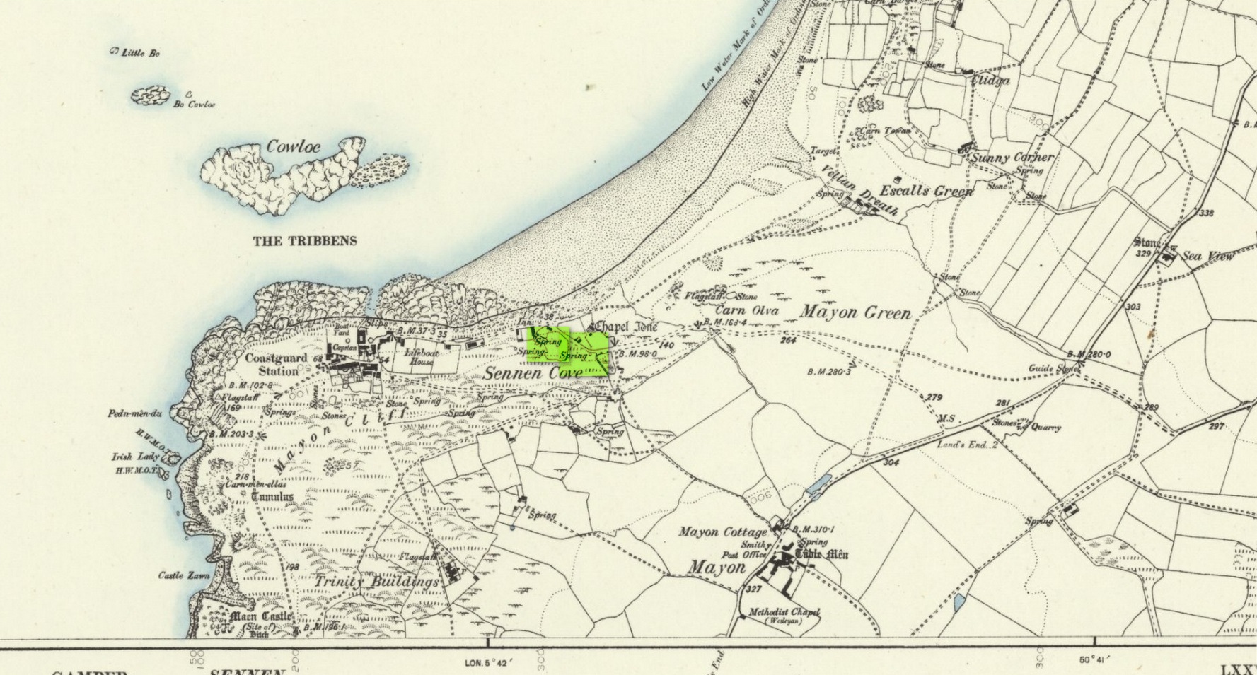
Holy Well (lost): OS Grid reference – SW 3550 2626
Archaeology & History
The springs of Chapel Idne
Highlighted on the 1888 Ordnance Survey map of Sennen Cove are the remains of Chapel Idne, just above the coast. Across the road from the chapel on its south-side, and also next to an old inn to its immediate west, springs of water are shown and it would seem more than likely that one of these two would have been the forgotten holy well of Sennen that was described, albeit briefly, in the great Mr Blight’s (1861) literary tour of the area. He told us that:
“At Sennen Cove was an ancient chapel, called by the people Chapel Idne, the “narrow chapel” being forty-five feet long and fifteen feet wide. It is now converted into a dwelling. Tradition says it was founded by one Lord of Goonhilly, who possessed dome portion of the land of Lyonesse. There was a holy well of some repute here also.”
The waters of St. Sennen’s Well were used in an act of ceremonial magick in the Arthurian tale known as the Battle of Vellan-druchar, as told in Robert Hunt’s (1865) great Romances. An attempted invasion by the Danes was met with by Arthur and nine other kings and the foreigners were slaughtered.
“A few had been left in charge of the ships, and as soon as they learned the fate of their brethren, they hastened to escape, hoping to return to their own northern land. A holy woman, whose name has not been preserved to us, “brought home a west wind” by emptying the Holy Well against the hill, and sweeping the church from the door to the altar. Thus they were prevented from escaping, and were all thrown by the force of a storm and the currents either on the rocky shore, or on the sands, where they were left high and dry. It happened on the occasion of an extraordinary spring-tide, which was yet increased by the wind, so that the ships lay high up on the rocks, or on the sands; and for years the birds built their nests in the masts and rigging.
Thus perished the last army of Danes who dared to land upon our western shores.
King Arthur and the nine kings pledged each other in the holy water from St Sennen’s Well, they returned thanks for their victory in St Sennen’s Chapel, and dined that day on the Table-men.
Merlin, the prophet, was amongst the host, and the feast being ended, he was seized with the prophetic afflatus, and in the hearing of all the host proclaimed–
“The northmen wild once more shall land,
And leave their bones on Escol’s sand.
The soil of Vellan-Druchar’s plain
Again shall take a sanguine stain;
And o’er the mill-wheel roll a flood
Of Danish mix’d with Cornish blood.
When thus the vanquish’d find no tomb,
Expect the dreadful day of doom.”
References:
Blight, J.T., A Week at the Land’s End, Longmans Green: London 1861.
Hunt, Robert, Popular Romances of the West of England, 1865.
Straffon, Cheryl, “Chapel Idne and the Holy Well,” in Meym Mamvro no.34, 1997.
Weatherhill, Craig, “A Guide to Holy Wells and Celebrated Springs in West Penwith,” in Meym Mamvro no.4, 1997.
Acknowledgements: Big thanks for use of the early edition OS-map in this site profile, Reproduced with the kind permission of the National Library of Scotland.
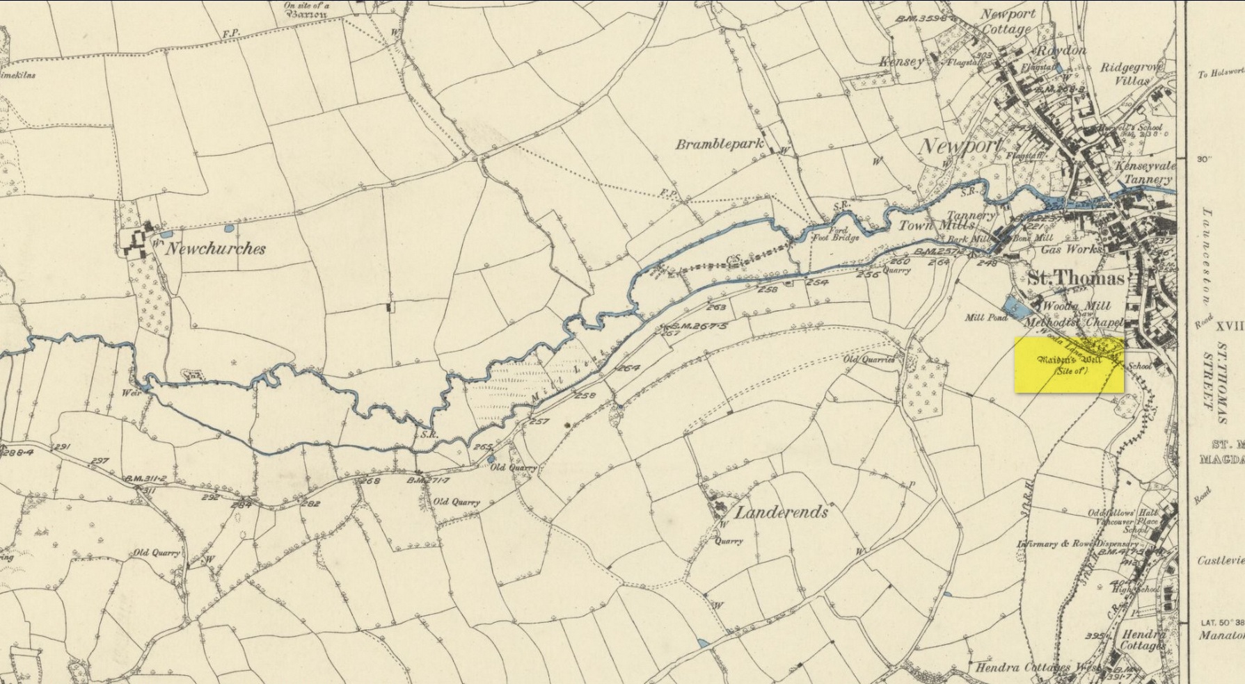
Healing Well (destroyed): OS Grid Reference – TQ 318 703
Archaeology & History
This was one of several so-called mineral springs in and around the Norwood area, but seemingly the least well-known—certainly in literary terms. Whatever renown it may once have had was overwhelmed by the relative proximity of the much more famous curative waters of the Beulah Spa, a few hundred yards to the southeast. It was mentioned, albeit briefly and already in the past tense, in John Anderson’s (1898) survey, when he told that “There used to be (a) mineral well at Biggin Hill. It is marked on the Croydon Inclosure Map” of 1800 and shown as a “Spring”, north of Biggens Farm. It seems that it had only just been destroyed when Anderson wrote about it, as the research of Alfie Foord (1910) showed. His inquiries found that,
“There used to be another mineral well about half a mile to the north-west of Beulah Spa, at Biggin Hill, the water from which gushed up at the rate of seven gallons a minute. In 1898 it was closed. The subjoined analysis of water from a well, which is at White Lodge, Biggin Hill, formerly the residence of Mr. H. Wilson Holman, was kindly supplied by him to the writer in 1907. This well, he says, undoubtedly taps the same spring that used to come out at the bottom of Biggin Hill, and which was blocked by the sanitary authorities in 1898. The site of the spring was beyond the small tenement houses at the bottom of the hill, and there is still some masonry in existence—the end of the culvert where the water used to run out into a pond. The reason of its being blocked was that it is alleged to have poisoned some domestic animal.”
References:
Anderson, John C., The Great North Wood, Blades: London 1898.
Foord, Alfred Stanley, Springs, Streams and Spas of London: History and Association, T. Fisher Unwin: London 1910.
Gover, J.E.B., Mawer, A. & Stenton, F.M., The Place-Names of Surrey, Cambridge University Press 1934.
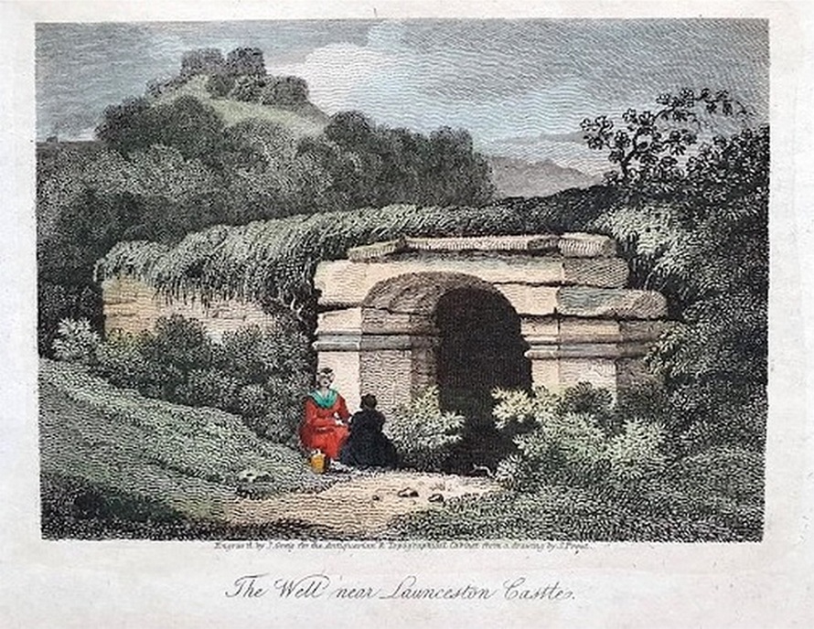
Holy Well (destroyed): OS Grid reference – SX 3285 8477
Archaeology & History
Very little is known about this holy well on the north-western side of town that was apparently destroyed sometime in the 19th century; for when the Ordnance Survey lads visited here in 1882, they found no running water but only the location of where it had been and they indicated this on their 1884 map of the area, marked as “Site of.”
Site of well on 1884 map
It was first mentioned in a short topographical notice in 1582, which told that the “Magden Well in the Quarrie Haye”—along with another well—was “found to be in decay.” (Peter 1885) Then, when the Ordnance Survey lads resurveyed the area once more in 1951, they could find no trace of it. It was mentioned in passing in Peter’s (1885) local history work, but there seems to be little else written about the place, which is a little odd for this part of the world. Anyone know anything more…?
References:
Peter, Richard, The Histories of Launceston and Dunheved, W. Brendon: Plymouth 1885.
Acknowledgements: Big thanks for use of the early edition OS-map in this site profile, Reproduced with the kind permission of the National Library of Scotland.
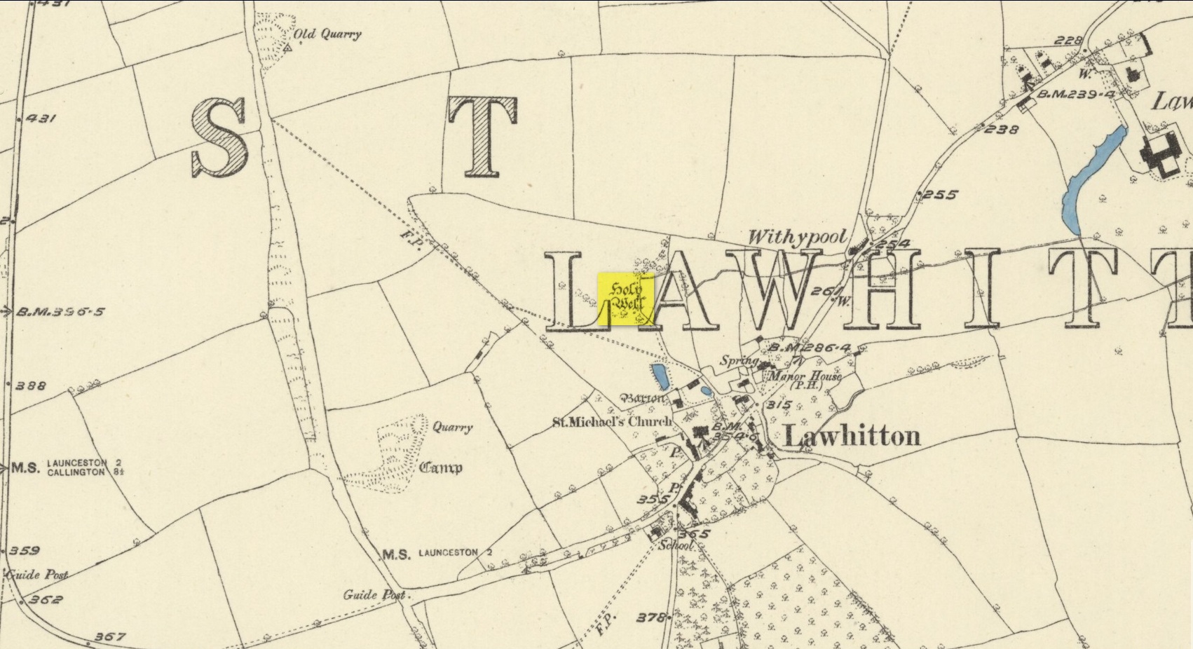
Highlighted on the 1882 OS-map several hundred yards north of St. Michael’s church, this site seems to have fallen back to Earth as no remains of it have been found in recent visits. It was described in Charles Henderson’s (1914) notes as the “holy well at Barton Farm”, and was visited by J. Meyrick (1982) in April of 1980, who told that it could be found by taking “the track immediately east of Lawhitton church which runs through the farm of Mr Lancaster… After going through the yard proceed ¼ mile down track to the valley where you reach a stream and the Well is on the right.” It was sought after by Cheryl Straffon (1998) but following her visit to find the Well she told that “there was nothing now to see except a kind of natural basin by the small bridge.”
References:
Henderson, Charles, Notebooks of Parochial Antiquities, Unpublished MS 1914.
Meyrick, J., A Pilgrims Guide to the Holy Wells of Cornwall, Falmouth 1982.
Straffon, Cheryl, Fentynyow Kernow: In Search of Cornwall’s Holy Wells, Meyn Mamvro: Penzance 1998.
Acknowledgements: Big thanks for use of the early edition OS-map in this site profile, Reproduced with the kind permission of the National Library of Scotland.
Healing Well (destroyed): OS Grid Reference –SE 1672 3866
Archaeology & History
Along the footpath below the family graveyard at Thackley, the great genealogist and industrial historian J.H. Turner (1878) told that, “at the right hand side of the wood, at the bottom, is Scout Willie’s Well, formerly noted for its medicinal properties” – though whatever curative aspects it possessed have long since been forgotten. It was also known as the Sweet Willie Well. I perused the woodlands here searching for the well in my younger days but could find no trace of it; nor is anything shown on the early OS-maps of the area.
References:
Turner, J. Horsfall, Idle Upper Chapel Registers and Graveyard Inscriptions, Bingley 1878.
Healing Well (destroyed): OS Grid Reference – SE 45 21
Archaeology & History
The waters of the once-renowned Organn Well goes down in history as being one of the first wells in Britain whose waters were used in a town pump. Written minutes from an early council meeting described how people gathered in the market place to discuss the objective of making such a pump in the times of Queen Elizabeth 1, in 1571. It was completed a year later and, some 450 years on, this old relic can still be seen. The Well used to be found off Penny Lane (now Wakefield Road), some 4-500 yards to the southwest and as such it’s exact position has been difficult to locate. But the fact that the waters were piped such a distance strongly suggests that the water supply from the Well was damn good – and most probably damn refreshing too! The old charter told us, in that wonderfully dyslexic manner of the period,
“…that a conduit in the Markett Place with lead pipes leading to water from Organ Well to the said conduit shall bee cleansed and repayred at the charge and contribution of severall inhabitants of the Towne and espetially by those that fetch water from the same conduit. And according to the auncient custome of the said Towne, whoe shall not beare theire p’t of the chardge p’portionable to what water they from the same at the discretion of the Majo’ for the time being and his brethren shall be debarred from the benefitt of the said conduit except they shall be poore people. And likewise that none shall receive any water from the said conduite for to brewe or steep barley w’thall at such time or times as others have need the same for meat water and water to washe w’hall, but onely at such times as there is water to spare over and besides what is convenient for meat and washing.”
More than two hundred years later the water pump was in dire need of attention, as George Fox (1827) told:
“Being in a ruinous state about the year 1810 and the supplies of water being insufficient for the public use; a clause was inserted in the act of parliament… wherein the pump, its pipes, and all other appurtenances belonging to it were vested in the power of the commissioners of the streets, who where bound to see it kept in proper repair.”
And so the water from the Organn Well continued to supply the townsfolk.
The etymology of this well—along with another of the same name near Harrogate—truly puzzled me for a long time; that was until I came across, quite by accident, records from early texts on herbalism. As a result, it seems very likely that it derives its name from the old English ‘organe,’ which, according to Stracke (1974) and others relates to both varieties of the indigenous herb marjoram (Origanum vulgare and O.marjorana) — a grand medicinal plant that’s pretty common in northern England (I used to go out gathering it each year in my younger days). There were obviously profuse supplies of this herb growing in and around the well and, as all good herbalists will tell you, when they grow by an old spring or well, their medicinal properties are much better than normal. The waters and the plant obviously had a good symbiosis; or, as the old women who’d collect the waters and the herbs in days prior to the pump would have told us, “the spirits of the water here are good”…
References:
Fox, George, The History of Pontefract in Yorkshire, J.Fox: Pontefract 1827.
Padgett, Lorenzo, Chronicles of Old Pontefract, Oswald Homes: Pontefract 1905.
Stracke, J. Richard (ed.), The Laud Herbal Glossary, Rodopi: Amsterdam 1974.