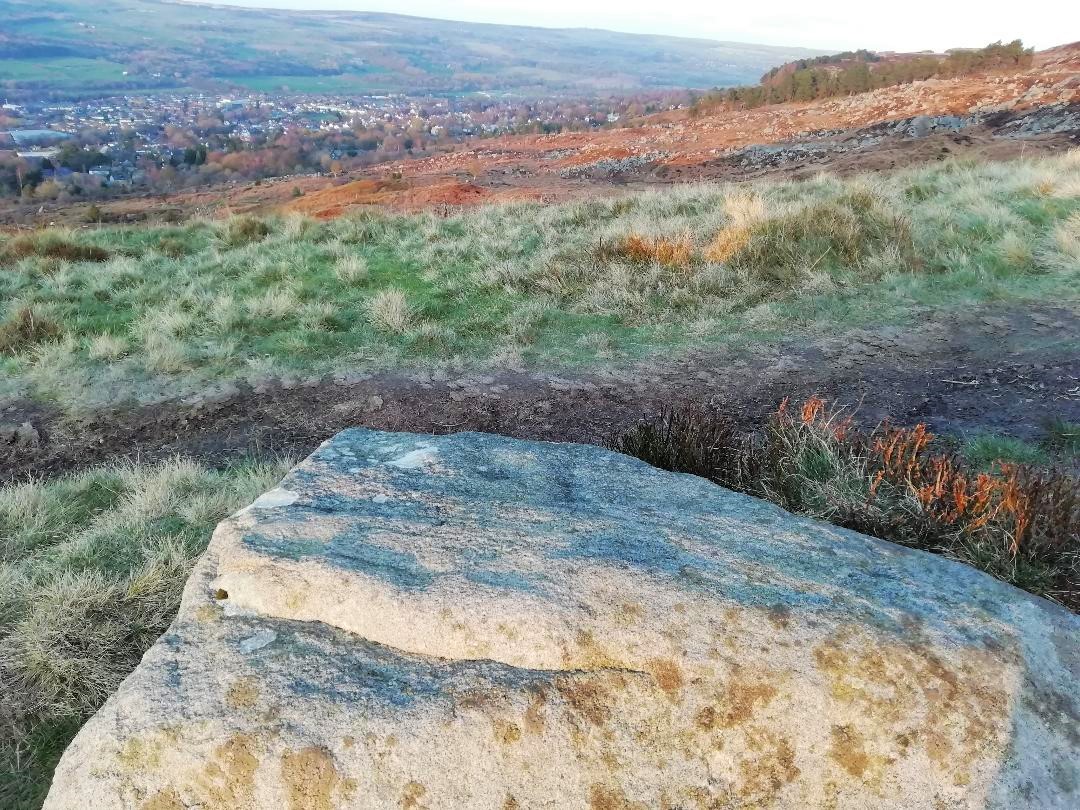
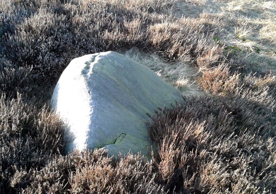
From Ilkley, go up to White Wells (ask a local if y’ get stuck) and walk round the back of the building. Walk to the trees and then follow the footpath up onto the moors; but after 70 yards a small footpath on your right goes up the slope. Take this and after about 90 yards it veers round to your left, following the contours up towards the copse of trees. Another 100 yards up it meets with another path and once here, just yards in front of you, right by the side of the footpath, is the stone in question.
Archaeology & History
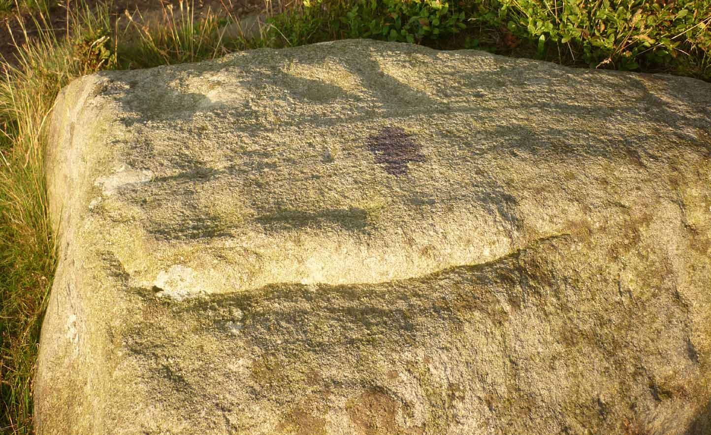
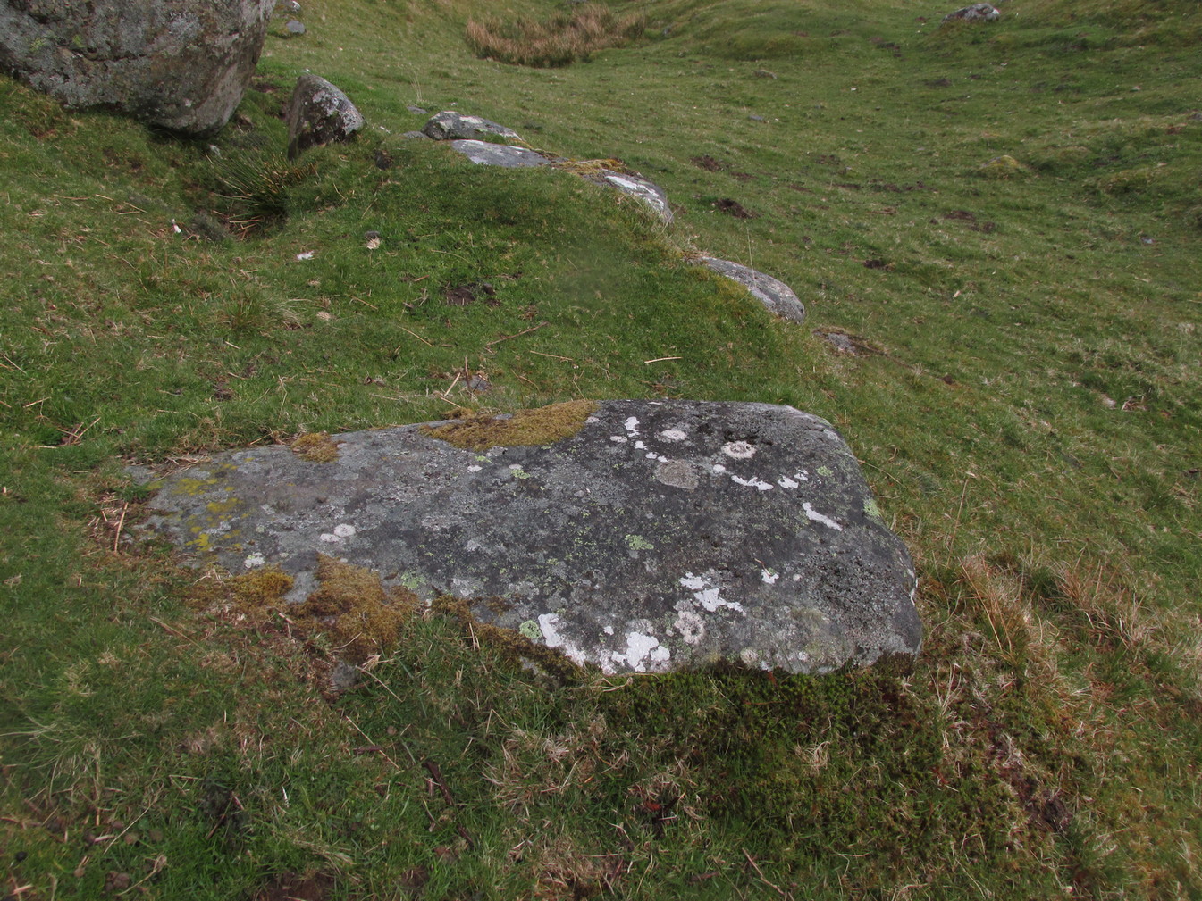
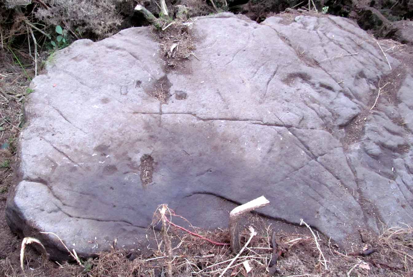
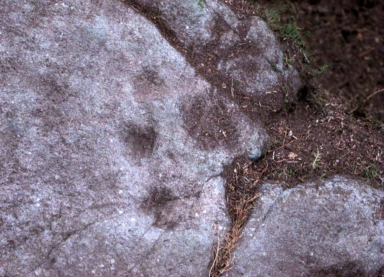
First described in John Hedges (1986) survey, this simple cup-marked stone typifies many petroglyphs on these moors: a barely visible design much eroded by centuries of wind and water, with markings perhaps only of interest to the devoted student and explorer. But at least it’s a good place to sit, rest and watch the valley below.
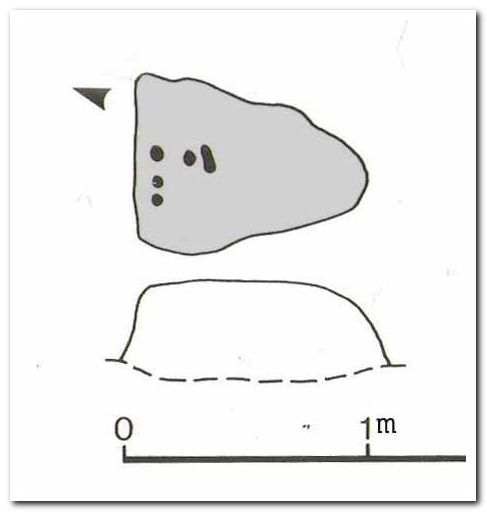
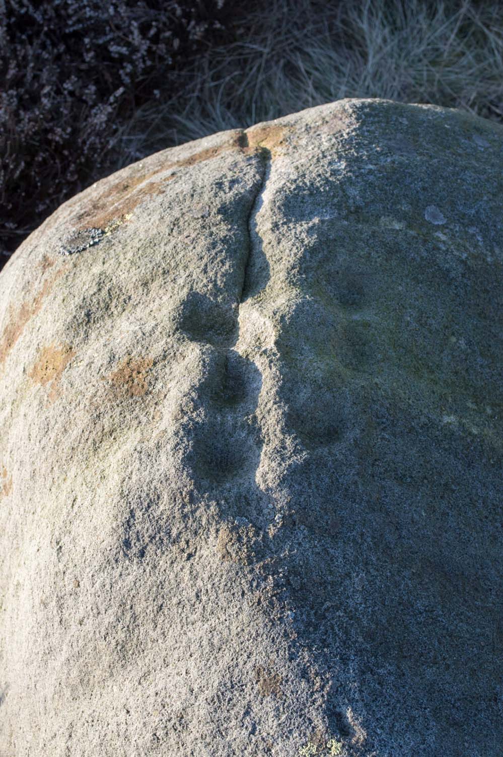
Looking down at the cupsHedges 1986 sketch
This old fella looks to have only five cupmarks on its supper surface, one of which is elongated, as shown in Hedge’s drawing. However, when he saw this, he thought the elongated ‘cup’ consisted of three of them in a line, all linked up. He saw a “medium sized smooth grit rock standing in grass, its surface triangular in shape, with flat top sloping slightly N to S. Three cups connected by a groove, c. four other cups, all shallow and worn.”
This description was echoed in Boughey & Vickerman’s survey (2003), where they thought that the “triangular top surface has about seven worn cups, three connected by a short groove.” But if the light isn’t quite right, this can be very difficult to see.
References:
Boughey, Keith & Vickerman, E.A., Prehistoric Rock Art of the West Riding, WYAS: Wakefield 2003.
Hedges, John (ed.), The Carved Rocks on Rombalds Moor, WYMCC: Wakefield 1986.
Cup-and-Ring Stone: OS Grid Reference – NS 8551 8819
Archaeology & History
Looking down on C-7c
Near the northwestern end of the small geological ridge that runs to the west of Castleton farmhouse, close to an awesome nine-ringed carving, we find this more simplified triple-ringed petroglyph. And although the carving is easy enough to describe, its labelling (as ‘Castleton 7c’) is rather troublesome. As with other carvings in this locale, the name of the stone is based on a survey done by Maarten van Hoek in the mid-1990s. But van Hoek’s sketch of Castleton 7c and the one shown in our photos, whilst very similar, possess attributes that aren’t on van Hoek’s drawing. Now this isn’t too odd, as many petroglyphs look different when lighting conditions change; to the point where some features you can see one day are almost invisible the next. But this carving has attributes that are very difficult to miss – and van Hoek’s detailing tended to be good. But, all this aside: until we can verify with certainty one way or the other and despite my suspicions that this isn’t what van Hoek described, I’m still entering this carving as Castleton 7c. So – now that bit’s out of the way…!
When we visited the site two years ago the day was dark and overcast, so we didn’t really have good conditions for seeing any faint carvings. But this wasn’t faint, thankfully. It was completely buried beneath soil and gorse bushes, but thankfully Paul Hornby managed to unearth the one you can see in the photos. If it is the Castleton 7c petroglyph, it was rediscovered by van Hoek on one of his ventures here in 1985.
Carving showing wavy lines on right…and from another angle
When we visited the site we only managed to uncover a small section of the stone, as the roots of the surrounding gorse prevented us from seeing more. (it’s tough stuff unless you’ve got the right gardening equipment!) The section we uncovered consisted of a cup-and-triple-ring. This is consistent with van Hoek’s sketch and description; but we also found there were two very notable ‘arcs’ on the outer edge of the rings—nearly opposite each other—as if another, fourth ring had been started. You can’t really miss these elements – and even in the poor lighting conditions we had, these outer arcs are very evident on a number of photos – especially when they are expanded to full-scale. However, as I mentioned, we were unable to uncover all the rock; but when van Hoek was here there was far less herbage. What he saw on this carving was as follows:
“Deturfing part of this ridge revealed a fine cup with three rings with a broadly pecked tail; one solo cup; one large oval ring with small central cup; and a faint cup with two rings, the outer one incomplete. The rock slopes 12º ENE.”
Crap drawing done in crap lightingvan Hoek’s 1996 sketch
The “broadly pecked tail” he mentions is also not really clear in any of the 60 photos we took. There is a faint line that runs through the three rings, into the central cup and out the other side: a single curving line no less. It’s certainly visible, but it’s far from broad. But there are a number of other lines coming out of the rings. These maybe just natural scratch marks, or even scratches acquired from farming activity. It’s difficult to say. In the poor light that we had, there as looked to be a single cupmark a few inches away from the rings, but this isn’t consistent with the position of the cupmark on van Hoek’s sketch.
There’s a simple solution to all this: we need to revisit the site and expose more of the rock. At least that will tell us once and for all whether this is the same as van Hoek’s stone, or whether we’ve found yet another new carving. Watch this space, as they say! 😉
References:
van Hoek, Martin A.M., “Prehistoric Rock Art around Castleton Farm, Airth, Central Scotland,” in Forth Naturalist & Historian, volume 19, 1996.
Follow the directions to reach the faint but impressive Allt a’ Choire Chireinich (04) petroglyph. Standing here, you’ll notice the large boulder that looks as if it’s fallen down the slope immediately to your left. You can’t really miss it.
Archaeology & History
Beneath the gorgeous excess of ancient lichens you can make out at least three cup-marks on the south-facing sloping rock-face in the top-half of the boulder. There may be some other faint cups on here, but due to the lichens they are very difficult to see, so I’m erring on the side of caution regarding their veracity. This is another one of those carvings likely to be interest only to the most ardent petroglyphic nuts amongst you.
Follow the directions to reach the faint but impressive Allt a’ Choire Chireinich (04) petroglyph. Standing here, look straight down at the dried-up burn barely ten feet below you, where you’ll see a small sloping rock. That’s it!
Archaeology & History
Nothing much to see here apart from a single shallow cup-marking. Most likely of interest only to the most ardent petroglyphic explorer, but worth looking at when you’re visiting the more impressive carvings nearby.
Table Stone carving (photo by Jonathan Warrenberg)
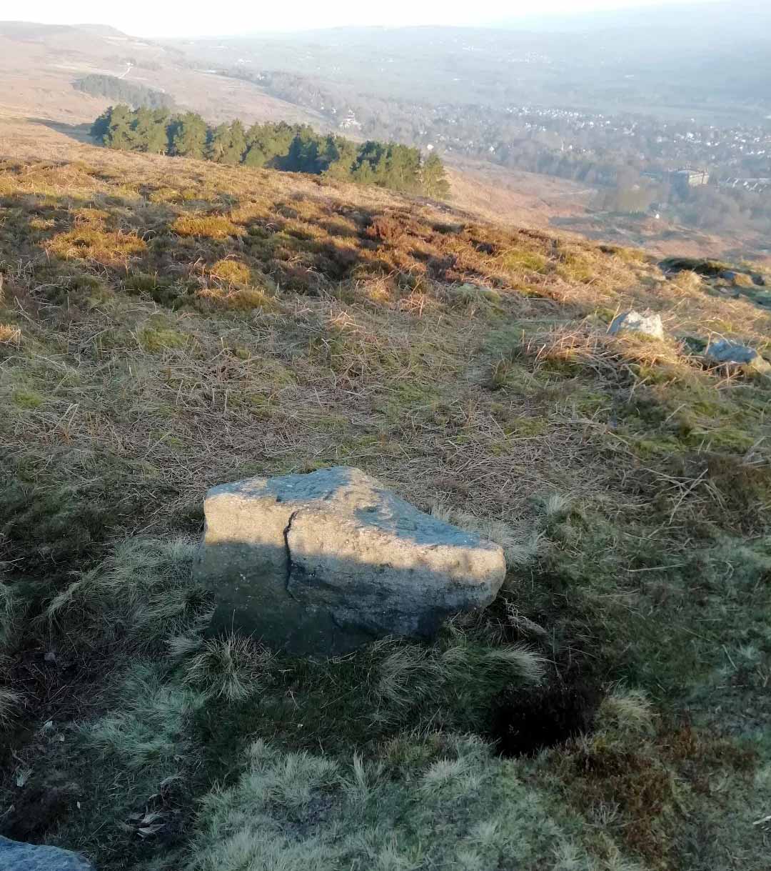
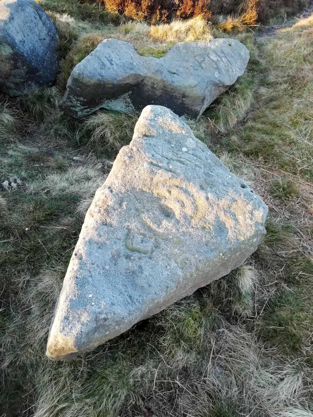
From Ilkley walk up to the White Wells and follow the footpath behind it up to the cliffs, up the stone steps and onto the moor itself. Once you’ve climbed the steps, walk uphill onto the moor for 100 yards, then turn right up a small path for another 80 yards until you reach the large Coronation Cairn with its faint cup-and-ring stone. From here there are two paths heading west: take the higher of the two for just 30 yards where a small group of rocks are by the path-side on your right. The curiously-shaped ‘upright’ one is the stone in question. You’ll see it.
Archaeology & History
Found high up on top of an oddly-shaped stone, somewhat like an anvil or small table (hence the name, courtesy of Jonathan Warrenberg), is carved a slightly worn, incomplete cup-and-double-ring. This aspect of the design is the one that stands out the most; but you’ll also see a cup-and-half-ring there too.
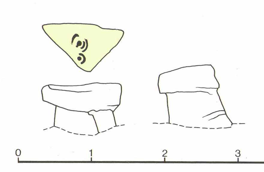
The carving seems to have been described for the first time in John Hedges (1986) survey (though I may be wrong), who described an additional feature to the design, saying:
“Small grit rock in possible cairn material, cut all round as if one pedestal, top surface triangular, sloping slightly SW to NE, overlooking Wharfe Valley, in grass and crowberry. Large cup with two vestigial rings, second large cup with vestigial ring. Possible third ring of corner edge (hewn off). Recent carving of initials spoils original carving.”
John Hedges 1986 sketchLooking from above (photo – Jonathan Warrenberg)
His description of the stone being “in possible cairn material” doesn’t seem true – although a number of petroglyphs are associated with cairns of varying sizes. Several other carvings can be found close to this one.
In Boughey & Vickerman’s (2003) later survey, they copy Mr Hedges earlier description, but with less detail.
The view from this stone is quite impressive. Even with the minor tree cover that would have existed when this carving was done, you’d still have clear views up and down the winding wooded valley that was carved by the River Wharfe. The moors to the north at Denton and Middleton with their own petroglyphic abundance could be chanted at with ease from here when the winds sleep. Tis a good spot to sit… if you’re lucky enough to get some silence…
References:
Boughey, Keith & Vickerman, E.A., Prehistoric Rock Art of the West Riding, WYAS: Wakefield 2003.
Hedges, John (ed.), The Carved Rocks on Rombalds Moor, WYMCC: Wakefield 1986.
Acknowledgments: Huge thanks to Jonathan Warrenberg for the use of his photos in this site profile – and also due credit for giving the stone its modern title. 🙂
As with other carvings in this locale, the name of the stone is based on a survey done by Maarten van Hoek. (1996) It’s a pretty simplistic design within the impressive Castleton complex, found at the southeastern end of the gorse-covered rocky ridge, about 70-80 yards west of the farmhouse. It was uncovered on a visit here by Nina Harris, Paul Hornby, Frank Mercer and Lisa Samson on Sunday 19 November, 2018.
The cup-marked stoneLarge cup & arc of 3
Unlike the others in the Castleton complex, this carving is probably of interest only to the hardcore petroglyph hunters. The design consists of at least ten cup-marks on the uncovered section of the rock, one of which appears to have a broken circle with two ‘entrances’ either side of it, so to speak. The most notable element in the design is close to the edge, where an arc of three cups almost corners a larger cup right at the edge. There may be more carved elements to be found on the westerly side of the stone, which was covered in deep vegetation when we came here.
References:
van Hoek, Martin A.M., “Prehistoric Rock Art around Castleton Farm, Airth, Central Scotland,” in Forth Naturalist & Historian, volume 19, 1996.
Along the A65 near Draughton, go (south) uphill at Height Lane until it levels out. ¾-mile (1.2km) up, a modernized stone milepost is where the road crosses the ancient Roman Road. From here, walk west for just over a mile (1.8km), past the trees on your right, until you approach another small copse further along on your right. In the field just before the copse, walk uphill until you reach the highest of the two rises and walk about. You’re damn close!
Archaeology & History
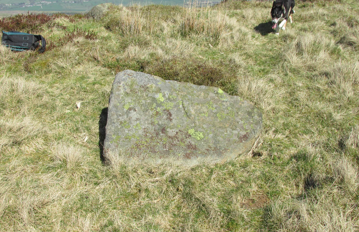
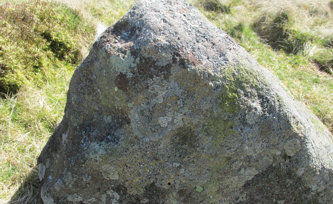
Nor Hill cupmarked stoneCupmarks, top & side
This small cup-marked rock was rediscovered by Chris Swales in April 2018. It’s probably only for the purist petroglyph fanatics amongst you, consisting of just a single cup-mark on its vertical west-face, and another near its top western edge. Official records show no other carvings in the immediate vicinity, but local antiquarians may find it profitable in surveying the area for other potential remains.
Along the moorland road between Cow & Calf and The Hermit pub, park up at the small wooded bit by the right-angle bend and cross over the Coldstone Beck. Walk up onto the moor itself and stick to the path that runs roughly parallel with the slowly-drying stream, towards Lower Lanshaw Dam. About 100 yards before it, walk left, into the heather, for about 50 yards. You’re damn close!
Archaeology & History
Lower Lanshaw Dam carvingClose-up of cupmarks (by James Elkington)
This is another neolithic or Bronze Age carving I first came across during one of my weekly rambles across these hills as a child, and upon revisiting the place a few days ago with James Elkington, found it associated with nearby cairns and what looks to be the remains of prehistoric walling – none of which I noticed when I was a kid. The petroglyph is a simple design, primarily consisting of two rows of three cup-marks: one row of three along the top or spine of the rock, and another one immediately beneath it, an inch or so below. The topmost line of cups runs into a natural crack in the rock, which runs down the northwest edge of the stone. A possible faint cup and partial ring emerges on the southeast side of the topmost row of cups, but this is difficult to make out. On the sloping northwest face of the rock is another single cup-marking.
References:
Bennett, Paul, Of Cups and Rings and Things, unpublished: Shipley 1981.
Acknowledgements: Many thanks to James Elkington for use of his photo to illustrate this petroglyph
Take the same directions as if you’re visiting the Lanshaw Dam 2 petroglyph, then keep walking directly towards the Lanshaw Dam, 130 yards east. Halfway between the two, closer to the footpath, look out for a stone of similar shape and dimensions to Lanshaw 2, just by a prehistoric cairn. You’ll find it!
Archaeology & History
Cup-marked stone & cairnClose-up of cup marking
As with a great number of petroglyphs in and around Yorkshire, this large single cup-marked rock is found in close association with a reasonably large prehistoric cairn (several others are close by), some 3 yards in diameter. The cup-marking here is larger than yer average cup-mark on these moors, being four inches across. It can clearly be seen on the southern vertical face of the rock and doesn’t appear to have been recorded before. On the whole, it’s nothing special to look at and is probably just one for the petroglyphic purists amongst you.
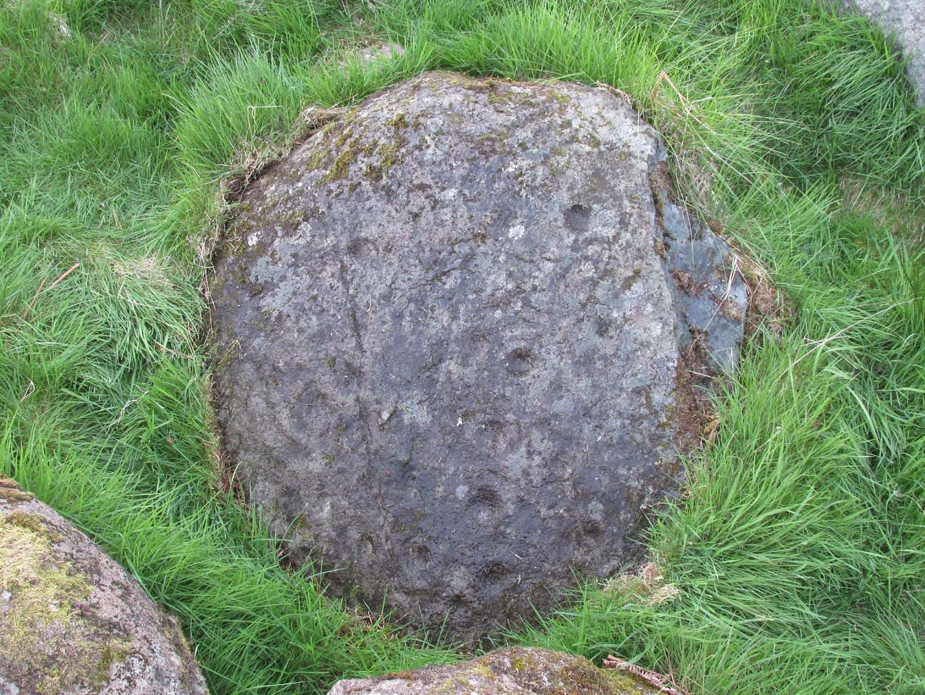
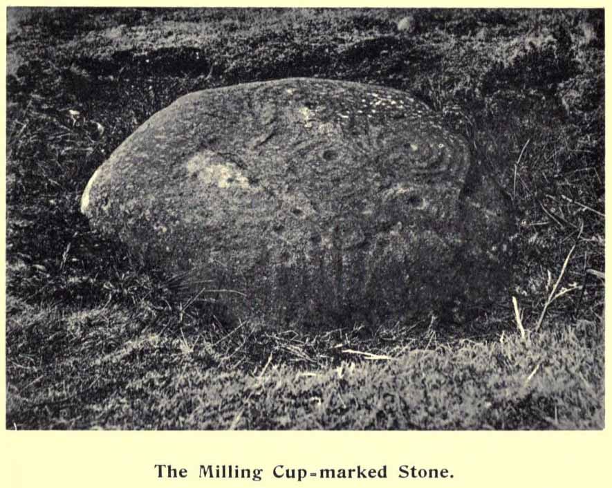
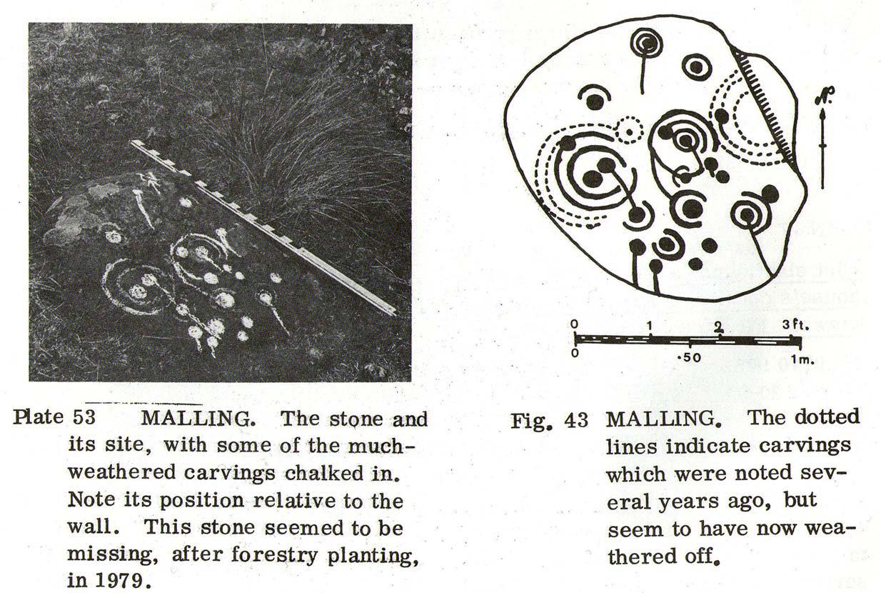
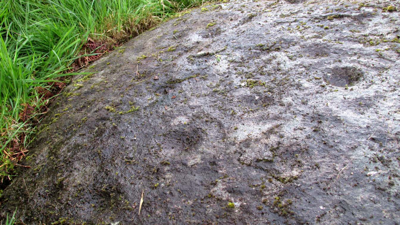
The quickest way here is bedevilled with troublesome parking (and an unhelpful local at Malling Cottage). That aside, roughly halfway along the A81 between the Braeval roundabout (near Aberfolye) and Port of Meneith, turn down the track at Malling, following it round for 300 yards through the farm, then another 500 yards or so until you reach a junction with a gate on your left. Walk down the track to your right, roughly alongside the Lake of Menteith, for nearly 700 yards until you reach the gate into the forestry commission land. Go thru the gate and turn immediate right, following the fence for about 200 yards where a clump of stones lives. You’re there!
Archaeology & History
The Peace Stone in 1899
This seemingly isolated petroglyph, known about by local people in the middle of the 19th century and earlier, was said to have been “held in great reverence.” It was first mentioned in literary accounts in 1866, when the oral traditions about it were more important than any archaeocentricism. But things change with the times: local people were kicked off their lands, old stories and knowledge of sites were lost, and the ‘discipline’ of archaeology was beginning to look at these curious carved rocks with puzzled minds.
The Peace Stone was described at some length and with considerable accuracy in Mr A.F. Hutchison’s (1893) gazetteer on the ancient stones of Stirlingshire. It was one of the regions only known petroglyphs at that time and thankfully he gave us a good account of it, saying:
“On the west ride of the Lake of Menteith, about half a mile south from the farm-house of Malling, this stone is to be found, lying at the boundary of the arable land. The ground at the place rises into a slight eminence, on the top of which the stone lay till some seven or eight years ago, when a labourer took it into his head that a stone on which so much labour had evidently been spent must have been intended to cover something valuable. He proceeded to excavate the earth at the side with the intention of getting at the buried treasure, with the result that the stone slipped down into the hole which he had made, where it now lies. It is quite possible, however, that an interment, if no treasure, might be found beside it on further research. The stone is roughly circular on the surface, measuring about 4 feet in diameter. It is entirely covered with cup and ring marks—22 cups in all—varying in size from an inch to two inches in diameter. The cups and rings are very symmetrically formed. Nearly in the centre is a fine one surrounded by four circular grooves. Others have incomplete triple and quadruple circles, with radial duct dividing them. There are other curious curves that sometimes interlace, and near the lower side of the stone are five or six cups with straight channels running out from them over the edge. This is an extremely interesting stone. It is unique in our neighbourhood, so far as I know, in showing these symmetrical carvings. They are now, however, much weather-worn.”
Ron Morris’ sketch & photoClose-up of faded cups
When Alison Young (1938) came to write about the carving, she echoed Hutchison’s thought that the stone might originally have covered a tomb—but we simply don’t know and it should be treated as guesswork, as there are no known prehistoric tombs anywhere hereby.
Years passed before the next archaeological visit – by which time the stone had been uprooted and moved, apparently “ploughed up by the Forestry Commission”, and when Ron Morris (1981) last sought it out found that “the stone was un-traceable”. On a previous visit, before being moved, he found it to be,
“a cup-and-three-rings, 3 cups surrounded by two rings…and 6 cup-and-one-ring. One of these and 2 cups form part of the design of the cup-and-three-rings. There were also at least 7 other cups, and a number of grooves, some forming lines from a central cup, or a cup-mark, downhill. Greatest diameter visible in 1977 30cm (12in) and depth of carving 3cm (1 in)… Many of the carvings are so weathered as to be visible only when wet in early morning or late evening.”
And when we visited the site a few days ago, the stunning sunlight that had followed us all day, sadly faded and disallowed us better photographs of the site. Huge apologies…. But it’s worth visiting when the daylight’s good, perhaps when you’re exploring the huge number of brilliant petroglyphs at Ballochraggan and Nether Glenny on the hillside 1½ miles immediately north of this “outlier”, as Brouwer & van Veen (2009) called it.
Folklore
In a landscape bedevilled with stunning petroglyphs, traditions and folklore of them is all but gone; but the story of the Peace Stone was thankfully captured in words by Mr Dun (1866), who told us:
There is a curious prophecy connected with a stone situated near the ruins of the chapel of Arnchly, and which is worth recording. From time immemorial this stone went under the name of the Peace Stone, and it was held in great reverence by the natives. One Pharic McPharic, a noted Gaelic prophet, foretold that, in the course of time, this stone would be buried underground by two brothers, who, for their indiscretion, were to die childless. By-and-by the stone would rise to the surface, and by the time it was fairly above ground, a battle was to be fought on “Auchveity,” that is, “Betty’s Field.” The battle was to be long and fierce, until “Gramoch-Cam” of Glenny, that is, “Graham of the one eye,” would sweep from the “Bay-wood” with his clan and decide the contest. After the battle, a large raven was to alight on the stone and drink the blood of the fallen. So much for the prophecy then; now for the fulfilment. About fifty years ago, two brothers (tenants of the farm of Arnchly), finding that the stone interfered with their agricultural labours, made a large trench, and had it put several feet below the surface. Very singular, indeed, both these men, although married, died without leaving any issue. With the labouring of the field for a number of years, the stone has actually made its appearance above ground, and there is at present living a descendant of the Grahams of Glenny who is blind of one eye, and the ravens are daily hovering over the devoted field. Tremble ye natives! and rivals of the “Hero Grahams,” keep an eye on Gramoch-Cam!
The name of Betty’s Field came from an earlier piece of folklore: where a prince out hunting a stag was caught in one of the deep bogs hereby, only to be rescued by a local lass. In return for her help, she was given a large piece of land which was to bear her name.
References:
Armit, Ian, “The Peace Stone (Port of Menteith parish),” in Discovery & Excavation Scotland, 1998.
Dun, P., Summer at the Lake of Monteith, James Hedderwick: Glasgow 1866.
Hutchison, A.F., “The Standing Stones and other Rude Monuments of Stirling District,” in Transactions Stirling Natural History & Antiquarian Society, volume 15, 1893.
Hutchison, A.F., The Lake of Menteith: Its Islands and Vicinity with Historical Accounts of the Priory of Inchmahome and the Earldom of Menteith, Stirling 1899.
Maitland, Mrs, “Cup Marked Stones”, in The Scottish Country Woman, 1935.
Mallery, Garrick, “Pictographs of the North American Indians,” in Bureau of Ethnology of the Smithsonian Institution, volume 4, 1886.
Morris, Ronald W.B., The Prehistoric Rock Art of Southern Scotland, BAR: Oxford 1981.
van Hoek, Maarten, “Menteith (Port of Menteith parish) Rock Art Sites,” in Discovery Excavation Scotland, 1989.