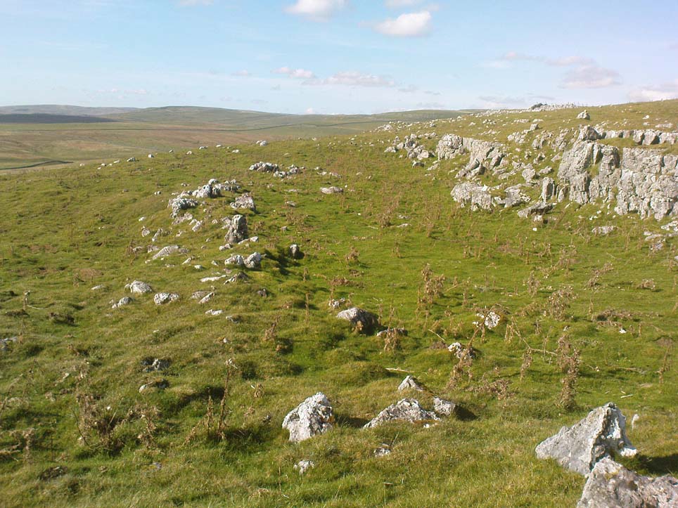
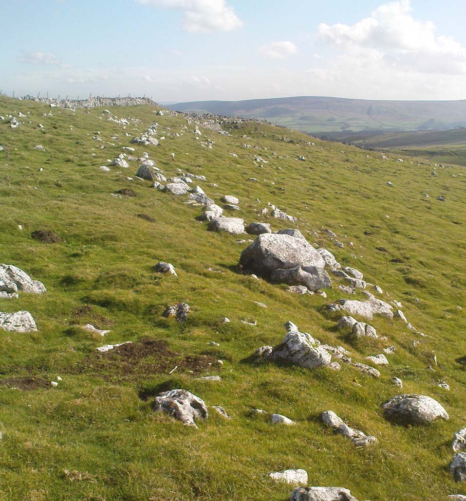
Green Plain, Blubberhouses Moor, North Yorkshire

Settlement:  OS Grid Reference – SE 1492 5378
Getting Here

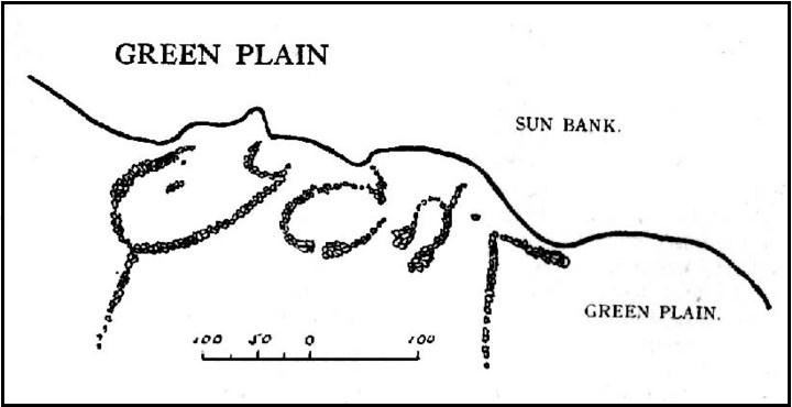
Cowling’s 1946 ground-plan of a portion of the settlement

From Blubberhouses church by the crossroads, walk up the slope (south) as if you’re going to Askwith, for 100 yards or so, taking the track and footpath past the Manor House and onto the moor.  Once you hit the moorland proper, take the footpath that bears left going down into heather and keep going till you hit the dead straight Roman Road path running west onto Blubberhouses Moor.  Go on here for nearly a mile until you hit the valley stream with its Eagle Stone down on your left.  Walk downstream, past the Eagle Stone, and cross over 100 yards down until you’re back on the level ground with the scatter of bracken and heather.  You’re here!

Archaeology & History

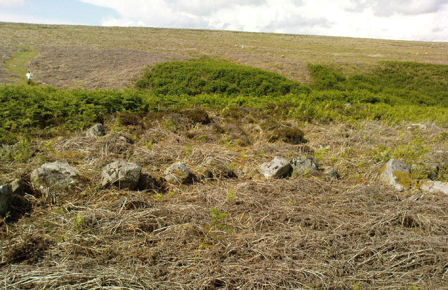
On the other side of the stream a short distance southeast of the large cup-marked Eagle Stone is a curious site, first described by Eric Cowling (1946) as “a series of enclosures of varying size and roughly circular shape” which he ascribed as a Bronze Age settlement.  Certainly we have a rather extensive scattered group of walled structures just as he described, but not all of the walling here seems typical of local Bronze Age constructions.  Cowling suggested the remains to be “useful for protection, herding and for shelter,” though admitted archaeological excavation would be the best way to ascertain their specific nature.  Such undertakings have yet to be done — and I wouldn’t hold your breath either.
Large section of walling
Walls of large circular structure

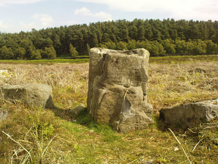
Although he described some of the walls here as nearly four-feet tall, when Graeme Chappell and I first ventured here in the winter of 1990, the walling wasn’t quite as high.  There are a number of individual tall stones sat in the walls that stand three-feet tall, with some that have been cut and dressed in more historic times.  Who did this and when is unknown.  However, if we visited this place when all the vegetation has been cut and burnt back at the end of winter and early months of Spring — a fact not lost on Cowling when he first found this place — we would gain a much clearer picture of things here.

Some sections of lower walling above the streamside appear to be prehistoric in nature, but many other parts of the walled structures across this flatland plain have a much later look and feel about them, illustrating that the site may have been used well into post-medieval periods.  This seems increasingly obvious where we find a number of the stones cut at sharp angles, with some having distinctive quarried grooves in them.  However, I can find no historical records to verify this at present.
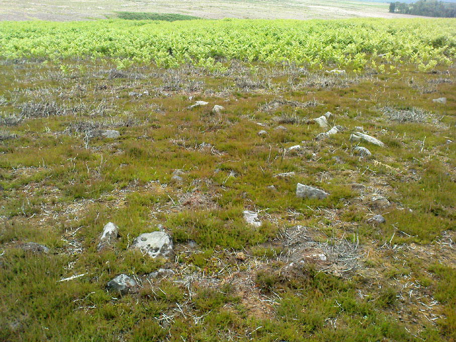
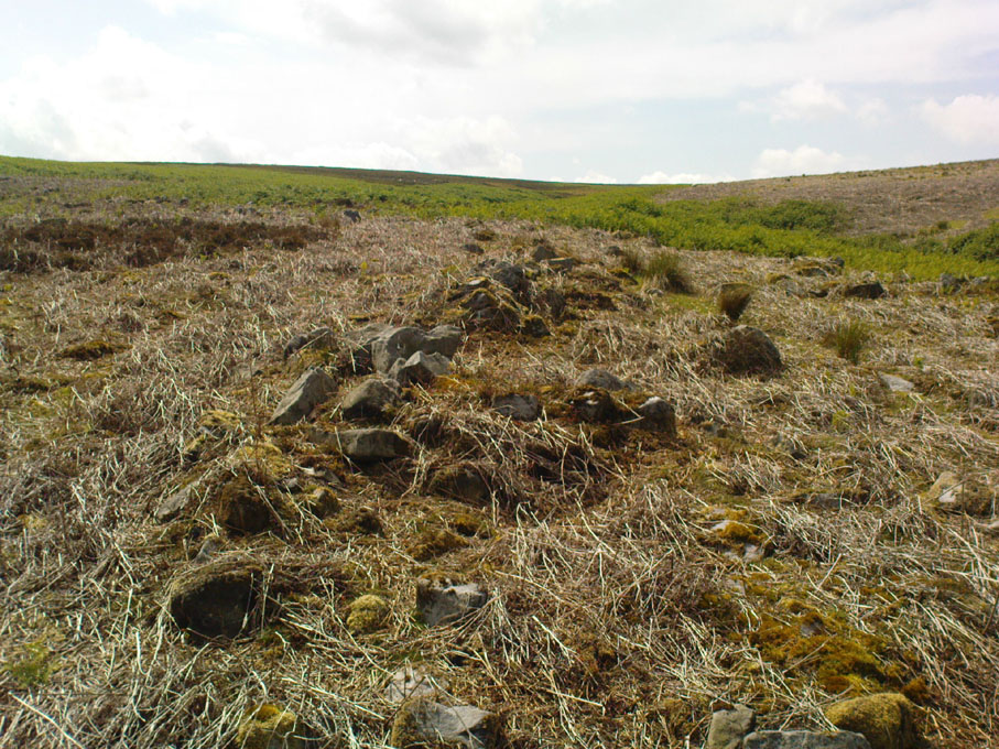
Hut circle remains
Medieval cut upright stone?

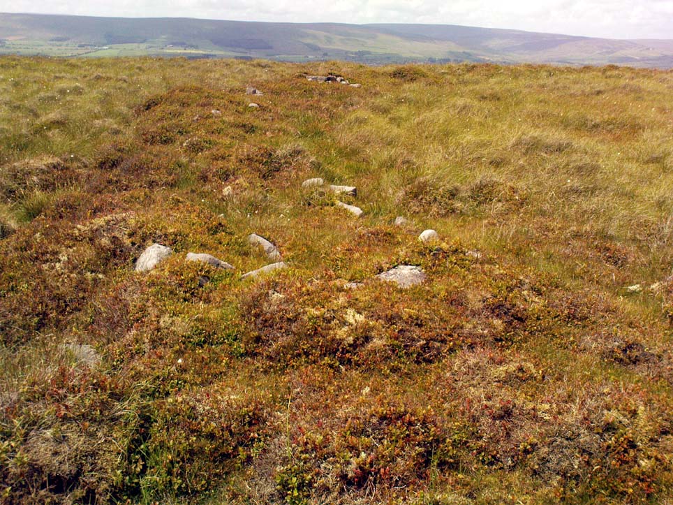
If we walk up the slight slope westwards however (before bracken and heath grow) there are more distinct prehistoric remains in the form of typical hut circles with low walls emerging from deep peatlands — although even these have been cut in one or two places by metal tools.  My view of this little-known but large settlement arena is that we’re looking at a site initially built in the Bronze Age period, continuing to be used by local tribespeople throughout the Iron Age and, as the cut stones clearly show, was a village that was certainly made use of in the last millenium.  But until someone comes along here and gives the site the attention it deserves, we’re not gonna know…

On the southern fringe of the copious walled structures we also find a very curious medicinal chalybeate spring that may have been of some importance to those who once lived hereby.  A ‘standing stone’ and prehistoric cairn can also be seen close by.

References:

  1. Cowling, E.T., Rombald’s Way: A Prehistory of Mid-Wharfedale, William Walker: Otley 1946.

© Paul Bennett, The Northern Antiquarian

Fair Oak Circle, Whitewell, Lancashire

Settlement:  OS Grid Reference – SD 6474 4584

Getting Here

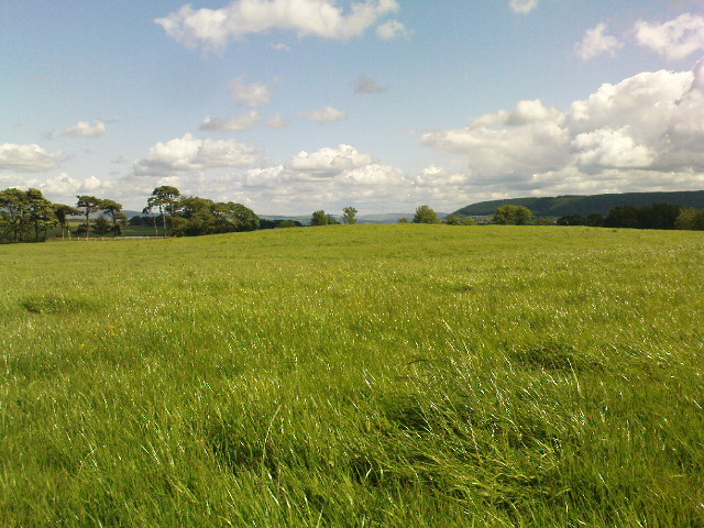
Fair Oak rise

From the village of Chipping, go along Talbot Street until it meets Green Lane and there, on the left, there runs a country lane roughly northwards.  Go along this and after about 1½ mile, watch out for the track of Quiet Lane on your left.  Go all the way up this track for nearly 1½ mile, till you reach its end.  Diagonally across to your right, note the stile into the field.  Go over this and, some 50 yards across the field, look to your south where the field rises to its small peak.  This is the site.

Archaeology & History

Fair Oak enclosure

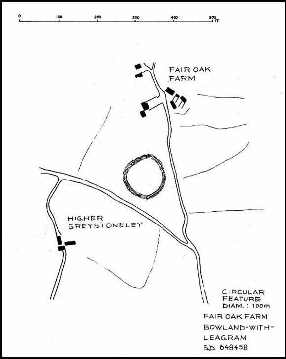
Although little can be seen of this site at ground level, aerial photography in the 1980s identified a large circular earthwork at Fair Oak Farm.  The circle has a surrounding ditch and bank enclosing a raised circular mound of approximately 100m in diameter.  It is thought that the feature may represent Bronze/Iron Age settlement in the area, and may possibly be a village site.   The site requires further survey.

Aerial photography has identified a number of possible settlement sites in the area between Dinkling Green and the River Hodder at Whitewell and in the area around Whitmore below Totridge Fell. The largest being that at Fair Oak.

Folklore

Jessica Lofthouse (1946) told of a number of places close by that were said by local people to be inhabited by faerie folk — Fair Oak itself being no exception.  Hinting of earlier heathen gatherings, she wrote:

“As for the farm of Fair Oak, where we take the path to Dinkling Green, nearby was the fairy oak, the scene of so much midsummer revelry.”

References:

  1. Dixon, John, The Forest of Bowland, Aussteiger Publications: Clitheroe 2004.
  2. Lofthouse, Jessica, Three Rivers, Robert Hale: London 1946.

© Paul Bennett & John Dixon, The Northern Antiquarian


Dyke Hills, Dorchester, Oxfordshire

Settlement:  OS Grid Reference – SU 5735 9364

Also Known as:

  1. Dorchester Dykes
  2. Dorchester Fort

Getting Here

Easy to find.  From Dorchester town centre, take the road at the bottom of town where the church is and walk along to the end where a footpath takes you into the field.  Once here you’ll note a rise in the land at the end, stretching away to the west and the River Thames.  That’s your Dyke Hills!

Archaeology & History

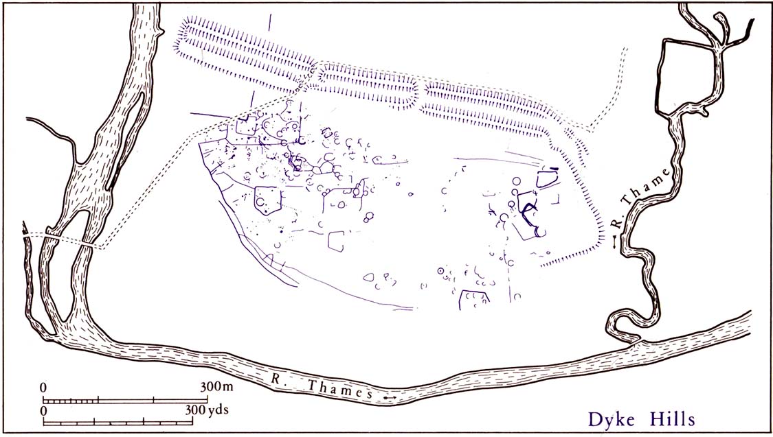
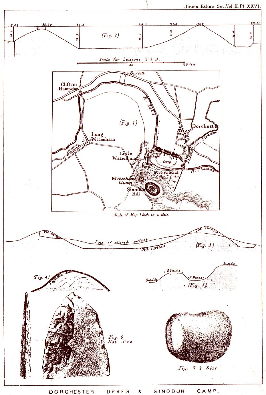
Plan of Dyke Hills (after Cook, 1985)

This site is another example of the considerable neglect shown to the prehistoric archaeological remains in and around the Dorchester region, despite Jean Cook (1985) describing the place as “a site of major local, regional and national importance.”  Which is a pity, as the site here was once huge and it seems that much could have been learned from here.  (you’ve gotta ask: do those doods who allegedly work for English Heritage care more for the ancient sites, or the money their organization gets?)

Lane-Fox’s 1870 survey

It would seem that the majority of the site was Iron Age in nature, with snifflings of Bronze Age remains scattered here and there. The primary position of the massive dykes and construction of internal domestic structures immediately below (south) of the dykes, was hemmed in on all sides by the surrounding River Thames and one of its tributaries, giving the place an excellent position in terms of food, plus shelter and protection from any intrusive tribes or hungry winter animals.

The first excavation at the huge dykes that define the northern edge of this ‘monument’ was done in 1870 by the renowned General Pitt-Rivers, then later Colonel Lane-Fox (at the time the Secretary of London’s Ethnological Society), as they were very concerned about the damage that was being inflicted upon the site, when the local landowner allowed sections of the banking to be “reduced for cultivation.”  An article in the Saturday Review magazine on July 2, 1870, told of these concerns and what was written — as Jean Cook so rightly tells — “has a depressingly modern ring to it”:

“…the fortress at Dorchester and the fortress on Sinodun (Castle Hill) are among the most speaking monuments of the earliest history of our island, and till lately they were among its most perfect monuments.  But it is a grievous truth that while we are writing, the dykes at Dorchester are being levelled.  Hitherto the neighbourhood ground has been grazed and the harmless sheep is no foe to history; but it has lately occurred to the owner of the ground hat a few shillings more of yearly profit might be gained by turning pasture land into arable; and to such a sordid motive as this these precious antiquities are at this very moment being sacrificed.  At least a third of the dyke has already been lowered, and will gradually be utterly destroyed beneath the yearly passage of ruin’s merciless plough share.  Such wanton destruction naturally aroused the indignation of men of taste and knowledge, especially in the neighbouring University.  A vigourous appeal to the owner to stay his hand was made by some of the most eminent Oxford residents, and an attempt was made to call public attention to the subject by describing the state of the case in various newspapers…”

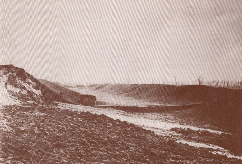
Lane-Fox’s 1872 photo

But the digging into the dykes continued.  For some time at least — until Colonel Lane-Fox himself went to the see the landowner and “persuaded” him to stop what he was doing.  A method we should always keep in mind ourselves…

The modern state of the Dyke Hills is summarised once again in Jean Cook’s (1985) fine survey of the region, where she wrote:

“This great enclosure, known to archaeologists as an oppidum, covered 46 hectares (c. 114 acres) and as defended by a massive double bank and ditch to the north and to the east.  The southern and western boundaries have all but disappeared, but can be traced in lines of modern field boundaries beyond which the Thames forms a natural boundary.  The interior is (now) empty, but cropmarks reveal that it is full of enclosures, pits and circular houses aligned along a regular pattern of internal roads.  Although there has been no scientific excavation within Dyke Hills, ploughing of the site has produced one of the densest concentrations of Iron Age coins in Britain.”

It would appear that this site was of considerable importance for local tribes and would have been home to powerful chiefs and impressive-looking shamans!  The large Castle Hill site immediately across the river would have had obvious links to this once-omportant prehistoric settlement.

References:

  1. Cook, Jean, “Before the Roman Conquest,” in Dorchester through the Ages, Oxford University 1985.
  2. Cook, Jean & Rowley, Trevor (eds.), Dorchester through the Ages, Oxford University 1985.
  3. Williams, Geoffrey, The Iron Age Hillforts of England, Horace Books 1993.

 © Paul Bennett, The Northern Antiquarian

Skelshaw Ring, Easington, Lancashire

Enclosure:  OS Grid Reference – SD 7194 5037

Archaeology & History

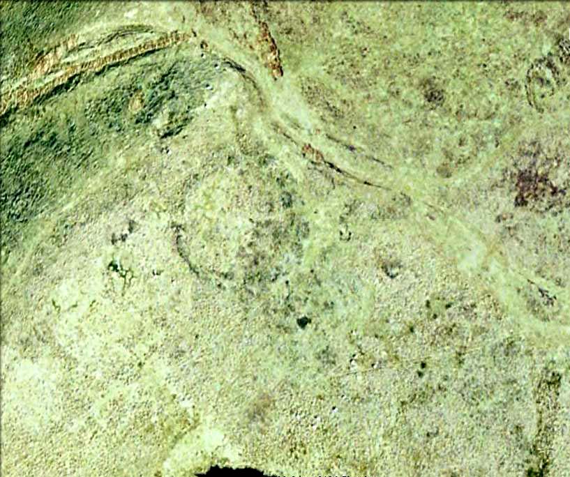
Faint outline of oval remains

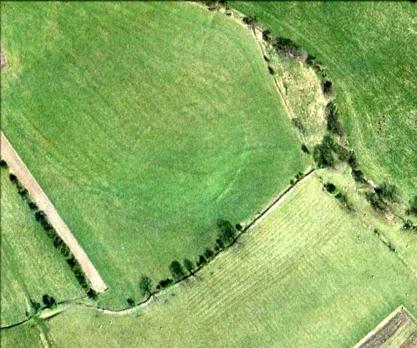
Very little can be seen of this once large oval-shaped prehistoric enclosure, a mile south of Slaidburn, on the level below the rise towards Easington Fell.  Few archaeologists know about the site and there has been little written about it.  Although very little of it is visible at ground level today, three-quarters of the site is vaguely discernible from the air and on GoogleEarth, as the photo here shows.  The Skelshaw Ring was described in Greenwood & Bolton’s Bolland Forest (1955), where they said, “The late Colonel Parker (Browsholme Hall) claimed to have found a good specimen of an ancient earthwork above Easington Green. Unfortunately, this has been ploughed over during the last war (WWII).” And little else appears to have been said of the place until the Lancastrian writer John Dixon (2003) wrote about it.  More recently John said the following about the site:

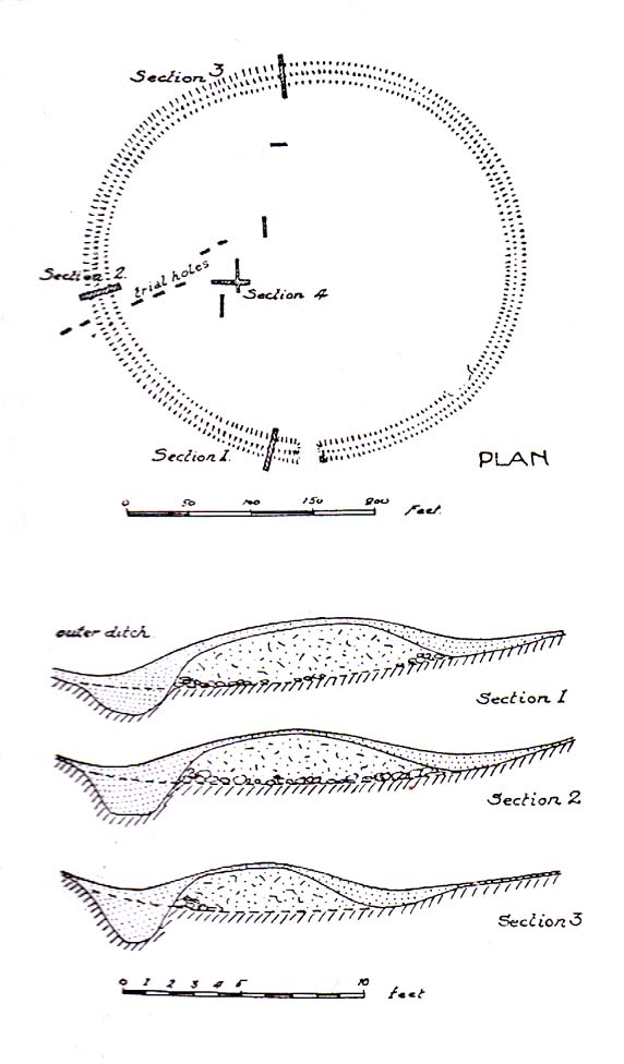
Skelshaw Ring plan (after Dixon 2003)

“This oval earthwork, 320 ft. diameter, crowns a small hill on the general slope of the east bank of Easington Beck. It consists of a ditch and bank with a gateway through the bank and a causeway across the ditch on the west side. Inside the bank and ditch the ground rises gently into a rounded hill so that most of the inside of the earthwork is well above the level of the bank.

“During the spring of 1934 a preliminary excavation of the site was undertaken by the late Dr. Arthur Raistrick. Three sections were cut through the ditch and bank and the inner area was briefly explored.

“Although nothing was obtained to date the earthwork, the sections did show the ordered structure of the site and proved the presence of large floors that may well have been the site of huts.

“This site may be compared with the large ringwork at Fair Oak Farm, SD 648 458, as both have a similar size and the same features are displayed. Bleasdale Circle, SD 577 460, is a slightly smaller ringwork, but I consider all three monument (plus: Easington Fell Circle [no:2] SD 717 492 ) to have the same origins.

“These earthworks represent the first settlements of a people determined to tame, settle and cultivate the landscape. What we observe at Skelshaw is the possible farmstead of an extended family unit, part of a clan that worked the land here some 4000 years ago in what is referred to as the Bronze Technology Period.”

References:

  1. Dixon, John, Slaidburn and Newton, Bowland Forest, Aussteiger Publications: Clitheroe 2003.
  2. Greenwood, Margaret & Bolton, Charles, Bolland Forest and the Hodder Valley: A History, privately printed 1955.

© John Dixon & Paul Bennett, The Northern Antiquarian

Easington Fell Ring, Newton, Lancashire

Enclosure:  OS Grid Reference – SD 7167 4911

Getting Here

Aerial view of Easington Ring

Go through the gorgeous old village of Waddington northwards, uphill, along the B6478 road, towards the villages of Newton and Slaidburn; or, if you like, go from Newton village uphill southwards along the B6478 road towards Waddington.  Either way, when you reach the top of the moors, park up at the car-park beside the road where the view stretches for miles ahead of you.  Walk on the road for 100 yards, then take the boggy footpath left, going first down and over a stream, then up to the right (northeast) towards a small cairn on the near-horizon.  From the cairn-top you’ll notice a large moorland pond a hundred or so yards ahead of you.  Walk towards and past its left side and onwards again for the same distance until, in front of you (before a nearly-dried stream running downhill) keep your eyes peeled in the deep grasses on where you’ll see a very large ring raised in front of you, defined in parts by scatterings of rocks along the tops and sides.  You’re here!

Archaeology & History

This is an outstanding prehistoric site, all but lost in old literary records until relocated in recent years by Lancashire historian and writer, John Dixon.  However, its precise nature remains a bit of a puzzle.  When John took a small party of us to the site on June 16, 2011, there was a variety of ideas as to the precise nature of the place.

Southwestern arc of the Ring

Structurally similar to a number of prehistoric enclosures in the Pennine range, this very large near-circular monument consists primarily of a very large number of rocks and stones making up a thick outer wall, presently piled less than a yard high above the peat and approximately 6 feet wide on average.  From north-to-south, outer wall to outer wall, it measures more than 42 yards (38.5m) across; whilst measuring 41 yards (38m) east-to-west.  There are distinct entrances on its western and northern sides, and possibly another on the east.  Certain sections of the inner region are now somewhat boggy in parts, perhaps indicating there was at one time an internal spring of water.  A large singular stone is found on the inner eastern section, which may have been placed there deliberately.  On the northwestern inner-edge of the walling is a notable long wide stone which may have stood upright.

My first impression of the site told it to bet at least Iron Age in date, though more probably Bronze Age.  But without excavations, I could be talking bullshit!  It is an obvious enclosure of some sort, but there are no visible internal structures on the present ground level.  There are no notable internal or external ditches and banks, which may have given the site a ‘henge’ classification.  More work is obviously needed here before we can say what it is for sure.

Very little has been said of this huge ring in the past.  John Dixon’s research found the site briefly described in Greenwood & Bolton’s (1955) work, saying:

“On page 24 they refer to the above site thus: ‘There is also a rough stone circle on top of the fells above Easington, like the remains of an ancient fort (the ringwork)…'”

Also mentioning how Richard Rauthmell’s Antiquitates (1746) very briefly mentions the place aswell.  Apart from these passing remarks, John has found little else.

On other parts of this moortop we found scattered evidences of other early human remains (walling, cairns, hut circles), much of it unrecorded.  There may well be other important prehistoric remains hidden upon these hills…

References:

  1. Dixon, John, Slaidburn and Newton, Bowland Forest, Aussteiger Publications: Clitheroe 2003.
  2. Greenwood, Margaret & Bolton, Charles, Bolland Forest and the Hodder Valley: A History, privately printed 1955.
  3. Rauthmell, Richard, Antiquitates Bremetonacenses; or, The Roman Antiquities of Overborough, Henry Woodfall: London 1746.

© Paul Bennett, The Northern Antiquarian

Tooter Hill, Bacup, Lancashire

Settlement:  OS Grid ReferenceSD 888 237

Getting Here

From Bacup town centre, take the A681 Sharneyford road for about 1½ miles towards Todmorden.  At Sharneyford village take the footpath south for about 1 mile to Parrock Farm.  At the farm, take the footpath in an easterly direction to Tooter Hill. Upon reaching the hill, head around the southern periphery for about ½-mile, or climb the hill to its height of 430 feet.  Here is the former site of a Neolithic or Bronze-Age settlement. From the top of the hill you get fairly spectacular views of the surrounding countryside.

Archaeology & History

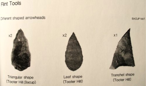
Flints from Tooter Hill

The former (or lost) site of The Tooter Hill prehistoric settlement or enclosure is not marked on any map. It has unfortunately suffered from quarrying on its periphery, but this has long since ceased. There are some small mounds at the southern side of the hill along with traces of earthworks, but I don’t know whether these are part of the former quarry workings.  However, a number of artefacts have been excavated from the peat at this site; these include a tanged and barbed arrowhead with serrated edges — probably from the Neolithic period 4,500BC-2,500BC as well as a Bronze-Age arrow-head 2,500BC-700BC, and also a tranchet-shaped arrow-head of unknown date.  These artefacts are housed in the N.A.T museum in Bacup town centre.  Other finds from Tooter hill on display are some small flint implements such as a flint scraper, flint adze and a flint borer.

References:

  1. Yates, G.C.,  “Stone Implements,” Transactions of the Lancashire & Cheshire Antiquarian Society, 5, 320-331.

Copyright © Ray Spencer 2011


Broadbank Earth Circle, Thursden, Burnley, Lancashire.

Enclosure: OS Grid Reference — SD 9024 3522

Also Known as:

  1. Burwains Enclosure
  2. Burwains Camp

Getting There

From Nelson town centre go north east towards Catlow, turning left near the Shooters Arms public house, then turn right again to the Coldwell Activity Centre.  Carry on towards Thursden Valley till you see the World War 2 pillbox on the right.  Here turn right and after 300 yards a picnic site and carparking area is reached along the Briercliffe road. On the opposite side of the road over a wall and barbed wire is Broadbank Earth Circle, though unfortunately there is not much to see there today. 

Archaeology

First excavated in 1950 by the Archaeology Department of Liverpool University and again in the 1960s, the earthworks here stand at 1,147 feet above sea-level (350m). The site comprises of an earth circle 150 feet (46m) in diameter which encloses an inner ditch 1 foot (30.5cm) deep and 10 inches (25.4cm) across. The bank was composed of boulder clay thrown out from the ditch. A hearth was found below the bank at the eastern end.  Some rough flint and chert flakes were also found together with a stone axe of Langdale origin. This is four-and-half inches or 11.4cm wide.  It has a curved cutting edge and a thin rounded head. Its surface is ground smooth but there is no evidence of polishing.

The earthworks at Broadbank have suffered through farming activity over many centuries and the earthen circle is now difficult to see at ground level, though the inner ditch is still visible. The low hillside or, what look like ramparts, at the northern end by the pillbox are probably not in any way connected, though this low bank may have added to the building of the bank. Archaeologists consider the site to be of Iron Age origin.

References:

  1. Liverpool University Archeology Department, Report and pamphlet, 1950.
  2. Powell, J.G.E., “Excavations of a Circular Enclosure at Broadbank, Briercliffe, Lancs,” in Transactions of the Historical Society of Lancashire & Cheshire, 104, 145-151.

Copyright © Ray Spencer, The Northern Antiquarian 2011


Ivy Chimneys, Witham, Essex

Settlement (destroyed):  OS Grid Reference – TL 811 136

Archaeology & History

Sadly this site has been built over, as happens so much down south it seems (regional archaeo’s, architects, councillors and businesses are very much in each other pockets – even those who allege ‘pagan’ allegiances to ancient sites – hence the demise of ancient sites). Which is a pity, as it sounded a decent spot!  Essex county council employee, Robin Turner, forwarded a summary of the findings from the site to The Prehistoric Society following an assessment prior to its destruction at the end of the 1970s.  The brief account of what was there told:

“A small area of the site contained part of an Iron Age settlement, probably of village proportions.  Three hut circles, two possible hut circles and two square four-post structures were found, as well as a number of ditched enclosures.  The main settlement area was enclosed by a multi-phased series of associated palisades and ditches, the earliest of which had a causeway and external protective fence, which may have served as a defended entrance.  One of the four-post structures, c.3m square, lay immediately inside the gap, and may have been a gatehouse or lookout.  Three main areas were enclosed outside the settlement and are thought to have represented a stock enclosure, a working area and a field.  Some evidence of pottery production, weaving, thatching and metalworking was found.  The presence of unusually large quantities of deer and dog remains may have had some religious significance which carried on into the Roman period.”

Turner and his team “hoped to investigate the insdie of the settlement area more thoroughly in 1980,”but I aint been able to get a copy of the report.  There was also found remains of a Roman temple here, including artifacts that were thought to have been offerings to the gods or local spirits.

References:

  1. Champion, T.C., (ed.), “Summary Excavation Reports,” in Proceedings of the Prehistoric Society, volume 46, 1980.
  2. Turner, Robin, “Excavations of an Iron Age Settlement and Roman Religious Complex at Ivy Chimneys, Witham, Essex, 1978-83,” East Anglian Archaeology Monograph no. 88, 1999.

© Paul Bennett, The Northern Antiquarian

Townhead, Rothesay, Isle of Bute, Argyll

Settlement (destroyed):  OS Grid Reference – NS 086 635

Archaeology & History

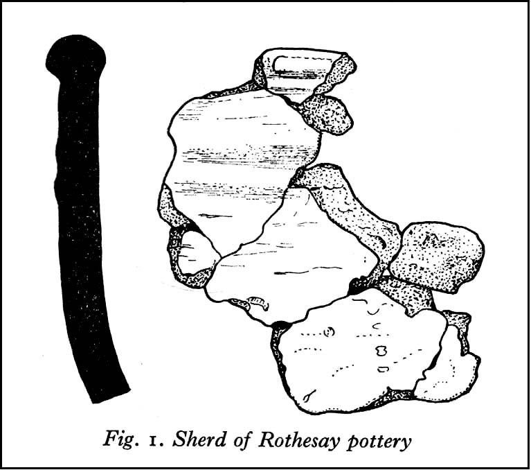
Pottery remnants

Somewhere beneath the modern cemetery and adjacent factory close to St. Mary’s church on the southern outskirts of Rothesay, right by the roadside, was once an important prehistoric settlement.  All remains of the site however, have long since been destroyed.  An axe that was found here was held in the local museum.  There are several scattered accounts of the place, one of which was written by J.G. Scott (1968), who reported that,

“between 1914 and 1929, a series of finds — pottery, a polished stone axehead, a saddle quern, hearths and remains of shallow trenches — was made at Townhead…at a now disused gravel pit.  Excavations in 1929 revealed several slots in the original gravel surface, which suggested the remains of sleeper beams for wooden buildings.  All the pottery recovered was neolithic… Amongst it were sherds of two vessels of Rinyo-Clacton ware.  Most of the rest of the pottery…showed well-developed rims, often thickened and bevelled externally and sometimes everted.  This pottery recalls the Abingdon style of southern Britain, and has been termed Rothesay ware by the writer.

“Sherd from one of these Rothesay vessels were associated with charcoal, possibly from a hearth, with hazel-nut shells and small fragments of bone.”

Scott told that radiocarbon analysis dated the finds  at around 2120 BC.  A couple of hundred yards away are the enclosed remains of St. Mary’s Holy Well, whose waters may well have been of magickal repute all those centuries ago…

References:

  1. Scott, J.G., “A Radiocarbon Date for a West Scottish Neolithic Settlement,” in Antiquity journal, volume 42, no.168, December 1968.

© Paul Bennett, The Northern Antiquarian

Lantern Holes, Bordley, North Yorkshire

Settlement:  OS Grid Reference – SD 9528 6574

Getting Here

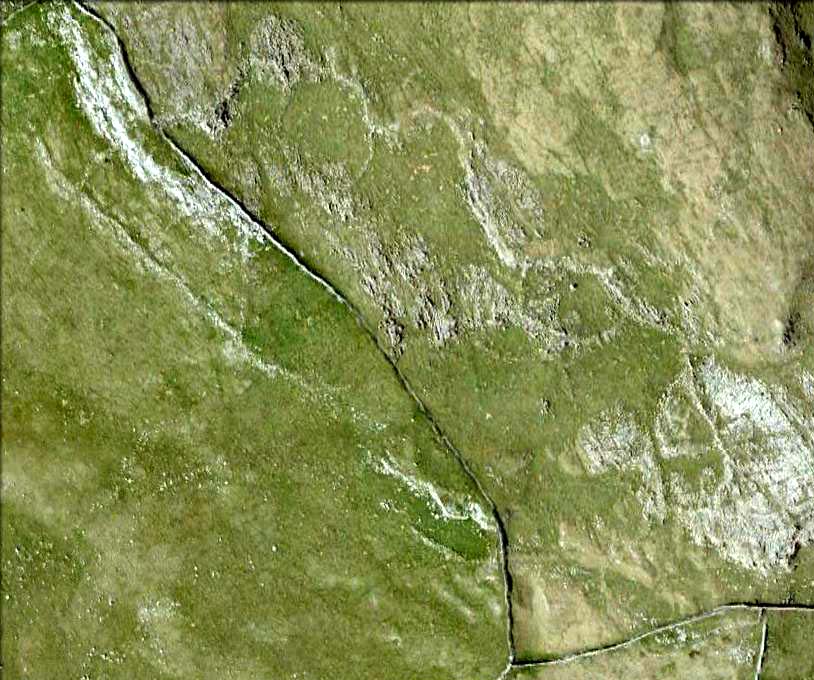
Aerial view of settlement

Follow the same directions to get to Bordley’s Druid’s Altar circle.  Where the little rough car-parky-bit happens to be by the cattle-grid, look up the sloping field where the wall runs up in a line and follow it up on foot.  A coupla hundred yards up you’ll see a small craggy outcrop in front of you and another line of drystone walling in the corner.  Just below this craggy outcrop you’ll notice a raised embankment comprising a line of small rocks running along the edge of the hill.  This is the first bitta prehistoric walling that makes up a part of the settlement system.  From hereon, follow y’ nose along and up the hill and look around.  The settlement’s all around here!

Archaeology & History

This is quite an extensive area of prehistoric (seemingly Iron Age) enclosures on the top and around the edges of the unnamed rocky peak at the top of the large open Lantern Holes field.  I’m not aware of any excavation work that may have taken place at this site, so please excuse me of any errors in the description that follows. (if anyone’s got an excavation report of the site, I’d love to read it!)

As with the many other settlements and enclosures in this region, much of it comprises of extensive stonework built up into and against the geological limestone bedrock either side of this hilltop site.  Huge lines of prehistoric walling, measuring anything between one and three yards across, runs for hundreds of yards in and around this set of enclosures.  We also find several distinct and well-preserved examples of old hut circles (one of which appears to have been re-used as a sheep shelter in more recent centuries) dotted around the edges and in the middle of larger sections of enclosed stone walls.  This is all very impressive when you consider it was done a coupla thousand years back!

Walled enclosure on south side
Walling along SW edges

Very similar in design to the prehistoric settlement enclosures on the other (south) side of the valley at Hammond Close Pasture, above the Druid’s Altar, though more extensive.  Measuring roughly 340 yards (311m) along its longer southeast-northwest axis, and nearly 280 yards (254m) from east-to-west, the uppermost parts of the site have at least seven separate large elliptical ‘enclosures’ built within the rocky enclaves, made up of typical Iron Age wall systems: a series of large upright monoliths packed up by smaller packing stones all along the length of the walling (using a system that still prevails today in drystone walling techniques on our upland moors).  A couple of the photos here illustrated the walling very well and give you an idea of what to look out for if you’re out wandering the region, looking for old sites.

Although the walling we see today is barren and easy to spot, remember that in the time when people built these great structures, you wouldn’t have been able to see them, as they’d have been deliberately covered over and camouflaged with dressed earth and plants.  In watching people emerging from these enclosures, you’d have got the distinct impression that they literally came out of the hill itself: a motif well-known to folklorists in relation to the origin of faerie-folk and other ‘little people.’

We need to go back up here and explore this settlement a bit more, as there’s tons more to be seen.  And if anyone knows of any surveys that have already been done of this site, it’d be good to read the reports, preliminary or otherwise.  A rough-camping weekend is planned on the tops at the break of Spring – so contact us if you’re into joining us for the amble.  I reckon there’s gonna be other sites hidden in the landscape up here that even Arthur Raistrick missed out on!

…to be continued…

References:

  1. Raistrick, Arthur & Holmes, Paul F., Archaeology of Malham Moor, Headley Bros: London 1961.

© Paul Bennett, The Northern Antiquarian