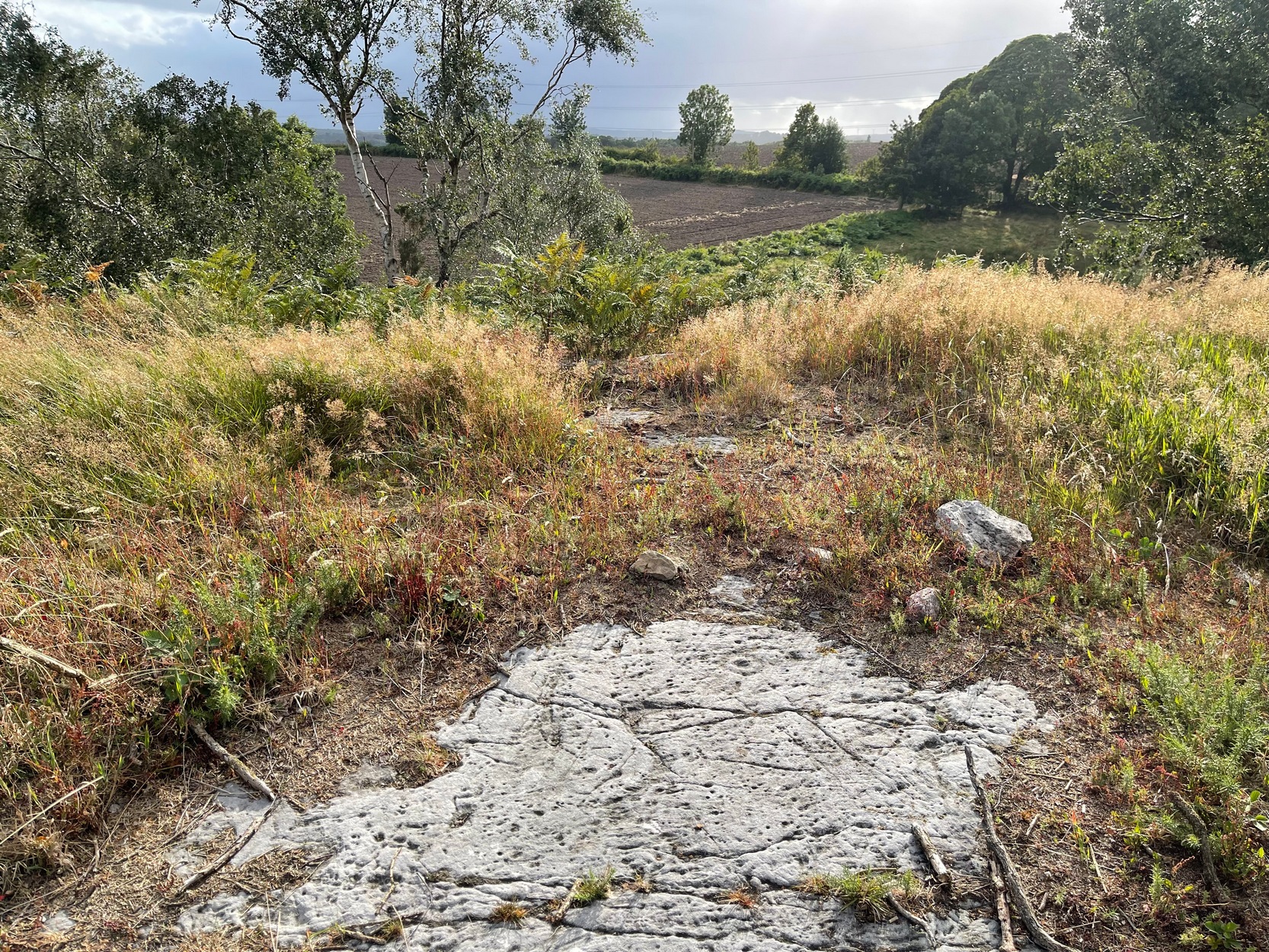
If you start from the Castleton (2) carving, in the first small birch copse closest to the road, walk to its southeast side where there’s a small break before the next small birch copse begins which runs along the raised rocky crag to the southeast. Walk along the back lower east-side of these birches for about 100 yards until you reach a break in the copse (the next lot of trees are another 30-40 yards further on) and from here walk up the slope onto the first flat piece of rock on the crag itself. Zigzag hereabouts until you’re about two or three yards from the edge.
Archaeology & History
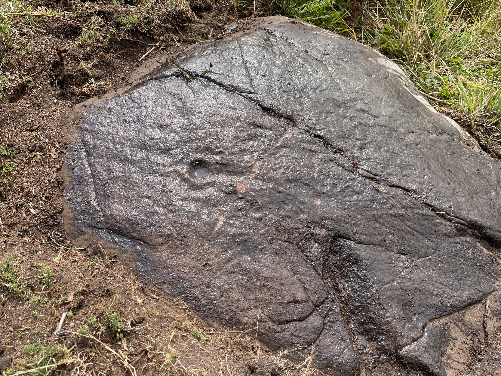
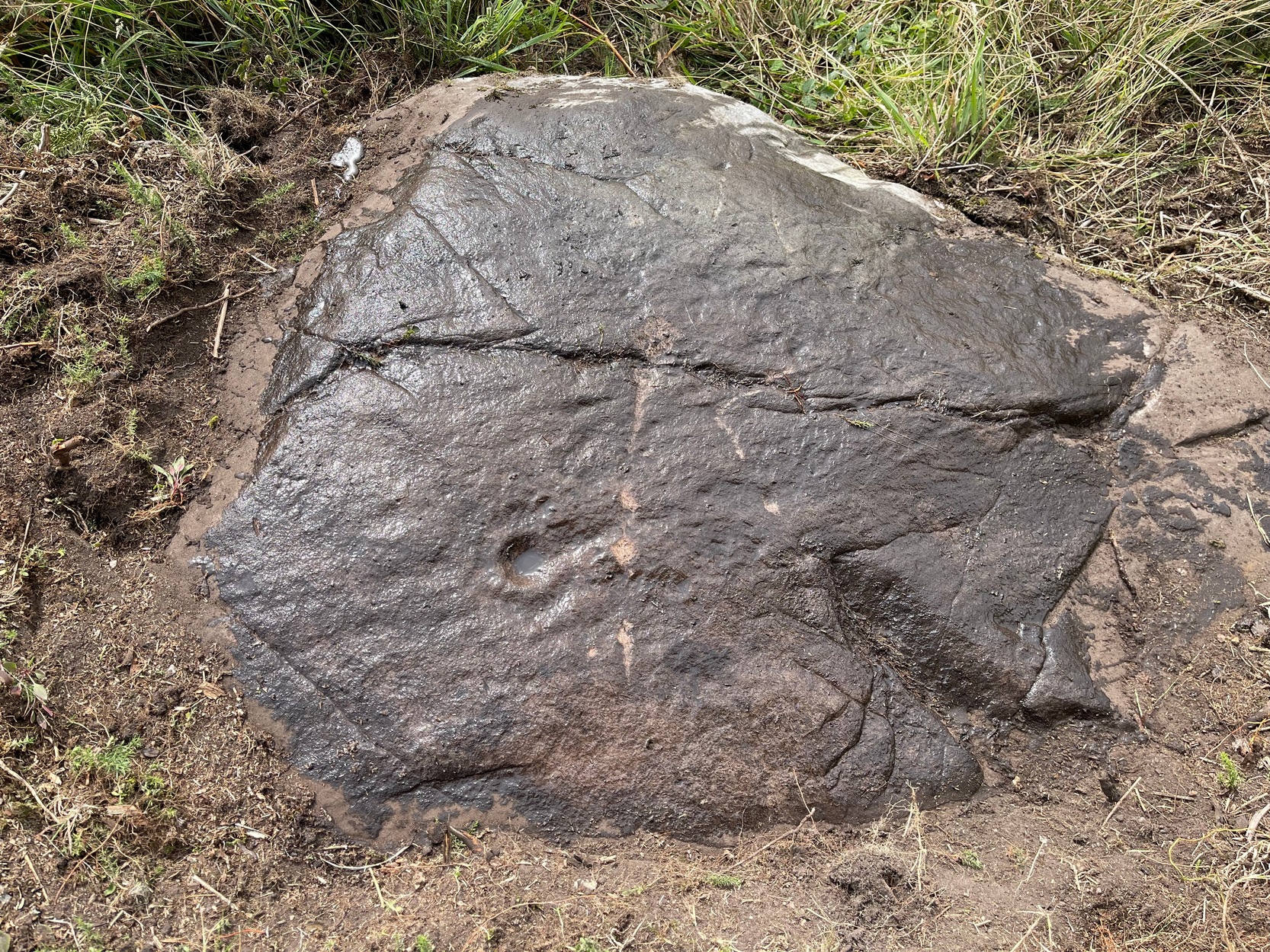
Single cup-and-ring
Once this rock surface is covered again by Nature’s carpet, you’ll struggle to find it. Unlike many of its more ornate neighbours, this seems to be a lonely solitary cup-and-ring design, cut near the edge of a large level piece of otherwise blank rock. Numerous geological nicks and scratches scatter the same surface, but the carved element is easy enough to see, as the photos here show. It was rediscovered in the 1980s by Morris & van Hoek (1986) who described it simply as “a single cup and one ring, 8cm in diameter on horizontal rock.” There may well be additional elements to this design beneath the soil.
References:
Morris, Ronald W.B. & van Hoek, Maarten, “Stirling District: Castleton 4d; Castleton 5e,” in Discovery & Excavation, Scotland, 1986.
Acknowledgments: Massive thanks to Thomas Cleland for helping to make this site visible again.
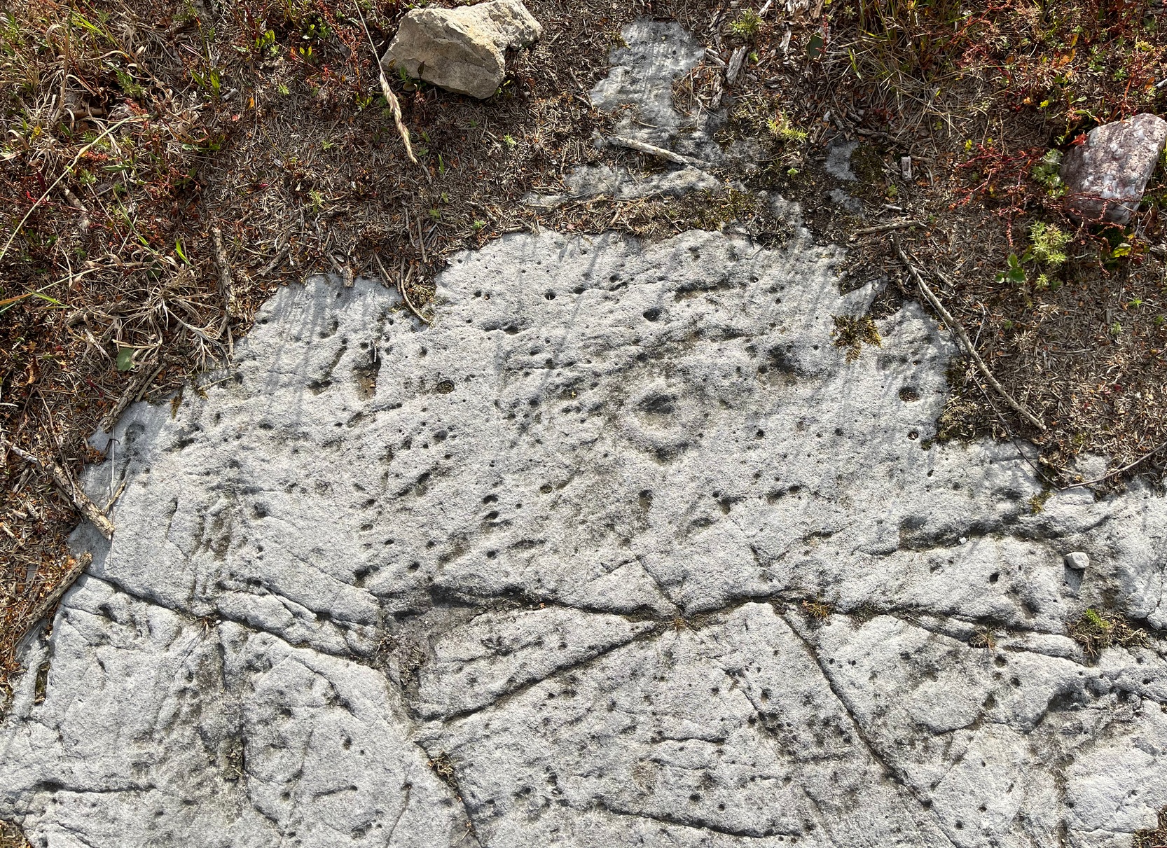
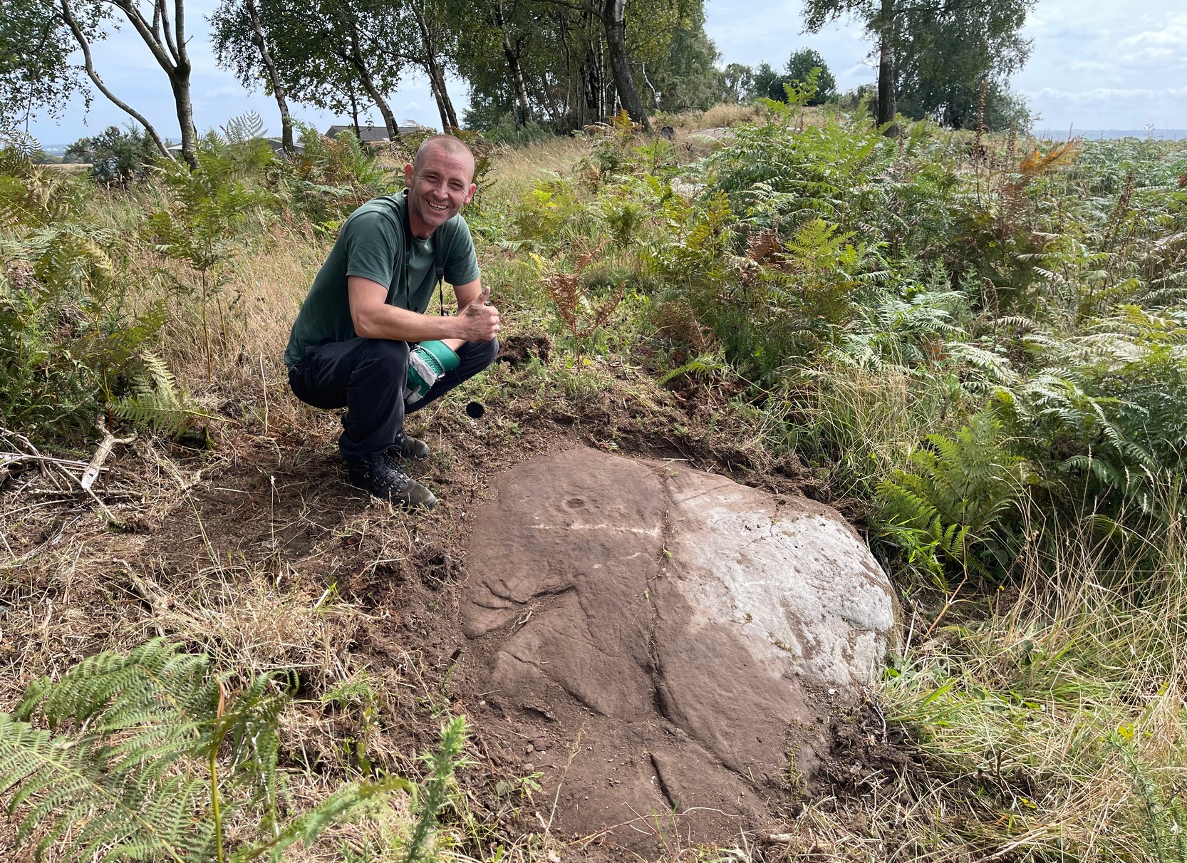
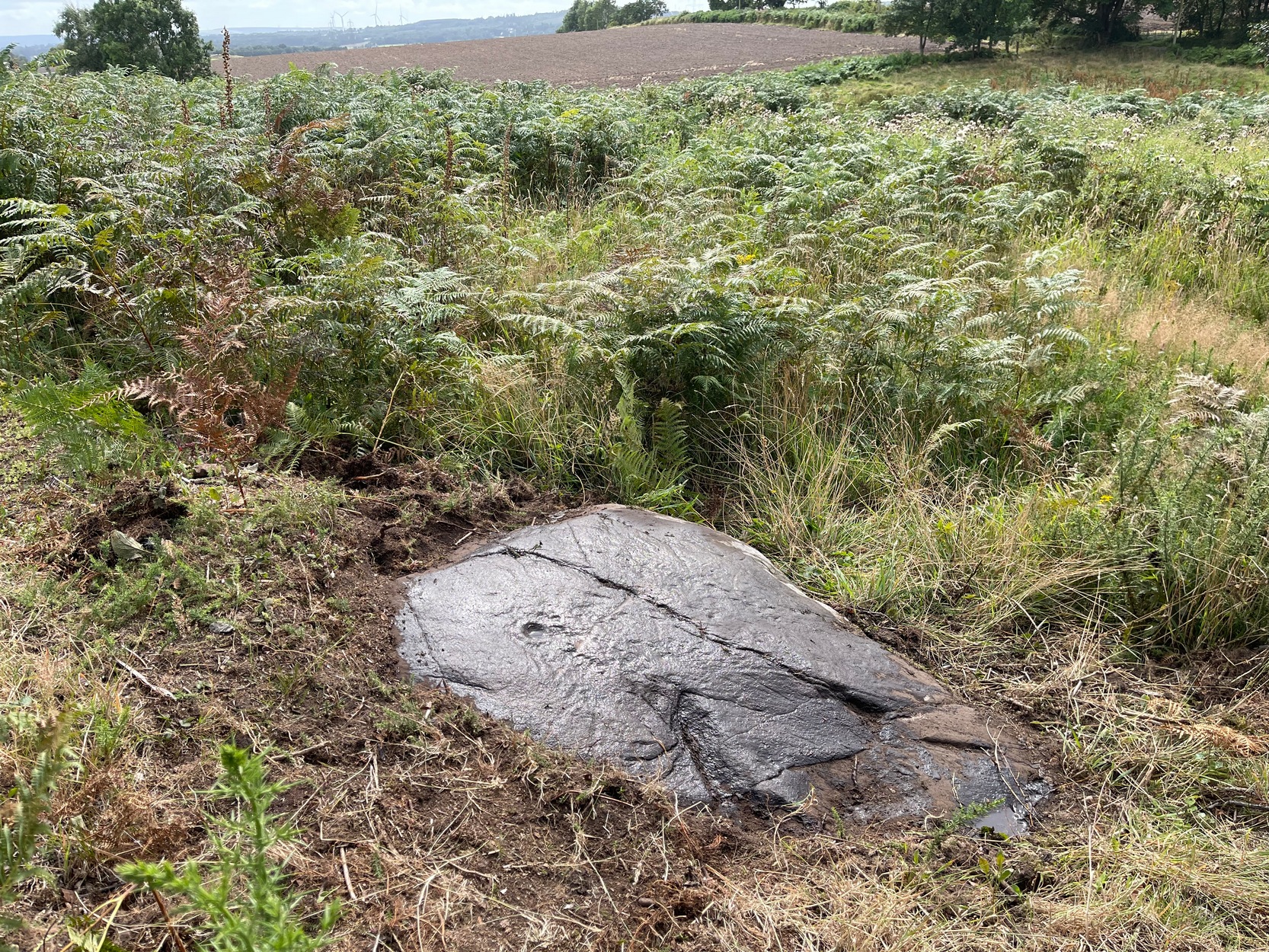
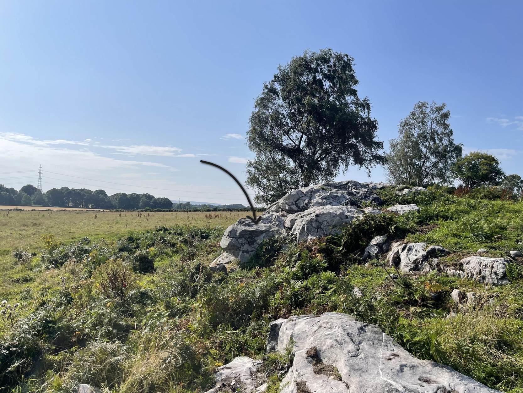
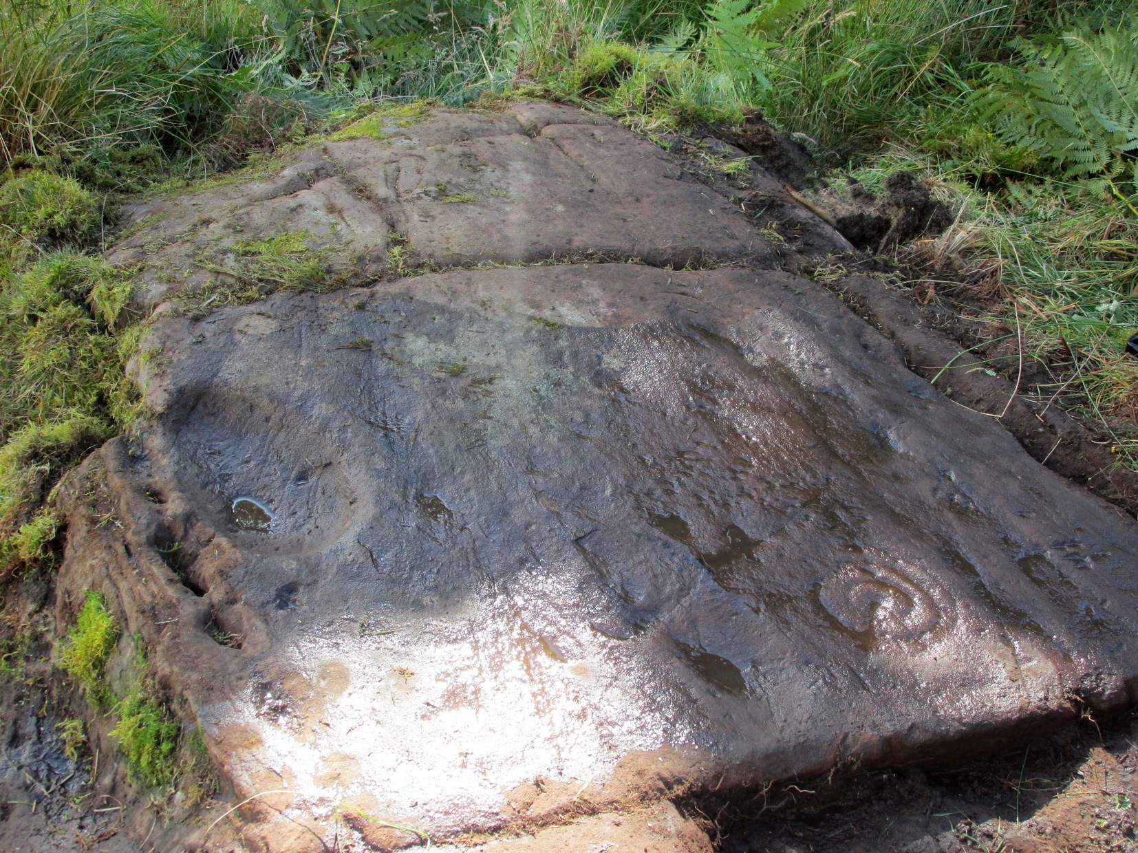
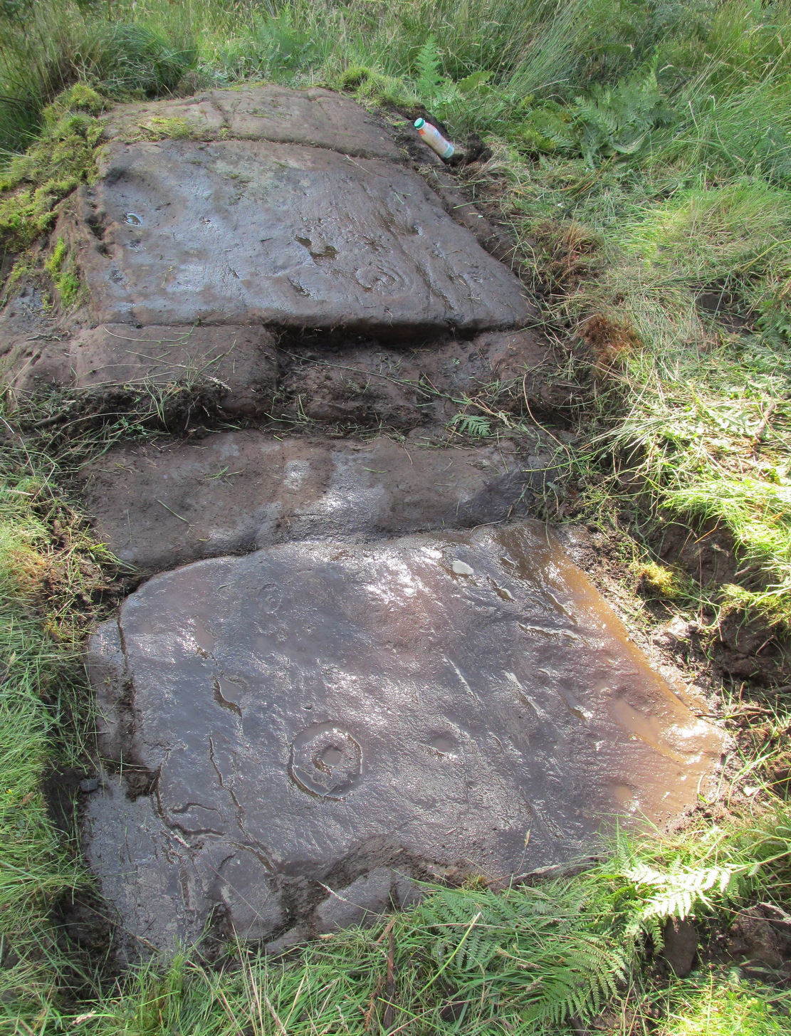
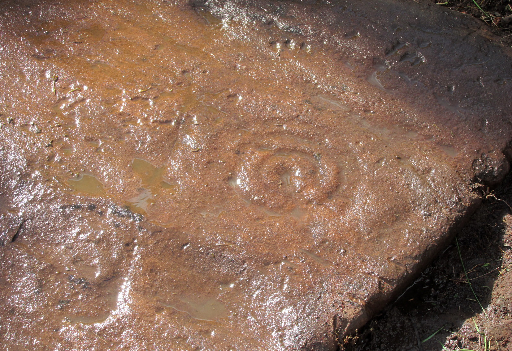
Start from the Castleton (2) carving, in the first small birch copse closest to the road and walk to its southeast side where there’s a small break in the trees before the next small birch copse begins, which runs along the raised rocky crag to the southeast. Walk to the front or western side of the trees there and along the very edge of the low crag. About thirty yards along, right on the edge of where the rocks begin, look for the smooth sloping earthfast boulder (about 20 yards before the mighty nine-ringer of Castleton 7). Rummage around and you’ll find it.
Archaeology & History
Castleton (7e) carving
This newly recorded petroglyph was rediscovered by Thomas Cleland on August 6, 2025. Initially it was thought to consist of just a single cup-and-ring with an opening from which a carved line ran outwards; but, once wet, there seemed to be the beginning of an outer second-ring on its left-side. You can see it clearly in the photos. And, the more we looked, the more it seemed there were one or two other very faded elements.
Above the main cup-and-ring is a faint, shallow cup-marking and surrounding this appears to be an incomplete dumb-bell-shaped ‘ring’ that you can only just make out in the photos. It’s very faded and would seem to pre-date the primary design by some considerable time (unless, of course, it was merely ‘outlined’, so to speak and never completed).
Cup & ring & faint ‘bell’Cup & ring & faint ‘bell’
Both Tom and I are convinced that there’s more to this carving than is presently visible. The rock is covered in deeply compacted soil and it would require a lot of work to uncover the rest of it. A job for the future maybe…..
Note to self: This carving and all the others in the Castleton complex need to be fully re-catalogued as their indexing is haphazard through various academic tomes and websites.
Acknowledgements: Massive thanks to Thomas Cleland for locating this carving, for the first time in millenia. 🙂
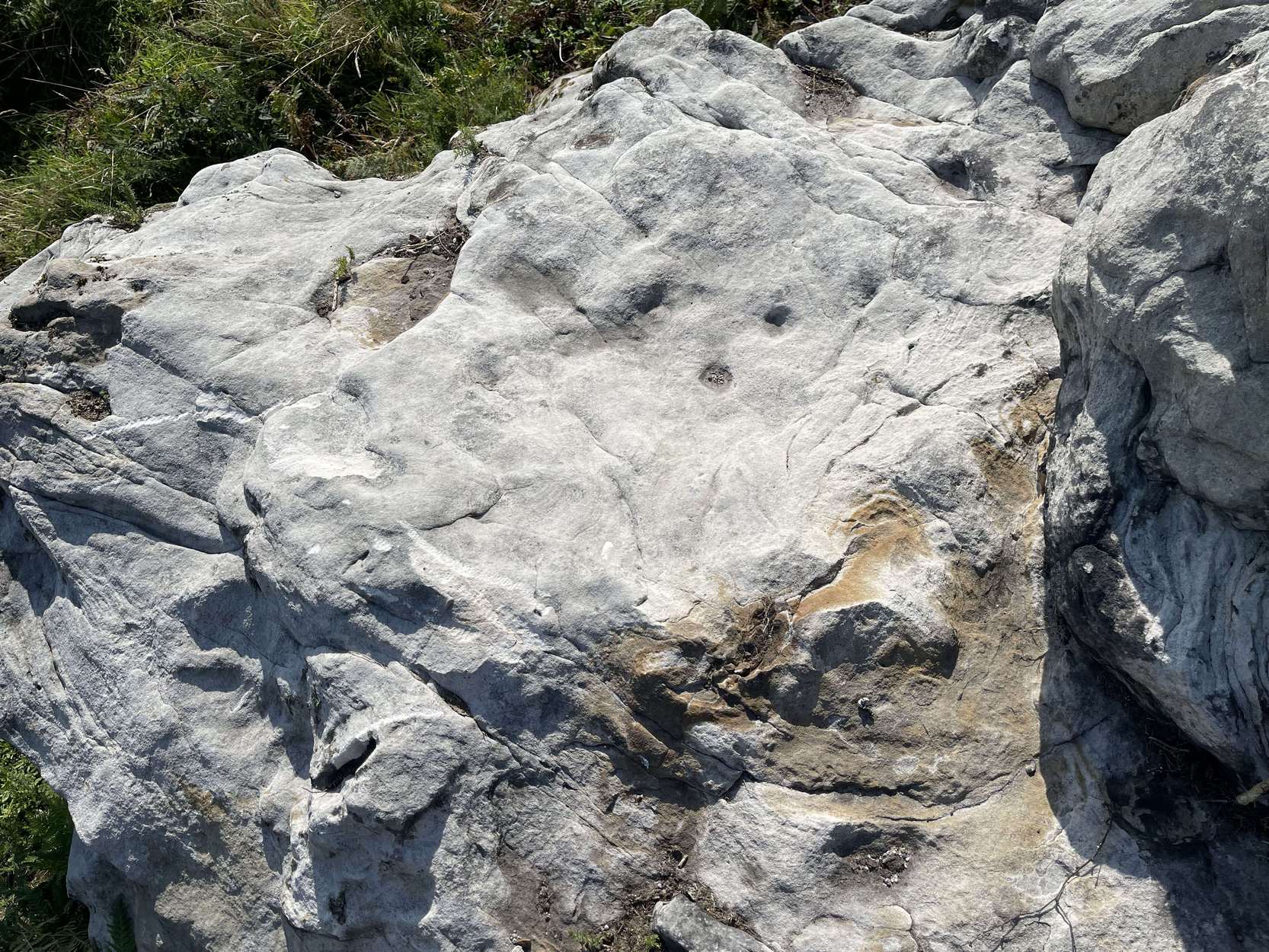
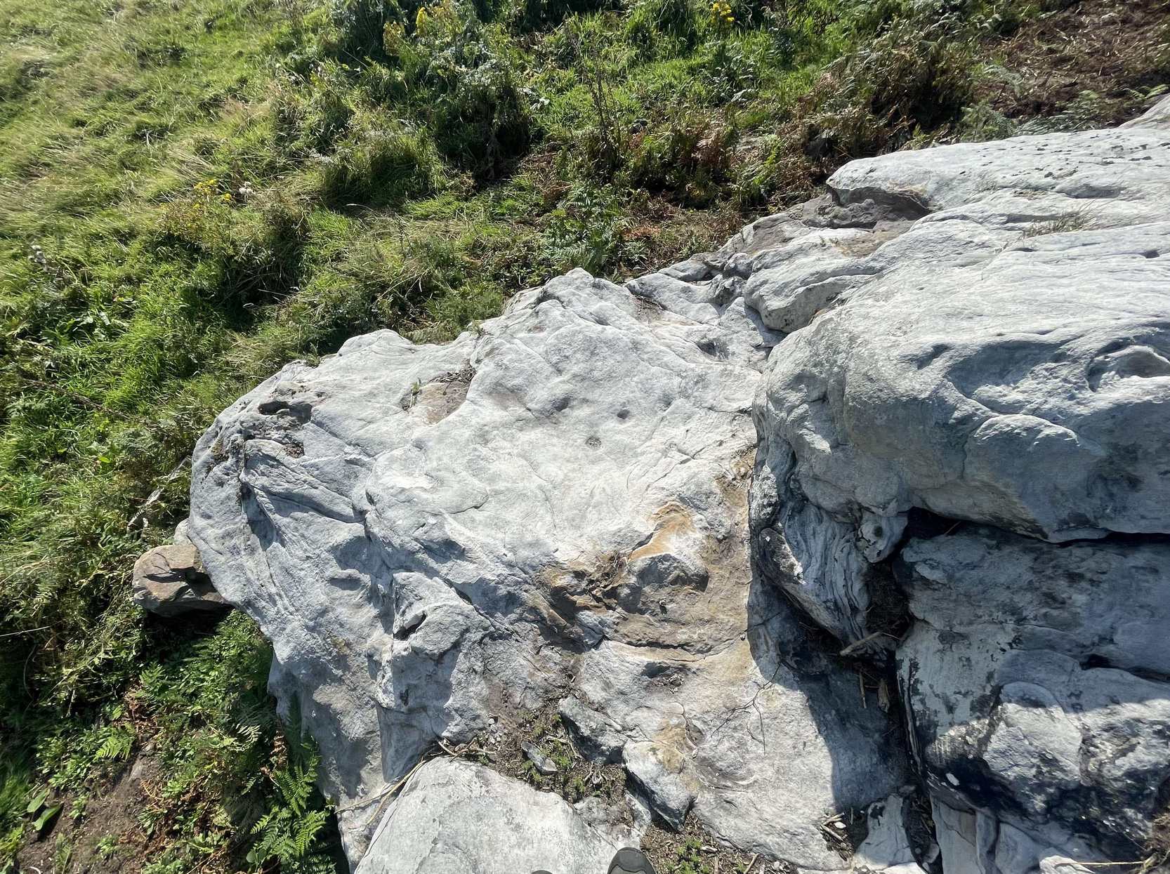
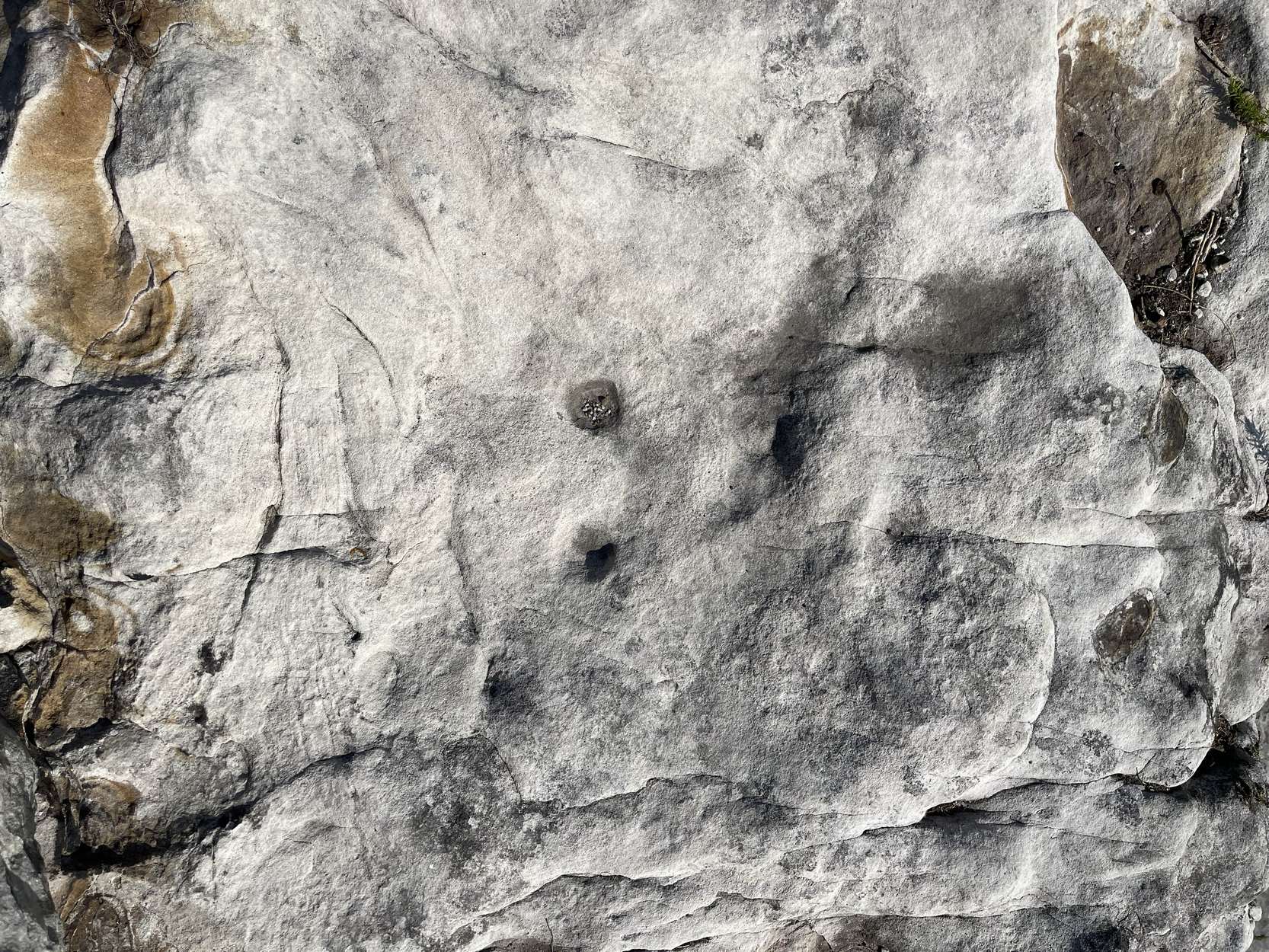
Follow the directions as if you’re visiting the impressive multi-ringed design of the Castleton (10) carving. Once there, walk south-east along the geological ridge for 45 yards where the small cliff drops down to the field. Just where this drop occurs, on a lower horizontal level of the rock face (only a small section) you’ll notice two distinct “cups”. You can’t really miss it!
Archaeology & History
This very basic cup-marked stone was, until recently, covered in dense gorse, making access to the site almost impossible. But following a fire that happened here not too long ago, the smoldering remains needed to be cleared and, once the job was done, we were able to see the two distinct ‘cups’ that were first described in Maarten van Hoek’s (1996) survey. But the cups that he described are, most likely, little more than Nature’s handiwork. I’m somewhat skeptical of them as being the real deal. In the same survey, he added another site, which are just natural bowls in the rock just over 100 yards southwest of here as being cup-marks — which they’re not!
References:
van Hoek, M.A.M.,”Prehistoric Rock Art around Castleton Farm, Airth,” in Forth Naturalist & Historian, volume 19, 1996.
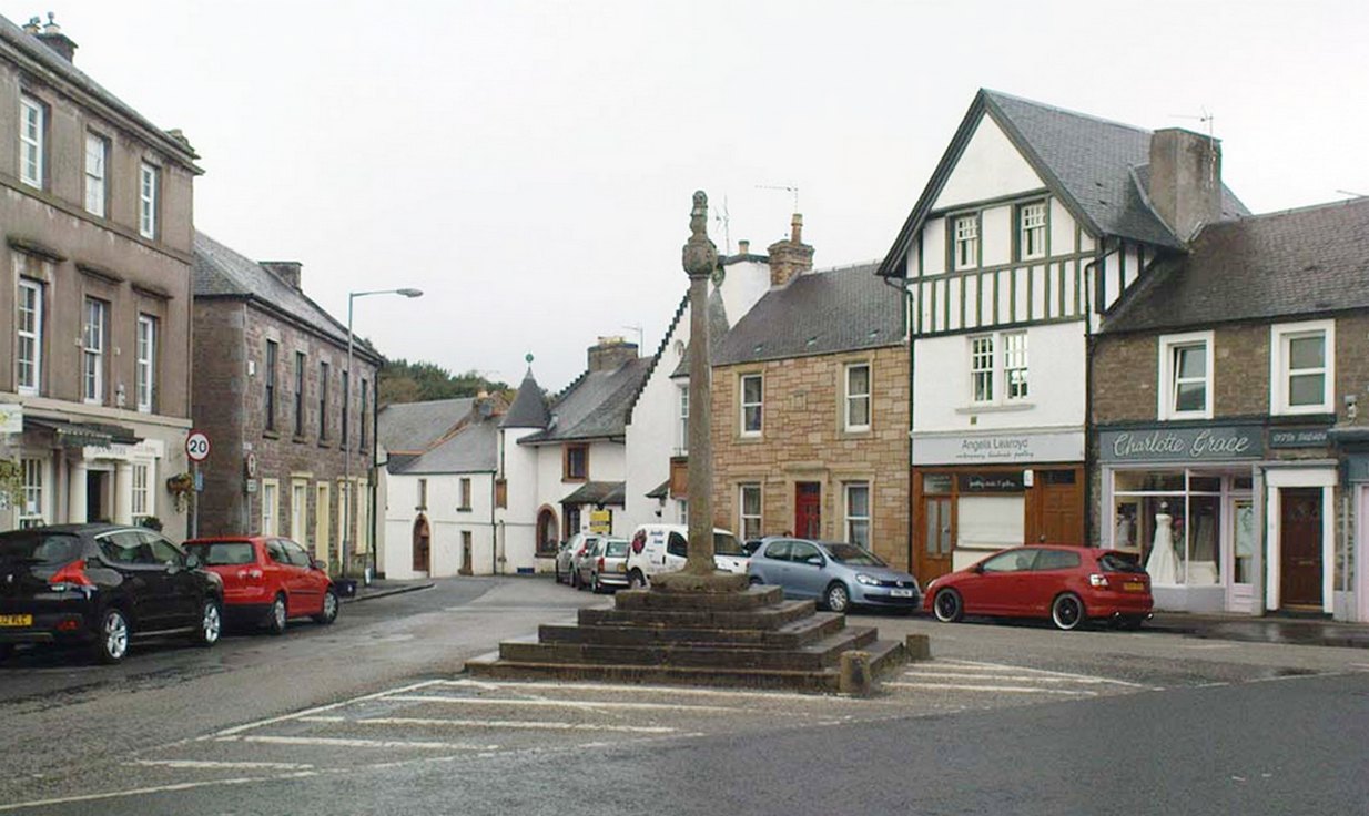
Easy to find: get into the middle of the village where the shops are in the main street and where another road veers off, the cross sits there in the middle in the traffic island. The photo here shows its location clearly.
Archaeology & History
Doune’s Mercat Cross
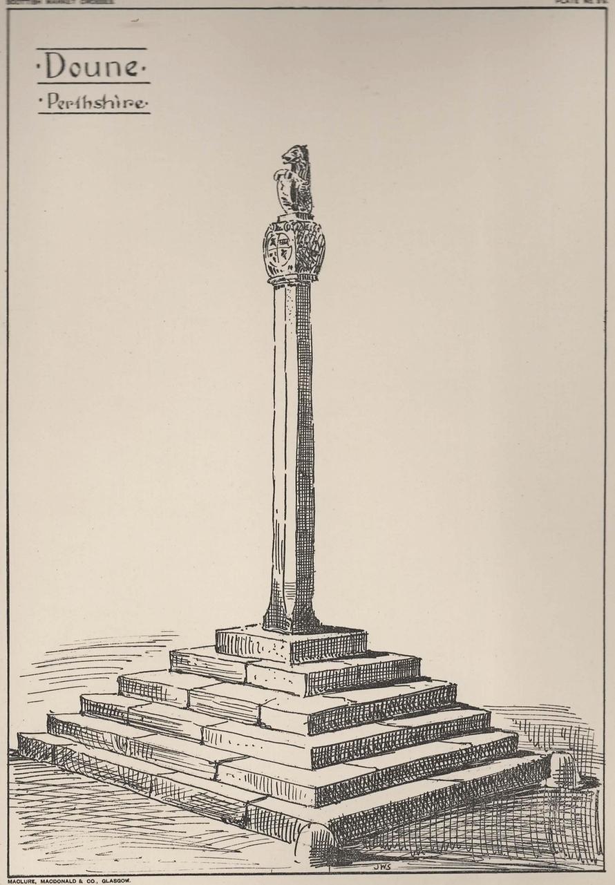
Found at the meeting of the roads in the centre of this old lovely village, the Mercat Cross in its present state was, according to Act of Parliament, erected a few years prior to 1696. Set on a square base of six steps in traditional pyramidal fashion, near the top of the 12-foot tall shaft are carvings on the sides of the stone. On the east-face was carved the Moray arms, and on the west face were carved sundials. John Small (1900) told how the top of the cross is crowned by the figure of a lion, “holding in its paws a circular shield or escutcheon, surrounded by a ribbon enclosing he Moray crest, and bearing the motto, ‘Salus per Christum.’
John Small’s 1900 sketch
It has been damaged a few times over the years. Sometime around 1800, Moray Mackay (1953) told that “the lion fell of and was damaged”, but was repaired shortly afterwards by a local man. He also told, with considerable indignation, how the local authorities were responsible for damaging what used to be “four short pillars which stood at the corners of the base,” when they were “smashed off and removed , impairing the balance of the whole (cross) for the sake of six inches more traffic room”! There are two such short pillars at the edges, but these aren’t the original stones. There used to be a water pump in front of the cross, but this was removed many years ago.
Along the A81 road from Port of Menteith to Aberfoyle, watch out for the small road in the trees running at an angle sharply uphill, nearly opposite Portend, up to Coldon and higher. Keep going, bearing right past Mondowie and stopping at the dirt-track 100 yards or so further up on the left (ignore the english fuckers up here who tell you it’s a pwivate road and they don’t want you parking there—unless you’re blocking the road obviously!). Walk up up here for ⅔-mile, as if you’re visiting the Over Glenny (5) carving, but as you get close to the defining sycamore tree, walk past it for about 60 yards towards the ruinous buildings. You’re looking for a reasonably large earthfast rock with a notable bowl about 12-inch across at the edge of the stone. That’s your defining feature.
Archaeology & History
Arty sketch of the design
This is another decent design in the mass of petroglyphs on this plain overlooking the Lake of Menteith. On our first visit here ten yeas ago, only one half of the rock was visible—and half of that was covered with grasses! But with patience, we slowly rolled back the turf and slowly uncovered more and more, eventually seeing the main elements you can see in these photos and the arty sketch I’ve made here. (the Over Glenny [14] carving a few yards further east may be just be a continuation of this design)
Full length of the stone
The triple cup-and-ring
When the carving was first noticed by George Currie (2010), he only noticed “a cup mark surrounded by two penannulars, an arc and a single radial”—ostensibly meaning, a cup-and-triple ring, with the outer ring incomplete, and a line running out from the central cup. But there’s more, obviously. On our second visit, a very faint but distinct cup-and-double-ring was noticed in low light on the same section of the rock where the triple-ringed element is carved. We weren’t able to get a photo that showed it, as the light wasn’t doing as we needed, but I’ve highlighted it on the sketch, where it’s to the right of the large ‘bowl’ at the very edge of the rock. This ‘bowl’ probably had utilitarian functions, whether it was for just crushing herbs or grains, or to make organic paints: and this function most likely had some relationship with the petroglyph—but we know not what! It’s possible that the people who lived in the adjacent ruin, several centuries ago, may also have made use of this.
East-end of the design
East-end angular pose
When we exposed the other half of the carving, a very well-cut and well-preserved cup-and-ring sat beside another much more eroded partner, which was almost impossible to see from some angles. You can just make it out in the photos here. You’ll also notice a scatter of several other cup-marks and elongated ‘cups’ on the same section of rock. It was difficult to work out whether some of these marks in the stone were Nature’s handiwork, or the result of human hands. Some were obviously man-made, but we need to look at it again when the daylight conditions are good, so that we can make a more accurate assessment.
Currie, George, “Port of Menteith: Upper Glenny (UG 1), Cup-and-Ring Marked Rocks”, in Discovery & Excavation, Scotland, New Series – volume 11, 2010.
Acknowledgements:Huge thanks to the crew: Paul Hornby, Lisa Samson & Fraser Harrick in making this carving come to life, and for use of a photo or two.
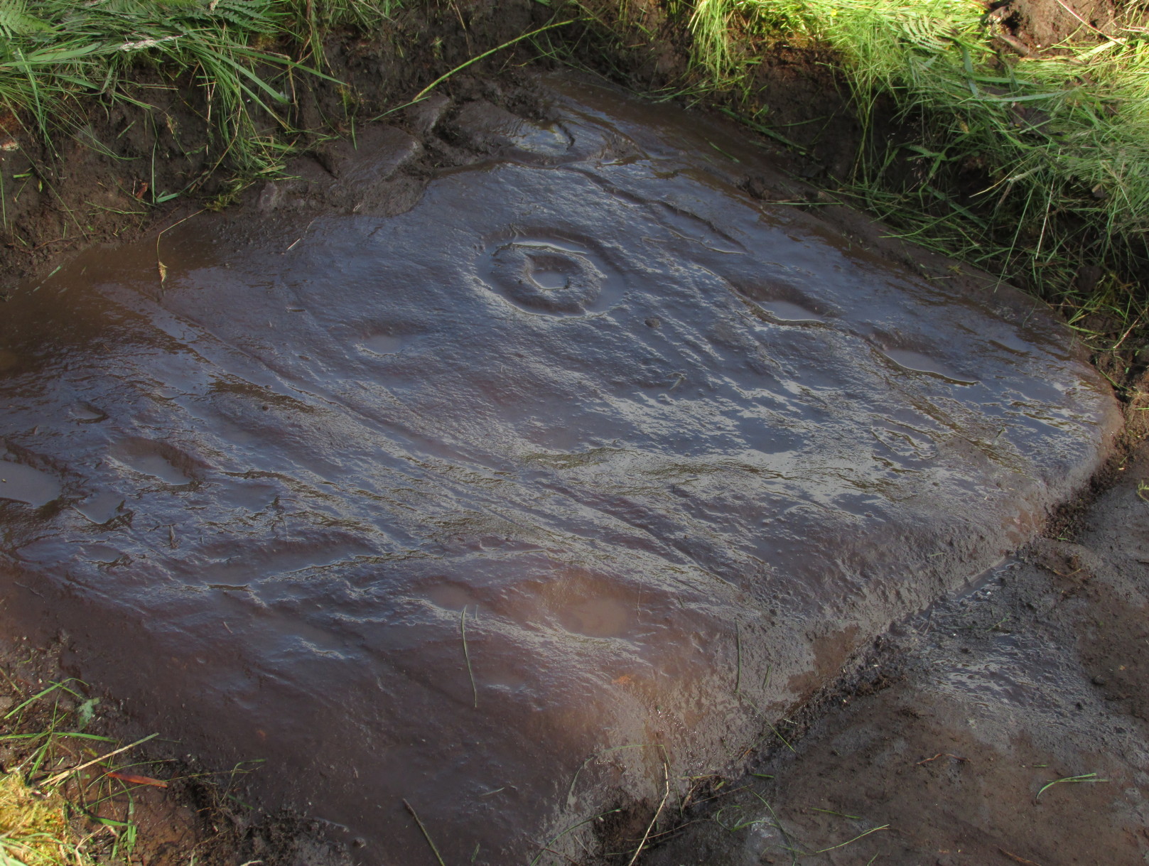
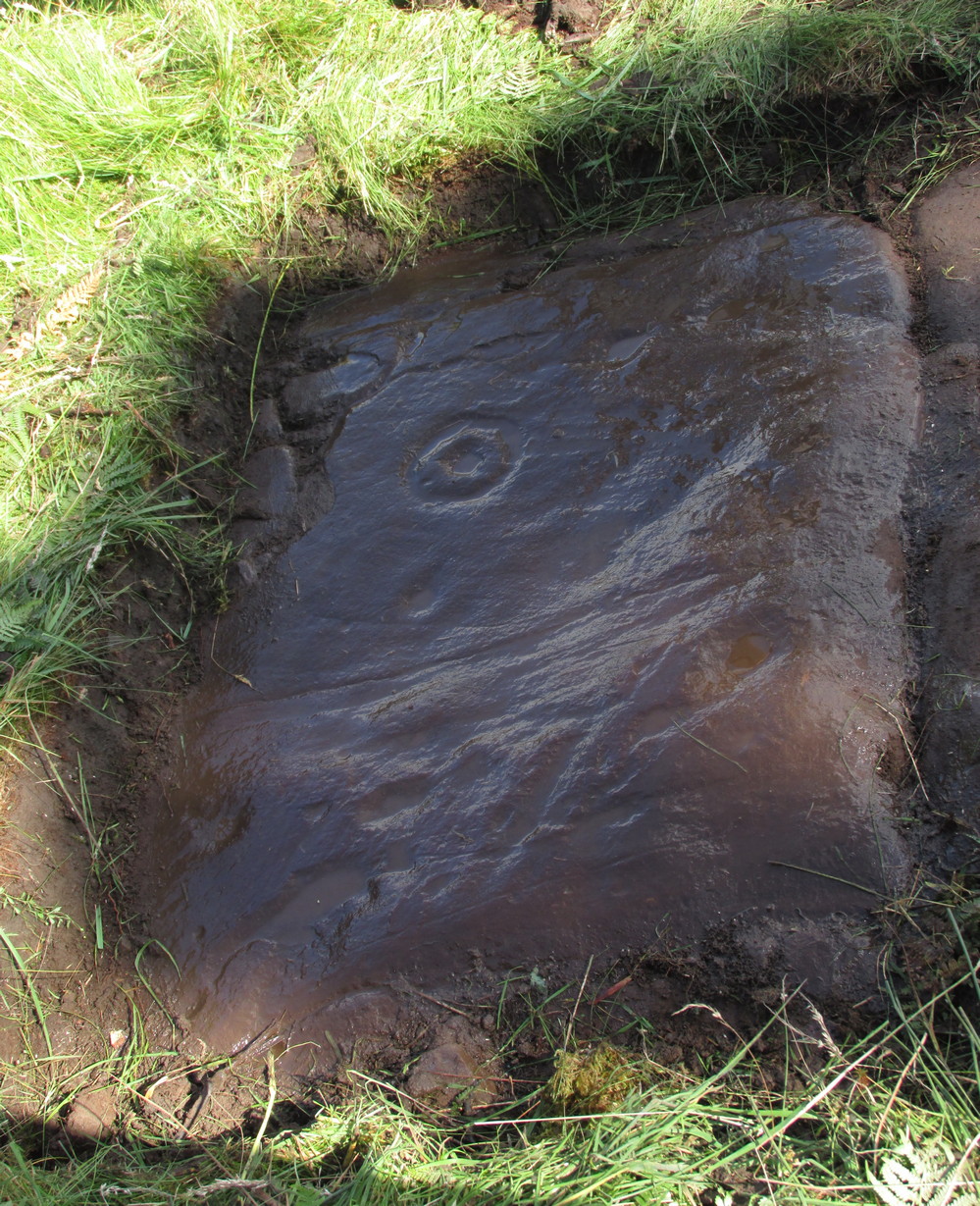
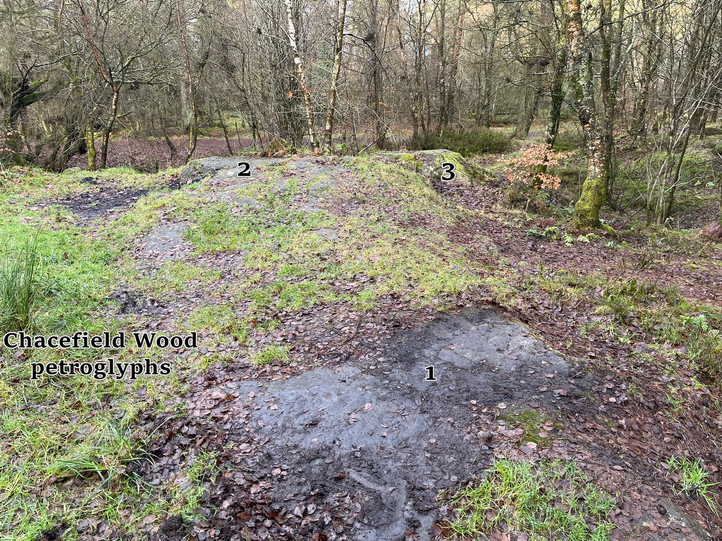
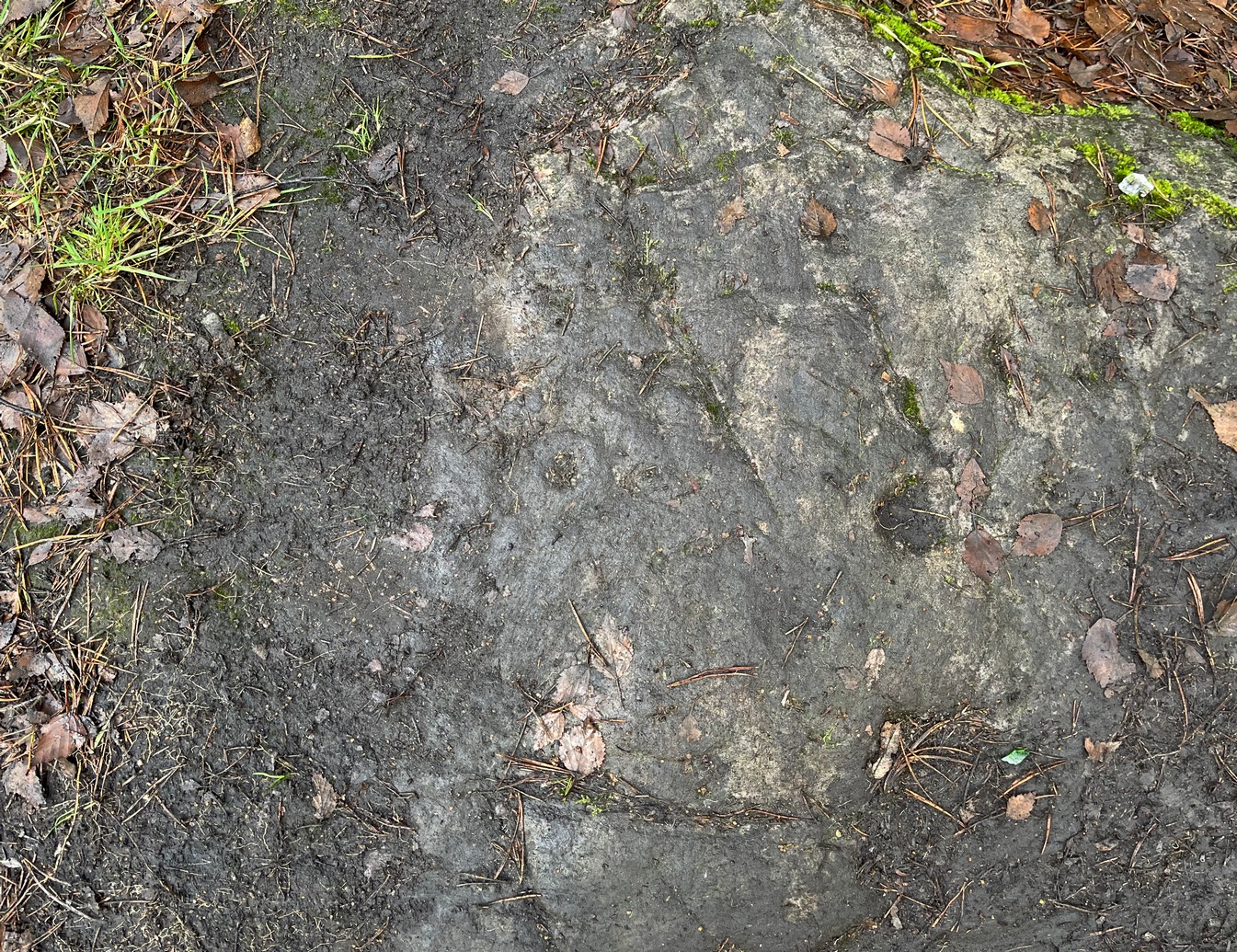
We took the A872 road on the south-side of Denny to Dennyloadhead and Longcroft, but a few hundred yards before you go under the M876, keep your eyes peeled for Drove Loan on your left. Go down here for literally ¼-mile (0.4km) where there’s a footpath into the woods on your left. Walk on the path into the trees and you’ll reach a track that heads to your right (east). Less than 200 yards on, you’ll see a pond on your right and above here is a small quarried rock outcrop. This carving’s up top, on the gently sloping rock behind carvings no.2 and no.3.
Archaeology & History
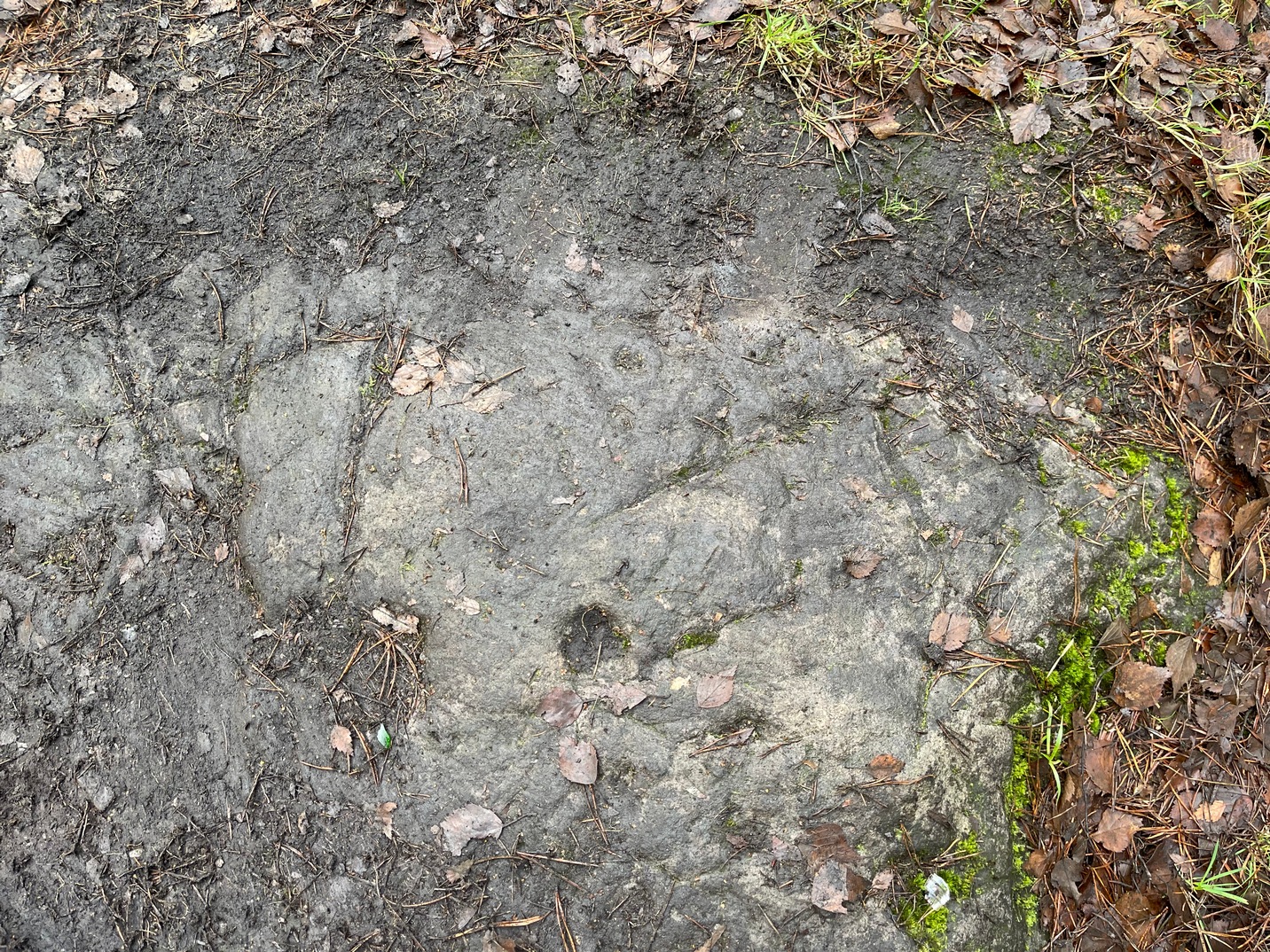
Half-covered in mud and vegetation, the first thing you’ll notice on this sloping smooth surface is what looks to be a standard cup-marking, all on its own. But it has company—albeit quiet and faint. A single incomplete cup-and-ring can be seen about 18 inch above (north-ish) this single cup-mark, which may itself be natural. You can make out the cup-and-ring pretty clearly in the photos.
When we found this, we began to clear the rest of the stone but stopped pretty quickly as a scatter of broken glass was mixed into the mud and I was lucky not to cut my hand open. Some kids have evidently been getting pissed here and have left their mess on the rock. But there may well be more symbols beneath the mulch, so if any local folk want to clean it, please make sure to wear some good gardening gloves to protect your hands! And if you find any other hidden elements, please let us know! 🙂
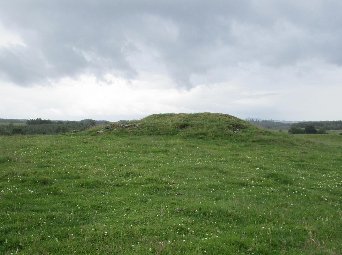
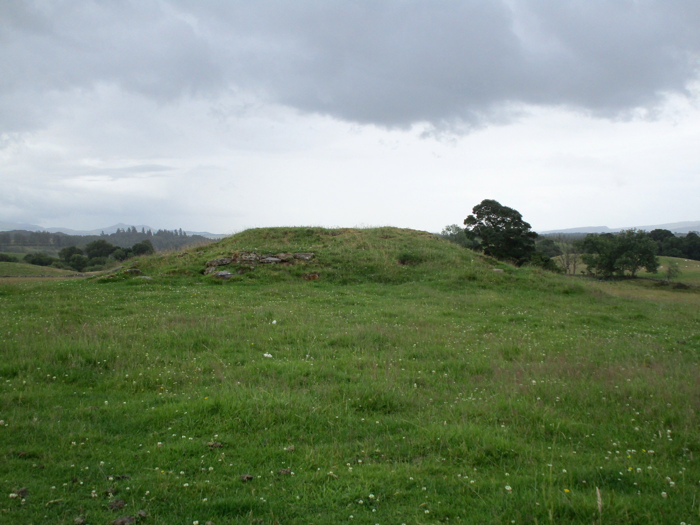
From Doune, take the A84 road to Callander. As you pass through the hamlet of Buchany, keep your eyes peeled a few hundred yards on as the road dips down and swerves gently right, for the road sign of Drumloist (or Moist as some locals keep amending!) which goes up to the right. It’s a small single track road that zigs and zags slowly uphill. After exact one mile you reach a small track on your right (there one left too). Carefully park hereby (don’t block the gate!). Across the road, go through the gate on your right and walk along the edge of the field until you reach the burn. Go across it, and then across the field, through the gate and you’ll see it ahead of you. In the tick season (summer) treat the brackens as possessed by a plague and avoid it!
Archaeology & History
Looking at its stony face
A curiously forgotten place, hidden from sight, this large rounded grass-covered mound with small upright stones around one side, seems timeless amidst the open fields. It seems alone, but the denuded chambered tomb of Ballachraggan is just visible 1.4 miles to the northwest on the near-horizon; and there’s a hidden cairnfield just a half-mile away. This cairn measures 18 yards (N-S) by 16 yards (E-W) and stands 7-8 feet high when you look at it from its southern side. The top of the mound is a mix of stone and grass with a slight dip in the middle, perhaps by someone in ages past digging, albeit only slightly—perhaps scared away by the old folk buried herein.
One of the most notable aspects of this site is the complete silence. On my last two visits hereby, a fusion of mists from the low cloud above and the breathing Earth below gave an atmosphere the likes of which lived when this tomb was first built. On one occasion hereby, no vehicles for several hours gave the silence a curious atmosphere (those of you who like sitting in the rain with the wilderness will know what I mean). To me this is a gorgeous site…
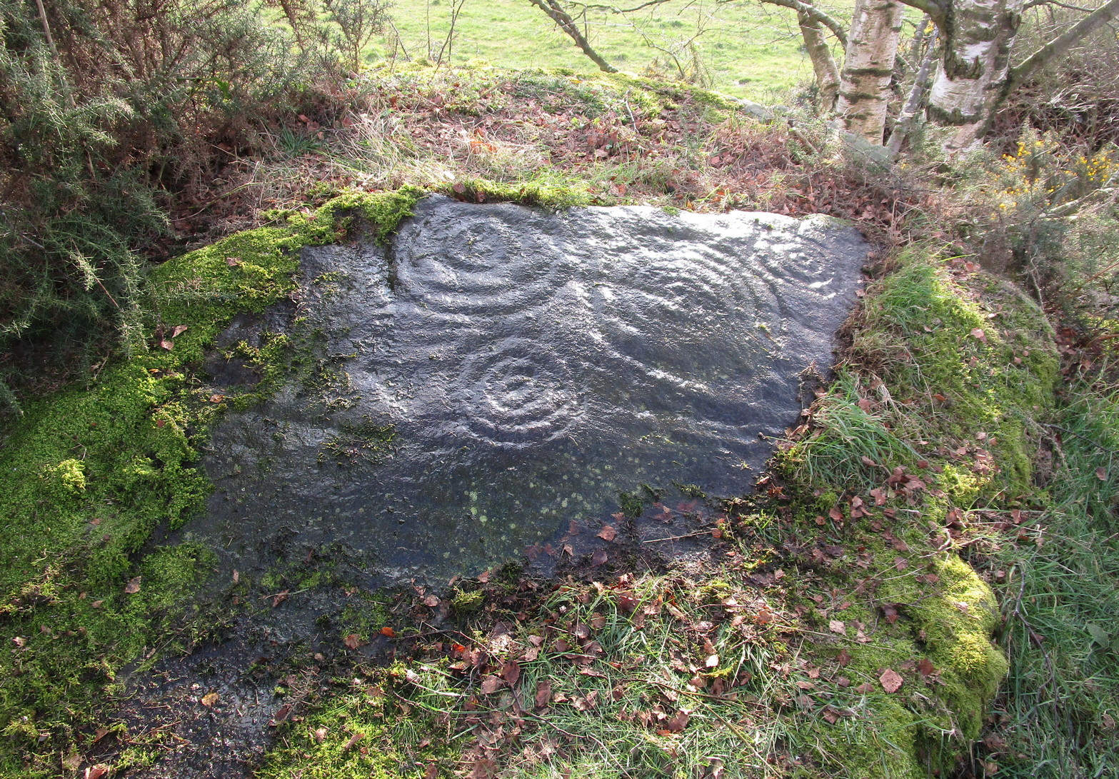
To reach here from Stirling or Bannockburn, take the B9124 east to Cowie (and past it) for 3¾ miles (6km), turning left at the small crossroads; or if you’re coming from Airth, the same B9124 road west for just about 3 miles, turning right at the same minor crossroads up the long straight road. Drive to the dead-end of the road and park up. You’ll notice that this is a crossroads of dirt-tracks. Walk along the one that heads to the houses you can see on a rise above the fields, eastwards. About 300 yards on, instead of going up towards the houses, walk thru the gate and along the wall-edge for 85 yards and go thru the gate to your right. You’ll see a small rise covered in gorse trees 100 yards in front you and roughly in the middle of it all, you’ll find this carving.
Archaeology & History
The naked stone
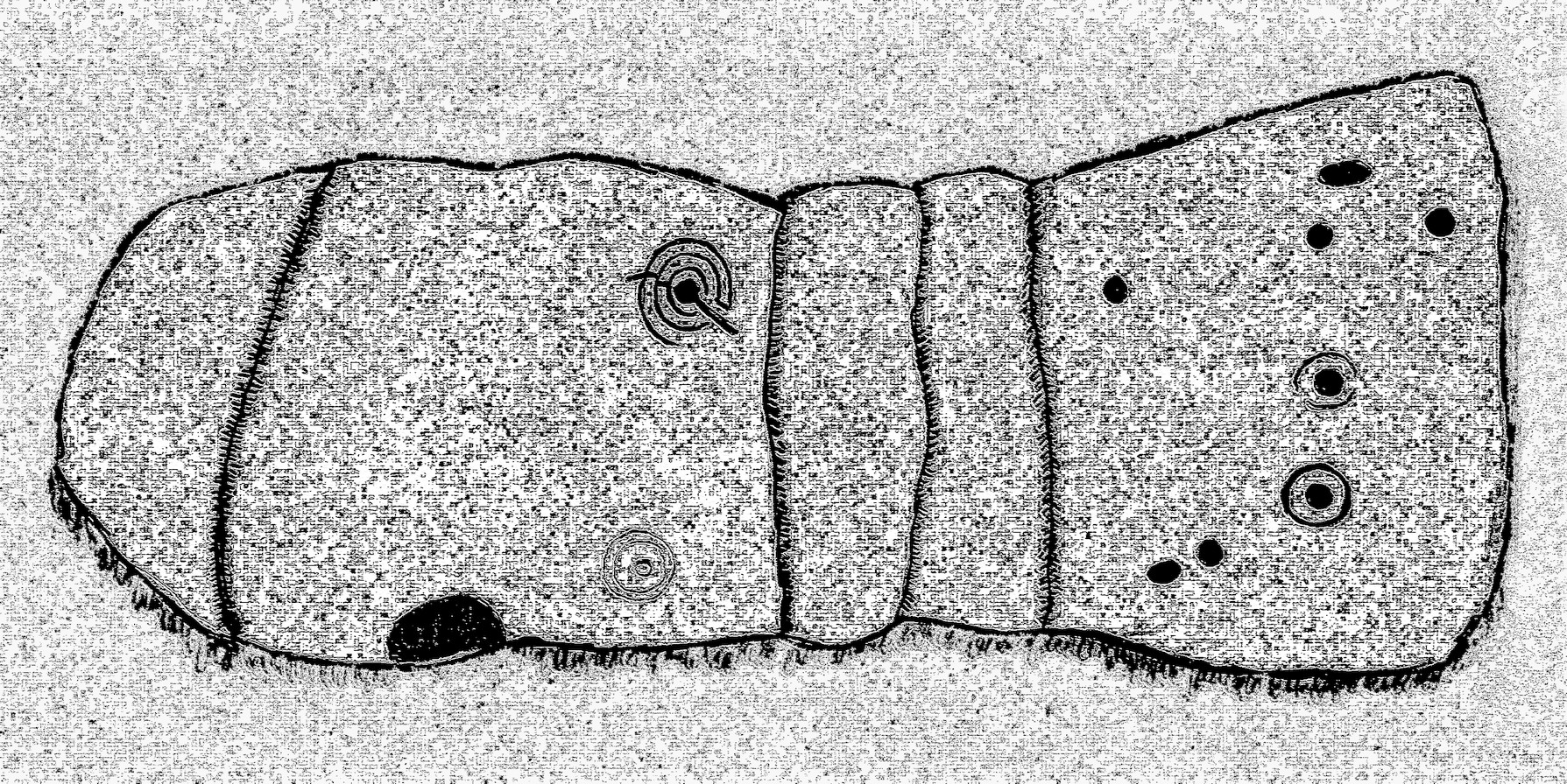
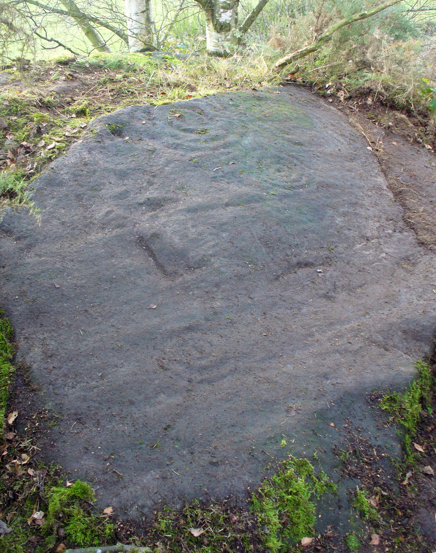
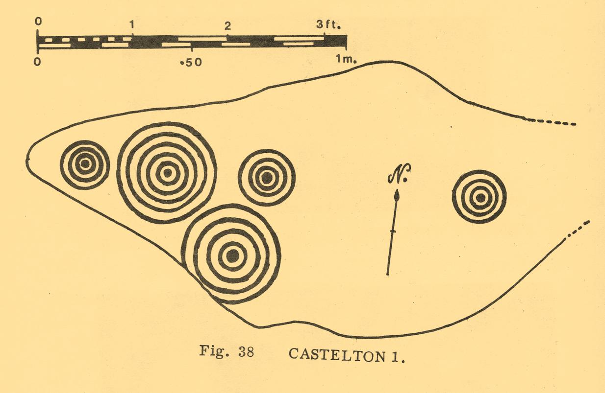
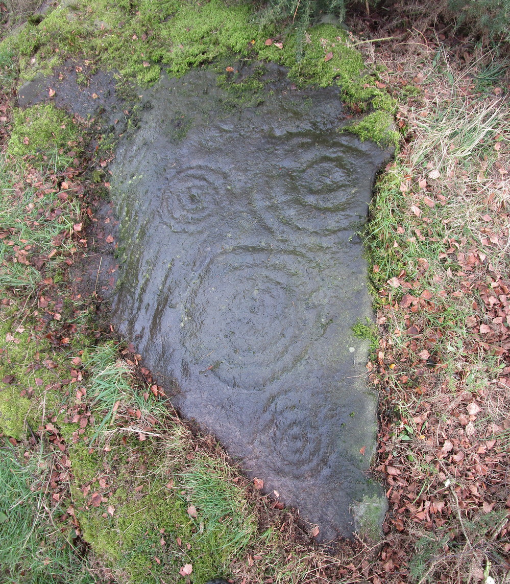
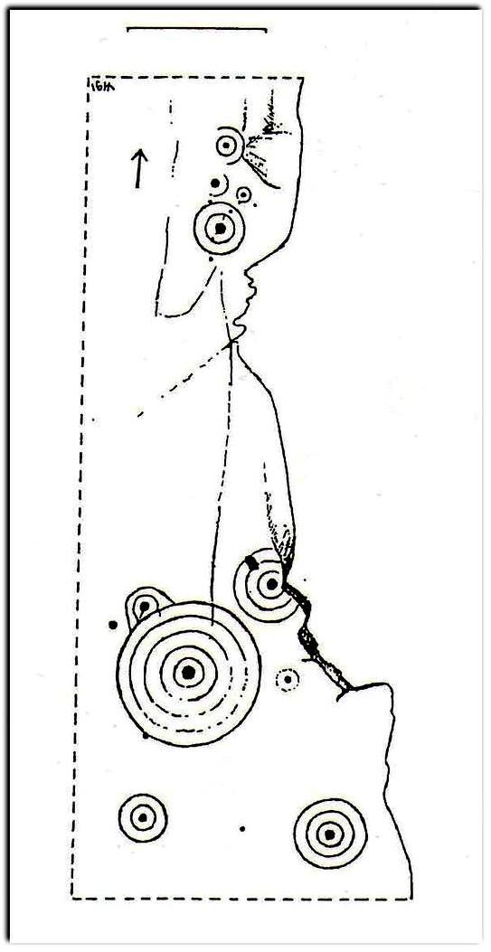
When John Bruce (1896) wrote his article on the mighty Cochno Stone a few miles north of mighty Glasgow, he left some end-notes about a petroglyph near Carnock (near Castleton) that was “found to bear a few much weathered cups with concentric circles.” He wasn’t at all clear where the carving was located, merely telling that it was “in the Gosham Park” area on the Carnock estate. This vague description was probably the reason why, when the lads from the Royal Commission came looking for it in August 1955, they left without success. Nevertheless, when Ron Morris (1981) explored this area he located the place-name of Gosham Field and, therein, this multi-ringed carving. It seems more than likely that this was the carving described by Mr Bruce – and it’s an impressive one!
Despite being eroded by the passage of time, the carved design is still pretty easy to see, comprising a cluster of archetypal cup-and-multiple rings in close proximity to each other, etched onto a sloping stone. Ron Morris’s (1981) description told that, 125 yards east of Gosham Field’s western wall,
“is a prominent greywacke outcrop, part of a rocky ridge running NW-SE, exposed in 1969-75 for 3m by 2m (10ft x 6ft), 4m (12) high on its S, but at ground level elsewhere, sloping 15° NE. On its fairly smooth surface are:
“5 cups-and-complete rings, with no grooves, 3 with three rings, 1 with four, and 1 with five rings, up to 36m (14in) diameters and 1cm (½in) depth.”
Ron Morris’ 1981 sketch
Yet contrary to Morris’ description, there are some “grooves”, or carved lines emerging from some of the rings; faint but definitely there. You can make them out in the accompanying photos above. (are there any sketch artists out there could accompany us to these carvings, so we get some good portraits of the stones?) When Maarten van Hoek (1996) visited this carving he also missed these ‘ere carved grooves.
An additional feature that needs to be mentioned is the cluster of small geological deep natural cups, inches away from the carved rings on the southern edge of this stone (completely covered in vegetation in the attached photos). The same feature also exists on the southern edges of the Castleton 5, Castleton 6 and Castleton 12 carvings and it probably had some mythic relationship with the petroglyph.
There’s another cup-marked stone about 30 yards east of here, along this same geological ridge. It was previously covered in gorse, which was thankfully removed following a fire caused by the hot weather at one of the other carvings, preventing a cracking of the rock which would damage the carvings. All of the rock surfaces in the Castleton complex need to be laid bare to enable a greater visual experience of the wider Castleton complex and to prevent them being damaged by the gorse roots cracking the rocks, as well as stopping fires which will also damage these vitally important petroglyphs. People in the Cowie area want to see and experience their own local history…
Morris, Ronald W.B., The Prehistoric Rock Art of Southern Scotland, BAR: Oxford 1981.
Ritchie, Graham & Anna, Edinburgh and South-East Scotland, Heinemann: London 1972.
Royal Commission on the Ancient and Historical Monuments of Scotland, Stirlingshire: An Inventory of the Ancient Monuments – volume 1, HMSO: Edinburgh 1963.
Royal Commission on the Ancient & Historical Monuments of Scotland, Archaeological Sites and Monuments of Stirling District, Central Region, Society of Antiquaries of Scotland 1979.
van Hoek, M.A.M.,”Prehistoric Rock Art around Castleton Farm, Airth,” in Forth Naturalist & Historian, volume 19, 1996.
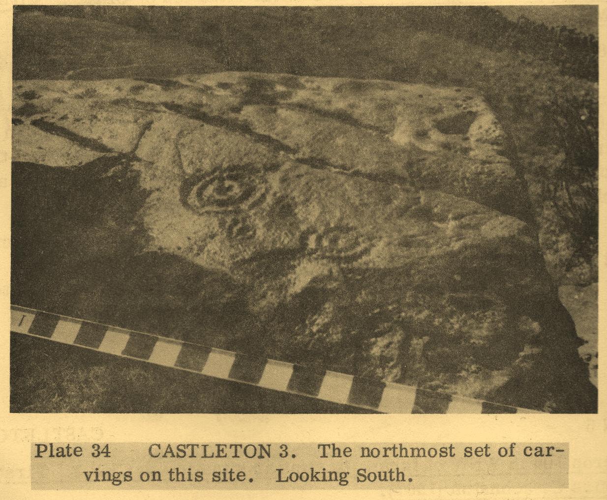
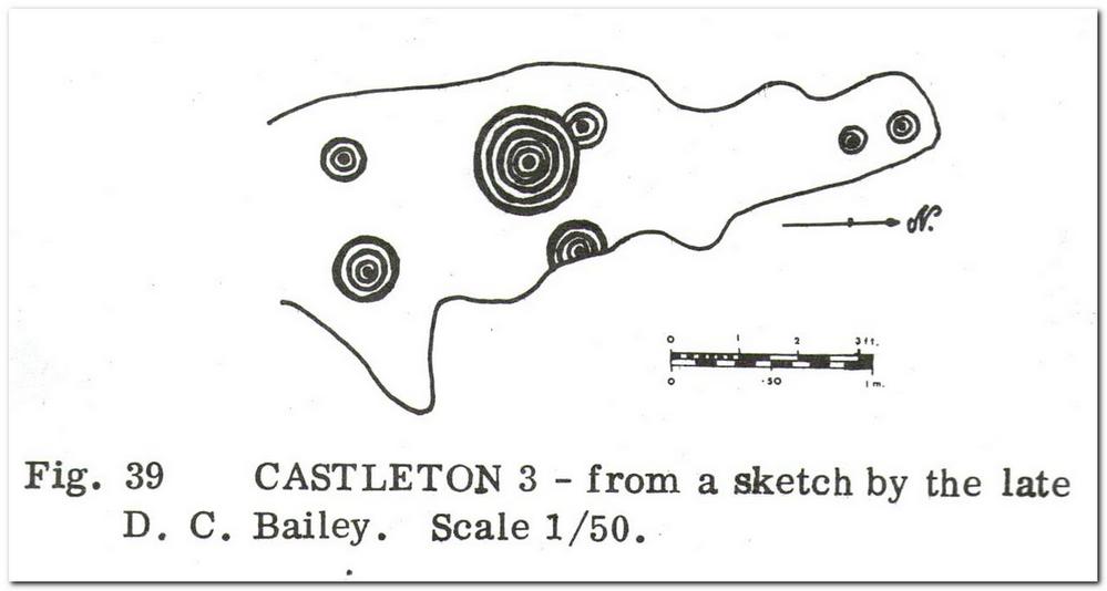
40-50 yards southwest of the Castleton (11) cup-and-ring stone, beneath the marauding mass of spindly-killer-bushes (or ‘gorse’ as it’s known in the common tongue) could once be seen another impressive cup-and-ring, etched along the edge of the small rocky rise. But Nature has done Her bit and hidden the old stone for the time being. A pity – for as the old photos and sketches show, it’s quite a good one.
Listed in several archaeo-surveys, the best descriptions of this carving are from the reliable pens of Messrs Morris (1981) and van Hoek. (1996) Morris first told us that,
“Leading S from near the farm to Bruce’s Castle (a ruin) is a greywacke ridge, up to 7m (24ft) high on its SW, but at ground level elsewhere, partly turf-covered. Faint cup-marks, some possibly ringed, can still be traced at various points on its top. On a shelf about 7m by 2½m (23ft x 8ft), sloping mostly 20° W, near the steep SW edge, are:
“7 cups-and-complete-rings — in one case broken off at rock edge — one with five rings, 2 with three, and 4 with two rings, up to 51cm (20in) diameter and 2cm (1in) deep. The cup-and-five-rings has a cup-and-two arcs budding from it.”
Fifteen years later, when van Hoek visited the place, it was already “becoming overgrown with gorse,” but fortunately he was able to give us a slightly more detailed description. “There are two engraved surfaces” here, he wrote,
van Hoek’s 1996 sketch
Sketch from Morris’s text
“The north part slopes 9° to the north and has two cups with two rings each. The smaller is clearly unfinished and possibly the pocking of the east part of the outer ring caused a part of the ring to flake off. Undescribed (by Morris, PB) are a very small cup and one complete ring, and a faint cup with incomplete ring in between the two larger devices although Morris…gives a clear photograph of all these features. (above) The south group is dominated by a large but worn cup-and-five-complete-rings on a sloping surface 16° SSW. It is encircled by four rather distinct cup-and-rings and one very faint cup with one incomplete ring, which has never been reported. All single cups drawn on the plan are very doubtful and probably all are natural, especially the small ones.”
This doesn’t necessarily mean to say that these “probably natural” cups had no bearing on the man-made designs; such elements have been given mythic importance in traditional cultures elsewhere in the world, and some ‘bowls in the UK possess curative folklore of their own.
Due to the importance of this carving, effort needs to be made to clear it of the gorse and so allow fellow students the ability to contextualize it and probably uncover yet more cups-and-rings further along the surface of the rock.
Morris, Ronald W.B., The Prehistoric Rock Art of Southern Scotland, BAR: Oxford 1981.
Royal Commission on the Ancient & Historical Monuments of Scotland, Archaeological Sites and Monuments of Stirling District, Central Region, Society of Antiquaries of Scotland 1979.
van Hoek, M.A.M.,”Prehistoric Rock Art around Castleton Farm, Airth,” in Forth Naturalist & Historian, volume 19, 1996.
Cross / Sacred Tree: OS Grid Reference – NN 581 012
Also Known as:
Law Tree
Archaeology & History
As a folklorist and antiquarian, I find this long lost site more than intriguing. Most ancient crosses are stone; but in early centuries many were made from wood which, obviously, have decayed down the years. But this cross, located on the northeast edge of the Lake of Menteith, was actually a tree: a hawthorn no less. This choice would have been made based on it being one of the few trees that are deemed sacred in both christian and indigenous lore. It was described—albeit briefly—in A.F. Hutchison’s (1899) excellent history book of the area:
“The cross of the burgh is said to have been the trunk of an old hawthorn tree, which stood by the lake side, opposite the manse of Port, and was known as ” the law tree.” Around this tree an annual fair was held in the month of September, and called after St. Michael.”
We’re obviously seeing here the traditional animistic veneration of trees by local people, with the incoming christian symbol being grafted onto it. Hawthorns were one of the potent protections against witchcraft and so the handshake between christian and pre-christian systems obviously worked here. Faerie-lore was also rampant at many places for many miles around this site.
References:
Hutchison, Andrew F., The Lake of Menteith – Its Islands and Vicinity, Eneas Mackay: Stirling 1899.