Follow the directions to reach the faint but impressive Allt a’ Choire Chireinich (04) petroglyph. Standing here, you’ll notice the large boulder that looks as if it’s fallen down the slope immediately to your left. You can’t really miss it.
Archaeology & History
Beneath the gorgeous excess of ancient lichens you can make out at least three cup-marks on the south-facing sloping rock-face in the top-half of the boulder. There may be some other faint cups on here, but due to the lichens they are very difficult to see, so I’m erring on the side of caution regarding their veracity. This is another one of those carvings likely to be interest only to the most ardent petroglyphic nuts amongst you.
Follow the directions to reach the faint but impressive Allt a’ Choire Chireinich (04) petroglyph. Standing here, look straight down at the dried-up burn barely ten feet below you, where you’ll see a small sloping rock. That’s it!
Archaeology & History
Nothing much to see here apart from a single shallow cup-marking. Most likely of interest only to the most ardent petroglyphic explorer, but worth looking at when you’re visiting the more impressive carvings nearby.
Out of Aberfeldy, take the A826 road as if you’re going up Glen Cochill. Not far up, just where the housing of Aberfeldy itself ends and the green fields open up either side of you, keep on the road for a half-mile where you meet a small copse of trees on your left, with a dirt-track that runs down the slope. Go along the track for 0.8 miles (1.3km), past the Ursa Major Stone and where the track splits, go left past the Quartz Stone and follow the track through the farmyard. It’s somewhere there – or is supposed to be!
Archaeology & History
On our visit here, we couldn’t locate the cup-and-ring stone that’s described in Sonia Yellowlee’s (2004) regional rock art survey. She described it, as archaeologists always do, in the briefest manner, telling us simply:
“Leaning against a pile of rubble in the farmyard there is a split boulder bearing eighteen cupmarks, one of which is ringed.”
It may have been destroyed, as we were told by a couple of locals that there used to be “a real miserable sod” living there. When we visited the place and tried to ask the present farm owner, sadly he wasn’t to be found. If any rock art explorer manages to locate this seemingly lost cup-and-ring, please let us know – and mebbe send us some photos so that we can add them to this site profile. 😉
References:
Yellowlees, Sonia, Cupmarked Stones in Strathtay, RCHAMS 2004.
Acknowledgements: Big thanks to the crew – this time being Neens Harris, Paul Hornby & Frank Mercer. And the stunning resource of Scotland’s 1st edition OS-maps is Reproduced with the kind permission of the National Library of Scotland.
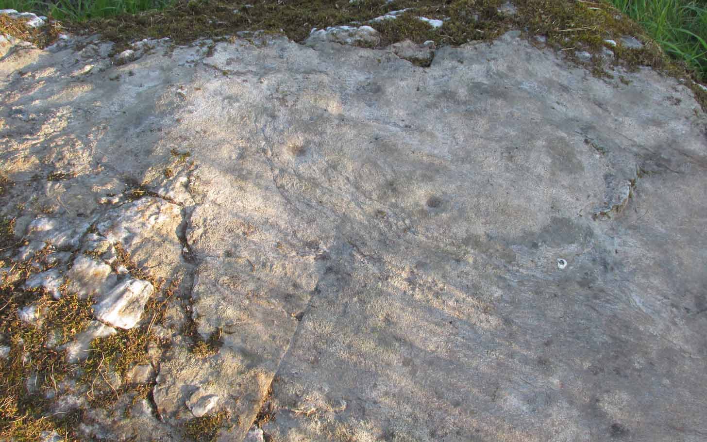
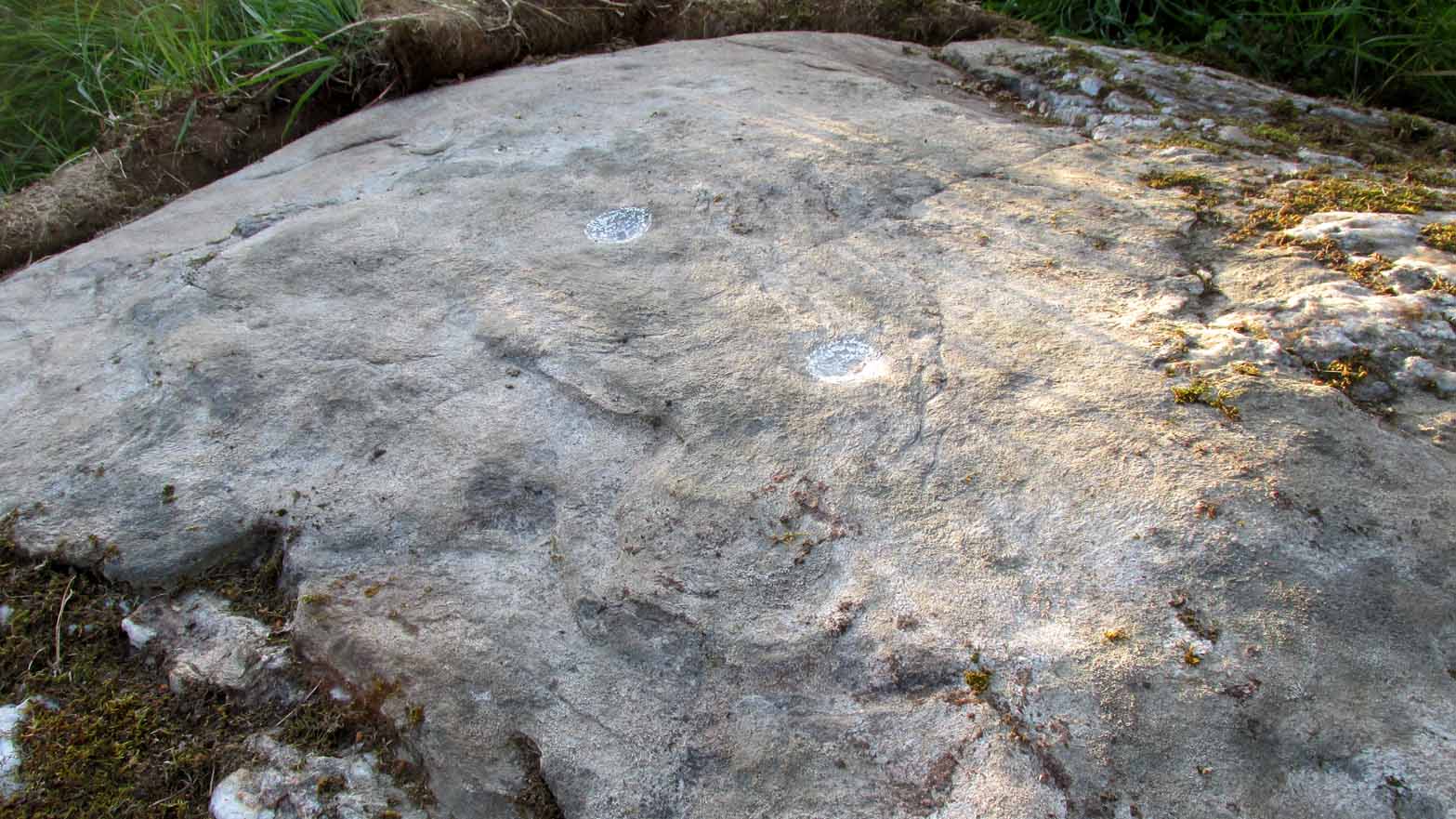
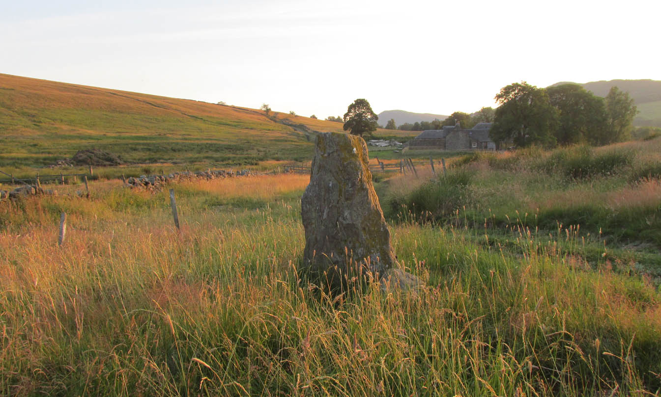
Out of Aberfeldy, take the A826 road as if you’re going up Glen Cochill. Not far up, just where the housing of Aberfeldy itself ends and the green fields open up either side of you, keep on the road for a half-mile where you meet a small copse of trees on your left, with a dirt-track that runs down the slope. Go down here and follow the slightly meandering track for 0.8 miles (1.3km), a short distance past the Ursa Major Stone where the track splits. Take the track to the left and there, less than 100 yards on you’ll hit a large boulder on your left. That’s it!
Archaeology & History
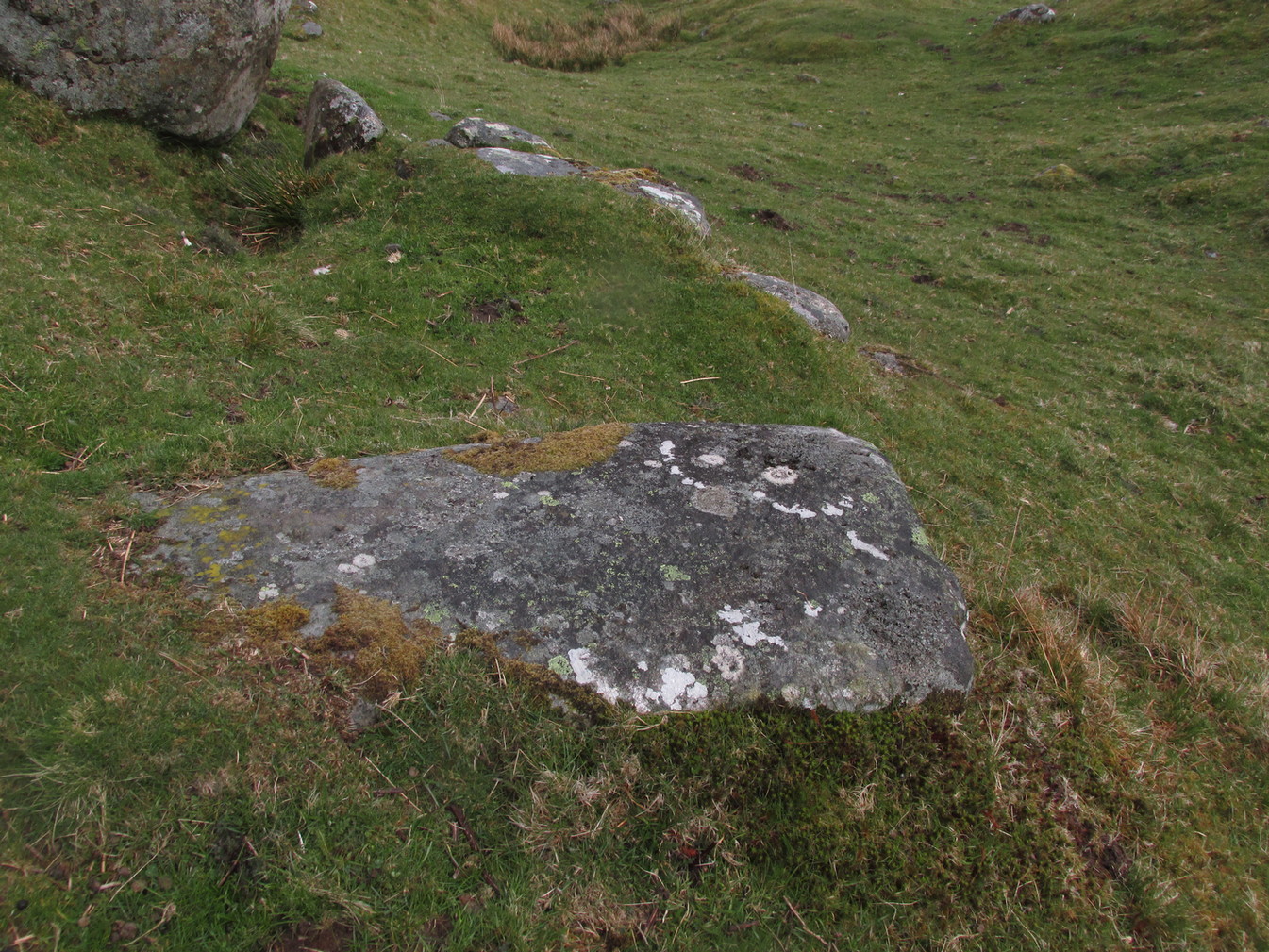
Not previously recorded, this simple cup-marked stone will probably only be of interest to petroglyph aficionados, or those folk who are into ‘energies’ at sites. This latter aspect is due entirely to the carving being etched onto a huge rock, much of which is composed of quartz—which isn’t too unusual in this part of the world. But that aside…
Looking down at the cupsThe cupmarks highlighted
It is one in a group of carvings within a few hundred yards of each other, with its nearest neighbour 20 yards to the north. That one’s covered in cups—but on this large Quartz Stone, only two of them exist, on the top near the centre. Just a couple of inches across and half-an-inch deep, they’re pretty clear once you see them. The raised piece of ground behind the stone is artificial and has variously been described by antiquarians and archaeologist alike, as either a prehistoric dun, or a stone circle. Whatever it may be, some of it is certainly man-made. Check it out – and mebbe ask the friendly fat fella who lives nearby and what he thinks.
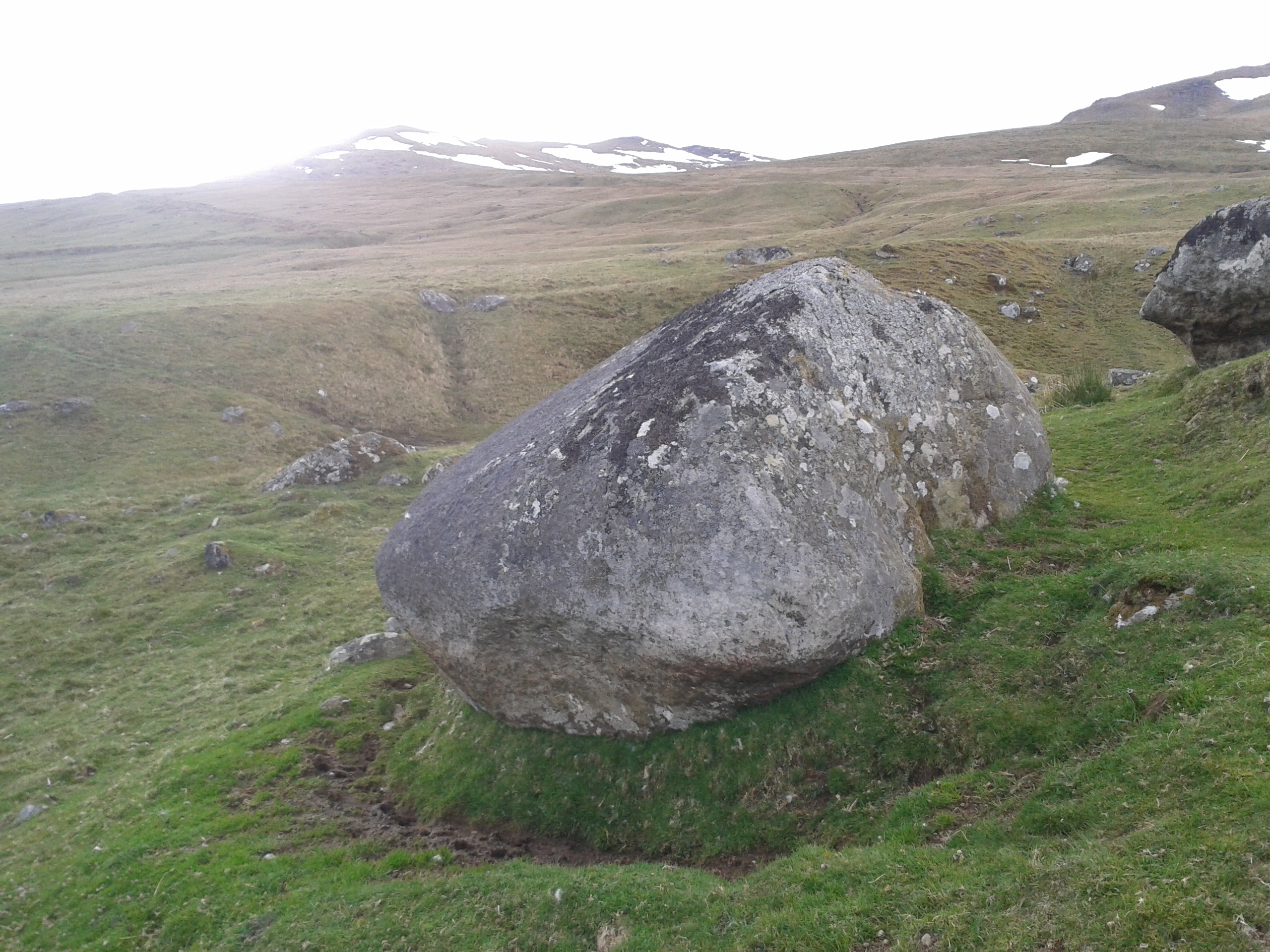
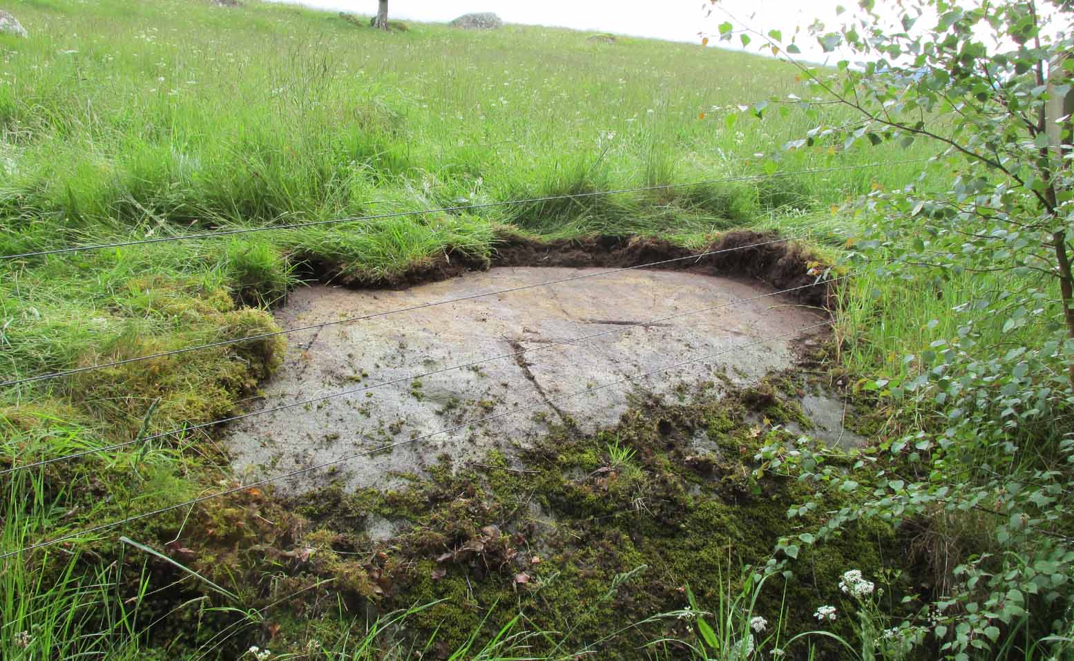
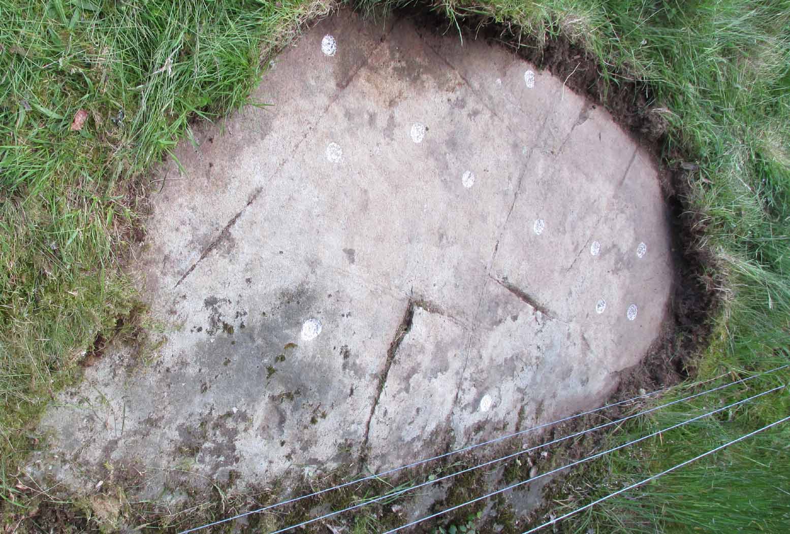
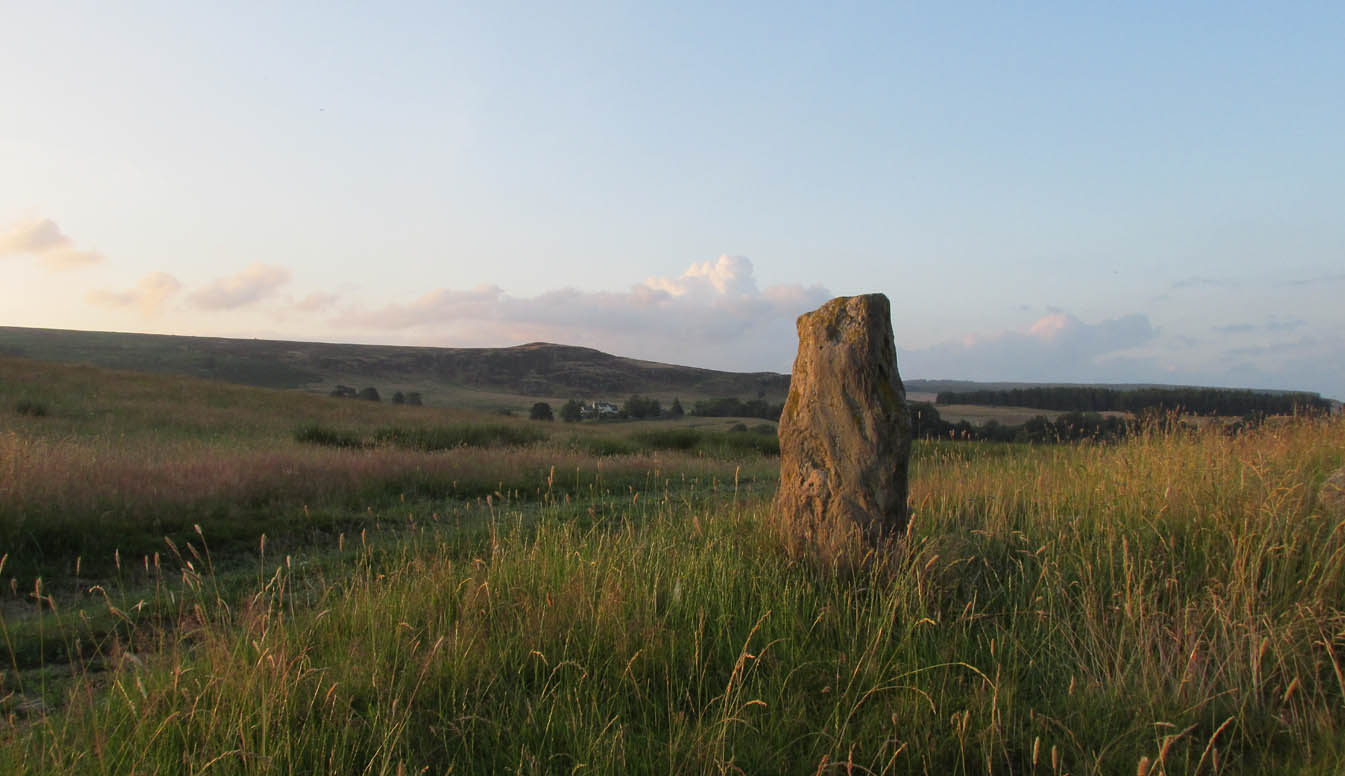
Out of Aberfeldy, take the A826 road as if you’re going up Glen Cochill. Not far up, just where the housing of Aberfeldy itself ends and the green fields open up either side of you, keep on the road for a half-mile where you meet a small copse of trees on your left, with a dirt-track that runs down the slope. Go down the track, bending to the right, then the left and then on for a quarter of a mile until the lines of trees appear either side of you. Barely 200 yards along, the track swerves slowly to your right, and the field above you slopes uphill. Keep your eyes peeled at the fencing on your right and you’ll see a stone sloping towards you right by the fence with faint cup-marks on it. You’ll find it!
Archaeology & History
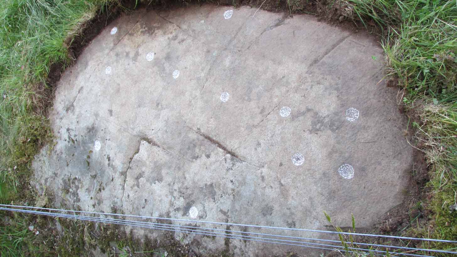
A truly fascinating cup-marked stone recently uncovered by Paul Hornby on another one of our TNA meanderings. Fascinating because of the curious arrangement of the cups on the stone. Often, cup-marked stones have little to interest the causal visitor – but this one’s different. As can be seen quite clearly, the cups are arranged in the shape of the constellation of the Great Bear, or Ursa Major – albeit with an extra ‘star’ in this design. But it’s damn close! In all likelihood (he says with his sceptical head on 😉 ), the design is fortuitous when it comes to the Ursa Major. I know from many years experience how easy it is to see meaningful shapes and designs in the almost entirely abstract British petroglyphs, but the design is very close to the constellation we all got to know when we were kids.
Looking along the stoneGazing down at Ursa Major
The stone itself slopes upwards at an angle of about 60º, before starting to level out as it rises. All of the cup-marks have been pecked onto this sloping surface (the vast majority of carvings are found on top of stones). Altogether, at least twelve faint and shallow cups were exposed when we looked at it—measuring the usual inch to inch-and-half across—but it is likely that more of them are hidden beneath the turf at the top of the stone. We could discern no rings or other features in the design.
This is just one carving amidst a good cluster of petroglyphs within a few hundred yards of each other (the Quartz Stone being one of the nearest) that are well worth checking out if you like your rock art. It may also be of interest to astronomy students, or those exploring archaeo-astronomy.
References:
Yellowlees, Sonia, Cupmarked Stones in Strathtay, RCHAMS 2004.
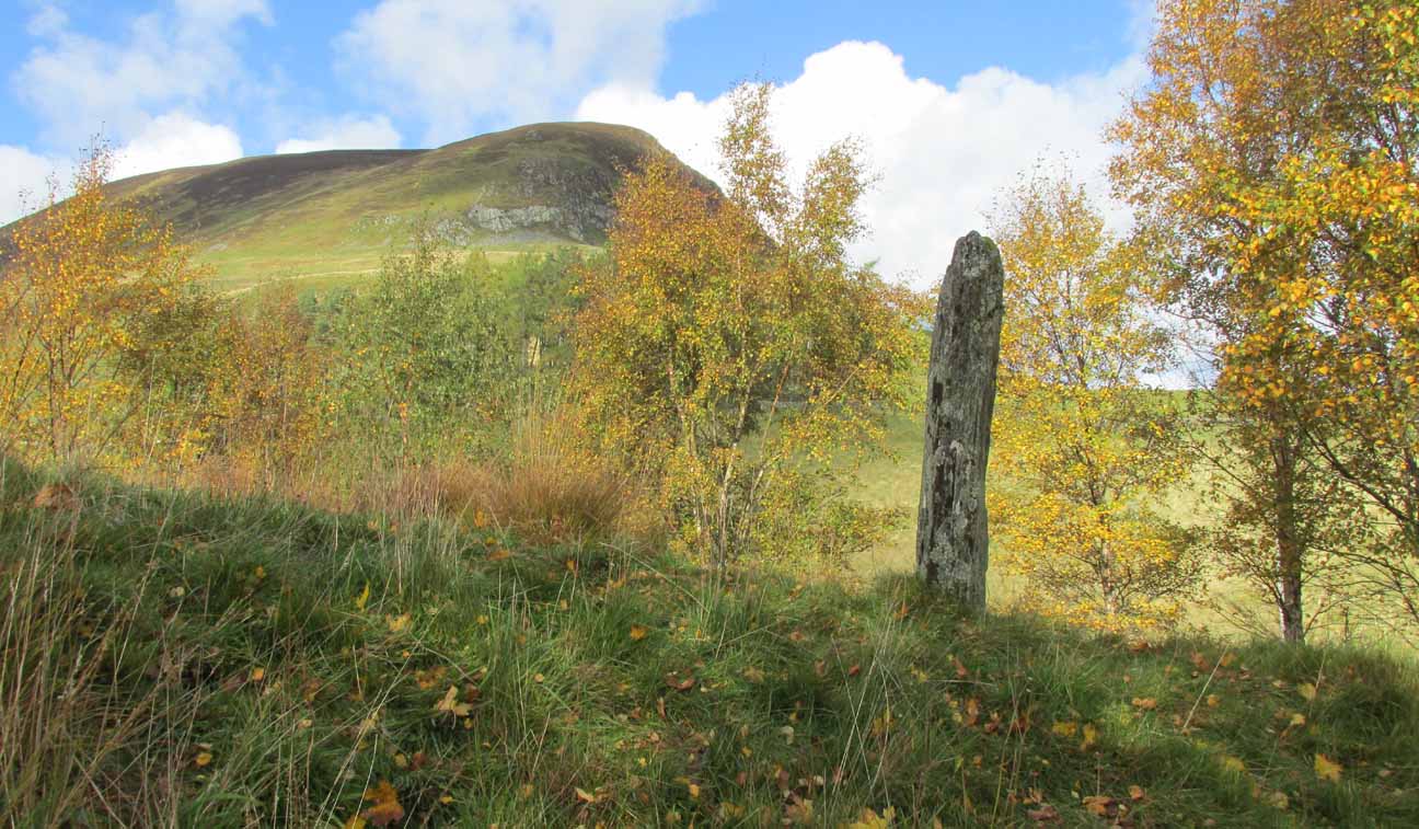
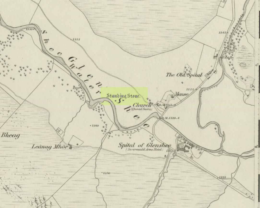
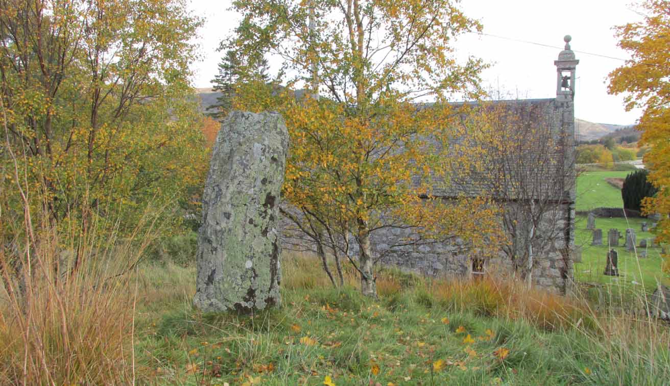
Take to A93 road, north, between Blairgowrie and Braemar, keeping your eyes peeled many miles on, to turn left along the minor road as you approach the tiny Spittal of Glenshee hamlet. Just as you go over the ancient bridge, park up on your left, below the church. Walk round the back of the church and you’ll see a large tree-covered mound. Walk onto its top.
Archaeology & History
Stone marked on 1862 map
This quiet, almost hidden, six-foot tall standing stone on what initially seems to be a large fairy mound or tumulus at the back of the rude church, has been occluded from general view (in my opinion, deliberately) by the construction of the more debased christian edifice right in front of it. But it detracts not from its gentle majesty once you reach its ancient body, atop of the old hill.
The stone is one in a cluster of prehistoric sites in and around this Glen of the Fairy Folk (as its name tells), where the rivers Shee and Beag converge. If the church didn’t obstruct the view, some of the other sites would have been visible from here.
Folklore
The old stone, looking east
Folklore tells that when the christians came into the Glen to build a church—initially a half-mile or so to the east—the little people were much annoyed at the actions of the incomers, as it intruded on one of their sacred rings of stone close by. By night they came out, and every stone that had been laid by the christians in the day was removed. Each day the insensitive christians came and built their church without asking, and each night the little people removed it. Eventually an agreement was made, and the fairies let them build the church next to this standing stone. So goes the tale….
A veritable cluster of stories about Fingal, Ossian, Dermid and Grianne scatter this area, with many of them relating to ancient sites, but I’ve not found one directly relating to this stone.
References:
Miller, T.D., Tales of a Highland Parish, Munro Press: Perth 1929.
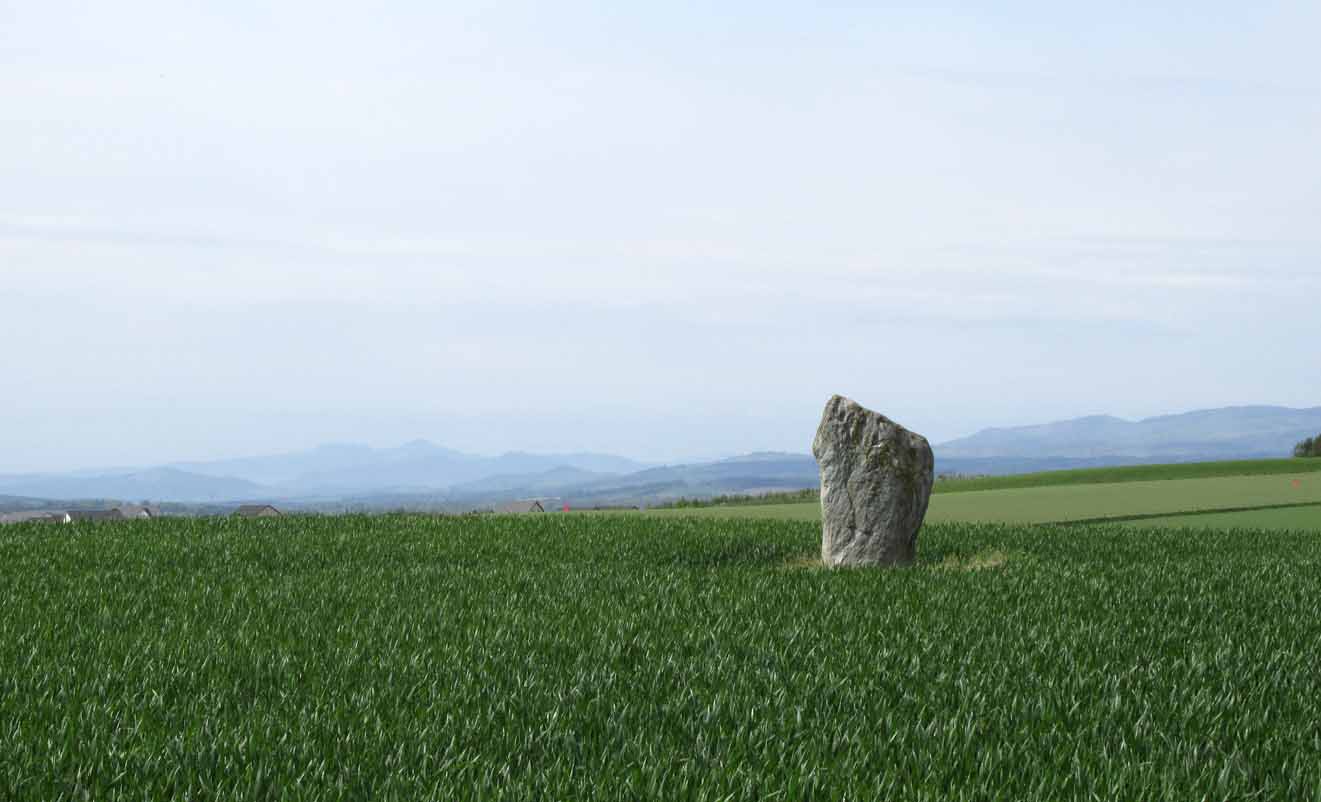
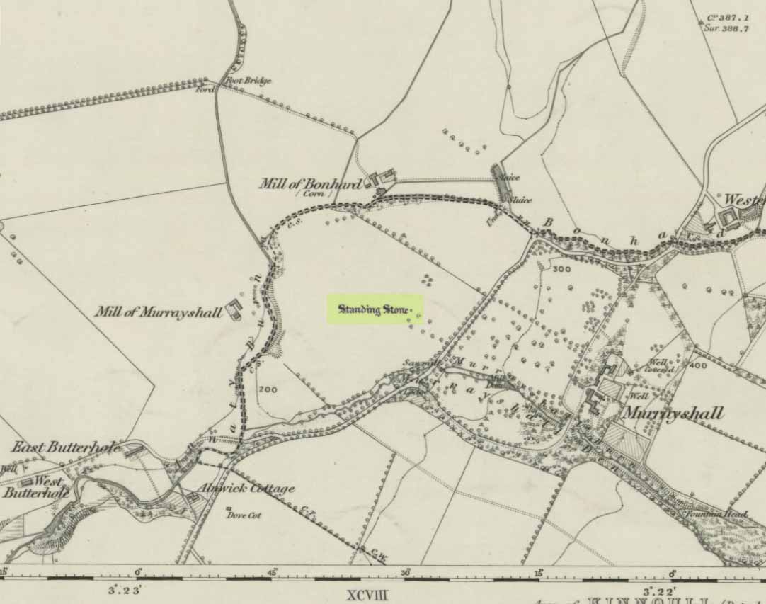
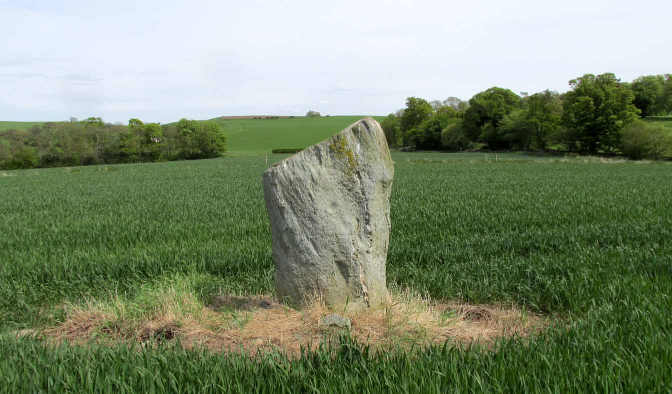
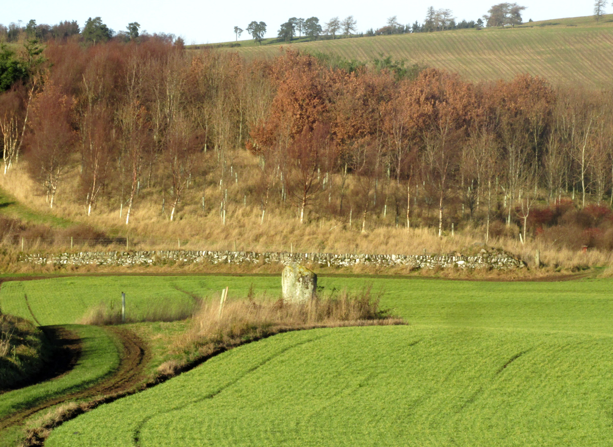
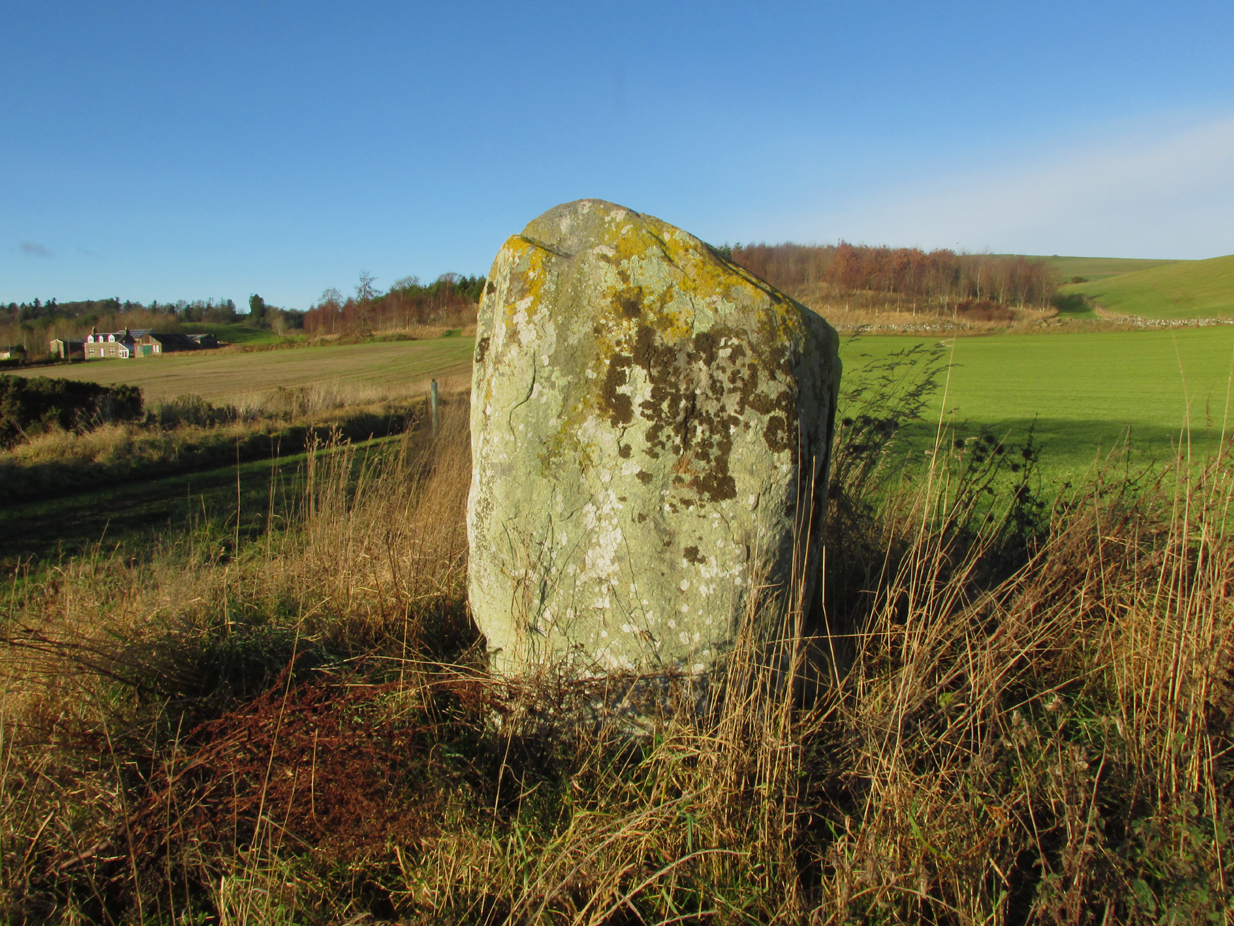
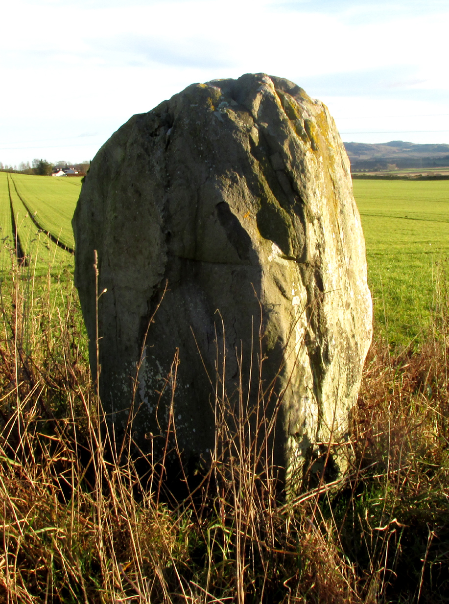
On the main road (A94) through Scone, go east along either Murrayshall Road or Bonhard Road for a short distance until you go out of the town and into the countryside. About ⅓-mile (0.5km) along the country lane, go left at the road junction; and just another ¼-mile on, notice the field-gate on your left. As you’ll see, the standing stone is just over 100 yards away in that field.
Archaeology & History
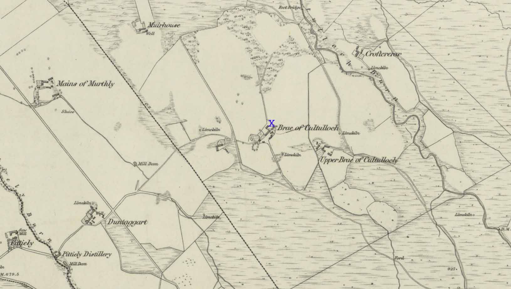
Murrayshall on 1867 map
In a region littered with megaliths, this fine upright single stone stands, quite deliberately, at a point in the field where you have excellent 360° views, which to the north looks way into the orgasm of the Scottish mountains. History and tradition seem to tell it has always been a loner, without companions, but no archaeological excavation has taken place here to my knowledge; and the apparent proximity of some type of prehistoric ring-ditch 30 yards away may be related to the stone. But we don’t for sure…
Close-up of cupmark
North-face with cupmark
Despite being shown on the first OS-map of the region in 1867 and despite being a large monolith more than 6 feet tall, very little seems to have been said of it. It was included in Swarbrick’s (2012) poorly arranged survey; and the Royal Commission (1994) merely listed it, without comment, other than to say “it bears no markings.” Yet when Paul Hornby and I visited the place recently, a large single cup-mark is plain to see on the north-face of the stone.
Although the stone is alone in this field, once you start exploring the hills a short distance to the south and the farmed fields heading north and east, masses of prehistoric sites begin to appear. It’s well worth checking out!
References:
Royal Commission on the Ancient & Historical Monuments of Scotland, South-East Perth: An Archaeological Landscape, HMSO: Edinburgh 1994.
Swarbrick, Olaf, A Gazetteer of Prehistoric Standing Stones in Great Britain, BAR: Oxford 2012.
Acknowledgements: Huge thanks as always to Paul Hornby for getting us to this site. Plus, accreditation of early OS-map usage is reproduced with the permission of the National Library of Scotland.
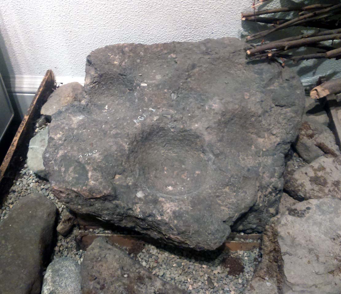
This is a curious stone and may not be the type of ‘cup-marked’ rock we’re used to. Maybe… It is presently housed in Stirling’s Smith Art Gallery & Museum, where a small note tells that is was originally found “on the top of the Ochils, near Mount Alt Farm, Path of Condie in 1893.” The stone was found at the same time, and adjacent to, a prehistoric collared urn—which implies it had an association with a cairn or cist, or burial site of some sort (which isn’t uncommon). However, the exact location of its original whereabouts has been forgotten.
Broken off from a larger piece of stone, the remaining piece of rock has six cup-markings cut into it, between one and three inches across. The smallest cup is what we might call a ‘normal’ size, but the rest of them get increasingly large and may have been more functional than purely mythic in nature. In a small note attached to the stone in the Museum, they add the interesting note that,
“There are…indications that in some places they may be related to transhumance: the practice of moving sheep, cattle and goats to higher pastures in the summer, where they may have been used to mark routes or sources of water.”
They may indeed – amongst a variety of other things too. But the suggested relationship with cattle occurs in stones found near Haworth, West Yorkshire, where large man-affected carved ‘cups’ such as the ones here, were known to be filled with milk at specific times of Nature’s calendrical rhythms, for the spirits of the place to give good fortune to the farmer and local people. We know of one instance where this practice still occurs and goes back generations in the same family. Examples of this animistic practice have also been found in the Scottish Highlands.
Along the A822 road between Dunkeld and Milton, 4.7 miles (7.6km) west of the A9, turn left down the track signposted ‘Meikle Findowie’. About 700 yards along the track you’ll reach a modernised farmhouse and here, on your left, a track takes you eastwards (left). Go along here for about 100 yards until, just before the modernised house on your right (it was just a pile of ruins when we came here), you’ll see the standing stone in front of it.
Archaeology & History
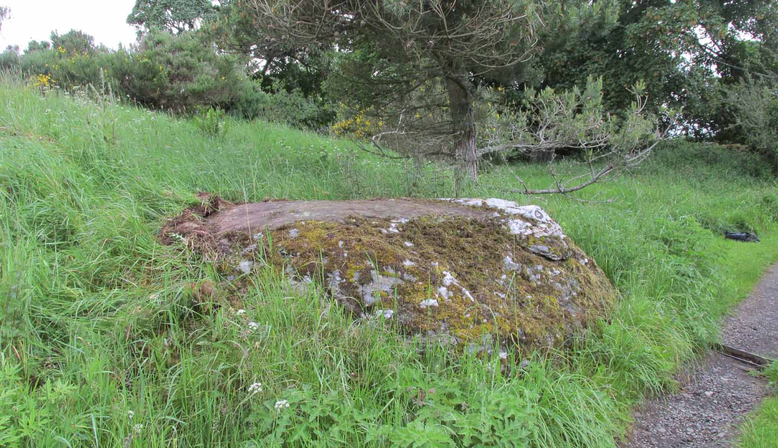
Looking westwards
Beside the old trackway that runs east-west past Meikle Findowie, above the ancient flood-plain of the breathing River Braan, a solitary stone lives by the more modern shadow of old sheep-folds. Tis a quiet little fella, less than 5 feet tall, that you could almost pass as a forgotten gatepost if you chattered when walking by. But it’s much more ancient than any old gate…
It nestles below the old hill of Airlich, with its beautiful stone circle and huge ancient enclosures higher up: a chunky old stone with no carvings or other human marks upon it. Tis a site site worth visiting before heading uphill, to the megalithic ring of enchantment.
Acknowledgements: Huge thanks as always to Paul Hornby for getting us to this site.
Just less than a mile east of Blairgowrie, the site is situated about 200 yards along a farm track that runs north from the A926 Rattray – Alyth Road. This road is narrow with a lot of bends and very busy, with no safe parking places. It is best to walk from Rattray, the stone will be seen in the field just east of Drumend Farm.
Archaeology & History
There is one stone here that survives from a megalithic ring that was progressively destroyed some time between the publication of the 1792 Old Statistical Account and the publication of the 1867 OS map. Reverend James Smith, writing in the 1792 Statistical Account, told us:
“Above the river, SE from the village, in a beautiful situation, is a Druidical temple, much defaced, and many of the stones carried off. The farm upon which it has been built, is called Standing Stones.”
Reverend William Herdman wrote patronisingly in the 1845 New Statistical Account:
“If large graystones be entitled to the appellation of antiquities, or are any indication of the religious worship of our ancestors, a few of these appear in a field, thence called Standing Stanes, which are supposed to be the ruins of a Druidical Temple.”
Many years later, in the first few years of the 20th century, the great northern antiquarian and megalith writer, Fred Coles, visited the site and gave this description in 1909:
“Standing Stone on the Farm of Standing Stone, Old Rattray. [A] monolith attracts our notice, in a field on the north of the main road, one mile and a quarter east of the middle of Old Rattray village. The height above sea-level is 270 feet. This monolith …[has a] mineralogical composition …more analogous to the quartziferous schists so frequently found in the vicinity.
The top is smooth, with an inclination towards the south-east, and the whole mass is squarish and pillar-like. It is set up with the longer axis N.E. 50° and S.W. 50°. The highest point is 5 feet 1 inch above ground, the basal girth 8 feet, but rather more than mid-way up it increases to 10 feet 4 inches.
In this lower-lying district, comprising an area of about 35 square miles, the megalithic remains are extremely sparse. Agricultural operations, doubtless, have swept away some monoliths, and possibly also whole circles of stones; but at any rate it is somewhat significant that only four Standing Stones are now left, and that there is no record on the maps of any other variety of sepulchral structure.”
This brave survivor has a commanding position over the valley of the River Ericht, and again we can only lament the loss of its companions, but be thankful it too didn’t fall prey to ‘agricultural improvements’ or religious bigotry.
References:
Smith, Rev.James, Old Statistical Account, Perthshire, Parish of Rattray, 1792. #
Herdman, Rev. William, New Statistical Account, Perthshire, Parish of Rattray, 1845.
Coles F.R., ‘Report on stone circles surveyed in Perthshire (South-East District), with measured plans and drawings; obtained under the Gunning Fellowship’, Proc. Soc. Antiq. Scot., vol. 43, 1908-9.