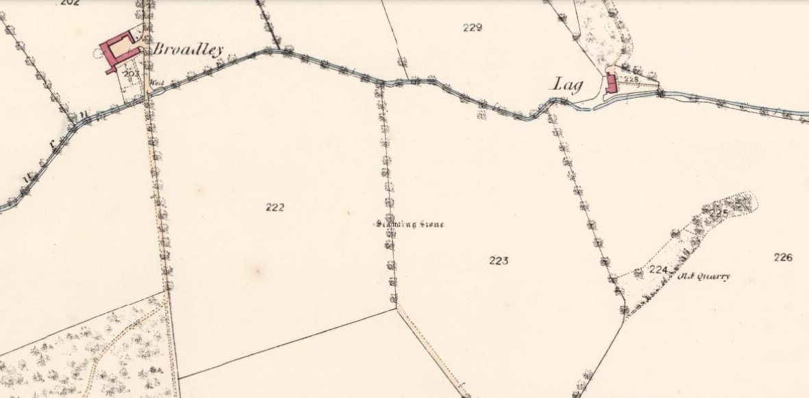
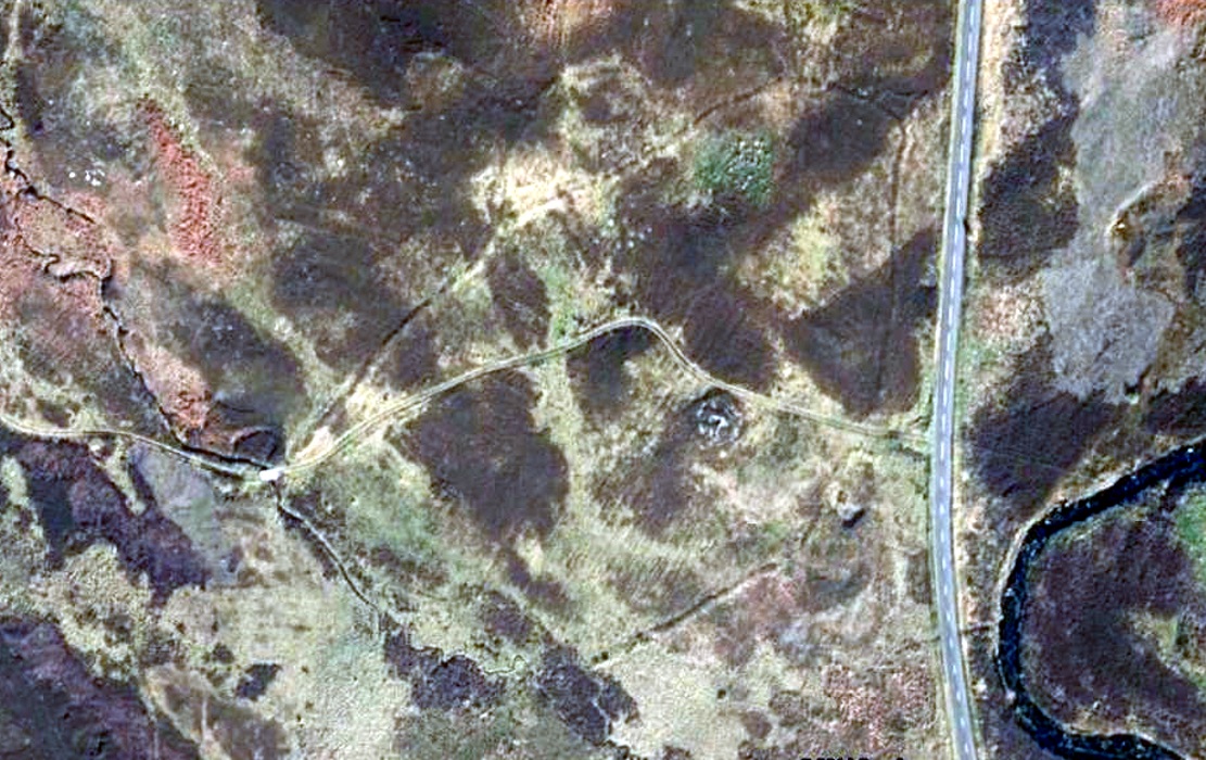
Take the A822 road south out of Crieff and less than half a mile down, in a field on the east side of the road is the giant solitary standing stone of Dargill. On the opposite side of the road from here (roughly) is a small country lane. Go along here and past the third field on your left, park up. Look down the fields for a coupla hundred yards and you’ll see the standing stone. Make your way there by following the field-edges.
Archaeology & History
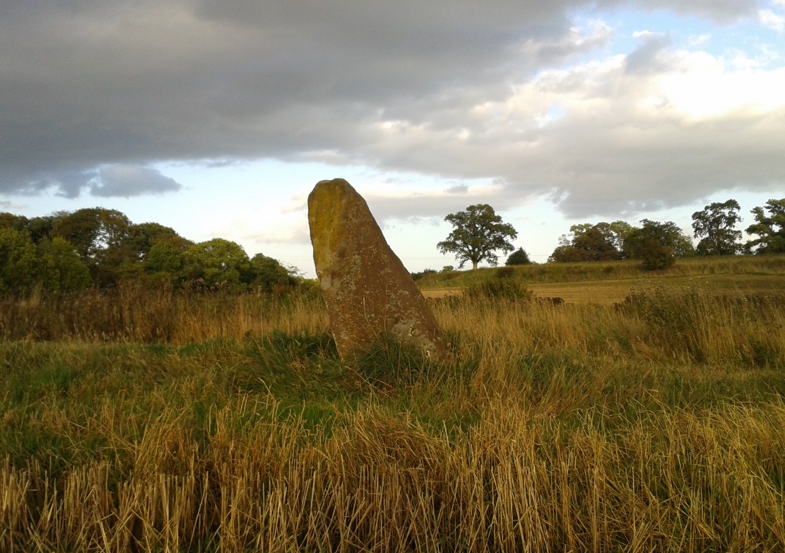
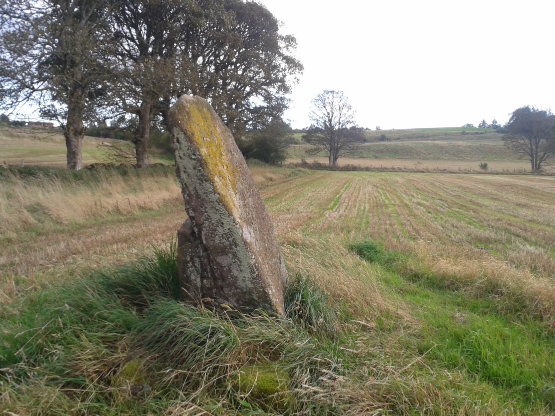
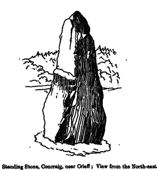
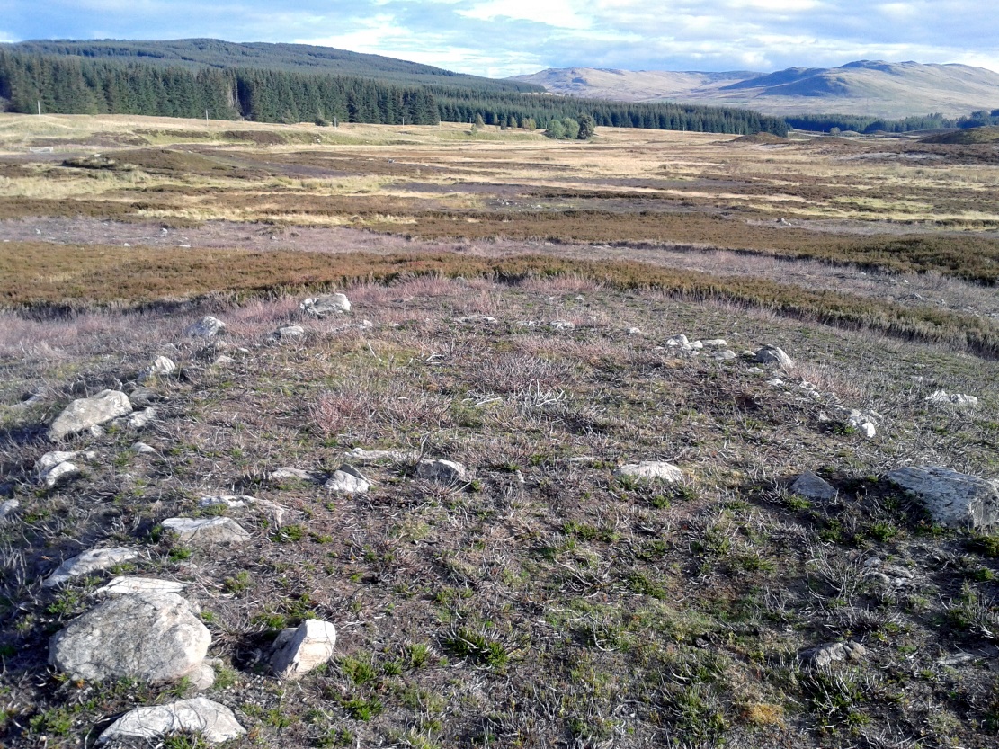
Concraig stone, near Crieff
Closer to the larger town of Crieff than it is to the village of Muthill, this seven-foot tall standing stone, leaning at an angle to the north and with a small scatter of stones around its base, stands alone near the side of the field, feeling as if others once lived close by. It’s set within a distinctly nurturing landscape, enclosed all round instead of shouting out to the hills, with that nourishing female quality, less commonly found than those stones on the high open moors. The only real ‘opening’ into a wider landscape here was mentioned by the local writer Andrew Finlayson (2010), “to the distant east.” Whether this possessed any astronomical-calendrical importance hasn’t yet been explored.
Concraig, looking southFred Coles 1911 sketch
The stone was first highlighted on the 1863 Ordnance Survey map—and described in their Name Book as “a large upright Stone adjacent to and South-east of Broadley about 8 feet high and traditionally said to be either the remains of a Druidical Temple or in some way associated with the Druidical period”—but since then it hasn’t fared very well in antiquarian tomes. Fred Coles (1911), as usual, noted it in one of his Perthshire surveys, but could find very little information from local people about the place, simply telling us that,
“in an open field about 300 yards to the north-west of Concraig, there stands this irregularly four-sided block of conglomerate schist… The stone measures 9 feet 3 inches round the base and stands 7 feet 3 inches in height. About halfway up its eastern face it has been broken so as to leave a very distinct ledge.”
What appears to be cup-markings on the southern-face of the stone are just Nature’s handiwork.
Take the directions to find the Carn Ban giant cairn. Once there, you’re in the middle of the enclosure—or near enough!
Archaeology & History
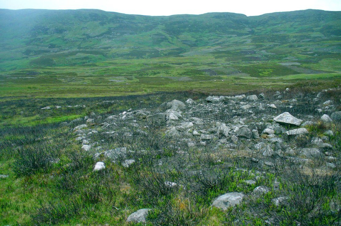
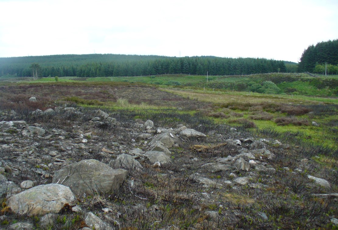
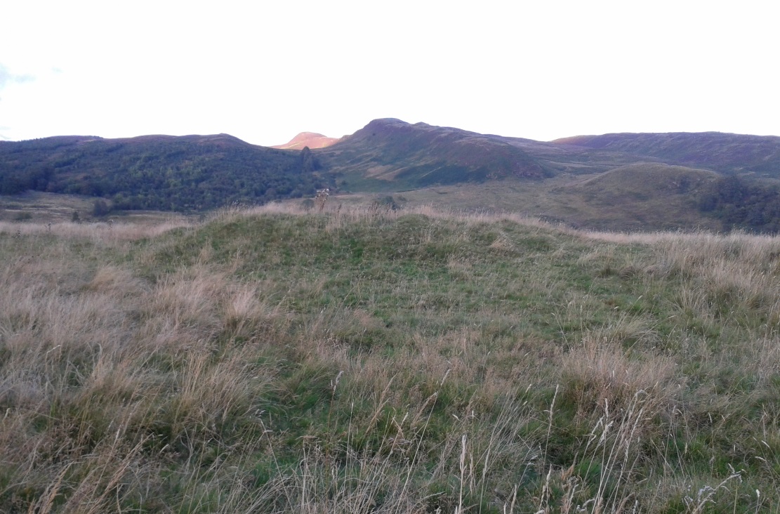
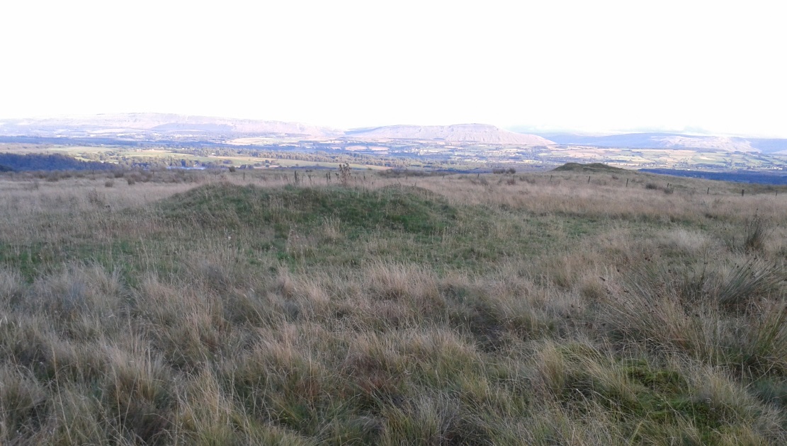
This is one of several very large extensive prehistoric enclosures that stretch across the undulating rocky plains of this wild moorland, high up below the mountain-tops south of Aberfeldy. Although humans are scarce up here nowadays, in ancient times it was a very different ballgame.
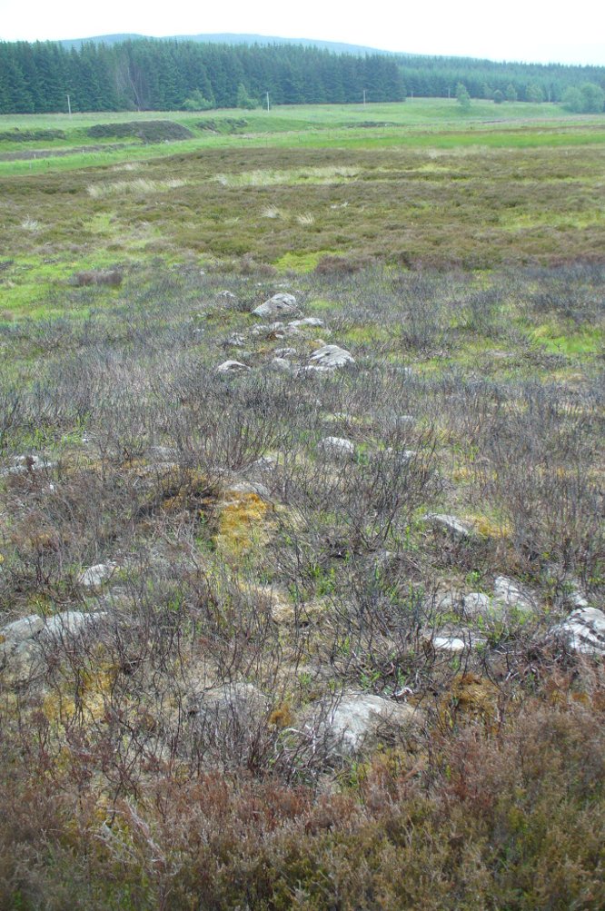
Internal line of wallingEastern edge walls
Extensive and well constructed walling, measuring an average of 2-3 yards across and several feet high in places, encircles the giant White Cairn some distance away from it, running for a third-of-a-mile (0.5km) in a contorted oval shape. The walling is pretty much continuous except for where the modern tracks have destroyed two sections of it (and other monuments within) and where entrances or ‘doors’ allowed access on the west, north and eastern sides. The circuitous route of the walls appears to start and end at a small unnamed stream at its southern end.
Outer northeastern walling
Inside the perimeter walls, there are scattered examples of simple hut circles and cairns—some singular, others for families, and others that may be clearance cairns. It’s difficult to say without excavations. On the top northwestern side of the enclosure there is another, smaller enclosure attached to the main mass—seemingly earlier in construction than the giant creature its attached to—which overlooks the curious Shaman’s Lodge double hut-circle 75 yards to the west. This and much of the internal area was, when we visited, covered in extensive and deep heather, so we couldn’t get a clear picture of the entire site.
We might never know exactly how many people used this site, but we can say with some certainty, due to the remains found inside and around the place, that it was used by lots of people over many centuries, not just for what modern homo-profanus defines as ‘utilitarian’ purposes, but also important rituals were practised herein (though we are looking at an ahistorical period before the boundary of ‘sacred’ and ‘profane’ had been defined).
For antiquarians and explorers, this region is a must! A weekend of sleeping rough up here might well be in order!
References:
Stewart, Margaret E.C., “Strath Tay in the Second Millenium BC – A Field Survey”, in Proceedings Society Antiquaries Scotland, volume 92, 1961
Acknowledgements: Huge thanks again to Paul Hornby for his assistance with site inspection, and additional use of his photos.
Take the same directions to reach the giant Carn Ban prehistoric tomb. Follow the track past the tomb further onto the moorland until you reach a small wooden bridge over the small burn. From here, walk straight north off-path onto the moor for 100 yards and a small rise in the land, with several cairns just below it, is the site in question.
Archaeology & History
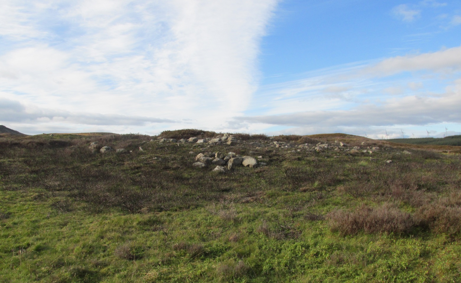
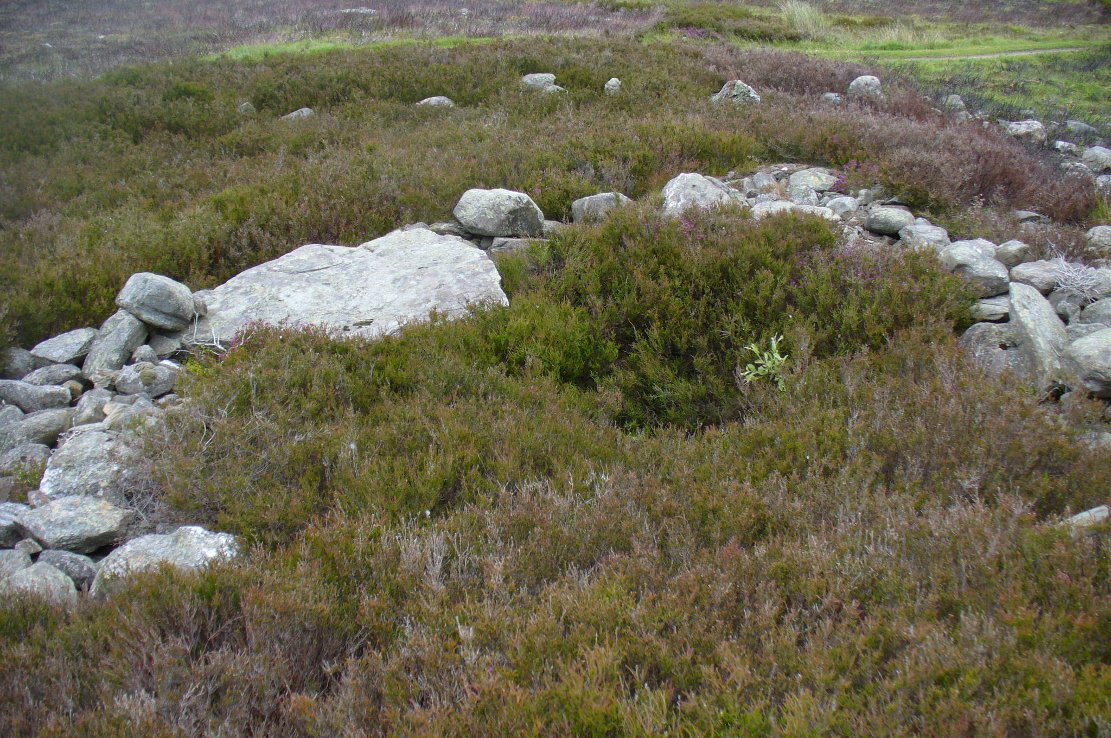
Hut circle are hut circles – right? Well, usually that’s the case. We find them attached to, or within, or outlying prehistoric enclosures and can date from anywhere between the neolithic and Iron Age periods. With the site we’re looking at here, on the outer western side of Glen Cochill’s southernmost giant enclosure, there’s something amiss….or maybe that should be, “something rather peculiar.”
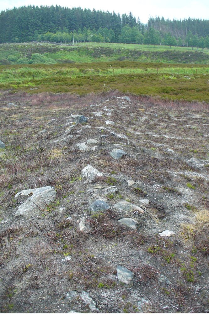
Mr Hornby, hut-sideShamans Lodge walling
Paul Hornby found it a few weeks ago during an exploration of the region’s prehistory. We went in search of, and found, the giant Carn Ban close by, but noticed curious archaeological undulations ebbing in and out of the heathlands: cairns, walls, hut circles, settlements, more cairns—and then this!
Consisting of two slightly larger-than-average ovals of walled stone, probably Bronze Age in date, the first impression was of a remarkably well-preserved site (and that it is!), seemingly of an elongated stretch of walling, with a central wall that split it into two halves. Each ‘hut circle’ was found to be between six and seven yards across, with the two conjoined architectural features giving an overall NW-SE length of 14 yards. But the more we looked at this, the more obvious it became that this was originally one single hut circle—the lower southeastern one—with an additional one that was added and attached onto the northwestern side at a later date, probably several centuries later.
Lower earlier hut circle, with upper later hut circle attached
Walking around the structure we found that the very well-preserved walls—about 2 feet wide in places and rising a foot or so above the compacted peat—had been built onto a raised platform of earth. This was no ordinary hut circle! The ground beneath it seems to have been raised and supported and on the southern side in particular it is notable that other building stones are compacted into the peat. There may even be the remains of a secondary outer wall on this southern edge, where it seems that the entrance was made.
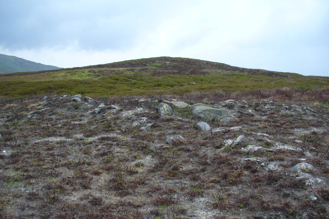
Small group of cairns 15 yards away
Here’s the curious bit: immediately outside the northwestern and southern walls are small prehistoric tombs, or cairns. Not just one or two, but more than a dozen of them, all constructed within 20 yards of this curiously raised double hut circle. Literally, a small prehistoric house of some form was raised in the centre of a prehistoric graveyard—and it doesn’t end here.
Of at least three giant enclosures in this region, and what looks like a very well-preserved prehistoric tribal hall or meeting place, there are upwards of a hundred tombs scattered nearby. Two cairn circles were also found about 100 yards to the north, one of which was damaged by a military road a few centuries ago.
Close-up of walling
I give this double-roomed abode the somewhat provocative title of the Shaman’s Lodge because of its setting: surrounded by tombs, the ‘house’ would seem to have been a deliberate setting erected in the Land of the Dead here. I hope you can forgive my imaginative mind seeing this as a structure where, perhaps, a medicine woman would give rites to the dead, either for those being buried in the small graves, or rites relating to the giant White Cairn of the ancestors close by. Shamans of one form or another occur in every culture on Earth and have been traced throughout all early cultures. If no such individuals ever existed within the British Isles, someone needs to paint one helluva good reason as to why they believe such a thing….
When the heather grows back here, the site will disappear again beneath the vegetation. It is unlikely to re-appear for quite sometime, so I recommend that anyone wanting to have a look at this does so pretty quick before our Earth covers it once again….
References:
Stewart, Margaret E.C., “Strath Tay in the Second Millenium BC – A Field Survey”, in Proceedings Society Antiquaries Scotland, volume 92, 1961
Acknowledgements: Huge thanks again to Paul Hornby for his assistance with site inspection, and additional use of his photos.
Take the A826 road south out of Aberfeldy, uphill – and uphill. Several miles up, past the roadside Loch na Craige, and past the solitary farmhouse of Scotston, you’re getting close. A few hundred yards past here watch out for the small bridge over the small burn; and literally another half-mile past this, keep your eyes peeled for the small track on your right, onto the moors. Walk 70 yards on the track and there, on your left, it rises from the heather!
Archaeology & History
Carn Ban, Glen Cochill (photo credit, Paul Hornby)
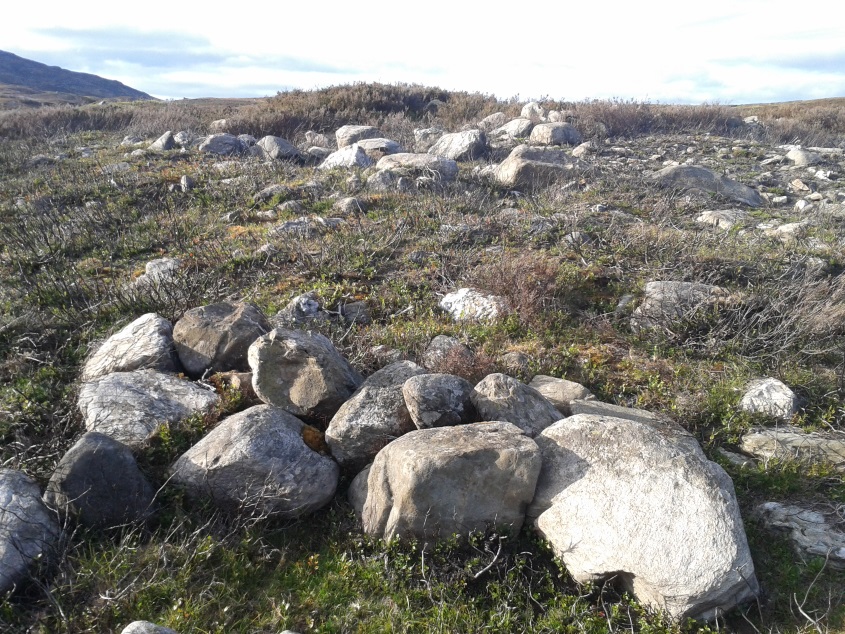
This giant neolithic tomb in the middle of a beautiful nowhere is perhaps the tomb of an ancestral King or Queen, later idolised into creation myths by our heathen ancestors who, we know, lived across this huge moorland plain for countless centuries. One account tells that “a circle of free-standing boulders set at irregular intervals” used to surround the cairn, but this seems to have gone.
Southeastern quadrant
Measuring 21 yards (19.2m) across east-west, and just over 21 yards (19.3m) north-south, this is quite a large construction made up of thousands of small stones in a near-perfect ring that measures 68 yards (62m) in circumference. The cairn seems to have been built in three layers, with its outer defining ring of medium-sized rocks, upon which a layer of typical cairn-spoil stones were laid. A couple of yards within this, a second internal ring has been set consisting of much larger stones, more typical of those found in small stone circles or average ring-cairns. Within this, the cairn seems to have been raised again and another large deposit of countless stones were scattered, with many pieces of white quartz (very common in this area) incorporated in the construction.
Capstone and outer ringSection of internal ring
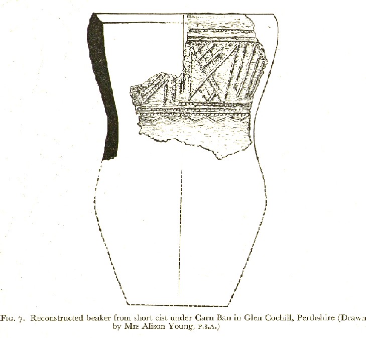
At the very centre of the cairn, at least one large central ‘tomb’ or cist is clearly evident. Within this cist were found the severely damaged ruins of a small decorated beaker, in which, perhaps, the ashes of the dead might have once been found. A very large and heavy capstone that covered the central tomb, has been rolled over and lays just off-centre. No rock art seems visible on this capstone, but we were unable to check its underside. When standing here at the middle of the tomb, you are four feet above the average ground-level of the surrounding moorland.
Section of cairn edgeImaginative reconstruction of beaker in central tomb
Curiously and erroneously reported by Margaret Stewart (1961) to have “been completely removed”, this large and very visible monument lives near the middle of a very large and extensive prehistoric enclosure, whose walled remains extend for some distance all round this section of the moors. Within this arena we find large numbers of other architectural features, including many smaller cairns, some hut circles and additional lines of internal prehistoric walling. Just a few yards south of the tomb itself, we can clearly see a length of walling running east-west and another seemingly reaching up to the White Cairn. Whether these were built at the same time, or later, is difficult to say.
In the event that you visit this site, take your time! All round here, mainly to the north and west, you will find masses of prehistoric remains, none of which has been adequately excavated. A few hundred yards north is an extended necropolis that doesn’t appear to have been surveyed.
References:
Stewart, Margaret E.C., “Strath Tay in the Second Millenium BC – A Field Survey”, in Proceedings Society Antiquaries Scotland, volume 92, 1961
Acknowledgements: Huge thanks again to Paul Hornby for his assistance with site inspection, and additional use of his photos.
Take the same directions to locate the cup-and-ring stone of Ballochraggan 12. There are several rocks adjacent. The one immediately next to it, to the northeast, is the one you’re looking for. Be gentle and careful if you’re gonna look at it — deadly serious, be very careful indeed!
Archaeology & History
One of the most intriguing and most fascinating of all the prehistoric carvings I’ve yet to discover. Not that this was all my own work. If it hadn’t been for Paul Hornby, we might have simply walked past it as being little more than a single cup-marked stone—and in this area, single cup-marks tend to be little more than geological in nature.
After we’d looked over several of the registered carvings close by, I did my usual meandering back and forth, stroking stones and seeing if there were any carvings that had been missed by previous surveyors. And in walking past a small piece of smooth rock, a singular cupmark seemed to stand out. I walked past it, shouting across to my colleague.
“It looks like we’ve got a single cup-mark here Paul,” I said, “with possible half-ring.” Thankfully Mr Hornby gave it his better attention.
Mask Stone, with faint ‘urn’Close-up of features
The sun was still out and shining across the smooth rock surface, which tends to mean that you’re not seeing any carving on the stone quite as good as it actually is. Thankfully however, the sun was beginning to get lower and, when this happens, if we wet the rock, any carvings that might be there stand out much better. And this little fella just seemed to get better and more curious the more attention Paul gave it!
The first thing that became obvious were a series of faint carved lines above the single cup-mark. Initially these didn’t seem to merit much attention (straight lines on rock are usually more the product of geophysical action than that of humans), but as the rock got wetter, Paul saw something very distinct indeed.
“There’s a face on it!” he exclaimed. And indeed there was. A Rorschach response no doubt, but it was still very much like a face. This looked for all the world akin to the stylised olde English gentry sort of countenance, as in old cartoons. It was quite ‘distinct’, as such characters themselves insist on being! Yet around this initial face, more lines seemed to be emerging as the stone gave up more and more of its hidden story.
Standing back from an initial investigation, the carving was seen to consist of a triple-ring, but without the traditional ‘cup’ in its centre. Instead, the centre was marked simply by a small ‘dot’—perhaps, originally, being a small conglomerate hole formed as a result of another tiny harder fragment of stone falling away from its larger mass. But a ‘dot’ it was. The other carved ‘lines’ however, immediately below and attached to the triple-ring, gave us something almost unique—and another strong Rorschach response. As the photos clearly show, we have a distinct second ‘face’ made up of the same lines but in a quite different form. This ‘face’ has all the attributes we usually associate with pictures of mythical spirits, demons, or a mask—hence the name!
Paul took a series of fine photos, hoping that he could catch the image that our eyes could clearly see. And thankfully, his digital camera brought the image to life even better than our eyes did! The ‘mask’ is comprised of carved lozenge forms, akin to the more decorative ones we find at Kilmartin, and more especially around Newgrange, Ireland. We sat and talked about this: wondering and working out routes that we’d take over mountains and moors, from Ireland, to Kilmartin, then onto Ballochraggan, etching the same designs onto the rocks hereby and attaching similar mythic notions to them: of shamanism and kingship; underworlds and journeys—paradigms lost and certainly misunderstood in the non-polysemia of many modern academics.
Lozenges and rings
…The stone here was still slightly covered over and, beneath the loose grasses, another feature emerged of another petroglyphic rarity. At the topmost western side of the rock a straight line ran across the surface, seemingly marked by the hand of man, with a curious little line almost doubling back on itself for just an inch or so, and then feeling to run down the stone, towards the concentric rings and the face below. When we stood back and took the photos, this line and its tracer took on a form that I’ve only seen echoed in one of the Netherlargie tombs at Kilmartin, Argyll, 44.4 miles (73km) to the west. It is very distinct.
The beaker, rings & ‘face’
Spuriously ascribed as being ‘axe’ carvings (oh how archaeologists love this Rorschach projection), the Netherlargie North tomb cover-stone in Kilmartin has a series of burial ‘urns’ or beakers carved onto the rock, amidst a scattered collection of cup markings. (Beckensall 2005:73-4; Bradley 1983:92-3; Royal Commission 1971:68-70; Twohig 1972, etc) Here too at Ballochraggan we find another such symbol, but just a singular example, much larger and more clearly a beaker or urn, as are traditionally found within many old neolithic and Bronze Age tombs; although no tomb is immediately apparent at this Ballochraggan carving.
The entire carving is very faint indeed (you can’t even see it when you’re looking directly at it unless conditions are good) showing that it remained open to the elements for thousands of years. Other adjacent carvings lack the erosion that we find on this one, even on those which, as archaeologist Lisa Samson said, is “softer sandstone rock than this one”—implying that it’s one of the older carvings in this incredible cluster.
References:
Beckensall, Stan, The Prehistoric Rock Art of Kilmartin, Kilmartin Trust: Kilmartin 2005.
Bradley, Richard, Altering the Earth, Society of Antiquaries Scotland: Edinburgh 1993.
Royal Commission on the Ancient & Historical Monuments of Scotland, Argyll – volume 6: Mid-Argyll and Cowal, HMSO: Edinburgh 1971.
Twohig, Elizabeth Shee, The Megalithic Art of Western Europe, Clarendon: Oxford 1981.
Acknowledgments: Huge thanks again to Mr Paul Hornby for his considerable help with this site, and for use of his photos.
Take the same directions as if you’re visiting the Ballochraggan 12 carving, or nearby standing stone. Literally 10 yards above the leaning monolith, you’ll see what looks like a glacial rock drop ahead of you (though it’s actually volcanic). That’s the stone you want!
Archaeology & History
A site that was first described in Maarten von Hoek’s (1989) survey of the area, where he told this carving to be “a loose boulder (that) bears 14 cups, some possibly natural.” There is very little doubt about it—many of the ‘cups’ on this stone are indeed natural, caused directly by the erosion and subsequent falling of conglomerate rock nodules coming away from the larger rock mass, leaving holes in it that look like cup-marks, but are blatantly natural in origin.
Close-up of the cups – natural or man-made?
When Paul Hornby and I visited the site on August 28, 2014, we looked briefly at the stone and then walked on by—but we took some photos, “just in case the archaeo’s have this listed as a monument, ” I said. And they do! Several of the ‘cups’ shown in the images here might be man-made. Might…. It’s difficult to say for sure (are there any geologists in the house?) Of course, if the faint half-ring below one of these large ‘cups’ turns out to be legitimate, we’ve got a definite here. But even that looks a bit dodgy!
Despite these marks possibly being geophysical, we must not forget, nor rule out, that this rock had some importance to the neolithic or Bronze Age people who frequented this region. Natural marks on rock would be emulated by humans sometimes, or seen as elements of spirit in the stone itself—as found all over the world. A standing stone is only yards away, and we have highly impressive multiple cup-and-ring stones very close by. The natural ‘cups’ on this and other adjacent rocks may have catalysed the petroglyphs themselves.
Check it out when you visit the other, much more impressive multiple-ringed carvings hereby; but also watch out for the many conglomerate rocks still scattering this hill—some with the softer rounded nodules of rock fallen, leaving cups, and others still in place in quite a few of the stones, awaiting their own geological timing to leave more cup-marks ready for some folk to misread. (I did it misself in younger years!)
Follow the same directions as if you’re visiting the nearby Nether Glenny 1 cairn; but look into the field immediately north (through the gate on the other side of the fence) about 100 yards away and you’ll see the telling bump rising out of the grasses.
Archaeology & History
Another burial mound of roughly the same size and form as its companion 100 yards to the south, but this one appears to be more intact than its close neighbour. The top centre of the overgrown cairn seems to have been robbed sometime in the past—perhaps for use in the nearby walling; perhaps by treasure-seekers. We will probably never really know.
Nether Glenny 2 & its close neighbour
Although much overgrown in grasses (with species of shamanic fungi surrounding), the roughly circular tomb is between 3-4 feet high, roughly flat-topped, and measures 12 yards north-south, by 15 yards east-west. There is no immediate evidence of the internal tomb and it has yet to be satisfactorily excavated. A small outcrop of stones about 30 yards to the north possesses a highly impressive detailed multi-ringed neolithic petroglyph.
References:
Bailey, G.B., ‘Nether Glenny (Port of Menteith parish)’, in Discovery & Excavation Scotland, 1987.
Take the same directions as if you’re visiting any of the upper Ballochraggan petroglyphs, but 100 yards before the carvings, out in the open on the grasslands, below the reach of the forest, you’ll see the leaning stone if you wander about. You can’t really miss it!
Archaeology & History
Not included in any of the Canmore, Royal Commission or Ordnance Survey records, this standing stone appears to have eluded official records until now. Found close to the petroglyph-rich arena of the Ballochraggan complex, with attendant tombs to the east, there is the possibility that this large leaning stone was itself, once, a part of a long-gone cairn, as Paul Hornby suggested. The small cluster of stones around its base certainly adds to that idea (similar to the incredible Dunruchan cluster, more than 17 miles (28km) northeast).
The stone leans at a considerable angle from a previously upright position. When standing it would have been nearly five-feet tall and measures nearly as wide. The stone is roughly triangular in shape, above ground. What appear to be two faint cup marks on its topmost surface are very probably due to conglomerate rock erosion and not the handiwork of humans.
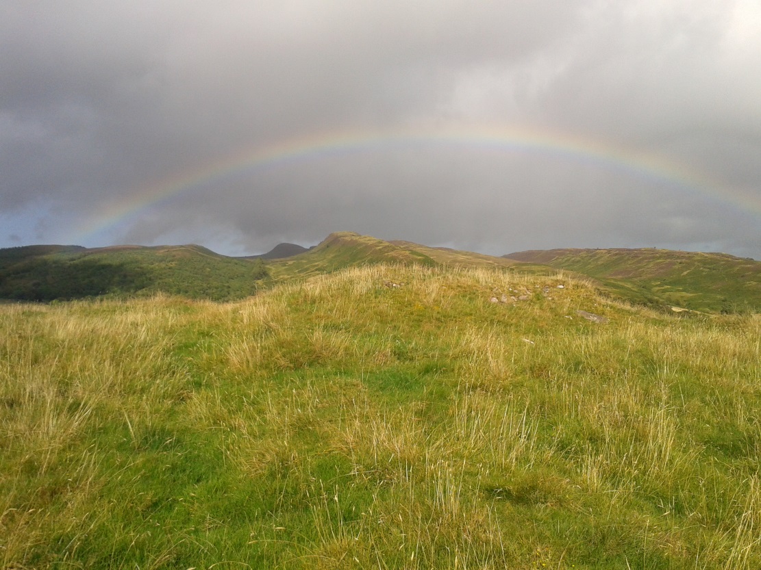
Along the A81 road from Port of Menteith to Aberfoyle, watch out for the small road in the trees running at an angle sharply uphill, nearly opposite Portend, up to Coldon and higher. Keep going, bearing right at Mondowie, then stopping at the dirt-track 100 yards or so further up. Walk up the track, thru the gate, and another 100 yards or so higher up, go thru the gate on your left. Walk up the field alongside the fence until you’re on the level and you’ll see a large rounded mound about 75 yards in the same field to your left.
Archaeology & History
This little known prehistoric tomb sits within a landscape rich in very impressive neolithic and Bronze Age petroglyphs and probably had some relationship with one or more of the carvings in aeons past. It is one of several tombs in the area.
Rainbow across the tomb
The site was only recently rediscovered in the 1980s, following an archaeological survey of the area before the forestry plantation was done. Measuring about 20 yards across and about five feet high, the large mound consists of the traditional mass of hundreds, if not thousands of stones. It seems that a ring of small uprights encircled and defined the edge of the cairn, although this element is only visible on its eastern side. Its northern mass and edges have been dug into and ruined at some point in the past, leaving a mass of rubble visible beneath the encroaching grasses. The tomb has not be adequately excavated, so we do not know whether it was built at the same time of the surrounding petroglyphs. It must be noted (again) that the incidence of tombs and cup-and-ring stones is not infrequent.
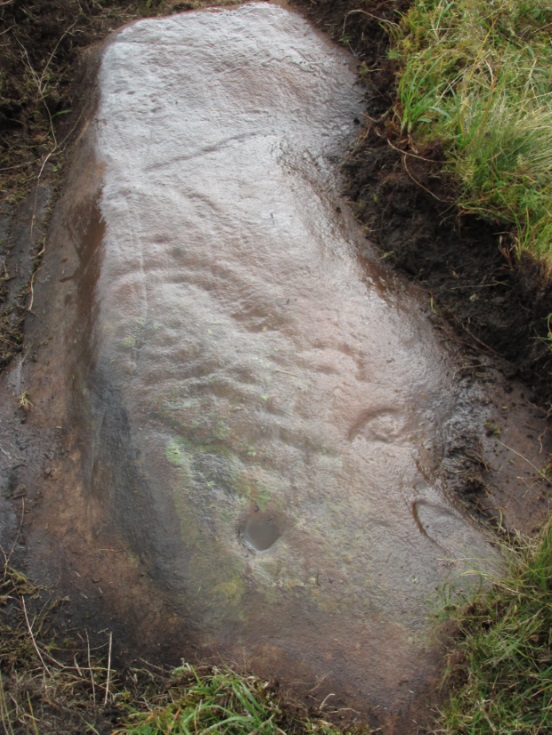
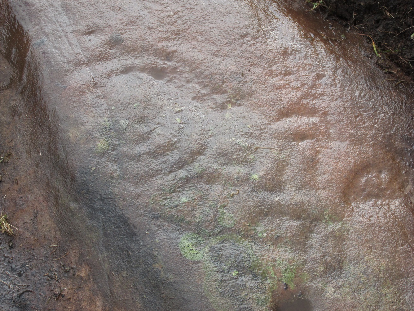
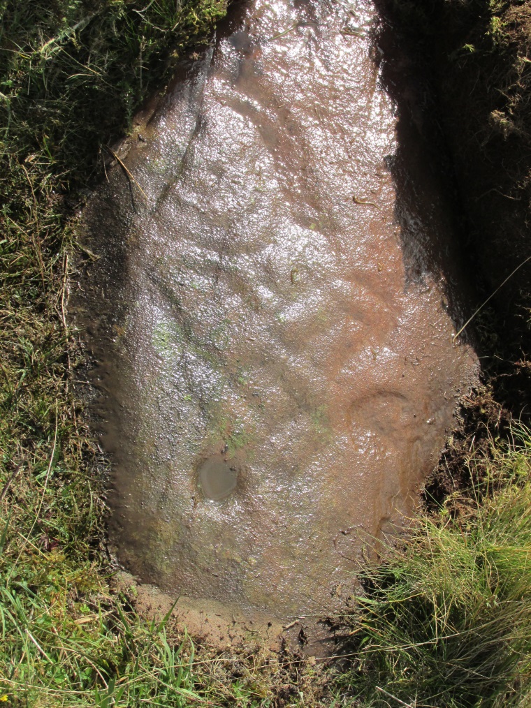
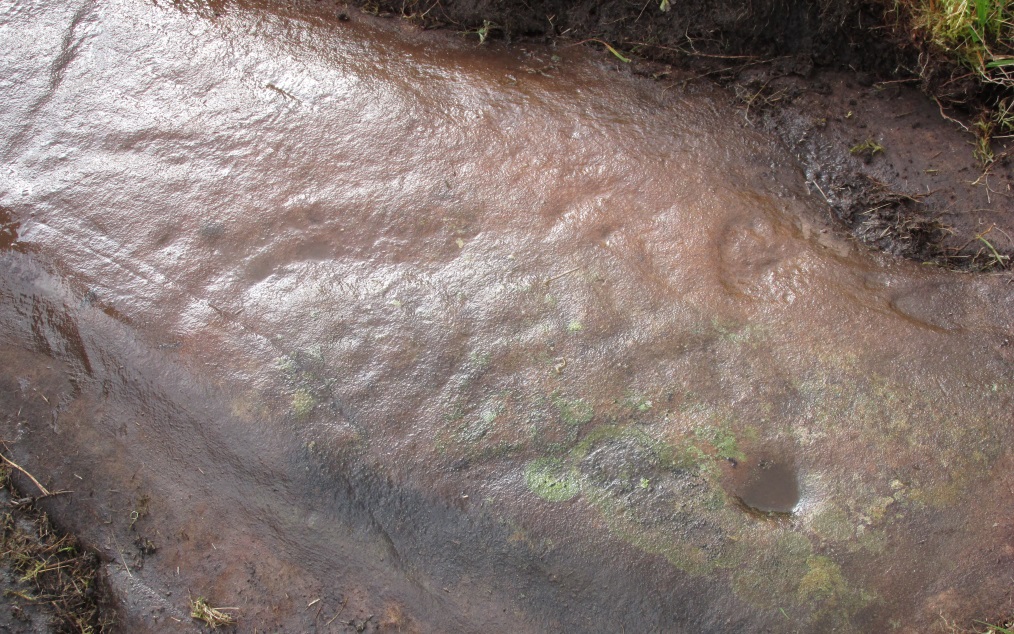
Park by the entrance to Ballochraggan, which is set back off the A81 between Aberfoyle and Port of Mentieth. Walk up the track, and just before you reach the cottage, notice the large boulder on your left, about 50 yards away. That’s it.
Archaeology & History
The Ballochraggan 1 Stone
This large dolmen-capstone-like boulder in front of the old cottage, was reported by Maarten von Hoek (1989) to possess about 10 faint cup-markings, with a large one near the centre of its upper surface. When Paul Hornby and I visited the site yesterday, several ‘cups’ were visible, but these were purely geological in nature; and even the large cup in the middle seemed somewhat dubious. The markings are the product of conglomerate rock, where smaller softer types of stone that are embedded in the boulder fall away, leaving cupmark-like indentations and other hollows. There are a lot of conglomerate rocks in these hills and it is essential that all students make themselves aware of the difference between the geological ‘cups’ and those forged by humans. In many cases this can be difficult, so apply the rule: if in doubt, kick it out—and err on the side of caution.
Some carvings in this region (and elsewhere in the country) possess conglomerate marks that have been enhanced and possess additional rings and carved lines. On this particular stone, such marks do not seem to exist. A dodgy example indeed…..
References:
von Hoek, Maarten, ‘Menteith (Port of Menteith parish): Rock Art Sites’, in Discovery & Excavation Scotland, 1989.
Acknowledgements: Huge appreciation to Paul Hornby for his photo and assessments.