Cock Hill, Wadsworth Moor, West Yorkshire

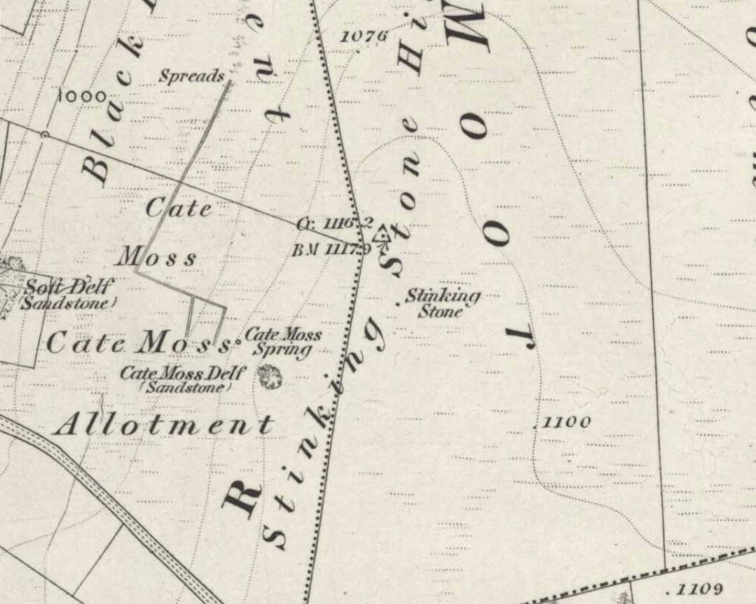
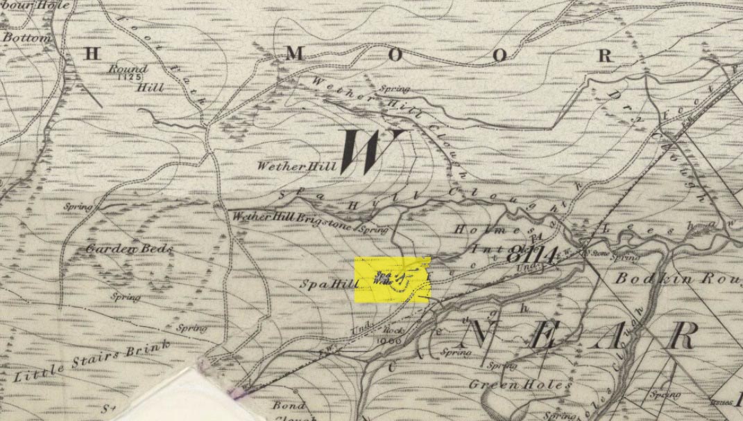
Cist:  OS Grid Reference – SE 009 275

Also Known as:

  1. Mount Skip tomb

Getting Here

OK – OK – stop laughing at the title!  If you wanna check the hill out for yourselves, get to Hebden Bridge, then go up the long and very steep Birchcliffe Road.  Keep going all the way to the very top (a couple of miles uphill).  When you reach here, the building in front of you was the Mount Skip pub.  From here, walk up over the golf course and you’ll hit the disused quarries on the moor edge.

Archaeology & History

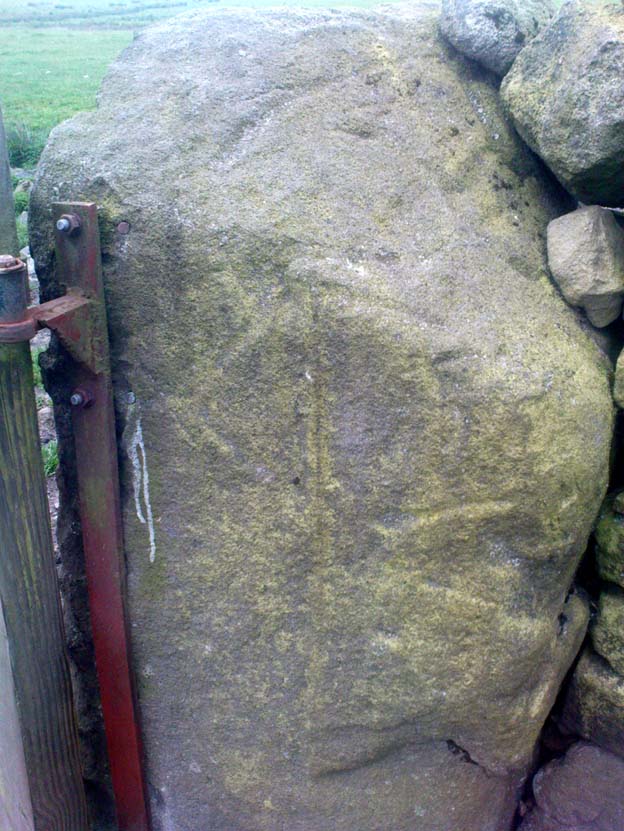
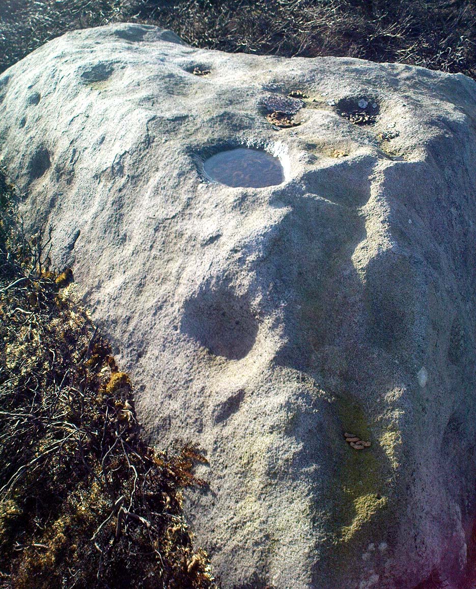
The grid reference given above is an approximation.  The tomb (long gone) was within 100 yards of the coordinate.  But don’t let that put you off having a good bimble around the moors here, cos there are several sites to see.

This long-lost burial was located in May, 1897, when quarrying operations were being undertaken behind the Mount Skip Inn, on the edge of Wadsworth Moor.  Ling Roth (1906) told that

“the first indications were the rolling down of pieces of urns which the delvers called flower pots.  Then in digging a hole to fix the leg of a crane, human bones were discovered.”

Geoffrey Watson (1952) later echoing Mr Roth’s comments wrote that,

“a grave containing a skeleton was discovered at a quarry about Mount Skip Inn.  The grave was about 6ft long, 14-18 in wide, and about 2ft deep.  The bones, which were exceedingly brittle, crumbled on handling.  Within the grave, and mainly at the ends, there appeared to be about 6 in of mixed charred wood and bones.  The larger portion of a small earthenware vessel was picked up and retained by one of the quarrymen.”

According to Mr Roth, the “earthware vessel picked up…by one of the quarrymen” was “picked up by a man named Thomas Greenwood, of Shawcroft Hill.”   What became of it, I do not know! If anyone knows, please let us know!

The description telling that “the grave was about 6ft long, 14-18 in wide, and about 2ft deep,” implies it to have been a stone cist – although this is quite long.  The nearest of any similar form would be the giant cairns at Low Bradley, 12½ miles (20km) to the north  This may have been the last remnants of a giant cairn (its landscape position would allow for this).

References:

  1. Roth, H. Ling, The Yorkshire Coiners…and Notes on Old and Prehistoric Haifax, F. King: Halifax 1906.
  2. Watson, Geoffrey G., Early Man in the Halifax District, Halifax Scientific Society 1952.

© Paul Bennett, The Northern Antiquarian


Castle Hill, Upper Cumberworth, West Yorkshire

Settlement:  OS Grid Reference – SE 2042 0697

Getting Here

Morehouse’s 1861 plan

Taking the A629 road between Shepley and Ingbirchworth, as you hit the staggered crossroads at High Flatts, take the west turn up the slightly sloping straight road of Windmill Lane.  Just where the road ‘kinks’ at a small bend, stop and look into the field on your left.

Archaeology & History

Deemed by some as a hillfort, and others as settlement remains, what little are left of the remaining earthworks here were first described by local historian Henry Morehouse in 1861.  Found about a mile west of Upper Denby, the site was described in the Victoria County History as being “on a commanding though not exactly a defensive situation on the slope of a hill.” This remark coming from the belief (and that’s all it is) that this was an Iron Age castle site.  In 1924 James Petch said of it,

“The earthwork seems originally to have been almost square, and two sides and an angle remain. The external ditch is from ten to twelve feet broad in its present state.”

While Faull & Moorhouse (1981) tell of there being “evidence for Neolithic activity” here, modern surveyors reckon it as an old prehistoric settlement — which makes sense; though little of the site remains to be seen today.

References:

  1. Faull, M.L. & Moorhouse, S.A., West Yorkshire: An Archaeological Survey, I, WYMCC: Wakefield 1981.
  2. Morehouse, Henry James, History and Antiquities of the Parish of Kirkburton and the Graveship of Holme, Roebuck: Huddersfield 1861.
  3. Petch, James A., Early Man in the District of Huddersfield, Huddersfield 1924.

© Paul Bennett, The Northern Antiquarian


Stinking Stone, Steeton, West Yorkshire

Standing Stone:  OS Grid Reference – SE 01814 42411

Getting Here

Stinking Stone on 1853 map

One of two ways to get here really.  The easiest is from Sutton-in-Craven: go through the village and up the steep hill (don’t take the right turn as you start up the hill).  Go all the way up until the hill starts to level out and on the left-side of the road you’ll notice a boundary stone stood upright (this is the Sutton Stoop).  Stop here.  Of the 2 gates, climb over the top-most one and walk down the path into the adjacent field, heading over to the gap a couple of hundred yards away where the gate to another field is.  That’s it!

Archaeology & History

Stinking Stone, Steeton

Now here’s a weird one.  With a name like this you’d expect there to be plenty of info or historical comments.  But despite all the books and journals in my huge library, aswell as visiting town libraries and exploring the resources on-line, there’s nowt written about this ‘ere spot.  Not a jot!  Even the usually satisfactory place-name fellas have a thing-or-two to say about sites with names such as this—but even their old tomes are closed-lipped.  Hmmmmm…..

I visited the place several times to try ascertain what this site was, thinking — perhaps — that it was an old boundary stone whose name had been convoluted from some older, more obvious title.*  The nearby Sutton Stoop boundary stone, right by the roadside, seemed a good indicator to such an assumption, as it was a recognised boundary marker with written history and a meeting point along the local perambulation.  But the curiously-named Stinking Stone was neither on the same line, nor ever had been according to old records, and couldn’t be located either.  There had been obvious quarrying and other industrial destruction along the hilltop where the old stone was marked and it seemed logical to assume that it had been destroyed in bygone years by that usual breed of capitalist industrial halfwits.  Until a psilocybin venture one afternoon, last season…

Twas a lovely sunny day, though windy on the tops as usual.  I was out with a couple of neophytes showing them Psilocybes and various other species, chewing them here and there and talking the way of healthy usage.  We passed by an old well, long forgotten, before heading onto Stinking Stone Hill.  Bimbling somewhat, and ruminating about the moss of colour, we decided to sit by the walling in-field and dream for a short while.  As we hit the old gate the Stinking Stone came up right before us.  Literally!

There in the old walling, blunt as you like, stood this four-and-a-half-foot tall standing stone, smoothed on one side by a short aeon of weathering, upright and proud as if it had been stood there for centuries, awaiting attention!  I exclaimed a few triumphant expletives; rubbed myself here and there over the old thing, then sat for a while behind the wind with the old upright, solidly embedded in old earth — then awaited the dream…

Twas a good day…

And then I returned home and later sought what I could on a possible etymology.  Around the hilltop a hundred yards away were small depressions and the faded remains of industrial workings, like I said; and with this in mind the awesome Mr Wright (1905) told us about the existence of ‘Stinking coals’, “an inferior kind of coal” no less.  Referring us to a work from 1818, we’re told,

“The Stinking-coal is noted for containing a great proportion of sulphuret of iron, thick seams or layers of these pyrites running in it.  In consequence of this it cannot be used for smelting purposes.”

Another account from 1868 telling us that:

“On opening the body, it contains a strong sulphureous smell, characteristic of the disease; hence it is called the stinking ill; and the stomach and bowels are prodigiously distended with air, having the same intolerable foetor.”

Worn metal scratch-marks caused when dragged here
Worn metal scratches, made when dragged here?

This old worn gatepost however, perhaps has a history that only goes back a few centuries.  It has been cleaved in half, as you’ll see if you visit it; but its western face is old and worn and it’s been embedded in the ground for a long time.  On its northern face are the curious etchings of carvings, which are more akin to wounds from some past offence (perhaps when it was split in half), cleaved by metal toolings and dragged by farmers to be fixed in into present spot.  It’s history may not be truly ancient.  Twouldst be good to know for sure though…

References:

  1. Wright, Joseph, The English Dialect Dictionary – volume 5, Henry Frowde: Oxford 1905.

* ‘Stinking’, stone-king or King Stone?  Unlikely though…

© Paul Bennett, The Northern Antiquarian 


Mini-Skirtful of Stones, Ilkley Moor, West Yorkshire

Cairn:  OS Grid Reference – SE 1346 4606

Getting Here

Follow directions to get to the Pancake Stone.  From here walk SE on the footpath that runs on the edge of the moor.  After about 200 yards you’ll hit a small footpath which heads into the moor (south).  Walk on here for about 200 yards and notice the small rise in the land to your right (if you cross the small stream where the land dips into a very small valley, you’ve gone past).  That’s it!  The Little Haystack Rock is less than 100 yards away down the slope from here.

Mini-Skirtful of Stones, looking north

Archaeology & History

Of approximately eighty prehistoric cairns that have been alleged to exist along the Green Crag Slack ridge on Ilkley Moor, this site in particular is worthy of note, due mainly to its size. As independent archaeological researcher Paul Bowers said of it when he first saw this cairn-spoil, “it seemed too big to have not been discovered in the past.”  Too right!

Mini-Skirtful, looking west

When we tracked across Green Crag Plain a few days ago, it was Michala Potts that called our attention to it.  Half-covered in full heather growth, only the eastern edge was exposed.  At first it seemed that it was loose prehistoric walling, but then I realised it was on the edge of small knoll and the stone work was deeper and wider than walling.  As we explored through the heather atop of the knoll, it was obvious that there was a more extensive gathering of stones scattered all over the top of this small rise, and it seemed that we were looking at the remains of a reasonable sized cairn. Its extent carries about ten yards down the slope from the small hillock, but only a few yards either side of it.  It seems likely that the extended loose stones have, over the centuries, simply slipped further down the slope.  However, not until a decent excavation occurs will we know anything certain.  It is possibile that this is simply the scattered remains of damaged neolithic or Bronze Age walling, but only a more detailed exploration of the site will tell us for sure.

Cowling (1946) mentioned the numerous cairns and scattered walling reaching across this part of Ilkley Moor, but gave no specific information relating to this mini-skirt full of stones! (blame Mikki for the title!)

References:

  1. Cowling, E.T., Rombald’s Way, William Walker: Otley 1946.

© Paul Bennett, The Northern Antiquarian


Green Crag Top Cairns, Ilkley Moor, West Yorkshire

Cairns:  OS Grid Reference – SE 131 458

green-crag-top-cairn02-sm
Larger of the Green Crag Top cairns – with blizzard in background!

Getting Here

Follow directions for getting to the Haystack Rock.  Once here, walk dead straight south onto the moor and go up the slope you see a few hundred yards ahead of you.  Once you’re at the top of the slope, a few yards onto the ridge itself, look around!  If there’s deep heather growth when you arrive, you’ve no chance!

Archaeology & History

To my limited knowledge, it appears there’s no previous references to the cairns here.  We found at least two of them, with a probable third not far away; but we were lucky inasmuch that the heather had all been burnt away, allowing a clearer inspection of the sites.  The larger of the two is nearly four yards across and nearly a yard high.  It’s somewhat larger than the majority of what are thought to be single-person cairns along Green Crag Slack ridge, down the slope.

Much denuded cairn
Much denuded cairn

A smaller cairn less than 100 yards west on the same ridge (near the large boulder with a couple of cup-markings on top) looks as if it was robbed of stone sometime in the past.  About six-feet across, this one is more typical of the cairns found on the Ridge below.

There are what seems to be other remains along this ridge, including a very distinct thin, six-foot-long stone, which looks very much as if it could have stood upright in the not-too-distant past.  We could do with more heather-burning on this part of the moor to help us out!

© Paul Bennett, The Northern Antiquarian


Three Cups Stone, Ilkley Moor, West Yorkshire

Cup-Marked Stone:  OS Grid Reference – SE 12998 46314

Also Known as:

  1. Carving no.138 (Hedges)
  2. Carving no.298 (Boughey & Vickerman)

Getting Here

Dead easy!  Follow the directions to the unmissable Haystack Rock, then look at the small upright stone about 40 yards west, just off the footpath.

The Three Cup Stone

Archaeology & History

This is another one of the many carvings I first saw when I was a small lad, about 12 years old, in one of my countless walkabouts over these moors.  It’s thought by some to be a small cup-marked standing stone (it’s possible I s’ppose, but improbable); whether that’s the case or not, it certainly has three distinct cup-markings on its east-facing vertical face.  There are also what appears to be lines cutting through the cups and running out to near the edge of the stone which may or may not be natural.  A small, cute little thing!  Boughey and Vickerman (2003) make a note that this carving may be recent — but if so, it was done some considerable time before 1975, when I first clapped eyes on it!

References:

  1. Boughey, Keith & Vickerman, E.A., Prehistoric Rock art of the West Riding, WYAS: Wakefield 2003.
  2. Hedges, John, The Carved Rocks on Rombalds Moor, WYMCC: Wakefield 1986.

© Paul Bennett, The Northern Antiquarian


Urn Stone, Green Crag, Ilkley Moor, West Yorkshire

Cup-and-Ring Stone: OS Grid Reference – SE 12832 46163

Also Known as:

  1. Carving no.130 (Hedges)
  2. Carving no.287 (Boughey & Vickerman)

Getting Here

Drawing of the Urn Stone (after Hedges 1986)

Follow the directions for getting to the Haystack Rock, then bear right (west) along the footpath, past the little Three Cups Stone, until the path bends and goes up onto the moor.  A hundred yards or so, walk left into the heather (you’re straddling the remains of considerable prehistoric walling and enclosure remains by now) and look around.  You’ll find it!

Archaeology & History

I was only about 12-years old when I first saw this and the nearby prehistoric carvings — but when I came to look for any references to it as a boy, there were none I could find at the time.  Then, ten years later when John Hedges (1986) brought out his fine work on the cup-and-ring art of Ilkley Moor, its presence was shown in pen-and-ink at last.  Found amidst the remains of an extensive settlement or series of walled enclosures, the carving’s name comes from the curious urn-like element that Hedges showed faintly.   There is also an additional ring around one of the cups above the ‘urn’.

Excavations that were done on the prehistoric ‘enclosure’ close to this petroglyph in the 1990s, uncovered the remains of a decent amount of ‘grooved ware’ pottery and worked flint (Edwards & Bradley 1999), dated between 2900 and 2600 BC.  As such pottery has been found elsewhere in Britain within and/or near earthworks and other prehistoric remains (obviously!), its incidence here isn’t really too much of a surprise.  However, Edwards & Bradley (1999) speculate — albeit vaguely — that there may be a link between the cup-and-rings here and the pottery, saying, “if so, the rock carvings (here) might be indicating a place of special significance.”

This may be so: considering the prevalence of rock-art along the geological ridge and its close association with the large number of burial cairns.  If it can be ascertained that the charred remains of humans were kept inside the pottery or vases, the relationship between death and the carvings (well established on this part of Ilkley Moor) would be reinforced.

References:

  1. Boughey, Keith & Vickerman, E.A., Prehistoric Rock Art of the West Riding, West Yorkshire Archaeology Service 2003.
  2. Edwards, Gavin & Bradley, Richard, ‘Rock Carvings and Neolithic Artefacts on Ilkley Moor, West Yorkshire,’ in Grooved Ware in Britain and Ireland (edited by Cleal, R. & MacSween, A.), Oxbow: Oxford 1999.
  3. Hedges, John, The Carved Rocks on Rombald’s Moor, WYMCC: Wakefield 1986.

© Paul Bennett, The Northern Antiquarian


Young Idol Stone, Ilkley Moor, West Yorkshire

Cup-Marked Stone:  OS Grid Reference – SE 13264 45943

Also Known as:

  1. Carving no.158 (Hedges)
  2. Carving no.323 (Boughey & Vickerman)

Getting Here

The Young Idol Stone (bottom) & parental Idol Stone above

Take the directions to reach the Haystack Rock, then head onto the moor following the south-east footpath for a few hundred yards, towards where the moor slopes uphill.  20-30 yards before the uphill slope, a yard to the right of the path, a couple of yards below the well-known Idol Stone carving – you’ll find it!

Archaeology & History

Described simply as a “small, rounded, smooth grit rock,” this long-tooth-shaped stone has just two cup-markings on its upper face: one on the more southern tip, and the second smaller cup several inches below it – as shown on the photo.  The adjacent carving seen at the top of the photo is the parent guardian, Idol Stone!  If you visit this, or any adjacent carvings here, please remember that all along this moorland plain are numerous unexcavated prehistoric tombs. You’re effectively stood at the edge of, or within, a huge prehistoric cemetery.

References:

  1. Boughey, Keith & Vickerman, E.A., Prehistoric Rock Art of the West Riding, WYAS 2003.
  2. Hedges, John, The Carved Rocks on Rombalds Moor, WYMCC: Wakefield 1986.

© Paul Bennett, The Northern Antiquarian


Green Crag Top Stone, Ilkley Moor, West Yorkshire

Cup-Marked Stone:  OS Grid Reference – SE 1304 4582

Getting Here

Green Crag Top stone - from above
Green Crag Top stone – from above

Head for the binary-like Idol Stone carving and keep walking on the footpath, up the hill.  Once on top of the ridge, walk along it to your right (west) for about 300 yards, then walk south (left) into the flat heathland plain.  Look around!

Archaeology & History

I’m probably not reading it right – but it seems this large stone with several distinct cup-marks on its vertical south-face, isn’t in the surveys of either Hedges (1986) or Boughey & Vickerman (2003).  If someone can correct me on this one – please do!

Green Crag Top Stone, looking north

This is quite a large boulder, as the photos here show.  At least two average-sized cup-markings have been etched onto the south face, and two larger ones accompany them on the same edge.  There’s another larger cup-mark on the northeast side of the stone, and a possible companion, which may or may not be artificial.  Then on top of the stone we have several large cups and a ‘bowl’ — though some of these upper markings may be natural, or just well-eroded cup-marks.  It’s hard to tell for sure!

Now I’m gonna have another look in the Hedges, Boughey & Vickerman surveys.  They surely can’t have missed this!

© Paul Bennett, The Northern Antiquarian


Haworth Moor Spa Wells, West Yorkshire

Healing Wells:  OS Grid Reference – SE 0041 3513

Getting Here

Spa Wells on 1852 map

Go through Haworth and head for the well-known Penistone Hill country park.  On the far western side of the hill up near the top of Moorside Lane, there’s a car-park.  Right across the road from this there are two footpaths: one heads you into the moor, whilst the other (going the same direction) follows the edge of walling onto the moors.  Take this path. Walk on and downhill, past the end of the reservoir, then the path continues uphill. You’ll hit a nice cheery tree beside the path a few hundred yards up.  Stop here, look into the boggy region with bits of walling on the moor in front of you.  That’s where you’re heading!

Archaeology & History

The first, weaker of the Spa Wells

This was a really curious spot to me, as I found absolutely nothing about the damn place!  But thanks to the assistance of local historian and writer Steven Wood (2009), that’s changed.  Shown on the 1852 OS-map, at least two springs of clear water trickle slowly from the wet slope above you into the boggy reeds.  Close by there are overgrown remains of old buildings, covered with the time of moorland vegetation, seemingly telling that the waters were collected for bathing rooms.  But who the hell even started the notion that they’d be able to get Victorian rich-folk up here at the crack-of-dawn to drink or bathe in the waters is seemingly forgotten.  And, as is evident from the lack of local history, the project was a failed one which seemed not to have lasted too long. 

Folklore

The stronger of the Spa Wells
The stronger Spa Well

It was quite obvious that of all the springs around here and despite the strong-flowing streams either side of these spa well, that the local animals drink here more than the other nearby springs of water, as there were literally hundreds of animal tracks all across the boggy ground of the spas.*  The waters also seem to have the usual ‘spa’ qualities of stinking, but once we’d cleaned out the overgrown springs — which looked as if they hadn’t been touched for 100 years or more the waters were clear and tasted good, and were curiously slightly warm!

Although my initial search for information on this site drew a blank, Steve Wood pointed us in the right direction for info on the place.  As with many other holy wells and spas in Yorkshire, it turned out that this was another spot much revered around Beltane, indicating strongly there would have been  earlier pre-christian rites practiced at this site.   Steve pointed me to Martha Heaton’s (2006) local history work, which told:

“For many years the first Sunday in May was a special day. It was known as Spa Sunday, for on this day people gathered up in the hills overlooking what is now Leeshaw Reservoir, here was a well, known as Spa Well, and the stream which now feeds the reservoir is known as Spa Beck. People came from Haworth, Oxenhope, Stanbury, and other villages sitting round the well, they sang songs, some bringing their musical instruments to accompany the singing. Children brought bottles with hard spanish in the bottom filling the bottle with water from the well, shaking it until all the spanish or liquorice had been dissolved. This mixture was known as ‘Poppa Lol’ and would be kept for weeks after a little sugar had been added, then it was used sparingly as medicine.  The custom seems to have died out when Bradford Corporation took over the water and made Leeshaw Compensation Reservoir in 1875, though up to about 1930 two men from Haworth would wend their way to the spot on the moor, the first Sunday in May. The men were John Mitchell and Riley Sunderland, better known, in those days as ‘Johnny o’Paul’s’ and ‘Rile Sun’.

It was a great day for many people, the Keighley News of May 1867 mentioned it, the report of local news reads thus: ‘A large assembly met on Spa Sunday on the moors about two miles from Haworth, and a party of musicians from Denholme performed sacred music’.

This locality was often visited during the summer months by the Bronte family.”

References:

  1. Heaton, Martha, Recollections and History of Oxenhope, privately printed 2006.
  2. Wood, Steven & Palmer, Ian, Oxenhope and Stanbury through Time, Amberley Publishing 2009.

Acknowledgements: – Huge thanks to Steven Wood for his help; and to Hazel Holmes for permission to quote from Martha Heaton’s work.

* A common creation myth behind many healing wells is that animals with breaks or illness drag themselves to drink from otherwise small or insignificant springs and wells, despite of the copious streams or rivers which may be nearer.

© Paul Bennett, The Northern Antiquarian