Cup-and-Ring Stone: OS Grid Reference – NN 72936 17198
Getting Here
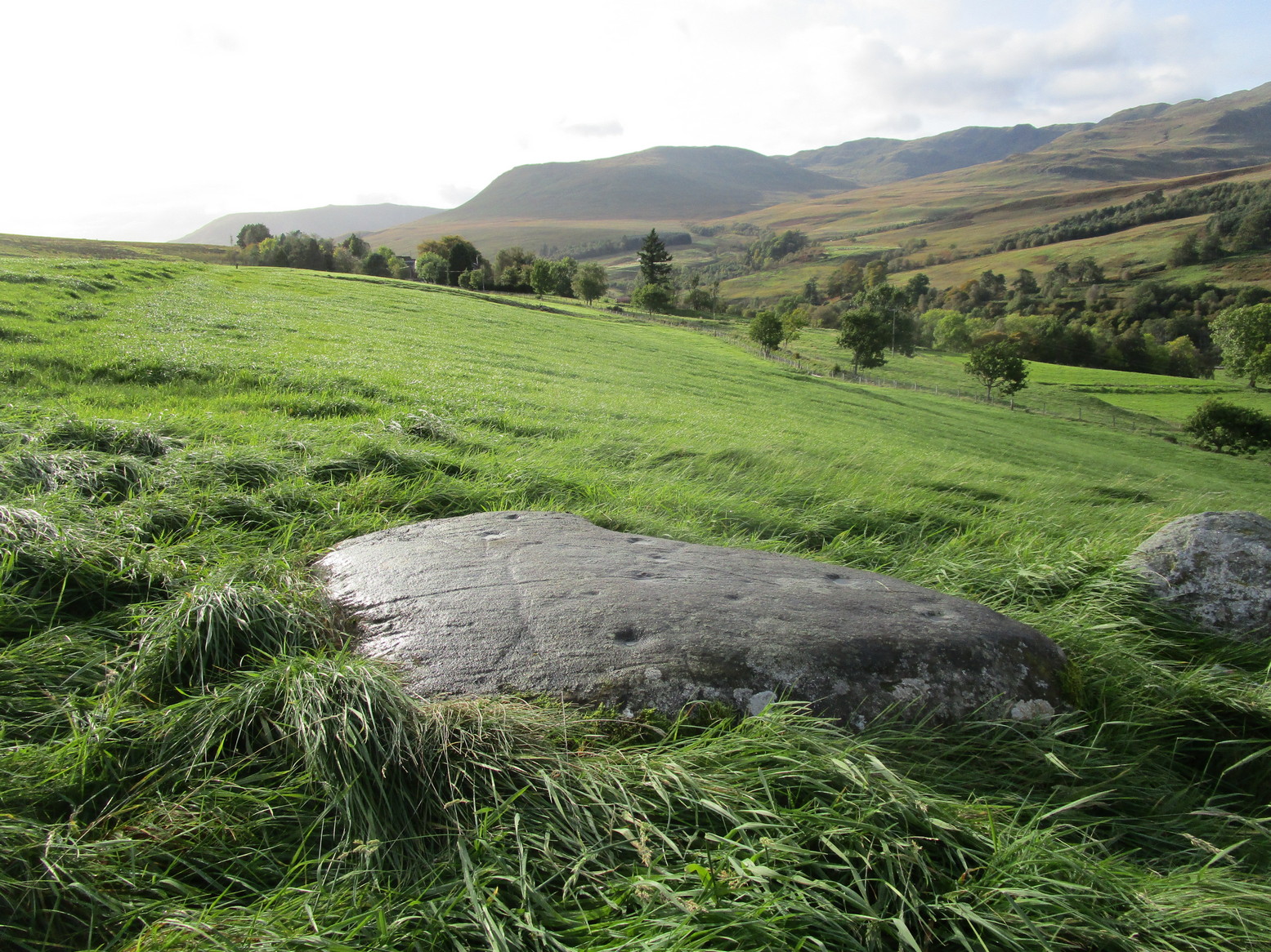
From Comrie take the B827 road to Braco and less than a mile out of town keep your eyes peeled for the tiny Glen Artney road on your right. Past the derelict Dalness cottage 3 miles on, a half-mile further, just where you hit a track-road veering downhill on your right, you need to park up in the small parking-spot on your left. Walk along the road 100 yards, keeping your eyes peeled again for the gate set back on your left (easy to miss!); go thru here, walk up the old path which bends back on itself before leveling out and, as it does, two or three small boulders lie just off the pathway on your right, one with its own petroglyph.
Archaeology & History
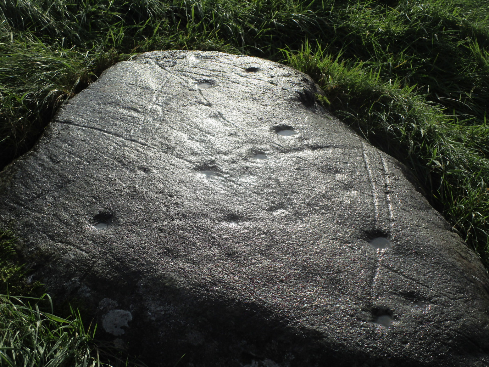
There are cups, rings and lines on this old stone, with the lines in particular being somewhat troublesome when it comes to working out their origin: some are natural, some made by modern farming implements (about a hundred years back), and some that were carved thousands of years ago—and it’s not that easy to work out which is which. You’ll be able to see what I mean by looking at the photos.
Rediscovered, it would seem, by M.D. King in 1991, he described it plainly as a simple
“recumbent cup-marked stone 1900mm by 1200mm by 300mm…found in a stone dyke running down the hill from the deserted farm of Mailer Fuar. The stone may have been moved down from its original position for inclusion in the now ruinous stone dyke. Fourteen cup-marks were visible on the stone.”
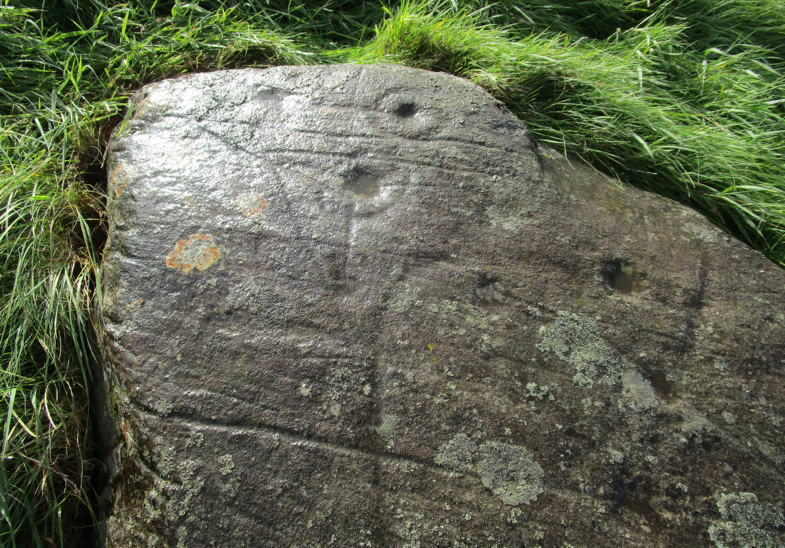

But there’s much more to it than that! There are rings around the cups for starters. Four of them. Two cup-and-rings next to each other at the southeast portion of the stone are just about complete, as you can see (right); the various lines that run either side and into them seem to be a mix of early and more recent scratches—although I think we’re best asking a petromorphologist to tell us which is which! We have a similar problem for another cup-and-ring near the centre of the stone, for it has two lines going right through its centre: one of them running almost the full north-south length of the stone giving the impression it was carved a long time back, yet looking much less ancient when it comes to its form and erosion; whilst the other line—almost at right-angles to the first—has a decidedly more archaic worn appearance.
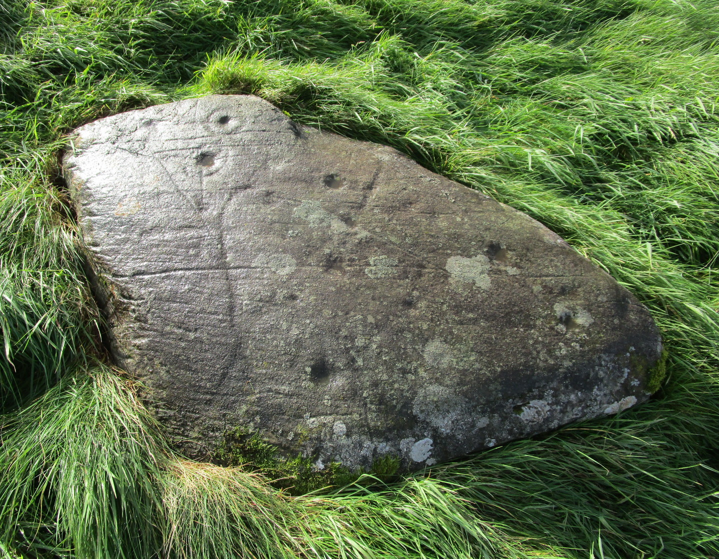
One of the more assured “ancient” carved lines is on the eastern section of the stone. (left) It’s an odd looking thing, not very clear on the photo, comprising an elongated curved line, with a fork at the bottom, almost like short legs on an elongated stick-man like the ones we drew as kids. The long line seems to eventually curve over and into one of the cup-marks. Adjacent to the bottom of this forked curve is a cup and faint incomplete ring with a faint line running out of its centre to a smaller faint cup to its west. You can see this reasonably well in the lower photo (right)
The carving needs a lot of attention if we’re to work out its original design, as the photos show. Even the millionaire computer-tech work of the Scottish rock art club didn’t really suss out the differences regarding chronological elements in this carving (I don’t think they even mentioned it), which shows how difficult some of these buggers can be! Personally, I’d love to see the impression of some good artists at this stone when the light’s just right and see what their mind’s eye brings to the fore.
After all this I’ve not even mentioned its position in the landscape. Go check it out and see for y’selves. It’s a bittova beauty! And then wander a little further uphill to look at the Allt na Drochaide (1) carving I found not long ago. The view’s even better from there!

References:
- King, M.D., “Mailer Fuar (Comrie parish): Cup-marked Stone”, in Discovery Excavation Scotland, 1992.
© Paul Bennett, The Northern Antiquarian