Legendary Tree (destroyed): OS Grid Reference – SK 49751 83799
Folklore
This was one of the many sacred trees beneath or next to which, in pre-christian days, tribal councils met. Thanks to the local historians Paul Rowland and Lis Tigi Maguire Coyle (see ‘Comments’, below), the whereabouts of the tree has been located (contrary to my earlier idea that it had sadly died). The local writer Harry Garbutt wrote of it in the 1940s, saying:
“The importance of Harthill in Saxon days may be adduced also from the fact that of the Three Hundreds of the Wapentake, Harthill was one. The Hundred was the Court of local justice and government, and at Harthill would meet under the old Trysting Tree.”
The very word trysting relates to any species of tree that has importance, be it by its appearance or position, and relates to those that were used as traditional or popular meeting sites.
References:
Garbett, Harry, The History of Harthill-with-Woodall and its HamletKivetonPark, Arthur H. Stockwell: Ilfracombe n.d. (c.1948)
Acknowledgements: Massive thanks to Paul Rowland (‘Comments’, below), for information pointing us to the exact spot where our Trysting Tree lived; and to Lis Tigi Maguire Coyle for the additional folklore ‘Comment’, below. Huge thanks to you both!
From Redmires Road, follow the path on the opposite side of the road from the reservoirs that follows the “conduit”: a man-made dyke marked on the map at SK 2601 8578. You’ll need to follow this for about 1km till you come to a junction with a path crossing a small bridge on your left, and a path to your right onto the moor. You need to take the latter for about 200 metres downhill. The standing stone is roughly 100 metres onto the moor in a NNE direction.
Archaeology and History
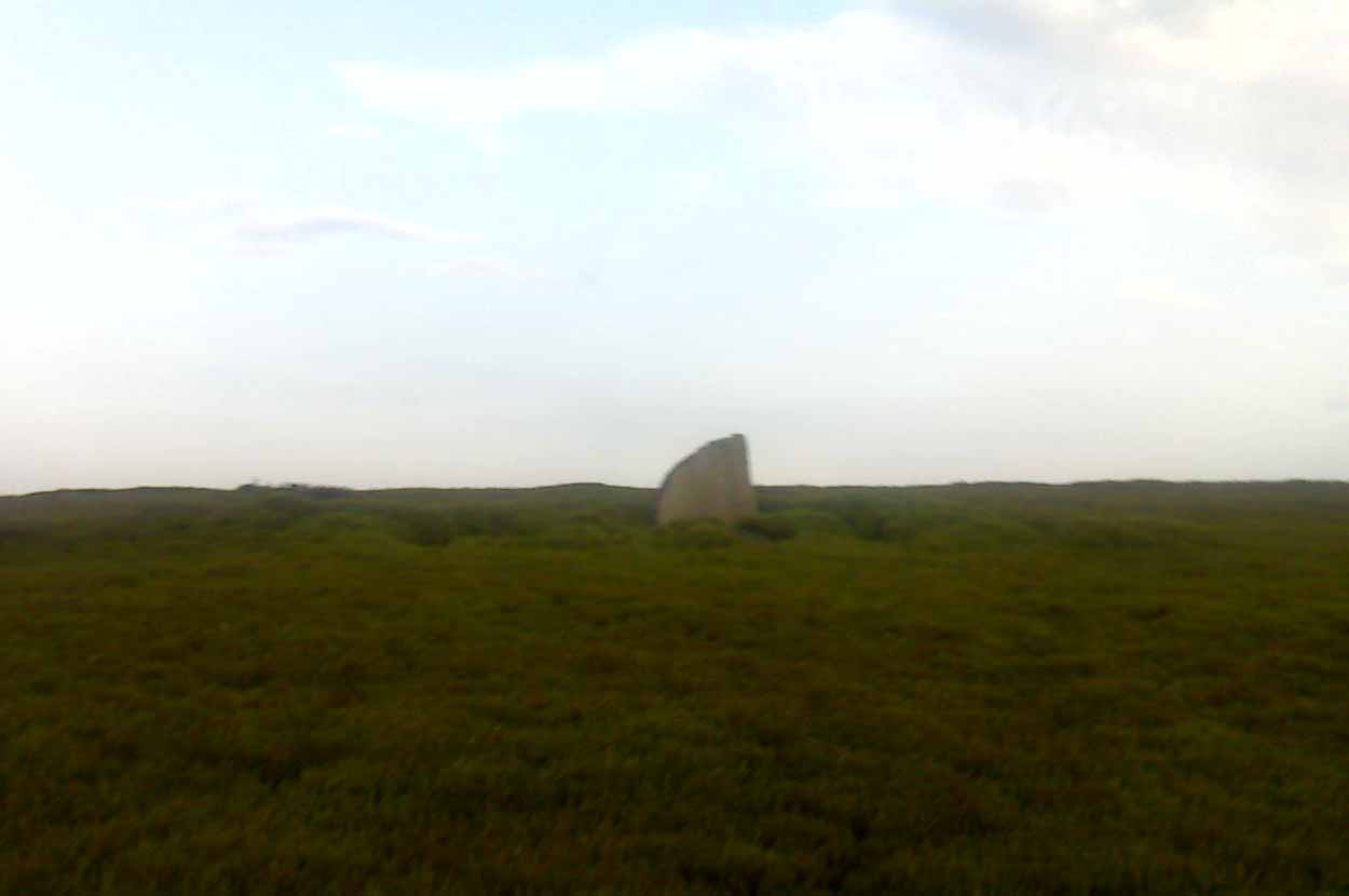
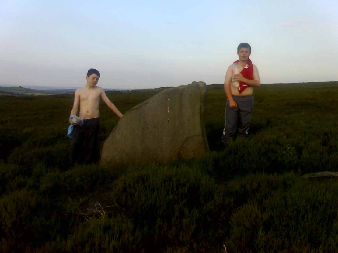
New Hagg, with kids for scale
None that I know of! I didn’t know of its existence until I found it whilst wandering the moor one day. Though I can find no record of it anywhere, the weathering on its top in comparison with other authentic standing stones suggest that it’s been stood for a very long time and probably since prehistory.
Four feet tall, the stone stands roughly half a kilometre SSE from the Headstone which can be seen from here – and roughly half a kilometre from the Reddicar Clough Long Cist, ESE of here.
Cross (destroyed): OS Grid Reference – SK 2612 9417
Also Known as:
Hanson Cross
Archaeology & History
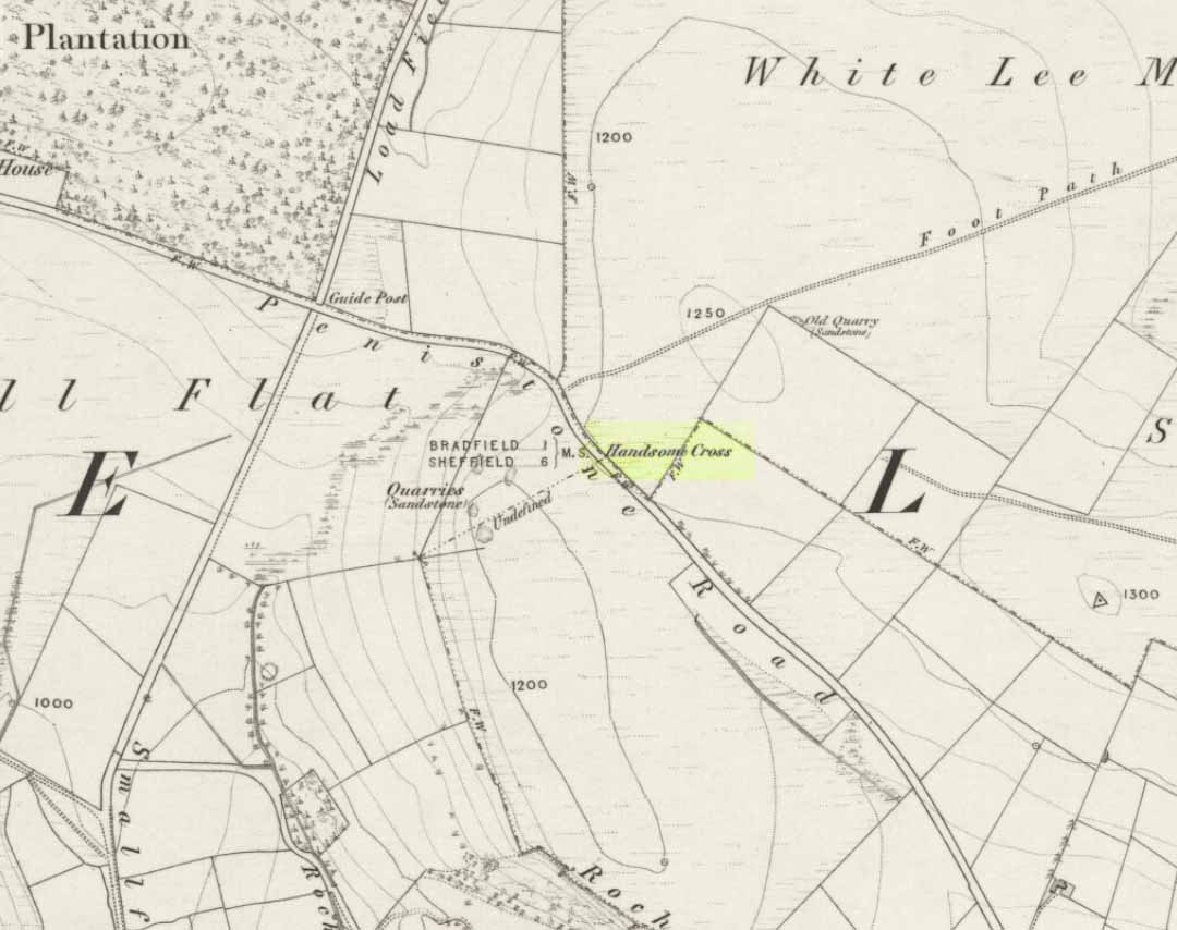
Handsome Cross on 1855 map
Described in Joseph Hunter’s (1819) rare work as being close to a now-lost stone circle, this wayside cross is shown on the earliest Ordnance Survey map of 1855 as being at the side of the old Penistone road, across from the guide-stoop which can still be seen. The cross stood at a peak on the roadside which allowed it to be visible from either direction and probably stood on the ancient township boundary line.
In Neville Sharpe’s (2002) fine survey he found an early account of this lost relic from writings ascribed to one John Wilson, who lived between 1719 and 1783, which told that,
“Ann Hawley, an old woman who lived at Broomhead in 1700, says she remembers Hanson Cross having a head and arms. The head is still there, but the arms I do not remember.”
References:
Hunter, Joseph, Hallamshire: The History and Topography of the Parish of Sheffield, Lackington: London 1819.
Sharpe, Neville T., Crosses of the Peak District, Landmark: Ashbourne 2002.
Smith, A.H., The Place-Names of the West Riding of Yorkshire– volume 1, Cambridge University Press 1961.
Located just off Hathersage Road, by Parsons House outdoor pursuits centre with parking in a roadside layby. Don’t Park at Parsons House – they won’t like it! Head up the old road besides Parsons house and take the entrance onto the moor about 100 metres past the pursuits centre track. If memory serves me correct, it’s by the second wall on the right. Follow the post-and-mesh fence to the end of the wall and turn right, following the wall for around 70 metres down hill and you’ll be able to see the cairn’s bank before you in the heather. The stone pictured lays in the banking by the entrance which faces NNW.
History and Archaeology.
There’s no excavation taken place here that I know of, but the site is well known and mentioned in an old report I found Here. The article also contains an old map of the area showing the site.
Also mention is made of a stone referred to as the Fingeram stone. There is a stone laid flat in the position marked on the map, but I’m unsure whether it’s the standing stone mentioned. According to the old text the ring cairn has a diameter between 83ft and 95ft. Directly to the north and roughly 50 metres onto the moor, in line with the wall, is an interesting egg-shaped and weather-worn boulder that’s also worth a look at. This whole area is a sea of sandstone.
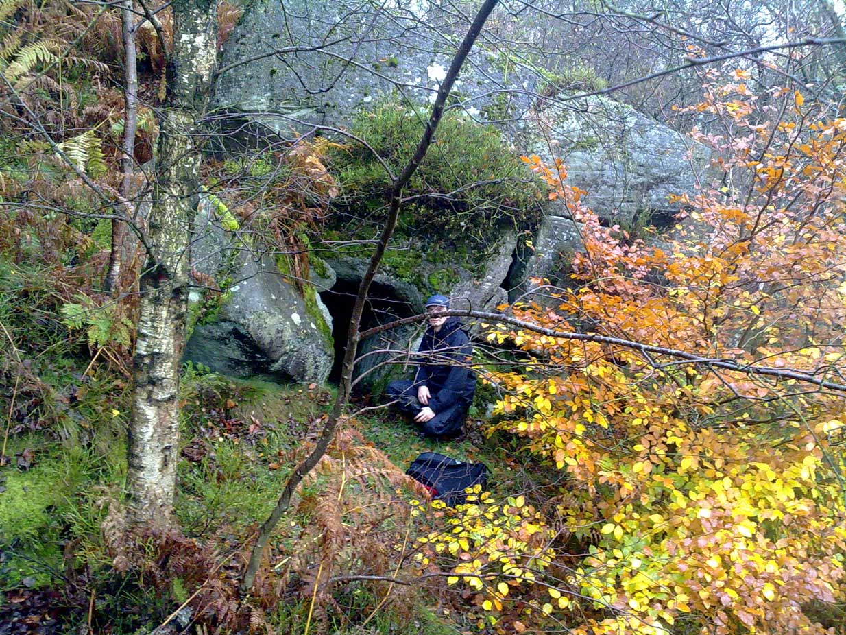
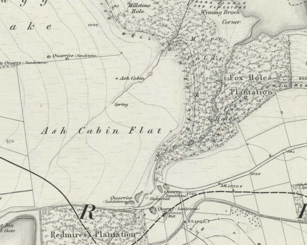
Park at Wyming Brook nature reserve car park off Redmires road and head off up the steps to the right of the notice board. Turn immediately right through the trees and you’ll soon pick up the path running along the ridge above Wyming Brook drive. Stay on the obvious path for around ½-mile passing “Big rock” to your right and the views it offers over Rivelin Valley and the dams. A short way further along the path steps down a couple of feet and turns to the right before straightening again, this is where you need to start looking down the edge to your right for a large rock that resembles a Chesterfield sofa which makes up part of the shelters roof.
Once you’ve located the site a short scramble will be needed to gain access to the entrance and this is where care is needed. It’s not difficult but has the potential to be deadly due to the steep nature of the edge so please take care and keep any kids on a very short rein.
Head down to the right of the “sofa” and jump down the 3ft drop holding onto the rather handy bracken and saplings if needed and the entrance is right there to your left.
Archaeology & History
Errr……..yeah, it’s history! — Well I’ve yet to find anyone else that actually knows about this cave, let alone it’s past! There are obviously locals who know of it’s existence but after half a dozen visits there I’ve not seen anyone except a brave old lady, 70 if-a-day, who was there looking for the supposed wartime carvings and that was on my first visit.
I have tried every possible avenue i know to reveal the caves past but as yet nothing, I’d be grateful if you could enlighten me at all.
I did e-mail John Barnatt with hope he’d have some information but alas no, though it is admittedly just outside his patch being on the Sheffield side of the Derbyshire / Sheffield border.
The shelters entrance is around 3ft high but once inside the roof quickly gains height and tops out at around 7ft so standing is easy. Beware half way along the interior by the small opening though — you’ll crack your head if your attention is drawn to the light beaming in through the side! There’s quite a bit of occupation rubbish within the cave due to someone making their home there: a sleeping bag, old tin cans, bottles, etc, is evidence enough, but the stuff’s quite old and no one resides their now.
“X” marks the spot!
At the far end of the shelter is a small chimney like opening and it’s just possible to squeeze between the fallen rocks and make your way out, it would also make an excellent outlet for smoke if you chose to have a warming fire inside.
You probably won’t notice on your way in but coming out and on the rocks by the entrance to your left are carvings dated to 1944 said to have been inscribed by German prisoners of war held in the area but I’ve yet to substantiate that.
Despite a footpath being marked on the OS map, there’s none I could find and the only way to get there is to make your way through the heather. Park at the Wyming Brook nature reserve car park on Redmires road, take the signposted path besides the notice board and follow the line of the dry stone wall. Go through the gate and continue till you come to the end of the wall where a path leads off to your left through the broken wall, follow the path through the boggy bit and head uphill till you get to the highest point of the path by another wall with a path the other side. From here it gets a little tricky! You’ll now need to go off path heading NNE and down hill till you come to the post-and-wire fencing where you should pick up a slight path heading WNW (your left) and head for the high point about half a mile in front of you. Just before you come to the high point you’ll have to cross the stream (easily done). The cist lays on the flat ground just beyond the brow of the rise.
Archaeology & History
A long cist around 3 feet wide and 6 feet long in a well preserved condition aligned almost — but not quite — East/West on a prominent position on Hallam Moor, commanding views over Ash Cabin flat, Rivelin Valley and the A57 road. The only restricted view is to the northwest, where the moor rises then drops down again towards the Headstone.
There are 3 side-stones still in situ: the largest around 1 metre tall, the others still in place being about 70cm. The stones that would have made up the rest of the walls lay close by.
When you’re at the site it’s obvious why it’s in this location: the views are spectacular and afford excellent views of the surrounding area. A burial site with a vista truly fit for a king!
Archaeologically there’s not much info kicking around that I can find and I’m indebted to Stubob for alerting me to it’s presence. It’s very unlikely you’d be walking this area for any reason other than to visit the site, as there are decent paths across the moor to the most popular site in this area, the Headstone off to the North West. Remains of the Ash Cabin Flat stone circle are about 750 yards southeast of here.
A real gem of a site and a “must see” if your in the area.
Follow Redmires road till you come to Wyming brook nature reserve and use the free parking facilities there. From the car park you need the signposted path to the right of the notice board, the first one not the one by the metal barrier; climb the rocky steps and follow the line of the dry stone wall to your left, and after around 50 metres you’ll pass through a wooden gate. You then continue following the wall as it heads downhill and the wall becomes broken. Here you should notice a path that goes through the broken wall off to your left: don’t take it but continue another 50 metres or so, then turn 90° to your right facing the moorland. The circle is around 50 metres into the heather.
Ash Cabin Flat Stone Circle – as of 26/5/09
Archaeology & History
A fairly well preserved late neolithic or early Bronze age embanked stone circle located in a sea of heather on Ash Cabin Flat on the Western outskirts of Sheffield and rediscovered in 1981 due to the moor being burnt back.
The site is oval in shape and around 9m x 7m diameter to the outer edge of the bank. The banking is well preserved and shows there was no entrance to the interior.
There are around a dozen stones within and on top of the bank but it’s uncertain whether they are circle stones or packing stones from the bank. English Heritage have recorded 5 of the stones, 2 still standing, as stones that once stood making up the circle.
If you visit any time soon (23/11/09) you’ll find the moor has been burnt back again giving an excellent view of the site, when the heather is in full flow it’s as high as the highest stones making not only finding the circle nigh on impossible to find but also defining the site very difficult.
Additional Notes:
Editor – 1.12.9. – Following a visit to this site in the company of Megadread recently, we found what appears to be a number of other cairns on the flat moorland plain around this seeming cairn-circle site. There also appeared to be distinct evidence of ancient walling. Further archaeological evaluations are required here.
References:
Burl, Aubrey, The Stone Circles of Britain, Ireland and Brittany, Yale University Press 2000.
Stone Circle (destroyed): OS Grid Reference – SE 426 099
Archaeology & History
On the southern outskirts of Brierley and the northeastern edge of Grimethorpe is the curiously-named site of Ringstone Hill. I say “curiously,” as there are no physical remnants of anything which would presently tell us of there ever being such a ring of stones here — well, nothing authentic anyway! Some doods stuck a modern ring of stones here, but it’s pretty obviously a recent construction (apparently 1990-ish); but sometime in the not-too-distant past another circle, very probably prehistoric, could be found here…
First mentioned in 1591, the original stone circle which gave this place its name has seemingly gone; but the hill which preserves its name is a prominent place in the landscape, and this was very probably of some relevance to the builders. On the eastern side of the hill were two large oak trees known locally as Adam & Eve, or the Well-Bred Oaks: the first name implying a creation-myth story which may have related to the ring of stones. It also stands at the edge of the old boundary line along which, somewhere, was another tree called the Gospel Thorn, “where the gospel was read when beating the bounds.” (A.H. Smith 1961: 1:269)
This was a theme explored and developed in Mr Gomme’s (1880) old work on ancient meeting, or moot spots. He told:
“Ringston Hill, an eminence partly natural and partly artificial, is near a point at which meet the three wapentakes (district boundaries, PB) of Strafford, Stancross and Osgodcross. This mound appears to be connected in some manner with the early political state of this district. It was a place of rendezvous in the time of the Civil War; for in the accounts of the township of Sheffield in 1645 occurs this entry: ‘In money, coats and the charging of a guard which went to Ringston Hill with five men that were pressed, £4, 13s, 3d.’ (Hunter’s South Yorkshire ii, 407)”
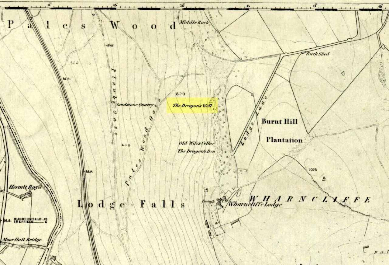
Highlighted on the first OS-map of the area in 1855—along with it’s home and an associated site of the Cailleach, or Old Wife’s Cellar close by—the famous Wharncliffe Dragon used to drink from here, moreso than the other Dragon’s Well at Bolsterstone more than a mile to the west. The dragon – with its “seven heads and twice seven eyes” – lived a short distant away on the rocks above, at the Dragon’s Den. The description of this great beast and its antics at the well were summed-up in Rob Wilson’s book on the Holy Wells of South Yorkshire (1991). He told that:
“The Wharncliffe area has been taken as the setting for the theme of a centuries-old ballad of 19 stanzas , its full title being, ‘An Excellent Ballad of a Dreadful Combat fought between Moore of Moore-Hall and the Dragon of Wantley.’ The 6th and 13th stanzas contain references to Dragon’s Well and are printed below in full:
“Some say this dragon was a witch;
Some say he was a devil;
For from his nose a smoke arose,
And with it burning snivel;
Which he cast off when he did cough,
Into a well that stands by;
Which made it look just like a brook
Running with burning brandy.
It is not strength that always wins,
For wit doth strength excel;
Which made our cuning champion
Creep down into a well:
Where he did think this dragon would drink,
And so he did in truth;
And as he stopp’d low, he rose and cry’d Boh!
And he hit him on the mouth!””
References:
Jewitt, Llewellyn, ‘The Dragon of Wantley and the Family of Moore,’ in The Reliquary, April 1878.
Wilson, Rob, Holy Wells and Spas of South Yorkshire, Northern Arts: Sheffield 1991.
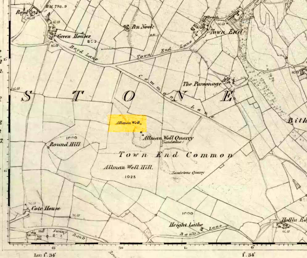
Also known as the Allman’s Well, an inscription with an 1818 datestone was to be found here. But according to folklorists Dave Clarke & Phil Reeder, the site can no longer be found as its waters were “diverted for use at a nearby farm.” However, something that does need checking is their description of a cup-and-ring stone on one of the boulders close by – reckoned to be one of those dropped by the dragon which gives the well its name.
Folklore
Something strange was once going on in this locality if place-names and legends have owt to go by. The local Wharncliffe Dragon, as it was known, used to fly from its home at the Dragon’s Den (a mile-and-a-half east of here) and drink the waters from this well. On one of its flights from Wharncliffe Crags, it carried with it three huge boulders which it dropped in transit and which were said by the folklorists David Clarke and Phil Reeder “to stand in a line on the slope below the well at Townend Common.”
The water from here was said to be good for curing both asthma and bronchitis and was also said never to have dried up, even in the greatest of droughts.
References:
Wilson, Rob, Holy Wells and Spas of South Yorkshire, Northern Arts: Sheffield 1991.