Get yourself to the Roms Law circle, by hook or by crook. Then take the long almost straight footpath south, as if you’re heading to the very damaged Horncliffe Well (thanks to Yorkshire Water). You’ll notice the fencing that runs parallel to the path eventually. Nearly 400 yards along the parallel fenced line you reach the first decent-sized stream. From here, walk upstream, keeping to its northern edges for another 300 yards—then walk 10-20 yards into the heather. You’re damn close!
Archaeology & History
The site is named after Mr James Elkington who recently rediscovered this previously unmapped prehistoric trackway, close to where Burley Moor meets the western edge of Hawksworth Moor, on the greater Rombald’s complex. And it’s a bloody good find if I might say so myself! But, like so many sites covering the Rombald’s complex, it begs more questions than it answers.
2014 aerial view showing outline of trackway2002 aerial view of trackway
The trackway is consistent in architectural design and dimensions with at least six of the eight prehistoric trackways that I’m aware of on these moors — none of which have ever been adequately mapped nor investigated by regional archaeologists (thankfully, there are folk like us around!). This ninth trackway, upon initial investigation, may be the shortest of them all up here.
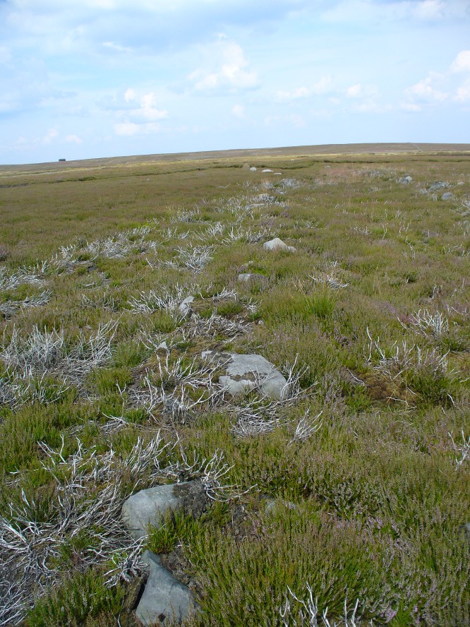
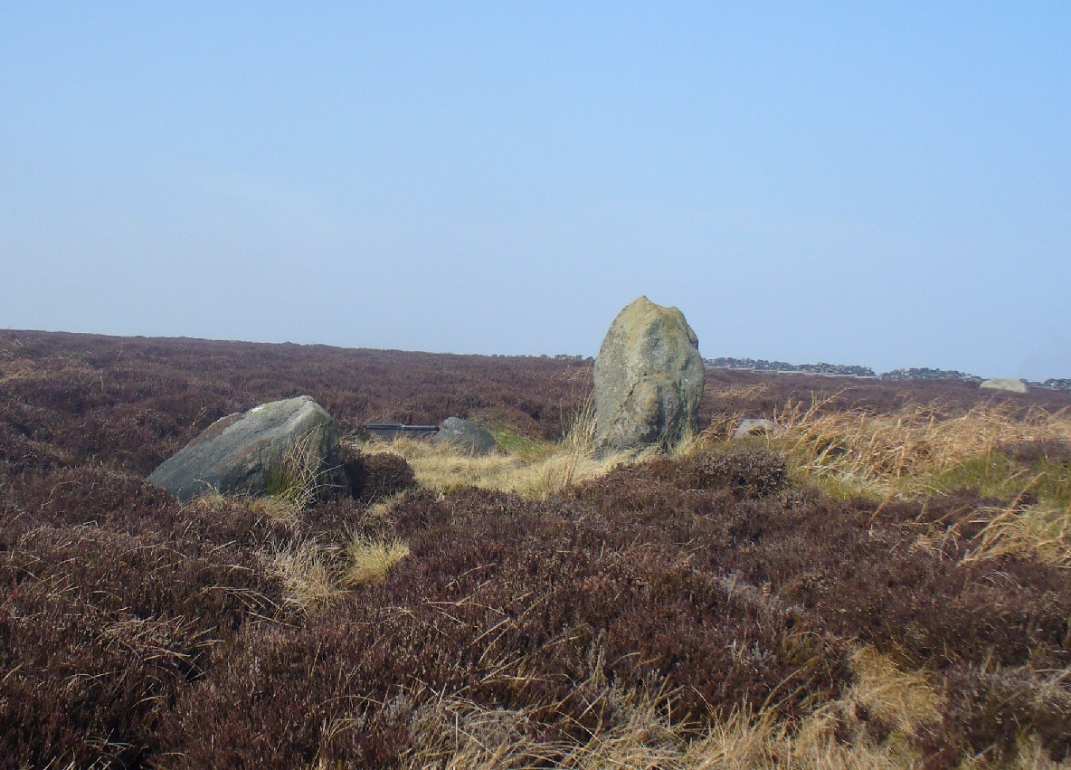
Section of large stones marking the trackOvergrown section of track-edge
Elkington’s Track seems to begin its route about 10-20 yards north of the once large, fast-flowing stream of the Middle Beck—which in itself seems curious. No trace of any trackway seems evident on the other side of this stream and there are no other prehistoric remains accounting for why it should begin or end here…
Walking along the track, it heads northeast for 80 yards, with low lines of raised parallel walling 4-5 yards apart defining the avenue, before it begins to gradually bend round in a more easterly direction. Thirty yards along this more easterly alignment, in the southern walled section, lays an eroded stone (SE 13255 44165) that seems to have stood upright in the not-too-distant past. It seems to mark an opening or gap in the walled trackway and a large scatter of small stones, akin to the denuded remains of a cairn is evident just below the track at this point. The raised embankment of the trackway keeps heading east, towards the line of Hawksworth Moor boundary stones.
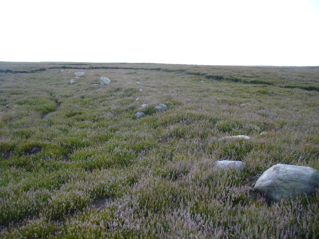
More long line of walled edgesLooking NE up the track
Upon initial investigation, the trackway was visible for a minimum of 185 yards (169.4m) in length, whereafter any immediate trace of it disappeared into the ancient peat. However, aerial views of it on GoogleEarth indicate a faint extension of the track, but these are difficult to apprehend at ground-level. There is every possibility that this trackway eventually meets up with one of the four other prehistoric trackways near the Great Skirtful of Stones giant tomb, or even the North Road running past Roms Law—but until this can be ascertained, the trackway must be defined on its own merits. Further heather-burning on the moors at either end would obviously enable a great examination of the remains.
In the event that the southernmost point of this trackway does begin above the Middle Beck stream, as seems apparent, we may be looking at a ceremonial trackway and not just a ‘road’ as we define them in the modern parlance of homo-profanus culture. Think of it as a small version of The Avenue trackway that runs from Stonehenge outwards, past the Heel Stone and eventually bending down to the River Avon. (Burl 2006) Y’ just never know…..
References:
Burl, Aubrey, A Brief History of Stonehenge, Constable: London 2006.
Cowling, Eric T., Rombald’s Way, William Walker: Otley 1946.
Raistrick, Arthur, Green Tracks on the Pennines, Dalesman: Clapham 1962.
Wright, Geoffrey N., Roads and Trackways of the Yorkshire Dales, Moorland: 1985.
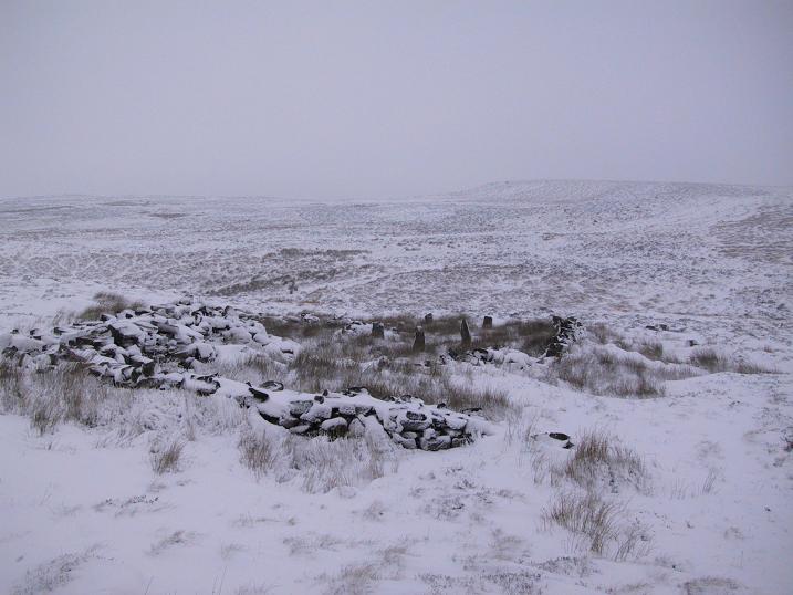
The ruins of Backstone Circle (photo, Richard Stroud)
There are many routes to get here, but this is the one I usually take. From Cow & Calf Rocks, walk up the steep hillside onto the first moorland plain, taking the path right, diagonally, across to the NW as if you’re heading to the Map Stone. From here, looking down at the stream valley below, follow the valley edge up, past the settlement, and then veer down to Backstone Beck and up on the other side till you meet with a footpath and also up in the heather ahead of you, notice the jumbled walling less than 100 yards away. That’s where you need to be!
Archaeology & History
A singular short sentence in Robert Collyer and J.H. Turner’s Ilkley, Ancient and Modern (1885) started it all off, where they told:
“There was still a rude circle of rocks on the reach beyond White Wells fifty years ago, tumbled into such confusion that you had to look once, and again, before you saw what lay under your eyes.”
…..And thankfully this is still what we see today – and in just the area they mentioned.
I’m intrigued to find there’s so much said about this site on the Net and feel I should put my recent feelings about the place to print at last (and after being badgered to gerrit done by James Elkington!). The information about its make-up and the mess it’s in, hasn’t changed since we rediscovered the place on June 3, 1989. Here, amidst the tall grasses and reeds of Juncus effusus and J. conglomeratus, our jumble of megaliths hides within a breakdown of fallen walls, that are thought to have been part of some sheep-fold or a similar animal enclosure (mebbe for the annual sheep-shagging contests that are held, quietly, on these moors each year!).
The name ‘backstone’ itself come from the adjacent beck (slowly depleting as the years pulse by) and is mentioned in the 18th century parish registers. A.H. Smith (1961) informs us that it was the “stream where bakestones were got”, and this was probably a tradition going way way back. The baking stones from the beck may even have been used by the people living in the prehistoric settlements close to the circle.
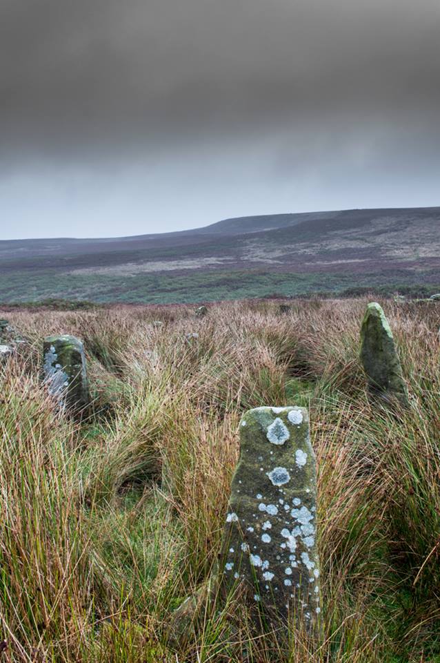
Stones amidst the reeds
In what looks today like a messy double-ring of stones, it’s likely there was originally just a single ring which has, subsequently, been knocked down and re-used for some form of sheep-fondling sessions—be it agricultural or otherwise! But for the record at least: we have small inner ‘ring’ of four upright stones, re-worked in more recent centuries, between two-and-a-half to three-and-a-half feet tall. Another stone is recumbent. The outer ring is more conspicuous. It consists of at least eight standing stones–seven of which are upright–between three and five feet tall, some of which have been re-worked in more recent times. There are several other stones either recumbent or partly covered by vegetation. The tallest of the stones is 4’11” tall. The outer circle has had at least one of the stones uprooted and used at the base of the dry-stone walling intruding the southwest side of the circle. What appears to be at least two original standing stones are embedded into earthworks on the other side of this wall, one of which was located through dowsing!
The best section of the ring can be seen on its eastern side, where an arc of upright stones between three and four feet high are still clearly in evidence, just inside a raised embankment like that found surrounding the Twelve Apostles stone circle less than a mile away.
A short while after finding the site, we contacted the Ilkley Head of Archaeology Studies, Gavin Edwards, about the circle and he subsequently included the site on one of the tourist-guides to the moors.
Alignments through this circle seem apparent in situ; and although such alignments are intriguing (to me anyhow), it’s the geometric relationship Backstone has with other circles on these moors that is rather notable. It’s position in the landscape plays an essential part in an isosceles triangle formation, 1180 yards [1.08km] from the Twelve Apostles stone circle which, as the centre point, is another 1180 yards from the Roms Law Circle. Odd….
Immediately visible from our ruinous circle across the small valley to the slopes of Green Crag, the Ilkley Archaeology Group spent more than fifteen years excavating the remains of what was initially thought of as a Bronze Age village, but their work here has proved startling, pushing the date of human occupation here into the mesolithic period! Local archaeologist Gavin Edwards opined that the Backstone circle would have been the religious site for the people who lived here. I have to concur. There are also more neolithic and Bronze Age walling, indicative of extended settlements and enclosures, less than 200 yards north of the Backstone Circle, structurally consistent with the remains across the valley at the excavated Green Crag Slack settlement.
Ten yards east of the circle is a small well which only runs following exceptional rainfall. This was probably of some ritual importance to the people who practiced rites here. Geological fault lines run not far away on three sides of the ring and an underground stream is present, quite close to the surface (as indicated by the presence of Juncus conglomeratus and J.effisus), encouraging the preponderance of regular electromagnetic variations: these in particular are likely to have some causative influence on the paranormal events described below….
Fortean History
Since rediscovering this site, a number of bizarre psychophysical anomalies have been experienced and described by more and more people — some of whom were previously very sceptical of such things. Both day and night, no doubt when Moon and water speak their subtle electromagnetic accord, a gathering corpus of all-too-familiar events keep speaking of a most disturbing resident spirit…
We begin on Wednesday, July 12, 1989, sometime around midnight, when an acquaintance and I were spending a few days here to record any possible electromagnetic anomalies at this disturbed ring of stones. We weren’t to be disappointed, as something very untoward raised its peculiar head.
As I sat barely ten yards beyond the tumbled group of stones there suddenly appeared, from nowhere, a host of figures—a dozen at most—walking ever so slowly around the old site. I could discern no physical features other than their height and humanoid shape. It was just too dark to see any details about them—they were, effectively, silhouettes. My acquaintance was terrified—although it was perhaps a minute or so before he even glanced at what I was pointing and exclaiming at, somewhat manically, stuttering and shaking my head in an attempt to make the things disappear back to my unconscious where they surely originated. Didn’t work though!
These were no psychic projections. I literally shook my head, closed my eyes and knocked my head against the walling; looked away, shook my head again, shouting at myself and looked back at the figures in front of us. It still didn’t do a damn thing! By now my friend was staring, aghast and scared shitless if the expression on his face was anything to go by.
“Wot a’ y’ seeing? Wot can y’ see?” I asked.
He murmured and mumbled something about some people he could see, walking round and round the old remains.
He was seeing exactly the same as what I could see. As the minutes passed by, this group of people, who were winding in and out of each and every stone and walking through the intrusive walling as it was not there, slowly but surely, ever so gradually, increased in speed. This was very slow and patient and went on for at least fifteen minutes — by which times they were barely visible as individual figures anymore. All we could see by now was a visual blur and a remarkable vortex that was created in the wake of their ‘dance’.
This spinning vortex of silhouettes seemed to get faster and faster until appearing to reach a sort of critical speed/energy state — and as this “critical state” occurred, what was by now a rapid spinning, energetic blur simply vanished right before our eyes! It was as if someone, somewhere, had flicked a switch and they disappeared. Yet, at the very same moment the blurred vortex vanished, several dead straight lines of orange-red appeared in their place. These were as baffling as the dance we had just watched: very thin, wavering lines of what I can only describe as subtle light, bounced off several of the standing stones. These lines—perhaps four of them—did not originate from the circle but appeared to come from further afield. One in particular seemed to come from the direction of the great boulder known as the Idol Rock, 700 yards [650m] east and continued past our field of vision in the direction of the Swastika Stone.
To be honest these “lines of energy” perturbed me more than the spinning figures which had just disappeared. Not only were these lines two-dimensional [a real screw-up that one!], I was at a loss to explain what these lines really were. The first thought was, of course, leys – but my idea of leys did not, and still does not accord with what I was seeing. Eventually the lines faded back to wherever they came, leaving both of us wondering what the hell we had just experienced.
Several minutes after talking over what had just happened, I stood up and walked into the circle. At this point, please remember it was July 12 and the night was so warm that neither of us had taken sleeping bags or a tent onto the high moors with us. As I got to the circle and took my first step inside, a tremendous shiver hit right through my body, almost like I was walking into a freezer. But I moved another step forward, unperturbed if truth be had by the probable chill wind that made me shiver. As I did so, the chill became more manifest and intense. As I took my third step forward the cold became biting and I collapsed onto my knees. [This is not like me, honest. Give me camping in the Scottish mountains in mid-February with average temperatures of -6 degrees and that’s my idea of a good night out!]
Shivering like hell, I stumbled upright and back onto my feet and virtually ran out of the circle. That, more than anything else that night, truly perturbed me.
The following morning another volunteer joined us. We told him about the events of the previous night and he thought whatever he thought; but he’d brought two thermometers with him and set them on two of the rocks: one of them about 25 yards outside the circle, the other on a stone in the circle. The two of them had the same reading: 73° F. We left them without checking for a good hour or so and then began to take readings. What transpired was bizarre to say the least: the one outside the circle was 62° F, the one in the circle was 72° F. A further reading fifteen minutes later, close to sunset, showed the temperature variations had come a little closer: the inner reading was 70° F, and outer reading still 62° F. Readings were then taken every fifteen minutes and the respective readings closed in on each other until both were the same, exactly when the sun was touching the horizon to set, at 9.05pm. But this was not the end of the anomaly. While the temperature outside the circle dropped naturally with nightfall, finally resting at 57-58° F, the inner circle reading continued falling at nearly twice the background rate! Our final reading after 11pm showed a deviation of nearly 7 degrees between the respective thermometers!
If these elements seem in anyway somewhat unbelievable, what occurred next bends the parameters of reality still further!
No further anomalous Fortean events happened at the circle that night—for us at least. However, a friend in Leeds—the internationally renowned ritual magician and author, Phil Hine—was at home with some friends, chatting.
“On the night in question,” he came to write sometime later, “I was talking to another magickian. He returned from the toilet and informed me that there was an “entity” lurking in the stairwell… This was unusual, but not sufficiently unusual to cause undue concern, and so, picking up my thunderbolt, I went out to see what was what. In the stairwell we both agreed on seeing a black amorphous shape. Since my friend had first noticed this, I asked him if he would be prepared to “open his mind” to it, so that I could question it, using him as an interface [which was one of his particular talents] and a fairly accepted procedure for questioning strange entities. “The entity declared,” I have come from the ancient hills.” It also stated that it had been “awakened” only recently due to activity around a sacred site. It said that it had come to give me “power” with which I could do something, but was reticent about the exact nature of this. When I asked what it would do if I rejected this, it said that it would return “screaming to the hills.” When I asked it to identify itself it gave the name Azathoth—which could well have sprung from the mind of my friend, although he had no particular knowledge of the Cthulu mythos entities.”
Phil continued:
“At the time I found it difficult to credit that such a powerful entity would be hanging politely about in the stairwell waiting to be noticed. Being unable to obtain a direct answer to my questions, I told it to go forth, which it apparently did. I later had to perform an intense banishing ritual on my friend who was suffering from symptoms such as feeling cold, a tight pressure on the chest, personality displacement, and motor spasms… Unbeknownst to me at the time, two friends of mine who were members of the West Yorkshire Earth Mysteries Group had experienced a strange encounter at the then newly-uncovered Backstone Circle on Ilkley Moor… It seems strange, on reflection, that the appearance of the entity claiming to originate from a newly disturbed site seems to relate to their experience.” [Hine 1994, 1997]
Other bizarre experiences at the circle itself have been reported by growing numbers of people—a lot of them quite unpleasant. One lady, Katy from Calderdale, whose interest in megaliths rarely stretched into the obscurities of their folklore or weird tales, will “probably never go there again. It terrified me. I don’t know why, there was nothing to be scared of, but the place just felt awful.”
There have been at least a dozen people who have related the same words to me—and I can empathise. On February 14, 1990, Mick N. and I went to the site for the night with intent to do a bit of sympathetic ritual magick. The night was cold and a slight fall of snow glittered across the moors as far as we could see, invoking quite healthy feelings about the forthcoming rite. But as we turned off the path and approached the stones, it was as if we had walked through an invisible gate or door just yards before the circle itself, screaming quite powerfully with gnarled teeth that we were not wanted there that night! It was overwhelming! We both acted accordingly and spent the night elsewhere, cold and querying over its genius loci. The potency of Azathoth seemed inherent in its silent voice.
This particular feeling, almost of malevolance, has been described by many people at Backstone. It occurs both day and night and is akin to what Prof Thomas Lethbridge (1961) described as ‘ghouls’: place-memories so to speak, or spirits of place. Most of the time there is no such feeling, of course. But when conditions are right, these potent subjective consumations can be quite overwhelming at some spots. They are reported worldwide in the aboriginal traditions of all races and are felt, obviously, even today by explorers, mountaineers and visitors to ancient haunted places like the Backstone Circle.
Strange lights have also been seen over and around here by a number of witnesses. On one occasion a ritual invocation of its spirit-nature brought forth a number of glowing red spheres of light. These were about the size of footballs, appearing for a minute or two, floating in front and around us, then vanishing—only to reappear yards away around the edges of the damaged ring of stones. These were very obviously living things and were examining us with equal bewilderment. Other light-phenomena that people have seen here and on this moor appear to relate to the phases of the Moon.
Although the site is quite ruinous, it is a worthwhile place to visit – just respect, and beware the Old Hag who sometimes comes forth from time to time….
References:
Bennett, Paul., “The Backstone Circle,” Earth 15, 1990.
Bennett, Paul, “Archaeological and Geometrical Applications of the Lost Stone Circle of Ilkley Moor,” Earth 15, 1990.
Bennett, Paul, Circles, Standing Stones and Legendary Rocks of West Yorkshire, Heart of Albion Press: Wymeswold 1994.
Bennett, Paul, “The Strange Case of Backstone Circle,” Right Times 1, 1998.
Bennett, Paul, The Old Stones of Elmet, Capall Bann: Milverton 2001.
Collyer, Robert & Turner, J. Horsfall, Ilkley: Ancient and Modern, William Walker: Otley 1885.
Devereux, Paul, Places of Power, Blandford: London 1990.
Gyrus T., “An Interview with Phil Hine,” Towards 2012 volume 4, 1998.
Hine, Phil, “The Physics of Evocation,” Chaos International 1990.
Roberts, Andy, Ghosts and Legends of Yorkshire, Jarrold: Norwich 1997.
Smith, A.H., The Place-Names of the West Riding of Yorkshire – volume 4, Cambridge University Press 1961.
Acknowledgements: Many thanks to Richard Stroud for his photo of Backstone at winter time; to James Elkington for saying, “Come on Paul – get yer finger out!” + his photos too…
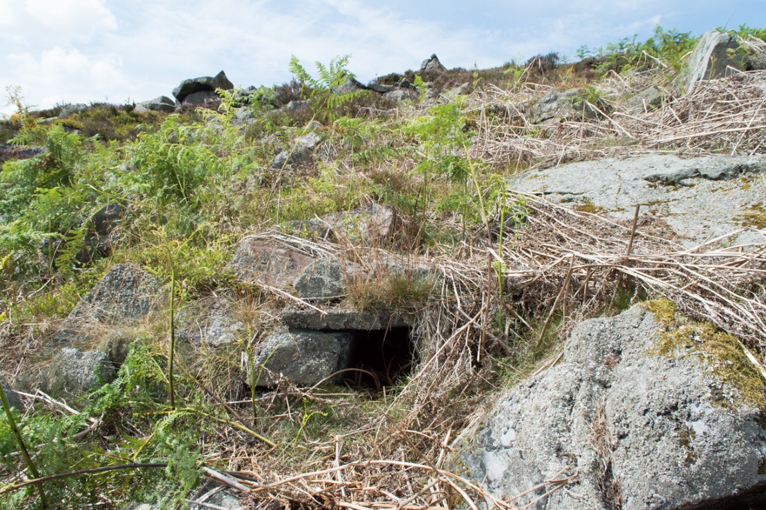
Fairy Mine, Bingley Moor (photo by James Elkington)
This is a strange one. A really strange one….. The site would not have even been written about had it not been for James Elkington pushing me to make its existence visible to a wide audience. As with many sites that I’ve rediscovered, this is one of many that I never seem to write about, for various reasons…although I did do a short piece on it (Bennett 2001) many years back in a little earth mysteries mag, but kept the location quiet. But now, James has got me to change my mind about it. If anyone can throw any light onto what they think this site might be, feel free to let us know. With the exception of is early history, this is its story…
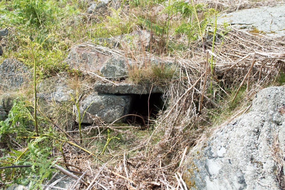
Close-up of the entrance (photo by James Elkington)
One weekend in the early Spring of 1977, Jon Tilleard and I made our weekly wander onto the southern edges of Rombalds Moor, doing little as usual apart from maybe seeking out the curious cup-and-ring stones and other ancient remains, along with walking through the obligatory bogs and wetlands, getting filthy and wet through as healthy kids do at that age. After making our way to Horncliffe Well (generally our first point of call most weeks), we decided to head straight west, off-path as always, and eventually sat ourselves down for something to eat near Wicking Crags on Bingley Moor.
As we packed up again, readying ourselves to walk further onto the moor, John stood upright. In doing so, he dislodged a stone by his feet—right where I was still sitting on the ground!
“Watch out!” he exclaimed loudly—and I quickly rolled forward to get out of the way of the impending stone. Thankfully it wasn’t too big. But then as I turned round to see what had happened, I saw John stood on the small rocky rise he’d been sitting upon—and right beneath his feet, the stone that he’d dislodged had been hiding a very curious secret indeed…
As the photos show, a small opening led into the Earth right underneath where Jon had been sitting. The stone he’d accidentally kicked away had covered and sealed a previously unrecorded entrance. Now, after however many centuries it had been closed and secret, he’d uncovered it again. For us two fourteen-year-old lads gazing into this passageway, our imaginations started running riot!
“What the hell izzit!?”—we must have exclaimed a dozen times or more to each other! To this day, we still don’t know.
I’m not sure how long we stayed here after we’d first found it, but before we left we made sure that the covering stone which had sealed the entrance was propped back upright, securely, so that no one else could find it. The site was quite a way off-path, at the head of a very large boggy area where—to this day—people very rarely walk (in all my years of walking these moors, I’ve yet to see another human walking in this area).
In looking into the tunnel for the very first time, the ground on the outside was of course covered by the usual moorland vegetation; but an inch behind where the stone had sealed this tunnel, the floor was grey dust, all the way in. There were no animal tracks, neither mice nor others, no droppings, no nothing (which we thought was rather unusual). No plants of any form were evident. This ‘door’ had been closed for a very long time it seemed. …Today if you visit the site, ferns and other small plants have encroached several feet into the tunnel.
The entrance itself is about 14 inches across, and from the ground to the top covering stone the entrance is less than 12 inches high, showing quite clearly that no humans can walk in or out of it. Which added to the puzzle: what the hell is it? And why was it sealed with a covering stone? But the more we looked (it became our regular port of call each time we were on the moors) the more obvious it became that a huge amount of work had gone into creating this antiquarian oddity.
As Winter came and cleared all the vegetation surrounding the site, we got an increasingly clear picture of it. But this wasn’t before we tried to get inside! Jon and I failed, but our torches showed that it went in for about 20-30 feet or so and then appeared to be stop, blocked by another stone. Thankfully I had a younger brother, Phil, who was seven-year old at the time—so we took him up to have a look at the place. We figured that only a small person could get inside the tunnel, but we didn’t tell him this (nor my parents!) until we arrived.
With torch in hand, Phil slithered into the entrance and, eventually, his little feet disappeared into the ground. He didn’t seem too happy about it as I remember—but I was his big brother! (cruel – cruel – cruel!) Shouting back down to us as he slithered further and further in, when he reached the blocking stone in the tunnel he exclaimed—”You can go round it!”
“What!? Really!?”
We were excited.
“Keep going Phil,” we urged. But he wouldn’t.
“I’m scared Paul,” he said. “I won’t be able to get back out”—or something along those lines. And he was probably right.
But he managed to get his young tiny body slightly round the blocking stone that he’d reached and shone the torch-light down the extended tunnel. He told that the it just kept going into the hill still further, keeping the same size and dimensions and straightness for about the same distance again—but then it started to curve very slightly, bending to the left (northwest) until it disappeared underneath the entire hillside, stretching out of sight. It seemed from his description, subsequently, that the tunnel went on for another 50 feet at least.
Once he was safely back out, he reiterated how far in it seemed to go. We walked up the hill under which it had been built and Phil bimbled to roughly where he thought the tunnel was as he saw it with the torchlight. Standing on the hilltop, this was obviously an extraordinary feat as there are thousands of tons of rock and earth covering it! Curiously, years later, a dowser who visited the place walked the same route that Phil had described when he went inside it (we told the dowser nothing of Phil’s venture until afterwards).
Denuded walling leading to entrance (photo by James Elkington)Low walling leading to the ‘Mine’ (photo by James Elkington)
When all the moorland vegetation has died back, you can clearly see how the tunnel has been built upon by a large mass of earth and rocks, some of them loose. All round it is an extended collapse of what seems to be quarried stone tumbling down the hillside. At the top of the hill are the remains of old walling and at least two walled structures—although they appear to be post-medieval in nature, not prehistoric. At the entrance itself is evidence of continued walling of some form. It seems as if a wider man-made chamber of some sort may once have stood here, right in front of the present-day entrance. Even if this proves not to be the case, there is very clear evidence that the tunnel which goes into the hillside was once longer, as low walling continues outside away from the entrance, bending away some 50 yards to the southeast, before ending with no indication of additional structural remains. This walled structure swerving out from the entrance is equally perplexing.
The closest prehistoric feature is an unrecorded cairn and petroglyph a few hundred yards away. As far as I’m concerned, this tiny little entrance into the ground isn’t prehistoric. But I’m nonetheless still very intrigued by it, not least because of a few very strange things that subsequently occurred here after we’d discovered it.
Whoever did this, went to a helluva lot of trouble and immense effort to build it. And for what? …Since being opened nearly 40 years ago, very few people have been to see this curious entrance into the Earth. I’ve kept its location hidden. But amongst the visitors has been an archaeologist, a historian, antiquarian authors, occultists and friends. None have been able to say what this site might be. From souterrains to mine-shafts, probably the best suggestion so far was by Mr Paul Hornby who suggested it might have been some sort of kiln, as there seems evidence of fire against one of the stones. But there are anomalies with the site that don’t quite fit the glove of a normal kiln. The extended collapsed ‘tunnel’ which reaches way out, past the entrance which Jon broke in the 1970s, doesn’t make sense; nor the fact that the tunnel goes way into the natural hillside. Indeed, many things here don’t make sense, simply—I presume—because we haven’t asked the right question yet.
But one thing seems obvious: there may be something at the end of this tunnel, deep inside the hill, which someone many centuries ago, for some odd reason, wanted to keep hidden for a long long time. What’s at the end of this tunnel? And if it’s valuable treasure deep in there—it is NOT going to some museum which then, in later years, will be sold off cheaply to some wealthy dood when the museum runs out of money. It should be kept within the safe holdings of The Northern Antiquarian. If this becomes an issue, whatever lies at the end will simply be re-buried elsewhere.
Fortean History
On that fine Spring morning when we first discovered this “mine shaft for little people” as we called it, before we went on our way, we placed the stone that Jon had dislodged that had covered the entrance back into position so that no one could see the opening leading into the ground and under the hill. It was firm and secure when we left—we made sure of it.
The following Sunday morning we made our way back up past Horncliffe Well again and onto this little mine-shaft to sit and have summat to eat. The rocky arena here made it difficult to locate, even though we knew where it was. But when we eventually did find it again, the covering-stone was missing. In fact it had been rolled a good 5 yards away from the entrance. This was odd, we thought—considering that no one even knew of its existence. We wondered if an animal had taken up residence inside, but there were no tracks or remains consistent with this initial idea. We puzzled about it, ate our food, and said our au revoirs. Before we left, we repositioned the covering stone again to block the entrance. This time we made it a little more secure than previously.
The following Sunday morning we visited the site again—and the covering stone had been removed, again! So we replaced it, securely, and visited the place a week later—and the same thing had happened again. This occurred time after time, month after month, year after year. Every single time we covered the entrance, something came and removed it. Yet no one ever comes on this section of the moorland—and even if they did, the site is very difficult to locate. Until now, the site has never been added to any archaeology or history records anywhere—so no one knew of its existence (in asking two of the moorland rangers who’ve worked here over the decades, neither of them knew what we were talking about).
When Andrew Hammond and I left school at 18 (in 1981), we decided as a ritual to bring our school books onto the moor and burn them as the sun was setting in the northwest. We sat near the little mine-shaft and sang our songs of joys at being out of school at last—and as the darkness began to fall over the moor, we replaced the entrance-stone again. Within 30 minutes Nature had cast pitch black across the moor and we fell asleep.
Awaking at sunrise the following day, we wandered down the slope to the little mine-shaft where we’d repositioned the stone only hours previously. It had been moved again, several yards away from the entrance. No animal could have moved it. Whatever it was, it kept doing it every time we repositioned the covering stone. No animal tracks, droppings, or any evidence whatsoever of Nature’s creatures being responsible for the constant removal of the covering stone has ever been found. The constant removal of the covering stone remains a complete mystery.
When a dowser came and tried tracing the underground route of the tunnel in the early 1990s, his rods took him to the top of the rocky hill above, then led him in a small curve to the northwest for more than 100 yards before stopping.
Note:
In the event that archaeologists ever get round to excavating or assessing this site, I would appreciate being contacted before anything is done and would love to be involved in any work performed at the site. I’ll be a good boy! Other remains nearby (usually covered by heather) need appraising to enable a more complete analysis, otherwise all subsequent reports would lack wider archaeocentric contextualization. Thanks, in advance. 🙂
References:
Bennett, Paul., ‘Into a Mythic Domain – a Passage into the Ilkley Underworld,’ in Northern Earth, 87, Autumn 2001.
Acknowledgements: Huge thanks to James Elkington for use of his photos to illustrate this site profile.
From Burley-in-Wharfedale train station, take the road uphill to the moors, turning right at the top, until you hit the bend where the stream and rocky valley of Coldstone Beck appears. Walk up the right-hand (west) side of the beck until the moorland levels out. Walk along the footpath above Stead Crag for a coupla hundred yards, keeping your eyes peeled for the largest upright stone in the heather about 50 yards into the moors. The other way is to get to Woofa Bank Enclosure and keep walking east through the heather for a coupla hundred yards till you see the tallest upright stone in the heather.
Archaeology & History
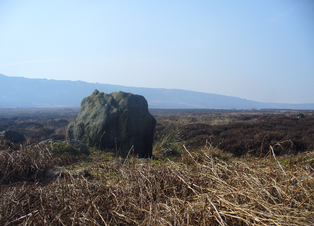
Apart from my own short entry about this site in The Old Stones of Elmet, we have no archaeological account of this standing stone, less than four feet tall and nearly as wide at its maximum, living in a landscape renowned for its excess of neolithic and Bronze Age remains. For those of us who love our megaliths it’s nothing special — but at the same time it’s worth looking at, if only because of the other mass of prehistoric remains close by. It received its name from the adjacent Coldstone Beck a short distance to the east, whose etymology isn’t clear.
Cold Stone, looking eastGazing into a hazy SW
Although we know that many of the sites on this ridge are prehistoric in origin (incredibly some of it still aint registered by those who get paid to do such things), we also need to take into consideration that this site may have been effected by the early industrialists who also made their mark on this section of the moor: they have scarred some cup-and-rings along here, destroyed other remains and left incisions on some rocks which could easily be mistaken as ancient. There is also the possibility that this upright and its adjacent stones were once part of a cairn. If evidence comes to light that the Cold Stone is more recent, we will of course amend this site entry.
Folklore
A number of Cold Stones are found scattered across upland Britain, in the form of crags or solitary stones. In North Yorkshire and beyond, the name is sometimes a corruption of a Call Stone, i.e., a site where village matters were called out prior to the institution of a bell-man. The old Market Cross in Kendal village, also known as the Cold Stone was where village notices were proclaimed.
References:
Bennett, Paul, The Old Stones of Elmet, Capall Bann: Chieveley 2001.
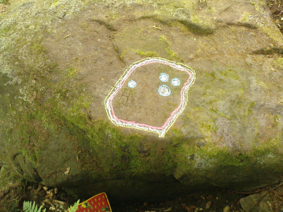
From Ilkley, take the directions up to the Panorama Woods 232 carving. From here you can step from this rock over the stride onto the cup-marked carving 231b, and then go onto the next adjoining rock surface a little lower down. From here, you’ll see another mossy rock surface in front of you by a yard or two. That’s the one!
Archaeology & History
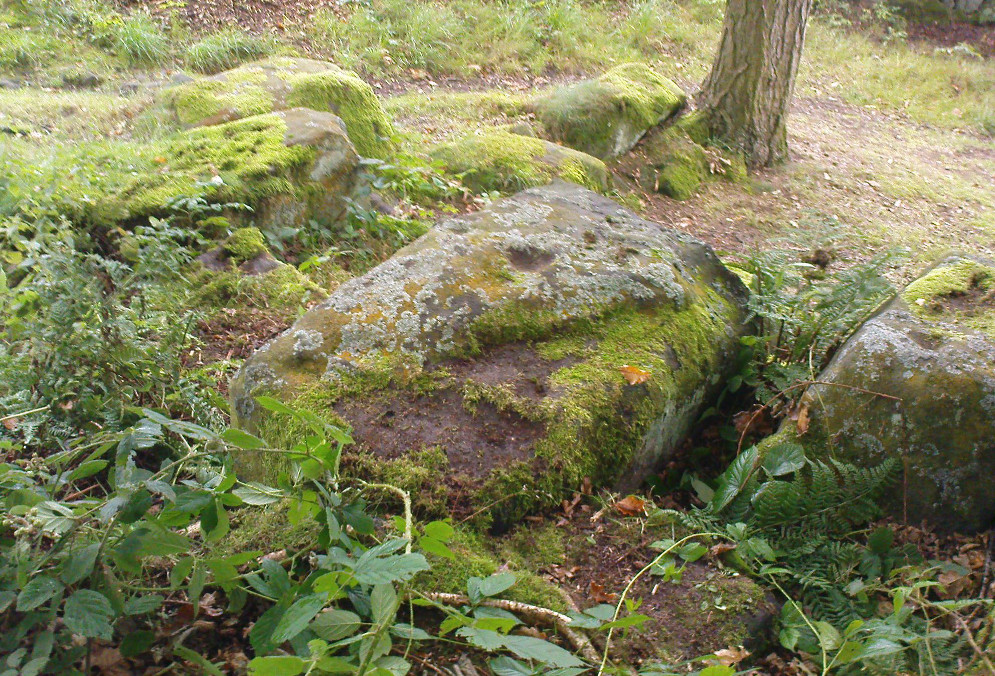
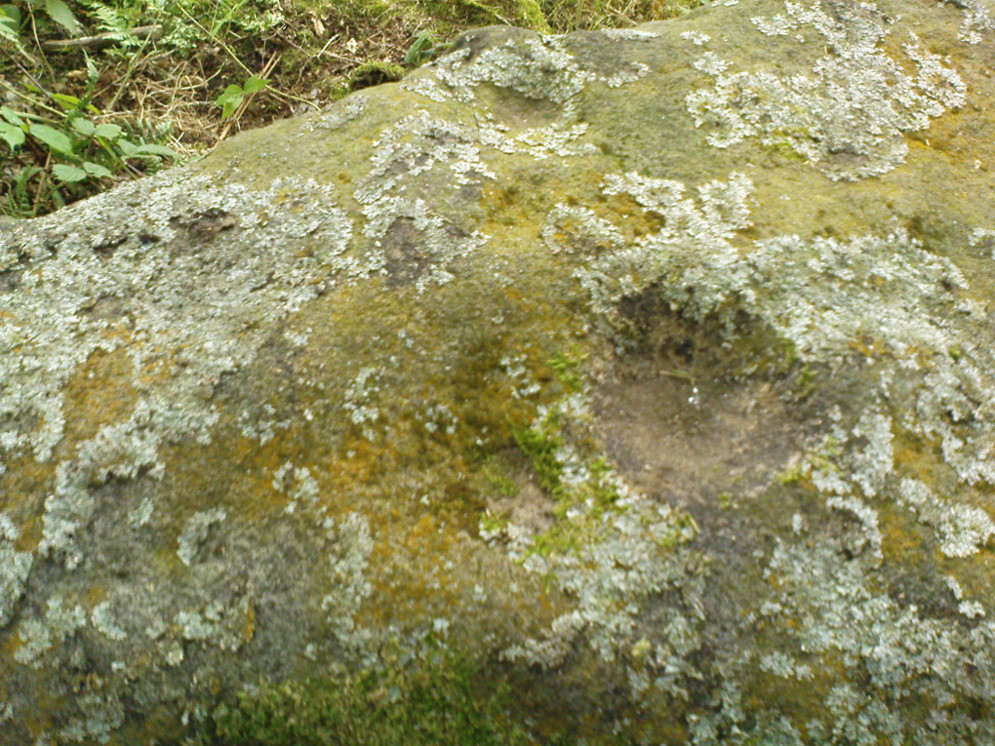
The three cup-markings
Here’s another simple cup-marked stone, probably only for the purists amongst you—although in visiting here please take into account the primary carving’s association with other more prominent designs that once existed only a few yards to the west where the houses now stand. There is also the cluster of other carvings right next to this stone. A prehistoric settlement was also in evidence adjacent to this carving which was destroyed in the latter half of the 19th century.
Close-up of the cupsJohn Hedges 1986 drawing
Described simply in John Hedge’s (1986) fine survey as a small “piece of rock with three clear cups and one depression.” Boughey & Vickerman’s (2003) survey added nothing more and merely copied the same words. For some reason or other (mebbe cos I’m simple!) I really like this otherwise innocuous design and its close simplistic relatives. It’s probably due to the trees amidst which the stones are found and the bright mosses on the rocks, giving the site a slightly extra sense of more living genius loci than others on the top of these moors, where the winds move the subtle spirits with greater ease.
19th century addition
If you step down and look at the vertical side of this stone, you’ll notice a more modern stylistic carving etched onto the surface. Not as deep as the prehistoric cups on the top, it seems probable that a local artist by the name of Ambrose Collins carved this on here (and other similar designs on other rocks nearby) in the late 19th century.
References:
Bennett, Paul, The Panorama Stones, Ilkley, TNA: Yorkshire 2012.
Boughey, Keith & Vickerman, E.A., Prehistoric Rock Art of the West Riding, WYAS: Wakefield 2003.
Hedges, John (ed.), The Carved Rocks on Rombalds Moor, WYMCC: Wakefield 1986.
Follow the directions to reach Panorama Woods carving 232. Barely a yard or two southwest across the small gap where the kids have their little den or hideout, this long curvaceous rock is the fella in question.
Archaeology & History
Cup-markings on the rock
Curiously not included in the ‘official’ records, this large piece of rock, living right in between the Panorama Woods carvings 231 and 232, has at least two, possibly three faint cup-marks etched in the top northeastern portion of the rock. Of the same style and probably period as the basic designs on stones 230 and 231, this is one in a cluster of petroglyphs that used to live at the edge of a prehistoric enclosure, destroyed at the end of the 19th century.
References:
Bennett, Paul, Of Cups and Rings and Things, unpublished: Shipley 1981.
Bennett, Paul, The Panorama Stones, Ilkley, TNA: Yorkshire 2012.
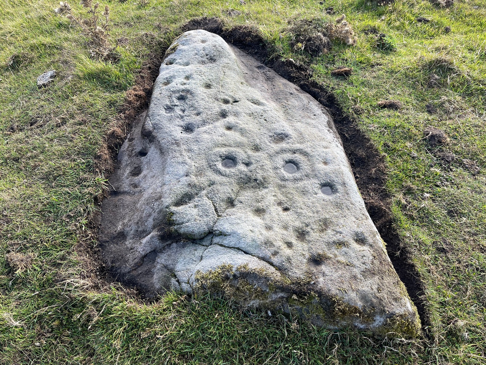
Take the Wells Road from Ilkley centre up towards White Wells, bending to the right as you hit the edge of the moor. Keep along the road, past the old college building with its lake and turn right up Westwood Drive. Keep going all the way up till you hit the small woodland on your right. Where the woodland ends – stop! Walk into the trees about 10-15 yards and you’ll see the large rocks ahead of you. Amongst other petroglyphs hereby, you’ll find this carving is on one of them.
Archaeology & History
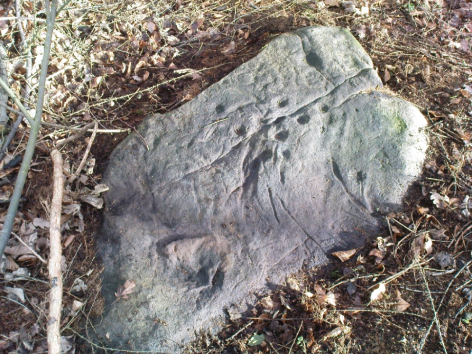
Close-up of deep cups & grooves
Although only given the usual dry description by our academic catalogue chaps, there’s something about this design that I’ve always liked. We first came across it ourselves in the late 1970s, in search of the legendary Panorama Stones, and found instead this large enclosure design with at least three cups inside it, still clearly visible. It is one of a cluster of carvings hereby, all of which were once adjacent to a prehistoric enclosure, described in the 1880s and destroyed soon after. This and the associated carvings very probably had some archaeocentric relevance to the lost enclosure.
Large carved ‘enclosure’, recently chalkedDrawing of the carving (after Hedges 1986)
The carving is sandwiched in between its petroglyphic companions, stone 231 and stone 233. As can be seen on some of the photos here, more recent vandalism has been inflicted on this carving and the recent chalk colouring is what local archaeologists Gavin Edwards and Alex Gibson have termed “social history”, implying fallaciously that cup-and-ring art could be seen as little more than neolithic and Bronze Age scribblings on rock, without any meaning other than it being comparable to “Leeds United Rules OK.” They may be right (highly unlikely) – but in reading copiously about prehistoric petroglyphs in cultures beyond the UK, we find that traditional societies tell such carvings relate to their creation myths, or river spirits, or rock spirits, and are intrinsically related to wider animistic cosmologies and social customs. This indicates, to me at least, that modern archaeologists who think of rock art as little more than childish scribblings still have a great deal to learn and we should beware their uneducated musings about our ancient carvings.
Although the complete carved ‘enclosure’ and its internal cups were mistakenly drawn in John Hedges (1986) survey, he described as being a,
“Roughly incised ‘enclosure’ with five cups in it, twenty eight shallow cups or depressions, one large oval marking, three irregular basins.”
In the later work of rock art students Boughey & Vickerman’s (2003), they simply said of the site:
“Large flat-topped, upstanding rectangular rock. Twenty-eight shallow cups, a few enclosed in two groups by grooves; irregular small basins.”
References:
Bennett, Paul, Of Cups and Rings and Things, unpublished: Shipley 1981.
Bennett, Paul, The Panorama Stones, Ilkley, TNA: Yorkshire 2012.
Boughey, Keith & Vickerman, E.A., Prehistoric Rock Art of the West Riding, WYAS: Wakefield 2003.
Hedges, John (ed.), The Carved Rocks on Rombalds Moor, WYMCC: Wakefield 1986.
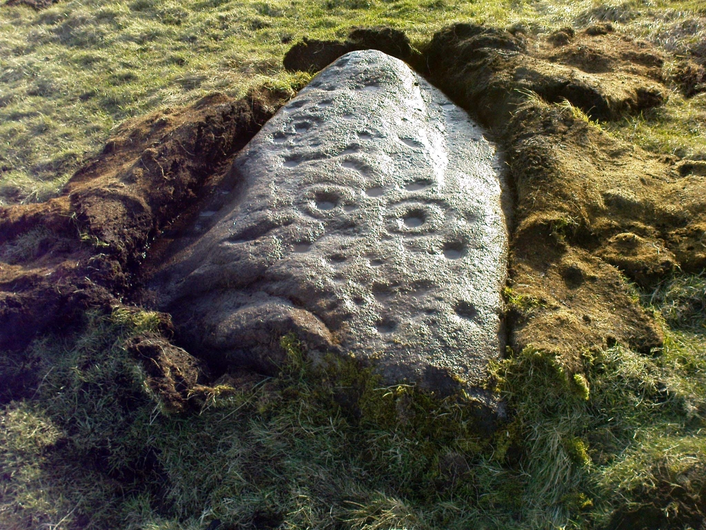
Probably the easiest (direction wise) is if you’re coming from Dick Hudson’s public house on the southern road surrounding Rombalds Moor. From the pub, head left (east) along Otley Road (passing Weecher reservoir) for 1.9 miles (3.1km) until you reach Reva reservoir where a track leads you to the waters. A small parking spot is on the left-side of the road. From here, go through the gate and along the footpath across the field for nearly 300 yards to the next gate; go through here and walk to your right for about 60 yards where uyou’ll reach a small straight dyke (keep your eyes peeled!) running NW (to your left): walk along here for nearly 200 yards until it hits another shallow dyke bearing right; follow this dead straight for 35 yards after which it changes direction, but you need to keep walking straight on forward for another 60 yards or so. Look around!
Archaeology & History
First photo of the carving
This carving is one in a cluster of previously unrecorded petroglyphs, uncovered in the summer of 2011 during a Northern Antiquarian bimble on the northern edge of Rombald’s Moor. The carvings were found as a bi-product of uncovering a previously undiscovered cairn circle, close to the Twelve Apostles stone circle. In assessing and exploring the newly-found circle, it was noticed that a small opening in the near horizon highlighted a rise in the landscape barely a mile away. This ‘opening’ in the land was not visible if you walked 25 yards either side of the cairn circle – but was very notable at the circle itself.
“We need to have a look at that site,” I said. “It’s position looks to have been relevant to this circle.” (or words to that effect) And a couple of weeks later we met up and walked to the place in question.
Fraggle Rock carving, looking westFraggle Rock carving, looking south
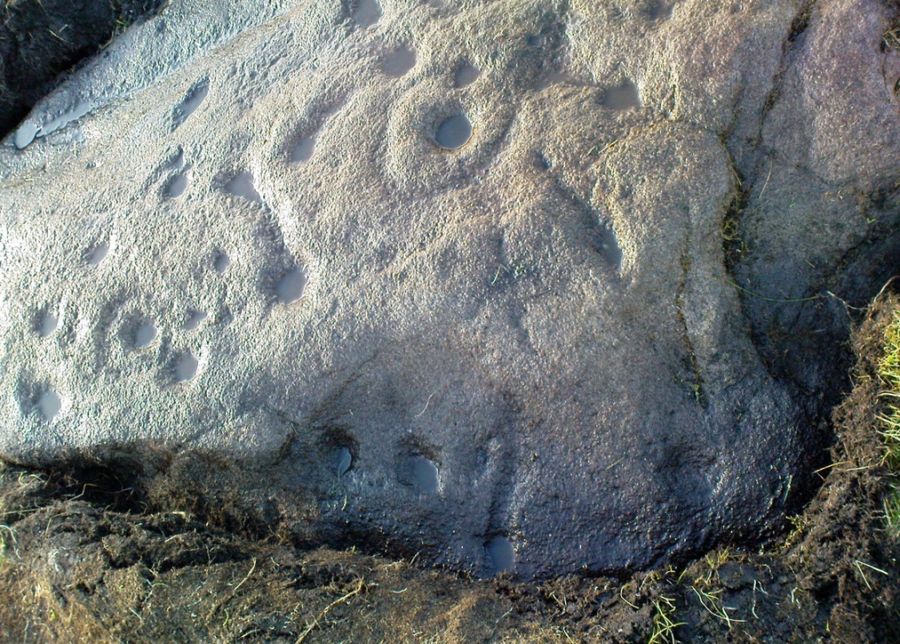
Within five minutes we came across a couple of previously unrecorded cup-marked stones, of simple design, right in line with the cairn circle. As we walked around this spot, then headed back in the direction of the circle, a cluster of small stones were noticed on the slope. One had what looked like a single cup-marking near its edge, but the rest of the rock was completely covered in vegetation. Paul Hornby and Michala Potts had, by now, already found several other previously unrecorded cup-marked stones close by; but as I carefully rolled back the vegetation at the edge of this particular rock, cups-and-rings and carved lines seemed to be covering most of its surface. It was a good one!
Face on the Fraggle Rock
We called it the Fraggle Rock after noticing that when you look at the stone from one end, the two main cup-and-rings are likes two large eyes carved above a large natural down-turning ‘mouth’ feature, similar to some of the creatures’ faces on the muppets or the similar kid’s TV show, Fraggle Rock! (sad aren’t we!?) The photo here shows you what we mean.
The primary design consists of at least 3 cup-and-rings, 2 partial cup-and-rings, 28 cups and several carved lines along which some cup-markings are linked to others. The most notable of the carved lines is the longest (barely visible in the photos), running from a single cup-mark at the southernmost rounded end of the stone, almost straight and parallel with a natural ridge or dip along the rock, until it meets the largest of the cup-and-rings (one of the eyes on the Fraggle’s face!). Don’t ask me why, but for some reason this long faint line seemed the most perplexing element of the carving.
Eastern edge with low cupsCup-marks on rock edge
Most of the design is carved on the upper face of the stone, but a small part of the rock dips into the ground on its eastern side and a small group of cups and a single carved line, in a very good state of preservation, are etched right at the edge of the stone. Unusual. Another faint cup-and-ring is less than 100 yards west; and a fascinating cup-and-lines stone, with at least four long carved ridges running like hair from the top of the stone into the Earth, is a short distance to the north. A number of others are in this and adjacent fields.
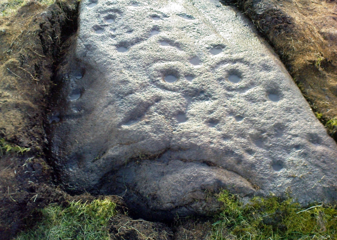
One of the first photos, just as the mud had been cleared
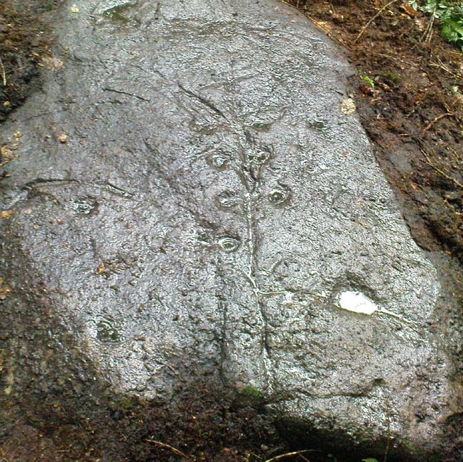
This carved stone was rediscovered by Michala Potts on the rainy afternoon of August 26, 2011, on a Northern Antiquarian excursion to explore some of the cup-and-rings on Ilkley Moor. The entire stone was totally covered in soil and leaves, and Michala spent some considerable time carefully clearing the dead vegetation to unveil the carvings beneath.
Close-up of cups & scars
This carving has at least 12 cup-marks on its slightly inclined surface, with several artificial carved lines and some that are obviously geophysical in origin. (we really could do with a geologist with a cup-and-ring fetish to accompany us on some of our outings!) But the main feature of this carving — as the photos here illustrate — appears to be the natural crack that runs up through the middle of the stone, either side of which have been etched a number of cup-markings attached by small lines or ‘branches’, giving the distinct impression of a tree. Whether this was a deliberate artistic feature (a tree), or just another Rorscharch response to non-linear systems on our behalf (more probable), we’ll never know. On the moors northeast of here on the other side of the Wharfe valley, the Tree of Life Stone acquired a similar association due to its design; but this Ilkley design, sadly, aint quite as good as the one on Askwith Moor.
Tree Stone, showing modern industrial scars
There are some puzzles on this stone aswell. Other lines scar the rock which are definitely man-made, but they are of a different nature and age. The marks have been scarred by more modern metal tools, or were caused by heavy metal machinery that have rested on the rock at some time in the not-too-distant past. You can see the curved deep scratches in the photo here to the right. It seems likely that when the modern houses were built straight across and above here, this cup-marking was damaged by the workers — although they didn’t know it was here as the stone had not been catalogued by the Ilkley archaeologists. But there’s also another peculiar feature on this stone. Someone a century or two ago also carved other fainter features into the stone, seemingly lettering, on the northeast edge of the rock. They can be seen faintly on the second photo, above.
From Ilkley, take the Cowpasture Road up past Cow & Calf rocks, the hotel and along the moorside. A few hundred yards further, just before the next farm-building on your right, walk up the Rushy Beck path to the top. Crossing the stream at the top, now walk diagonally south-ish into the heather for some 200 yards, a short distance before the hillside begins to rise up again onto the next ridge. Remains of this ‘enclosure’ is all around you!
Archaeology & History
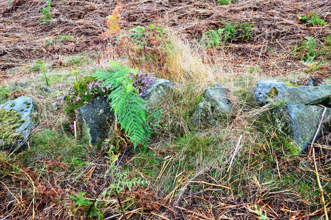
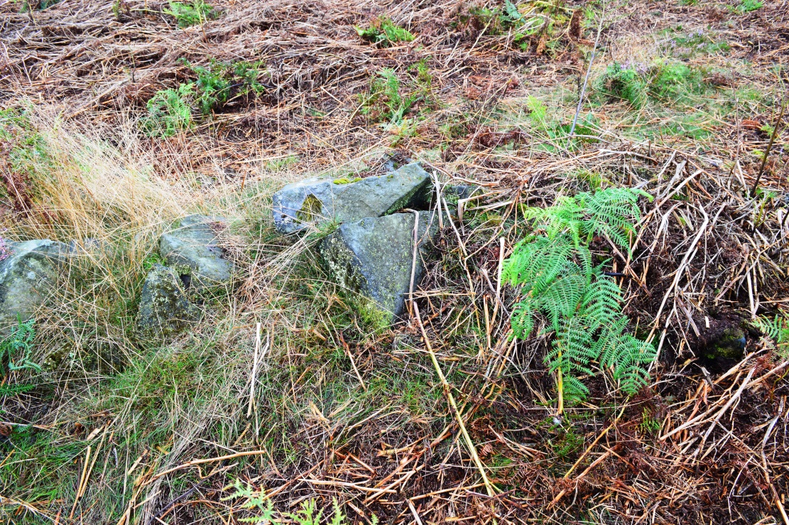
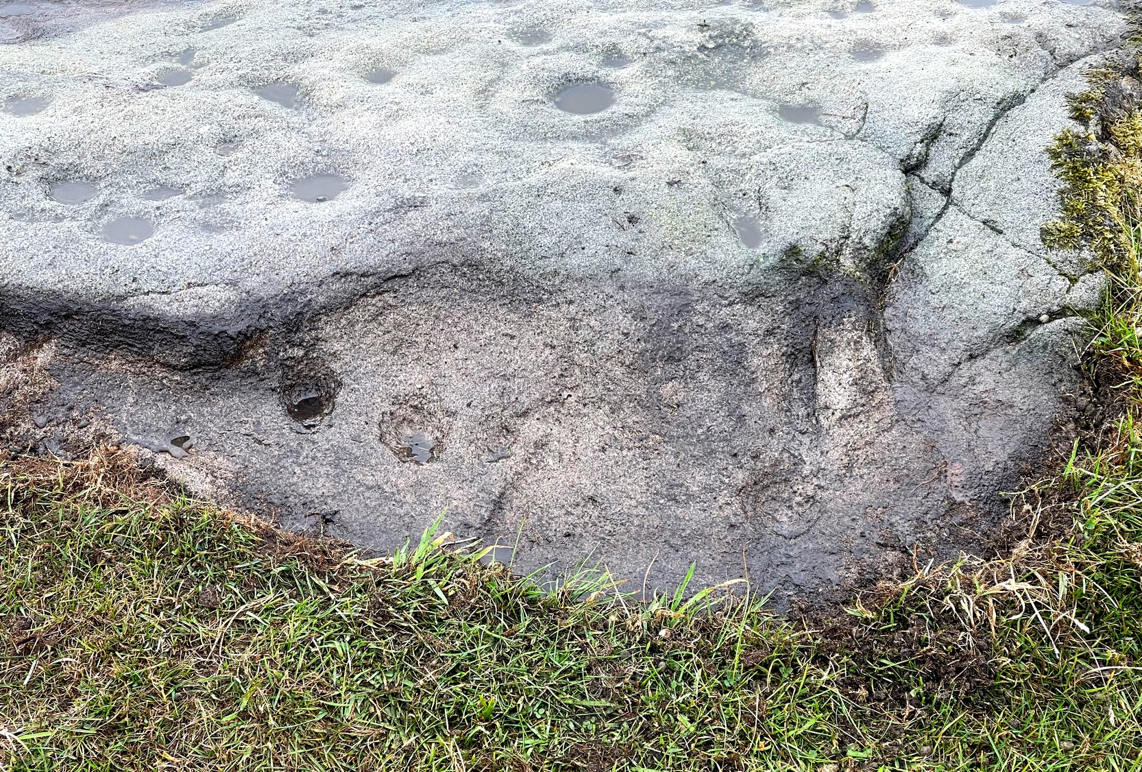
When the normal moorland vegetation covers this prehistoric site, you’d barely know there was anything here apart from various rocky rises and undulations in the ground and perhaps, if you were seeking out old stuff, what would seem to be lines of stone walls bending away onto the moor. But when the heaths have been burnt back, a whole new vista unfolds itself! You see before you a fantastic, well-preserved, unexcavated prehistoric enclosure, whose origins are probably neolithic, but whose history and use stretched through the Bronze Age and into the Iron Age—and it’s not alone! East, west and south of this particular enclosure, other prehistoric walled structures are found stretching all across the landscape hereby, structurally similar and also used over very long periods in prehistory. For antiquarians and historians alike, this is a truly impressive place indeed. In all honesty, the description I give here does not do the place justice!
Northwestern section of enclosure walling
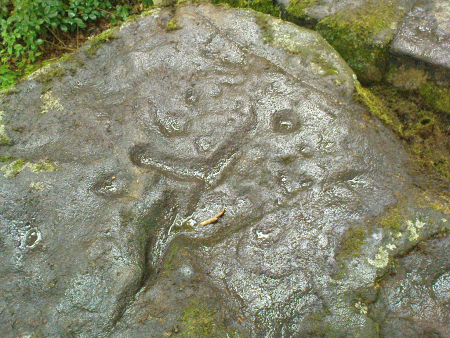
Things like ‘settlements’ and ‘enclosures’ are traditionally relegated by purist archaeologists to be little more than domestic or utilitarian sites: places where our ancestors kept cattle; or were used for defensive purposes; or lived for long periods of the year. Of course, these simple ideas are effective and true at some places; but here at Woofa Bank—in this particular enclosure—something more than just domestic activity was enacted, and over the period of many centuries by the look of things. We surmise this by the incidence of at least fifteen cup-and-ring stones being found within the enclosure itself; and at its very centre is a small standing stone, not previously recorded, that has perhaps five petroglyphs around it. The presence of such a large cluster of cup-and-ring stones close together within the enclosure would seem to suggest ritual activity.
Carved rock & central stoneClose-up of, dancing anthropomorphic figure?
One of the carvings at the centre of the enclosure (listed in the Boughey & Vickerman survey as Carving 372) has been suggested to represent a dancing human figure (the image here shows the anthropomorphic element), which it may well be. The incidence of this central stone and its surrounding petroglyphs has important magico-religious implications, relating it as a site used for creation myth narratives and repetitions (transpersonal explorations at this site may prove worthwhile). The wider extended enclosure with more petroglyphs contained inside it, suggest that additional ritual performances were enacted here; these may have had something to do with the cluster of prehistoric tombs scattered on the moorland plain 100 yards to the west, but we might never know.
Easternmost standing stone
It seems that the walled enclosure itself was constructed around the earlier cup-and-ring stones, probably many centuries later—but we need excavations here to give us more precise details. Much of the enclosure walling itself has the hallmarks of being late Bronze Age to Iron Age, whilst we know that prehistoric rock art can date back into the neolithic period; and from this period Eric Cowling (1946) reported that, at Woofa Bank, “at the western end of the ridge,” just above this enclosure, a neolithic flint site existed.
Cowling’s 1946 plan
Cowling (1946) himself was one of very few archaeologists to even mention this impressive site, in a section exploring the “Iron Age” sites along Green Crag Slack at the eastern end of Ilkley Moor. He wrote:
“At the other end of the site under the shadow of Woofa Bank and near the source of the Rushy Beck, is another D-shaped enclosure apparently unfinished. The plan is of a circle with a flattened side and does not exceed twenty-four yards across in any direction. Here the enclosing wall shows five or six courses at the lower end side and a simple entrance to the west.”
Western entrance to enclosureStone marking eastern entrance
Though Cowling’s measurements are way out! The enclosure itself is much larger than he describes. For the most part, three-quarters of it give the impression of it being a large oval shape, but the design and outline of the walling changes on its southeastern side and kinks inward, in an arc, to eventually meet the walling in the middle eastern section. Its entire circumference measures approximately 220 yards all the way round; it is 65 yards across east-west; and about 61 yards north-south. The average height of the main walling is between 2-3 feet tall, and is made up of many large rocks, some of them positioned upright as standing stones, all packed together with earth and countless thousands of smaller stones. The walling itself is between 2-3 yards wide in many places and has two main entrances: one near the middle of the western wall and the other almost opposite to the east. The eastern entrance is marked by a standing stone between 3-4 feet tall. No gaps are visible at all on the northern curved section of the enclosure. On the overgrown southern edges, not all of the walling is visible and much of it is overgrown. On the whole it’s still very much as Cowling found it, with the arc of walling in this part of the enclosure difficult to make out clearly. There is also another line of walling that runs off to the east, beyond the main enclosure itself.
Carved rock in western wall
The clearer, more visible western line of walling, running south of the entrance on that side, has a large singular cup-and-ring stone laid right along its axis (carving 366 in the Boughey & Vickerman [2003] survey), a short distance before the walling changes direction east-west and runs along the bottom of the slope.
Folklore
Tradition tells that the tribal people from this site were involved in a battle with the Romans along this moorland plain.
…to be continued…
References:
Bennett, Paul, The Old Stones of Elmet, Capall Bann: Chieveley 2001.
Boughey, Keith & Vickerman, E.A., Prehistoric Rock Art of the West Riding, WYAS: Wakefield 2003.
Cowling, Eric T., Rombald’s Way, William Walker: Otley 1946.
Eliade, Mircea, Images and Symbols, Harvill Press: London 1961.
Hedges, John (ed.), The Carved Rocks on Rombalds Moor, WYMCC: Wakefield 1986.
Size, Nicholas, The Haunted Moor, William Walker: Otley 1934.