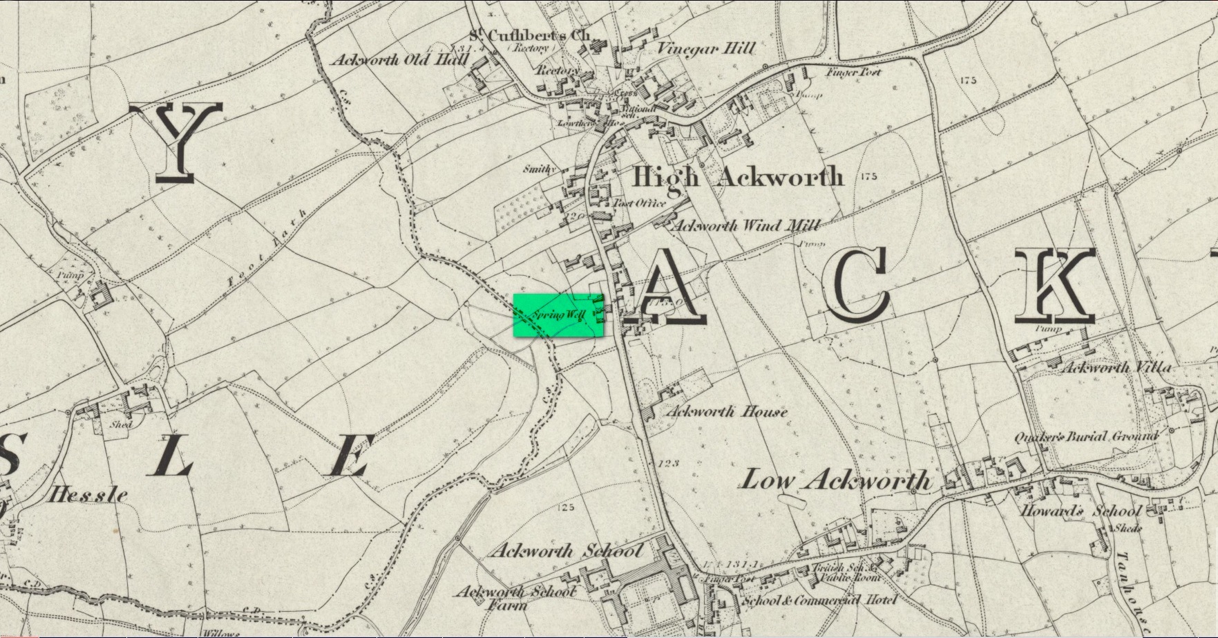
Somewhere close to the aptly-named Ladywell House (now a beauty salon) on the south-side of High Ackworth (just as you’re going into the village on your left) there was once a holy well, seemingly no longer with us. It was described in Saywell’s (1894) history of the town as one of the “antiquities” in the area. He told that,
Spring Well – Lady Well?
“This very ancient well is one of the several public wells, which has in recent years somehow become enclosed. From what it derived its name is not known, but from the fact of its being the oldest, it is not unlikely that it was originally set apart by some religious service, and dedicated to ‘Our Lady’ for the use of the inhabitants of the village. In pre-reformation times this custom was common, some wells having miraculous powers ascribed to their waters by the superstitious, like the well of St. Keyne, and in modern times, the ‘Holy Wells’ in Ireland; but nothing of the sort attaches to the well of ‘Our Lady’ at Ackworth.”
To the rear of the old cottages was once a ‘Spring Well’, as shown on the 1852 Ordnance Survey map. It’s possible that this was our Lady Well, dedicated in ancient times to St. Mary. Does anyone know? And is it still there?
References:
Saywell, Joseph L., The Parochial History of Ackworth, James Atkinson: Pontefract 1894.
Acknowledgements:Huge thanks for use of the Ordnance Survey map in this site profile, reproduced with the kind permission of the National Library of Scotland.
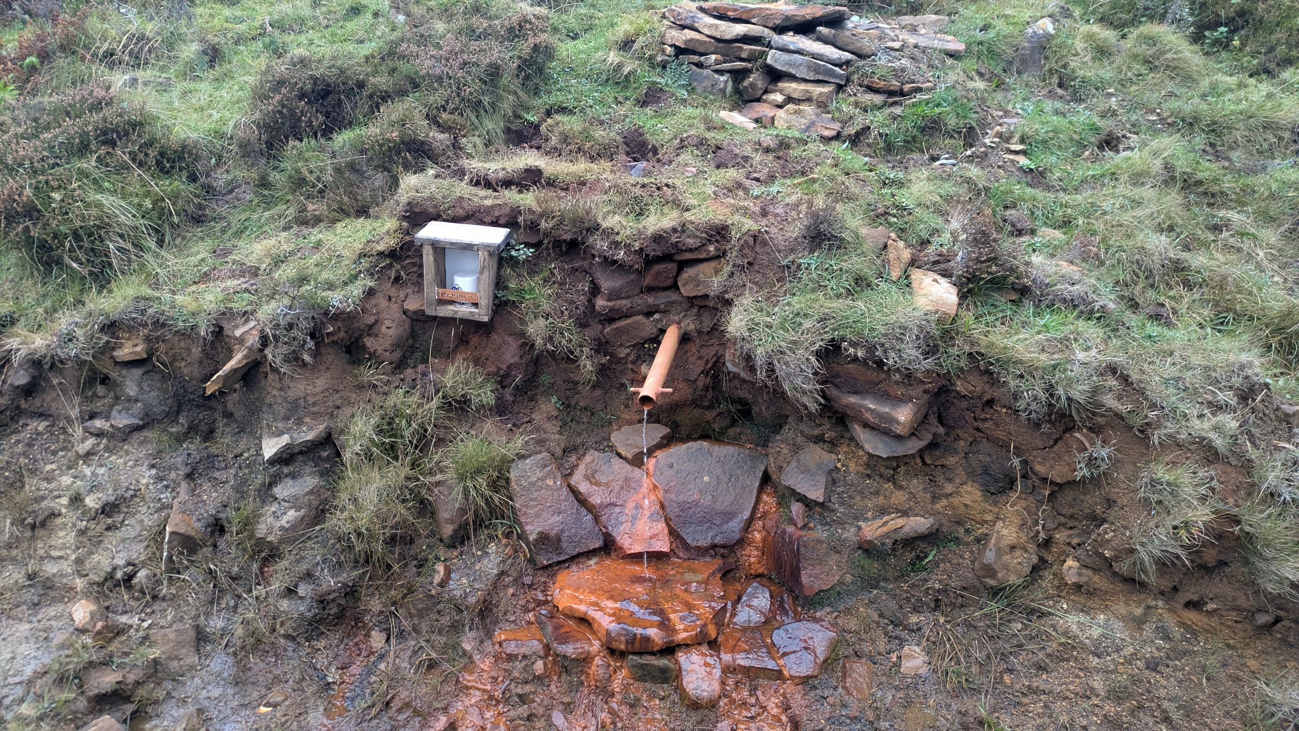
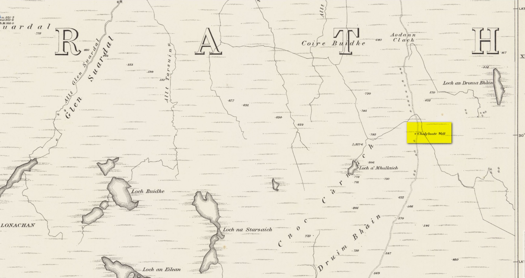
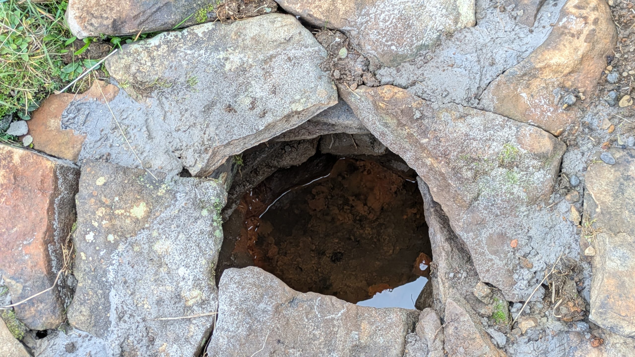
Highlighted on the earliest Ordnance Survey maps of the island, roughly halfway along the Broadford to Heaste road on the right (west) side you will come across the Tabar Ruadh (Gaelic for “Red Well”). For many generations at this point was a Chalybeate well where villagers would stop and drink in a pewter mug from outlet of cast iron pipe which connected to the stone well some nine feet from the road. It was a major stopping point for their horses and ponies to take a drink too.
This set up was functioning in the early 1980’s. At that time I talked to Heaste locals who remembered fishermen from their village taking bottles of this water to pregnant women in the village of Elgol. It was known then for it’s healing properties; this was the early 20th century. The pewter mug was stolen and with road widening and the pipe removed, the site was becoming increasingly overgrown and in danger of being lost for ever.
Site shown on 1881 mapWater under the well cover
For the last fifteen years I have been walking this road and had made it a determination to find this well. Success this summer! — and the hidden overgrown well was cleaned out a new steel pipe added. Chalybeate water now flows and a wooden box is at the roadside with a tin mug. On a wet roadside ditch this red water is very obvious where it joins the road.
Acknowledgements:Huge thanks for use of the Ordnance Survey map in this site profile, reproduced with the kind permission of the National Library of Scotland.
Holy Well (destroyed): OS Grid Reference – NN 9397 5770
Archaeology & History
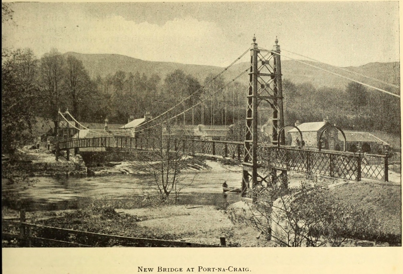
It was more than a hundred years ago that the waters of this sacred well fell back to Earth. They emerged above the eastern side of the River Tummel, close to the bridge where previous there had been a local ferry at the site known as Port-na-Craig. The mythic history of the ferry and the holy well went hand-in-hand, according to local tradition. Its lore was was spelled out by the local author and historian Hugh Mitchell in a speech he gave when a new bridge was opened here in 1913. He said:
The Well was on the far side of the bridge
“The ferry at Port-na-Craig, though not as old as many ferries in Scotland, bears the respectable antiquity of something like eight hundred years. It was established by the monks of Coupar Angus when they got a gift of the lands of Fonab, and as Coupar Angus lay on the north side of the river Tummel, they established the ferry in order to have communication. In those days the ferry boat was made of skins stretched on branches or twigs, so it was somewhat dangerous to cross in, and the monks thought that they would improve the occasion by dedicating the well near the old ferry to St. Bride, so that people, when they ventured across the ferry, might propitiate the saint. It was customary for people to drop either a small coin or a brass pin into the well. He was afraid that brass pins rather prevailed, and no doubt, St. Bride, being a lady, would find them more useful. The well remained until recent times, when it had, unfortunately, to be filled up, on account of being contaminated by neighbouring fields.”
For “fields”, read sewage—for that was the actual reason it was closed. Mr Mitchell (1923) told as much in his subsequent history of Pitlochry, saying that “sewage was percolating into it.” John Dixon (1925) echoed the same thing a few years later.
The curative and magickal properties of St Bride’s Well had considerable renown for local people. Mitchell told that:
“It had a great reputation at one time for cases of lung disease… Pins and coins were dropped into the well as votive offerings, and the bushes above it were hung with rags to call the attention of the saint to the sufferer.”
A few miles north from here, at the back of Blair Castle, an old church is dedicated to St. Bride, whose celebration date is February 1. “The day was known as Candlemas in the Highlands,” wrote Mrs Banks, saying, in commemoration of the Celtic Brigit, “Feill Bride, the festival of Bride, displaced the festival of Mary.”
References:
Dixon, John H., Pitlochry, Past and Present, L. Mackay: Pitlochry 1925.
MacKay, L., Atholl Illustrated, L. MacKay: Pitlochry 1912.
Mitchell, Hugh, Pitlochry District: Its Topography, Archaeology and History, L. Mackay: Pitlochry 1923.
Holy Well (destroyed): OS Grid Reference – SW 7202 5073
Archaeology & History
Not to be confused with another St. Agnes’ Well near the coast just 1½ miles southwest of here, this ‘holy well’ was found in the middle of the town itself. It was first described sometime between 1710 and 1720 by a certain Thomas Tonkin who penned lengthy notes about the history of the parish of St Agnes and, therein, mentioned this Well which was, he said, located “by the Cross before the Church.” But it had already been drained and “cut off”, as he put it, some years prior to him writing his notes.
More than two hundred years later, on 3 December 1931, the West Briton & Cornwall Advertiser reported on an excavation that took place of the nave of St Agnes church. The vicar, a Rev W.H. Browne, said that,
“On the west side there was evidence of water, which might have been a spring and possibly the holy well. We shall have to preserve it if it turns out to be what we anticipate it is. How this is to be done, I do not know, but we cannot allow it to be covered in again without doing something. It is creating tremendous interest, and will cause a great fight among the experts.”
Several years later, the great Cornish hagiographer Gilbert Dobie (1940) also mentioned the excavation, noting the wet area which they believed was the location of the well, also noting, “at the same time…the finding of remains of an earlier chapel.”
References:
Doble, Gilbert H., History of St Piran, 1940.
Tonkin, Thomas, “The Parish of St Agnes,” in Journal royal Institute Cornwall (eds. P.A.S. Pool & H.S Douch), volume 7 (2nd series), 1975.
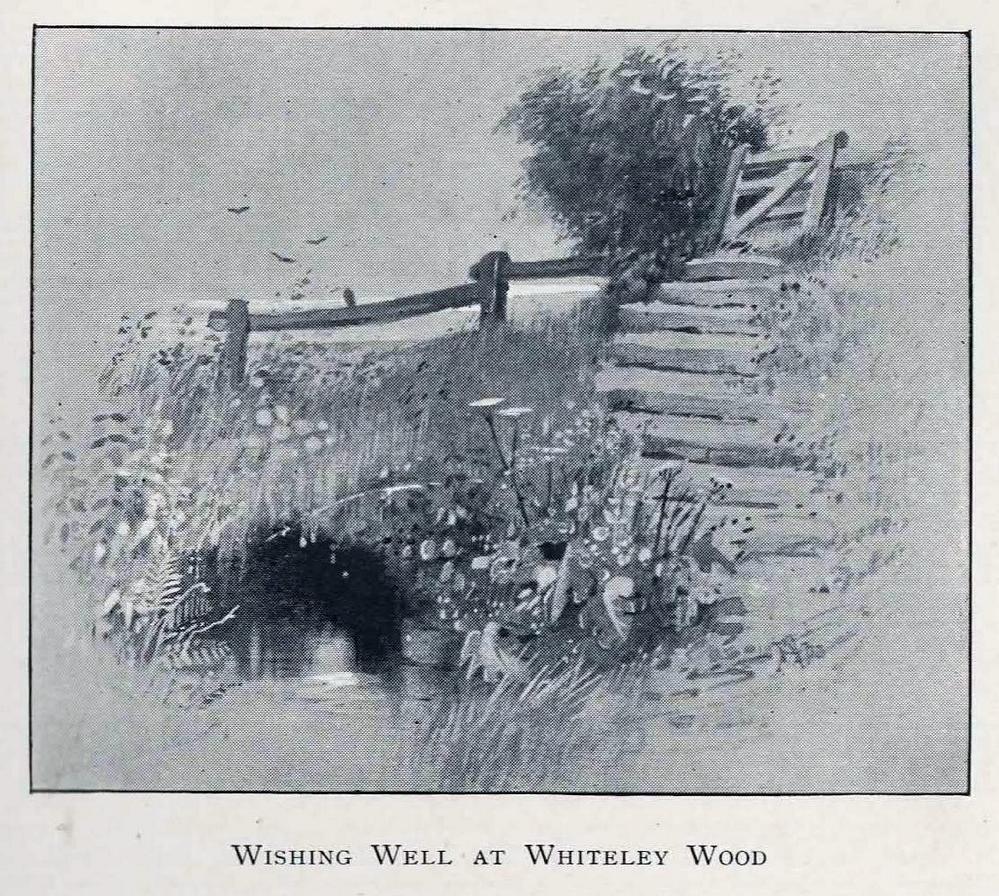
The location of this site has proved troublesome. Even when Rob Wilson (1991) did his local survey of holy wells he was unable to locate it—but it looks as if it shouldn’t be too troublesome to find, as the area in which it flowed is still very much a mix of open countryside and maintained landscapes. Described briefly as the “Wishing Well near Whiteley Wood” in Sidney Addy’s (1893) fine work, he makes a rather hopeful attempt to derive the word ‘wishing’ from German mythology, where “one of the names of the god Wuotan or Odin was Wunsch or Wish.” But – well – you just never know…..
In the landscape at Whiteley Wood there is a Priest’s Hill, so if this Well was found there, it may indeed have had an authentic ‘holy’ designation. But there were a couple of ponds in the area too, which may be fed by this spring. So, first, we need to find the well!
References:
Addy, Sidney Oldall, The Hall of Waltheof, William Townsend: Sheffield 1893.
Wilson, Rob, Holy Wells and Spas of South Yorkshire, Northern Arts: Sheffield 1991.
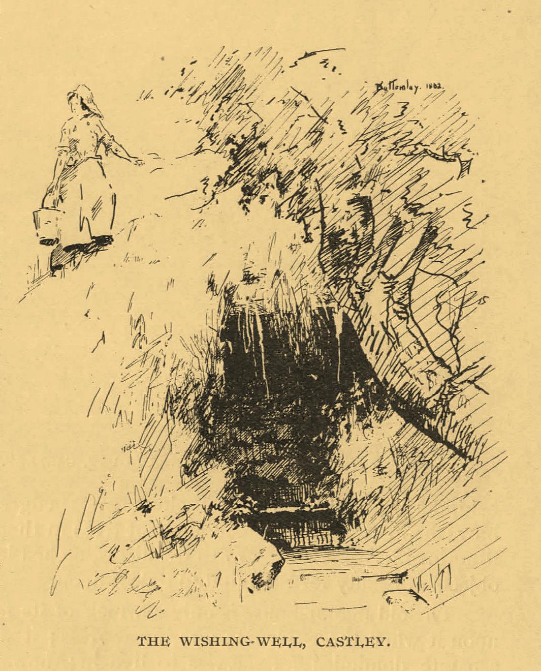
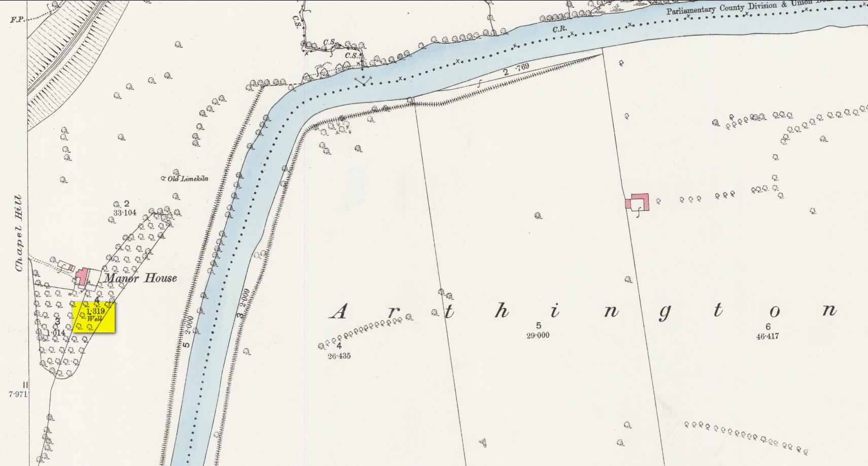
An important water source for local folk in Castley hamlet in previous centuries, this was one of several so-called ‘Wishing Wells’ above the higher banks of the River Wharfe a few miles from each other. It’s a title which, to be honest, was afforded the place when its original local name was removed. It was quite obviously a sacred well in earlier times, as it’s found beneath the slope of Chapel Hill, looking eastwards towards the rising sun, when the waters here (as at countless others) had their greatest remedial or magickal powers. Tradition told there was once a small chapel above the well itself. The spring was highlighted on early Ordnance Survey maps, but all that seems left here today is an occasional boggy mass in the trees at the bottom of the sloping hill.
The old folklorist and antiquarian Edmund Bogg (1904) wrote the following about it:
‘Wishing’ Well on 1888 map
“On the terraced bank near the garden, ’neath an overhanging hawthorn, is a beautiful spring of clear sparkling water, which is locally known as Castley ‘wishing-well.’ More than once we have heard the women-folk declare how, in their maidenhood, they loitered down the bank to the well, usually at eventide, when the birds were warbling their vesper song, and placed their offerings there in silence, yet breathing, as it were, the mute longing of their heart’s desire. It is a natural grotto fit habitation of fairies or the traditional elves. The bank, in which the well is situated, is known as ‘Snake Bank.’”
References:
Edmund Bogg, Higher Wharfeland, James Miles: Leeds 1904.
Acknowledgements:Huge thanks for use of the Ordnance Survey map in this site profile, reproduced with the kind permission of the National Library of Scotland.
On the west-side of the River Spey from Fochabers, follow the road-signs taking you south on the B9015, and near Inchberry is a tiny road on your right (careful not to miss it). Go along here to the end of the long straight road and turn right, down the track. When you reach the trees, bear left along the track to St Mary’s, Orton, marked “Private road”. 🙂 Parking is limited to one car only but very quiet.
Archaeology & History
St Mary’s Well, Inchberry (21st Century Pict)
Set in a stunning location next to the river Spey with a magnificent view of Ben Aigan to the south, St Mary’s Holy Well and Pool is easy to find behind the Chapel / Mausoleum wall, dedicated to the Duff Family. There is a small stone basin in the wall which may have been the Chapel font. At the time of my visit the weather has been dry and sunny for some time. The pool below the iron grate has been recently cleared of leaves before my visit, with no standing water but the stones on the bottom of the pool looked damp. And with the cemetery above and behind the wall, perhaps it was for the better.
It was clear and running, said J.F.S. Gordon (1880) at the end of the 1700s, but when he came to write about it the flow “has ceased for many years, and is now only a feeble, filthy, stagnant Driblet for the use of cattle.” Pilgrimages were made here on the first Sunday in May, and water collected from the site was kept for a year, in return for an offering (usually a stone or other inanimate object) that enabled the magickal spirit of the well to enact cures.
Folklore
A site described by Watson (1868) as being “long held in superstitious reverence”, the well was said to cure whooping cough, eye problems and joint conditions. It had thoroughly un-christian shennanigans practised here by local folk, much to the consternation of the usual culprits! Visited extensively by people from far and wide, Mr & Mrs Morris (1981) told,
(21st Century Pict)
“The visits displeased the Kirk and there were various summonses to the Session for “going supersticiously to a Vell at Speyside” and of persons who “kneillit about the chappell and drank the water.” The minister at Ruthven reported that a large number had gone to the chapel well “thrie Saturdays before Lambas and thrie efter called the six silie Saturdayes, and that the conventions wer on the night or before day in the morning.” And “quhairas zierlie about Lambnes, the ignorantes repaired to ane wel at this kirk, called Our Ladie Wel, superstitiouslie, and kneeled about the said kirk, it is reportit that the evil is removed.” This may be the well associated with the White Witch, Dame Aliset, who cured a fairy child with simples and the well water.”
References:
Bord, Janet, Holy Wells in Britain – A Guide, HOAP: Wymeswold 2008.
Watson, J.& W., Morayshire Described, Russell & Watson: Elgin 1868.
Acknowledgements:Huge thanks for use of the Ordnance Survey map in this site profile, reproduced with the kind permission of the National Library of Scotland.
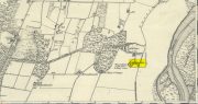
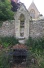
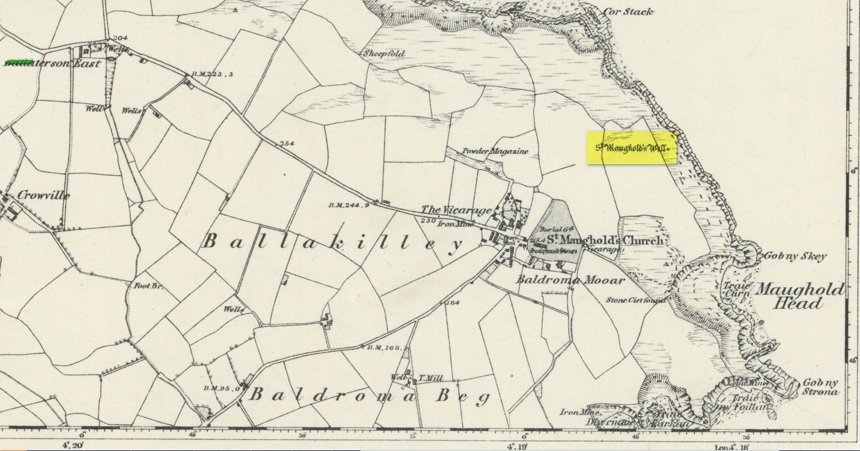
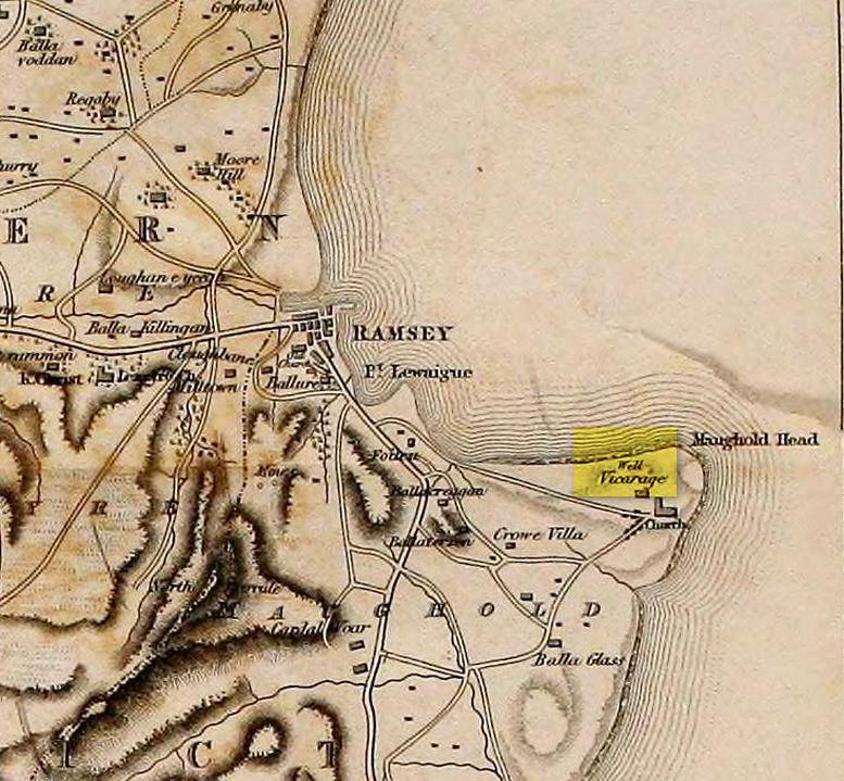
St. Maughold’s Well—also called Chibbyr Vaghal—is found on the northeast side of the headland on the cliff face about a hundred feet above the sea, a quarter mile from the St. Maughold’s church. It was a pilgrimage site which people visited on the dates of November 15 and July 31.
“…Beneath the head, under some moss clad rocks, is a deep spring, formerly much celebrated for its supposed medicinal virtues.” – George Jefferson, 1840
St Maughold’s on 1870 map‘Well’ on the 1836 map
Its medicinal properties are of great repute and was resorted to by many on account of its sanctity by crowds of pilgrims. The well was traditionally visited on the first Sunday in August, being the first Sunday after the Saint ‘s principal feast day, July 31 (significant in the Celtic calendar), but the devotions here have their origins in pre-christian times. The principal benefit at the well was a cure for sore eyes. After bathing the eyes or drinking the water it was/is customary to drop a coin, pin or button into it. Alternatively, a piece of cloth which had been used for bathing the eyes would be left by the well or on a nearby bush. As the cloth rotted, the ailment would be cured; while anyone who picked up the rags would himself receive the complaint associated with the offering; and to receive the full benefit of the well’s curative powers it should be visited on that first Sunday in August, and “while books were open in the church” — or in pre-reformation days, whilst Mass was being offered.
“…Where the spring gushes forth the rock has been hollowed into a small basin, and over it has been erected a simple shed of rough unhewn blocks of the rock immediately at hand. Hither the Saint is said to have resorted; nor is it altogether improbable that nearly fourteen hundred years ago at this very font he administered the baptismal rite. Certainly it was for many ages in great repute for its medicinal properties, and was resorted to on account of its sanctity by crowds of pilgrims from all parts. Nor is it yet forgotten.” – J.G. Cumming, 1848
“…A drink of its water, taken after resting in the saint’s chair close by, is supposed to be an unfailing cure for barrenness in women.” – A.W. Moore, 1890
Folklore
At Maughold churchyard above the well, ghostly whispers are said to be heard by the steps in the churchyard. This is interesting as when excavations were done here, the labourers found bones buried beneath the same steps. They were dug and exposed during the day and one worker who stayed in the church heard distant sounds, whispers and murmuring all around the church. When the bones were reinterred, the haunting stopped. (Bord & Bord 1985)
References:
Bord, Janet & Colin, Sacred Waters: Holy Wells and Water Lore in Britain and Ireland, Granada: London 1985.
Cumming, J.G., The Isle of Man: Its History, Physical and Ecclesiastical, J. van Voorst: London 1848.
Hall, John, “Earth Mysteries of the Isle of Man,” in Earth, no.17, 1990.
Moore, A.W., The Surnames and Place-Names of the Isle of Man, Elliot Stock: London 1890.
Jefferson, George, Jefferson’s Isle of Man, G. Jefferson: Douglas 1840.
Radcliffe, William & Constance, A History of Kirk Maughold, Manx Museum: Douglas 1979.
Acknowledgements:Huge thanks for use of the Ordnance Survey map in this site profile, reproduced with the kind permission of the National Library of Scotland.
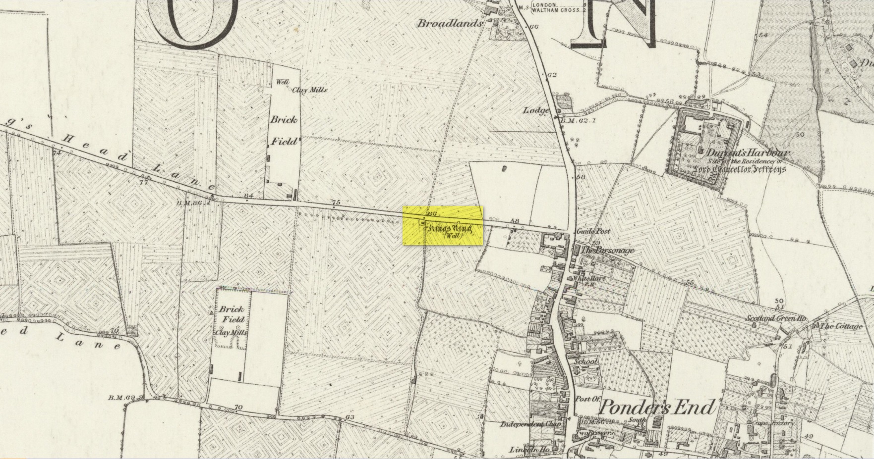
Healing Well (destroyed): OS Grid Reference – TQ 3496 9623
Also Known as:
King Ring Well
Tim Ringer’s Well
Archaeology & History
Site shown on 1879 map
Highlighted on the 1879 Ordnance Survey map, on the south-side of Southbury Road close to Ponders End, this curiously-named water source has a somewhat mundane history to it. It’s likely that an old stone conduit that was shown on John Ogilby’s 1698 road map of the area is the King’s Ring Well—although it hadn’t acquired that name at the time. It was described for the first time in Robinson’s (1823) classic work, located “on the south side of Gouldsdown-lane,”—which later became known as Nag’s Head Lane and today is Southbury Road. Anyhow, he continued telling us that here,
“there is a moat dividing two square fields. In the first there are remains of stables, barns, &c. and hollows, as of vaults, among the trees. There is a deep well, bricked, called “King Ring” or “Tim Ringer well,” (Timothy Ring was an opulent farmer who occupied the lands; and it is supposed from his arrogant manner obtained the nic-name of “King Ring.”) whose spring, it is said, never freezes nor dries up, and the water is esteemed very efficacious in disorders of the eyes.”
Robinson noted that the local drovers, “who from being so much exposed to the dust are subject to sore eyes, frequently turn up the lane to use the water, and there have been instances of children being cured of sore eyes by it after the measles.” He also alluded to a tradition that a religious house or convent once stood hereby, although he never obtained accurate information to prove his idea. If that was the case, the site may have been a holy well. The medicinal properties of the waters were repeated in Lewis’ Topographical Dictionary (1848); and again in Hodson & Ford’s (1873) subsequent survey of Enfield, emphasizing that it was “considered infallible as a remedy for inflammation of the eyes.” Sadly the well has long since been destroyed.
Acknowledgements:Huge thanks for use of the Ordnance Survey map in this site profile, reproduced with the kind permission of the National Library of Scotland.
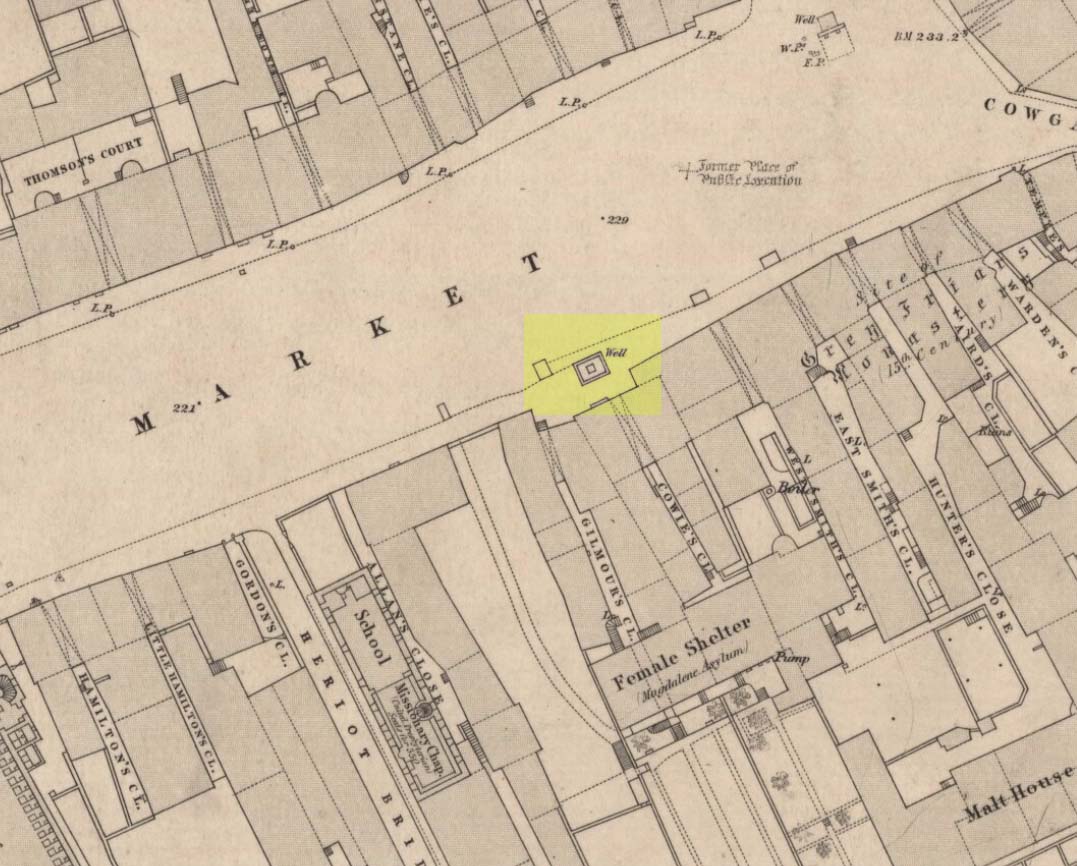
Healing Well (destroyed): OS Grid-Reference – NT 2547 7337
Archaeology & History
Muses ‘Well’ on 1852 map
We have the historical detective work of Stuart Harris (1996) to thank for the location and probable meaning behind the name of this long-lost well, that could once be seen along Haymarket, near the heart of the old city. Shown on the 1852 OS map, without name, the site was recorded as a public well “from 1502 onwards,” he wrote — and its name was variably written as muse, muss, meus and mwse, which led him to surmise that it was from the old Scots word “meuse”, or the “well by the stables”; although I cannot find this validated in the established dialect dictionaries and glossaries of William Grant (1934-76) or Simon Taylor (2012). Their relative definitions tell it to be of a mouse, or a small trackway left by rabbits, hares or rodents, running between hedgeways. This would mean the ‘Muse Well’ was a variant around a “well by an animal track”, which in earlier centuries were very important to note, as wild animals were indicators of food (amongst other things).
This aside, “the King’s Stables, dating from the 1340s, were of course over 200 yards further west,” he wrote,
“but the convent of the Greyfriars, founded in 1471 in the Cowgatehead only about fifty yards east of the Muse Well, certainly gave lodging to travellers of the more distinguished sort, and although no early record of stables here has come to light, it may be no accident that the only stables recorded in the Valuation Roll of 1635 as being on the south side of Grassmarket were in McIntyre’s Close, which had its entry ten yards east of the Well.”
References:
Grant, William (ed.), The Scottish National Dictionary – 10 volumes, SNDA: Edinburgh 1934-76.
Harris, Stuart, The Place-Names of Edinburgh: Their Origins and History, Gordon Wright: Edinburgh 1996.
Taylor, Simon & Gilbert, Markus, “Elements Glossary”, in The Place-Names of Fife – volume 5, Shaun Tyas: Donington 2012.