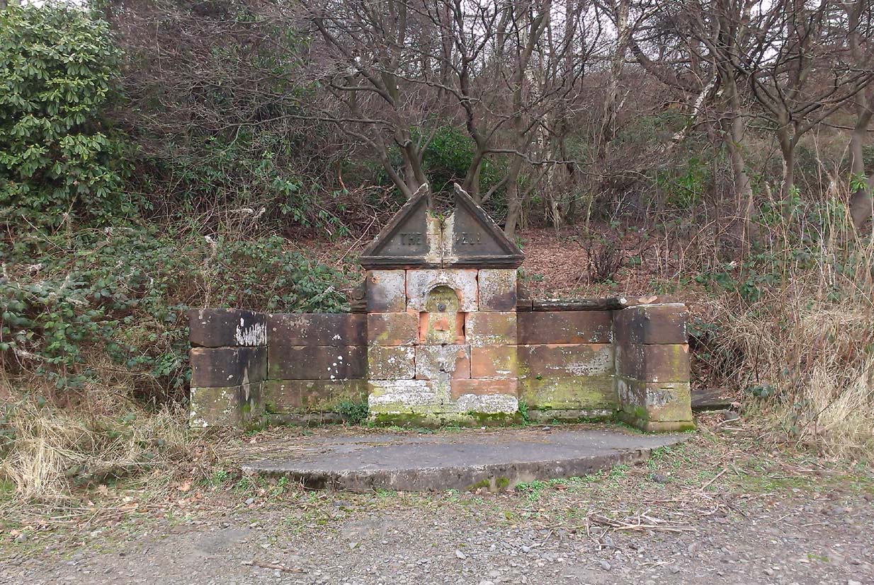
Along the A907 a mile west of Alloa and heading towards Tullibody, just before the roundabout across the road from the school fields, a small entrance takes you into the small wooded parkland. There, right in front of you as you walk in, and visible from the road, is the enclosed architectural stone walling and somewhat ruinous remains that are the Red Well, with its faded name carved on top.
Archaeology & History
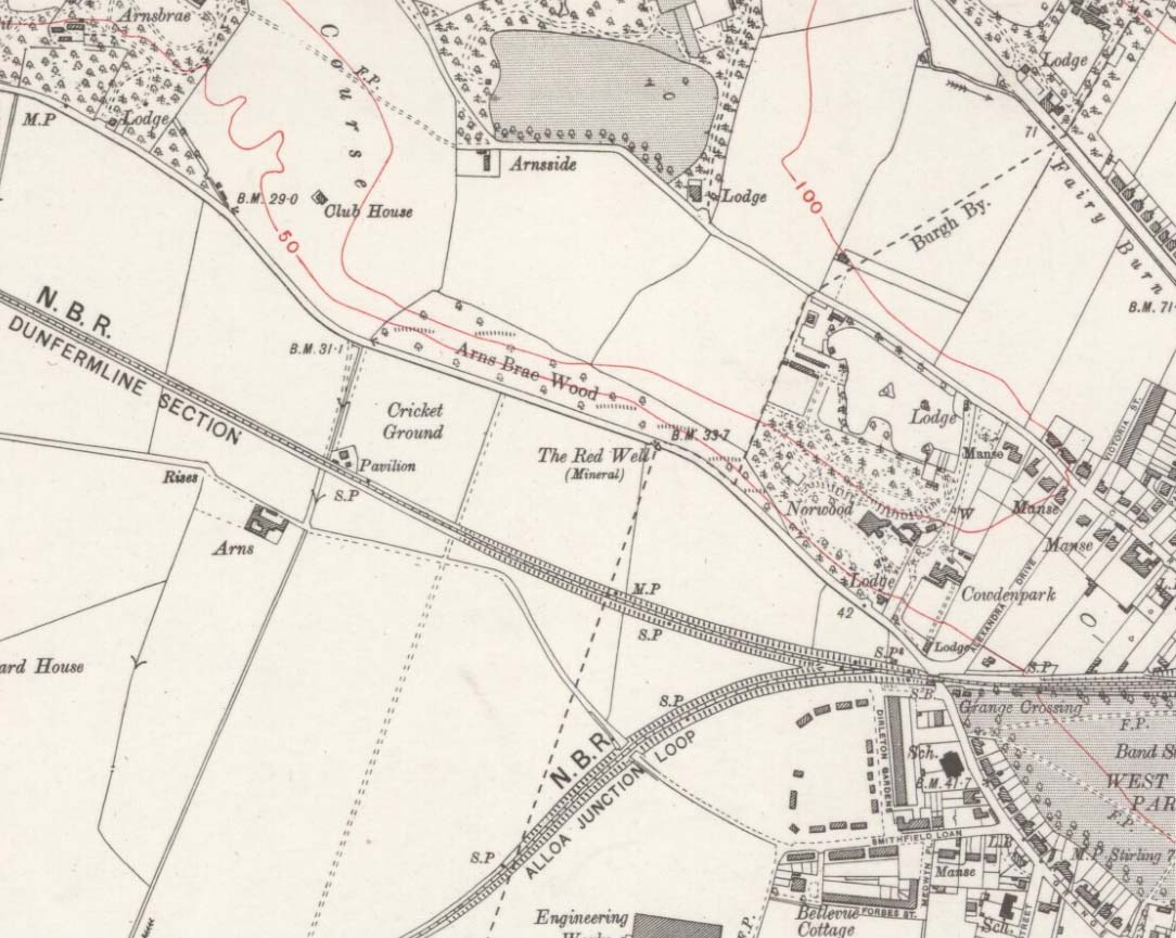
Red Well on 1913 map
Although the waters no longer run for the people to drink, this old iron-bearing spring was long of repute to the old folk of eastern Alloa. So much so, it seems, that even Janet & Colin Bord (1985) included it in their national survey of sacred wells! Like other chalybeate springs, its waters were known to be good as a tonic—which makes sense as iron fortifies the blood and general immune system. The Well was highlighted on the 1913 OS-map of the area.
References:
Bord, Janet & Colin, Sacred Waters, Granada: London 1985.
Holy Well (destroyed): OS Grid-Reference – NT 3452 7264
Archaeology & History
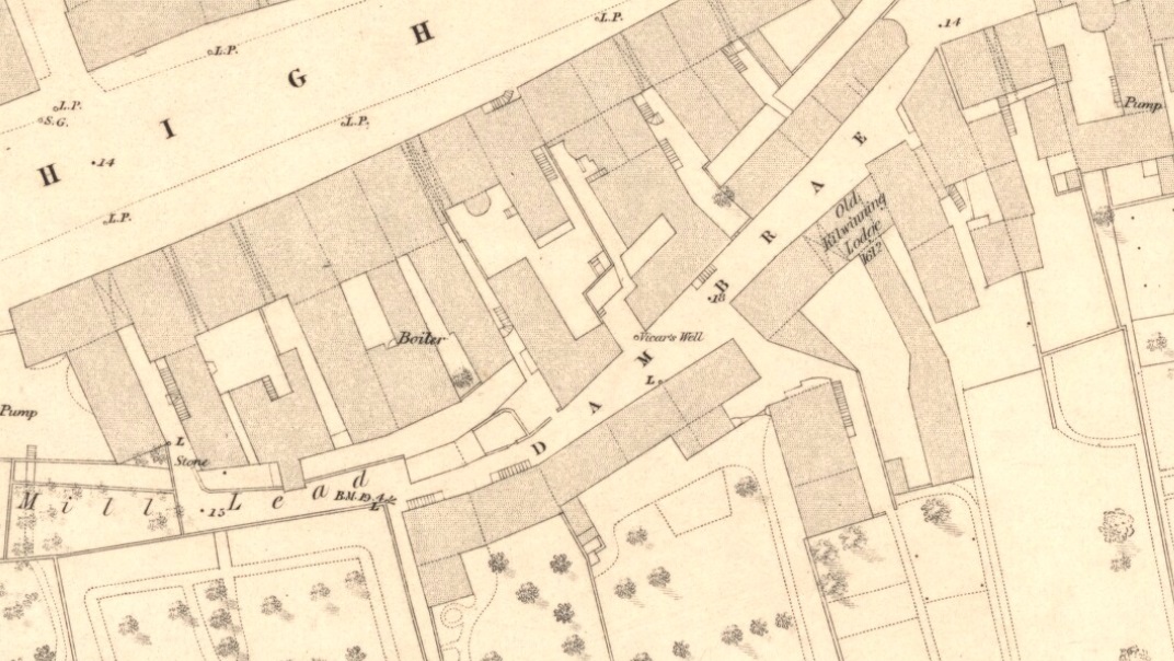
Vicars Well on 1853 map
First mentioned in the Scottish Statistical Account of 1845, its name originates from being attached to the vicarage of nearby St. Michael’s church. Highlighted on the 1853 township map of Musselburgh, this forgotten holy well was described in the middle of the 19th century by local historian James Paterson (1857). It was located near the middle of town, along a back-street south of the High Street. Mr Paterson told us that:
“At the Dam Brae there is still a well, celebrated for the excellence of its water, called ‘the vicar’s well’, from which it is believed the present manse occupies the site of the ancient vicarage. It lies to the southeast of the Brae, and the wall of the ground approaches pretty close to the mill lead, or damn, as it is called. It is well surrounded with old trees.”
When it was described by Mr Beveridge in the 1845 Statistical Account, the spring had been covered by a pump. Local lore told how the waters of this ancient Well was said by housewives to be excellent in the infusion of tea; and although its name was spoke in local dialect as the ‘Bickers Well’, Beveridge told it to mean the “Vicars Well.” There is the obvious possibility that the ‘bickers’—as in chit-chat and gossip—related to it being where local folk simply met and chatted.
When Mr Stirling (1894) wrote his account of the adjacent Inveresk parish, he told how water from the Vicar’s Well,
“was in much request till a few years ago, when its use was forbidden and its site enclosed (for) sanitary considerations.”
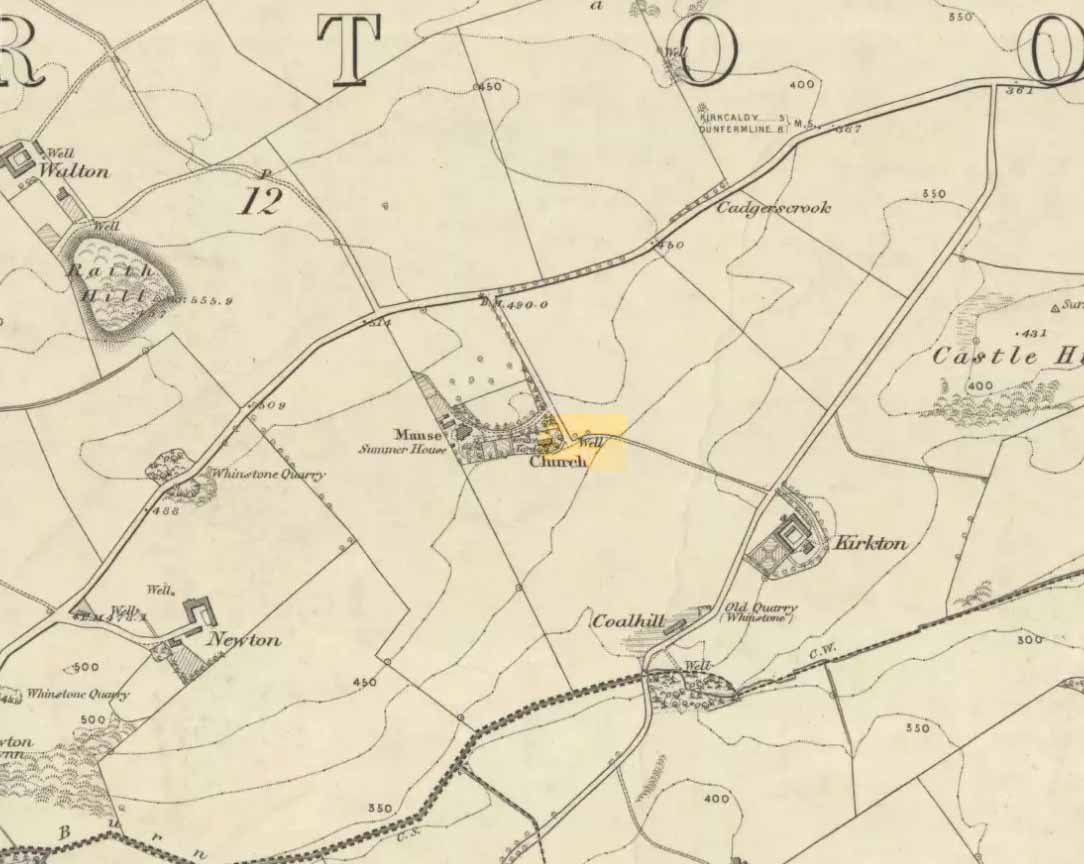
Along the B925 road between Dunfermline and Kirkcadly, ⅔ of a mile (1.07km) west of Auchtertool village, go down the small track leading down to the isolated church on the rise in some trees. Walk through the churchyard and out the other side where a small footpath runs downhill. 50-60 yards along, by the walling, this holy well is/was said to be.
Archaeology & History
Both history and tradition are pretty shallow on this all-but-forgotten site, which Penny Sinclair guided us to see in the summer of 2016. Sadly the entire area where the waters are reported to emerge were completely overgrown in nettles when we visited and, despite us trampling the Urtica down, we could find no remains of the spring. (the Church and its followers here should ensure that the well is properly maintained)
The greatest description of the site seems to be that given by William Stevenson (1908) in his rare work on the parish of Auchtertool. He wrote:
“As you approach the Kirk of Auchtertool by the old road…you come upon a well by the wayside. For many years it was the well that supplied the Manse with water, but it is now seldom used, even by the passing traveller. There is a belief that at one time this well was what is known as a holy well. Be that as it may, a friend of the late Rev. Walter Welsh, the late Dr Robert Wilson, caused a stone over the well to be inscribed with the following lines:
“Ye who the gently-winding path have trod,
To this fresh fount beside the house of God,
Taste the clear spring; and may each pilgrim know
The purer stream where living waters flow.””
The well was included in Ruth & Frank Morris’ (1982) survey, where they added that the waters from the well were “used in celebration of the mass.”
Described in Hope & Telford’s (1813) rare work, this little-known holy well has escaped the attention of all surveyors since then. It was one of four sacred and healing sites in the village and “the most copious” of them all, they said.
Located a little to the east of the old churchyard, chemical analysis showed its water to contain carbonates and sulphates of lime, “muriate of soda and a magnesium salt in very minute proportion, and carbonate of iron in a still smaller” amount.
Covering slabs on the wellThe ‘Spring’ on 1894 map
Until recently, the waters of St. Margaret could still be seen in the small copse of trees, just off the footpath, but they have now been covered in large stone slabs. Underneath them, you can clearly hear the sound of the rushing water still pouring out of the ground, quite copiously, as Hope & Telford said! A little further down the slope—into which the waters have cut a tiny glen—the ground is very boggy and marshy due to the outflow from the well. However, the waters here seem very dodgy indeed and it isn’t recommended that you try to drink them! (in the adjacent trees is a large dump site)
It is likely that the St. Margaret dedication here relates to the 11th century Scottish Queen, who was believed to have landed at nearby North Queensferry, known as St. Margaret’s Hope. Literary history tells that she became a Roman Catholic.
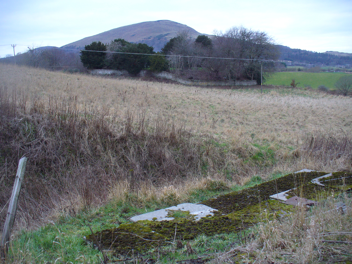
There must be an easier way to visit this site than the method I used. Which was: along Cambuslang’s Main Street (A724), turn up the B759 Greenlees Road for nearly 500 yards, turning left onto Vicarlands Road. Notice the grass verge and steep slope immediately to your left. Walk into the tree-lined gorge, following the left-side along the edges of the fencing. About 150 yards down the steep glen, note the very denuded arc of stone-walling and rickety fencing on the other side of the burn. That’s it! (broken glass and an excess of people’s domestic waste are all the way down; very difficult to reach, to say the least!)
Archaeology & History
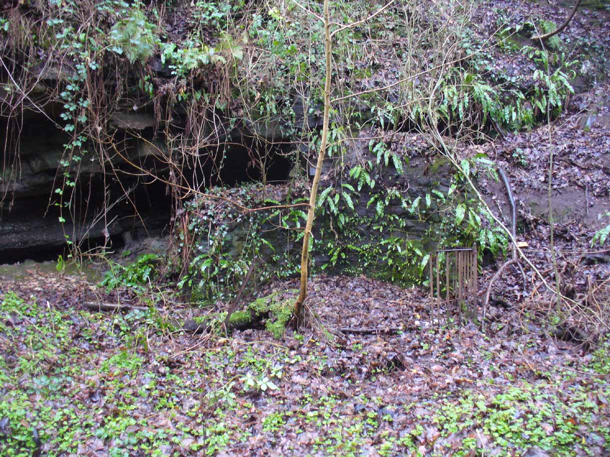
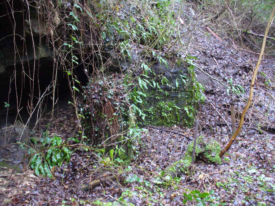
Found in a dreadful state down the once-beautiful Borgie Glen, this is one of the most curious entries relating to sacred and healing springs of water anywhere in the British Isles. Indeed, the traditions and folklore told of it seem to make the site unique, thanks to one fascinating factor…..which we’ll get to, shortly…..
Remains of the Borgie Well
The name ‘Borgie’ is an oddity. Local historians J.T.T. Brown (1884) and James Wilson (1925) wondered whether it had Gaelic, Saxon or Norse origins, with Brown thinking it may have been either a multiple of a simple bore-well, or else a title given it by a travelling minister from Borgue, in Kirkcudbright. Mr Wilson took his etymology from the very far north where “there is a stream called the Borgie” (just below the Borgie souterrain). This is said to be Nordic in origin, with
“borg, a fort or shelter, and -ie, a terminal denoting a stream. It is almost certain that our Borgie has the same origin; that is, ‘the fort or shelter by the stream.’”
The Borgie Well was described by a number of authors, each of whom spoke of its renown in the 19th century and earlier. One of my favourite Glasgow writers, Hugh MacDonald (1860), had this to say about the place:
“There are several fine springs in the glen, at which groups of girls from the village, with their water pitchers, are generally congregated, lending an additional charm to the landscape, which is altogether of the most picturesque nature. One of these springs, called “the Borgie well,” is famous for the quality of its water, which, it is jocularly said, has a deteriorating influence on the wits of those who habitually use it. Those who drink of the “Borgie,” we were informed by a gash old fellow who once helped us to a draught of it, are sure to turn “half daft,” and will never leave Cambuslang if they can help it. However this may be, we can assure such of our readers as may venture to taste it that they will find a bicker of it a treat of no ordinary kind, more especially if they have threaded the mazes of the glen, as we have been doing, under the vertical radiance of a July sun.”
Borgie Well, looking south
It’s somewhat troublesome to reach, but a beautiful landscape indeed is where, today, only remnants of the Borgie Well exist. A very eroded semi-circle of walling and iron bars protects what was once the waters of the well—which have long since fallen back to Earth. Behind it, right behind it, overhangs the cliff and a small cave: a recess into the Earth with its very own feeling. It has the look and feel of a witch’s or hermit’s den with distinct oracular properties. This geomancy would not have gone unnoticed by our ancestors. In this enclaved silence, the once bubbling waters beneath the cliffs give a feel of ancient genius loci—a memory still there, despite modernity. Whether this crack in the Earth and its pure spring waters was some sort of Delphic Oracle in days gone by, only transpersonal ventures may retrieve… Perhaps…
In the 19th century a path took you into the glen from the north, and a commemorative plaque was erected here by a Dr Muirhead, where now lie ruins. It read:
The Borgie Well here
Ran many a year.
Then comes the main verse :_
Wells wane away,
Brief, too, man’s stay,
Our race alone abides.
A s burns purl on
With mirth or moan,
Old Ocean with its tides,
Each longest day
Join hands and say
(Here where once flowed the well)
We hold the grip
Friends don’t let slip
The Bonny Borgie Dell.
1879.
At the base was carved an appeal to the local folk:
Boys, guard this well, and guard this stone,
Because, because, both are your own.
The plaque has long since gone; and according to the local historian J.T.T. Brown (1884), the waters went with it due to local mining operations around the same time. But there was an additional rhyme sang of the Borgie Well which thankfully keeps the feel of its memory truly awake (to folk like me anyway!). It is somewhat of a puzzle to interpret. Spoken of from several centuries ago, it thankfully still prevails:
A drink 0′ the Borgie, a taste 0′ the weed,
Sets a’ the Cam’slang folks wrang in the heid.
Meaning simply, if you drink the waters of this well, you’ll get inebriated! It’s the derivation of the word ‘weed’ that is intriguing here. In Grant’s (1975) massive Scottish dialect work we are given several meanings. The most obvious is that the weed in the poem is, literally, a weed as we all know it. But it also means ‘a fever’; also ‘to cut away’ or ‘thin out’; to carry off or remove (especially by death); as well as a shroud or sheet of cloth. These meanings are found echoed, with slight variants, in the english dialect equivalent of Joseph Wright. (1905) Hugh MacDonald told that the Enchanter’s Nightshade (Circaea lutetiana) grew hereby—which, initially, one might think could account for this curious rhyme. But the Enchanter’s Nightshade has nothing to do with the psychoactive Nightshade family, well-known in the shamanistic practices of our forefathers. However, in the old pages of one Folklore Society text, William Black (1883), in repeating the curious rhyme, told us:
“The Borgie well, at Cambuslang, near Glasgow, is credited with making mad those who drink from it; according to the local rhyme —
A drink of the Borgie, a bite of the weed,
Sets a’ the Cam’slang folk wrang in the head.”
The weed is the weedy fungi.”
A mushroom no less! In John Bourke’s curious (1891) analysis of early mushroom use, he repeats Mr Black’s derivation. If this ‘weed’ was indeed use of mushrooms that made the local folk “go mad” or “wrang in the head” (and if not – what was it?), it’s an early literary account of magic mushroom intoxication! If this interpretation is correct, the likelihood is that the Borgie Well was a site used for ritual or social use of such intoxicants. Many sites across the world were used by indigenous people for ritual intoxication, and this could be one of the last folk remnants of such usage here. We know that Scotland has its own version of cocaine, used extensively by our ancestors (even the Romans described it) and which was still being used by working Highlanders in the 20th century—but early descriptions of mind-affecting mushrooms are rare indeed!
Psilocybe semilanceataAmanita muscaria
Mr Black gives no further folklore, nor the source of his information, other than to suggest that the madness incurred by the Well typified the people of Cambuslang! “Weedy fungi” may have been ergot (Claviceps purpurea), but the incidence of the grasses upon which it primarily grows, rye, here seems unlikely—and the folklore would certainly have included the ‘death’ aspects which that fungus brings! Fly agarics (Amanita muscaria) however, may have grown here. Old birches are close by, which produce nice quantities of those beautiful fellas. On the fields above the gorge, where now houses grow, Liberty Caps (Psilocybe semilanceata) may have profused—as they do in the field edges further out of town—but this species has no local cultural history known about from the early period. We must, however, maintain a healthy scepticism about this interpretation—but at the same time we have to take into account the ‘intoxicating’ madness which the combination of the “waters and the weed” elicited.
One final note I have to make before closing this site entry: despite the beautiful location, this small gorge is in a fucking disgraceful state. Some of the people who live in the houses above the gorge should be fucking ashamed of themselves, dumping masses of their household rubbish and tons of broken glass into the glen. If these people are Scottish, WTF are you doing polluting your own landscape like this? This almost forgotten sacred site needs renewing and maintaining as an important part of your ancient heritage. Have you no respect for your own land?!?
References:
Armitage, Paul, The Ancient and Holy Wells of Glasgow, TNA 2017.
Black, William George, Folk Medicine: A Chapter in the History of Culture, Folk-lore Society: London 1883.
Walker, J.R., ‘”Holy Wells” in Scotland”, in Proceedings of the Society of Antiquaries, Scotland, volume 17, 1883.
Wilson, James A., AHistory of Cambuslang, Jackson Wylie 1925.
Wright, Joseph, The English Dialect Dictionary – volume 6, Henry Frowde: Oxford 1905.
Acknowledgements: Huge thanks again, in various ways, to Nina Harris for getting us here; and Paul Hornby, for reminding me of my literary sources when I needed them! Thanks too to Travis Brodick and his beautiful photo of the Amanita muscaria cluster.
Healing Well (destroyed): OS Grid Reference – NS 5619 6654
Archaeology & History
Along the B808, between Beith Street and Byres Road, where it meets the main Dumbarton Road, the memory of Cooper’s Well is preserved in the street-name. It was one of more than a dozen springs in the area, but was one of the most renowned by local people.
Although not shown on the early OS-maps, thankfully the local historian and folklorist—and early environmentalist, it must be said!—James Napier (1873), gave a good account of it in his excellent work on the traditions of the area:
“Cooper’s Well was situated on the side of the road at the north-west end of Well Street, at the corner of where the Gas-work wall now is. It was about three feet deep, and had two steps leading down to the water from the road. Two sides and back were walled up higher than the road, and covered with a stone slab. It was celebrated in the neighbourhood as a drinking water, being strongly chalybeate, and therefore could not be used for cooking purposes. Although shallow, it was never frozen during winter (so that it must have come from a considerable depth), and it was cold in summer. On a warm summer Sunday evening we have seen people, not only from all parts of the village, but from the gentle houses in the neighbourhood, carrying water from the Cooper’s Well to drink. It is from this well the street has its name. The Gas-work dried up the well. There was a story current of some Glasgow people who were visiting at Mr. Sharp’s of Horslethill. Mrs. Sharp had been baking some oatcakes with butter or dripping in them, which caused them to be very fine and short. The Glasgow gentlemen were anxious to know how they were baked, and were told that they were baked with the Cooper’s Well water, some of which they had got a drink of. Shortly after some of the gentlemen sent out their servants to Partick for a supply of the water, but the servants could not succeed in making the cakes so nice as those got from Mrs Sharp. For long after this, butter-cakes were known in and around Partick as Cooper’s Well bread.”
I have to admit I’ve not visited this site, but presume that all trace of the site has disappeared.
Holy Well (destroyed): OS Grid Reference – NS 6451 5981
Archaeology & History
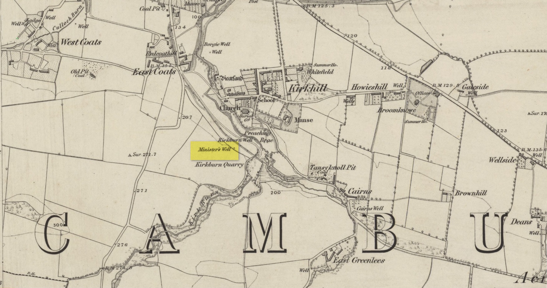
Site shown on 1864 map
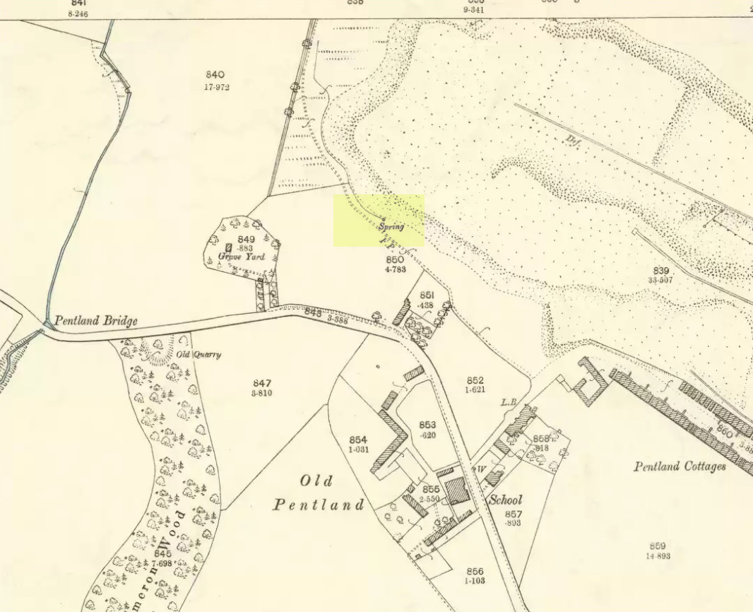
Illustrated on the earliest OS-map of the region, this is one of four holy and healing wells within half-a-mile of each other—including the legendary Borgie Well in the Borgie Glen. The waters from here emerged above the rise, close to the end of Mansefield Avenue, from where you look down onto the wooded burn. When it was visited by the Ordnance Survey chaps in the 19th century, they told simply that water here “is taken from pipes being laid from it to the Manse to supply the Minister.”
Acknowledgements:Huge thanks for use of the Ordnance Survey map in this site profile, reproduced with the kind permission of the National Library of Scotland.
The exact location of this site remains a mystery. Addison (1951) mentions it as being “close to the Blake Hall Road” where a drinking fountain was erected, but notes that this was not the original site of the spring. It was obviously a medicinal spring of some renown to the local people, before it was appropriated by the wealthy to turn it into a ‘spa well’. In doing so, it brought the attention of those curious lords and ladies, along with King James himself, adorning themselves in usual view as important people, and playing the part in social gatherings, as folks did at those spa wells. But the fad didn’t last long and the spa never really caught on. One account tells how it was a dangerous place for the rich and wealthy to visit! Locals can and do get pissed-off if you steal their basic water supplies!
The primary description of the site is that afforded by Christy & Thresh (1910) in their excellent survey of Essex waters. With no mention of the unimportant local people (!), they told how it was “first discovered” in the early 17th century:
“John Chamberlain, the news-letter writer, writing from London to Sir Dudley Carleton, on 23 August 1619, says:
“‘…We have great noise here of a new Spaa, or spring of that nature, found lately about Wansted; and much running there is to yt dayly, both by Lords and Ladies and other great companie, so that they have almost drawne yt drie alredy; and, yf yt should hold on, yt wold put downe the waters at Tunbridge; wch, for these three or foure yeares, have ben much frequented, specially this summer, by many great persons; insomuch that they wch have seene both say that yt [i.e., Tunbridge] is not inferior to the Spaa [in Belgium] for goode companie, numbers of people, and other appurtenances.”
“We have been quite unable to ascertain anything as to the part of Wanstead parish in which this spring was situated. In all probability, it was quite a small spring. One may infer as much from Chamberlain’s statement that, within a short time of its discovery, the company resorting to it had “almost drawn it dry.” If such was the case, the spring was, no doubt, soon deserted and ultimately forgotten.
“Mr. Walter Crouch, F.Z.S., of Wanstead, whose knowledge of the history of the parish is unequalled, writes us : —
“I have always had the idea that this Mineral Spring was not at the Park end of our parish, which abuts on Bush wood and Wanstead Flats, but in the vicinity of Snaresbrook and on the road which leads to Walthamstow; but it is possible that it was in the grounds of ‘ The Grove ‘ (now cut up and built over). The spring is not marked on Kip’s View (1710), nor on Rocque’s large Map (1735), nor on Rocque’s still larger map of a few years later.”
“Under the guidance of Mr. W. Ping, F.C.S., of Wanstead, Mr. Christy has visited two springs at Snaresbrook — namely, that known as the ‘Birch Well’, in the Forest, near the Eagle Pond, and a spring in the grounds of ‘The Hermitage’; but neither of these is credited locally with being a mineral spring and neither has any appearance of being such. Since then, Mr. Ping has written us as follows: “I have spoken with the oldest inhabitant of Wanstead, a Mr. Merryman, whose knowledge, both local and national, is remarkable and accurate. He tells me that the only Mineral Spring he ever heard of in Wanstead was in the grass bordering the roadside nearly opposite the house, in the Blake Hall Road, formerly occupied by Lord Mayor Figgis, and now by Sir John Bethell, M.P. This spring he remembers well. Its water was chalybeate and left considerable reddish deposit. People came and drank it to give them an appetite. They used to kneel down and drink it from their hands, and also took it away in bottles. Others used to bathe their ankles in it to make them strong. Mr. Merryman adds that, about 1870, drainage operations deprived the spring of its water. The fountain, which has since been put up near its site, supplies waterworks water only.” Mr. Ping adds that, recently when deeper drainage operations were in progress at the spot, water of a very markedly ferruginous character was encountered. This is no evidence that this spring was identical with that which came into prominence in 1619, but very likely it was.
“Mr. Dalton expresses the opinion that, if either surmise as to the position is correct, seeing that the comparison with the Tunbridge Wells chalybeate water was sound, the well in question probably yielded a ferruginous water from the Glacial (?) gravels of the Snaresbrook plateau at their contact with the pyritous London Clay.”
References:
Addison, William, English Spas, Batsford: London 1951.
Christy, Miller & Thresh, May, A History of the Mineral Waters and Medicinal Springs of the County of Essex, Essex Field Club: Stratford & London 1910.
Hembry, Phyllis, The English Spa 1560-1815, Athlone Press: London 1990.
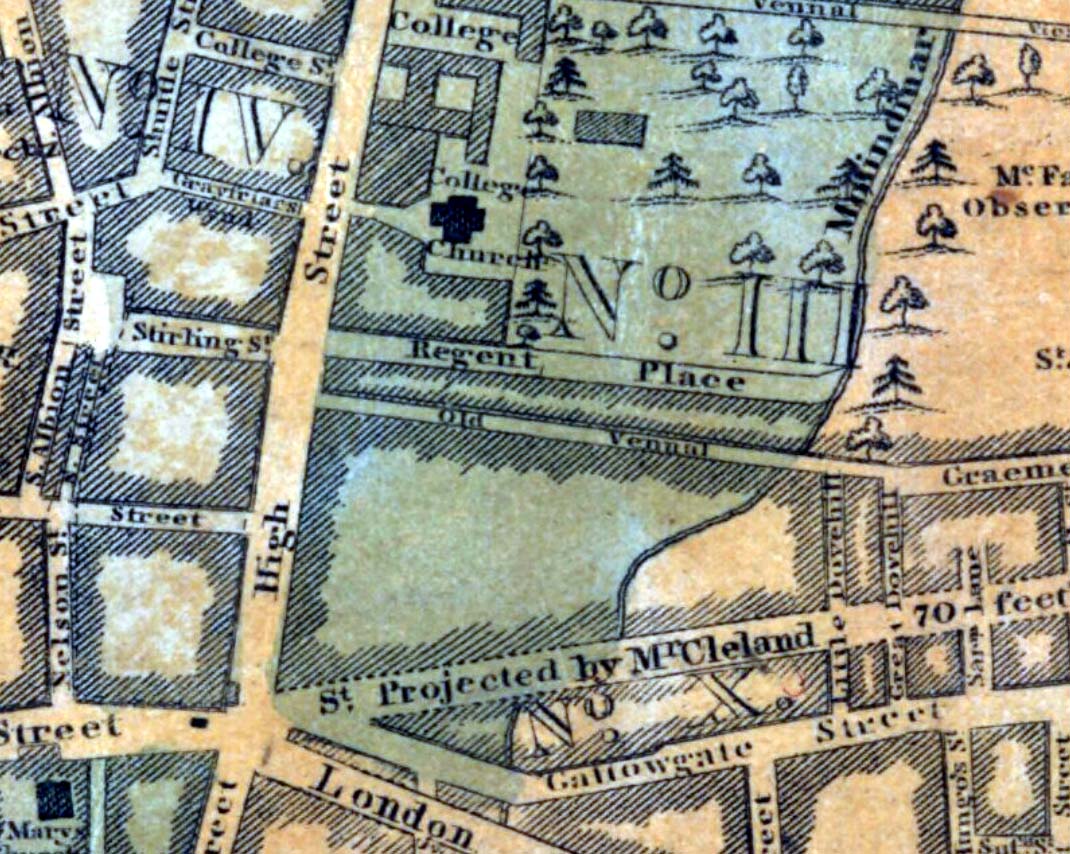
One of the many public wells in Glasgow, all trace of this site disappeared long ago. Found at the ancient heart of the city, the name ‘Vennel’ comes from the old dialect meaning, “a narrow alley or lane between houses,” which is where it was once found, along the Old Vennel. An early account of it was outlined in MacGeorge’s (1880) classic text, where it was described as,
“a draw well, as there is a minute of council in 1656 arranging with John Scott, mill-wright, to ‘rewle and governe’ this well and ‘the new well in Trongait’, he undertaking to uphold them ‘in cogis and rungis, the toun vphalding all ganging greth quhan athir it weirs or breckis.’”
A few years after this in 1663, it seems the Vennel Well had been closed due to it becoming regularly polluted and further council minutes told:
“Recommendis to the deane of gild to caus open again the wall at the Stincking Vennell, and to remove the old wark therof, and caus mak it lyk the wall in Trongait for service of the inhabitantis.”
Around this time a door and lock was put around the well to prevent people dumping and polluting the waters. Further council minutes from April 1663 inform us that,
“The keyes of the well at the Vennell is delyvered to Robert Bell, tailyeour, and he is to have twa dollouris yeirlie for his attending thereupon.”
All healing virtues, folklore and traditions of this site have long since been forgotten.
Holy Well (destroyed?): OS Grid Reference – NS 553 658
Archaeology & History
This is the conjectural title conferred by T.C.F. Brotchie (1920) upon a Well uncovered during construction of the Pearce Institute in Govan in 1908. It was certainly an old site and very well made by the sound of it: being “a stone-built well some ten feet deep (and) some eight feet below the present surface of the ground.” Brotchie thought it to be medieval in age – and he may have been right.
On asking local people if they knew anything about the site, he was lucky to meet “a very old man, a Mr Rellie”, who told him that when he was a boy his granny spoke of a lost “guid well (that) was near the kirk.” He continued:
“I have no doubt that the well discovered in 1908 was the guid well, and judging from its proximity to the god’s acre, and also from adjective ‘guid’, that the well was at one time the holy well of St. Constantine, who in the 6th century founded a church in Govan. Of course, that is conjecture, but I venture to think that the conjecture is reasonably well founded.”
The church is immediately adjacent and is indeed dedicated to St. Constantine. Inside of it are a variety of fascinating archaeological relics: not least of which is what Sam Small (2008) called the ‘Pagan Sun Stone’ upon which is carved an ancient swastika! That – I’ve got to see!