Panorama Woods (232), Ilkley, West Yorkshire

Cup-and-Ring Stone:  OS Grid Reference – SE 10380 47027

Also Known as:

  1. Carving no.62 (Hedges)
  2. Enclosure Carving

Getting Here

Panorama Woods Enclosure Carving

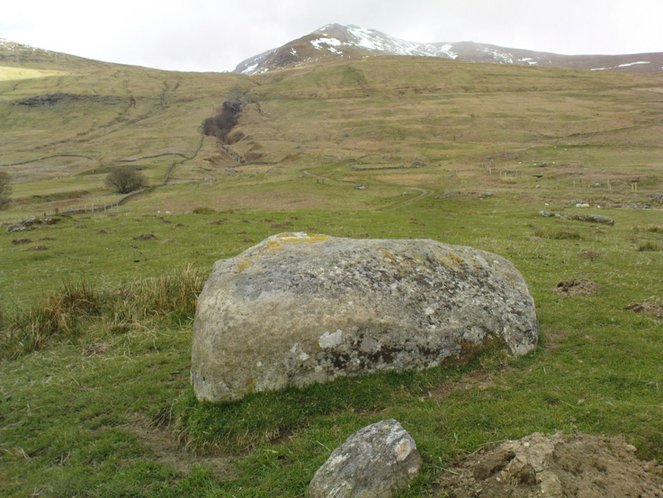
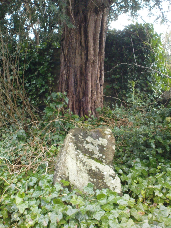
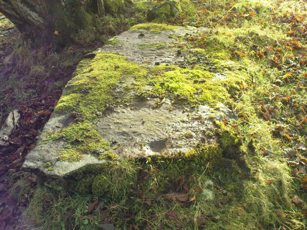
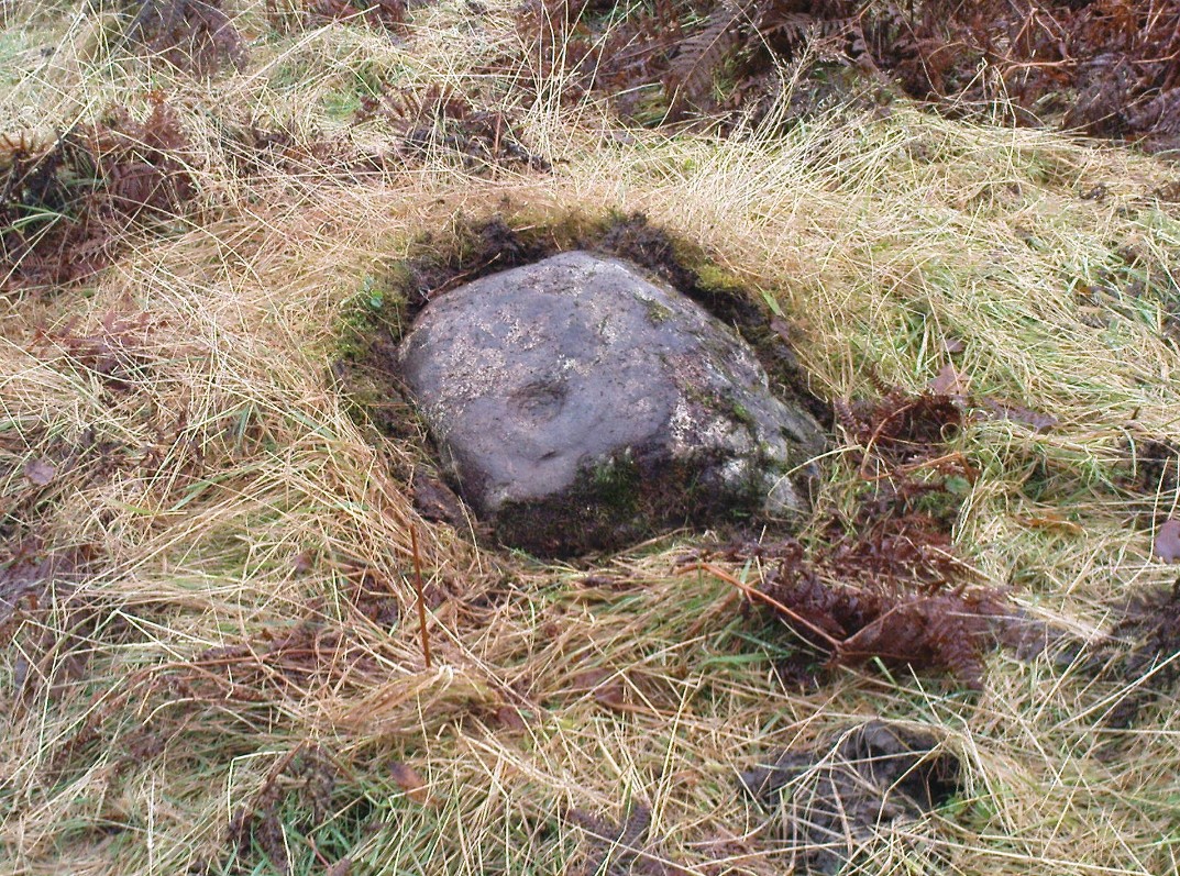
Take the Wells Road from Ilkley centre up towards White Wells, bending to the right as you hit the edge of the moor. Keep along the road, past the old college building with its lake and turn right up Westwood Drive.  Keep going all the way up till you hit the small woodland on your right. Where the woodland ends – stop!  Walk into the trees about 10-15 yards and you’ll see the large rocks ahead of you. Amongst other petroglyphs hereby, you’ll find this carving is on one of them.

Archaeology & History

Close-up of deep cups & grooves

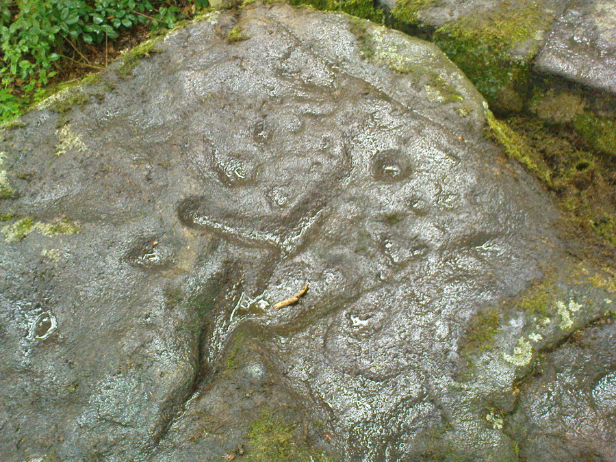
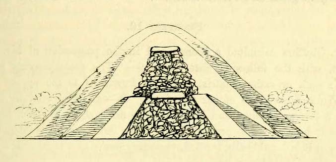
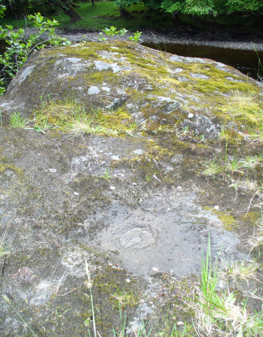
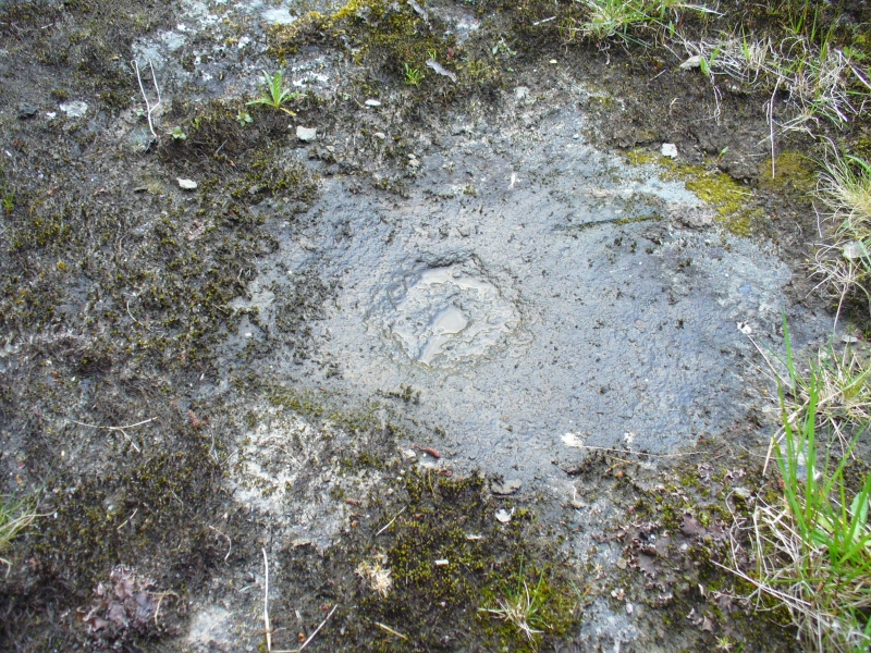
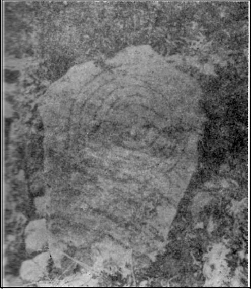
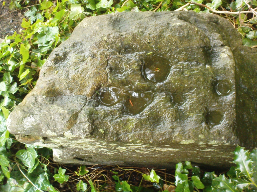
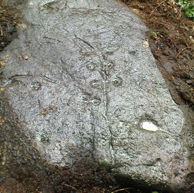
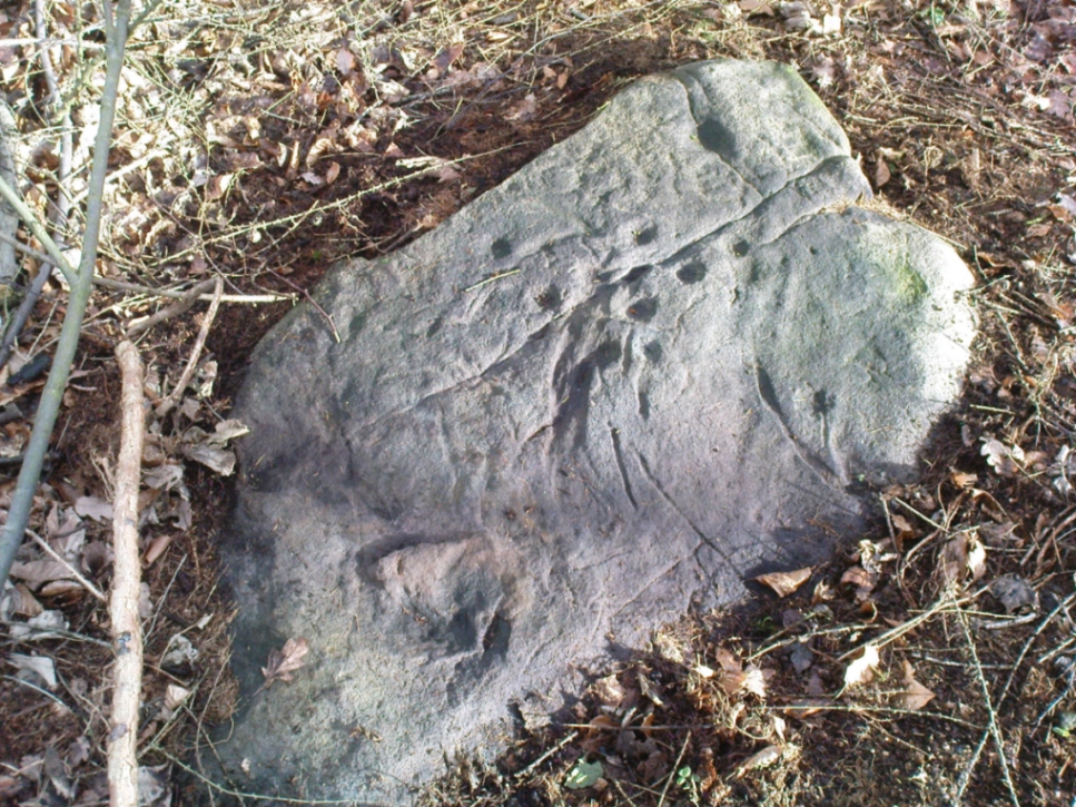
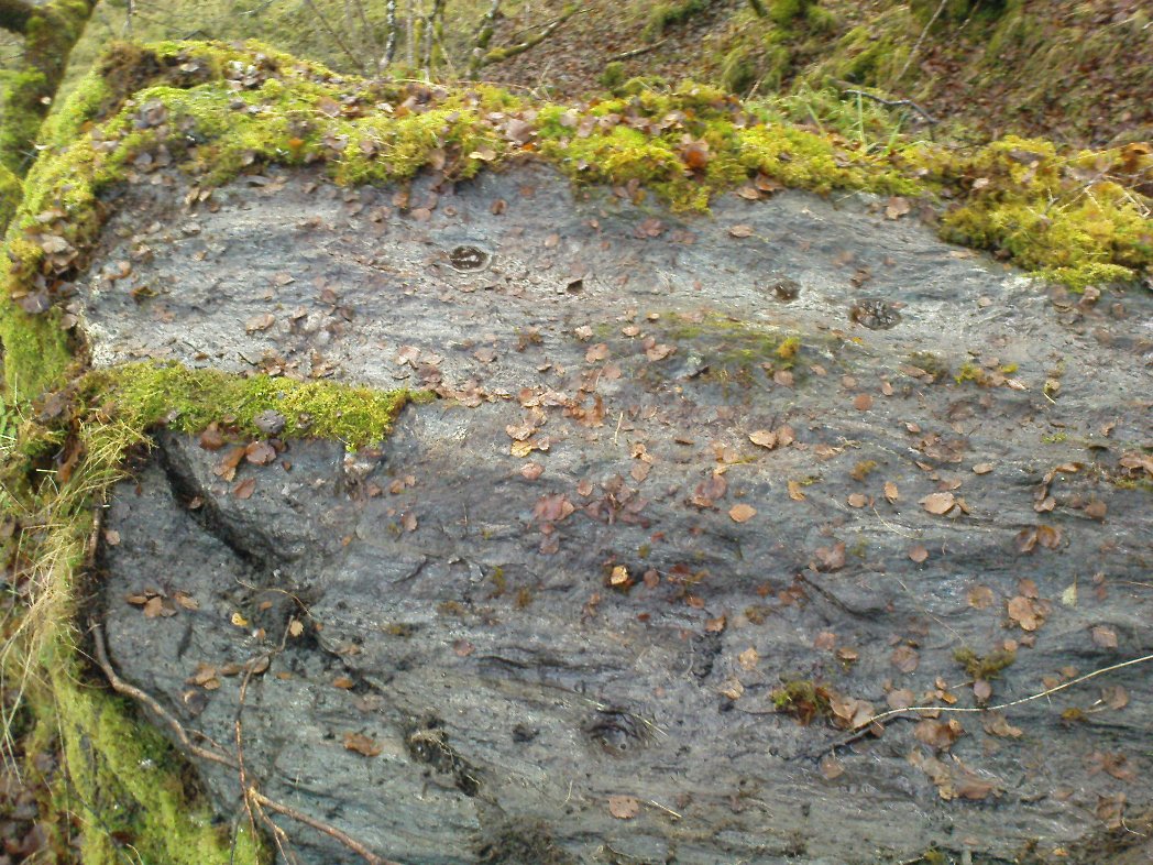
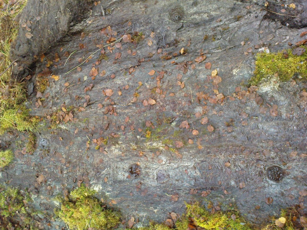
Although only given the usual dry description by our academic catalogue chaps, there’s something about this design that I’ve always liked.  We first came across it ourselves in the late 1970s, in search of the legendary Panorama Stones, and found instead this large enclosure design with at least three cups inside it, still clearly visible. It is one of a cluster of carvings hereby, all of which were once adjacent to a prehistoric enclosure, described in the 1880s and destroyed soon after.  This and the associated carvings very probably had some archaeocentric relevance to the lost enclosure.

Large carved 'enclosure', recently chalked
Large carved ‘enclosure’, recently chalked
Drawing of the carving (after Hedges 1986)

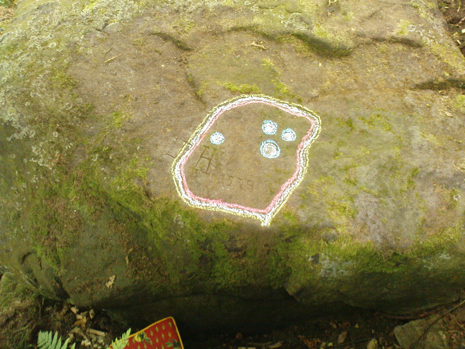
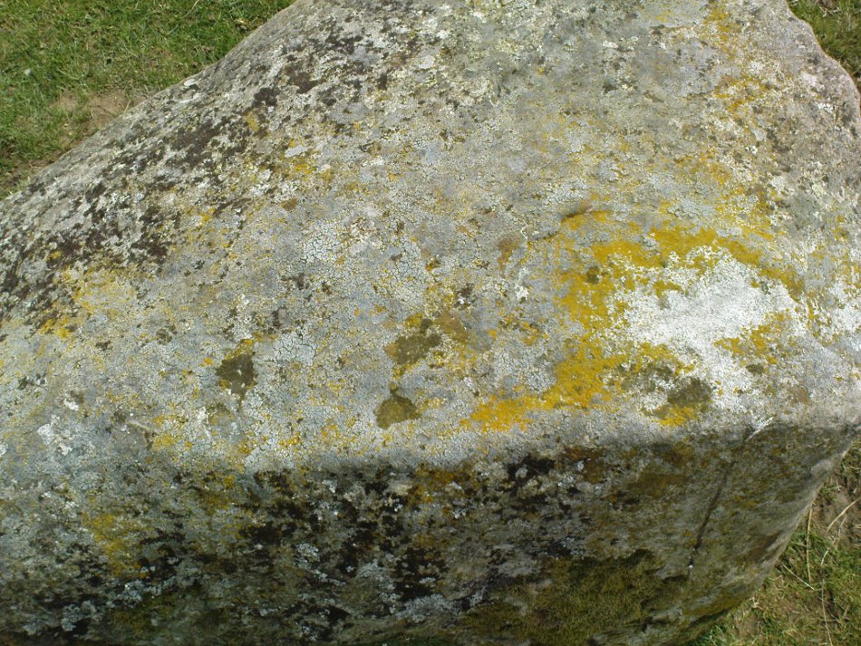
The carving is sandwiched in between its petroglyphic companions, stone 231 and stone 233.  As can be seen on some of the photos here, more recent vandalism has been inflicted on this carving and the recent chalk colouring is what local archaeologists Gavin Edwards and Alex Gibson have termed “social history”, implying fallaciously that cup-and-ring art could be seen as little more than neolithic and Bronze Age scribblings on rock, without any meaning other than it being comparable to “Leeds United Rules OK.”  They may be right (highly unlikely) – but in reading copiously about prehistoric petroglyphs in cultures beyond the UK, we find that traditional societies tell such carvings relate to their creation myths, or river spirits, or rock spirits, and are intrinsically related to wider animistic cosmologies and social customs.  This indicates, to me at least, that modern archaeologists who think of rock art as little more than childish scribblings still have a great deal to learn and we should beware their uneducated musings about our ancient carvings.

Although the complete carved ‘enclosure’ and its internal cups were mistakenly drawn in John Hedges (1986) survey, he described as being a,

“Roughly incised ‘enclosure’ with five cups in it, twenty eight shallow cups or depressions, one large oval marking, three irregular basins.”

In the later work of rock art students Boughey & Vickerman’s (2003), they simply said of the site:

“Large flat-topped, upstanding rectangular rock.  Twenty-eight shallow cups, a few enclosed in two groups by grooves; irregular small basins.”

References:

  1. Bennett, Paul, Of Cups and Rings and Things, unpublished: Shipley 1981.
  2. Bennett, Paul, The Panorama Stones, Ilkley, TNA: Yorkshire 2012.
  3. Boughey, Keith & Vickerman, E.A., Prehistoric Rock Art of the West Riding, WYAS: Wakefield 2003.
  4. Hedges, John (ed.), The Carved Rocks on Rombalds Moor, WYMCC: Wakefield 1986.

© Paul Bennett, The Northern Antiquarian


Winterborne Came 18b, Bincombe, Dorset

Tumulus (destroyed):  OS Grid Reference SY 6800 8600

Also Known as:

  1. Monument No.1300126  (Pastscape)

Archaeology & History

Charles Warne's 1848 drawing of the old tumulus
Charles Warne’s 1848 drawing of the old tumulus

A number of very large prehistoric burial mounds, or tumuli, were destroyed in this part of Dorset in the 19th century, including “three on the Came estate, near Dorchester, the property of the Hon Col. Damer.” This one—listed as a “bowl barrow” and known today as the Winterborne Came 18b tumulus in Grinsell’s (1959:148) brilliant survey—was found to house examples of petroglyphs, which are very rare in this part of Britain.  Thankfully before its destruction, the local antiquarian Charles Warne (1848) was present and has left us with a good description of its structure and contents.  After first telling of the demise of two other large tumuli close by, the biggest of them drew his attention:

“The last of these mighty mounds (and well do they merit the appellation from their vastness), measured rather more than ninety feet in diameter, and sixteen feet in height; this from the peculiarity of its contents was the most interesting of the three. The annexed rough sketch (above), shewing a central section of the tumulus, may serve to give some idea of the singularity of its composition. About the centre, at a depth of some three feet from the surface, was found lying flat a rough unhewn stone, with a series of concentric circles incised; this, on being removed, was seen to have covered a mass of flints from six to seven feet in thickness, which being also removed we came to another unhewn irregular stone, with similar circles inscribed, and as in the preceding case, covering another cairn of flints, in quantity about the same as beneath the first stone. It was in this lower mass that the deposits were found, consisting of all the fragments of an urn of coarse fabric, and apparently as if placed in its situation without either care or attention, no arrangement of the flints being made (as we have elsewhere seen) for its protection; the want of which observance had completed its destruction.  Under the flints, lying at the base, were the remains of six skeletons, and some few bones of the ox. The skeletons had apparently been placed without order or regularity: with the exception of a few bits of charcoal with the urn, there was no evidence of cremation.”

Nearly twenty years later, Sir James Simpson (1867) also described the tumulus and its carved rocks in his 19th century magnum opus, repeating much of Warne’s earlier description, saying:

“In his antiquarian researches in this county (Dorset), Mr Warne opened , at Came Down on the Ridgeway, a tumulus of rather unusual form. At its base…were found the remains of six unburnt human skeletons…and some few bones of the ox.  Above them, and in the centre of the tumulus, was built up a cairn or heap of flints around a coarse and broken urn, which contained calcined bones.  This mass of flints was surrounded and covered by a horizontal rough slab.  Above and upon this slab was built another large heap of flints, six or seven feet in thickness.  This second heap was capped with another rough slab, lying two or three feet below the surface of the tumulus.  Both these flat unhewn covering slabs had a group of concentric circles cut upon them.”

We don’t know for sure the exact whereabouts of the tumulus, nor the age of the tomb and its remains.  But the size of it may indicate an early Bronze Age and perhaps even neolithic status. The finding of the rock art in the tomb is also an indicator that could push the date back into late neolithic period—but we may never know for sure…

References:

  1. Grinsell, Leslie V., Dorset Barrows, Dorset Natural History & Archaeological Society 1959.
  2. Royal Commission on Historical Monuments (England), An Inventory of Historical Monuments in the County of Dorset – Volume 2: South-East, HMSO: London 1970.
  3. Simpson, James, Archaic Sculpturings of Cups, Circles, etc., Upon Stones and Rocks in Scotland, England and other Countries, Edmonston & Douglas: Edinburgh 1867.
  4. Warne, Charles, “Removal of Three of the Large Tumuli on the Came Estate, near Dorchester,” in Journal of the British Archaeological Association, volume 3, 1848.
  5. Warne, Charles, The Celtic tumuli of Dorset: An Account of Personal and other Researches in the Sepulchral Mounds of the Durotriges, J.R. Smith: London 1866

© Paul Bennett, The Northern Antiquarian 


Duncroisk (2), Glen Lochay, Killin, Perthshire

Cup-and-Ring Stone:  OS Grid Reference – NN 53134 35850

Also Known as:

  1. Canmore ID 24169
  2. Duncroisk 3 (Canmore)

Getting Here

Cup-and-rings by the River Lochay

Troublesome to get to unless you’re reasonably fit.  Probably the easiest route is to get to the Duncroisk 3 cup-and-ring stone. Keep walking along the riverside, climb over the first tall wooden fence and onwards till you reach the rocky crag reaching into the river Lochay. By whichever means possible, get yourself up and round this crag, but keep by the riverside till you get to the easier walkable rocky outcrop protruding into the river on the other side of the drop.  Hereby, on one of the stones, look and you’ll find these faint cup-and-ring symbols.

Archaeology & History

Although this carving was first described in Edward Cormack’s (1952) essay on the prehistoric carvings of the district, they have subsequently proved difficult to locate by the Royal Commission lads and other archaeologists.  I’ve been here a few times looking for it and never managed to find it — until last week.  When Mr Cormack first told of the design, he said:

“On a smooth rock surface just above the mouth of the small burn running into the Lochay, immediately west of the cup-marked ridge, are two cup-and-ring markings a yard apart. The rings are curiously rough edged, and do not give the same impression of weathering as those on the ridge; possibly they have been silted over shortly after being cut, and exposed again relatively recently.”

Flambeau the Cat uses the carving as his bed!

A few decades later, Ron Morris (1981) came across the carving, 10 yards “southeast of an elbow of River Lochay”, as he put it. Described as “hard to find”, he went on to give a basic outline of the design as he saw them, telling there to be “2 cups-and-one-ring, both probably complete, up to 16cm (6in) diameters, with radial grooves from cup to ring—up to 1cm deep.” Or more simply, two cup-and-rings, each with a line running from the centre to the surrounding ring.

After trying to find this carving on several occasions, without success (somehow!), it was brought to my attention under the brilliant guidance of a local cat called Flambeau only last week (no lies!).  In a venture down to the riverside, the great cat (in tandem with Pip the dog, who also ventures out with me to find ancient sites in this region) got to the riverside on the rock in question and began rolling about in the dust on the stone, mewing and purring away merrily!  It was really brilliant to watch. Sincerely heart-warming (soz…but I can’t help it!).

Primary cup-and-ring at Duncroisk-2
Primary cup-and-ring at Duncroisk (2)

I stepped over and complimented him as he looked superb (hence the photo, above) and he just kept purring. Then, curiously, he stood up and began scratching at the dried earth on the rock, mewing away whilst doing this.  Twas very odd indeed.  But there,  exactly where Flambeau has been scratching and rolling about, it seemed a faint cup-mark was apparent.  And such it was!  So I got on my knees and began cleaning away the dirt from the rock — and there, right where he’d been purring and playing, was the lost cup-and-ring carving!

Its location would suggest that the carving had some relationship with water: be that the spirit of the place, or a good site where fish can be had, or a place where someone had drowned, etc.  We’ll probably never know… But it’s a beautiful spot, with the impressive Stag Cottage carvings in the adjoining field, and the newly discovered Corrycharmaig East carvings on the other side of the river — plus many others in the area.

Folklore

The River Lochay where this carving is found is named after a dedication to the Black Goddess, according to Prof. W.J. Watson. (1926)  The stream by the side of the carving which runs into the River Lochay has been the place where faerie music has been heard by local people in times past.

References:

  1. Cormack, E.A., “Cross-Markings and Cup-Markings at Duncroisk, Glen Lochay,” in Proceedings of the Society of Antiquaries, Scotland, volume 84, 1952.
  2. Morris, Ronald W.B., The Prehistoric Rock Art of Southern Scotland, BAR: Oxford 1981.
  3. Royal Commission on the Ancient & Historical Monuments of Scotland, Archaeological Sites and Monuments of Stirling District, Central Region, Society of Antiquaries of Scotland 1979.
  4. Watson, W.J., The History of the Celtic Place-names of Scotland, Edinburgh 1926.

© Paul BennettThe Northern Antiquarian


Tombreck 01, Kenmore, Perthshire

Cup-Marked Stone:  OS Grid Reference – NN 64798 38284

Also Known as:

  1. Canmore ID 289069

Getting Here

Cup-marked stone, with Ben Lawers to the rear

Along the A827 Loch Tay road between Morenish and Lawers, take the track uphill where Carie farmhouse and Tombreck are either side of the road. Walk up this track 2-300 yards till you go through the gate just past the sheep-folds on your left.  Ahead of you is a small grassy hillock on your right – go to the top of it, where you’ll find one of them has a row of cup-markings on its northern edge.

Archaeology & History

This is a reasonably large boulder near the top of the hillock above the trackside.  Several rocks have what may be single cup-markings on them, but this roughly oblong-shaped block has four or five of them running along the more northern edge of the stone, in a rough line sloping gently down the surface of the rock.  No carved rings or other lines were immediately notable here.  It’s nothing special to look at and will probably be of interest only to the hardcore petroglyph enthusiasts amongst you. However, there are many more ornate cup-and-rings found further along the ridges close by (which we’ll add as the weeks and months go by); as well as the remains of a prehistoric enclosure about 200 yards southeast.  The small standing stone of Carie is roughly the same distance to the south.

Cup-marks visible along the edge
...and from above
…and from above

(Note: although I’ve listed this as the ‘Tombreck 01’ carving, this is likely to be revised in the near future as there is a large gathering of carvings all around this area. The region is still being surveyed and the designations of the petroglyphs will be revised as and when they are recorded more fully, or if/when a detailed published account catalogues them satisfactorily.)

References:

  1. Currie, George, “Kenmore: Tombreck (2-4), Cup-and-ring Marked Rocks,” in Discovery & Excavation in Scotland, New Series volume 10, 2009.
  2. Currie, George, “Kenmore: Tombreck (5-7), Cup-Marked Rocks,” in Discovery & Excavation in Scotland, New Series volume 10, 2009.

© Paul Bennett, The Northern Antiquarian


Leaston House, Humbie, East Lothian

Cup-and-Ring Stone (lost):  OS Grid Reference – NT 483 634

Also Known as:

  1. Canmore ID 54771

Archaeology & History

The lost Leaston carving

The concentric ring carving shown here was found on the north side of the large gardens at Leaston House early in the 20th century.  It was first reported by the Royal Commission (1924) boys, who told us that the small free standing stone measured 2½ feet long and was 1¾ feet wide, consisting of 5 concentric rings about 15 inches across.  No central cup-marking existed in the middle of this carving — like the Grey Stone at Harewood and a small number of other multiple-ringed petroglyphs. No other notes were made about any other associated monuments.  The carving was included in Ron Morris’ (1981) survey, with no real additional material.   Although the Canmore report told that the carving could be found “in a rockery bordering the lawn north of Leaston House,” its present whereabouts remains a mystery.

Only known photo of the stone

This is one of a number of cup-and-ring stones that have been ‘lost’, either through destruction or through some dood simply taking it for their own private collection (a practice even the modern rock art student, Paul Brown, has openly admitted in one of his books).  Not good.  This lost Leaston Hall carving was probably “acquired” by some local and probably rests either in their garden or hall somewhere.  If anyone knows where it hides, please tell us — as this is an important carving.

References:

  1. Morris, Ronald W.B., “The cup-and-ring marks and similar sculptures of Scotland: a survey of the southern Counties – part 2,” in Proceedings of the Society of Antiquaries, Scotland, volume 100, 1969.
  2. Morris, Ronald W.B., “The Cup-and-Ring and Similar Early Sculptures of Scotland; Part 2 – The Rest of Scotland except Kintyre,” in Transactions of the Ancient Monuments Society, volume 16, 1969.
  3. Morris, Ronald W.B., The Prehistoric Rock Art of Southern Scotland, BAR: Oxford 1981.
  4. Royal Commission on the Ancient & Historical Monuments of Scotland, Inventory of Monuments and Constructions in East Lothian, HMSO: Edinburgh 1924.

Acknowledgements:

With thanks to Janet Donaldson-Elder for the place-name correction!

© Paul Bennett, The Northern Antiquarian


Fortingall Churchyard, Perthshire

Cup-Marked Stone:  OS Grid Reference – NN 7417 4703

Also Known as:

  1. Canmore ID 25003
The stone & the yew
The stone & the yew

Getting Here

Go into the Fortingall churchyard, turning left through the gates (walking across in front of the enclosed sacred yew tree), towards the dip in the walling past the graves.  Go over this wall, turning left and through another small gate.  Immediately through the gate, note the small upright stone on your right, below an offspring of the old yew tree.  That’s the spot!

Archaeology & History

In the legendary churchyard at Fortingall — home to remains from a panoply of beliefs — below the sacred yew tree we find the remains of this hewn piece of stone, recovered from the Earth beneath the roots of the old tree more than 100 years ago.  Upon its crown we see a cluster of cup-markings: Fred Coles (1910) counted 14, I counted 13, the Ordnance Survey boys counted 9, and other surveyors are somewhere in between.

Fred Cole's sketch of the stone
Fred Cole’s sketch of the stone
Photo of the cup-markings

Described and illustrated in the Strathtay rock art survey of Sonia Yellowlees (2004), it seems that the earliest mention of the stone was by our Perthshire megalith hunter Fred Coles (1910).  When he wrote about it, the site had only recently been rediscovered.  He told that he was,

“informed by Rev. W. Camphell, minister of the parish, that in 1903, when some alterations were being made in that portion of the burying-ground belonging to the late Sir Donald Currie of Garth, the workmen came upon this Stone lying at a depth of 8 feet, at a point not many feet distant from the stem of the famous Yew-tree. Noticing the cup-marks on the Stone, the workmen raised it and set it up erect on the site it now occupies, close to the western wall of the Garth burial-ground — about 25 feet from the spot where it was unearthed: In the plan annexed (fig.2) the oblong bounded by the letters A B C D shows the dimensions of the base, and the small cup-marked surface, evidently much broken, and 2 feet 10 inches above ground, shows all that now remains of the work of the prehistoric artificer. There are no rings or grooves, and the cups, except for clearness and neatness of finish, do not present any special features.”

...and another angle.
…and another angle.

Mr Coles then made some intriguing suggestive remarks regarding the position of the carving beneath the ancient yew tree (which to those of you who aren’t aware, is believed to be the oldest yew tree in Europe and has a pagan altar next to it), wondering whether the animistic tradition of the tree had anything to do with the carving itself.  It would certainly make sense.  But there is also the possibility that the carving was brought from elsewhere and placed by the tree at a later date.  We simply don’t know.

References:

  1. Coles, Fred, “Report on Stone Circles Surveyed in Perthshire,” in Proceedings of the Society of Antiquaries, Scotland, volume 44, 1910.
  2. Yellowlees, Walter, Cupmarked Stones in Strathtay, Scotland Magazine: Edinburgh 2004.

© Paul BennettThe Northern Antiquarian 


Tree Stone, Ilkley, West Yorkshire

Cup-Marked Stone:  OS Grid-Reference – SE 1043 4702  

Archaeology & History

One of the first photos, just as the mud had been cleared

This carved stone was rediscovered by Michala Potts on the rainy afternoon of August 26, 2011, on a Northern Antiquarian excursion to explore some of the cup-and-rings on Ilkley Moor.  The entire stone was totally covered in soil and leaves, and Michala spent some considerable time carefully clearing the dead vegetation to unveil the carvings beneath.

Close-up of cups & scars

This carving has at least 12 cup-marks on its slightly inclined surface, with several artificial carved lines and some that are obviously geophysical in origin. (we really could do with a geologist with a cup-and-ring fetish to accompany us on some of our outings!)  But the main feature of this carving — as the photos here illustrate — appears to be the natural crack that runs up through the middle of the stone, either side of which have been etched a number of cup-markings attached by small lines or ‘branches’, giving the distinct impression of a tree.  Whether this was a deliberate artistic feature (a tree), or just another Rorscharch response to non-linear systems on our behalf (more probable), we’ll never know.  On the moors northeast of here on the other side of the Wharfe valley, the Tree of Life Stone acquired a similar association due to its design; but this Ilkley design, sadly, aint quite as good as the one on Askwith Moor.

Tree Stone, showing modern industrial scars

There are some puzzles on this stone aswell.  Other lines scar the rock which are definitely man-made, but they are of a different nature and age.  The marks have been scarred by more modern metal tools, or were caused by heavy metal machinery that have rested on the rock at some time in the not-too-distant past.  You can see the curved deep scratches in the photo here to the right.  It seems likely that when the modern houses were built straight across and above here, this cup-marking was damaged by the workers — although they didn’t know it was here as the stone had not been catalogued by the Ilkley archaeologists.  But there’s also another peculiar feature on this stone.  Someone a century or two ago also carved other fainter features into the stone, seemingly lettering, on the northeast edge of the rock.  They can be seen faintly on the second photo, above.

© Paul BennettThe Northern Antiquarian 


Tir Artair (01), Killin, Perthshire

Cup-Marked Stone:  OS Grid Reference – NN 59063 34807

Also Known as:

  1. Canmore ID 289905

Getting Here

Single cup-marked stone
Solitary cup-mark

Take the A827 road out of Killin to Fearnan and Kenmore.  A mile or so out of Killin, keep going go past the entrance to the Finlarig Power Station for just another 2-300 yards, keeping your eyes peeled for the small track on your right.  Go down here.   About 100 yards down the track bends, then another 50 yards it bends again – and just here there’s a small clump of trees, right by the bend.  You’re looking for the large flat rock therein.  You’ll see it!

Archaeology & History

Tir ArtairCR1b sm
Close-up of cupmark

Although listed by the lads at Canmore, I can find no previous literary reference to this stone — which is a simple thing to be honest: probably of little value to anyone unless you’re a real petroglyph fanatic!  The large flat rock has a single large cup-marking on its northern edge, 3 inches across and nearly an inch deep.  If you’re gonna visit here, you may as well check out the standing stone further down, in the trees on your right.

© Paul Bennett, The Northern Antiquarian


Corrycharmaig East (4), Glen Lochay, Perthshire

Cup-Marked Stone:  OS Grid Reference – NN 5311 3582  —  NEW FIND

Getting Here

Cup-markings to top & bottom of stone

Follow the same directions as if you’re going to the Corrycharmaig East 3 carving.  Walk off the rocky outcrop here, below the tree, and head diagonally across the boggy grasses back towards the River Lochay.  After about 50 yards you’ll see a rocky promontory ahead of you that overlooks the very edge of the river, with trees around it.  That’s the spot – right on the edge above the river!

Archaeology & History

Cup-markings on the Corrycharmaig East 4 stone

For me, this was the most intriguing of the newly-found Corrycharmaig East carvings.  Intriguing because this is on the same geological ridge as that on which the brilliant Stag Cottage carvings are found, right across on the other side of the river.  That singular rise of rock emerging from the field, heading to the river, continues on this side — though is much less conspicuous here, and is much smaller and covered with olde trees and Nature’s marshy greenery.  It was this fact which led me to look at these rocks in the first place…wondering if our neolithic ancestors had continued etching their mythographies on the other side of the living waters.  And so it turned out.

But don’t expect anything like as impressive as the Stag Cottage carvings.  Here instead, as the photos show, are just five distinct cup-markings: three running along one line near the SE side of the stone, with another two on its NW side.  The cups are all roughly the same size, being a couple of inches across; one is an inch deep.  There may be more beneath the excess of mosses along this and the adjacent rocks, but I didn’t look.

© Paul Bennett, The Northern Antiquarian


Corrycharmaig East (2), Glen Lochay, Perthshire

Cup-&-Ring Stone:  OS Grid Reference – NN 5294 3588

Getting Here

Faint cup-and-ring of Corrycharmaig East 2
Faint cup-and-ring

Follow the directions as if you’re visiting the other Corrycharmaig carvings, but as you cross the bridge over the River Lochay, turn immediately left and follow the edge of the river down the field till you reach the fence.  Go over here, but then head up the slope away from the river, over another fence up the small grassy hill ahead of you.  As you near the very top of the hill, you’ll find the stone in question.

Archaeology & History

Small overgrown cairn 10 yards away

Found near to the famous Stag Cottage and Duncroisk carvings, this previously unknown example is found on a small rounded female stone, barely 2 feet by 2 feet across.  The most notable feature is the large cup-marking, 2-3 inches wide and half-and-inch deep.  When I first found the stone, twas a cloudy grey day and I wasn’t sure whether a small carved arc along one edge of the cup continued into a semi-circle — but as the photo here shows, the cup-mark seems to have a large faint ring going about three-quarters of the way round it.  Hopefully I’ll get some better images of the stone when I visit again in the coming weeks.

The stone gave the impression that it belonged in a cairn of sorts, but a brief rummage in the grasses immediately around the rock showed nothing.  However, barely 10 yards down the grassy slope there was a small overgrown cairn — though it didn’t seem to have that prehistoric pedigree about it.  This carving is one in a group of at least four others—including Corrycharmaig East 3—not previously catalogued.  It’s likely that more remain undiscovered on the many other rocks nearby.

© Paul Bennett, The Northern Antiquarian