Langside Farm, Lanark, Lanarkshire

Cairn (destroyed):  OS Grid Reference – NS 866 411

Archaeology & History

This was an impressive site by the sound of things.  Sadly destroyed, its exact whereabouts isn’t clear but should—if the description of the site is anything to go by—be on one of the highest points of land around Langside Farm.  In Irving & Murray’s description (1864), they tell the cairn to have been one amidst a cluster of tombs that could once be seen “a mile to the south of his residence”, but this seems to be contested by the definitive pen of the Lesmahagow historian, John Greenshields. (1864)  He told us:

“The late Lord Corehouse had an excavation scientifically made of a karn or cairn on his farm at Longside.  It is to be regretted that information cannot now be obtained of so accurate a nature as the subject merits; but there were stones so arranged in the centre as to have been evidently intended for sepulchral purposes.  Two rude urns of baked clay, one very large, the other smaller, were found inside a stone coffin.  The small urn contained bones partially calcined and broken or pounded, some of them perfectly fresh.  It has been erroneously stated in Swan’s “Views of the Clyde,” that there were eighteen small urns around the large chest, in the form of a circle, which gave rise to the idea that the remains of the chief had been surrounded by those of his family or warriors. One of the urns has been lost sight of: the smaller one, about 6 inches in diameter at the top, and 4 in height, is now in the possession of Miss Edmondstoun Cranstoun, as well as a still smaller funerary urn, recently restored by kiln-burning it with some fresh clay.”

References:

  1. Greenshields, John B., Annals of the Parish of Lesmahagow, Caledonian: Edinburgh 1864.
  2. Irving, George V. & Murray, Alexander, The Upper Ward of Lanarkshire, Described and Delineated – volume 1, Thomas Murray: Glasgow 1864.
  3. Royal Commission on the Ancient and Historical Monuments of Scotland, Lanarkshire: An Inventory of the Prehistoric and Roman Monuments, HMSO: Edinburgh 1978.
  4. Swan, Joseph, Views on the Clyde – Historical and Descriptive, Joseph Swan: Glasgow 1830.

© Paul BennettThe Northern Antiquarian


Eastwood Farm, Lesmahagow, Lanarkshire

Cist (destroyed):  OS Grid Reference – NS 821 396

Archaeology & History

When the local historian John Greenshields (1864) wrote his definitive history of Lesmahagow parish, the book was just going to press when the remains of an ancient tomb was unearthed.  We are fortunate that he held publication of the book before adding the brief information about the findings.  He told us:

“When these pages were passing through the press, a stone cist was discovered on the farm of Eastwood, by the hollow sound emitted when the ploughshare struck its lid.  It was of the usual dimensions (about three feet by two), and contained fragments of bones, and a cinerary urn.  There were no indications that a cairn had ever been heaped on its top, but the stones may have long since been removed, as the field was in a high state of cultivation. The bones were much decayed, and the urn was shivered to fragments by the finder, in his anxiety to discover hidden treasures of gold or silver.”

No further information is known to exist about this site.  In all probability the cist was Bronze Age in nature, possibly earlier.  We surmise this from the rapid rate of decay of artefacts upon it being unearthed.

References:

  1. Greenshields, John B., Annals of the parish of Lesmahagow, Caledonian: Edinburgh 1864.
  2. Royal Commission on the Ancient and Historical Monuments of Scotland, Lanarkshire: An Inventory of the Prehistoric and Roman Monuments, HMSO: Edinburgh 1978.

© Paul BennettThe Northern Antiquarian


Chellow Heights, Heaton, Bradford, West Yorkshire

Cist (destroyed):  OS Grid Reference – SE 117 353

Archaeology & History

High up in the landscape on the northwestern edges of Bradford, where we now find the Chellow Heights reservoirs, ancient man saw fit to place the remains of their dead.  It’s in a damn good location too, typical of burial sites.  The views to the immediate north are directly at Rombalds Moor where, as we all know, Bronze Age and other prehistoric remains are found in huge numbers.

It was during the construction of the Chellow Heights reservoirs when the site was uncovered.  Twas here, in June 1921, where segments of three urns and,

“an incomplete incense cup, 2 inches high and 3 inches diameter at its base, were found together with partly burnt bones”,

of what were thought to be a young female adult. There are few other details.  The fact that there was no mention of any covering mound, nor mass or stones, strongly implies that neither a tumulus or cairn covered these urns—and neither place-name evidences nor early maps indicate anything to suggest such a monument—so it would be fair to surmise they had been deposited in a stone cist.

References:

  1. Barnes, Bernard, Man and the Changing Landscape, Merseyside County Council 1982.
  2. Longworth, Ian, Collared Urns of the Bronze Age in Great Britain and Ireland, Cambridge University Press 1984.
  3. Rowe, J.H., “An Ancient Burial at Chellow, near Heaton,” in Heaton Review, volume 2, 1928.

© Paul BennettThe Northern Antiquarian

Dowley Gap, Bingley, West Yorkshire

Cist (destroyed):  OS Grid Reference – SE 1196 3824

Archaeology & History

The remains of a prehistoric tomb existed near the foot-bridge on the south-side of the canal at Dowley Gap, but was destroyed during the building of the sewage works there in 1951.  It was reported by a Mr Duncanson to Bradford’s Cartwright Hall archaeology group, who told how they accidentally uncovered it during construction work.  He told that the

“stone cist (was) about 3½ feet long and 1½ feet deep and was found on rising ground at the western end of the works where the storm water tanks are now situated.”

We obviously don’t know the age of the cist, but such grave monuments are most commonly Bronze Age.  The existence of the Crosley Wood Iron Age enclosure 4-500 yards NNW and the prehistoric circle 800 yards east are the nearest other known early period monuments.

References:

  1. Jackson, Sidney, “Stone Cist at Bingley,” in Cartwright Hall Archaeology Group Bulletin, 3:6, 1958.

© Paul BennettThe Northern Antiquarian

Farr Church, Bettyhill, Sutherland

Cist:  OS Grid Reference – NC 71455 62258 

Also Known as:

  1. Canmore ID 6360
  2. Chealamay

Getting Here

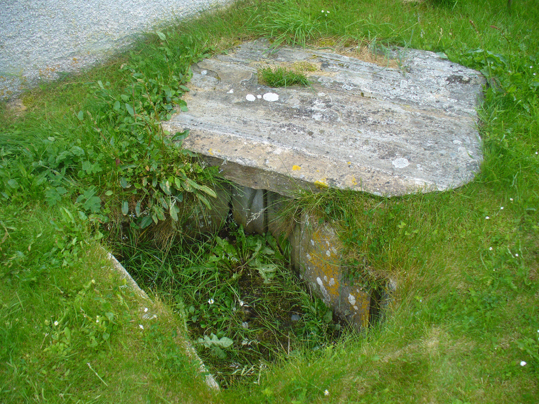
The cist in its new home

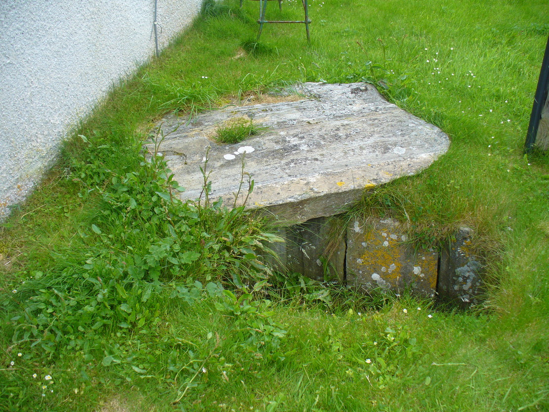
Dead easy.  From the top of the hill at Bettyhill, take the road east out of the village along the A836 Thurso road.  At the bottom of the hill, on your left, you’ll see the white building of Farr church Museum.  Walk to it and instead of going in the door, walk past it and round the back, or north-side of the church where, up against the wall, you’ll see this small stone-lined hole in the ground.  Y’ can’t really miss it.

Archaeology & History

Originally located 7½ miles (12.1km) to the south at Chealamy (NC 7240 5017), in the prehistoric paradise of Strathnaver, it was uncovered following road-building operations in 1981 and, to save it from complete destruction, was moved to its present position on the north-side of Farr church museum.  It was fortunate in being saved, as it was covered by a large boulder which the road operators tried to smash with a large jack-hammer; but in breaking it up, they noticed a hole beneath it.  Thankfully, old Eliot Rudie of Bettyhill—a well respected amateur historian and archaeologist in the area—was driving past just as it had been uncovered by the workmen.  He recognised it as being a probable cist and so further operations were stopped until it was investigated more thoroughly.

The relocated cist

The cist—measuring some 4 feet long by 3 feet wide and about 1½ feet deep—contained the burial of what was thought to be a man in his mid- to late-twenties.  The remains were obviously in very decayed state and it was thought by archaeologist Robert Gourlay (1996), that the body itself had been “deposited in the grave (when it was) in an advanced state of decomposition.”  Also in the cist they found a well-preserved decorated beaker, within which Gourlay thought “probably contained some kind of semi-alcoholic gruel for the journey of the departed to the after-life.”

References:

  1. Gourlay, Robert, Sutherland – An Archaeological Guide, Birlinn: Edinburgh 1996.
  2. Gourlay, Robert B., “A Short Cist Beaker Inhumation from Chealamy, Strathnaver, Sutherland”, in Proceedings Society Antiquaries Scotland, volume 114, 1984.
  3. Gourlay, Robert & Rudie, Eliot, “Chealamy, Strathnaver (Farr) Beaker Cist”, in Discovery Excavation Scotland, 1981.

Acknowledgments:  To that inspiring creature Aisha Domleo, for her bounce, spirit and madness to get me up here; and for little Lara too, for meandering to the church museum where this cist can be seen; and to Eliot Rudie, who pointed it out to us.

© Paul BennettThe Northern Antiquarian


Fiscary Cairnfield, Bettyhill, Sutherland

Cairnfield:  OS Grid Reference – NC 7279 6232

Getting Here

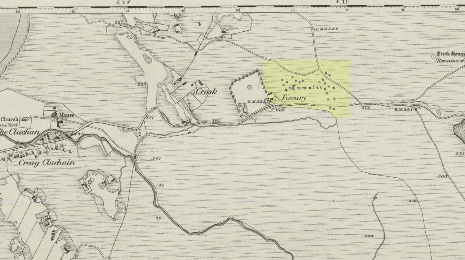
Tumuli on 1878 map

From Bettyhill, go out of the village along the A836 Thurso road for just over a mile.  You go uphill for a few hundred yards and just as the road levels-out, there’s the small Farr Road on your left and the cattle-grid in front of you.  Just before here is a small cottage on your left.  In the scrubland on the sloping hillside just below the cottage, a number of small mounds and undulations can be seen.  That’s it!

Archaeology & History

Although this place was highlighted on the first OS-map of the area in 1878, I can only find one modern reference describing this somewhat anomalous cluster of sites.  It’s anomalous, inasmuch as it doesn’t have the general hallmark of being a standard cairnfield or cluster of tumuli.  For one, it’s on a slightly steep slope; and another is that amidst what seems to be cairns there are other, more structured remains.  As I wandered back and forth here with Aisha, I kept shaking my head as it seemed somewhat of a puzzling site.  As it turns out, thankfully, I wasn’t the only one who thought this…

One of the ‘cairns’ from above
Profile of a typical cairn

In R.J. Mercer’s (1981) huge work on the prehistory of the region, he described the site as a whole as a field system comprising “enclosures, structures, cairns and field walls” and is part of a continual archaeological landscape that exists immediately east, of which the impressive Fiscary cairns are attached.  In all, this ‘cairnfield’ or field system is made up of at least 23 small man-made structures, with each one surviving “to a height of c.0.5m and are associated with 11 cairns from 2-6m is diameter.”

In truth, this site is probably of little interest visually unless you’re a hardcore archaeologist or explorer.

References:

  1. Mercer, R.J., Archaeological Field Survey in Northern Scotland – volume 2: 1980-1981, University of Edinburgh 1981.

Acknowledgments:  To the awesome Aisha Domleo, for her images, bounce, spirit and madness – as well as getting me up here to see this cluster of sites.

© Paul BennettThe Northern Antiquarian

Portmore Loch, Eddleston, Peeblesshire

Cist (destroyed):  OS Grid Reference – NT 2601 5074

Archaeology & History

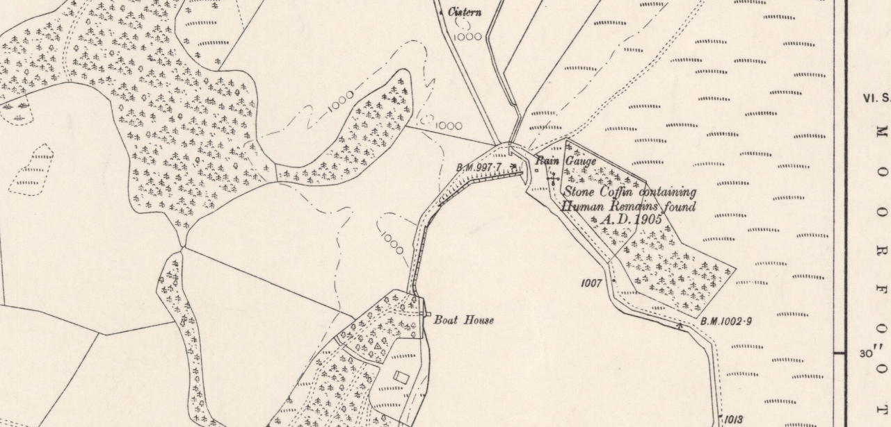
Cist site on 1906 OS map

It seems that very little is known about this site, long since gone when quarrying operations did what quarrying operations do.  The site was recorded by the Ordnance Survey lads on their 1908 map of the region, on which they noted: “Stone coffin containing human remains found AD 1905.”  The Royal Commission boys visited the site in April 1962 and reported that “nothing now survives.”  They listed it in their inventory as a prehistoric cist, or small stone-lined burial chest.  Such remains tend to be either neolithic or Bronze Age in nature.

References:

  1. Royal Commission Ancient & Historical Monuments, Scotland, Peeblesshire – volume 1, HMSO: Edinburgh 1967.

© Paul BennettThe Northern Antiquarian


Loch of Blairs, Forres, Morayshire

Cist:  SO Grid Reference – NJ 0194 5540

Also Known as:

  1. Canmore ID 15792

Archaeology & History 

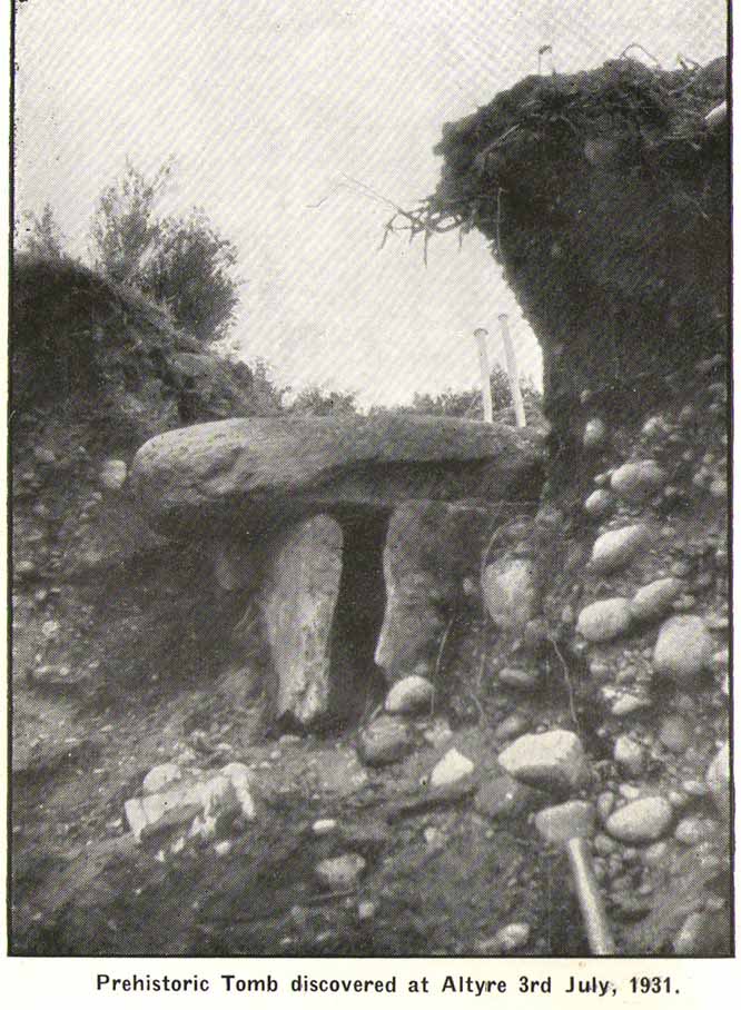
This is another of the many sites in the country that was uncovered fortuitously, as a result of widening the road just west of the Loch of Blairs.  It’s in relative isolation from other prehistoric sites.  The best description of it was by local antiquarian and folklorist James Ritchie (1932), to whom we owe our gratitude for the old photo.  “This cist,” he wrote, 

“as such tombs are called, had been discovered by workmen who were digging sand from a mound just by the main road to Grantown.  Flat, rectangular stones formed its ends and sides; its top was a single slab of massive proportions.  All around were packed smooth. water-worn boulders, that had once lain in the bed of the Findhorn.  The opening of the cist revealed the ashes of some long-departed dweller in Moray, together with pieces of what had been beautifully moulded pot of clay. On examination of the remains by antiquarian experts, the date of the burial was estimated to be at least a thousand years BC.”

The attached photo makes the site look larger than it is; as the length of the chamber is just 2ft 7in long, by 1ft 8in across, with the covering stone being nearly twice as large as the cist itself.  The urn found inside the cist now resides in the Scottish National Museum of Antiquities. 

References:

  1. Ritchie, James B., The Pageant of Morayland, Elgin Courant 1932.

© Paul BennettThe Northern Antiquarian

Simon Howe Stone Row, Goathland, North Yorkshire

Stone Row:  OS Grid Reference – SE 83016 98119 (SSW) to SE 83031 98142 (NNE)

Getting Here

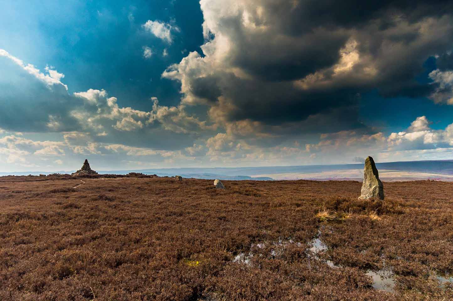
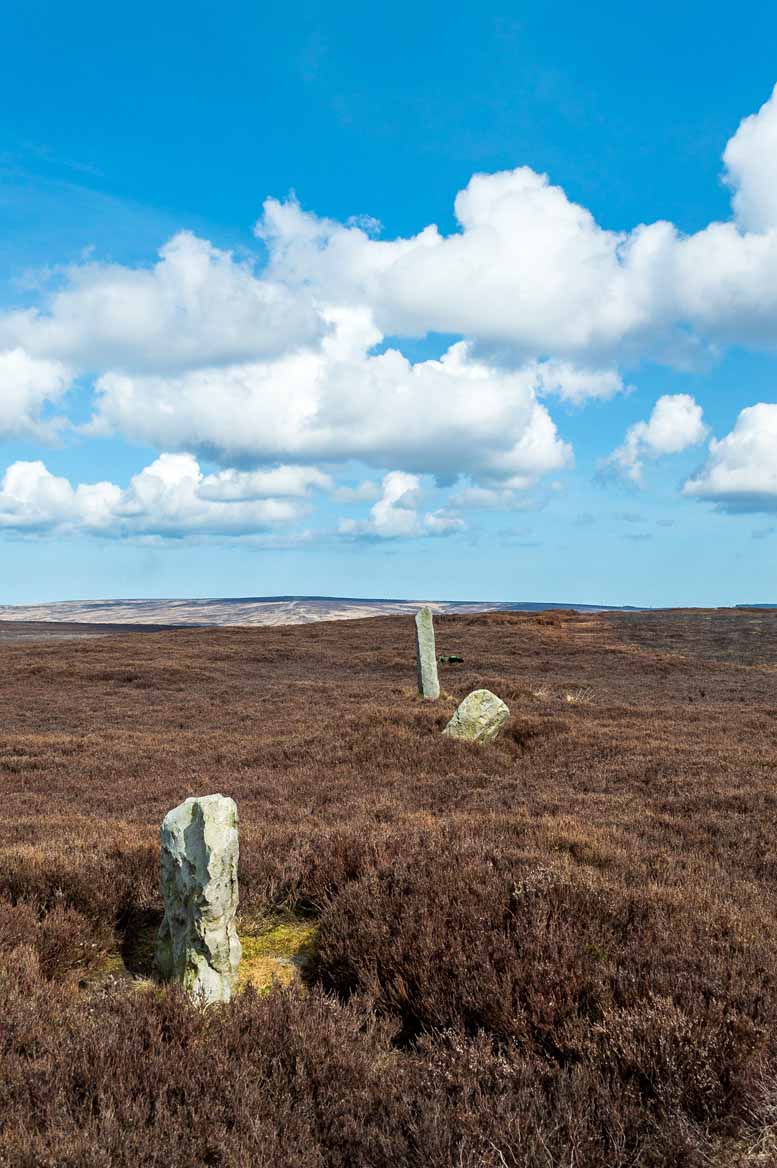
Simon Howe stone row (photo by James Elkington)

From Pickering take the moor road towards Whitby (A169) for approx. 12 miles.  After passing the Fylingdales Early Warning radar on the right (you can’t miss it), the road dips down to cross Eller Beck as a dog leg. After a half mile turn off left (west) towards Goathland (signposted). Follow the road under the North Yorks Moor railway bridge and after a third-of-a-mile the road turns slightly left.  Park in the little layby and follow the track onto the moors. Cross the small stream and walk along the narrow track through gorgeous heather for a mile and a half. Ahead you will see Simon Howe prominent on a ridge, with a stone row leading to it.

Archaeology & History

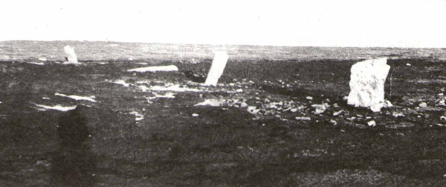
Not included in either of the giant megalithic alignments surveys of Burl or Thom, it seems that the first archaeological reference to this site was made by Raymond Hayes (1988).   He visited the site in 1947, shortly after a moorland fire had cleared away all the vegetation, allowing for a clearer view of the stones and, after his brief description of the adjacent Simon Howe tomb, he told that,

“The ridge is also the site of what is an unusual feature for the moors: a stone alignment consisting of three, formerly five upright stones that lead to a low eroded cairn c.65m to the south(west).  A moor fire in 1947 revealed the fourth, fallen stone, and I was able to locate the socket of a fifth.”

Raymond Hayes 1947 photo

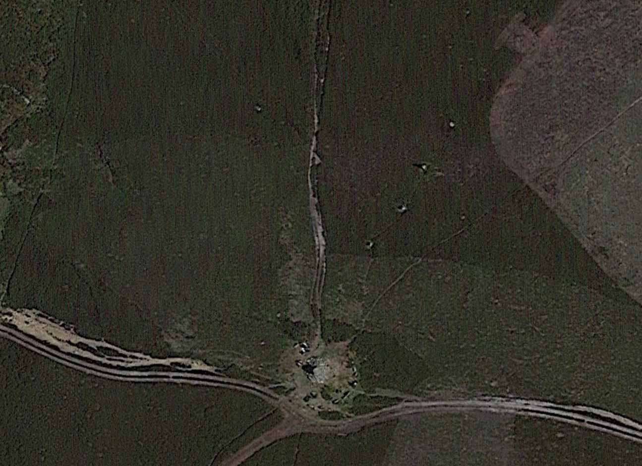
Stone row on GoogleEarth

From hereon, Hayes seemed to more interested in seeking out and describing a large number of flints that he found scattered on the ground around Simon Howe and its associated monoliths than the stones themselves.  Very sad…  The exact position of the missing fifth stone seems to be shown on Hayes’ plan as being closest to the cairn, about 10-15 yards away, but no trace of this remains.  However, of the remaining monoliths, they are all clearly visible from the air on Google Earth!

Looking SW (Photo by James Elkington)

Looking NE (photo by James Elkington)

The most southerly of the four stones (SE 83016 98119) stands just over 3 feet tall and the second upright, leaning at an angle, is just slightly taller, with the tallest of the three uprights at the northeastern end, being some 6 feet tall.   The fourth fallen stone (SE 83031 98142) lies just beyond this in the heather and which, if resurrected, would stand some 4 feet in height.  The length of the row, stone-to-stone, is just over 29 yards (26.6m).  I’m not aware if this site has ever been assessed as having an astronomical function, but its angle to the northeast might suggest a lunar rising.  Perhaps more pertinent would be another prehistoric cairn that can be seen less than 100 yards away past the northern end of the stone row: as North is the cardinal direction symbolizing Death in traditional lore…

References:

  1. Hayes, Raymond H., North-East Yorkshire Studies: Archaeological Papers, YAS: Leeds 1988.
  2. White, Stanhope, Standing Stones and Earthworks on the North Yorkshire Moors, privately printed: Scarborough 1987.
  3. Windle, Bertram C.A., Remains of the Prehistoric Age in England, Methuen: London 1909.

Links: 

  1. Simon Howe Stone Row on Stone Rows of Great Britain

Acknowledgements:  A huge thanks to James Elkington for use of his excellent photos in this site profile, as well as telling us about Getting Here. 🙂

© Paul BennettThe Northern Antiquarian

Simon Howe, Goathland, North Yorkshire

Cairn:  OS Grid Reference – SE 83007 98096

Getting Here

Simon Howe on 1854 map

From Pickering take the moor road towards Whitby (A169) for approx. 12 miles.  After passing the huge Fylingdales Early Warning radar on the right (you can’t miss it), the road dips down to cross Eller Beck as a dog leg. After a half mile turn off left (west) towards Goathland (signposted). There’s a free car park on the left where you can sit for awhile and enjoy the views.  Follow the road under the North Yorks Moor railway bridge, and after a third-of-a-mile the road turns slightly left.  Park in the little lay-by and follow the track onto the moors. Cross the small stream and walk along the narrow track through gorgeous heather for a mile and a half. Ahead you will see Simon Howe prominent on a ridge, with a stone row leading to it.

Archaeology & History

This impressive prehistoric tomb was first described in deeds as early as 1335 as Simondshou, which A.H. Smith (1928) translates to mean ‘Sigemund’s mound’ – alluding it to have been either the burial of someone with that name, or a name given to it by the incoming Vikings, oh so many centuries ago.  The latter is the more probable of the two…

Simon Howe (photo by James Elkington)

Hayes’ 1947 photo of Simon Howe

With excellent views in all directions, this monument is found high up in the landscape at the meeting of four paths that are closely aligned to the cardinal directions.  It was highlighted as a tumulus on the 1854 OS-map of the region and subsequently included in Windle’s (1909) listings as a “round barrow”, found in association with “three upright stones” running to the northeast. There are in fact four stones.

Not much has been written about it in archaeological circles.  Thankfully a brief survey of it was undertaken in 1947 by Raymond Hayes (1988) after a moorland blaze had cleared the heather, enabling good conditions to see the site more clearly.  He told that,

“Simon Howe…is very mutilated, what survives indicates that it was 11.50m in diameter and it is clear that it incorporated a stone kerb.”

This “stone kerb”, or surrounding ring of stones, is a feature found at other tombs on these hills—Flat Howe (1) being just one example.  However, in contrast to Flat Howe (1), Simon Howe has had most of its central mound totally stripped by peoples unknown a few centuries ago.  The remains we see today look more like a small ruined stone circle with internal rubble and a new walker’s cairn growing slowly from its centre.  Outside the cairn, just a few yards northeast, a fascinating megalithic stone row emerges.  Whether these were erected at the same time (in the early to mid-Bronze age, in my opinion) only an excavation would tell.

References:

  1. Hayes, Raymond H., North-East Yorkshire Studies: Archaeological Papers, YAS: Leeds 1988.
  2. Smith, A.H., The Place-Names of the North Riding of Yorkshire, Cambridge University Press 1928.
  3. White, Stanhope, Standing Stones and Earthworks on the North Yorkshire Moors, privately printed: Scarborough 1987.
  4. Windle, Bertram C.A., Remains of the Prehistoric Age in England, Methuen: London 1909.

Links

  1. Simon Howe on The Megalithic Portal
  2. Simon Howe on Stone Rows of Great Britain

Acknowledgements:  A huge thanks to James Elkington for use of the photograph in this site profile, as well as telling us about Getting Here.  And the map accompanying this site profile is Reproduced with the kind permission of the National Library of Scotland

© Paul BennettThe Northern Antiquarian