Take the same directions as if you’re going to visit the Black Beck cairn. From here, walk through the heather northwest for about 60 yards. If the heather’s been cleared, you’ll see it low down, otherwise you’re pretty much screwed when it comes to finding this one!
Archaeology & History
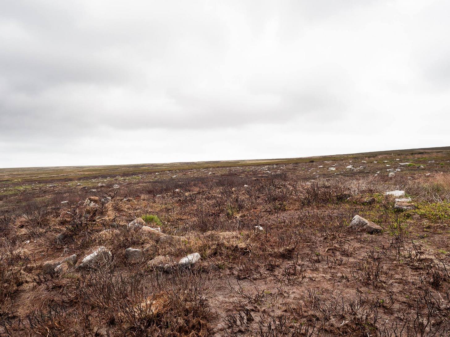
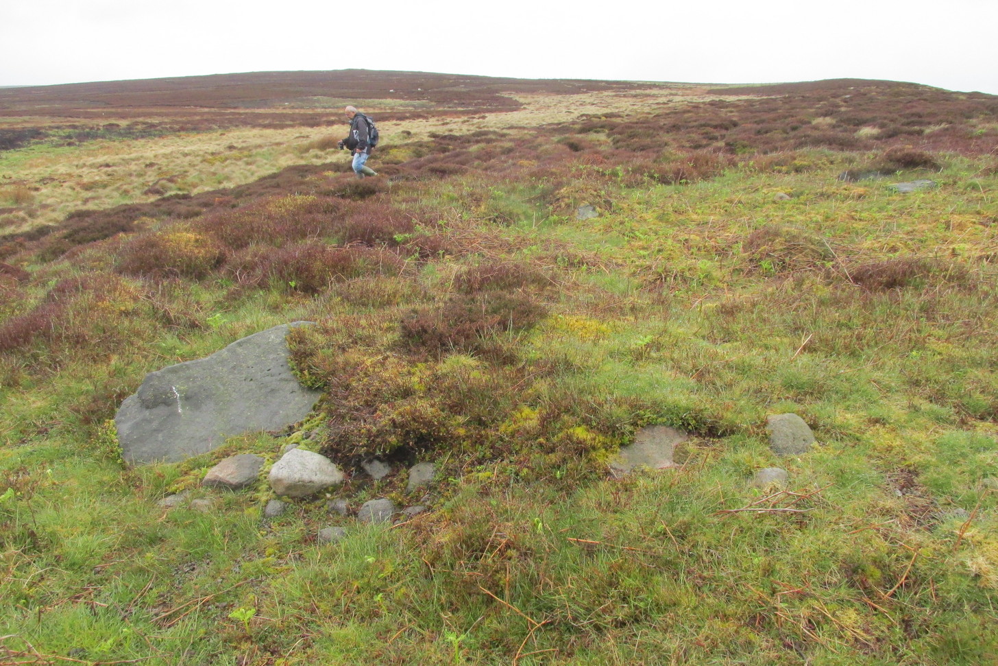
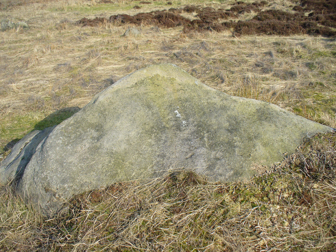
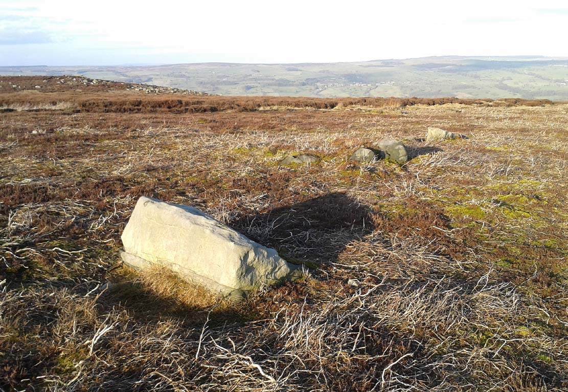
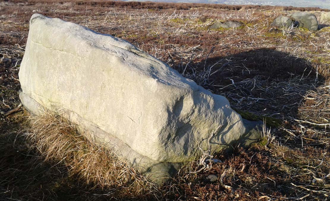
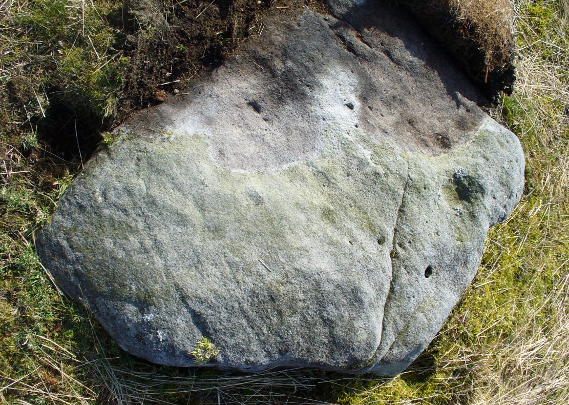
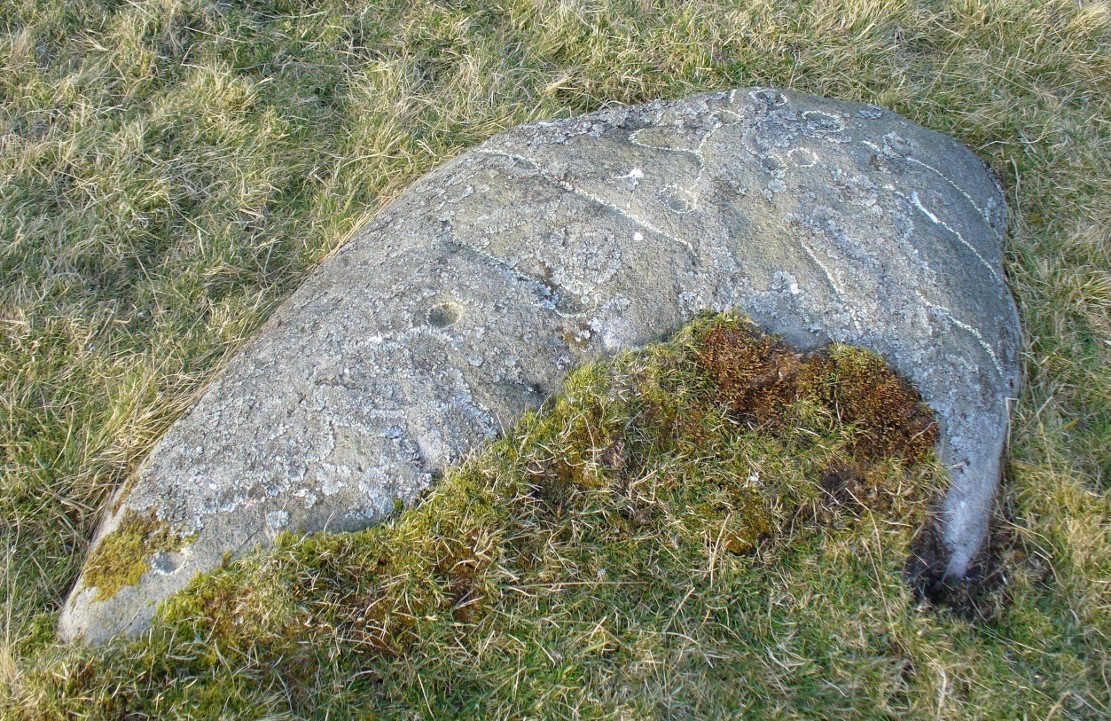
Seemingly in isolation, this low-walled, D-shaped hut circle is presently the only the structure of its kind known to exist on this part of Hawksworth Moor; although to be honest we should expect there to be such structures in the area when we consider the size and proximity of the associated cairnfields immediately north and southeast of here.
Southern arc of wallingNW section of walling; Black Beck tomb to rear
As with most hut circles, it’s nowt special to look at in all honesty. The south side of the structure is rubble walling typical of these structures, curving round as usual; but its more northern section straightens out, creating a D-shaped structure. This line of straight walling seems attached to another, outer parallel wall 3 feet away, creating its very outer edge. The rubble walls themselves average three feet across; whilst the hut circle measures 6-7 yards across. We assume that it was constructed during the same period as the adjacent prehistoric necropolis.
Acknowledgements: With huge thanks, as always, for James Elkington for use of his photos. Also to the evolving megalith and landscape explorer Mackenzie Erichs; and to Linzi Mitchell, for additional input…
Unless the heather’s been burnt back, this takes a bitta finding. Direction-wise, the easiest is from the moorland road above Menston. Go up Moor Lane and then turn right along Hillings Lane. 350 yards on is a dirt-track on your right marked as Public Footpath. Walk up here for two-thirds of a mile—going past where the track goes left to the Shooting Range—to where the track splits. Bear left and after 250 yards you reach a fence on your left where the moorland proper begins. Follow this fence SW for 300 yards until it does a right angle turn. Just before this, you’ll see a large worn overgrown trackway or path running north into the moorland. Walk up here for nearly 100 yards and look around. Best o’ luck!
Archaeology & History
Western arc of earth & stone
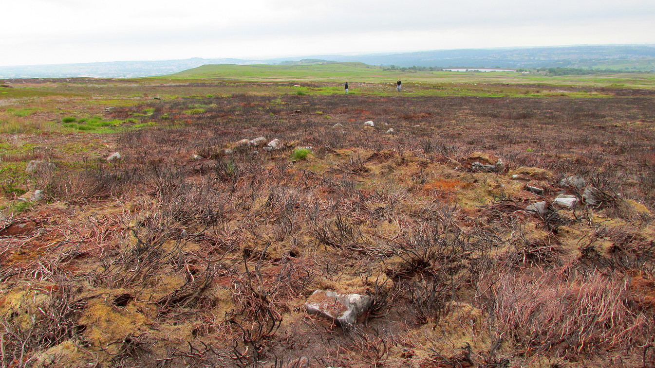
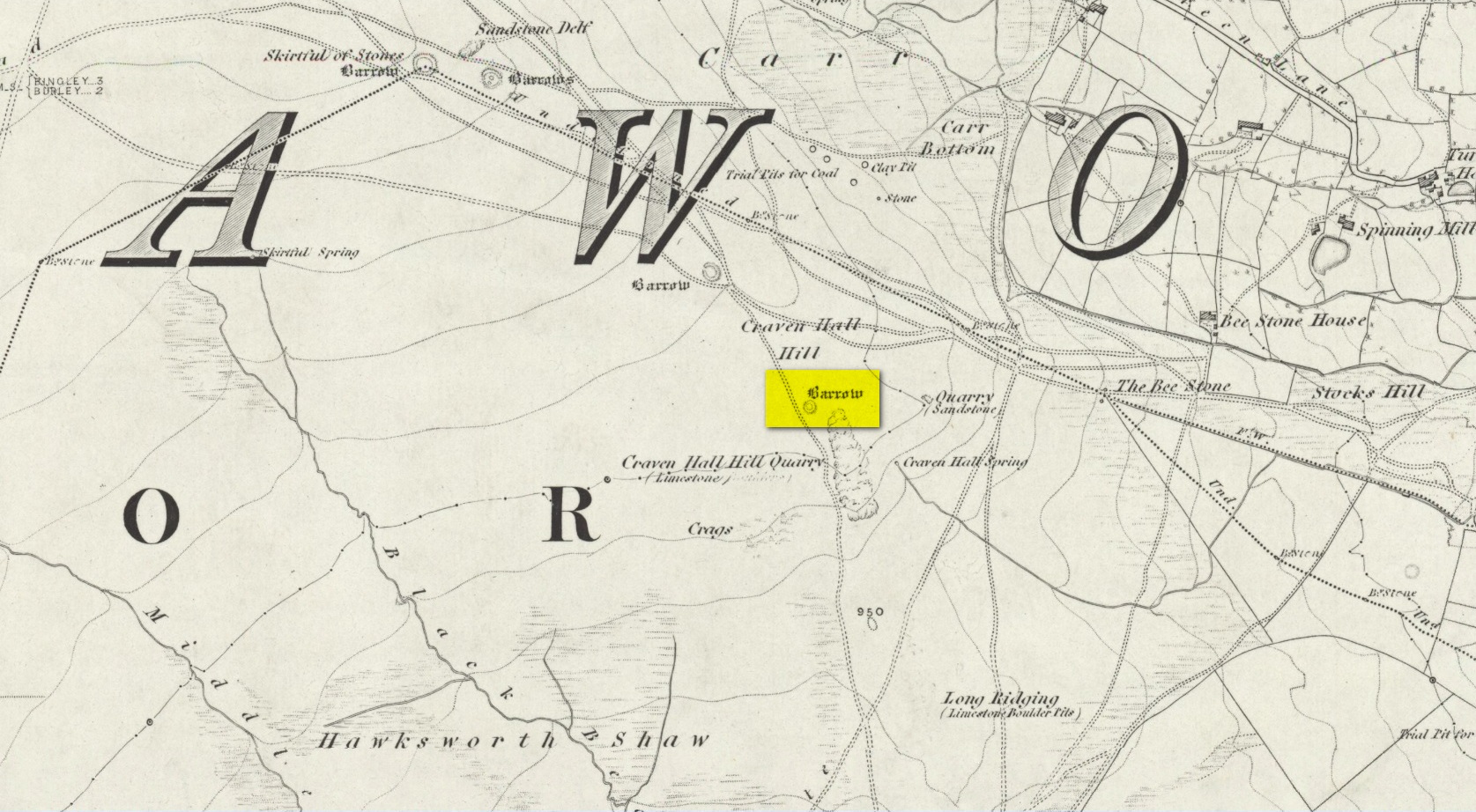
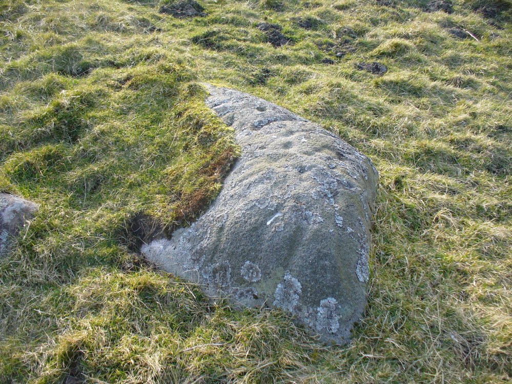
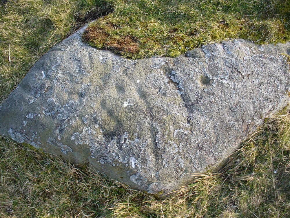
Shown on the 1851 OS-map adjacent to the long prehistoric trackway that runs past Roms Law, the Great Skirtful and other prehistoric sites, the antiquarian wanderings of Forrest & Grainge (1868) came past here and, although didn’t mention the Craven Hall cairns directly, they did write of “a group of barrows” hereabouts, and this may have been one of them. James Wardell (1869) gave an even more fleeting skip, only mentioning “pit dwellings” hereby. A little closer to certainty was the literary attention Collyer & Turner’s (1885) pen gave, where they described, “near the adjoining old trackway, which runs from East to West, will be seen a small barrow”—but this could be either of the Craven Hill sites. And the usually brilliant Harry Speight (1900) gave the place only more brevity….
Structurally similar to Roms Law nearly ¾-mile northwest of here, this little-known and much denuded prehistoric tomb has seen better days. It is barely visible even when the heather’s low—and when we visited recently, the heather was indeed low but, as the photos here indicate, it’s troublesome to see. It’s better, of course, with the naked eye.
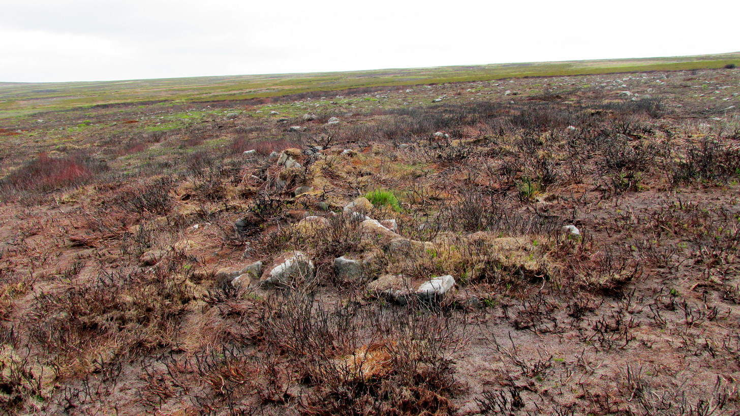
Highlighted ring cairn, looking NEHighlighted ring cairn, looking SE
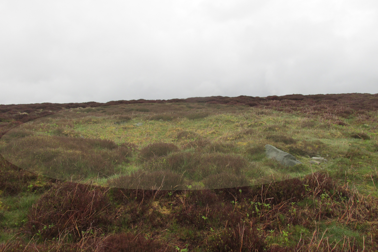
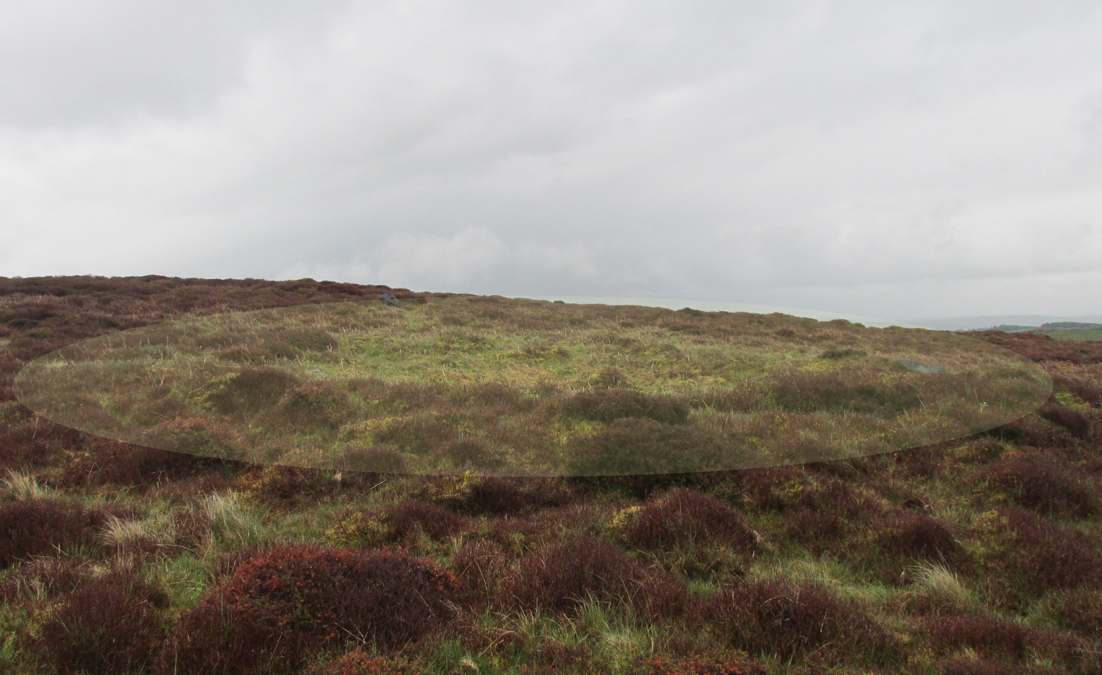
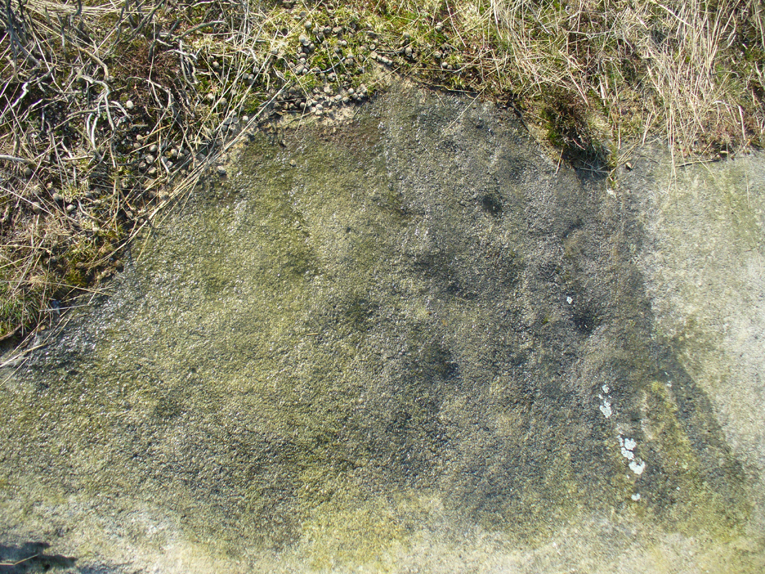
It’s the most easterly cairn in the large Bronze Age necropolis (burial ground) on Hawksworth Moor. Measuring some 12 yards across and roughly circular in form, the ring is comprised mainly of many small stones compacted with peat, creating a raised embankment barely two feet high above the heath and about a yard across on average. A number of larger stones can be seen when you walk around the ring, but they don’t appear to have any uniformity in layout such as found at the more traditional stone circles. However, only an excavation will tell us if there was ever any deliberate positioning of these larger stones. It would also tell us if there was ever a burial or cremation here, but the interior of the ring has been dug out, seemingly a century or two ago…
References:
Collyer, Robert & Turner, J.H., Ilkley: Ancient and Modern, William Walker: Otley 1885.
Faull, M.L. & Moorhouse, S.A. (eds.), West Yorkshire: An Archaeological Guide to AD 1500 – volume 1, WYMCC: Wakefield 1981.
Forrest, C. & Grainge, William, A Ramble on Rumbald’s Moor, among the Rocks, Idols and Altars of the Ancient Druids in the Spring of 1869, H. Kelly: Wakefield 1868.
Speight, Harry, Upper Wharfedale, Elliott Stock: London 1900.
Wardell, James, Historical Notes of Ilkley, Rombald’s Moor, Baildon Common, and other Matters of the British and Roman Periods, Joseph Dodgson: Leeds 1869.
Follow the directions to reach the impressive Woofa Bank prehistoric enclosure. You need to find the walling that constitutes the enclosure itself and walk along to its eastern side where you’ll reach an ‘opening’, as if it may once have been an entrance at that side of the enclosure. A reasonably large sloping rock is on one side of this ‘entrance’. You can’t really miss it!
Archaeology & History
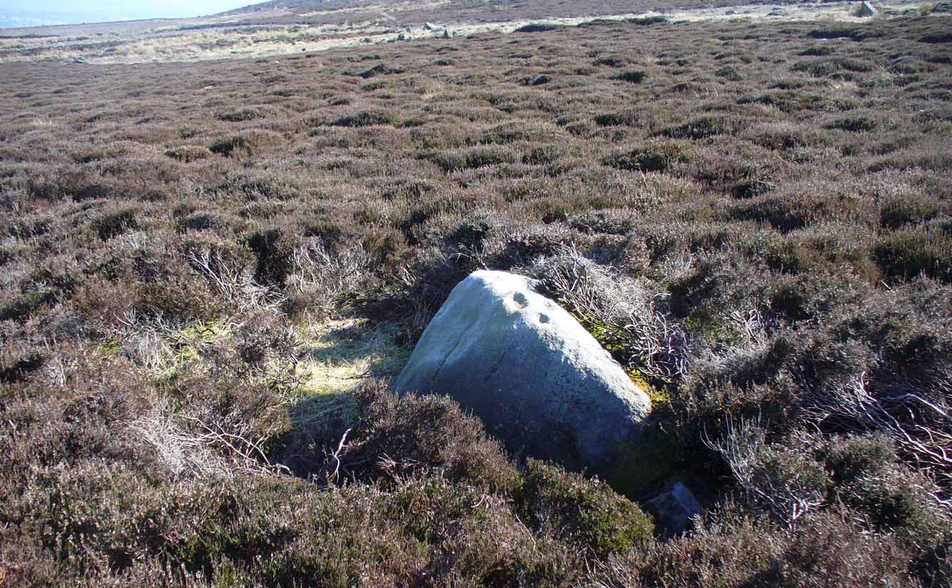
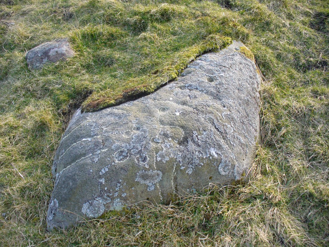
Unlike many of the other petroglyphs found within the Woofa Bank enclosure, the design on this one is faint — very faint indeed (much like the recently uncovered triple-ring petroglyph by the Thimble Stones). Comprising simply of a small cluster of cup-marks, you’ll struggle to see this one — unlike its compatriot on the western wall of the enclosure.
Looking down on the rockSome very faint cupmarks
It consists of a single cup-mark on the northern edge of the stone, whilst on the sloping southern part of the rock are a number of very faint cups, eroded by them there millenia of Nature’s wind and weathering. One or two of the cups are just visible in good lighting, but what are almost certainly a few more can be seen when the rock is wet and in low daylight hours. It’s a design that’s probably only of interest to the hardcore petroglyph fanatics, but without doubt this is yet another carving within this obviously important prehistoric enclosure.
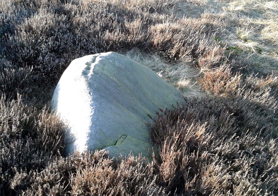
The easiest way to find this is to take the same directions to reach the Woofa Bank settlement. Get your compass out and make sure that you’re at the northern edge of the settlement walling. From here, walk about 60 yards northwest and keep your eyes peeled for a rock about 2 feet high, curved and elongated with its top surface above the heather. You’ll find it.
Archaeology & History
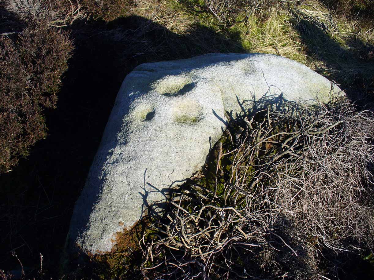
The name I’ve given to this stone is a conjectural one based entirely on comparative petroglyph designs elsewhere in the world. Or to put it more simply: elsewhere in the world we find examples of prehistoric rock art showing animal tracks and rituals relating to hunting animals, and in the design of this petroglyph on Ilkley Moor I wondered if we might be looking at something similar. Internationally respected anthropologists, archaeologists, geologists and rock art specialists such as Lawrence Loendorf (2008), Polly Schaafsma (1980), Dennis Slifer (1998) and many others show examples of animal tracks in the US and Mexico (examples exist throughout the world), and it’s not unlikely that some of the petroglyphs in the UK represent such things. But, like I say, this particular carving may have nowt to do with such a thing and the idea is entirely conjectural on my part and is probably way off the mark.
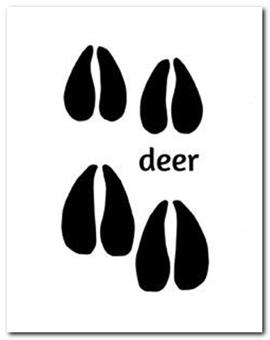
Deer-print motif & cup
Located less than 60 yards (54m) northwest of the impressive Woof Bank enclosure, it’s possible that the first literary note of this was by Stuart Feather (1968) when he made note of five cup-and-ring marked rocks (which) have been revealed by erosion in 1968,” telling us that some of the motifs on the rocks included cups with and without rings, channels and eye-shaped marks (occuli)— the latter of which may relate to this stone.
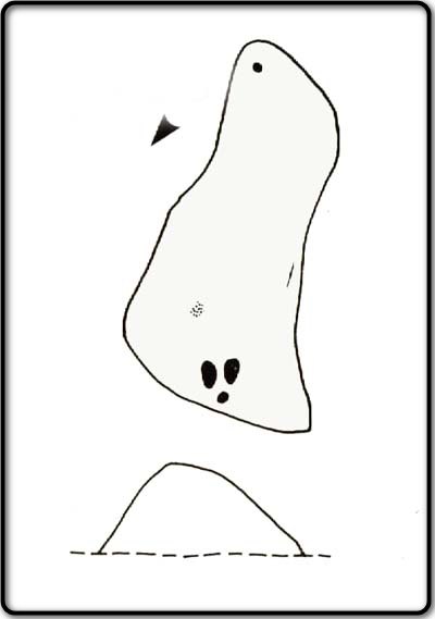
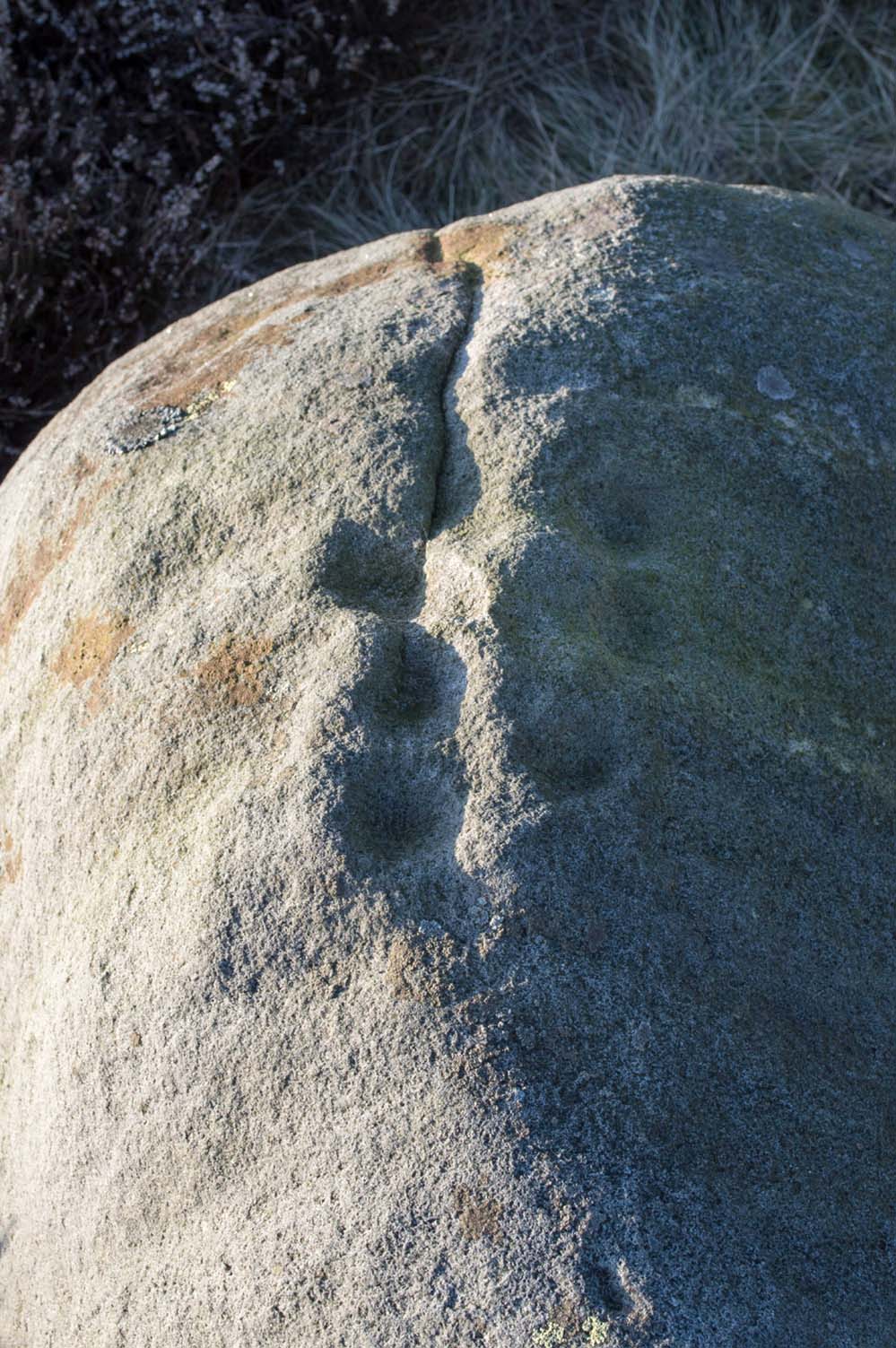
A more definite description of the stone was made in John Hedges (1986) survey where he described it in that usual simplistic form, telling us: “Long rock, its surface on two levels, sloping N to S in heather. Two large oval cups and one cup at N end. One clear cup at S end.”
Hedges’ 1986 sketch
It is these two elongated cups that have the distinct appearance of deer tracks. (another animal with a similar footprint is the goat) The cup-mark in front of them and the one at the back of the rock may be something relative to the animal. But more important than this is to recognise that, in lots of cultures, animal tracks are represented in some petroglyphs. That’s more important to think about when you look at British rock art, than the improbability of this design being such a thing…
References:
Boughey, Keith & Vickerman, E.A., Prehistoric Rock Art of the West Riding, WYAS: Wakefield 2003.
Feather, Stuart, “West Yorkshire Archaeological Register – Ilkley (WR) Green Crag Slack,” in Yorkshire Archaeology Journal, volume 42, 1968.
Hedges, John, The Carved Rocks on Rombalds Moor, WYMCC: Wakefield 1986.
Loendorf, Lawrence L., Thunder and Herds – Rock Art of the High Plains, Left Coast: Walnut Creek 2008.
Schaafsma, Polly, Indian Rock Art of the Southwest, University of New Mexico Press 1980.
Slifer, Dennis, Signs of Life – Rock Art of the Upper Rio Grande, Ancient City: New Mexico 1998.
Along the moorland road between Cow & Calf and The Hermit pub, park up at the small wooded bit by the right-angle bend and cross over the Coldstone Beck. Walk up onto the moor itself and stick to the path that runs roughly parallel with the slowly-drying stream, towards Lower Lanshaw Dam. About 100 yards before it, walk left, into the heather, for about 50 yards. You’re damn close!
Archaeology & History
Lower Lanshaw Dam carvingClose-up of cupmarks (by James Elkington)
This is another neolithic or Bronze Age carving I first came across during one of my weekly rambles across these hills as a child, and upon revisiting the place a few days ago with James Elkington, found it associated with nearby cairns and what looks to be the remains of prehistoric walling – none of which I noticed when I was a kid. The petroglyph is a simple design, primarily consisting of two rows of three cup-marks: one row of three along the top or spine of the rock, and another one immediately beneath it, an inch or so below. The topmost line of cups runs into a natural crack in the rock, which runs down the northwest edge of the stone. A possible faint cup and partial ring emerges on the southeast side of the topmost row of cups, but this is difficult to make out. On the sloping northwest face of the rock is another single cup-marking.
References:
Bennett, Paul, Of Cups and Rings and Things, unpublished: Shipley 1981.
Acknowledgements: Many thanks to James Elkington for use of his photo to illustrate this petroglyph
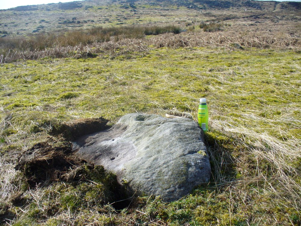
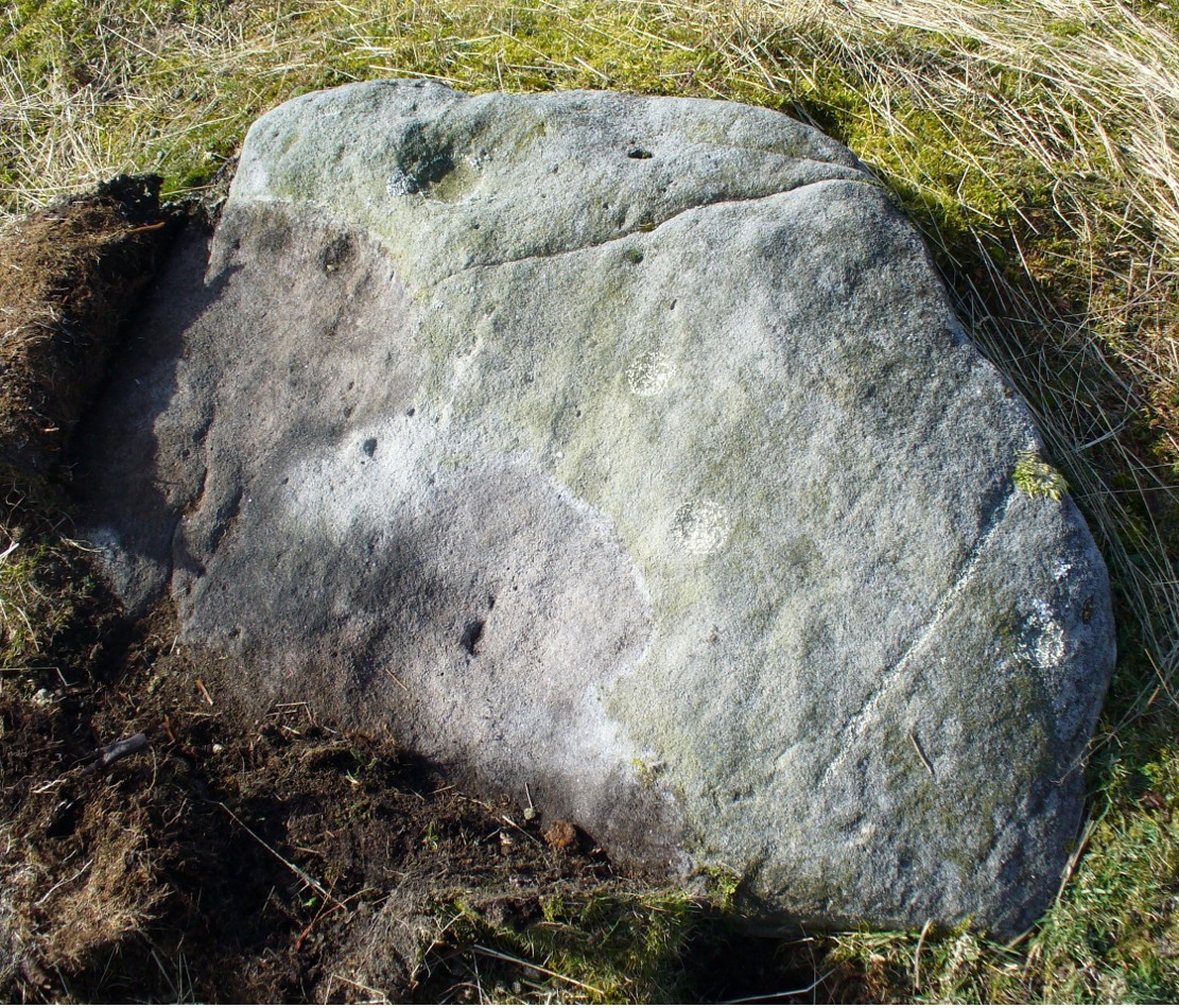
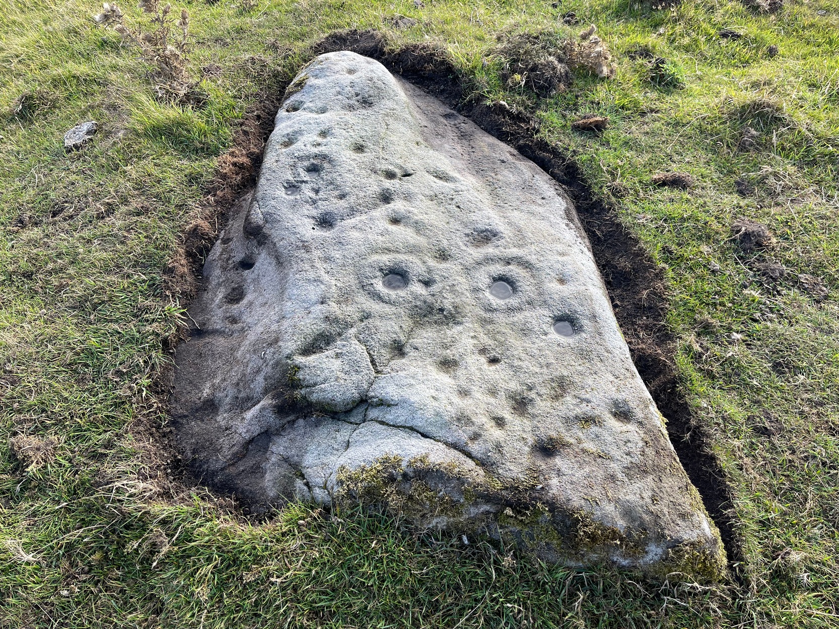
Take the same directions as if you’re visiting the Lanshaw Dam 2 petroglyph, then keep walking directly towards the Lanshaw Dam, 130 yards east. Halfway between the two, closer to the footpath, look out for a stone of similar shape and dimensions to Lanshaw 2, just by a prehistoric cairn. You’ll find it!
Archaeology & History
Cup-marked stone & cairnClose-up of cup marking
As with a great number of petroglyphs in and around Yorkshire, this large single cup-marked rock is found in close association with a reasonably large prehistoric cairn (several others are close by), some 3 yards in diameter. The cup-marking here is larger than yer average cup-mark on these moors, being four inches across. It can clearly be seen on the southern vertical face of the rock and doesn’t appear to have been recorded before. On the whole, it’s nothing special to look at and is probably just one for the petroglyphic purists amongst you.
From Burley train station, take the road uphill onto the moor edge, turning right at the top. Go on for a few hundred yards and park up round the sharp bend. Walk up the steep-ish path on the right-hand side of the rocky valley of Coldstone Beck. Once your on the level with the moors, veer to your right (west) on the footpath parallel with the walling. Barely 50 yards along, watch in the grasses and heather to your left (south). Keep looking and you’ll find it. (apologies for just a 6-figure grid-ref for this stone, but I paid little attention to its position when I was in walkabout mode)
Archaeology & History
A couple of hundred yards east of the Cold Stone monolith is another petroglyph that has evaded the diligent archaeologists of the region! But it’s easily missed if the daylight conditions aren’t too good. The most notable element on the stone is the large, possibly natural cup-marking on its top-right SW side. It’s that which initially gets your attention and, due to its initial singularity on the rock, you’d turn away and shake your head, muttering that well known petroglyphic mantra of “dunno.” But when the sun and air are clear or low on the horizon, other more faint etchings, almost lost in the worlds of erosion, catches the eye.
Carving faintly highlightedLooking straight down
At least four cups are visible on the stone, perhaps six, mainly near its middle and faintly highlighted in one of the images here. But there is also a pecked carved line here too, running across the shorter northern side of the stone. Near the bottom of this line there is the faint impression of a carved ring, but whether this is a trick of the light or real, I won’t hazard to guess. Not far away is the curiously shaped Chair Stone and its cup-marks. Others are in the vicinity.
This is another of the many unrecorded cup-and-ring carvings in the region—and one in a small cluster hereby. It was rediscovered several years ago on a Northern Antiquarian outing and, thankfully, remains in good condition. Encrusted by layers of gorgeous lichens, deep into the rock, it has hence proven difficult to explore the entirety of the exact design without tearing off the old lichen covering—which I’ve no intention of doing.
Lichen Stone, from above
There are at least a dozen cup-markings etched onto the upper surface of this curved stone, with the majority of them clustering around its eastern side. It seems there’s only one cup-marking on the western section of the rock, with the majority of them carved near the middle of the rock and then moving to its eastern section. But the curious features are the interlinking carved lines which you can see have been highlighted on the top and sides of the stone. Initially you get the impression that they’re natural, but it becomes obvious the more you look at them that they’re an integral part of the carving. Some of the lines typically link-up with other cups, whilst a number of them have been carved along and down the vertical faces of the rock, primarily on the east and north-east edges. At least seven of them have been done and they all reach down to ground-level.
Cups & carved linesCarved lines highlighted
It seemed obvious that an even larger design was apparent on the rock, but the stone had been covered in an age of lichen (hence the name) which I didn’t want to disturb; and although no distinct cup-and-ring can be seen here, it looked as if one such motif might have been hiding beneath the lichen cover. But let’s leave the rock and lichen to their own quiet life and move on our way…. to the other carvings nearby, like the impressive Fraggle Rock, or the more basic Snake Stone. Then follow your nose and seek out the other carvings in these fields…
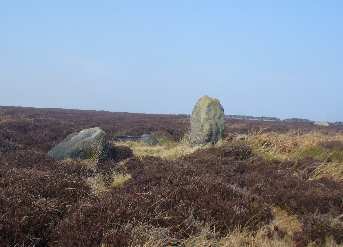
From Burley-in-Wharfedale train station, take the road uphill to the moors, turning right at the top, until you hit the bend where the stream and rocky valley of Coldstone Beck appears. Walk up the right-hand (west) side of the beck until the moorland levels out. Walk along the footpath above Stead Crag for a coupla hundred yards, keeping your eyes peeled for the largest upright stone in the heather about 50 yards into the moors. The other way is to get to Woofa Bank Enclosure and keep walking east through the heather for a coupla hundred yards till you see the tallest upright stone in the heather.
Archaeology & History
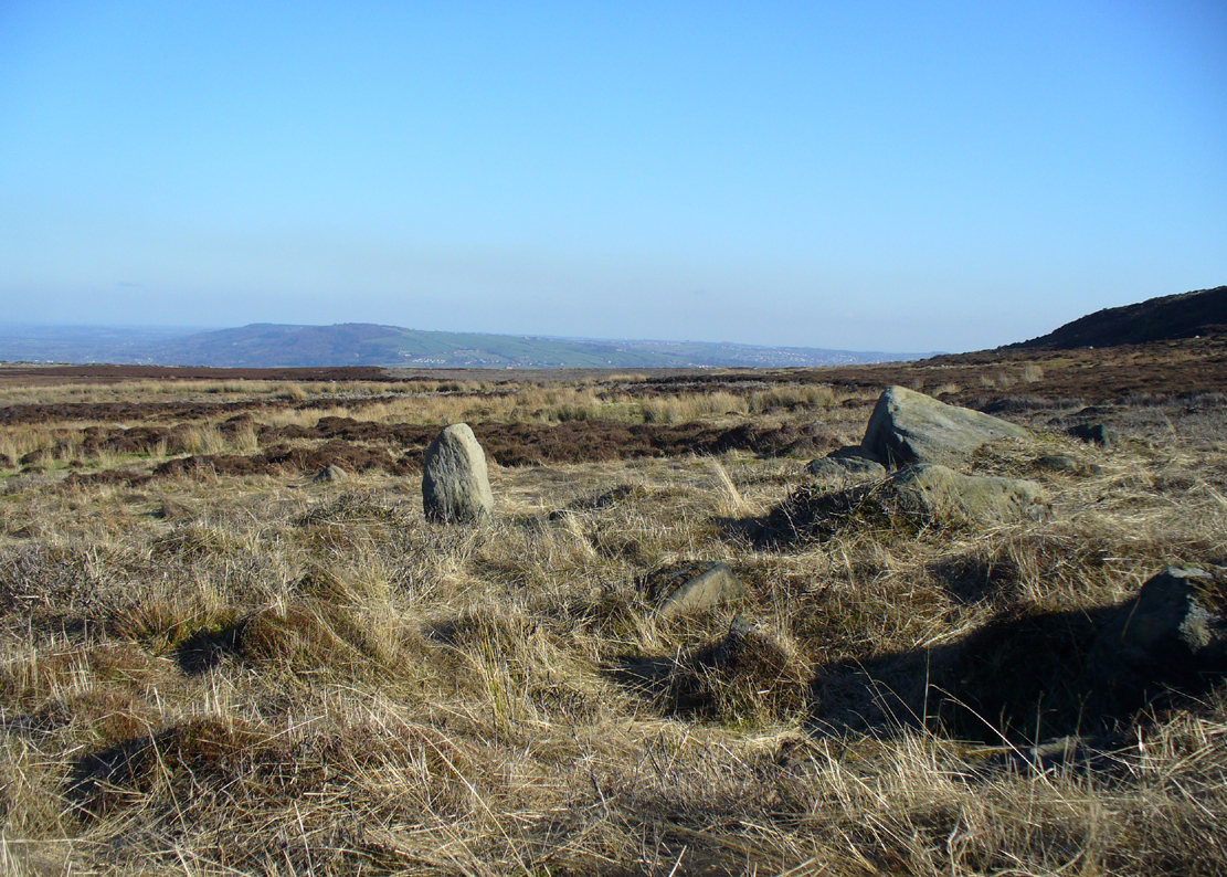
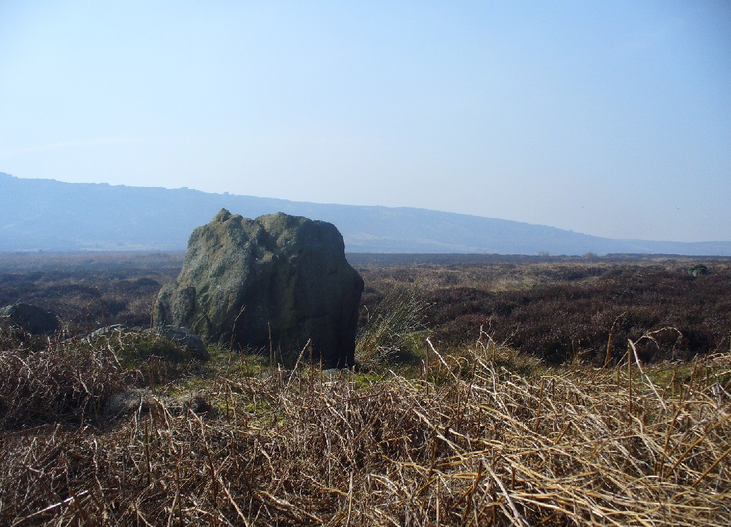
Apart from my own short entry about this site in The Old Stones of Elmet, we have no archaeological account of this standing stone, less than four feet tall and nearly as wide at its maximum, living in a landscape renowned for its excess of neolithic and Bronze Age remains. For those of us who love our megaliths it’s nothing special — but at the same time it’s worth looking at, if only because of the other mass of prehistoric remains close by. It received its name from the adjacent Coldstone Beck a short distance to the east, whose etymology isn’t clear.
Cold Stone, looking eastGazing into a hazy SW
Although we know that many of the sites on this ridge are prehistoric in origin (incredibly some of it still aint registered by those who get paid to do such things), we also need to take into consideration that this site may have been effected by the early industrialists who also made their mark on this section of the moor: they have scarred some cup-and-rings along here, destroyed other remains and left incisions on some rocks which could easily be mistaken as ancient. There is also the possibility that this upright and its adjacent stones were once part of a cairn. If evidence comes to light that the Cold Stone is more recent, we will of course amend this site entry.
Folklore
A number of Cold Stones are found scattered across upland Britain, in the form of crags or solitary stones. In North Yorkshire and beyond, the name is sometimes a corruption of a Call Stone, i.e., a site where village matters were called out prior to the institution of a bell-man. The old Market Cross in Kendal village, also known as the Cold Stone was where village notices were proclaimed.
References:
Bennett, Paul, The Old Stones of Elmet, Capall Bann: Chieveley 2001.
Probably the easiest (direction wise) is if you’re coming from Dick Hudson’s public house on the southern road surrounding Rombalds Moor. From the pub, head left (east) along Otley Road (passing Weecher reservoir) for 1.9 miles (3.1km) until you reach Reva reservoir where a track leads you to the waters. A small parking spot is on the left-side of the road. From here, go through the gate and along the footpath across the field for nearly 300 yards to the next gate; go through here and walk to your right for about 60 yards where uyou’ll reach a small straight dyke (keep your eyes peeled!) running NW (to your left): walk along here for nearly 200 yards until it hits another shallow dyke bearing right; follow this dead straight for 35 yards after which it changes direction, but you need to keep walking straight on forward for another 60 yards or so. Look around!
Archaeology & History
First photo of the carving
This carving is one in a cluster of previously unrecorded petroglyphs, uncovered in the summer of 2011 during a Northern Antiquarian bimble on the northern edge of Rombald’s Moor. The carvings were found as a bi-product of uncovering a previously undiscovered cairn circle, close to the Twelve Apostles stone circle. In assessing and exploring the newly-found circle, it was noticed that a small opening in the near horizon highlighted a rise in the landscape barely a mile away. This ‘opening’ in the land was not visible if you walked 25 yards either side of the cairn circle – but was very notable at the circle itself.
“We need to have a look at that site,” I said. “It’s position looks to have been relevant to this circle.” (or words to that effect) And a couple of weeks later we met up and walked to the place in question.
Fraggle Rock carving, looking westFraggle Rock carving, looking south
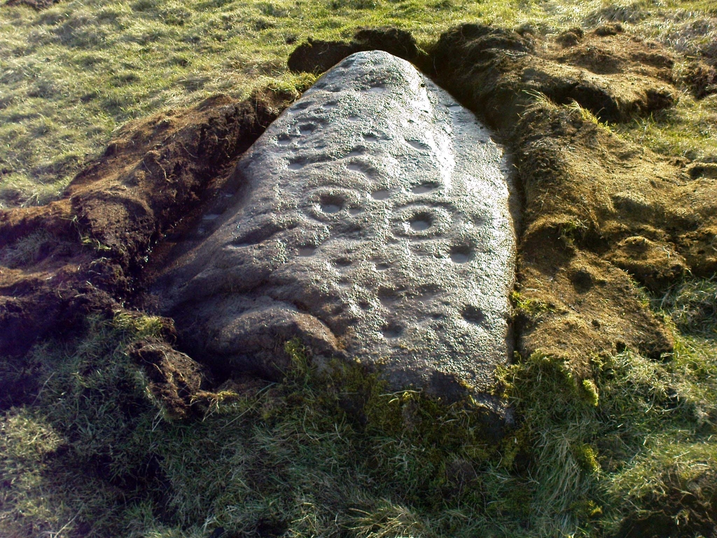
Within five minutes we came across a couple of previously unrecorded cup-marked stones, of simple design, right in line with the cairn circle. As we walked around this spot, then headed back in the direction of the circle, a cluster of small stones were noticed on the slope. One had what looked like a single cup-marking near its edge, but the rest of the rock was completely covered in vegetation. Paul Hornby and Michala Potts had, by now, already found several other previously unrecorded cup-marked stones close by; but as I carefully rolled back the vegetation at the edge of this particular rock, cups-and-rings and carved lines seemed to be covering most of its surface. It was a good one!
Face on the Fraggle Rock
We called it the Fraggle Rock after noticing that when you look at the stone from one end, the two main cup-and-rings are likes two large eyes carved above a large natural down-turning ‘mouth’ feature, similar to some of the creatures’ faces on the muppets or the similar kid’s TV show, Fraggle Rock! (sad aren’t we!?) The photo here shows you what we mean.
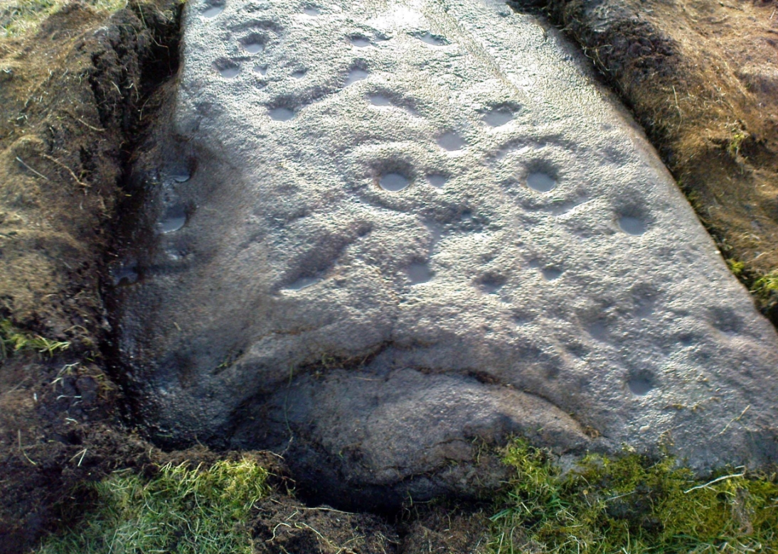
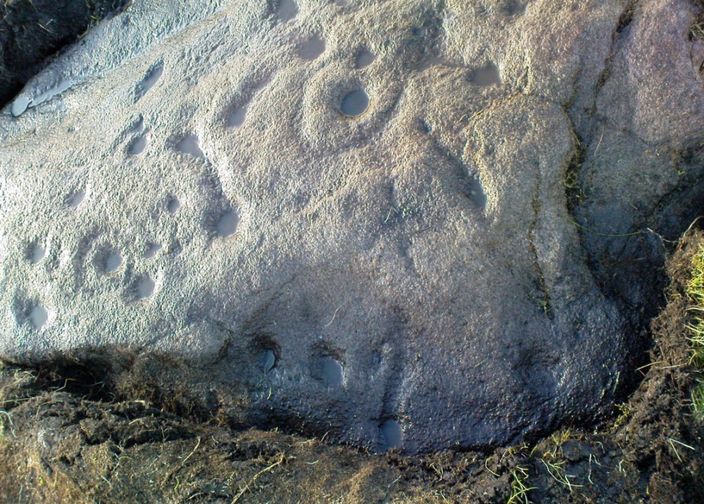
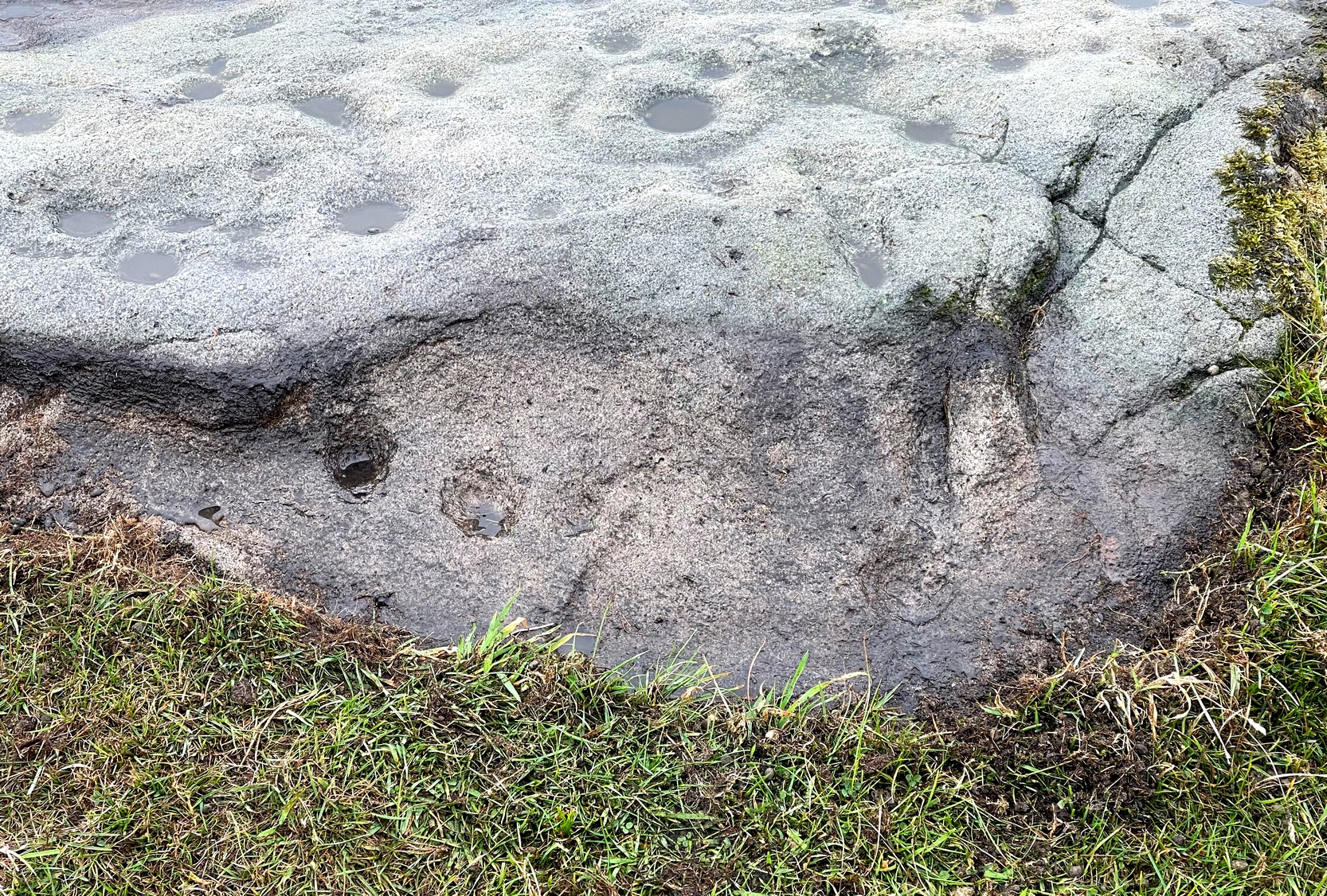
The primary design consists of at least 3 cup-and-rings, 2 partial cup-and-rings, 28 cups and several carved lines along which some cup-markings are linked to others. The most notable of the carved lines is the longest (barely visible in the photos), running from a single cup-mark at the southernmost rounded end of the stone, almost straight and parallel with a natural ridge or dip along the rock, until it meets the largest of the cup-and-rings (one of the eyes on the Fraggle’s face!). Don’t ask me why, but for some reason this long faint line seemed the most perplexing element of the carving.
Eastern edge with low cupsCup-marks on rock edge
Most of the design is carved on the upper face of the stone, but a small part of the rock dips into the ground on its eastern side and a small group of cups and a single carved line, in a very good state of preservation, are etched right at the edge of the stone. Unusual. Another faint cup-and-ring is less than 100 yards west; and a fascinating cup-and-lines stone, with at least four long carved ridges running like hair from the top of the stone into the Earth, is a short distance to the north. A number of others are in this and adjacent fields.