From Dunblane, head out east up and along Glen Road up towards Sheriffmuir. Turn left at the junction of the Sheriffmuir Inn and keep going for about 3 miles, keeping your eyes peeled for the TV mast on the left-hand side of the road. 100 yards past this, you can park-up. Walk down the road another 100 yards until you get to the next gate in the fence. According to Ordnance Survey, the circle is/was across the road from here.
Archaeology & History
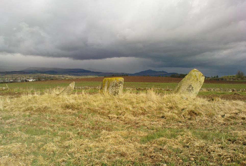
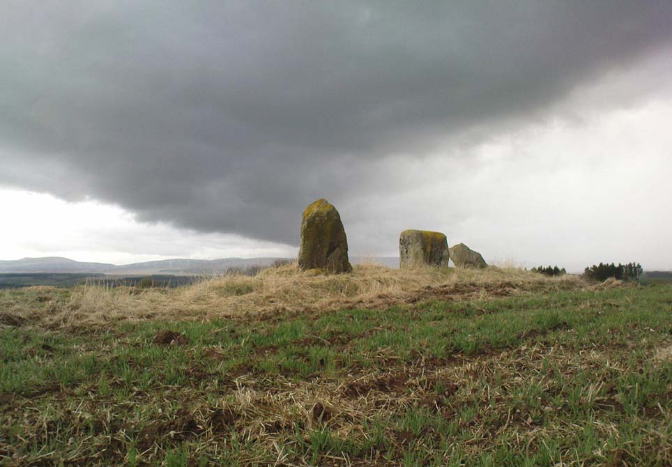
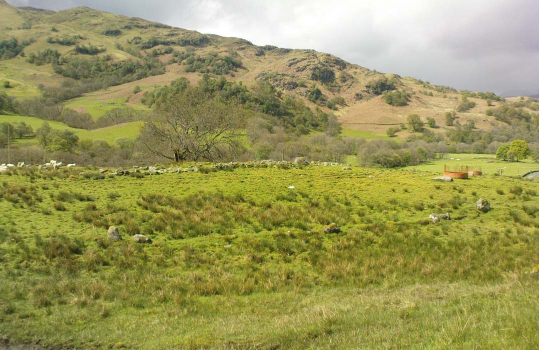
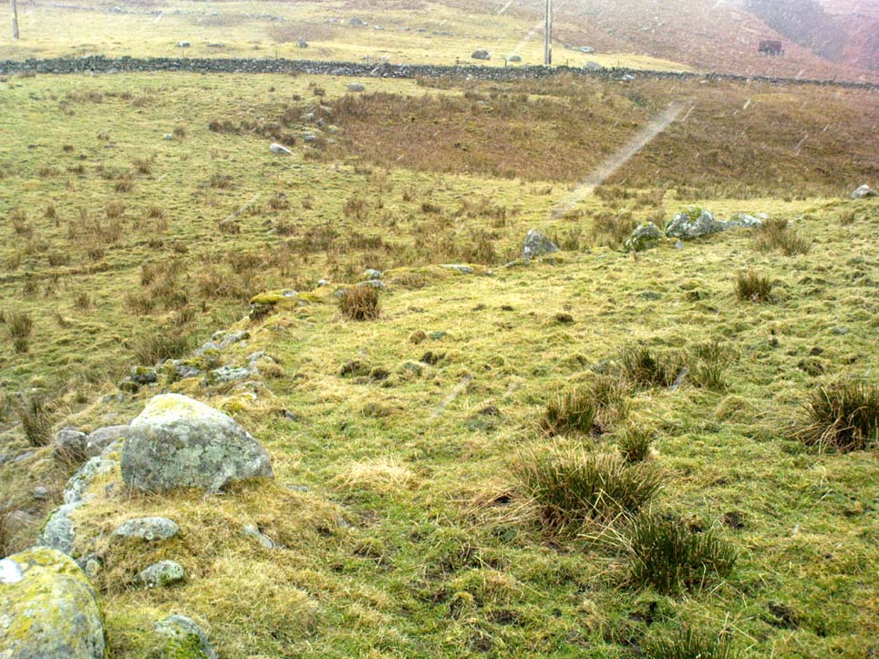
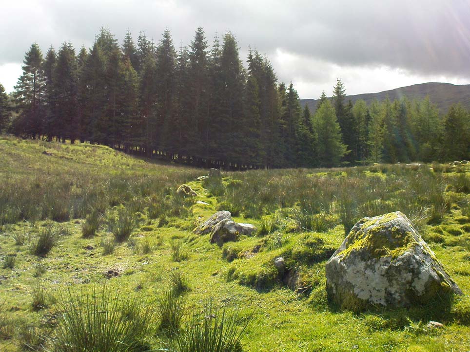
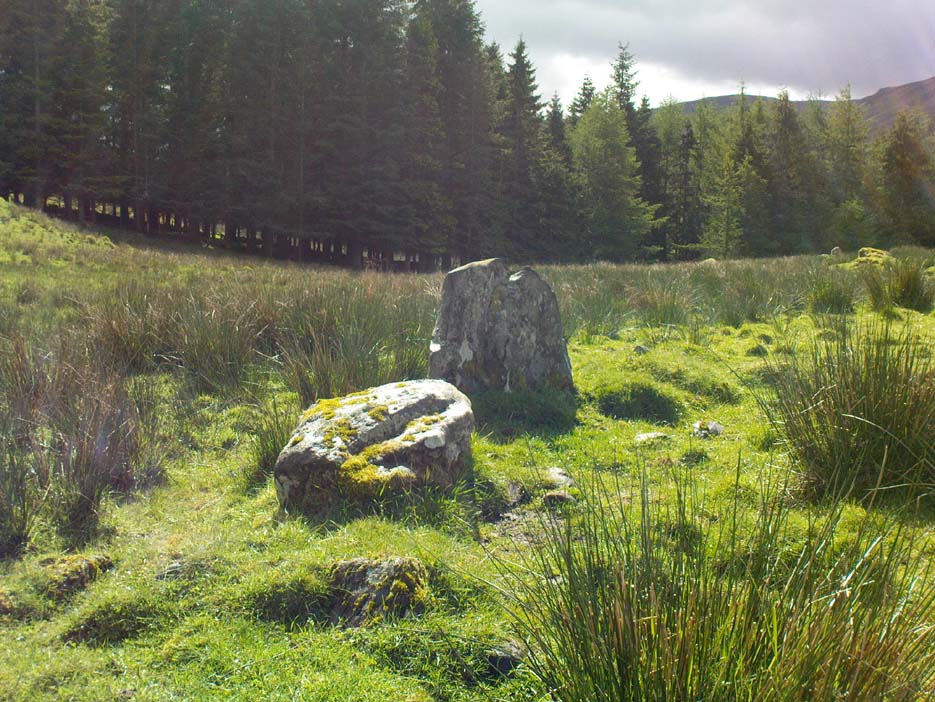
Although local tradition and historical accounts tells of a circle of seven stones nearby, there’s little to be seen at the position shown on the OS-map. On one side of the road, just above the embankment, there are hardly any rocks at all to even remotely ascribe as being touched by humans – i.e., there’s nowt there! On the other side of the road, close to the parking spot, we do find a small cluster of rocks, perhaps hinting at a cairn structure, and then another longer stone embedded in the embankment 20 yards further down – but even these ‘remains’ (if you could call them that) seem flimsy evidence indeed of any megalithic structure here. There is also a small arc of small stones by the roadside in the same area — but even these would be stretching imagination into psilocybe realms to call them a stone circle! So I’m not sure what’s happened here. My gut feeling told me that the position of this ‘stone circle’ shown on the OS-map was wrong, but that some remains of it would be found nearby. But that could be bullshit.
Nevertheless, there are what seems to be the remains of prehistoric walling and possible enclosures close by, so a greater examination and bimble in the heathlands here is on the cards in the coming weeks. If anyone living close by has further information on this spot, or fancies walking back-and-forth through the boggy moors (it’s arduous and not for the faint-hearted) in search of such sites, lemme know! I have the feeling that there’s more to be found along this stretch of countryside.
Whether this site was the “druidical circle” mentioned in the Old Statistical Account of Scotland “in the heights of Sheriffmuir,”(vol.3, p.210), or the lost Harperstone Circle, we cannot be sure. But an early account of this lost circle was written in John Monteath’s (1885) collection of Dunblane folktales. He told:
“About two miles south-west of the village of Blackford, on the Sheriff-muir road, and near to the farm-house of Easter-Biggs, is an arch of stones, seven in number, called the “Seven Stanes,” varying from perhaps a ton to two tons each. One of these is of a round prismatical shape, and stands in an erect position. Beside these lies a large bullet of stone, called “Wallace’s Puttin’ Stane,” and he is accounted a strong man who can lift it in his arms to the top of the standing one, which is about four feet high, – and a very strong man who is able to toss it over without coming in contact with the upright one. At one time few were to be found of such muscular strength as to accomplish this – not so much from the actual weight of the stone itself, as from the difficulty of retaining hold of it, it being very smooth and circular. This difficulty, however, was obviated about seventy years ago, by the barbarous hand of a mason, to enable himself to perform the feat, since which time a person of ordinary strength can easily lift it…”
It would seem there are or were additional prehistoric sites scattering the eastern edges of the Ochils within a few miles of each other along this ridge, as several accounts from both local newspapers and learned journals talk of a number of places, of differing dimensions. The lost Harperstone Circle is a case in point; and another ‘circle’ mentioned by A.F. Hutchison in 1890, measuring just “10 – 12ft in diameter, of 5 or 6 stones, each about 2ft high” (probably a small cairn circle) differs from Monteath’s description on the Wester Biggs ring.
Folklore
In Monteath’s (1885) account of local Dunblane traditions, the following narrative was given which local people held dear as a truthful statement of these ancient stones:
“Some antiquaries might suppose the ‘Seven Stanes’ to have been, in former times, a Druidical place of worship; but tradition contradicts this, in a manner so distinct and pointed, that none, in anyway acquainted with the connection which, in Scotland in particular, exists between oral testimony and written records, but must be struck with the plausibility of the story which tradition affords…
“The “Seven Stanes” then, instead of being the remains of a Druidical place of worship, tradition informs us, are intended to commemorate a glorious victory obtained by an army of Scottish patriots under Wallace over an English army 10,000 strong, who were taken by surprise and cut to pieces. Wallace, who was not less remarkable for the celerity of his movements than the strength of his arm, determined not only to intercept it, but formed, at the same time, the most daring plan of cutting off their retreat, as if already assured of victory. For this purpose he divided his brave followers into three divisions; one of which he dispatched in the night to the “Seven Stanes” – another was stationed at the Blackhill of Pendreigh, to fall upon the rear – and Wallace himself, with his division, lay on the Muir of Whiteheadston.”
References:
Hutchinson, A.F., “The Standing Stones of Stirling District,” in The Stirling Antiquary, volume 1, 1893.
Monteath, John, Dunblane Traditions, E. Johnstone: Stirling 1885.
Take the B824 road that runs between Dunblane and Doune and, whichever direction you’re coming from, watch out for the large statue of David Stirling by the roadside (y’ can’t really miss it!). Stop here. Then, walk along the dirt-track into the field by the side of the statue, keeping your eyes peeled 50 yards along, for the upright stones in the field on your right, at the top of the brow of the hill.
Archaeology & History
Glenhead Farm standing stones
A few hundred yards south of the large Glenhead Standing Stone, we come across this curious small row of three reasonably large standing stones which — the more you look at them — give the distinct impression that they may be the remains of a large prehistoric tomb. But archaeology records are silent on this matter and we must contend with what we can see. At the northernmost end of the row, a fourth stone lays amongst the vegetation: it may have once stood alone, or maybe been snapped from its fellow monolith. 20 yards south is a large mass of stone; perhaps from an old building, perhaps cairn spoil (does anyone know?)
The local historian Moray Mackay (1984) thought that the line of stones here were once a part of something larger, saying:
“Originally it was probably a circle of six stones, with a seventh in the middle, and this central stone can still be identified by its flat top on which are the mysterious and well known cup-marks, much weathered but plainly visible. Close to the site, urns and stone hammers were unearthed last century.”
Glenhead stone row, looking north
Of the three remaining upright stones, it is the central one which has the cup-markings visible on its top and side (Allen 1882), with a lovely covering of almost luminous lichen giving it extra effect! (a separate TNA Site Entry for the cup-marked stone will be written in due course)
The famous astroarchaeologist Alexander Thom and his son (1990) described the place as,
“A three stone alignment showing about 33° N declination in one direction and 31° S in the other, but the azimuth comes from the stones only and so cannot be accurate. Perhaps the line is lunar to the hill in the SW…”
In Thom’s (1967) earlier work he posited that the alignment may relate to the rising of the star Capella around 1760 BC, but this is untrue. Thom’s error however, was not of his making, but due to the false dates that archaeologists ascribed to megalithic ruins at the time – dates which Thom used in his research, believing that the archaeological fraternity would know what they were talking about! In their collaborated text, Aubrey Burl added how,
“these stones stand on a hill summit at 360ft (110m) OD. The row is on a north-facing slope. Three stones stand. A fourth, prostrate, 6ft 6 in (2m) long, lies against the NE pillar. The row has a NNE-SSW axis. The northernmost stone is 3ft 6in high, the centre 4ft, and the SSW, characteristically the tallest, 6ft 6in… The line is about 27 feet (8.3m) long. The central stone has 23 cupmarks on its top and 4 more on its western side.”
…to be continued…
References:
Allen, J. Romilly, “Notes on some Undescribed Stones with some Cup-Markings in Scotland,” in PSAS 16, 1882.
Burl, Aubrey, From Carnac to Callanish, Yale University Press 1993.
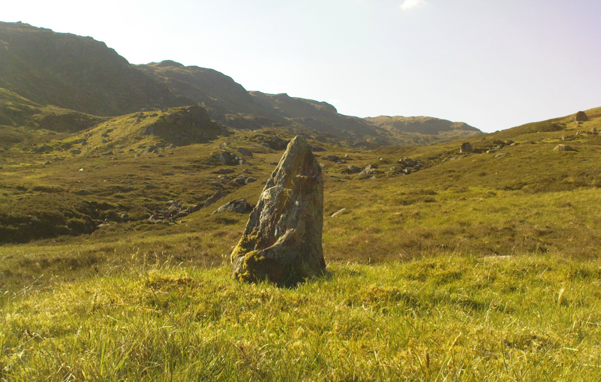
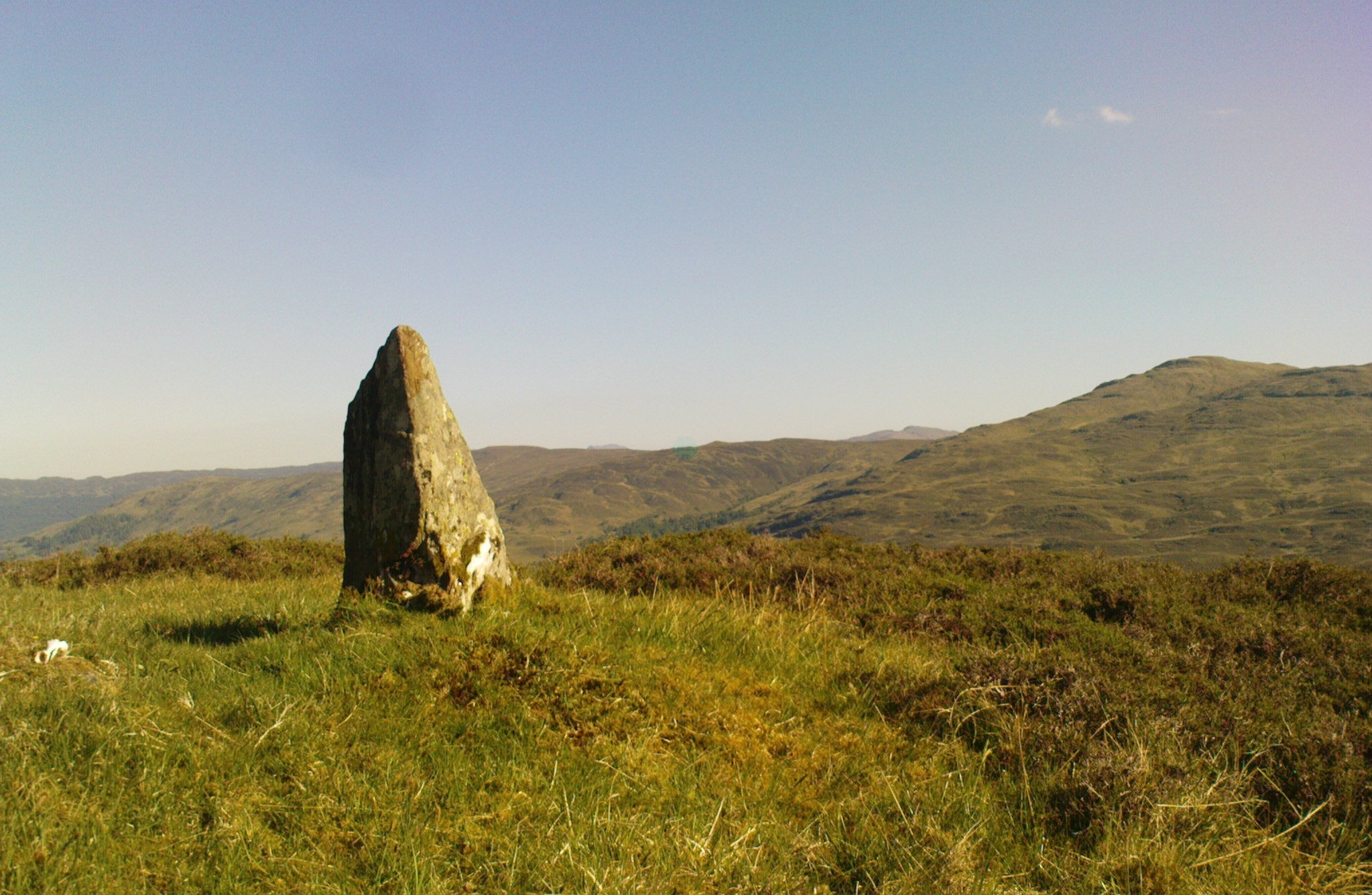
One helluva climb to reach this little fella. I simply started at Dalgirdy cottage, some 5 miles along Glen Lochay, on the right-hand side of the road. Then, walk right up the burnside, all the way up until it begins to level out and the old shielings appear. When you’ve got to where they just about finish, about 50-70 yards on the east side of the burn, you’ll see the small stone standing upright, all alone. You can’t really miss it!
Archaeology & History
Allt Ghaordaidh, looking south-ish!
No previous written records exist that describe this small standing stone, whose nature and age may be akin to that at nearby Tirai, found amidst the derelict village a couple of miles east, lower down the slopes — i.e., it may have simply been part of some of the ancient village remains and shielings found close by, either side of the rushing burn. But whether it’s only medieval or much more ancient than that, its position in the landscape alone (much like Tirai’s uprights), deserves to be known about.
There are considerable amounts of ancient remains scattering the mountains slopes all round here: some have been catalogued, but a lot of it has not. This little standing stone is at last alive again! (take good food and kit when visiting here)
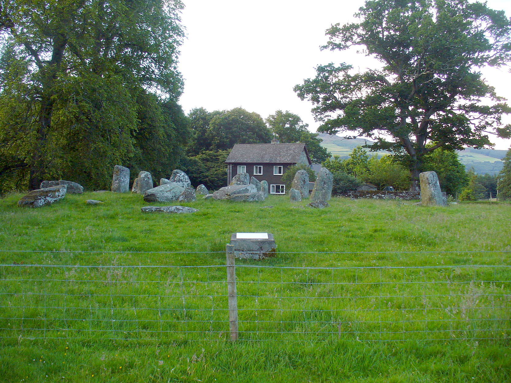
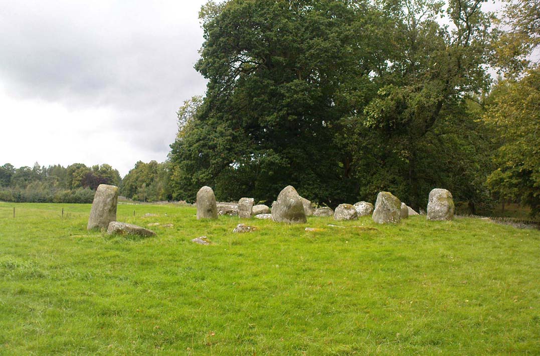
Take the A827 road that runs from Kenmore (top-end of Loch Tay) to Aberfeldy, and about 2 miles outside Kenmore, once you come out of the woodland (past the hidden standing stones of Newhall Bridge) and the fields begin on the east-side of the road, a small dirt-track leads you slightly uphill to the farm and house of Croftmoraig. The stone circle is right in front of the house less than 100 yards up the track (you can see it from the road).
Archaeology & History
A truly fascinating site, whose history is much richer than its mere appearance suggests. It has mythic associations with both moon and sun, a cup-marked stone to the southwest, and an earlier structure that had Aubrey Burl (1979) suggesting was possibly “the dwelling-place of a priest, a witch-doctor, a shaman.” Not bad at all!
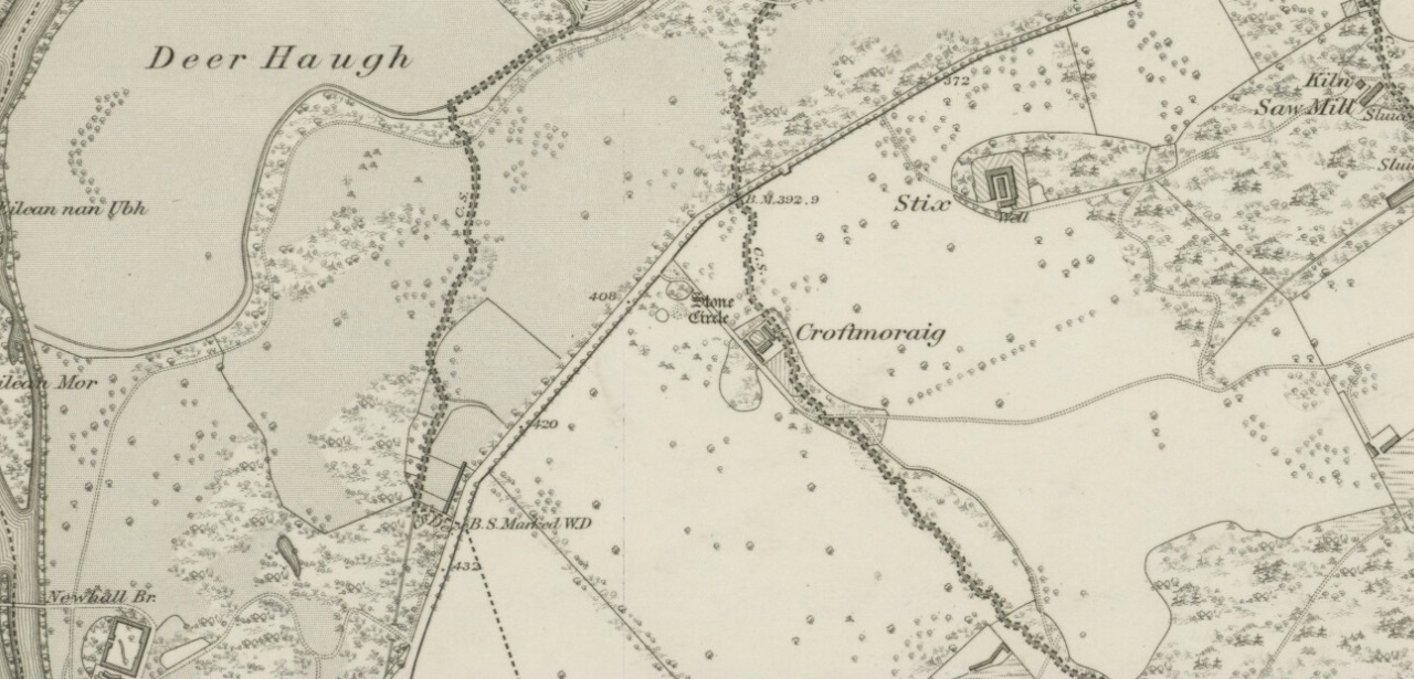
Croft Moraig on 1867 map
The sad thing today is its proximity to the increasingly noisy road to Aberfedly whose begoggled drivers care little for the spirit of place or stones. Here sits a feel of isolation and tranquility broken. But at least the cold information of its architecture is available for tourists and archaeologists alike; at least their depersonalized appreciations are served!
Described first of all (I think) in the old Statistical Account by Colin MacVean (1796), he told Croft Moraig to be one of “several druidical temples” in the area, “perhaps the largest and most entire of any in Scotland,” he thought:
“It is about 60 yards in circumference, and consists of three concentric circles. The stones in the outermost (ring) are not so large as those in the inner circles, and are not, like them, set on end.”
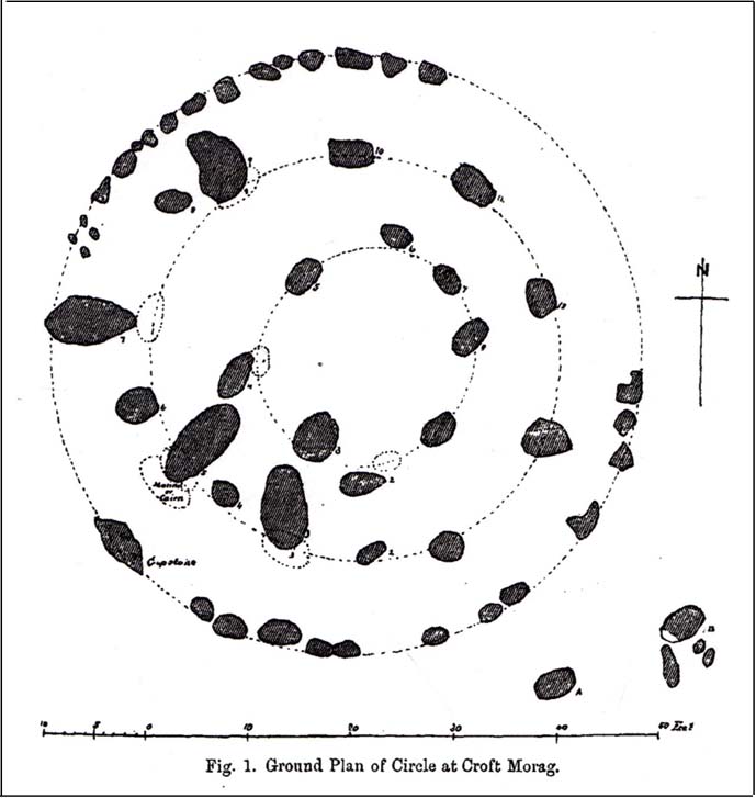
Hutcheson’s 1889 planCroft Moraig, looking N
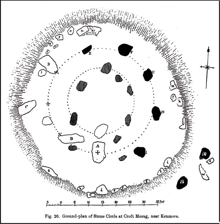
The first decent archaeocentric evaluation of Croft Moraig was done in the 19th century by Alexander Hutcheson (1889), who gave us not only the first decent ground-plan of the site, but was also the first person to note that there were some faded cup-and-ring markings at the circle. After first directing his antiquarian readers to the site, he described the multiple rings of stones here, that had been built on top of an artificial platform of earth and stones:
“The circles are concentric, three in number, and occupy a little plateau which may be artificial, as the outer circle just covers it, on the gentle slope which here rises towards the south from the public road.
“I have prepared and exhibit a plan of the circles, and for reference have distinguished the stones by numbering them in the plan. The inner circle consists of eight stones all standing, with one exception, No. 3, which presumably has fallen inwards. The next or second circle consists of thirteen much larger stones, nine of which stand erect; Nos. 3 and 5 have presumably fallen in, while Nos. 7 and 9 have fallen outwards. The outer circle is formed by a number of smaller stones placed so as to form a sort of rampart. These are recumbent, and lie generally with their larger axes in the direction of the rampart. The circle measures, over the stones, as follows:
“Inner circle, West to East, 25 ft. 6 ins., North to South, 22 ft. 6 ins.
“Second circle, West to East, 40 ft North to South, 41ft 3in
“Outer circle, West to East, 58 ft North to South, 58ft
The stones are all rounded or water-worn boulders of dolerite, granite, schist, &c. The stones marked A and B are large blocks, 6 feet 6 inches high, 4 feet broad, and 2 feet 6 inches thick, standing upright. C seems to be a large (section) which has fallen from B, and lies flat on the ground.
“At the south-west side and in the line of the outer circle lies the cupmarked stone… If, as has been suggested, the two large blocks A and B formed the entrance to the circles, then the entrance faced towards the south-east. The blocks vary in height from 3 feet to 7 feet above ground, while of those which I have supposed to have fallen, their dimensions are, naturally from the ground-hold having to be added, much greater, amounting in one of them to 9 feet 6 inches long. There is a longish low mound of small stones, like an elongated cairn, which might yield something if it were to be searched. It lies just abreast of the cup-marked stone. I have referred to the recumbent stones in the two inner circles as having probably stood at one time erect. This I have presumed for several reasons, the principal being that one end of each of these stones corresponds in position with the circle formed by the standing stones; and while this is the case the recumbent stones do not preserve a uniformity of direction, but lie indifferently outwards and inwards from the lines of circularity, and at differing angles from these lines…”
Fred Coles’ site planOne of the cup-marked stones
Some twenty years later, the legendary northern antiquarian Fred Coles (1910) brought his lucidity to Croft Moraig and with it, even greater attention to detail. In a lengthy description of each and every aspect of the circle that has yet to be equalled he gave the reader the most detailed description we have. I hope you’ll forgive me adding Mr Coles’ prolonged description, but it is most valuable for anyone wanting to explore the site in greater detail. He wrote:
“As will be seen from the plan…the structural portion of Croft Morag consists, first, of a roughly circular, earthen mound (lettered in small type a-t), some 3 feet high, which is marked off by several stones of a more or less slab-like character, set irregularly upon a circumference of, approximately, 185 feet. This outermost setting, or revetment of stones is visible now only at certain fragments of the arcs; i.e., it is well-defined on the SW at a, where a long Stone, 6 feet 5 inches by 2 feet lies flat, and bears numerous cup-marks…; on the S arc there are five small Stones (b, c, d, e, f) all earthfast and flattish; on the SE are three similar Stones (g, h, i); on the E arc, four (j, k, l, m); on the N arc, very slightly to the west, one very large Stone (n) flush with the ground at the edge of the bank and a good deal overgrown with grass, measuring 8 feet 6 inches by 3 feet 3 inches; farther to the NW are five stones more (o, p, q, r, s), the last three having only very small portions visible; and, still farther round, is the last of what I consider to be these ridge-slabs (t) close under the edge of the great fallen sloping stone D. Thus the total number of measurable and separate stones now resting on the outermost ring is twenty.
“The stones of the intermediate ring constitute the imposing feature of the circle. They are thirteen in total number in the present condition of the circle, but they probably numbered eighteen when the circle was complete. Nine of them are the tallest in the whole group; four of these are prostrate on the W arc. By striking a radius from the common centre of the circle through the centres of these great stones which are erect, to the outermost circumference, the following measures are obtained: from centre of E, the NNW stone, to the ridge 14 feet 6 inches; from F, NNE stone to the ridge 13 feet 4 inches; from G to ridge 14 feet 4 inches; from H to ridge 13 feet 4 inches; and from I, the SE stone, only 10 feet 6 inches. The four fallen blocks, lying as shown A, B, C, D, no doubt stood on this intermediate ring, the diameter of which measured from centre to centre is 38 feet. Now, it must be observed that between A and B and A and I there are Stones (shaded in the plan); these two are erect, the one near B measuring 3 feet in length, 2 feet in breadth, and 3 feet 4 inches in height; it is quite vertical, and is undoubtedly in situ. The other small erect Stone midway between A and I has much the same size’ and features. Between B and C there is shown in outline another of these small stones ‘in line’ with the great pillars which remain on the E arc; and it is quite clear that if this remarkable and novel feature of alternating each tall stone with a very small but vertical block was originally carried out all round this intermediate ring, there would have been eighteen stones in all. Without the most arduous and careful excavation in these interspaces however, it would be extremely difficult, if not impossible, to prove that these small blocks did once stand on the eastern semicircle.
“As illustrating the general size of the great stones, when fully exposed to view, the dimensions of the four fallen blocks are here given: A, 7 feet 7 inches by 4 feet 10 inches, and fully 2 feet thick; B, 9 feet 2 inches by 3 feet 9 inches (on the upper face), and 2 feet 9 inches thick; C, 8 feet by 4 feet, and 3 feet fi inches thick; D, 7 feet by 4 feet 6 inches, and 3 feet thick at its vertical outer edge.
“The five upright stones of the intermediate ring measure as follows: I, the SE stone, 5 feet 6 inches in height, and in girth 11 feet; H, the east stone, 5 feet 8 inches in height, pyramidal in contour, and in girth 11 feet 4 inches; G, the NE stone, 5 feet 3 inches in height and 11 feet in girth; the next stone, F, 5 feet 7½ inches in height and 13 feet 6 inches in girth; and stone E, nearest to the north on the W arc, stands 6 feet 3 inches in height and measures round the base 9 feet 3 inches.
“The stones forming the inner ring, which is a broad oval in form, are eight in number, quite erect, with one exception; the fallen one (shown in outline) is due south of one set at the north point and the distance between these two is 23 feet 8 inches. If however, the distance between the N Stone and the E one at the SSE be taken, this diameter is 26 feet, as against one of 21 feet taken between the NW and SE stones. Measured from the centre of the fallen stone a space of 10 feet 3 inches divides that from the centre of the erect stone on the east, and an equal space divides it from the centre of the stone on the west. Between the N stone and that on its southwest an equal space of 11 feet 3 inches exists as between that stone and its SE stone; but between these last two there is a third almost exactly midway. The fallen stone measures 5 feet 10 inches by 3 feet 9 inches; the NW stone is 4 feet 6 inches in height, the SW stone 3 feet 6 inches, the N stone 3 feet 4 inches, the NE one 2 feet 6 inches, and the stone between it and the fallen block 3 feet 4 inches in height.
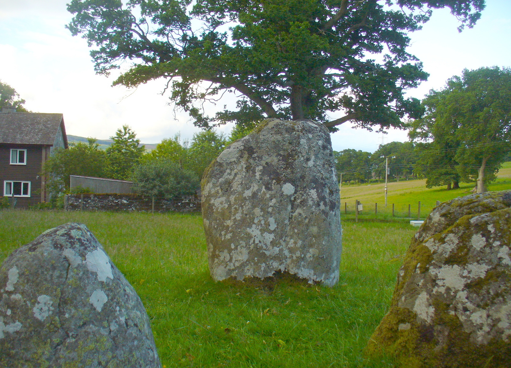
“In addition to the feature above noticed, of tall stones alternating with much smaller ones, Croft Morag possesses another noticeable arrangement in the presence of two great massive monoliths (U and V on the plan) standing like the remains of a portal, nearly eight feet outside of the boundary ridge on the SE. Neither of these stones is now absolutely vertical, stone U leaning considerably out towards the SE, and V having a very slight lean inwards to the circle. The former is 6 feet 2 inches in vertical height with a basal girth of nearly 12 feet, which is probably an under-estimate, for there are two large fragments (w and x) which appear to have been severed from this stone, the edges of which nearest the fragments are rough and sharp. The latter (V) stands 6 feet 4 inches in height and girths 11 feet 8 inches…
“…Besides its complexity of arrangement and the great number of measurable stones, forty-two in all, this circle is emphasised by the existence of a cup-marked stone set in a portion of its structure…on the SW arc… There are nineteen cups in all, only two of which differ much in diameter and depth from the rest, and there does not appear to be anything in their design to suggest a meaning or lend a clue to their symbolism.”
When the monument was excavated by Stuart Piggott and his mates in 1965, it was found to have been built over many centuries. As Aubrey Burl told:
“The first phase, of the late neolithic, consisted of about 14 heavy posts arranged in a horseshoe shape about 25ft 10in x 22ft 10in (7.9 x 7m) with a natural boulder at its centre. Burnt bone was found near this. Outside was a surrounding ditch and at the E was an entrance composed of 2 short rows of posts.
“In the second phase the timbers were replaced by 8 stones graded in height towards the SSW, also erected in a horseshoe 29ft 10 x 21ft (9.1 x 6.4m). A rubble bank was heaped up around it. On it at the SSW was a prostate stone with over 20 cupmarks carved on it. Other cupmarks were ground into the NE stone.
“Finally a circle of 12 stones, about 40ft (12.2m) is diameter, was erected around the megalithic horseshoe with a pair of stones forming an entrance at the ESE. Graves may have been dug at their bases later.”
Fred Coles mentioned a couple of other local names given to the site, one of which – Mary’s Croft – he thought may point “to a dedication to the Virgin.” Another curious place-name next to the site is called Styx,
“which appears to be the modern abbreviated form of the Gaelic word stuicnean. This, Mr Dugald McEwan affirms, meant ground full of overturned forest-trees; and it is therefore probable that in the remote past all the land surrounding the Stone Circle was a deep forest, and perhaps because of its seclusion, this site was selected as the most fitting for the erection of the principal Circle of the district.”
Alex Thom’s ground-plan
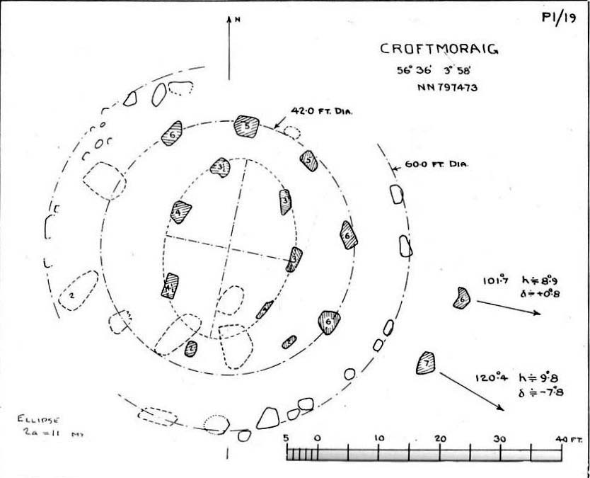
When the engineer and archaeoastronomer Alexander Thom (1967) came to examine Croft Moraig, he found the outlying stones to the southeast could have been solar alignment indicators, albeit poor ones. However, the geometric structure of the ring appeared to further confirm the use of his Megalithic Yard by those who built the circle. Thom’s illustration shows his finding, which he described briefly as follows:
“Two concentric circle and an ellipse. The circle diameters drawn are obviously too large and could be as small as 58.5ft outer circle and 41.0ft inner. Outer circle diameter58.5ft = 21.5 MY. Perimeter 67.5 MY = 27 MR. Inner circle diameter 41.0ft = 15.1 MY. Perimeter 47.3 MY = 18.9 MR. Ellipse drawn has major axis 11 MY, minor axis 8 MY, distance between foci is 7.5 MY. Perimeter is 30.0 MY = 12 MR. This ellipse looks slightly large but the triangle on which it is based and the perimeter are almost perfect.”
Folklore
Old lore told that the standing stones of Newhall Bridge 850 yards away (777m) were once connected with the Croft Moraig circle. William Gillies (1938) told this tradition saying,
“that at one time there was a paved way connecting the circle, of which these stones are the remains, with the great Croftmoraig circle.”
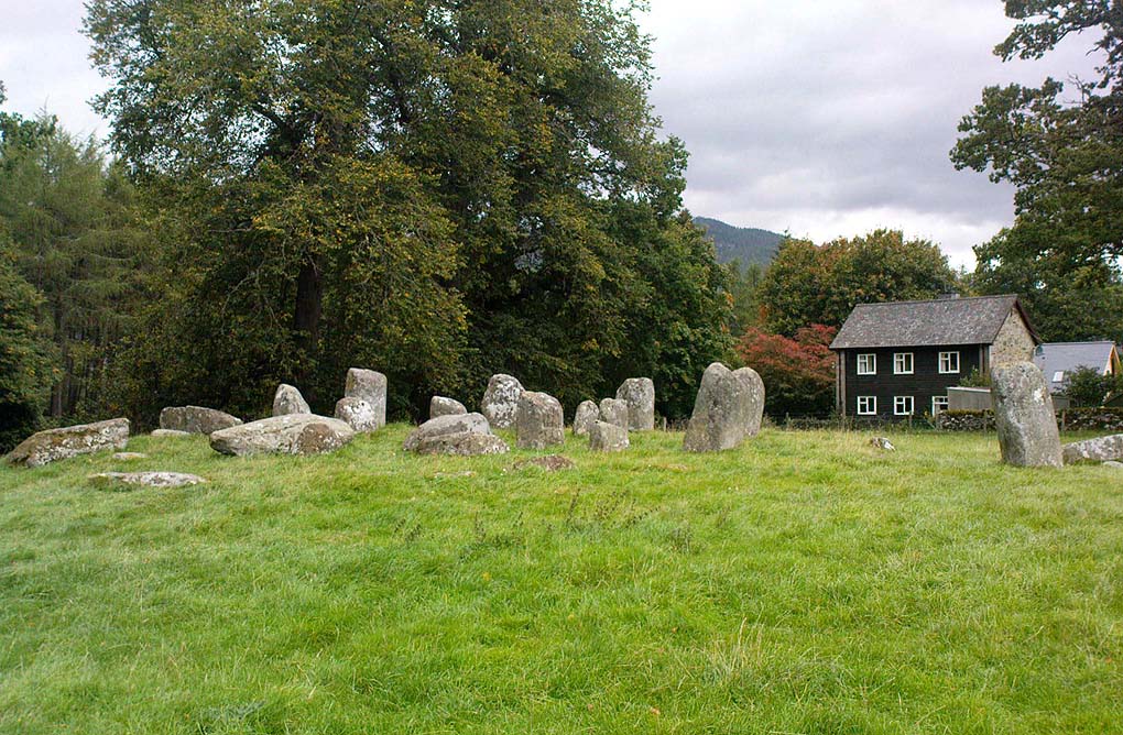
Croft Moraig, looking W
Fred Coles also noted that one of the stones in the circle (stone D in his plan) had “been polished by the sliding of generations of children”. This playful action on stones elsewhere in the UK and around the world sometimes relates to fertility rites (i.e., the spirit of the stone could imbue increased fertility upon the practitioner), but Coles made no mention of such rituals here.
References:
Burl, Aubrey, Rings of Stone, Frances Lincoln: London 1979.
Burl, Aubrey, The Stone Circles of Britain, Ireland and Brittany, Yale University Press 2000.
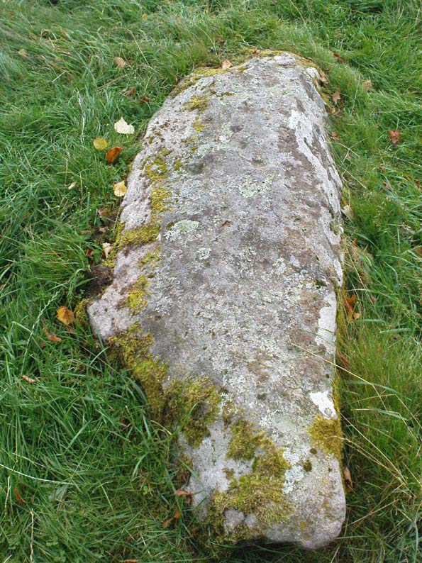
Follow the same directions for the Croft Moraig stone Circle. Then check out the elongated stone lying in the grass on the southern edge of the circle. It’s not that hard to find!
Archaeology & History
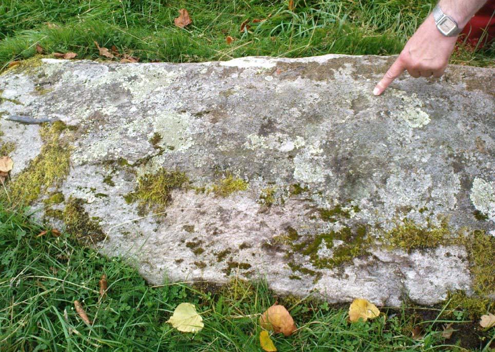
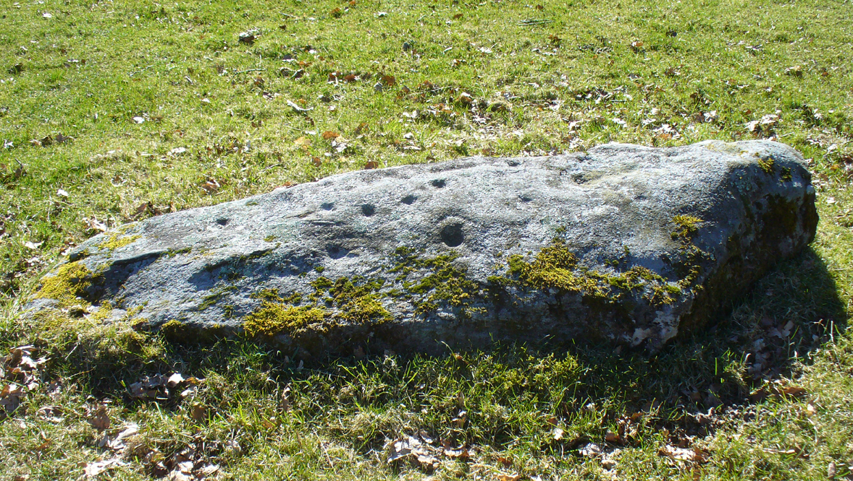
Nearly 13 yards (11.75m) south of the faded Croft Moraig 2 carving, this cup-and-ring stone on the SSW edge of Croft Moraig is one of at least four that have been found in this megalithic ring. It has been suggested that the stone on which the carving is found once stood upright. The earliest account I’ve found of it comes from Alex Hutcheson’s (1889) essay in which he wrote:
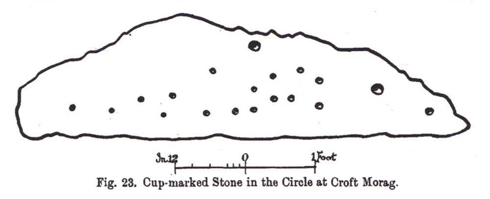
“At the south-west side and in the line of the outer circle lies the cupmarked stone. It is a recumbent stone, and like the others in that circle lies with its larger axis in the direction of the encircling line. It measures 6 feet 6 inches long by 2 feet broad, and bears on its surface 23 cups. Two of these are connected by straight channels. The largest cup is 2 inches in ‘diameter and f inch deep. Two of the cups are encircled, each with a concentric ring. None of the other stones exhibit any cups or other artificial markings.”
Cup-marks pointed outFred Coles 1910 drawing
…Although other cup-marks have subsequently been found on other stones within the circle. Consistent with the location of cup-and-ring marks elsewhere in the country, Hutcheson found the carved rock to be just in front of “a longish low mound of small stones, like an elongated cairn, which might yield something if it were to be searched.” Very little of this cairn remains today.
When Fred Coles (1910) came to explore Croft Moraig about 20 years later, he could only discern 19 cups on the stone, most of them the same size, “only two of which differ much in diameter and depth from the rest.” The cup-and-ring that Hutcheson described and the other missing cups had been overgrown by the grasses, Coles said. When Sonia Yellowlees described the carving in 2004, she said that 21 cups were visible, “one of which is surrounded by a single ring”—which you can clearly see in the photos below.
Carving 1 with cup-and-ringClose-up of design
When archaeologist Evan Hadingham (1974) looked at this site, he found deposits of quartz here and thought that their presence may have been relevant to the placement of the carving, noting how such a relationship is found at other circles in Scotland. In more recent years, rock art students Richard Bradley and others have found similar quartz deposits in or around some petroglyphs a few miles from here; as have fellow students Jones, Freedman and o’ Connor (2011) at some of the rock art around Kilmartin. In my own explorations of the carvings near Stag Cottage, hundreds of quartz chippings were found that had been pecked into the cups and rings.
References:
Burl, Aubrey, Rings of Stone, Frances Lincoln: London 1979.
Ornate cup-and-ring in Queens Wood (after RCAHMS 2004)
From Kenmore, take the road towards Acharn on the south-side of Loch Tay for about a mile. Just as you go out of Acharn, watch for the small road of Queens Drive on your left going uphill. Go up here, following the tree-lined burn (stream) towards the superb Falls of Acharn, crossing the track over it and winding uphill still, until the track veers left across open fields towards the large woodland 400 yards east. Just before the track meets the trees, notice the small burn running into the woods. Follow this for some 200 yards – and where it bends more sharply to go uphill, keep going for another 75 yards upstream until you meet with another opening going east. The rocky outcrop here is where this carved stone is found. Look around!
Archaeology & History
Hidden deep within the woods where wet feet and good ankles come together, is this fine example of a cup-and-ring stone, perhaps having something in times of olde to do with the meeting of the waters. A cluster of urisks and prehistoric remains scatter this lovely rolling section of southern Loch Tay, but I’ve found nothing specific to this bitta woodland that might give added mythos to the site. The carving was described in Mr Stark’s (2005) fine little work on the local rock art, saying:
“A rock outcrop, situated in woodland between Acharn Burn and the burn running down to Remony House, bears at least thirty-six cupmarkings. There are twenty-four plain cups, three cups each with a single ring, three cups each with double rings, and a cup surrounded by three faint rings, which has a gutter leading to the NW. The cups range from 40mm to 75mm in diameter and from 60mm to 120mm in depth.”
The next time we visit the place, I’ll make sure I get some good photos – and visit the stone circle and settlement a few hundred yards further up the hill…
References:
Stark, Gordon (ed.), Cupmarked Stones in Strathtay, Breadalbane Heritage Centre 2005.
Take the single-track Glen Lochay road down past the Bridge of Lochay hotel at the edge of Killin, as if you’re gonna visit the superb cup-and-ring carvings opposite Stag Cottage (or Duncroisk 1). Immediately past the garden of Stag Cottage is a small copse of trees and a couple of old wartime-looking buildings in the field above the roadside. Go up past these buildings and onto the rise at the back. You’re here.
Archaeology & History
This is a fascinating site of multi-period historical usage, which Dugald MacInnes (2001) thinks may have its origins in the early Bronze Age or neolithic; but which I reckon was probably first used in the Iron Age. Either way, we have here a large interesting well-preserved prehistoric stone enclosure, that has yet to be excavated. I first came across it whilst gathering firewood from the adjacent copse and was quite puzzled by what seemed to be an extensive curved line of ancient walling running from its east to northeastern section, typical of prehistoric Iron Age walled structures common in northern England and beyond. I must have paced back and forth along a 75 yard length of this section of walling a half-dozen times, wondering what the hell this place was. And the more I looked at this section of the enclosure, the greater my conviction grew that this was constructed in prehistoric times. And thereafter came the puzzle.
Looking down at the walled enclosureNW section of walling
For along the southern walled section were a number of much more modern medieval and much later walled sections, including the remains of buildings that looked barely Victorian in age and nature. The site was obviously being used presently by the local farmer for his cattle. And so it became obvious that here was a large oval-shaped stone-walled enclosure or settlement that had been used over and over again through many centuries, with its origins seeming to be Iron Age in nature. Measuring approximately 195 yards (178m) in circumference, the structure has a maximum E-W diameter of 78 yards (71m) and N-S measurement of 44 yards (40m).
The mass of evidence for prehistoric activity is all round this hidden enclosure, with the fascinating clusters of cup-and-ring stones of Duncroisk and Corrycharmaig close by. The small standing stones of Tirai 600 yards NW, and a similar prehistoric enclosure at Tullich ¾-mile NW show ample evidence of prehistoric man in this part of Glen Lochay.
Despite the size of the place, no literary reference of it occurs before MacInnes and his team came here. His description is as follows:
“An oval enclosure, its boundaries formed principally from large water-worn boulders interspersed with drystone walling and in part by an earthen bank in the easternmost section, sits atop of a natural terrace about 155m OD. The terrace slopes steeply to the west and south and cut into the western slope is a track, the course of which cannot be determined beyond the extent of the slope. This track displays revetment in the form of stone coursing.
“The SW corner of the enclosure is angular rather than the rounded character of the other sections. The W and SW sections are composed of coarsely constructed stonework in which large, 1m wide, often 1m high, water-worn boulders at two to three metre intervals, are interspersed with smaller boulders which form crude drystone coursing.
“The NE section is formed largely of large boulders, one of which is 1.5m in width and 1.2m high by 0.8m wide. Sections of the northern part would appear to be robbed out, perhaps to construct the modern wall which lies about 25m to the north. There are no remaining large boulders there, however, which could indicate their absence in the original construction of the enclosure. The central section of the northern perimeter may be constructed of two outer skins of boulders, forming a wall about 0.9m wide, 0.4m high on its exterior, but reducing to 0.3m on its interior side. Two sections could possibly be filled with a rubble core.
“The E section is formed by a low 0.3m high earthen grass-covered bank with occasional boulders. This bank is about 0.2m high relative to the interior, but is about 0.5m to.0.8m high on its exterior side. The NW side shows on the western side more evidence of double skin, rubble construction. Close inspection of the stonework around the perimeter of the enclosure has revealed no evidence of shot-holes. However a monolith situated in the NE has been split, but this would appear to be natural. The interior of the enclosure is more or less level and grass-covered. There is however, a slight drop in level in the western third of the interior. This is defined by a linear slope which may be a lynchet.”
Northern section of enclosureUpright stone in eastern wall
Northeast of the enclosure about 40 yards away is the normal drystone walling running along the sloping hillside. But more intriguingly to archaeologists is the second line of much more ancient walling 76 yards (70m) further up the grassy slope, running at an angle across and uphill in a northwesterly direction. This line of walling has a distinctly Iron Age flavour to it and is composed of some very large upright monoliths, almost Bronze Age in nature! It continues into the next field for some 400 yards and onto Duncroisk Burn — the other side of which we find another line of ancient walling with an impressive cup-and-ring stone incorporated.
There’s tons more to be said of this region…
…to be continued…
References:
MacInnes, Dugald, An Archaeological Field Survey of a Deserted Settlement at Duncroisk Farm, Glen Lochay, Association of Certified Field Archaeologists: Glasgow 2001.
Legendary Stone & Healing Well (lost): OS Grid Reference – NN 579 323
Also Known as:
Fuaranna Druidh Chasad
Whooping Cough Well
Archaeology & History
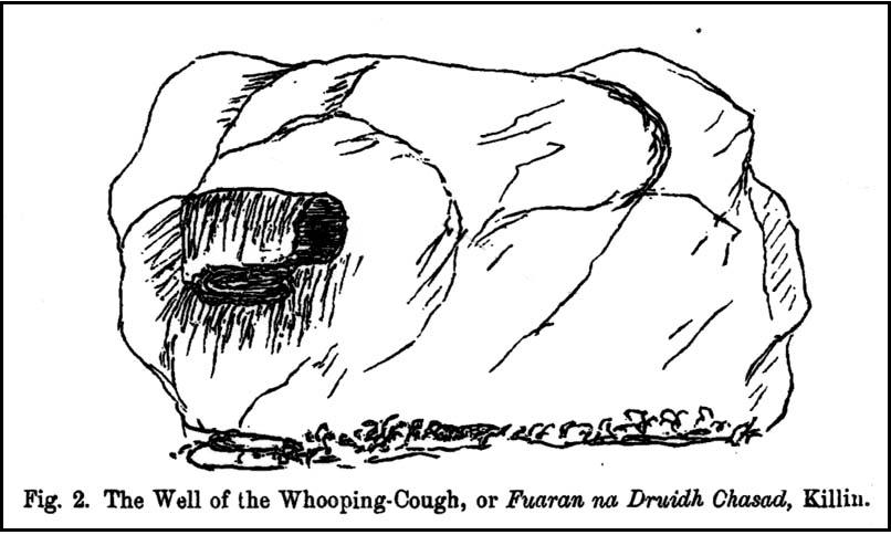
“Well of the Whooping Cough” stone, near Killin
The grid-reference given for this site is only an approximation based on the description given by Hugh MacMillan (1884), below. The exact whereabouts of the place remains forgotten, but based on the story we have of the place it would be great if we could locate it and — as far as I’m concerned — be highlighted and preserved as an important spot in the history of religious and social history for the people of Killin and the wider mountain community. The region here was well populated all along the northern and southern sides of the adjacent Loch Tay before the coming of the Highland Clearances (Prebble 1963), and so the lore which MacMillan describes below was very likely of truly ancient pedigree.
Not to be confused with a site of the same name (and attributes) as the healing well at Balquhidder, this site comprises of a large stone, typical of the region, covered in that delicious carpet of old mosses and lichen bestowed by the aged love from Nature that bedecks much of the hidden sites in the area. Upon one side of the rock was a large hollow, in which water was always collected: of both dew and rain and the breath of low clouds, within which were great medicinal virtues long known of by local people. Foreign or shallow archaeologists would denounce this rock and its virtues as little more than the superstitious beliefs of an uneducated people living in uneducated times, but such derision is simply foolish words from pretentious souls who know little of the real world. For the attributes and mythic elements at this old stone is another example of living animism: vitally important ingredients in the spiritual background and nourishment of a people not yet overcome by the degrading influence of homo-profanus. Here we still find the living principles of the natural world, sleeping away in the consensus trance of modern folk…
Folklore
The stone and its ‘healing well’ are not mentioned in the standard Scottish texts on holy wells (MacKinlay 1893; Morris 1982) and we have to rely solely on Hugh MacMillan’s first-person account of the place from the latter-half of the 19th century. He told that the stone was to be found “in the woods of Auchmore at Killin,” some twelve miles from a similar curative rock at Fearnan called the Clach-na Cruich:
“This stone is called Fuaranna Druidh Chasad, or the Well of the Whooping-Cough. I heard of it incidentally last year in Paisley from a native of Killin, who remembered vividly when a boy having been taken to drink the water in the cavity of the stone, in order to cure the whooping-cough, from which he was suffering at the time. Happening to be in Killin lately, enjoying a few days’ holiday, I made inquiries in the village; but though some of the older inhabitants remembered having heard of the stone, and the remarkable practice connected with it, I could not get any one to describe the exact locality of it to me, so completely has the superstition passed away from the mind of the present generation. I went twice in search of the stone; and though, as I afterwards found, I had been within a very short distance of it unawares on both occasions, I was unsuccessful in finding it. At last I met an old man, and after some search we found the stone, and he identified it.
“I understood then what had puzzled me before, viz., why it should have been called Fuaran or Well, for I had supposed it had a cavity in a stone like that at Fernan. It was indeed a cavity; but it was in the projecting side of the stone, not on its top surface. It consisted of a deep basin penetrating through a dark cave-like arched recess into the heart of the stone. It was difficult to tell whether it was natural or artificial, for it might well have been either, and was possibly’ both; the original cavity having been a mere freak of nature — a weather-worn hole — afterwards perhaps enlarged by some superstitious hand, and adapted to the purpose for which it was used. Its sides were covered with green cushions of moss; and the quantity of water in the cavity was very considerable, amounting probably to three gallons or more. Indeed, so natural did it look, so like a fountain, that my guide asserted that it was a well formed by the water of on underground spring bubbling up through the rock. I said to him, “Then why does it not flow over?” That circumstance he seemed to regard as a part of its miraculous character to be taken on trust. I put my hand into it, and felt all round the cavity where the water lay, and found, as was self-evident, that its source of supply was from above and not from below; that the basin was simply filled with rain water, which was prevented from being evaporated by the depth of the cavity, and the fact that a large part of it was within the arched recess in the stone, where the sun could not get access to it. I was told that it was never known to be dry — a circumstance which I could well believe from its peculiar construction.
“The stone, which was a rough irregular boulder, somewhat square-shaped, of mica schist, with veins of quartz running through it, about 8 feet long and 5 feet high, was covered almost completely with luxuriant moss and lichen; and my time being limited, I did not examine it particularly for traces of cup-marks. There were several other stones of nearly the same size in the vicinity, but there was no evidence, so far as I could see, of any sepulchral or religious structure in the place. There is indeed a small, though well-formed and compact so-called Druidical circle, consisting of some seven or eight tall massive stones, with a few faint cup-marks on one of them, all standing upright within a short distance on the meadow near Kinnell House, the ancestral seat of the Macnabs, and it is a reasonable supposition that the Fountain of the Whooping-Cough may have had some connection in ancient times with this prehistoric structure in its immediate neighbourhood; for, unlike the cavity in the stone at Fernan, the peculiar shape of the cavity in this stone precluded its ever having been used as a mortar, and apparently it has never been used for any other purpose than that which it has so long served. There can be no doubt that the fountain dates from a remote antiquity; and the superstition connected with it has survived in the locality for many ages. It has now passed away completely, and the old stone is utterly neglected. The path leading to it, which. used to be constantly frequented, is now almost obliterated. This has come about within the last thirty years, and one of the principal causes of its being forgotten is that its site is now part of the private policies of Auchmore. The landlady of the house at Killin, where I resided, remembered distinctly having been brought to the stone to be cured of the whooping-cough; and, at the foot of it, there are still two flat stones that were used as steps to enable children to reach up to the level of the fountain, so as to drink its healing waters; but they are now almost hidden by the rank growth of grass and moss. There is more verisimilitude about the supposititious cures effected at this fountain than about those connected with the stone at Fernan; for one of the best remedies for the whooping-cough, it is well known, is change of air, and this the little patient would undoubtedly get, who was brought, it may be, a considerable distance to this spot. I am led to understand that, in connection with the cure, the ceremonial turn called “Deseul” was performed. The patient was required, before drinking the water, to go round the stone three times in a right-hand direction, which may be regarded as an act of solar adoration. This practice lingered long in this as in other parts of the Highlands, and the “deseul” was religiously performed round homesteads, newly-married couples, infants before baptism, patients to be cured, and persons to whom good success in some enterprise was wished; while the “Tuathseul,” or the unhallowed turn to the left, was also performed in cases of the imprecation of evil.”
Should anyone know the whereabouts of this fascinating healing stone and its waters, please let us know!
References:
MacKinlay, James M., Folklore of Scottish Lochs and Springs, William Hodge: Glasgow 1893.
At the pub by the bridge which crosses the Falls of Dochart (aptly called the ‘Falls of Dochart Inn’), walk downstream following the dirt-track which runs parallel with a section of the river for a good 5-600 yards. In the field that appears on your right, watch out for the rise of the stones as you approach the large gates which take you into the ground of Kinnell House. You can climb over the gate just into the field and go straight to the stones.
Archaeology & History
Found on the field called Kinnell Park in the grounds of Kinnell House, less than a mile out of Killin, this is a well-preserved site consisting of six stones. It appears to have been described first of all by Thomas Pennant in 1772, in the same breath as the megalithic remains at Lawers on the other side of Loch Tay. Pennant wrote:
“In going through Laurs observe a Druidical circle; less complete indeed than one, that should have been mentioned before, at Kinnel, a little southwest of Killin; which consists of six vast stones, placed equidistant from each other.”
Coles’ 1910 plan of KinnellThom’s geometric plan
It would seem that the site has changed little since Pennant’s visit. Sitting on a reasonably level grassy plain, the hills rise and surround the small ring of stones, with the lower horizons running along the south. Due west (equinox) we have the large pyramidal hill of Meall Clachach; whilst to the north are the legendary hills of Creag na Cailleach and Ben Lawers, each with their own rich mythic archaeological legacies. Legendary stones and wells are also close by, some with rites still enacted by old local people keeping truly ancient traditions alive.
The first detailed archaeological survey of the Kinnell site was done by Fred Coles and published in 1910. It has yet to be superseded. Mr Coles wrote:
“Taking the Stones in the usual order…I here give their dimensions and characteristics: Stone A, 6 feet 3 inches high, springs from an oblong base which girths 11 feet 4 inches, to a rough irregular top; Stone B leans forward towards the centre of the Circle, and measures along its sloping back 6 feet 9 inches, the present height from the ground to its upper edge being 4 feet. It is of smooth garnetiferous schist, and free from the deep fissures and rifts so common in these Stones. Stone C, a very rectangular but narrow block of schist, has a 15 Feet-girth at the base of 9 feet, but tapers up from both ends to a pyramidal summit, 5 feet 4 inches above ground. Its inner face is over 6 feet in breadth. Stone D, 4 feet 6 inches high, is a broad, flat-topped, very massive block, measuring 9 feet 5 inches round the base, but near the middle of its height 11 feet 2 inches. Stone E, the shortest of the group, is only 4 feet high, has a rough, uneven top, and a basal girth of 8 feet 11 inches. Stone F, the tallest, measures 6 feet 4 inches in height, but in girth only 7 feet 3 inches. It is very rough, vertically fissured in many places, and full of white quartz veins.
“Neat, well-defined, and comparatively small as this Circle is, it is to be noticed that the positions of the Stones do not conform to perfect regularity as points on the circumference. On working out the plan, the measurements prove that a diameter of 29 feet exactly bisects three of the erect Stones, B, C, and F, but leaves the other two untouched. The interspaces of the settings are not all quite equal, a space of 14 feet 8 inches dividing the centres respectively of F and A, A and B, F and E, and E and T); but between D and C it is 13 feet 8 inches, and between 0 and B I S feet 5 inches. Yet, the Stones stand proportionally near enough to each other to give one a satisfying impression that these six megaliths represent the group in its completeness, and that there were no smaller blocks between any two of them. The space enclosed by these stones is quite smooth and level, bearing no indication of having at any time been disturbed.”
Many years later, the late great Alexander Thom came here and, with his geometric perspective, gave a more precise ground-plan and lay-out. Thom (1980) defined the site as a “Type B flattened circle, or possible ellipse,” with a perimeter of 35 megalithic yards and diameter of 11.8 MY. Aubrey Burl’s commentary described Kinnell as:
“Six stones of schist stand evenly spaced on the circumference of an ellipse 32ft 7in x 27ft 5in (9.9 x 8.4m) in diameter. The stones are graded in height towards the SW where the two tallest are over 6ft (1.8m) high.”
One of the upright stones was said by Hugh MacMillan (1884) to have had cup-markings on it in the 19th century, when he told of the circle possessing “some seven or eight tall massive stones, with a few faint cup-marks on one of them.” But these appear to have faded, or were cut into the one of the missing stones.
Folklore
Close to the Kinnell circle could once be found a curious large boulder, covered in moss, but with a large cavity in which water gathered. Local lore ascribed the rock to actually be a well, as it was known as ‘The Well of the Whooping-Cough’, or Fuaran na Druidh Chasad, measuring some eight feet long and five feet high. Local people visited the site to be cured of the said disease, but Hugh MacMillan also suggested that the miraculous well-in-the-stone was connected with ancient rituals once enacted at the Kinnell circle, saying:
” it is a reasonable supposition that the Fountain of the Whooping-Cough may have had some connection in ancient times with this prehistoric structure in its immediate neighbourhood…”
He may have been right!
References:
Burl, Aubrey, A Guide to the Stone Circles of Britain, Ireland and Brittany, New Haven & London 1995.
Pennant, Thomas, A Tour in Scotland, 1772 – Part 2, Benjamin White: London 1776.
Royal Commission on the Ancient & Historical Monuments of Scotland, Archaeological Sites and Monuments of Stirling District, Central Region, Society of Antiquaries of Scotland 1979.
Thom, A., Thom, A.S. & Burl, H.A.W., Megalithic Rings, BAR: Oxford 1980.
Wheater, Hilary, Killin to Glencoe, Appin Publications: Aberfeldy 1982.
Go thru Killin and, just past the Bridge of Lochay hotel, take the tiny road on your left. Go down here for 3 miles till you pass the gorgeous Stag Cottage (with its superb cup-and-rings in the field across the road) for another 300 yards, until you see Duncroisk Farmhouse set back on your right. On the other side of the road, go thru the giant deer-gates (close ‘em behind you) to the river-bridge and across it. Walk along the track till you reach the turning to Corrycharmaig House on the right (over the stream), but here, go up into the field thru the gate. Walk up the hill ahead of you with its trees on the left, walking up onto the grassy level, over the deer-fence, then up again to the rounded knoll another 100 yards up. You’re here!
Archaeology & History
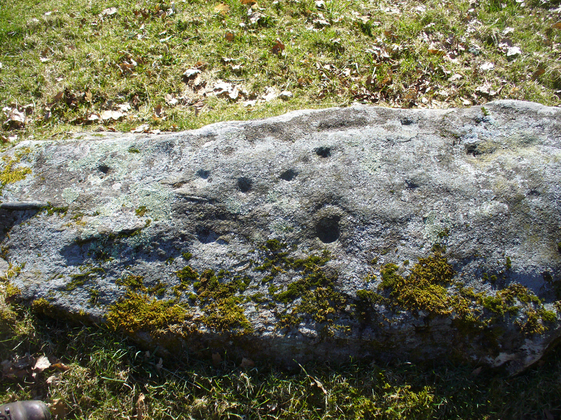
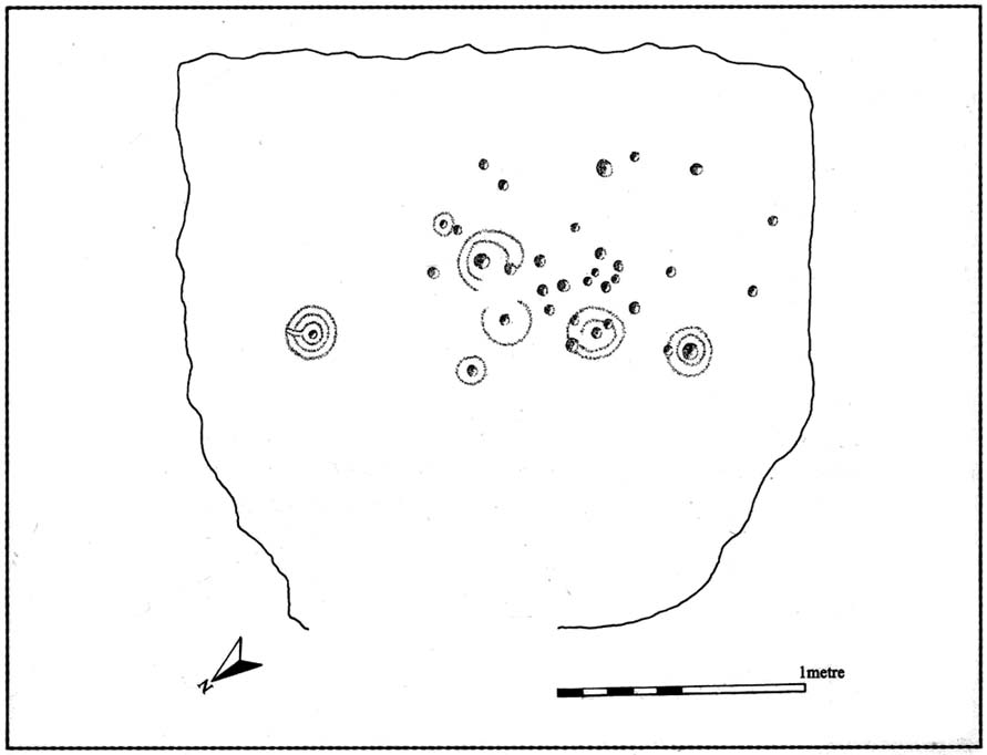
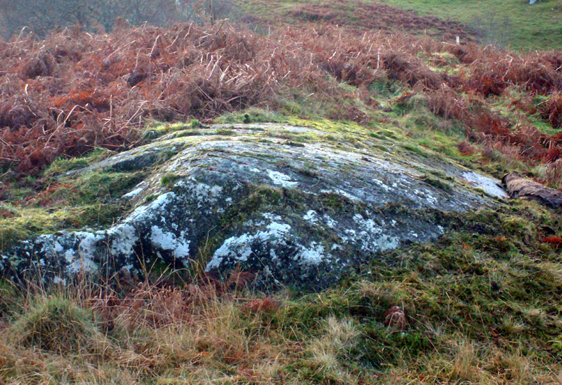
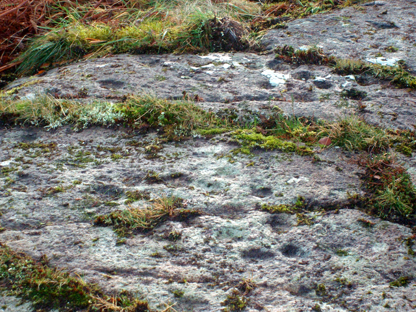
On my first visit to this stone, in overcast and wet conditions — the easternmost of at least four separate carved rock faces along the same geological ridge — I only noticed a handful of cup-marks etched onto the northeastern section of the stone. But I was sure there were supposed to be more. And when I returned home to check up, found that Ron Morris (1981) said there were “40 widely scattered cups of which, however, 29 well-defined cups are in a compact group, of which 6 are in a line.” Much more than what I saw! And when I checked further, it was evident that even more cup-marks were once visible on the rock. In the very first description of this carved stone, E.A. Cormack (1952) told:
“On the easterly area there are about 70 small cups, roughly one inch in diameter, in groups of ten to twelve. Most are on the flatter rock surface, but some are on the steeper slope facing south, which also bears the marks of deep glacial scorings.”
A sample of cups on ‘Corrycharmaig 1’
So on our visit here again a few weeks ago when we stayed at Corrycharmaig house*, a couple more visits allowed a slightly better investigation, albeit in even wetter and cloudier conditions than our first visit! And the more we looked, the more we could see; and it was plainly evident that a number of cup-marks had become receptacles for moss-growth! We counted at least 40 cup-markings on this ‘Corrycharmaig 1’ stone, but it seemed pretty obvious that beneath the grasses and vegetation, more carvings would be found.
Walking SSE along the same rocky ridge brings you to the other rock faces of Corrycharmaig (2), (3) and (4) — all with their own carvings. Corrycharmaig 2 possessing the only known complete cup-and-ring on the ridge. More carvings remain hidden nearby…
Morris, Ronald W.B., The Prehistoric Rock Art of Southern Scotland, BAR 86: Oxford 1981.
Royal Commission on the Ancient & Historical Monuments of Scotland, Archaeological Sites and Monuments of Stirling District, Central Region, Society of Antiquaries of Scotland 1979.