Vennel Well, Glasgow, Lanarkshire

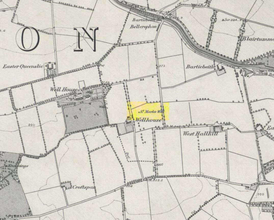
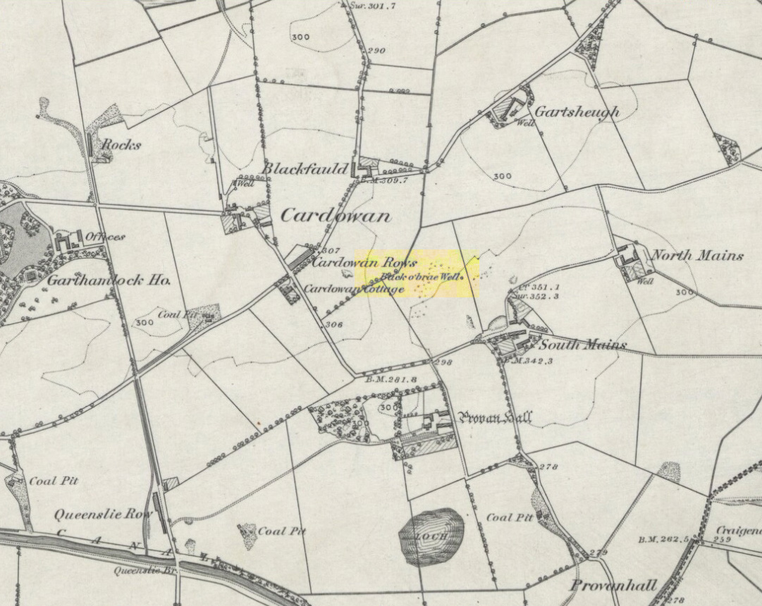
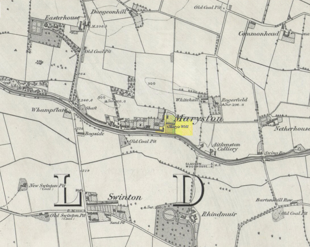
Healing Well:  OS Grid Reference – NS 598 649

Site of Well, along Old Vennal

Archaeology & History

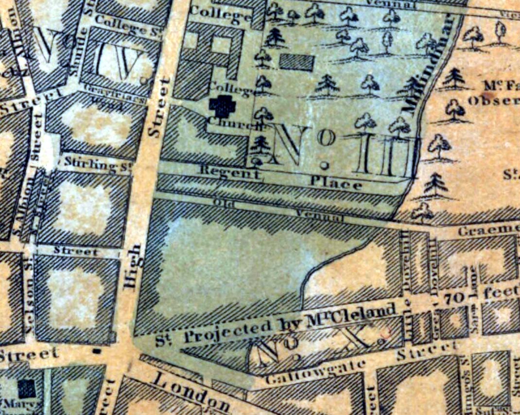
One of the many public wells in Glasgow, all trace of this site disappeared long ago.  Found at the ancient heart of the city, the name ‘Vennel’ comes from the old dialect meaning, “a narrow alley or lane between houses,” which is where it was once found, along the Old Vennel.  An early account of it was outlined in MacGeorge’s (1880) classic text, where it was described as,

“a draw well, as there is a minute of council in 1656 arranging with John Scott, mill-wright, to ‘rewle and governe’ this well and ‘the new well in Trongait’, he undertaking to uphold them ‘in cogis and rungis, the toun vphalding all ganging greth quhan athir it weirs or breckis.’”

A few years after this in 1663, it seems the Vennel Well had been closed due to it becoming regularly polluted and further council minutes told:

“Recommendis to the deane of gild to caus open again the wall at the Stincking Vennell, and to remove the old wark therof, and caus mak it lyk the wall in Trongait for service of the inhabitantis.”

Around this time a door and lock was put around the well to prevent people dumping and polluting the waters.  Further council minutes from April 1663 inform us that,

“The keyes of the well at the Vennell is delyvered to Robert Bell, tailyeour, and he is to have twa dollouris yeirlie for his attending thereupon.”

All healing virtues, folklore and traditions of this site have long since been forgotten.

References:

  1. Bennett, Paul, Ancient and Holy Wells of Glasgow, TNA 2017.
  2. Brotchie, T.C.F., “Holy Wells in and Around Glasgow,” in Old Glasgow Club Transactions, volume 4, 1920.
  3. Grant, William (ed.), The Scottish National Dictionary – volume 9, part 4, SNDA: Edinburgh 1974.
  4. MacGeorge, Andrew, Old Glasgow, Blackie & Son: Glasgow 1880.
  5. Marwick, J.D. (ed.), Extracts from the Records of the Burgh of Glasgow, AD 1663-1690, SBRS: Glasgow 1905.

© Paul Bennett, The Northern Antiquarian 


St. Constantine’s Well, Govan, Glasgow, Lanarkshire

Holy Well (destroyed?):  OS Grid Reference – NS 553 658

Archaeology & History

This is the conjectural title conferred by T.C.F. Brotchie (1920) upon a Well uncovered during construction of the Pearce Institute in Govan in 1908.  It was certainly an old site and very well made by the sound of it: being “a stone-built well some ten feet deep (and) some eight feet below the present surface of the ground.”  Brotchie thought it to be medieval in age – and he may have been right.

On asking local people if they knew anything about the site, he was lucky to meet “a very old man, a Mr Rellie”, who told him that when he was a boy his granny spoke of a lost “guid well (that) was near the kirk.”  He continued:

“I have no doubt that the well discovered in 1908 was the guid well, and judging from its proximity to the god’s acre, and also from adjective ‘guid’, that the well was at one time the holy well of St. Constantine, who in the 6th century founded a church in Govan.  Of course, that is conjecture, but I venture to think that the conjecture is reasonably well founded.”

The church is immediately adjacent and is indeed dedicated to St. Constantine.  Inside of it are a variety of fascinating archaeological relics: not least of which is what Sam Small (2008) called the ‘Pagan Sun Stone’ upon which is carved an ancient swastika!  That – I’ve got to see!

References:

  1. Bennett, Paul, Ancient and Holy Wells of Glasgow, TNA 2017.
  2. Brotchie, T.C.F., “Holy Wells in and Around Glasgow,” in Old Glasgow Club Transactions, volume 4, 1920.
  3. Small, Sam, Greater Glasgow: An Architectural Guide, Rutland 2008.

© Paul Bennett, The Northern Antiquarian 


St. Mark’s Well, Easterhouse, Glasgow, Lanarkshire

Holy Well (destroyed):  OS Grid Reference – NS 667 653

Archaeology & History

St Marks Well on 1864 map

Information on this long forgotten holy well that once flowed a few miles east of Glasgow city centre, beneath what is now Wellhouse estate, is all but lost.  Local history works of the area tell us little (though there must surely be something somewhere?) and even the place-name surveyor of this area—Peter Drummond (2014)—could find nothing.  Noted by the Ordnance Survey lads in 1858, when they came to re-survey the area again in 1899 its waters had, it seems, been covered and carried into the ‘Well house’ less about 50 yards to the southwest (another ‘Wellhouse’ found 150 yards further west is the site that gives the estate its present name).  From thereon, this wellhouse and St. Mark’s Well fell into the forgotten pages of history and, sadly it seems, even its oral tradition has died…

The origin and nature of the ‘well house’ isn’t too troublesome, as Drummond (2014) explains:

“The name Wellhouse exists in several places in Scotland, and could indicate a ‘house beside wells’, or a protective ‘house over wells’; the early record here suggests the former, since the first Glasgow Water Company’s Act was obtained in 1806, many years later.”

However, the reasons behind the dedication to St. Mark at this probably heathen arena in times gone by, seems to be quite a mystery.  Perhaps the folklore of the saint concerned may be of some help.

Customs practiced on St. Mark’s Eve and St. Mark’s Day (April 24-5) are replete with animistic elements throughout and are certainly not christian!  Six months after the old New Year, we find rituals once more allowing, not for the passing of, but the emergence of the dead: bringing the spirits into the Spring and Summer. Divination rites were practiced with Cannabis sativa no less!  Prophecy and wise-women were advisors to the young.  Walking backwards around wells were known at some St. Mark’s wells; whilst others without his name—but on this saint’s day—were leapt across, symbolizing the crossing of danger and darkness in the ritual calendar. All around this period of time, up to and including Beltane, the end of the dark cold year has passed, and these plentiful rites are prequels to the lighter days, warm spring, summer and good autumn: all vital rites for the people in their myths of the eternal return…

St. Mark’s Well at Glasgow meanwhile, seems to have lost its old tales… Surely not?

References:

  1. Banks, M. MacLeod, British Calendar Customs: Scotland – volume 2, Folk-lore Society: Glasgow 1939.
  2. Bennett, Paul, Ancient and Holy Wells of Glasgow, TNA 2017.
  3. Drummond, Peter, An Analysis of Toponyms and Toponymic Patterns in Eight Parishes of the Upper Kelvin Basin, University of Glasgow 2014.
  4. Eliade, Mircea, The Myth of the Eternal Return, Arkana: London 1989.
  5. Greene, E.A., Saints and their Symbols, Sampson Low: London 1897.
  6. Hole, Christina, Saints in Folklore, M. Barrows: New York 1965.
  7. Wright, A.R., British Calendar Customs: England – volume 2, Folk-lore Society: London 1938.

© Paul Bennett, The Northern Antiquarian 


Todds Well, Garthamlock, Glasgow, Lanarkshire

Healing Well:  OS Grid Reference – NS 66826 66603

Also Known as:

  1. Back o’ Brae Well

Getting Here

Site location on 1864 map

Many ways to get here, via the M8 or the B806. Just get to the Glasgow Fort shopping centre on the northern edge of Easterhouse, above Provan Hall.  At the T-junction where the road from the Fort meets Auchinlea Road, note the sign saying ‘Todds Well’.  Walk along the winding path, keeping to the lower side, and as you swing round the small hill, keep your eyes peeled for the small burn emerging from the shrubs 10-20 yards off the track.  That’s the place.

Archaeology & History

Follow the track past the sign

Thankfully this site still exists and the waters—slow though they flow—are quite drinkable (us lot drank here anyway!).  It was illustrated on the early OS-map of the area as the ‘Back o’ Brae Well’—no doubt gaining its name from the surveyors who took the directions to the place as its title!  At the point where the spring water emerges from the Earth, very overgrown remains of low walling marks the opening well-head, and a number of larger stones mark the course of the tiny burn as you walk towards the track (though these could be more recent).

Getting ready for a drink!
The slow-flowing water source

Thought to derive its name from the old word todd, meaning ‘fox’ (Grant 1973), a variant on the word may have meant that children’s games were played here (but without a confirmation of this in local folklore, we should urge caution).  As well as being used by local people, the water from Todds Well was one of the places used by them there ‘rich’ folk who lived at nearby Provan House.

References:

  1. Bennett, Paul, Ancient and Holy Wells of Glasgow, TNA 2017.
  2. Grant, William (ed.), The Scottish National Dictionary – volume 9, SNDA: Edinburgh 1973.

Acknowledgements:  Big thanks to the other doods – Nina Harris, Paul Hornby and Frank Mercer – in our visit to this site.

© Paul Bennett, The Northern Antiquarian 


Mary’s Well, Easterhouse, Glasgow, Lanarkshire

Healing Well:  OS Grid Reference – NS 68613 65094

Archaeology & History

This old well, named after Queen Mary (one of at least three dedicated to her in Lanarkshire), was illustrated on the earliest Ordnance Survey map of the area in 1864.  Local tradition tells us that the site gained its name when the great Mary Queen of Scots visited this old healing well, amidst a period when she stayed at Provan Hall 1½ mile away.  Both she and her horse stopped and drank here for refreshment.

Site of Mary's Well
Site of Mary’s Well
Mary's Well on 1864 OS-map
Mary’s Well on 1864 OS-map

In the 19th and early 20th century, the well was converted into a pump and supplied the water to a row of cottages that used to be here.  When we visited the site yesterday, no trace of the pump, nor any spring of water could be found.  It seems that a huge pile of industrial crap has been piled on top of the well, then trees planted to give the impression that Nature has taken back the place.  The well seems to have been completely destroyed (the photo here shows the spot where the well should be, just a few yards into the young trees).  Due to this site being an important part of Scotland’s heritage, its ignorant destruction must be condemned.

Acknowledgements:  Big thanks to the team – Nina Harris, Paul Hornby and Frank Mercer – for their work here. And to Dan Holdsworth and John Bestow for their additional input.

© Paul Bennett, The Northern Antiquarian 


Lighthouse Well, Dunnet Head, Caithness

Healing Well:  OS Grid Reference – ND 20422 75807

Getting Here

Lighthouse Well, Dunnet Head
Lighthouse Well, Dunnet

Take the B855 road northwards out of Dunnet village, through Brough and, nearly four miles on, you’ll see the waters of the Long Loch right by the roadside.  Roughly 300 yards along the side of the loch, keep your eyes peeled to left-hand side of the road, where you’ll see a white stone surround just below the roadside just a couple of yards away.  Right by its its side is a small stone with a plaque highlighting its position.  You can’t really miss it.

Archaeology & History

Stone & plaque by its side

Marked on the earliest OS-map of the region in 1875 (simply as “Well”), this is the most northerly example of a healing well in mainland Scotland, being a good mile further north than John o’ Groats!  Consisting of a standard stone surround, the well has two stone troughs: one inside the surround, and another outside, where the water runs, before being directed back to Earth.

Secondary stone trough
Second stone trough

Although the waters here have long since quenched the thirst of crazy travellers, the well was the main water supply for the men who lived and manned the famous Dunnet Head lighthouse in earlier years, who would carry the water from here more than half-a-mile up to their remote abode, overlooking the great cliffs and out towards megalithic Orkney.  Its healing properties have, sadly, long since been forgotten.  When we visited the site, the waters did not look to be in a healthy state to drink.

© Paul Bennett, The Northern Antiquarian


Silver Well, Shouldham, Norfolk

Holy Well (destroyed?):  OS Grid Reference – TF 6753 0817

Archaeology & History

Once found in the small woodland known as the High Plantation, this holy well has, seemingly, long since fallen back to Earth.  Mary Manning (1994) included it in her survey where she told that in earlier days it could be seen

“in a field which has drainage ditches and cultivation. Here was formerly marshy land draining to the Nar and lying on the south slope of the Nar valley.”

She thought that the title ‘Silver Well’ meant it was a holy site, but others told that it was due to a silver scum that formed on the surface of the waters—and it was a chalybeate (or iron-bearing spring) this is possible.

It was described in Francis White’s (1854) Directory of Norfolk for Shouldham:

“On Mr. Cotton’s estate is a fine chalybeate spring, called Silver Well, which gives rise to a small rivulet which passes through the village.  Near this a new spring was discovered about 20 years ago, and both of them possess similar properties to those of Tunbridge Wells.”

This secondary “spring” was another chalybeate well, above which a stone obelisk was erected in 1839.

Folklore

In relation to the object found in the well, Manning (1994) thinks “the objects found could have been pagan votive offerings in a venerated well.”  She also told that:

“The well is the subject of a local legend, which takes two forms.  One version is that at the Dissolution, treasure from one of the abbeys was hidden in the well.  The second says that workmen repairing the well brought up a container/box of silver ware, which was inadvertently dropped back and never recovered.  Both tales attribute the silver colour of the well water to the effect of passing over silver treasure.”

A variation on this was noted by folklorist W.B. Gerish (1892) who told that the silver which the workmen dropped back into the well, did so as a result of the devil fighting them over it, and they fled!

References:

  1. Anonymous, Kelly’s Directory of the Counties of Cambridgeshire, Norfolk and Suffolk, Kelly’s Directories Ltd 1925.
  2. Gerish, W.B., Norfolk Folklore Notes, 1892.
  3. Hope, Robert Charles, Legendary Lore of the Holy Wells of England, Elliott Stock: London 1893.
  4. Manning, M., Taking the Waters in Norfolk, NIAS: Norfolk 1994.
  5. White, Francis, Gazetteer and Directory of Norfolk, 1854.

© Paul Bennett, The Northern Antiquarian 


Our Lady’s Well, Gateside, Fife

Holy Well: OS Grid Reference – NO 18505 09169

Also Known as:

  1. Chapel Well

Getting Here

Access to the field - ask at the pleasant house!
Access to the field – ask at the pleasant house!

Travelling from Milnathort on the A91, in Gateside village, turn right down Old Town, and after the left bend in the road, park up.  Access to the field where the Well is situated is through the gate on land next to the easternmost house on the south side of Old Town.  Ask at the house first.  Walk down the field towards the Chapel Den burn, and the ruins of the Well will be seen next to the burn just before the line of bushes that cross the field.

Archaeology and History

In his brief description of Strathmiglo parish, Hew Scott (1925) wrote:

“At Gateside…there was a chapel of St Mary, with Our Lady’s Well beside it.”

It was described in the nineteenth century Ordnance Survey Name Books by an informant:

“A small spring well on the north side of the Mill Dam.  Supposed to have been used in the days of Popery as holy water and for other purposes when the building supposed to have been St Mary’s Chapel was in existence.”

Another informant wrote:

“…a Romish chapel is supposed to have been erected in this village and is borne out in a great measure by names of objects adjoining, namely Chapel Den, Chapel Well.”

And further:

“According to Doctor Small…it is stated, ‘The ancient name of this village called in old papers the Chapelton of the Virgin, changing its name at the Reformation.'”

Shown as Chapel Well in 1856

This latter statement would seem to imply that the part of modern-day Gateside south of the main road (the north side was known as ‘Edentown’) was a pilgrimage centre of the Cult of the Virgin.  The chapel was erected by the monks of Balmerino to whom it was known as ‘Sanct Mary’s of Dungaitsyde’.  It was highlighted as the Chapel Well on the 1856 OS-map.

The ruined Well from across the burn
Nature takes back the ruined masonry at this magickal spot

While no trace of the chapel remains, the Well is evidenced by some low ruins of what had once been a red sandstone structure, and it was just possible to make out in the field the line of the pilgrim’s path to the well. But what a lovely serene place next to the burn! An ideal spot to meditate or daydream… The spring no longer flows, and a manhole in the field probably indicates the water supply has been diverted, perhaps to serve the long since closed Gateside Distillery?

References:

  1. Scott, Hew, Fasti Ecclesiae Scoticanae – Volume V, Oliver & Boyd: Edinburgh 1925.

Links:

  1. On Canmore

© Paul T. Hornby 2016 The Northern Antiquarian 


St Medan’s Well, Kirkton of Kingoldrum, Angus

Holy Well (destroyed): OS Grid Reference – NO 33410 54961

Getting Here

Travelling away from Kirriemuir towards the Braes of Angus on the B951, park outside the now disused Church of Scotland, and walk up the hill past the adjoining house, and turn left through the farm gate into the field. The site of the Well will be seen in front of you on the slope as a patch of nettles between an electricity supply pole and its ground tensioning wire.

The site of the well from the roadside.

Archaeology and History

According to Hew Scott’s Fasti Ecclesiae Scoticae (1925), ‘The church of Kingoldrum was dedicated to St Medan, and not far from it is St Medan’s Well‘.  The Canmore record in respect of  finds in the churchyard (Canmore ID 32254) has the following note in respect of a field visit by a Canmore official on 12 November 1975: ‘According to Mr Mackintosh, session clerk, St Medan’s Well (name verified) was a spring well situated on a hill slope “some 50 yards S of the cottage of the SW of the church. The ground was improved within living memory, and there is now no trace of the well.”‘

A close up of the well site.

Despite what was stated in the above quote, the site of the well is visible as a patch of nettles exactly where stated, the adjoining house owner confirming that the water is now piped to a cistern in front of the house, and marked by a blue painted stone.

The well is not recorded in the Ordnance Survey Name Books, nor is its position shown on the maps, and that usually reliable source of information on the history of this area, Andrew Jervise, does not mention it in his Epitaphs and Inscriptions in North East Scotland.  As this writer does not have access to the works referenced by Hew Scott, he feels that, in common with other saint’s wells, there may be some uncertainty as to the exact identity of the patron saint of the well, but it is likely to be a separate person to Saint Madden who gave his name to St Medan’s Knowe at nearby Kirkton of Airlie. The argument for this separate identity is strengthened by the discovery in 1843 of a quadrangular bronze coated iron bell that had been buried with other artifacts in the Kingoldrum churchyard. The history of the bell of St Madden of Kirkton in Airlie is historically recorded.

The Water from the well is piped to a roadside cistern in front of the blue painted stone

Alexander Forbes (1872) refers to a St Medan whom he identifies as Saint Medana, and who may be the patron of the well and the original owner of the bell, but he records this Irish born saint as having been active in Galloway, but that she “ended her days near the blessed bishop and confessor Ninian” who was active in Angus. He writes of her: “A native of Ireland, fleeing from the admiration of a soldier, came in a vessel with two handmaidens only to Scotland…where she lived a life of labour and poverty. The soldier pursued her, whereupon she and her maidens embarked upon a stone, which floated thirty miles to a place called Farnes….the soldier still pursued her, and passed without noticing it, the house where she lodged with her maidens, but his attention was drawn to it by the crowing of a cock. She now climbed into a tree, and finding that it was her face and eyes that were the soldier’s attraction, she plucked out her eyes. The soldier repented, and the virgin descending from the tree washed her wounds in a fountain which then and there sprang up“. It seems we can not know if this is the mythic history of the origin of St Medan’s Well.

References:

  1. Forbes, Alexander, Kalendars of Scottish Saints, Edmonston & Douglas: Edinburgh, 1872.
  2. Scott, Hew, Fasti Ecclesiae Scoticanae, the Succession of Ministers in the church of Scotland from the Reformation – Volume V, Oliver and Boyd: Edinburgh 1925.

Links:

  1. Kingoldrum Parish Church

© Paul T. Hornby 2016 The Northern Antiquarian 


Bogle’s Well, Glasgow, Lanarkshire

Sacred Well:  OS Grid Reference – NS 597 650

Archaeology & History

Of all the ancient wells in the city of Glasgow, this has to be one of the most intriguing! Descriptions of it are few and far between, but it is the name of the site which is of interest, to folklorists and occult historians alike.  For the word ‘Bogle’ is another term for a ‘boggart’ or goblin of some sort!  The well is mentioned in Andy MacGeorge’s (1880) excellent study in his description of ancient wells in the city. Citing notes from the 17th century, amidst many sites,

“Another was Bogle’s Well, in regard to which there is a minute of the town council “that Bogillis Well should be assayed for bringing and convoying the water of the same to the Hie street according to the right the town hes thereof,” and the magistrates are recommended to arrange for having this done “by conduits of led.””

…Obviously in the days when they were clueless about lead-poisoning!  The word ‘bogillis’ is the early plural form of the bogle, or bogill (Grant 1941:201).  But where exactly was this old well?  Are there any other records hiding away to help us locate its original position?  It seems to have been one in a cluster of legendary and holy wells in a very small area scattered between Glasgow’s cathedral, down the High Street and to the northern banks of the River Clyde… (the grid-reference given for this site is an approximation)  In a less esoteric fashion, the occult historian Jan Silver suggested that the name of the Well may relate to the family name, ‘Bogle’.

Folklore

Traditionally ascribed in the lower counties of England to be an evil malicious sprite, in more northern counties and in Scotland the creature was said by Katherine Briggs (1979) to be a more “virtuous creature”, akin to the helpful brownies or urisks of country lore.  This was said to be the case in William Henderson’s (1868) Folklore of the Northern Counties. Whether this well was haunted or the home of a bogle, we do not know as the folklore of this site appears to be lost; so I appeal to any students who might be able to enlighten us further on the place.  The Forteans amongst you might have a cluster of ‘hauntings’ hereby, perhaps….

References:

  1. Bennett, Paul, Ancient and Holy Wells of Glasgow, TNA 2017.
  2. Briggs, Katharine, A Dictionary of Fairies, Penguin: Harmondsworth 1979.
  3. Grant, William (ed.), The Scottish National Dictionary – volume 2, SNDA: Edinburgh 1941.
  4. Henderson, William, Notes on the Folklore of the Northern Counties of England and the Borders, W. Satchell: London 1879.
  5. MacGeorge, Andrew, Old Glasgow, Blackie & Son: Glasgow 1880.
  6. MacKinlay, James M., Folklore of Scottish Lochs and Springs, William Hodge: Glasgow 1893.
  7. Steele, Joyce, Seeking Patterns of Lordship, Justice and Worship in the Scottish Landscape, Glasgow University 2014.

© Paul Bennett, The Northern Antiquarian