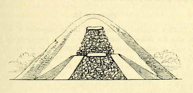
Tumulus (destroyed): OS Grid Reference – TM 117 178
Archaeology & History
Bronze Age beaker from the Flag Inn tumulus
Roughly halfway between Thorrington and St. Osyth, a few hundred yards east of the Flag Creek on the grassy wasteland south of the historic Flag Inn, could once be found a fine tumulus, of whose past we sadly know so little. Nothing now remains of the old burial mound apart from a carved urn that once lived therein and was recovered from the site before its final demise. According to M.R. Hull (1946) the well-preserved Bronze Age beaker found here—which he said “stood out as different” from others in this area—
“was found in 1930 on the 50ft contour-line about 200 yards south-southeast of the Flag Inn, in a gravel pit, in St. Osyth parish. The position is a mile and a quarter north-northwest of St. Osyth church. On this occasion it was not possible to examine the site, which could only be established with moderate accuracy some time after the discovery…
“The clay is fine, of light red colour, ornamented with three bands of trellis pattern, each bounded by three horizontal lines, and a band of four such lines at the base, all executed with an instrument making a short line of square impressions, probably the end of a comb used in weaving.”
References:
Hull, M.R., “Five Bronze Age Beakers from North-East Essex,” in Antiquaries Journal, volume 26, Jan-April 1946.
Tumulus (destroyed): OS Grid Reference – TL 8228 2704
Archaeology & History
Aerial image showing ghostly circular outline
This is one of many lost prehistoric burial sites destroyed in Essex in recent centuries and whose only remains now, as seen here to the right, are the ghostly outlines left in the Earth when looking down from above. We are very fortunate indeed in even having a record of this place—this time thanks to an astute fellow antiquarian hearing of some old remains alleged to have been in an old burial mound, south of Greenstead Green.
It’s short story was described in M.R. Hull’s (1946) essay on a series of Bronze Age beakers in Essex that were found in association with once-proud tumuli, living amidst a landscape held as sacred by our peasant ancestors. Although we have no good description of the tumulus, Mr Hull said that this well-preserved clay beaker,
Perces Bronze Age beaker
“was found in 1930 on the 200ft contour-line 366 yards due south of Piercys in the parish of Halstead…that is 2¼ miles south-southeast of Halstead Church. I visited the site immediately after the discovery with our late Fellow, Mr P.G. Laver, and the finder assured us that no other remains were found. He had dug a small pit into the natural gravel, and in doing so came upon this vessel at a depth of 7ft from the surface. When we arrived the burial pit had been destroyed, and, although the depth of the vessel from the surface suggests that a tumulus existed, we were unable to see any remains of it. We found a calcined flint…in the excavation. The vessel…(of) clay is fine, containing a very small quantity of quartz-like grit; the colour is a warm red-brown, and the body is decorated all over with finger-nail impressions.”
References:
Hull, M.R., “Five Bronze Age Beakers from North-East Essex,” in Antiquaries Journal, volume 26, Jan-April 1946.
Tumuli (destroyed): OS Grid Reference – TM 022 143
Also Known as:
Barrow Hills
Five Barrows
Archaeology & History
Known as Five Barrows presumably from the five main burial mounds that were once here, very little in modern texts seem to describe them. In the grid-reference given above, I’m not 100% certain that this is the correct spot – and as many of them have been destroyed, we’ll stick to this until someone tells us otherwise! (it is only Essex anyway)
The ‘barrow’ site that remains has been ascribed as Romano-British in date, whilst the others don’t seem to get a modern mention. These missing barrows were described in a short article in The Gentleman’s Magazine by a Mr J.A. Repton (1840), who told the following:
“In reading an account of Essex, I find the following Borough, or rather Barrow Hills, on the north side of the Black Water Bay, were considerable in number. These tumuli are supposed to have been raised indiscriminately over the bodies of the Danes and Saxons that fell in the battles occasioned by the frequent landing of the former in this part of the coast. The lands on which the barrow hills stood were completely inclosed from the sea in 1807, and the whole are now levelled, one excepted.
“This barrow I heard was going to be cleared away for manure. I made a point of visiting it under an idea that it might be proved a Roman one; when I arrived at the spot, I found it to be a bowl barrow, about 14 yards diameter, and about 6 or 7 feet high, and rather more than half of it cut away, and what surprises me, not a single urn, bone, or ashes, nor any mark to be found; perhaps the barrows being mostly under water during the tide may account for the disappearance of bones, etc., if there ever were any placed; or rather that the Danes and Saxons were not so careful as the Romans in preserving the remains of their friends. I met one of the old inhabitants who lived in the parish more than forty years; he remembered the number of barrows being destroyed, and said not a single bone or urn was ever found in them.
“Perhaps you can give me some information, whether by digging below the natural surface of the ground, any remains may be traced. It is not a gravelled, but a clean, light clay soil. The land is low and marshy, and celebrated for Maiden salt, and near it there is a decoy. ”
If anyone has further information about the other barrows which are described in several old early accounts, it’d be good to know!
Folklore
Archaeologist and folklorist Leslie Grinsell (1976) noted briefly that the barrows here supposedly covered the remains of Danes who died in battle here.
References:
Grinsell, Leslie V., Folklore of Prehistoric Sites, David & Charles: London 1976.
Repton, J.A., “Borough Hills, Essex,” in The Gentleman’s Magazine, 1840 (part 2, p.114).
Although cited in all modern archaeology texts as a series of four henge monuments, a recent article by J. Lewis & D. Mullin (2011) inform us that these “are not henges but belong to a tradition of enclosure that predates them and had a different function.” We’ll have to wait and see what they mean by that! In the meantime, we’ll have a quick scurry through the historical accounts of these four impressive ‘henges’ as Burl, Piggott and the others call ’em.
Surrounded at all angles by numerous barrows and tumuli, these four great henge monuments were shown on the 1887 Ordnance Survey map as a row of ‘Supposed Ring Forts’, when such ideas were in vogue, running in a line roughly SSW-NNE; the third one up having a couple of ponds within it. A brief early account of them was given by Harry Scarth (1859)—who was describing the series of nine round barrows a few hundred yards to the south—who told them to be “circular banks” each 500 feet across. The first more detailed account was in A.H. Allcroft’s (1908) classic text, where he wrote the following:
“…Close to the Castle of Comfort Inn, where the high road to Bristol crosses the line of the old Roman road running north-westward towards Charterhouse, there lies immediately west of the high road a series of four circles…all of one size, all of one plan, and all as mathematically exact as circles could well be when executed in such a soil and on such a scale. Although they have suffered greatly from the mining operations which have scarred all the Mendips, as well as from the plough — one of the four is almost obliterated — they are still quite easy to make out. The diameter of each is some 550 feet within the area, which is surrounded by a broad low vallum, and that again by a correspondingly broad and shallow ditch. The height of the vallum above the ditch, where best observable, is some 5 feet. There are no determinable entrances. The most southerly of the group is about 250 feet away from the second ; the second about 200 feet away from the third; and a line joining the centres of the first and third passes through the centre of the second also, and points 17° east of north. The fourth circle lies 1,200 feet away from the third, not in a right line with the others, but slightly to the west. Between the third and fourth circles passes the Roman road. Within the third circle is an old pond of some size.
“With every appearance of being all of one date, and that a venerable one, these circles lack every characteristic of military works. Their peculiar disposition, their painstaking regularity, and their identity of size, all suggest that they must, if really old, be of ritual, and perhaps of astronomical character”
Old drawing of the central hengesHenge 1, recently damaged (courtesy Pete Glastonbury)
Allcroft’s ideas of ritual and astronomy were pretty good for the period, as we take it for granted these days that such events occurred at henges — so the existence of four such sites right next to each other, would have made this one helluva place in neolithic and Bronze Age periods. A few years after Allcroft, the henges were described in Mr Burrow’s (1924) excellent illustrated survey, from which the drawing of the two central henges is taken (the two ‘R’s in the background highlight the line of the Roman road which runs past them). Burrow’s didn’t add much more of any note, simply telling:
“…in the fields north and south, are placed earth-work rings, each about 180 yards in diameter, on a line placed slightly north by east. The most northerly of these rings is almost obliterated, but the three on the west of the road from Chew Stoke to Oakhill are quite clearly defined, as my drawing (above) will show. I have been able to include two of these remarkable rings in my picture, the edge of the bank (which was, when I saw it, fringed with yellow gorse), being about 6 feet above the level of the ditch outside. It is generally supposed that these ringed earthworks were connected with some prehistoric ritual, and Hadrian Allcroft thinks were used for primitive astronomical observations or the construction of a primitive calendar.”
Tratman’s plan of Priddy HengesAnother view of Henge 1 (courtesy Pete Glastonbury)
Many years later when archaeologist K.S. Painter (1964) came to describe these henges, he listed them as “stone circles” (what the hell was he on!?), but this error may derive from the finding of several stones that once existed inside the southernmost Henge 1. These were uncovered following excavation work done here by E.K. Tratman (1967) and his colleagues, who explored and numbered the four henges—running from south to north—as follows:
“Circle 1: This is tolerably complete. A portion of the southwest quadrant has been destroyed by mining and there are three modern gaps in the ring. Mining has involved the ditch on the west and south, and to a small extent on the east. There is an irregular extensive hollow west of the centre and this too is a product of mining and contains a number of large stones so derived. The circle is not quite a true one, being flattened slightly on the west. The circle has a diameter from bank top to bank top of 520ft. The single original entrance is NNE of the centre. Stones 1 and 3-7 were removed by the farmer before excavation, but subsequent ploughing immediately after removal did not reveal any change in soil texture or colour. Stone 8 was placed in its present position quite recently. It is not known where it came from. Other stones have recently been placed on top of the bank east of the entrance by the farmer (1964-5). Stone 2 is in a relatively ancient position.
Circle 2: This is a true circle and its diameter and position of its entrance are similar to Circle 1. It has been considerably disturbed by mining. A group of stones (10-14) and stone 9 represent modern collections from the field. None of them is in its original position. There are two modern gaps in the ring.
Circle 3: This is distinctly flattened on the east and west. The N-S diameter is 520ft and the E-W 490ft from bank top to bank top. The northeast quadrant reported by Allcroft as being levelled is still traceable. The circle has been greatly disturbed by mining… The entrance is SSW of the centre, the opposite pole to circle 1 & 2, and has probably been widened, perhaps by miners. The marsh may be an original feature or the product of mining. The two ponds are certainly modern, and so is a small mound, which is probably spoil from the major pond.
Circle 4: This is incomplete. It has a diameter of 560ft, which is considerably larger than any of the others. The OS map shows only the eastern semi-circle remaining. However, the bank and in part the ditch can be traced…If the visible and proved end of the ditch on the SSW was intended to be at the edge of the causeway, then the entrance would have been in the same position as that of Circle 3.”
Very recently, a local land-owner quite deliberately bulldozed a large portion of the southern henge in this complex, destroying much of it. This act of criminal vandalism will hopefully not go unpunished and is, at the present time, going through the courts.
…to be continued…
References:
Allcroft, A. Hadrian, Earthwork of England, MacMillan: London 1908.
Burrow, Edward J., Ancient Earthworks and Camps of Somerset, E.J. Burrow: Cheltenham 1924.
Lewis, J. & Mullin, D., “New Excavations at Priddy Circle 1, Mendip Hills, Somerset,” in Proceedings of the University of Bristol Speleological Society, volume 25, 2011.
Painter, K.S., The Severn Basin, Cory, Adams & Mackay: London 1964.
Scarth, Harry M., “Some Account of the Investigation of Barrows on the Line of the Roman Road Between Old Sarum and the Port at the Mouth of the River Axe,” in The Archaeological Journal, volume 16, 1859.
Standing Stones (destroyed): OS Grid Reference – SY 6070 8701
Also Known as:
Jefferey and Jone
Archaeology & History
Described in early field-name listings as ‘Jefferey and Jone’, this was another group of standing stones, whose precise nature is difficult to truly discern, that met with an untimely end in the middle of the 19th century. They may have been part of a large tomb, or even a stone circle. Marked on the early Ordnance Survey map of the area as ‘Standing Stones (site of)’, they appear to have been described firstly by John Hutchins (1774) close to other megalithic remains, who told that:
“A little north of Hell Stone near Blagdon are four upright stones, near to, and equally distant from each other, about two feet high, except that one is broken off even with the ground.”
In Warne’s (1866) classic text he mentioned these petrified monoliths,
“In a small valley, on the down of Portesham Farm, there stood within these last ten years, four upright stones… By the direction of the then occupier of the farm, Mr Manfield, these stones were built into an adjoining wall.”
A few years later another account by H.C. March, which referred to Mr Warne’s description, gave another report citing information from one who was present at the destruction of the site:
“Warne says they have been built into an adjacent wall: but a man who was present at the ceremony stated that, by the spot where they once stood, a hole was made for them, and they were decently interred. The place where they are said to lie can be pointed out, as well as a wall which contains four large stones.” (Harte 1986:54)
Historian and folklorist Jeremy Harte (1986) concluded that the megaliths must obviously have been destroyed around the year 1855. However, the historical references of Jeffrey & Jone being moved into the adjacent walling appears to be verified by independent researchers who’ve found standing stones hereby.
Folklore
Very probably the remains of petrified ancestors, a curious rhyme describes a forgotten folktale of these lost standing stones relating to them as possessing spirit, or once being alive. They were thought of once as being a family who lived in the hills:
“Jefferey and Jone,
And their little dog Denty
and Edy alone.”
Sadly, I can find nothing further that might enrich the folktales that were obviously once spoken of these monoliths.
References:
Harte, Jeremy, Cuckoo Pounds and Singing Barrows, Dorset Natural History & Archaeological Society 1986.
Hutchins, John, The History and Antiquities of Dorset, John Bowyer & J Nichols: London 1774.
Warne, Charles, The Celtic Tumuli of Dorset, John Russell Smith: London 1866.
A prehistoric round barrow with an ancient literary pedigree, dating back to Anglo-Saxon records according to A.D. Mills (1989), when is was described in the boundary records of 833 AD as ‘on burg‘. It was described again in local records as Buleberwe in 1270, then more like the form we recognize today as the Bulbarowe in 1545, and variants thereof many times since then.
Measuring about 18 yards across and standing four feet high, Grinsell (1959) defined the monument as a ‘Bowl Barrow’, due to the shape of the mound. A brief description of the site by the Royal Commission (1970) lads told:
“Bulbarrow (77500574), bowl, lies at about 870ft above sea-level near the summit of the chalk escarpment, here known as Bulbarrow Hill. The centre of the mound has been dug into. Diameter 54tf, height 4ft.”
Grinsell and the Royal Commission both made note of a “sharpened bone of deer”, reported by Mr Woolls (1839), but pointed out there was an uncertainty whether the bone was dug “from this or the Bull Barrow in Holt” parish.
All early forms of the burial mound’s name strongly suggest it derived to a once great bull. The reason for this cannot be known for certain, but if we follow Conrad (1959) or Eliade’s (1986) rationale, the animal here was very likely a sacred bull — akin to the more famous Bull of Minos, or Apis, or Nandi. The religious importance of sacred animals was just as widespread in the British Isles as it was elsewhere in the world (examples of bulls relating to prehistoric remains scatter the British Isles with a similar association: see the Bull Stone, Guiseley; the Creagantarbh stones and hillfort, Argyll, etc.). It would be good to know of any local folklore relating to oxen or other bovines in the Woolland area.
References:
Conrad, Jack Randolph, The Horn and the Sword: The History of the Bull as Symbol of Power and Fertililty, MacGibbon & Kee: London 1959.
Eliade, Mircea, Zalmoxis, University of Chicago Press 1986.
Grinsell, Leslie V., Dorset Barrows, Dorset Natural History & Archaeological Society 1959.
Mills, A.D., The Place-Names of Dorset – part 3, English Place-Name Society 1989.
Royal Commission on Historical Monuments (England), An Inventory of Historical Monuments in the County of Dorset – Volume 3: Central Dorset, Part 2, HMSO: London 1970.
Cup-and-Ring Stone: OS Grid Reference – SY 6800 8601
Also Known as:
Winterborne Came 18b Carving (Grinsell)
Archaeology & History
Charles Warne’s 1848 drawing of the old tumulus
On January 27, 1848, the great Dorsetshire antiquarian Charles Warne sent a letter to the British Archaeological Association about a series of three large tumuli he’d explored south of Dorchester in Dorset, within which he’d found some fascinating remains. And in what he called “the last of these mighty mounds (and well do they merit the appellation from their vastness),” which “measured rather more than ninety feet in diameter, and sixteen feet in height,” the most intriguing remains emerged. In the middle of what L.V. Grinsell (1959) catalogued as the Winterborne Came 18b tumulus, Mr Warne told:
“About the centre, at a depth of some three feet from the surface, was found lying flat a rough unhewn stone, with a series of concentric circles incised; this, on being removed, was seen to have covered a mass of flints from six to seven feet in thickness, which being also removed we came to another unhewn irregular stone, with similar circles inscribed, and as in the preceding case, covering another cairn of flints, in quantity about the same as beneath the first stone.”
“…It will be seen that the most singular feature connected with this tumulus, is that of the incised stones: examples of which I am not aware have before been met with in like situations. It may be as well to forego any attempt at an elucidation, which must be purely hypothetical; but it seems more reasonable to believe that they bore some mystic reference, rather than that they were the unmeaning amusement of some Celtic idler.”
One of 2 carved stones found in the tumulus
Sir James Simpson (1867) described these carved stones in his 19th century magnum opus, giving an early illustration of one of them, as shown here. You’ll note that the carving is devoid of any central ‘cup’ as commonly found, consisting simply of a mere series of concentric rings.
If anyone knows the whereabouts of this and its companion stone today, it would be good to see them. Are they kept in some local museum?
References:
Grinsell, Leslie V., Dorset Barrows, Dorset Natural History & Archaeological Society 1959.
Royal Commission on Historical Monuments (England), An Inventory of Historical Monuments in the County of Dorset – Volume 2: South-East, HMSO: London 1970.
Simpson, James, Archaic Sculpturings of Cups, Circles, etc., Upon Stones and Rocks in Scotland, England and other Countries, Edmonston & Douglas: Edinburgh 1867.
Warne, Charles, “Removal of Three of the Large Tumuli on the Came Estate, near Dorchester,” in Journal of the British Archaeological Association, volume 3, 1848.
‘Standing Stone’ (destroyed): OS Grid Reference – TQ 282 804
Also Known as:
Oswald’s Stone
Ossul Stone
Archaeology & History
Described as far back as 1086 in Domesday — as Osulvestane — this old stone was mentioned in numerous old documents, but its ancestral importance had long since been disregarded by modern Londoners. Probably heathen in nature, the stone was referenced in various texts as Osulfestan (1167 and 1168), Osolvestone (1274), Oselstone (1290), Ossulstone (1610) and variants thereof all the way through literary accounts until the emergence of the self-righteous judaeo-christian Industrialists in the 19th century, bringing about its destruction. (they’ve never really stopped to be honest) The grand place-name masters Gover, Mawer & Stenton (1942) told us a bit about the old stone, saying:
“This was probably a stone marking the meeting-place of the Hundred. It has been surmised that its site was near the present Marble Arch, but in 1484…there is mention of Westmynster lane leading between Tyburn and les Osilston Pyttes. Westmynster lane is the later Park Lane…and in a Grosvenor Estate map of 1614… Osolstone is marked as a field-name about halfway down Park Lane on the east side just beyond the present South” Street.
According to the Victoria County History of London (volume 1), the stone was actually in position up to 1822, “but was then earthed over.” However, it was resurrected during the construction of the modern Marble Arch in 1851 and stood up against the monument for several years until its eventual demise around 1869.
W.H. Black’s isosceles triangle, showing Oswulfs Stone at ‘O’
One intriguing commentator on Oswulf’s Stone suggested a more recent Roman origin, due to him finding that the monolith played an important part in a precise isosceles triangle. In a talk given to a meeting of the London & Middlesex Archaeological Society on 10 January, 1870, William Black (1871) reminded his audience that he had,
“already shown that the sculptured and inscribed marble sarcophagus or sepulchral monument…at Clapton had served as a geometric point from which numerous measures extended to boundary points of Hackney and its neighbouring townships.”
And when he explored this potential at Oswulf’s Stone he found even more geometry. Alexander Thom and Alfred Watkins would have been proud of him! His research led him to compare two relative antiquities, both of which he deemed to be Roman:
“Of these two monuments the first is Ossulstone, from which the great Hundred…derives its name. Its position and identity I had discovered some years ago by reversing my method of determining the uses of geometric stones: that is, by finding, from the proper boundary points, a centre where lines of proper quantities unite, so as to make them serve as radii from such centre to the said boundary points…
“Ossulstone is figured in Sir John Roque’s great map of 1741-1761, sheet XI, in the very spot to which my process on other maps had led me; and it is there called the ‘Stone where soldiers are shot,’ situate near the northeast angle of Hyde Park. It was afterwards covered with an accumulation of soil, and is now dug up and lies against the Marble Arch, as stated in my petition, presented last session to the House of Commons, for the protection of ancient uninscribed stones, mounds and other landmarks…
“The second line leads to the well-known sculptured stone, undoubtedly of Roman work, formerly uninscribed, but now bearing an English inscription below the sculpture dated ‘1685’, which (now) forms part of the front wall of a house on the eastern side of Payner Alley… I had already found…that this stone had geometric uses… Now I find that this stone is equally distant from the newly-discovered Sepulchre as that is from Ossulstone.”
But the position of William Black’s stone and that mentioned in the early records described by Gover, Mawer & Stenton, are two different sites—albeit by only 700m—meaning that Black’s triangle never initially existed even if it was a Roman milestone. The likelihood is that the stone was moved about as London slowly grew on top of the once fair Earth. (the OS grid-reference given for the site is an approximation based on the 1614 Grosvenor map) Does anyone know owt more about the place, have any old drawings, or have copies of the old maps showing where the stone once stood?
References:
Black, William Henry, “Observations on the Recently Discovered Roman Sepulchre at Westminster Abbey,” in Transactions of the London & Middlesex Archaeological Society, 4:1, 1871.
Gover, J.E.B., Mawer, Allen & Stenton, F.M., The Place-Names of Middlesex, Cambridge University Press 1942.
Sharpe, Montague, Middlesex in British, Roman and Saxon Times, G. Bell: London 1919.
Healing Well (lost): OS Grid Reference – TQ 315 817
Also Known as:
Fagge’s Well
Archaeology & History
First described in local church records from around 1190 AD (Webb 1921) as Fageswelle; then again a few years later in early crime records of the region (Hardy & Page, 1892) as Fackeswell, there were a number of other references to this lost water source, which could once be found near the Skinners Well and the more famous Clerks Well, Finsbury. Gover, Mawer & Stenton (1942) believed the site owed its title to some long-forgotten local name, though could give no specifics. (i.e., they didn’t know!) The old dialect word ‘fag’, relating to old grass is as good a meaning as any!
The site was described by John Stow in his Survey of London, 1603, saying it was “near unto Smithfield by Charterhouse, lately dammed up.” In Mr Foord’s (1910) excellent work on the subject, he told that,
“In 1197 certain lands are described as lying between the garden of the Hospitallers and Smithfield Bar, “super rivulum de Fackeswell,” and other lands as between that brook and ‘Chikennelane’… This fixes the position of Faggeswell Brook as approximately at the boundary of the City.”
Further information about this site would be much appreciated. The grid-reference for this site is an approximation.
References:
Foord, Alfred Stanley, Springs, Streams and Spas of London: History and Association, T. Fisher Unwin: London 1910.
Gover, J.E.B., Mawer, Allen & Stenton, F.M., The Place-Names of Middlesex, Cambridge University Press 1942.
Hardy, W.J. & Page, W. (eds), A Calendar of Feet of Fines for London and Middlesex, 1197-1569 – volume 1, Hardy & Page: London 1892.
Sunderland, Septimus, Old London Spas, Baths and Wells, John Bale: London 1915.
Webb, E.A. (ed.), The Records of St. Bartholomew’s Priory, and of the Church and Parish of St. Bartholomew the Great, West Smithfield – volume 1, Humphrey Milford: Oxford 1921.
Healing Well (lost): OS Grid Reference – TQ 313 822
Archaeology & History
Like oh so many of the healthy old springs and streams in that dreadful metropolis, the blood and natural health of Skinner’s Well was killed long ago by the self-righteous arrogance of Industrialists. Even its precise whereabouts seems to have been forgotten… So we thank the written words of antiquarians to keep its memory alive.
Mentioned as far back as 1197 AD in early fine records of the region (Hardy & Page, 1892) as Skinnereswell — and thereafter in various local history records from 1200, 1244, 1385 and constantly from thereon — the place-name authorities Gover, Mawer & Stenton (1942) told that the prefix ‘skinner’, “clearly derive from personal names,” from “the occupational name skinner, of Scandinavian origin.” But this isn’t to everyone’s etymological fancy! When A.S. Foord (1910) sought for information on this healing spring, he found the same 1197 account, in which
“Skinners’ Well is there described as lying in the valley between the Nun’s Priory and the Holeburn, in which was a large fish-pond… Strype, in his continuation of Stow’s Survey (1720) say, ‘Skinners’ Well is almost quite lost, and so it was in Stow’s time. But I am certainly informed by a knowing parishioner that it lies to the west of the church (of St. James, Clerkenwell), enclosed within certain houses there.’ The parish would fain recover the well again, but cannot tell where the pipes lie. But Dr Rogers, who formerly lived in an house there, showed Mr Edmund Howard…marks in a wall in the close where, as he affirmed, the pipes lay, that it might be known after his death.”
Mr Sunderland (1915) thought Skinners Well a probable holy well, “because Mystery Plays were were performed yearly around it by the Skinners of London.” Citing as evidence the earlier words of John Stow in his Survey of London, 1603, which he narrated:
“In the year 1390…I read, the parish clerks of London, on the 18th July, played interludes at Skinners Well, near unto Clerkes’ Well, which play continued for three days together; the king, queen and nobles being present. Also in the year 1409…they played a play at the Skinners Well, which lasted eight days, and was of matter from the creation of the world. There were to see the same the most part of the nobles and gentles in England, etc.”
Whether this “matter from the creation of the world” was a tale of a Biblical nature, or more related to indigenous creation myths of the waters and lands around Skinners Well, we have no way of knowing.
References:
Foord, Alfred Stanley, Springs, Streams and Spas of London: History and Association, T. Fisher Unwin: London 1910.
Gover, J.E.B., Mawer, Allen & Stenton, F.M., The Place-Names of Middlesex, Cambridge University Press 1942.
Hardy, W.J. & Page, W. (eds), A Calendar of Feet of Fines for London and Middlesex, 1197-1569 – volume 1, Hardy & Page: London 1892.
MacLagan, David, Creation Myths, Thames & Hudson: London 1977.
Sunderland, Septimus, Old London Spas, Baths and Wells, John Bale: London 1915.


")
")

")