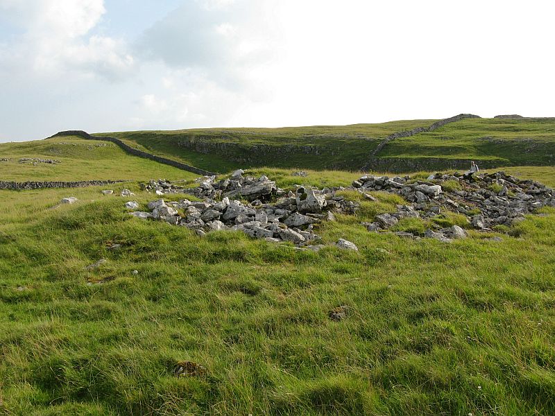
Pretty simple really. Go up the B6265 Skipton-Rylstone road for about 3 miles, past the Nettlehole Ridge woodland on your right. The next turn along to your right, up the track, is Scale House. Go past this until you get to Scale House Farm. The remains of the burial mound is in the field to your left, just before the farm. Knock on the door and ask!
Archaeology & History
This ‘tumulus’ (as it’s marked on the OS-map) was one of the many explored by the legendary reverend William Greenwell (1864) in the middle to latter-half of the 19th century. His description of the finds at Scale House were considerable; thankfully our old Yorkshire antiquarian Edmund Bogg (1904) shortened it and told us the following:
“The tumulus was 31 feet in diameter and about 7 feet high; it opened from the southeast; the soil immediately under the sod consisting of yellow clay to a considerable depth; then layers of blue clay… Exactly in the centre…at a depth of 7 feet, and on a level with the plane of the field, was found an oak coffin, formed out of a tree, split and hollowed-out, and placed due north and south, the head being placed to the south, as that as the larger part of the tree. After being exposed to the air for about 2 minutes, the bared coffin parted at the sides, and could not be moved except by detached pieces. The body had been wrapped in a cloth or shroud of texture resembling wool and coarsely-woven, of which there was a considerable quantity remaining; but the body itself was dissolved… The interment was considered to be that of an ancient Briton… The learned antiquary said it was the only instance (except the one at Gristhorpe, near Scarborough) where an interment in an oak tree hollowed out had a tumulus placed over it. It was more than 6 feet in length inside and about 7 feet 6 inches outside. The remains were carefully replaced and the mound restored to its former shape; a small leaden tablet being placed within, stating that it had been opened in AD 1864.”
Folklore
Jessica Lofthouse (1976) listed this as one of the places reputed to be an old fairy haunt, wherein “the folk of Scale House discovered a fairy kist or chest.”
References:
Bogg, Edmund, Higher Wharfeland, James Miles: Leeds 1904.
Greenwell, William, British Barrows, Clarendon Press: Oxford 1877.
Lofthouse, Jessica, North Country Folklore, Hale: London 1976.
Easy enough to get to – and a lovely place to behold for an amble! From Settle, take the B6479 road up to Horton-in-Ribblesdale (ask a local if you’re too dumb to find it!), turning right at Stainforth and up the single-track road towards Pen-y-Ghent. Keep yer eyes peeled for Rainscar – you’ve about a mile to go. If you end up at Pen-y-Ghent House you’ve gone past ’em. Turn back for 2-300 yards. It’s on the right-hand side of the road as you’re coming up, about 100 yards up the footpath.
Archaeology & History
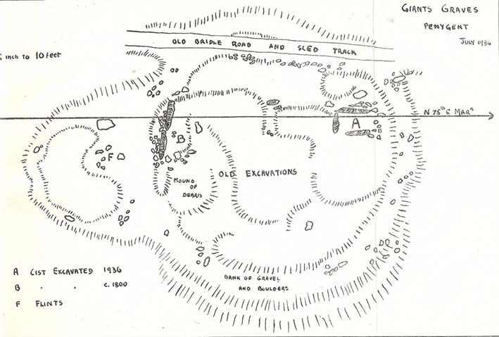
The Giants’ Graves (after W. Bennett, YAJ 1937)
The earliest description I’ve found of this is in Terence Dunham Whitaker’s History and Antiquities of Craven (1878), where he reckoned the remains here to be of Danish origin. The same thing was professed by the southerner, archdeacon W. Boyd, who said as such to the local people hereabouts more than 100 years ago, but they thought him a bit stupid and laughed at his notions! (though it does seem that Boyd wasn’t liked locally, tending to think himself better than the local people, who told him very little of local lore and legend) Describing the remains, Whitaker said there were skeletons found in the tombs:
“The bodies have been inclosed in a sort of rude Kist vaen, consisting of limestone pitched on edge, within which they appear to have been artificially bedded in peat earth.”
But Harry Speight (1892) doubted this, saying that Whitaker never even visited the site! When he went here he told us that,
“What is left at present are a few mounds of earth, the largest, which is divided into two, and lies north and south, measures about 28 feet by 25 feet. There is another apparent grave-mound on the east side of it, and again to the north is an oblong excavation or trench, 7 feet wide and nearly 30 feet long, in which several bodies or coffins may have been deposited. Several large oblong stones lay flay upon the ground beside the graves, but these were removed a few years ago and degraded to the service of gate-posts.”
The site was excavated in June 1936 by Arthur Raistrick and W. Bennett (1937) after they had been badly damaged and the stones robbed for walling and other profane building operations. Herein were found two burial cists with fragments of human bones in each tomb. In Bennett’s short account he told:
“The site consists of a nearly circular bank, about eight feet wide, and in parts two feet high, surrounding a much disturbed area. Within the area are the remains of two cists and a number of hollows that certainly represent other similar structures. The farmer tells of the removal of more than twenty large stones from these hollows, for use as gateposts, wall throughs and drain covers.* The bank encloses an area fifty-four feet east to west…and fifty feet north to south. At the west end there is a smaller bank, roughly in form of a circular apse, extending a further thirty feet. Many large boulders and vast quantities of smaller stone are incorporated in the bank.
“Near the east end, with its axis bearing N75E, is a cist — three stones in position. This was cleared to a depth of eighteen inches, and though no floor stone was present, among the sifted soil were found (i) broken bones, including parts of humourus, axis, vertebrae, ulna, ribs and cranium, all human; (ii) five teeth — two molars, one wisdom tooth, and two incisors, which appear to represent tow individuals. Sir Arthur Keith reports that the bones submitted to his examination may represent more than one adult person, and there is also a fragment of a child’s tibia. Most of the limb bones belong to a man of medium stature… He suggests from the condition of the bones a person of the Iron Age. While this is possible with a secondary interment in the area, it is rather unlikely, as all the bones came from within the built cists, and not from the earthen part of the mound, where secondary burials would be expected.
“At the west end are two large stones, the side stones of cists or of a chamber. The ground in front of them has been excavated many years ago…and partially refilled with boulders… Within the small extension on the west a trial excavation showed eighteen inches to two feet of random boulders, and beneath them, on the old sub-soil surface, two inches of fine grey sand, with two small flints — one of them a well-worked blade. These probably pre-date the construction of the circle.
“The whole site is suggestive of a multiple cist burial mound, or even a “passage grave” type. The obvious hollows, from which many of the larger stones have been lifted, are aligned in a parallel series, along an axis N75E, directed towards the two remaining large stones at the west, which may be part of a chamber wall and not part of a cist.”
Recent archaeological analysis has suggested these may be the remains of an old chambered cairn, although there is today far too much damage that’s been done to give us an accurate portrayal of what this originally looked like. The Dawson Close prehistoric settlement is less than half-a-mile further up the ridge.
Folklore
The folklore here is simple: these are the graves of giants who lived in the valley of Littondale in ancient times.
References:
Bennett, Walter, ‘Giants’ Graves, Penyghent,’ in Yorkshire Archaeological Journal, part 131, 1937.
Boyd, W. & Shuffrey, W.A., Littondale Past and Present, Richard Jackson: Leeds 1893.
Feather, Stuart & Manby, T.G., ‘Prehistoric Chambered Tombs of the Pennines,’ in YAJ 42, 1970.
Speight, Harry, The Craven and North-West Yorkshire Highlands, Elliott Stock: London 1892.
Whitaker, Thomas Dunham, History and Antiquities of the Deanery of Craven, Joseph Dodgson: Leeds 1878 (3rd edition).
* It might be worthwhile exploring the local gateposts and walls to see if any of these covering stones had cup-and-rings carved on them, as was traditional in many parts of Yorkshire and northern England.
Takes a bitta finding and aint too accessible for those of you who need footpaths! Below the eastern slopes of Addlebrough Hill, by the present source of the Gill Beck right beneath the Dove Stones (the water tastes gorgeous), are the ruinous remains of an old sheepfold. In the field immediately behind (south) of here are a number of small rocks. Look around and you’ll find the stone in question!
Archaeology & History
Unless you’re a real rock-art-freak, I can’t imagine too many of you checking this one out! When Richard Stroud and I visited this spot a few years back (2006), it was a mixture of love and madness that brought us here!
Dove Stones Carving
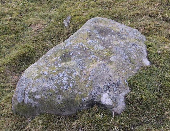
Amidst the many stones scattered hereabouts, one of them possesses two clear cup-marks on a stone measuring roughly 3ft by 2ft, along the line of a much ruined ancient wall. This might be the one that Beckensall and Laurie (1998) described in their Prehistoric Rock Art of County Durham, Swaledale and Wensleydale, as “a rock with several cups (which) has recently been noticed on Thornton Rust Moor, near the Dovestones” — though it seemed blatantly apparent to us that there were only two cups here, not “several”. However, Brown (2008) appears to list the site, citing it as having “two cups”, just like the one we found, and being “found in prehistoric low field settlement wall,” which fits the picture perfectly — although Brown gives a slight difference in grid-reference to the one Richard Stroud took. It looks a good area to scout around and, I reckon, find previously unrecorded sites.
References:
Beckensall, Stan & Laurie, T., The Prehistoric Rock Art of County Durham, Swaledale and Wensleydale, County Durham Books 1998.
Brown, Paul & Barbara, Prehistoric Rock Art in the Northern Dales, Tempus: Stroud 2008.
From Grassington go north up the B6160, turning left to Arncliffe, and parking up by the pub. Take the footpath past it and onto the rocky ridge to your SW for a mile-and-half. Dew Bottoms settlement is on the wide ridge between the two decent streams dropping back into the valley road below. Look round!
Archaeology & History
The remains of this prehistoric settlement first seem to have been described by Arthur Raistrick and Paul Holmes. (1961) They told that:
“the principal field is approximately 120 feet square, enclosed by a massive boulder and gravel bank, probably the foundation of a substantial stockade. The field is now mostly bare limestone pavement. Four smaller fields adjoin it on the north and west. Circular huts with drystone walls still about 3 freet 6 inches high before excavation, covered by collapsed material suggesting an original height of 5 feet, are placed, two of them in the course of the field wall and two in the junction of three field walls. The huts are about 10 feet internal diameter, the walls about 3 feet thick. A very fine quartzite hone was the only find in the huts. There are two rectangular stone-built enclosures, 20ft by 10ft, and 15ft by 8ft, and several small rectangular enclosures, probably buildings, with walls of boulders and turf, using one wall of a field as a common back wall. The whole site suggests a compact family farm.”
A few years later the site was visited and later described by Miss D. Charlesworth at the annual meeting of the Archaeological Society in July 1968, and is one of several found on the hills 2-3 miles southwest of Arncliffe village. Miss Charlesworth told:
“This site also faces north and covers an area of about 330 by 280ft, much of it now bare limestone. There are eight rectangular buildings and four circular huts associated with a large enclosure about 120ft square, with five smaller enclosures adjoining it.”
References:
Charlesworth, D., ‘Iron Age Settlements and Field Systems,’ in Proceedings of the Archaeological Journal, 125, 1968.
Raistrick, Arthur & Holmes, Paul F., Archaeology of Malham Moor, Headley Brothers: London 1961.
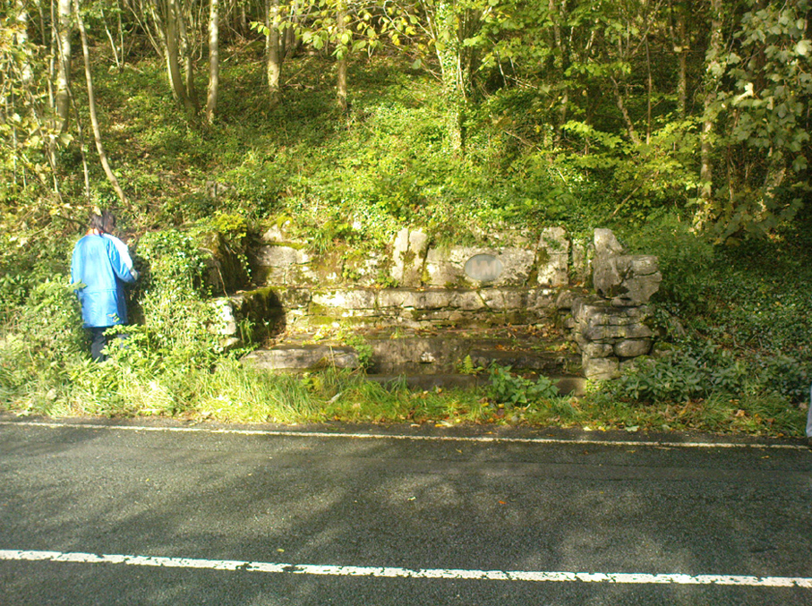
This famous old site can be found right by the roadside—the B6480—as you head out of the northern end of the town, beneath Giggleswick Scar. It’s less than a mile along the old main road, just as you start to climb up the hill, just across from the entrance to Huntworth. It is in reasonable condition and has long been thought of as a holy and magickal well. Edna Whelan and Ian Taylor included it their fine work, Yorkshire Holy Wells. (1989)
Archaeology & History
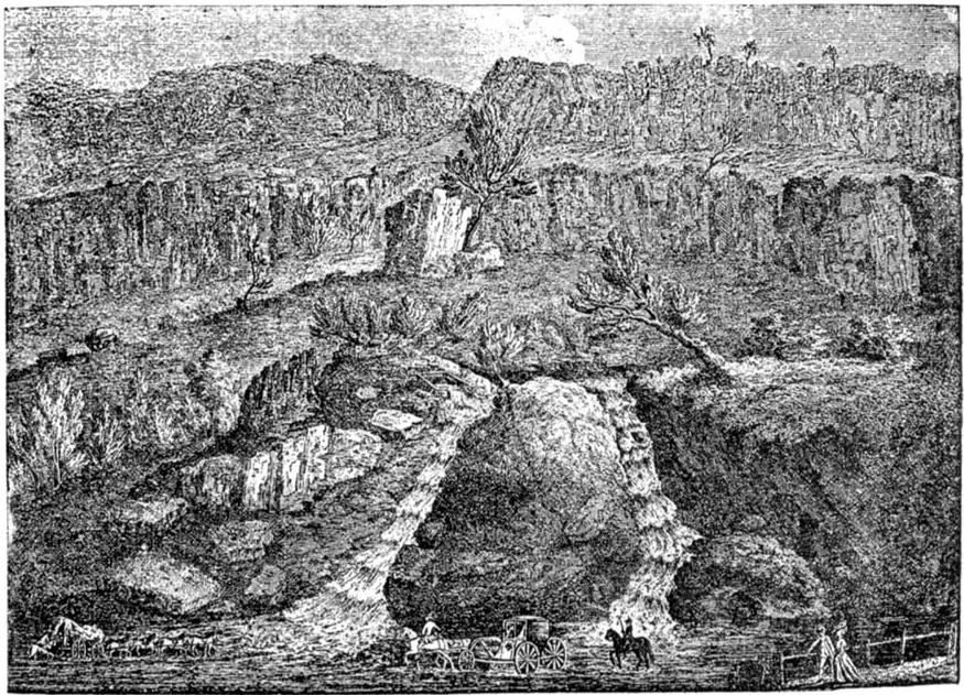
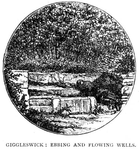
The site as we see it today is but a shadow its former self. Although the stone trough that we look at seems to be the site, this once great great well originally emerged up from the ground a good hundred yards further up the steep hill slope above us, as the early illustration here clearly shows.
Ebbing & Flowing Well (Whitaker, 1878)
Just above where the Ebbing & Flowing Well first appeared an excessive amount of flints were found in earlier years; and just above that, early human habitation in the caves to the back; along with ancient burials nearby — as well as numerous other neolithic, Bronze- And Iron Age remains all round here. This peculiar water supply was obviously of considerable importance to our pre-christian ancestors…unless you’re an idiot that is!
The site’s name comes from the very action of the waters here, which have sadly long-since been stopped. The well could suddenly overflow very rapidly and the next minute subside, with seemingly little rational explanation. As such, it was seen to be miraculous. It was first described by one John Speed in 1627 (England and Wales Described), where he said,
“At Giggleswicke…there are certain small springs not distant a quaits cast from one another; the middlemost of which doth at every quarter of an houre (?) ebbe and flowe about the height of a quarter of a yard when it is highest, and at the ebbe falleth so lowe that it be not an inch deepe with water.”
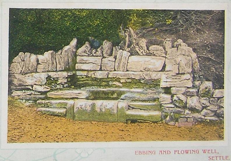
Ebbing & Flowing Well
Though Harry Speight (1900) reckons such rapid undulations were slight exaggerations on Speed’s part.
Nearby we also find the Bank Well, where old lead goddess figurines were deposited around Romano-British times. Archaeologist Alan King (1970) saw such deposits as important to the spirit of the waters, saying,
“The wells at Giggleswick, especially the Ebbing and Flowing Well, would be considered entrances to the Underworld and suitable sites for making offerings.”
It seems more likely however, that the Ebbing and Flowing Well would have a more pronounced oracular nature; though Underworld aspects would be prevelant, though would be the province of selected priestesses (whose folklore is found nearby, albeit in distorted form).
The waters themselves today flow quite well, but are close to freezing when you immerse your hands therein. They also taste very good indeed and are most refreshing – better than any of the alleged ‘spring water’ people today buy in plastic bottles. It’s gorgeous water here!
Folklore
Early drawing of the Well
An undoubted oracular site: the ebbing and flowing actions of the waters giving the well the distinct characteristic as a place used for prophecy and divination in very ancient times. I have little doubt that this was a place used by shamans. It was likely to have been a dreaming site aswell. (it would be good to know if there is any old witchcraft lore still left here)
The waters themselves are supposed to be a manifestation of a local female spirit, who was transformed into the waters by a woodland spirit. Also here, a local highwayman called Nevison was being chased by the local cops, when his horse stopped at the waters desparate for a drink. While here, Nevison prayed to the water spirit for help. She duly obliged, giving him a magic bridle, enabling his horse to run and jump over the high moors to escape his pursuers: a place called Hell Ghyll being one of the places he was said to have cleared.
References:
Bord, Janet & Colin, Sacred Waters, Granada: London 1985.
Hope, Robert Charles, The Legendary Lore of the Holy Wells of England, Elliott Stock: London 1893.
King, Alan, Early Pennine Settlement, Dalesman: Clapham 1970.
Ross, Anne, Pagan Celtic Britain, RKP: London 1967.
Speight, Harry, The Craven and NorthwestYorkshireHighlands, Elliott Stock: London 1892.
Whelan, Edna, The Magic and Mystery of Holy Wells, Capall Bann: Chieveley 2001.
Whelan, Edna & Taylor, Ian, Yorkshire’s Holy Wells and Springs, Northern Lights: Pocklington 1989.
Whitaker, T.D., The History and Antiquities of the Deanery of Craven, Joseph Dodgson: Leeds 1878.
Paul, Danny and I came here via the Feizor village route, zigzagging about, to and fro, seeing the other old sites in the region; but the easier direct way to get here would be from Settle. Walking through Settle, going out of the top end of town, cross the old bridge and take the country-lane on the right, up northwards towards Stackhouse. A mile along the road (shortly before Stackhouse), a footpath on your left veers up diagonally through a small copse of woods. Go up here and out the other side of the trees, the path turns left and up over the fields. Go up here, and over the third wall along the footpath, you’ll see a large overgrown pile of rocks 30 yards in front of you with a large stone laid roughly in its middle. You’re here!
Archaeology & History
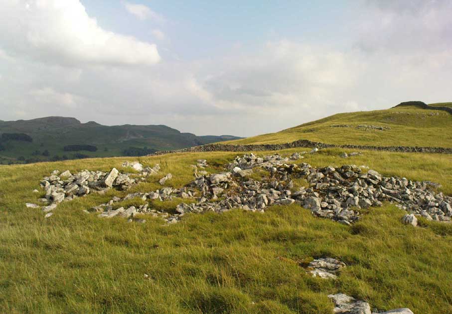
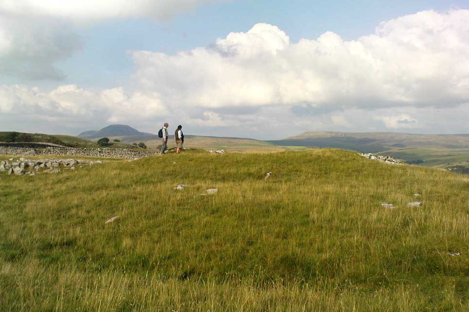
This is an excellent though much neglected prehistoric cairn of some considerable proportions, its rocky mass laying half-covered in deep earth and grasses, yet with still a very large section of it open to the elements. The creature is nearly 30 yards across and some 4 yards high — though it’s hard to say with any certainty, where exactly the natural Earth begins and the cairn starts. But from whichever way you look at this large cairn, walking around the overgrown features, you know it’s a big thing — similar in size and nature to the Great Skirtful of Stones on Burley Moor, and the neolithic cairn on Bradley Moor, near Skipton.
Paul & Danny atop o’ t’ pileBear’s photo, looking SW
On the modern OS-map there are 2 ancient cairns marked close to each other — and our “Apronful of Stones” is the lower one of the two.
In recent years the site was described briefly in Dixon’s (1991) Journey through Brigantia, but there’s been very little written about the place in modern archaeological surveys. The first account I’ve found of the site was written by an anonymous “W.F.” in The Gentleman’s Magazine of 1784. In a detailed lengthy essay, the following words were penned:
“This barrow, or tumulus, stands in an elevated situation, upon a mountain, above the hamlet of Stackhouse, and may be discerned at a great distance…
“The form of this vast mass is circular, or rather orbicular ; the height, by computation on the spot, about 9 or 10 feet. It is composed of an incredible quantity of stones, piled in such a manner as to rest upon each other’s basis, and strengthened by its conic form, it rises upwards in this curious shape. Those stones that form the outside of the work are so small that a soldier could carry them; and since it has been argued that such a monstrous work as this would not be attempted by any nation, but was natural, the largeness of the tumulus may easily be accounted for, since they were annually increased out of reverence…
“This barrow had been opened many years ago, and it is represented in the plate in the state in which it has appeared till lately. Some old people in the neighbourhood remember its being entirely complete, and having a very flat top. It was usual, in finishing these works, to lay a flat stone at the top. The people that opened it left their intention unfinished, only throwing down the lid of the stone coffer, and one or two of the sides; and, meeting with nothing worth digging for, they left it. Upon examining it in this state, before its being entirely disfigured in the last attempt, I found several human bones scattered up and down therein, amongst which I selected the patelae of the knee, the vertebrae of the spine, part of the jaw, and several teeth.
“Round the area is a wall or rampart, of the same materials as the outside, its height from the interior part about 2 feet, irregularly ranged with fissured remnants. In the centre of the cavity or area is the above chest, consisting of several huge stones of vast magnitude and density, fixed firmly into the ground, which supported a lid of equal size, though it is now thrown off the top. In this chest are partitions, for what purpose is not known, unless each space was allotted to its particular relique or body. In the partitions and sides of the coffin is a kind of hole in the edge, with a rude mould. (my italics, PB) Not many weeks ago, the curiosity of some of the neighbourhood was excited to investigate this stupendous work of art, and accordingly labourers were hired, when, upon searching a day (yet not half the work done), a human skeleton was found, in due proportion, and in a fine state of preservation, excepting the skull and one of the limbs, which were moved out of their place by the workmen’s tools. A small circular piece of ivory, and the tusk of an unknown beast, supposed to be of the hog genus, was also found ; but no ashes, urns, coins, or instruments were discovered. ”
Many years later the giant cairn was described briefly in William Howson’s (1850) early survey of the district, when he told that,
“Near a gate on the path, where the descent is commenced to Stackhouse, there’s a cairn of eighty feet in diameter; it has not been completely examined, but human bones are commonly found in it.”
But it was more than a century after “W.F.’s” initial essay before another detailed appraisal of the place was given — and that was after a visit here by the legendary Harry Speight (1892) in the latter half of the 19th century. Along with mentioning a number of other prehistoric tombs upon this ridge, Mr Speight told:
“From Settle Bridge you may take the field-path…or the rustic lane to Stackhouse, and where the road divides just beyond Mr Priestley’s pretty house you wind beneath the wood behind Scale House to a gate and stile on the left. Here ascend the field between two large trees, and at the top go over a stile, whence a path leads up the field a good half-mile to a gate which opens into what our remote Celtic ancestors would have reverentially called the ‘Field of the Dead,’ for within this enclosure are traces and remains of human graves which carry us back to the far dim ages of unwritten history. Following the grassy cart-road a short distance you will see on the left a large circular mound thrown up about 30 feet on the south side, and about 10 feet on the north or higher side. There are other mounds of similar and smaller dimensions within the same area, some of which have been examined, but others do not appear to have been disturbed. Many of the barrows or ‘raises’, have at some time or other been carelessly dug into in the hope of finding valuables, and as doubtless in most cases nothing was found but rude chests or coffins, containing bones, these were tossed aside and no record of them deemed worthy of preservation…
“The largest of these existing raises has happily been described by a writer who signs himself ‘W.F.’ in the ‘Gentleman’s Magazine’ for 1784 and 1785. Although his account fills several pages, it is obviously defective in many particulars. We are told that the circumference of the base of the mound is 210 feet, and that its height is 9 or 10 yards, and that the casing is composed of stones “so small that a soldier could carry them,” while the inside is made up of earth and stones, some of the latter being “much larger than the external coating.” In form it was circular…and the diameter of the summit was 45 feet. The barrow he tells us was opened many years ago, but some old people in the neighbourhood remember it being entirely complete, and having a very flat top.
“…Upon examining it in its former state the writer discovered several human bones scattered about the rock and soil, among them the palletae of the knee, the vertebrae of the spine, part of the jaw and several teeth. In the centre of the mound was a cavity containing a chest composed of four upright stones and a lid 6 feet 9 inches long and 3 feet broad. The chest was in partitions, in the edges of which were a kind of hole with a rude mould. The writer, under date, Settle, Nov 23rd 1784, next informs us that, “not many weeks ago the curiosity of some of the neighbourhood was excited to investigate this stupendous work of art, and accordingly labourers were hired, when upon searching a day (yet not half the work done) a human skeleton was found, in due proportion, and in a fine state of preservation, excepting the skull and one of the limbs, which were moved out of their place by the workmen’s tools. A small circular piece of ivory, and the tusk of an unknown beast, supposed to be of the hog genus, were also found; but no ashes, urns, coins, or instruments were discovered.”
Other important prehistoric monuments can be found on the grassy limestone plain beyond the Apronful: these include the fascinating Sheep Scar Enclosure just 180 yards (165m) to the north; an associated prehistoric cairn (one of several) 57 yards further northeast; and a delightful, though overgrown cairn circle 325 yards NNW. Other Iron Age and Bronze Age remains can be found elsewhere within this arena. Archaeologists could do themselves a big favour by exploring this landscape more efficiently than they’ve done so far as other unrecognized sites exist in this area.
Folklore
Big stone in t’ middle
Harry Speight (1892) told us how the place got its name “from a tradition…that his Satanic Majesty, in haste to complete the bridge bearing his evil name near Kirkby Lonsdale, tripped and his apron-string broke which let drop this immense heap.”
Another tradition narrated again by our anonymous ‘W.F.’ in the Gentleman’s Magazine(1785) said how this giant tomb, “was raised over the body of some of the Danes slain in the general massacre of that nation.” He also told, “Such a conspicuous work must certainly be erected to the manes of some chiefs, though there is no ground to support its tradition.”
References:
Dixon, John & Phillip, Journeys through Brigantia – volume 4: Beyond the Hill of Winds – Walks in Upper Ribblesdale, the Three Peaks & Upper Wharfedale, Aussteiger: Barnoldswick 1991.
Ferrand, William, “Stackhouse, Yorkshire,” in The Gentleman’s Magazine (London 1784).
Howson, William, An Illustrated Guide to the Curiosities of Craven, Wildman: Settle 1850.
Speight, Harry, The Craven and Northwest Yorkshire Highlands, Elliott Stock: London 1892.