Sacred Well (lost): OS Grid reference – SW 4614 3259
Archaeology & History
It’s difficult to know what to make of this site: whether it was merely a healing well or whether it possessed greater esoteric functions. In all likelihood it was the latter as many so-called “wishing wells” in earlier centuries possessed oracular attributes. It’s also difficult to work out precisely where this well happened to be, as we know little about it apart from the singular reference of Quiller-Couch (1894), who told simply that,
“There was also a wishing-well in the Bone Valley; it is now only a small stream, and is not used for purposes of divination.”
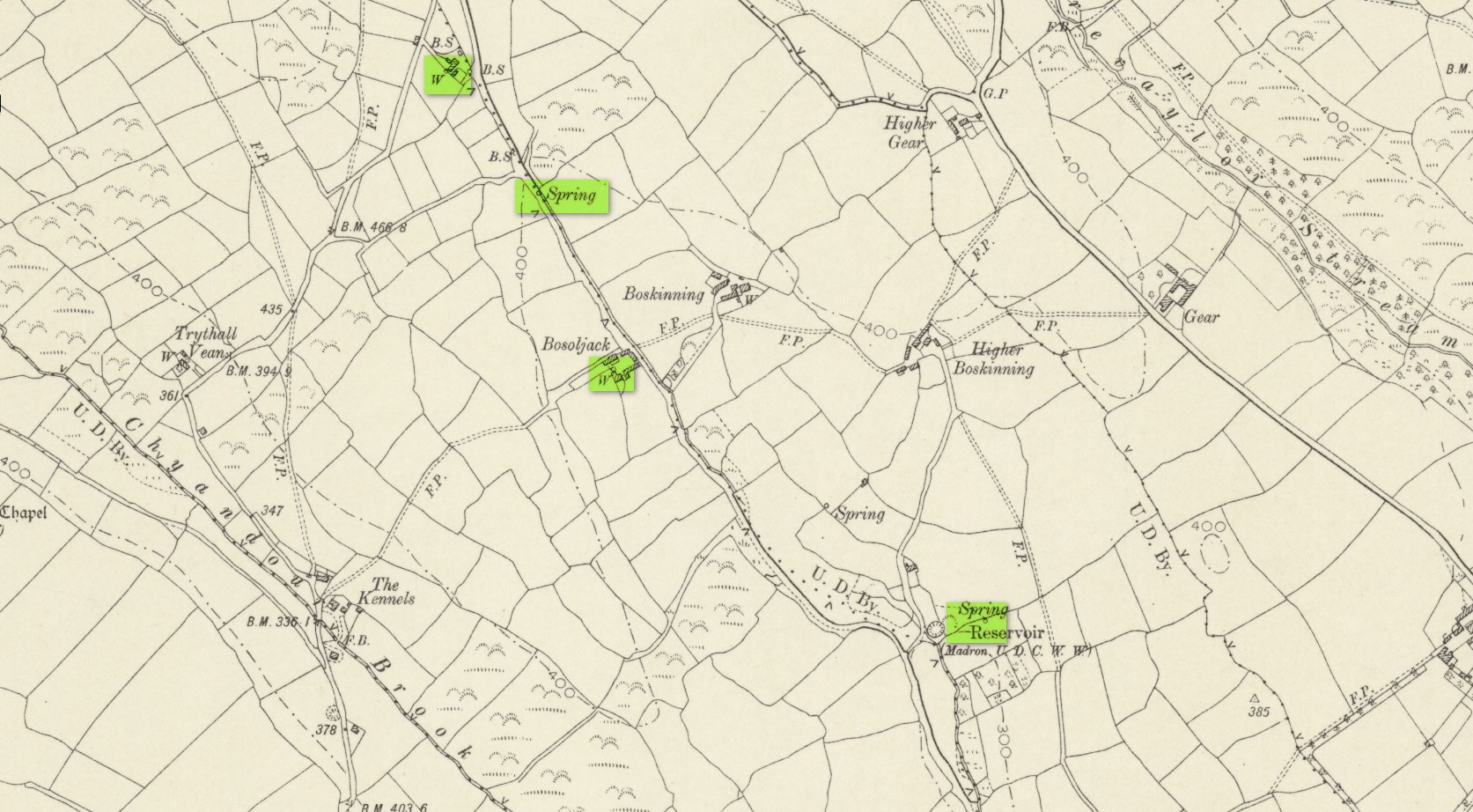
There were a number of wells along the Bone Valley road highlighted on the early OS-map, all of which may have been known to Quiller-Couch at the time, three of which appeared to have streams emerging from them back then: one just above Bosoljack (SW 4556 3319) and one below it (SW 4571 3292), each just off the roadside; but then a slightly more enticing one is hidden a little further down the lane and up the tinier lane to Higher Boskinning, in the trees on the right (east). Shown on the first OS-map as a simple “spring”, a small stream runs from it and then into the larger Bone Valley Brook which runs towards Penzance. The solace and quietude of this spot would seem much more favourable than the other two…. but my impressions may be wrong. It would be good if someone could find this old place…
References:
- Quiller-Couch, M. & L., The Holy Wells of Cornwall, C.J. Clark: London 1894.
- Russell, Vivien, West Penwith Survey, Cornwall Archaeological Society 1971.
Acknowledgements: Big thanks for use of the early edition OS-map in this site profile, Reproduced with the kind permission of the National Library of Scotland.
© Paul Bennett, The Northern Antiquarian