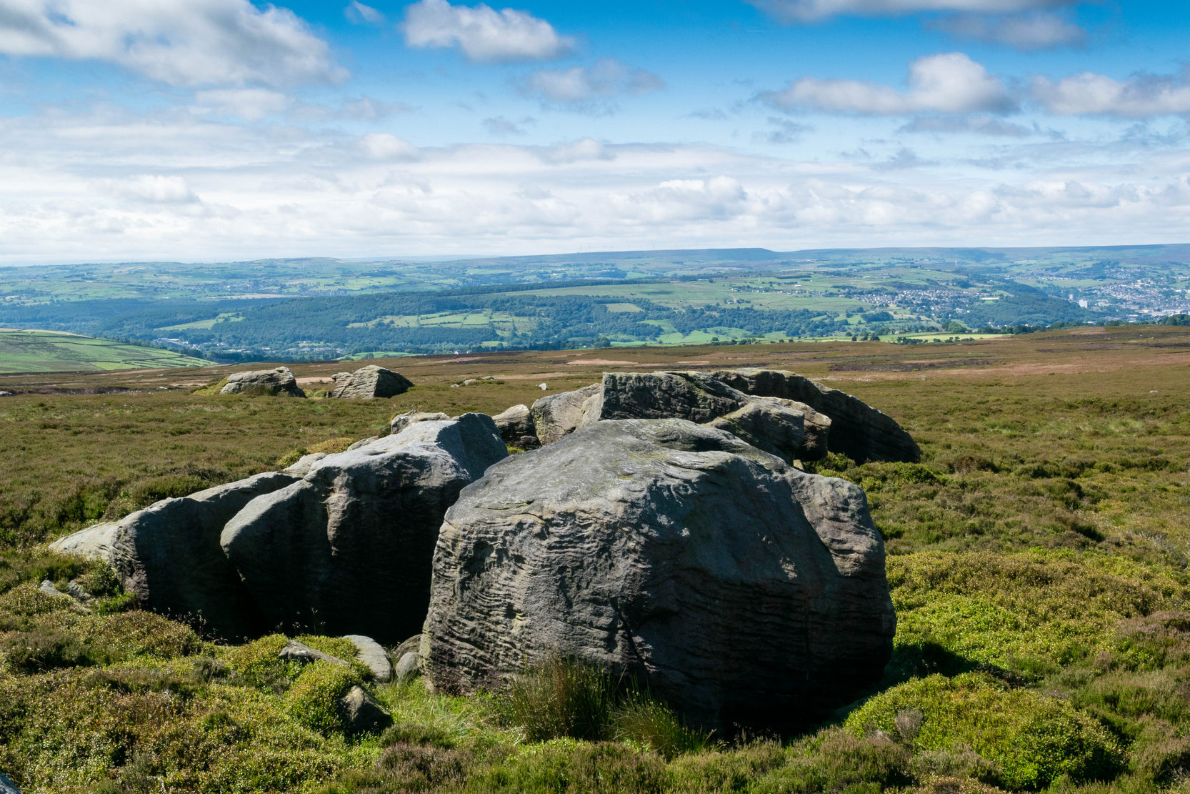
Ostensibly non-linear carved designs, generally assumed to be Bronze Age in date, but many originate in the neolithic period (some may indeed date back to 5000 BCE). Their central features are small rounded cup-markings, circles, semi-circles, curved lines (short, mid-length, and long), straight-ish lines, double- and multiple-rings, all in usually abstract design-forms. Their almost complete non-linear nature relate to non-egoic structuralisms, making them difficult to ‘intellectually’ grasp. Added to this is that no two carvings are the same. Although no direct ‘meaning’ can be ascribed to the carvings, many of them have a relationship with ancient notions of death and/or burial. In animistic terms, they relate to the spirit of rocks and other features of the natural landscape. They have very little relationship with alignment features (though exceptions in some megalithic rings have been found). Some modern writers allege positive relationships with water, but this ingredient (if tenable) cannot yet be said with any certainty: the idea should be forged onto animistic relationships with the land itself.
Turn right off the A93 at Cargill onto the side road at Keepers Cottage and up the hill. Gladsfield Wood is at the top of the hill on your right. Park up at the top side of the Wood and walk along the narrow track to where it crosses another track, look 45º to your right and you’ll see the stone.
Archaeology & History
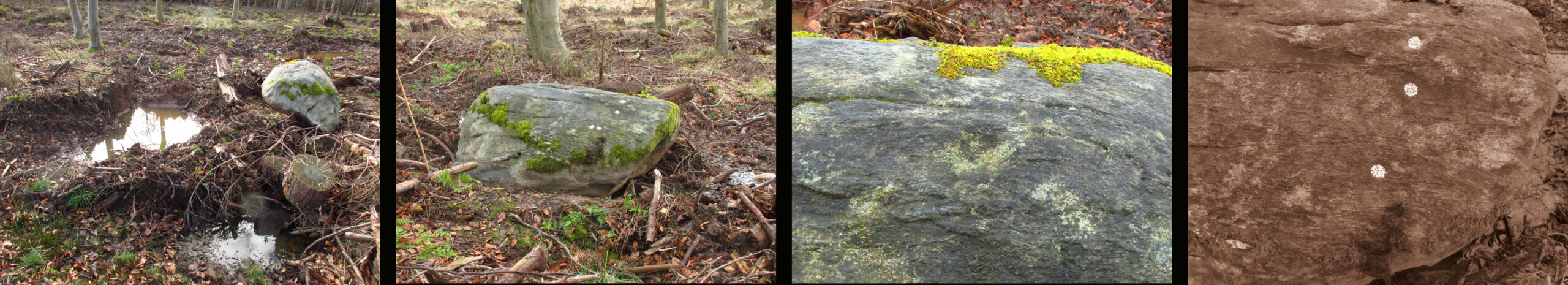
One of those chance finds that turns up when you’re looking for something else. Recent forestry work had dislodged the stone from its original earthfast position of millenia, only a few feet away. It may have been rotated from its original position. The grey whinstone rock measures around 5′ 8″ (1·75 m) long, 3′ 9″ wide (1·15 m ), 2′ 9″ (0·85m) high, and the moss shows its original depth in the ground. Fortunately the cup marks weren’t damaged in what appears to have been a quite brutal move. On what is now the north east facing side there are three definite and one possible very shallow fourth cup mark. The top cup is the most prominent, while the possible fourth cup is just to the left of the bottom one.
L-R 1. The original position of the stone 2. The stone showing the possible fourth cup 3. The prominent top cup 4. The three definite cups
One for the enthusiasts really, in an area of Strathmore quite rich in megaliths and rock art; whatever the future holds for this dislodged stone in the savage world of agri-business, it is now recorded for posterity!
From Crieff central, take the A85 road east out of town where the golf club is on your left. Park up and ask the helpful lads who work in the shop, who’ll direct you to the standing stones on the golf course. The cupmark is on the second stone along the row of stones from the direction you’ve approached from.
Archaeology & History
Here’s another one of those petroglyphs only of interest to those with the madness in their bloodstream! Found within the ruins of the Ferntower megalithic ring is a distinct single cupmark on what John Coles (1911) called ‘Stone D’ in his survey:
The stone in questionCupmark, lower centre
“Stone D, a boulder of whinstone also containing seams of quartz, 5 feet 6 inches in length and breadth, and 2 feet 3 inches above ground. At some period the intention of blasting this block must have been considered, for there is the beginning of a jumper-hole near the centre of its upper surface. Close to this unmistakably modern hole there is one single genuine cup-mark about 1¼ inch in diameter.”
A note of this was also made when Aubrey Burl (1988) surveyed the site, who pointed out that in accordance with a characteristic found at other ‘four poster’ stone circles, the carving is “another example of a decorated stone on the eastern side” (my italics) of such a ring.
Folklore
Although we have nothing specifically relating to the carving, it’s worth noting that when we visited the stone circle, the groundsman told us that it had been a place where local people gathered at summer solstice.
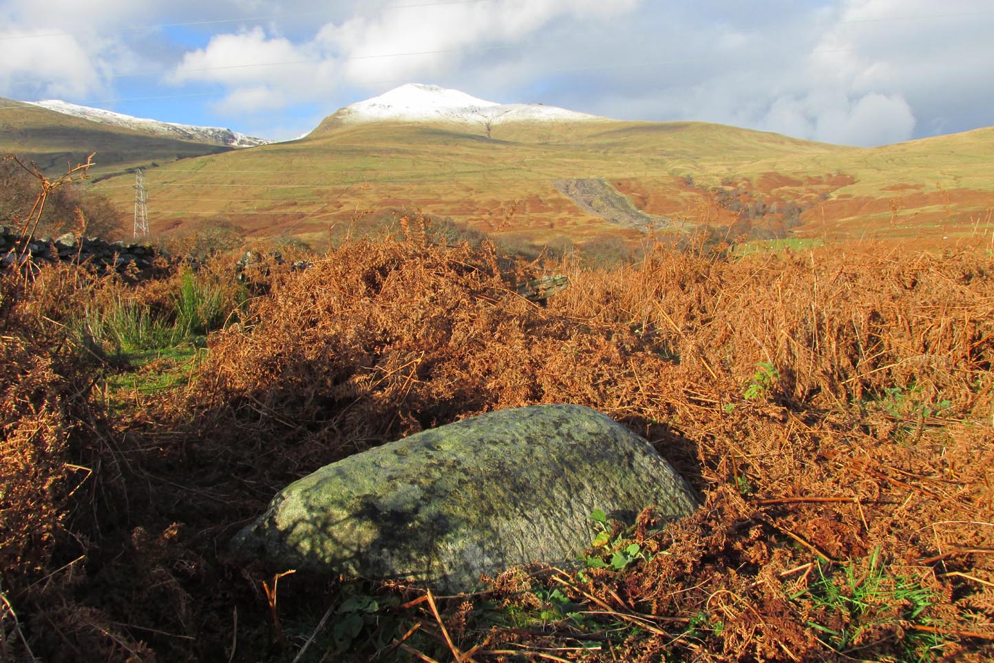
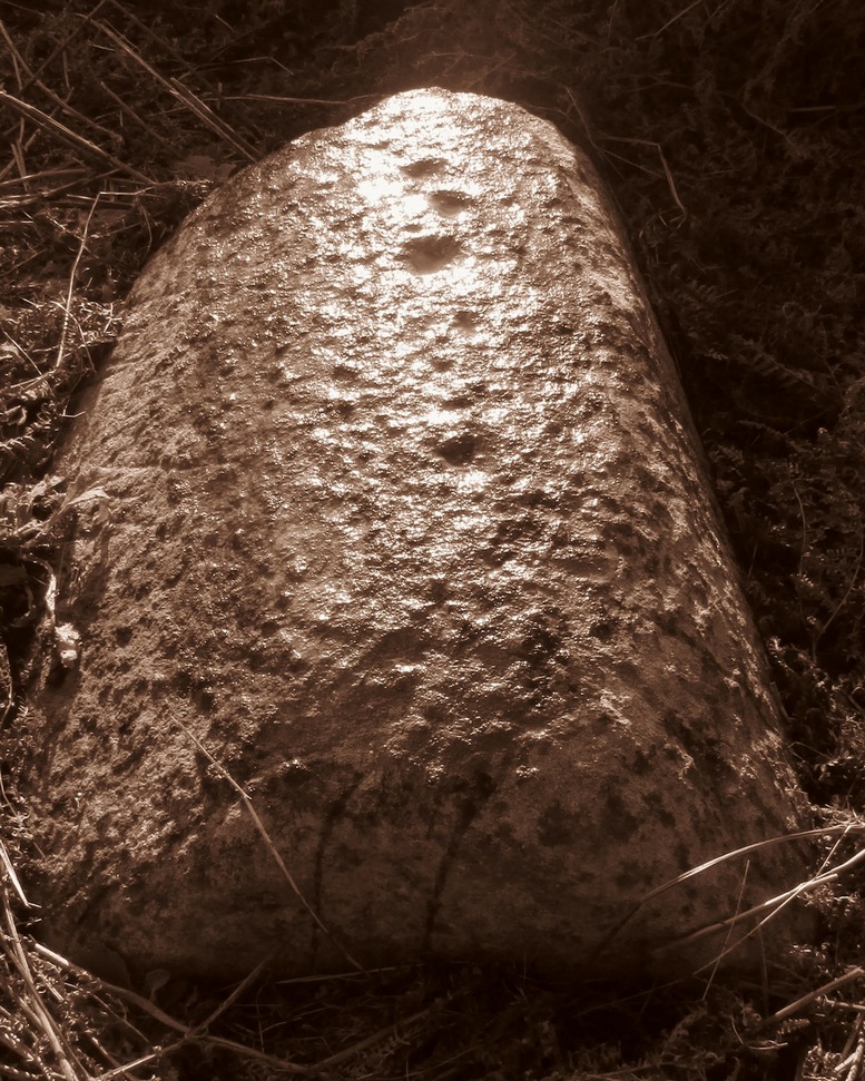
Difficult to reach, this large protruding rock on the west side of Thorrisdail Hill, was known as the Thorrisdail Stone in the old boundary records. It’s a bittova giveaway when you find it, as its name is inscribed on the lower face of the stone – etched a century or two ago by the look of it.
Thorrisdail Stone, with Sarah stood belowOne of the cupmarks highlighted, upper middle
It’s a difficult rock to climb upon if you aren’t used to such things – and you need to do this if you want to see the cupmarks; although they’re hardly worth seeing unless you’re a petroglyph freak! If you go to the trouble so see them, make sure to squat down carefully, being even more careful not to fall off (you’re screwed if y’ do). Once in position, you’ll see between three and five very faint shallow cups etched onto its flat surface. You can just make one of them out in the photo here. The more impressive thing to see here is the small standing stone that seems to artificially crown the top of the rounded hill to which the Thorrisdail Stone is attached.
Acknowledgements: Huge thanks to Sarah MacLean for her company and landscape knowledge in visiting this and other nearby antiquarian remains. And to Aisha Domleo, for getting me into this neck o’ the woods.
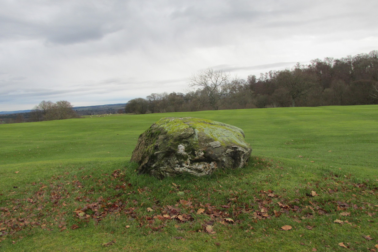
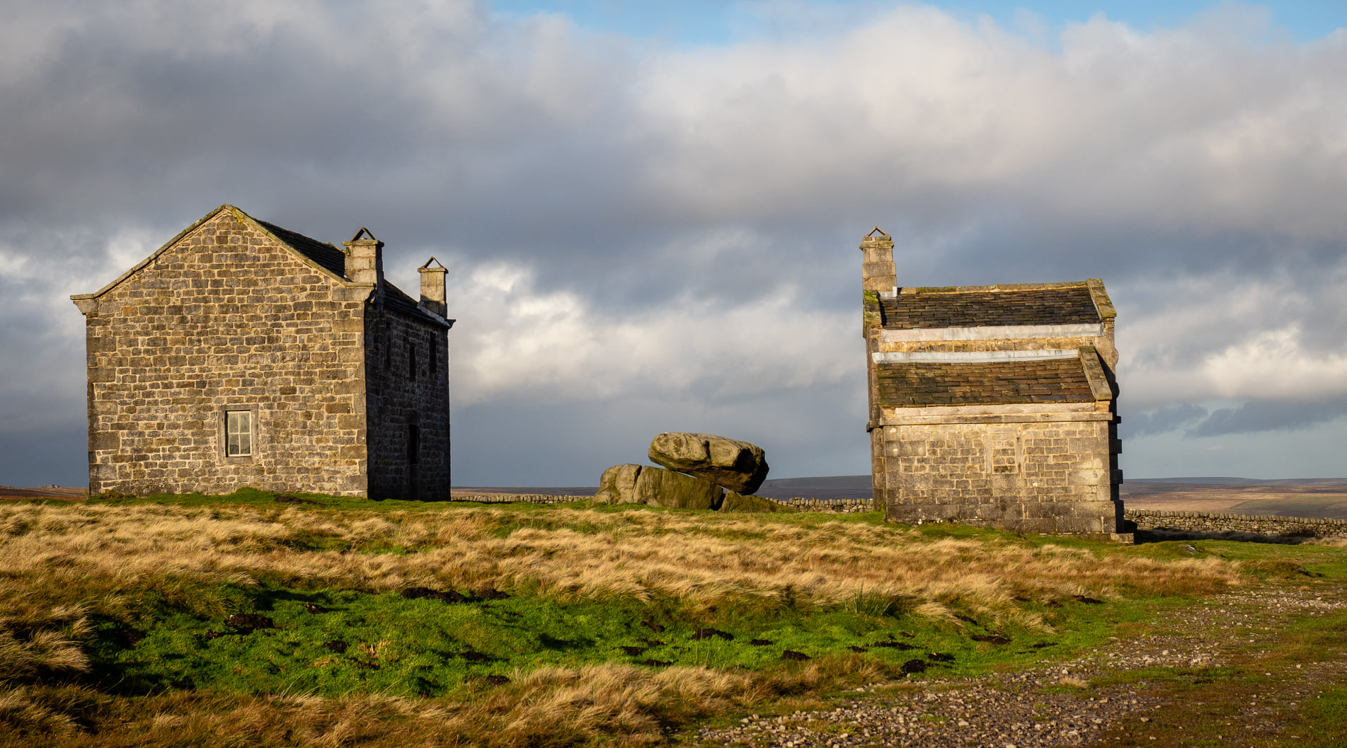
Visiting this site is a bittova walk across the moors, with probably the best route being along one of two footpaths from near the Outdoor Centre following (whichever is your preference) the moorland track or path westward onto the open landscape. Tis a 2½ mile walk before you reach two large buildings stuck high up in the middle of nowhere. Y’ can’t miss them. Equally unmissable is the large blatant rocking stone between the buildings. Gerron top of it!
Archaeology & History
Rocking Stone, in situ
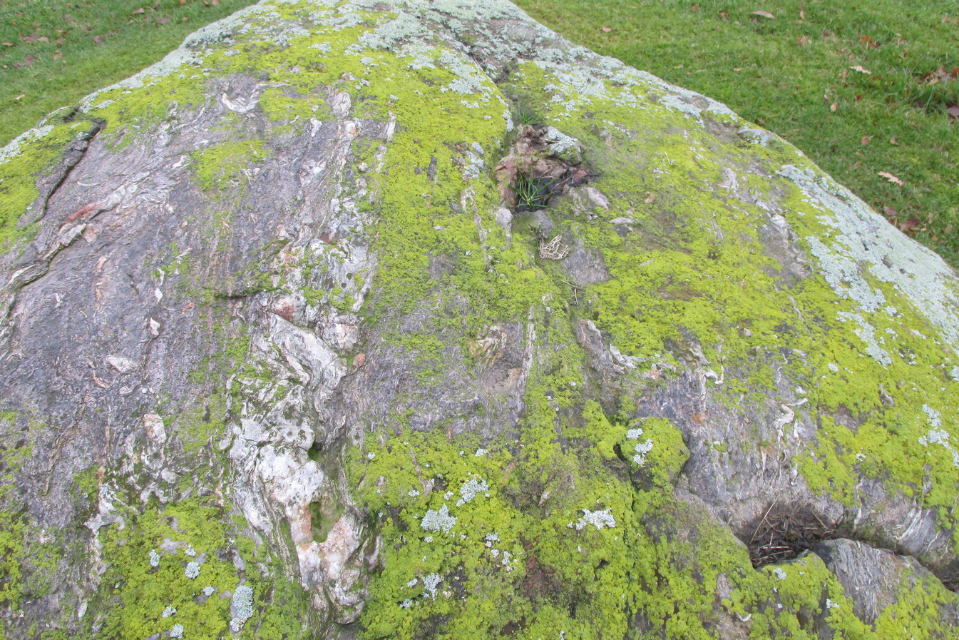
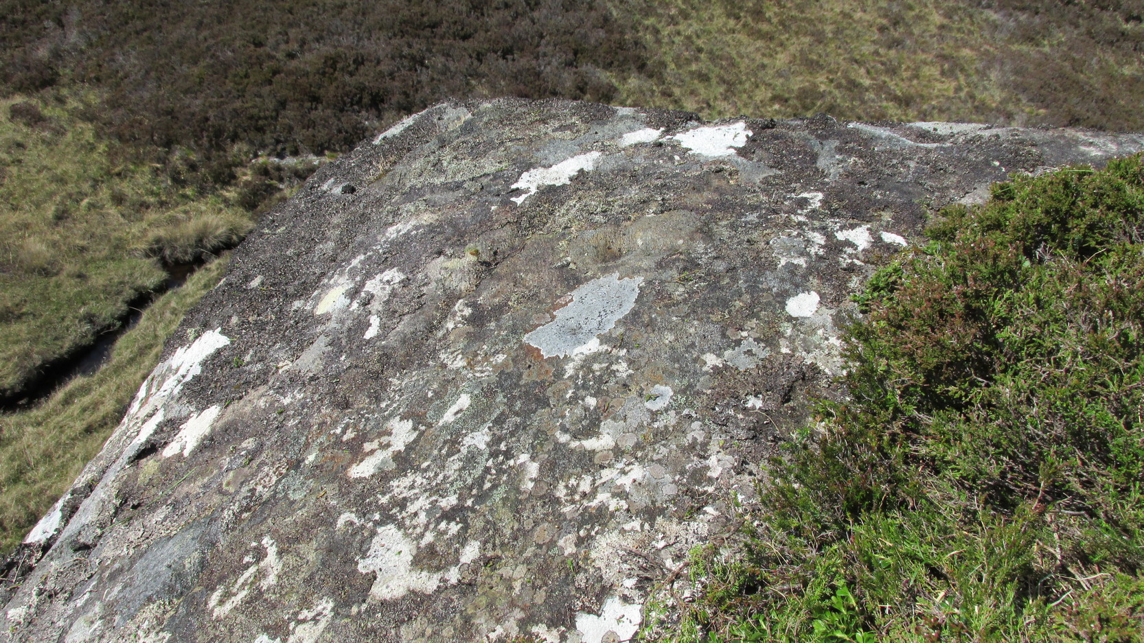
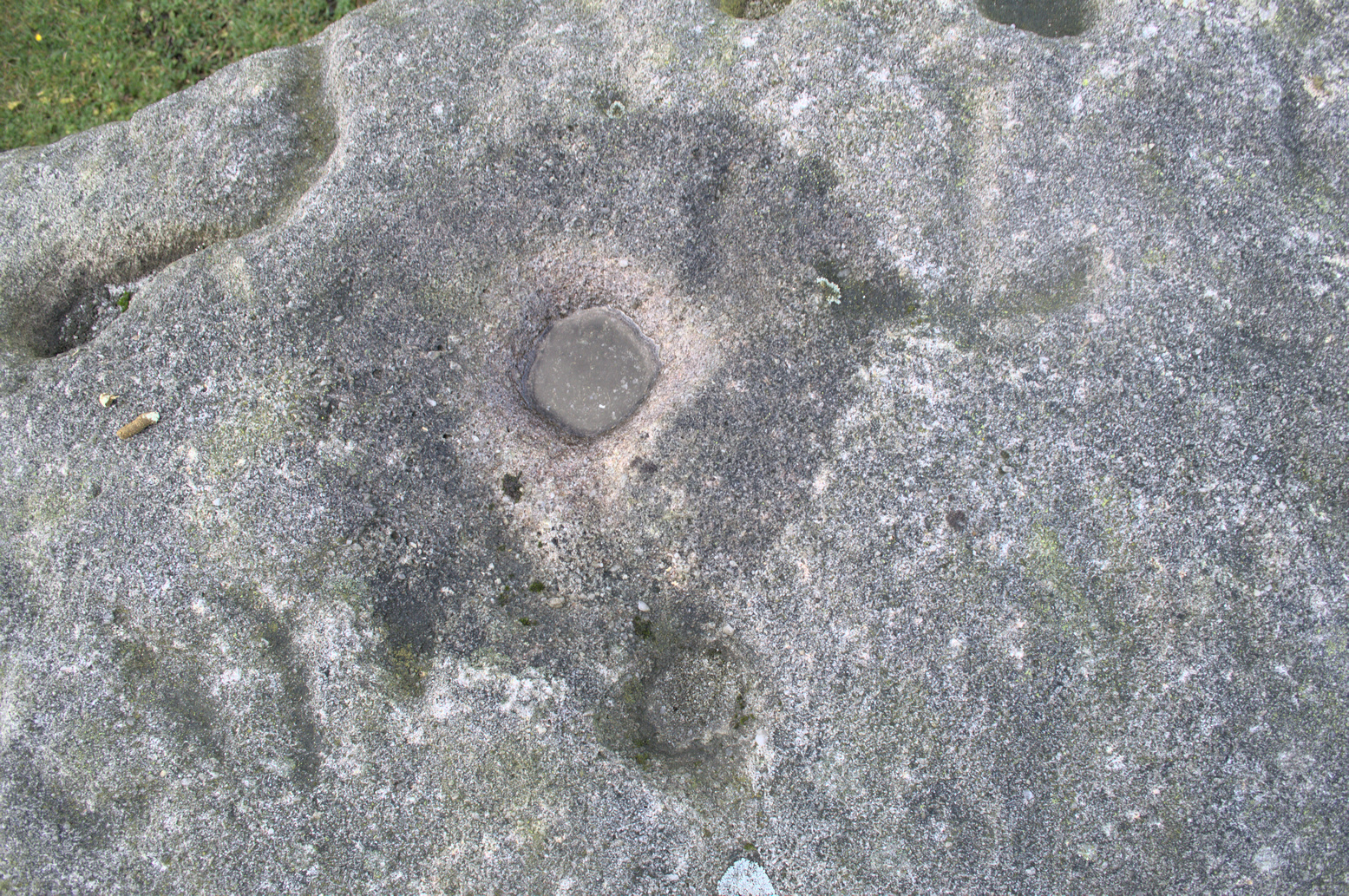
This impressive-looking rock that sits between the two buildings has a number of cup-markings of varying sizes across its topmost surface: some deep and some not-so-deep. There are perhaps as many as 20 of them on different parts of the stone, but some have been intruded on by more recent graffiti. On a recent visit to the site, photographer James Elkington and his young assistant MacKenzie, saw what looked like “a very faint ring around one of the cups” – which doesn’t surprise me. On one section of the stone we see a fascinating series of natural curves and geological undulations, some of which may have been modified a long time ago when the cupmarks were etched. But whether they were added to or not, it’s more than likely they’d have had some significance in the mythic nature of the rock.
The earliest description telling us that this possessed any prehistoric attributes seems to have been written by William Grainge (1871), in his huge work on the history of this region. He told that,
Faint ring highlightedSome of the many cups
“This rock…is eleven feet in length, seven feet six inches in breadth, and two feet six inches in thickness. The whole of the upper surface is thickly indented and grooved with cups and channels; the artificial character of which can be easily seen by anyone. This logan rests upon a lower rock, the upper surface of which is about three feet above the ground, fourteen feet in length, and nearly the same in breadth.”
Folklore
Curvaceous nature & cups
Although this yummy-looking geological sight no longer rocks, it wasn’t always that way. Indeed, according once more to the pen of Mr Grainge, although “it does not rock now, it has done so within living memory” – meaning that it would have been swaying at the beginning of the 19th century. We can only take his word for it. Also, as with many rocking stones the length and breadth of the land this, unsurprisingly it was adjudged to have been a place used by the druids.
References:
Grainge, William, The History and Topography of Harrogate and the Forest of Knaresborough, John Russell Smith: London 1871.
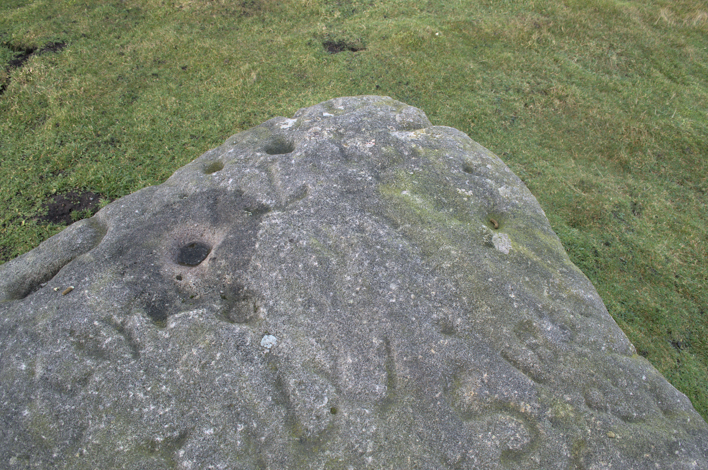
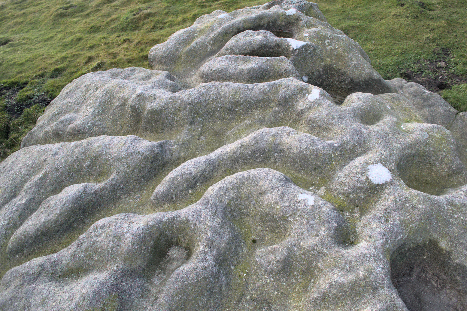
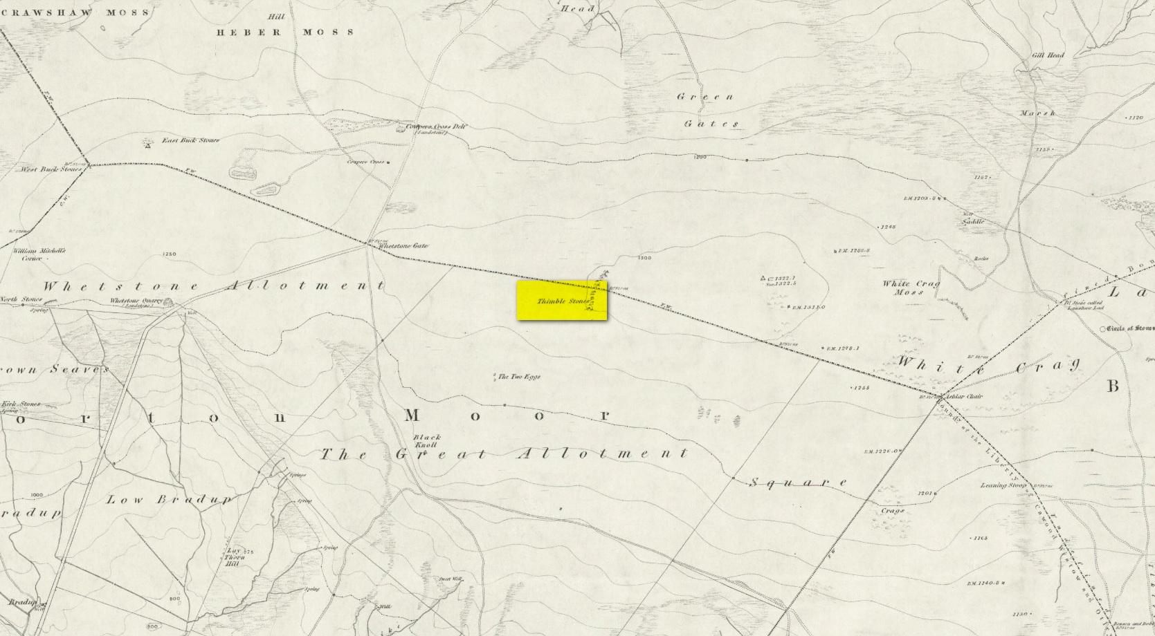
You can either head up to the Twelve Apostles stone circle, then a short distance west to the Ashlar Chair and head just head west along the moorland footpath that runs parallel with the old walling for ¾-mile (1.2km). This is the boggier route, beloved of real walkers! The other route is from the top of the Roman Road that bisects the moor at Whetstone Gate. From here, where the normal ‘road’ meets up with the dirt-track at the very top of the moors, take the footpath east for ½-mile (0.75km) until you reach the large cluster of rocks, just over the wall on your right-hand side. The carving is on top of one of them there stones.
Archaeology & History
Without doubt there’s one helluva spirit to this cluster of large weather-worn rocks whose bodies gaze in every cardinal direction—and it’s a place where me and a number of earlier historians thought cup-and-rings could be found. The first petroglyphic context of the rocks was made in the 1860s by the grand 19th century historians Forrest & Grainge (2012) where they gave it the usual druidic associations, so beloved of academics and antiquarians alike at the time. They wrote:
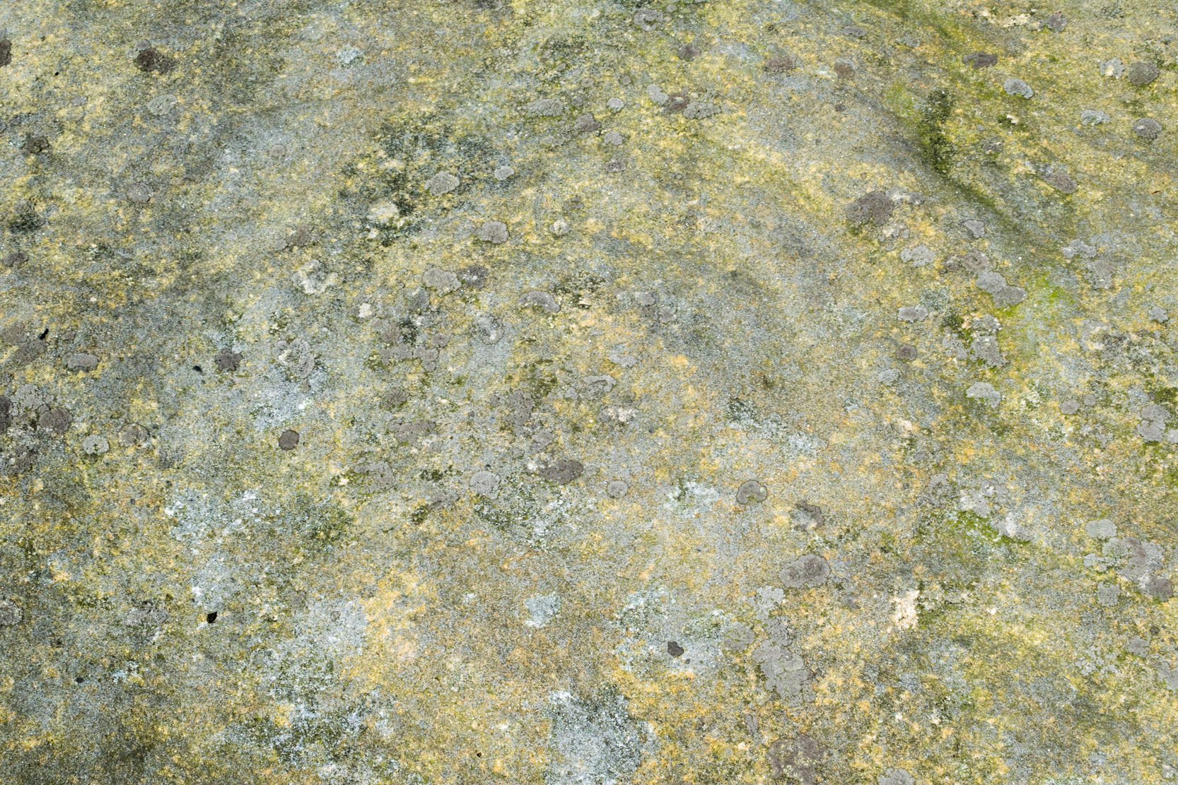
Very faint cup-and-3-ringsThimble Stones gazing south
“The Thimble Stones are a ½-mile north of the Two Eggs, with which they are nearly in line. They are of the same outcrop of stratification and appear as though they had been pushed upwards by some force acting from beneath, breaking them up with a vertical fracture, and separating them so as to leave wide spaces between the blocks. They are about a furlong in length and in front about 10ft in height, diminishing eastward to the level of the ground. Two of them a few feet apart are 7ft high, and bear on their eastern angles the cups and channels which we designate the marks of Druidic consecration.”
Subsequently, in Collyer & Turner’s (1885) work they told that the rocks “bear cups on two margins”; and when the great Harry Speight (1900) came here, he found they were “bearing cups and grooves.” Yet no-one reported any rings. And in the countless visits I’ve made here—thinking that there must have been cup-and-rings!—no such symbols have ever cried out. The various large ‘bowls’ and lines that Nature has carved here—some of which may have been important in ancient days—are all that the casual eyes can see. Until now…
The local rambler and photographer James Elkington and James Turner were up here a couple of years ago. The light was falling through a clear bright sky and so, as James likes to do at such times, he clicked his camera a few times to catch the landscape. Clambering onto the rocks, Mr Turner unknowingly stood upon the carved rings, and when he moved his foot Mr Elkington spotted them! And as we can see on the image above, only just, there’s a single cup-mark surrounded by a concentric triple ring. Incredibly faint, it is without doubt the real McCoy—and the highest of all petroglyphs on these moors. In the photo it seems that there may be other elements to the carving, but until conditions allow for a further examination, we won’t know for sure.
James is hoping to get back up there when conditions are just right so he can get clearer photos. But if you hardcore antiquarians and petroglyph seekers wanna get up there y’selves to get some photos of your own, please send us whatever you might find.
Folklore
On the esoteric side, the Thimble Stones was a place favoured by the progenitors of the ritual magickal Order, the Illuminates of Thanateros, in years gone by.
References:
Allen, J. Romilly, ‘Cup and Ring Sculptures on Ilkley Moor,’ in Reliquary & Illustrated Archaeology, volume 2, 1896.
Bennett, Paul, The Old Stones of Elmet, Capall Bann: Milverton 2001.
Boughey, Keith & Vickerman, E.A., Prehistoric Rock Art of the West Riding, WYAS: Wakefield 2003.
Collyer, Robert & Turner, J. Horsfall, Ilkley, Ancient and Modern, William Walker: Otley 1885.
Feather, Stuart, “Mid-Wharfedale Cup-and-Ring Markings,” in Bradford Cartwright Hall Archaeology Group Bulletin, 6:3, 1961.
Forrest, Charles & Grainge, William, A Ramble on Rombald’s Moor, Northern Antiquarian: Bradford 2012 (1st published 1867-69).
Hedges, John (ed.), The Carved Rocks on Rombalds Moor, WYMCC: Wakefield 1986.
Speight, Harry, Upper Wharfedale, Elliott Stock: London 1900.
Acknowledgements: Huge thanks as always to James Elkington for use of his photos.
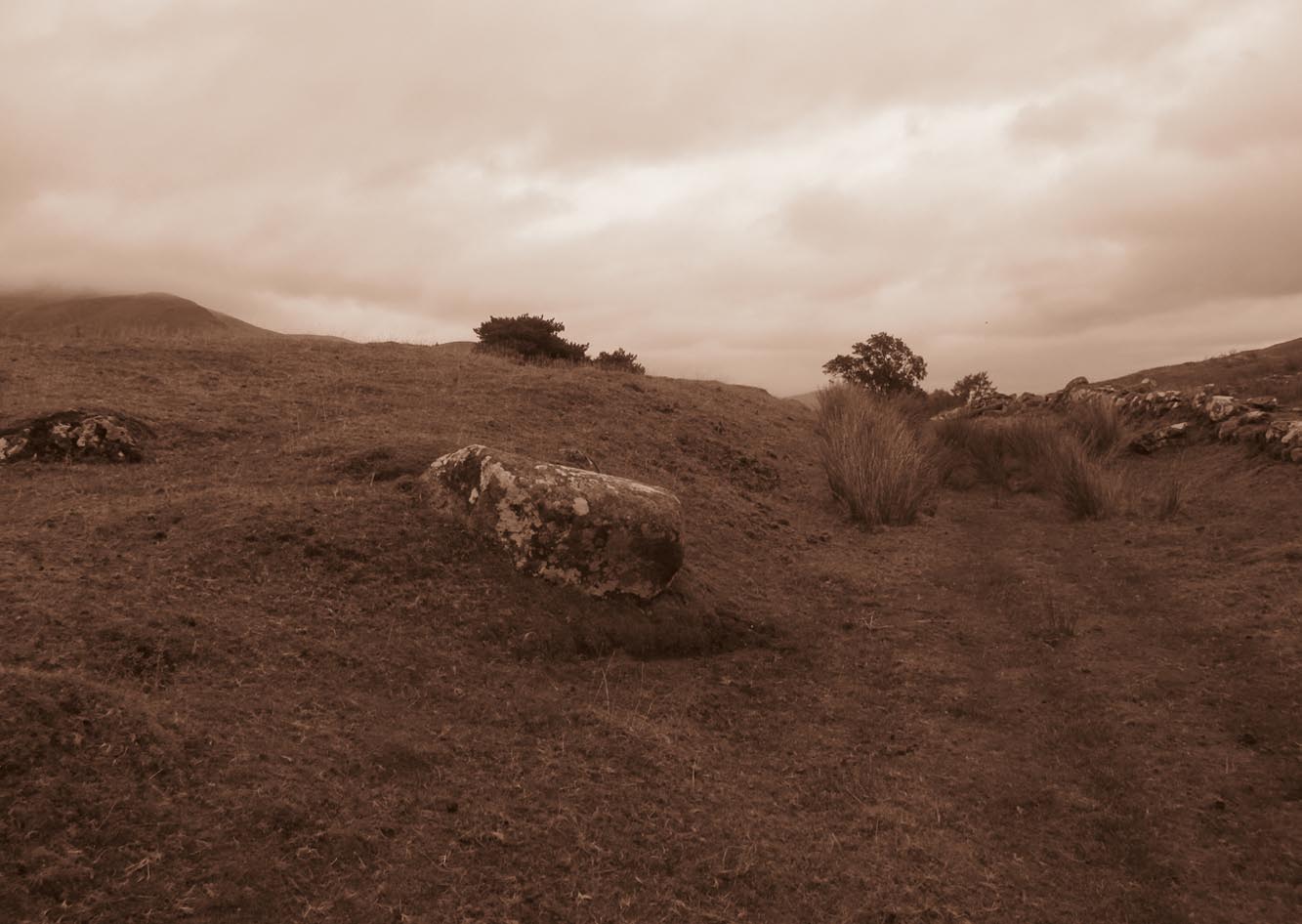
From Killin, take the A827 road to Kenmore. 6 miles along, on your right, is the track down to the Big Shed at Tombreck. Keep on the A827 for exactly ⅓-mile (0.53km), and opposite the driveway to Craggantoul is a small parking spot. A few yards on the road, over the burn, go thru the gate on your left and walk up the path for less than 100 yards. The stone is just a coupla yards on your right (if you reach the derelict tractor, you’ve gone about 10 yards past the stone).
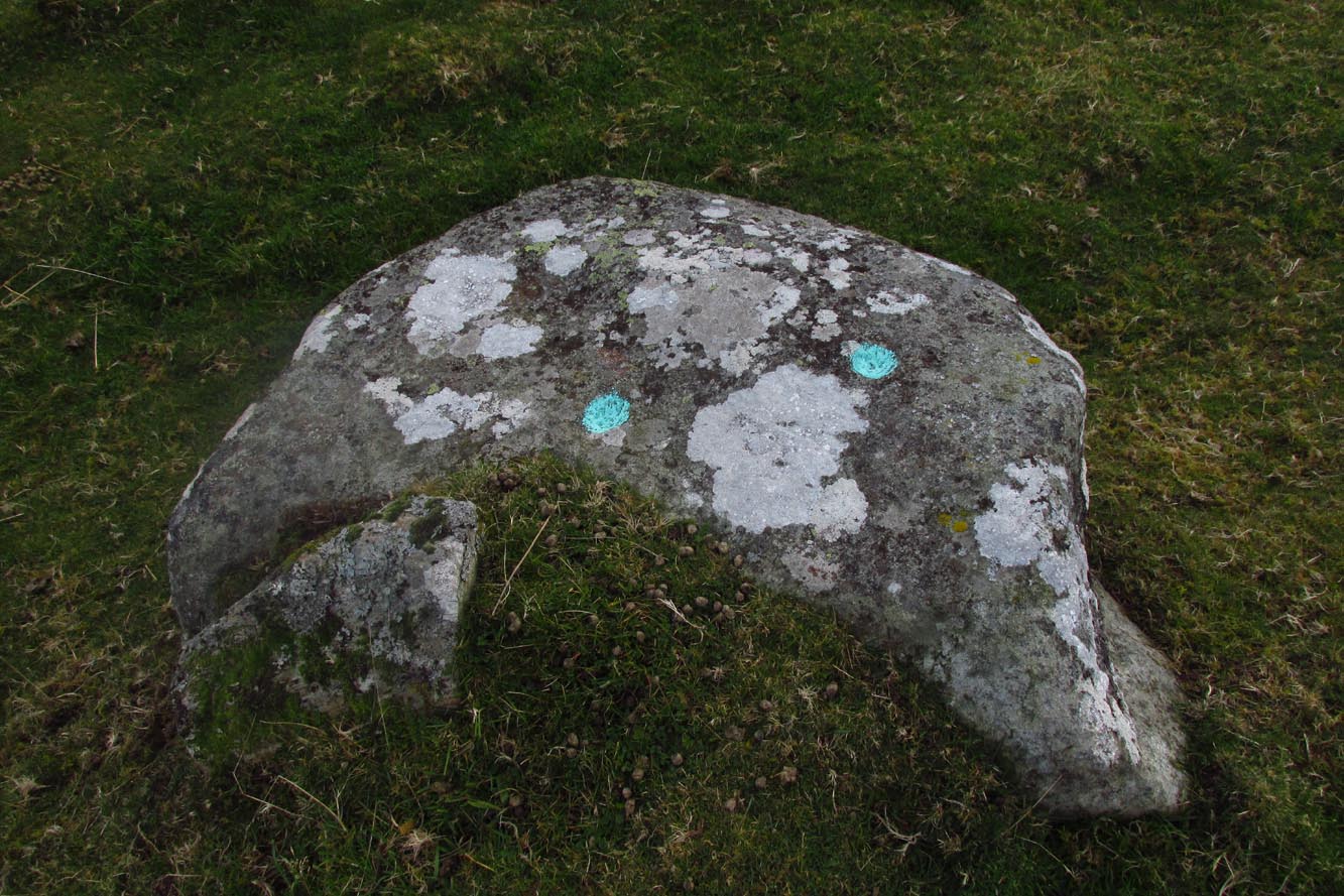
Archaeology & History
Cupmarks along the top
This is another one of the many simple cup-marked petroglyphs scattering the Cragganester and Tombreck regions beneath the slope of Ben Lawers. It’s an elongated, smoothly-shaped ‘female’ stone, aligned north-south, possessing four distinct cups along its crown: three in a small line at the south-end of the stone and a single one close to the north end. However between these is what may be another, shallow fifth cupmark—but this is uncertain.
One notable feature here is that the rock is encrusted with small garnets. This geological ingredient isn’t uncommon in this area, and we’ve found that quite a proportion of the petroglyphs hereby possess this feature. It was probably of some importance to the people who carved them.
Acknowledgements: Thanks to Paul Hornby for use of his photograph.
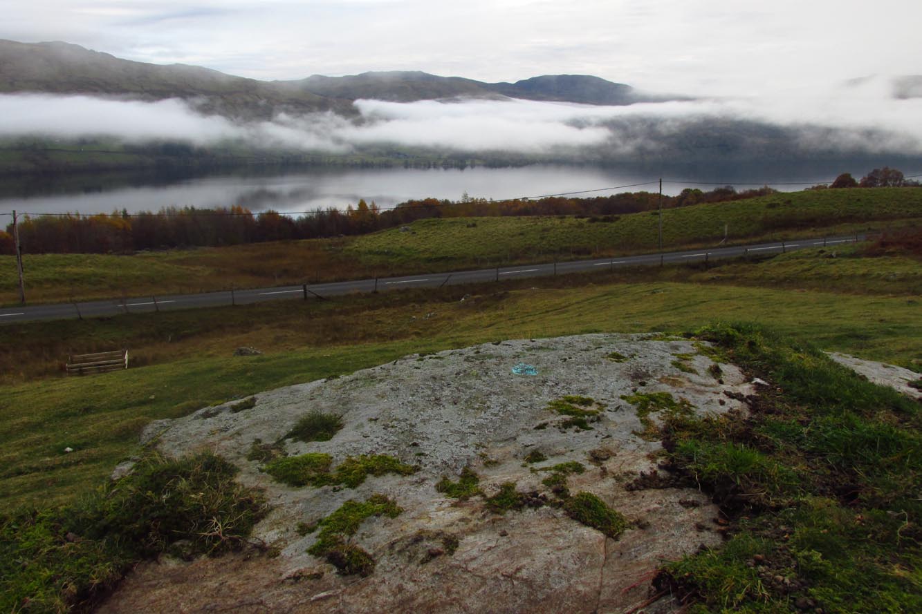
Although you could just as well follow the directions to reach the Cragganester 22 carving (exactly 100 yards away), it’s probably easier to get there from where the track leads down to Balnasuim, but there’s nowhere to park any vehicle here—unless you’re on a bike! Across the road from the Balnasuim track is a gate. Go thru this and then follow the fence immediately on your left, running parallel with the road for roughly 250 yards (218m), until you reach a denuded wall that runs onto the hillside above you. Follow this up for roughly 200 yards (96m) until you reach a grass-lined track. Walk to your left and keep your eyes peeled for a reasonably large rounded boulder next to the track 40 yards on. That’s it!
Archaeology & History
2 cupmarks highlighted
This is one of the many simplistic petroglyphs in the Cragganester complex, probably only of interest to the fanatics amongst you! There are two distinct cup-marks on this nice rounded ‘female’ stone, one near the top and one near the middle, amidst the olde lichen growth. Loch Tay stretches along the glen below here, but only a portion of it is visible nowadays. In times gone by, tree growth probably prevented any vision of the waters below…
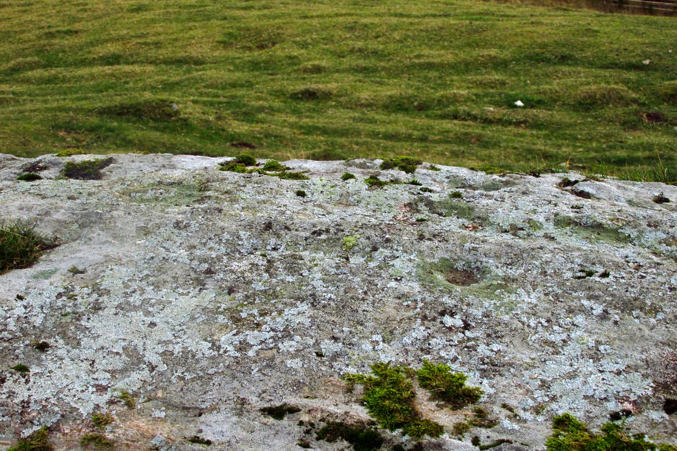
It’s a bittova pain-in-the-arse to reach this and its associated carvings, as there’s little place to park along here. The easiest is to park 600 yards east of Tombreck at the spot just by the small bridge at Craggantoul. Keep your eyes truly peeled! From here, walk along the road for ⅔-mile where you’ll hit a gate taking you onto the boggy hillside. Go diagonally up here for 150 yards where you’ll hit an overgrown track and small disused quarry. Some 50 yards along you’ll see a small rock outcrop on your left (as if you’re going back to the road). That’s the spot!
Archaeology & History
Close-up of cupmark
Not previously recorded, this simple petroglyph on a small rock outcrop—barely 50 yards above the A827 Killin-Kenmore road—comprises of one clear cup-mark prominently etched near the middle of the upper surface; and another possible cup on the left (eastern) section of the rock. Cragganester carvings 19 and 20 are respectively about 100 yards NE and NW of here but, like other carvings nearby, is only gonna be of interest to the fanatic nutters out there!
From Killin, take the A827 road to Kenmore. 6 miles along, on your right, is the track down to the Big Shed at Tombreck. Keep on the A827 for exactly ⅓-mile (0.53km), and opposite the driveway to Craggantoul is a small parking spot. Go through the gate here and walk up the little hill right in front of you until you can see an electricity pylon 200 yards away. Head for, go up the slope behind and along until you drop into a tiny little valley where a long line of very distinct old walling runs east-west. Walk back and forth along it till you see a reasonably large earthfast stone on its own.
Archaeology & History
Close to a long line of what I think is pre-medieval walling—possibly Iron Age—is what can only be described as a truly crap-looking petroglyph which, to be honest, I’d walk past and give not a jot of notice if it wasn’t for the fact that it’s been recorded. When we visited here, three very worn large cup-marks were visible on its sloping west face, with what looked like two more on top of the stone—but these seemed questionable in terms of them being man-made. Apparently there’s another one on it, but in the searing heat and overhead midday sun when we visited, this couldn’t be seen.
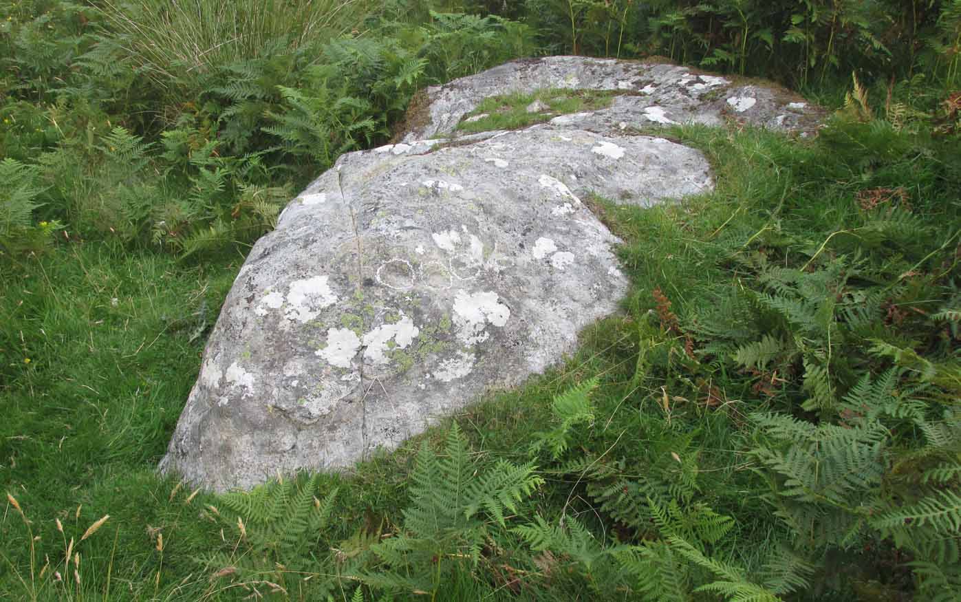
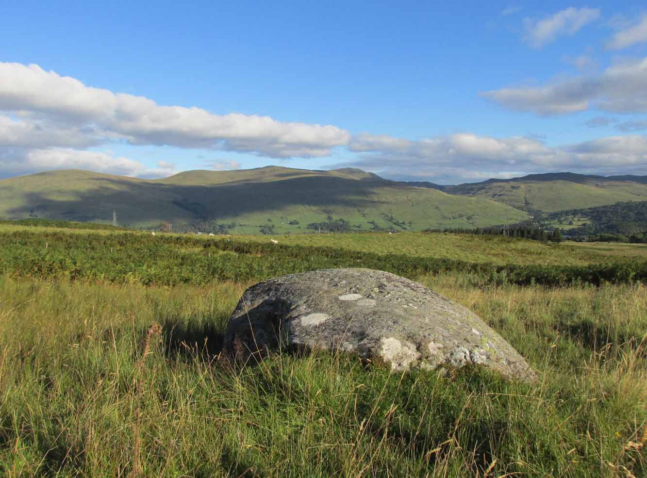
From Killin, take the A827 road to Kenmore. 6 miles along, on your right, is the track down to the Big Shed at Tombreck. Keep on the A827 for exactly ⅓-mile (0.53km), and opposite the driveway to Craggantoul is a small parking spot. A few yards on the road, over the burn, go thru the gate on your left. Follow the straight line of walling up for 800 yards where the walling hits the burn, then follow the water up until you cross a fence. Once over this, 50- yards to your right you’ll see a large rounded rock and companion. It’s the rounded rock.
Archaeology & History
As with most the carvings along here, it is the setting that captivates more than the petroglyph. This is another one mainly for the purists amongst you, but there’s a distinct feel of other carvings hiding very close by that remain hidden. Anyhoo…
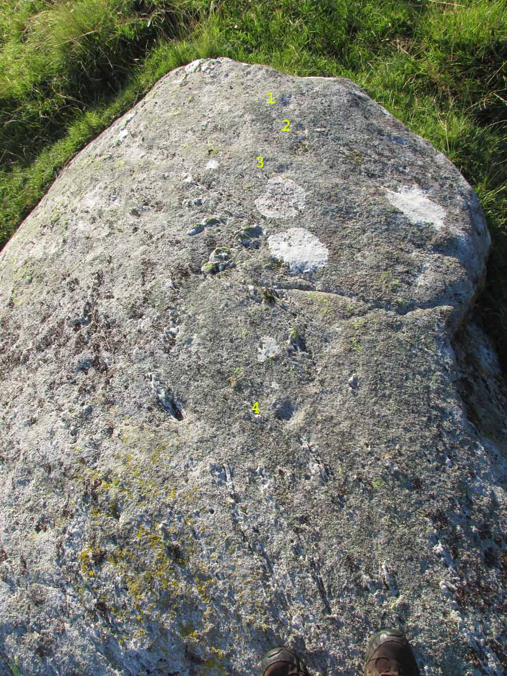
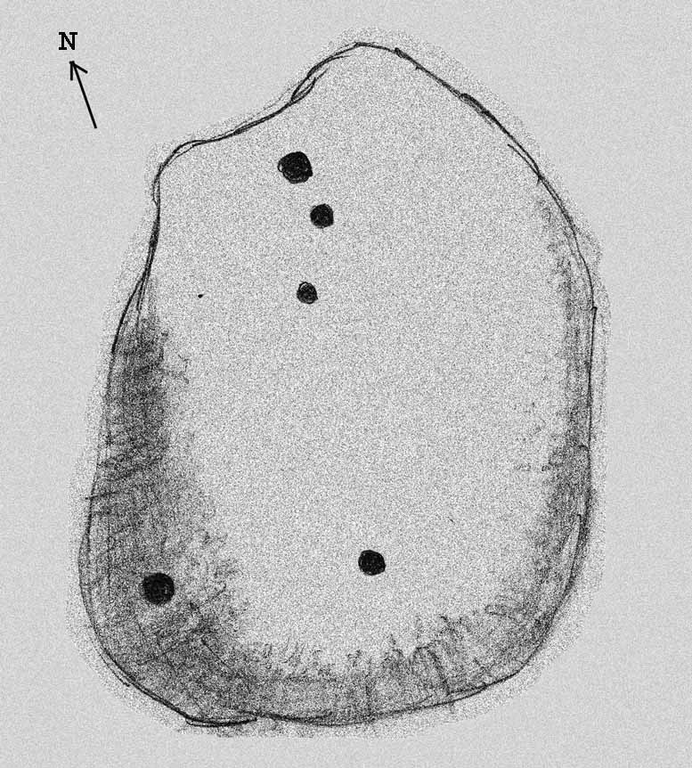
4 of the cups numeratedRough sketch of design
This reasonably large, rounded, female stone has the usual scatter of quartz in its veins, along with at least four cup-marks on its upper sloping surface. Three of them are seen in a slight arc on the more northern slope of the stone with one of them particularly faint; but the most notable of the lot on the very crown of the stone. (see the numerated image, right) A fifth cup-mark is clearly visible on the western face of the boulder, shortly below where the rock begins to level out. You’ll see it. Some 200 yards west of this carving, the prominent rock hosting the Cragganester 10 carving is visible on top of its rounded knoll.