Sacred Well: OS Grid Reference – SD 9795 3629
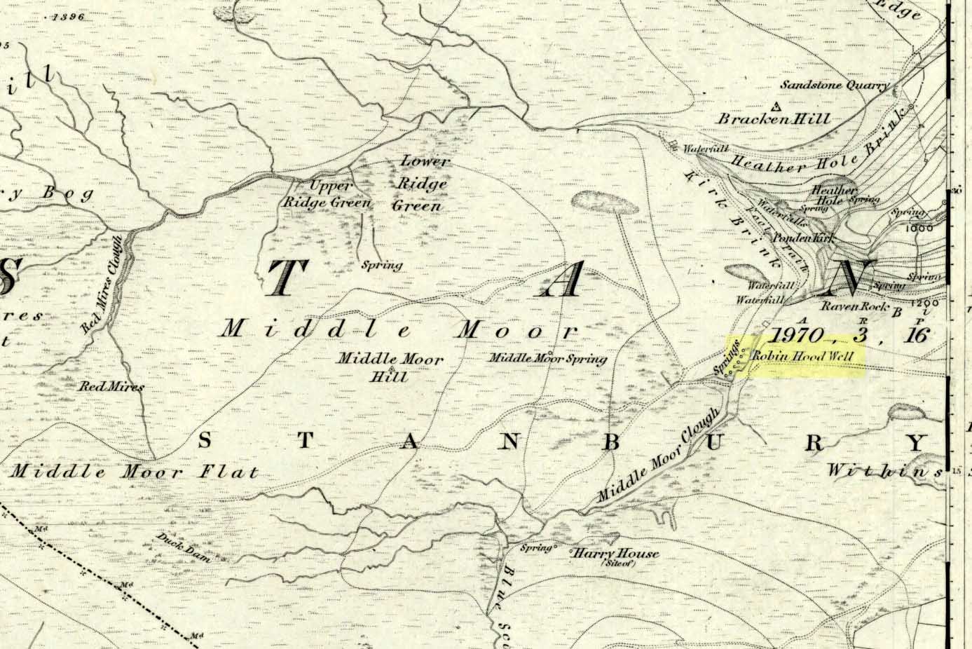
Follow the same directions to get to the nearby Ponden Kirk and, once on top of the rocks, overlooking the valley, walk on the footpath to your right. It bends round and follows the stream up onto the moors. About 100 yards along, walk up the heathery slope to the right and you’ll find several boggy watering holes on the top of the ridge. In looking at the first OS-map of the area in 1853, it seems that the northernmost of six boggy springs is the Robin Hood’s Well – although we don’t know this for certain. It’s one of them though!
Archaeology & History
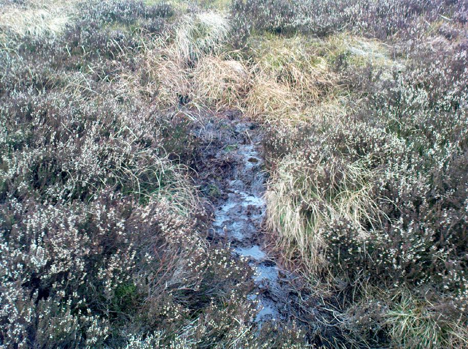
There’s little to see here really: it’s little more than a small boggy spring of water emerging from the edge of the ridge, as the photo shows. Curiously, descriptions of the site (and its neighbouring compatriots, Will Scarlett’s Well and Little John’s Well) are sparse aswell. It was noted by the Ordnance Survey lads in 1848 and subsequently posted on the first OS-map of the area in 1851. Both Horsfall Turner (1879) and Johnnie Gray (1891) mention the site passing, saying nothing of the place. However, several years after Gray’s work, Halliwell Sutcliffe (1899) ventured here and gave us the first real description of the place, telling:
“Half-hidden underground, and fringed with fern and bog-weed, lie the three wells which go by the names of Robin Hood, Little John and Will Scarlett. One may stop to ask how they came by their birth-names, to wonder why a man should have troubled to fashion them in this out-of-the-way spot; but neither speculation nor questioning of the moor folk brings one nearer to an answer.”
Folklore
Apart from this site being a spot where the legendary outlaw stopped and drank in ages past, the healing attributes of these waters have long since been forgotten. Considering the proximity of the Ponden Kirk and its legendary association with fertility and marriage rites, I’d guess that such lore wold have centred around Beltane, or Mayday; and Robin Hood is very well known in folklore to have close associations with the same period. So — and I’m guessing here — it’s likely that whatever might have occurred at this well, would have taken place around Beltane aswell.
References:
- Gray, Johnnie, Through Airedale from Goole to Malham, Walker & Laycock: Leeds 1891.
- Sutcliffe, Halliwell, By Moor and Fell in West Yorkshire, T. Fisher Unwin: London 1899.
- Turner, J. Horsfall, Haworth, Past and Present, Hendon Mill: Nelson 1879.
© Paul Bennett, The Northern Antiquarian