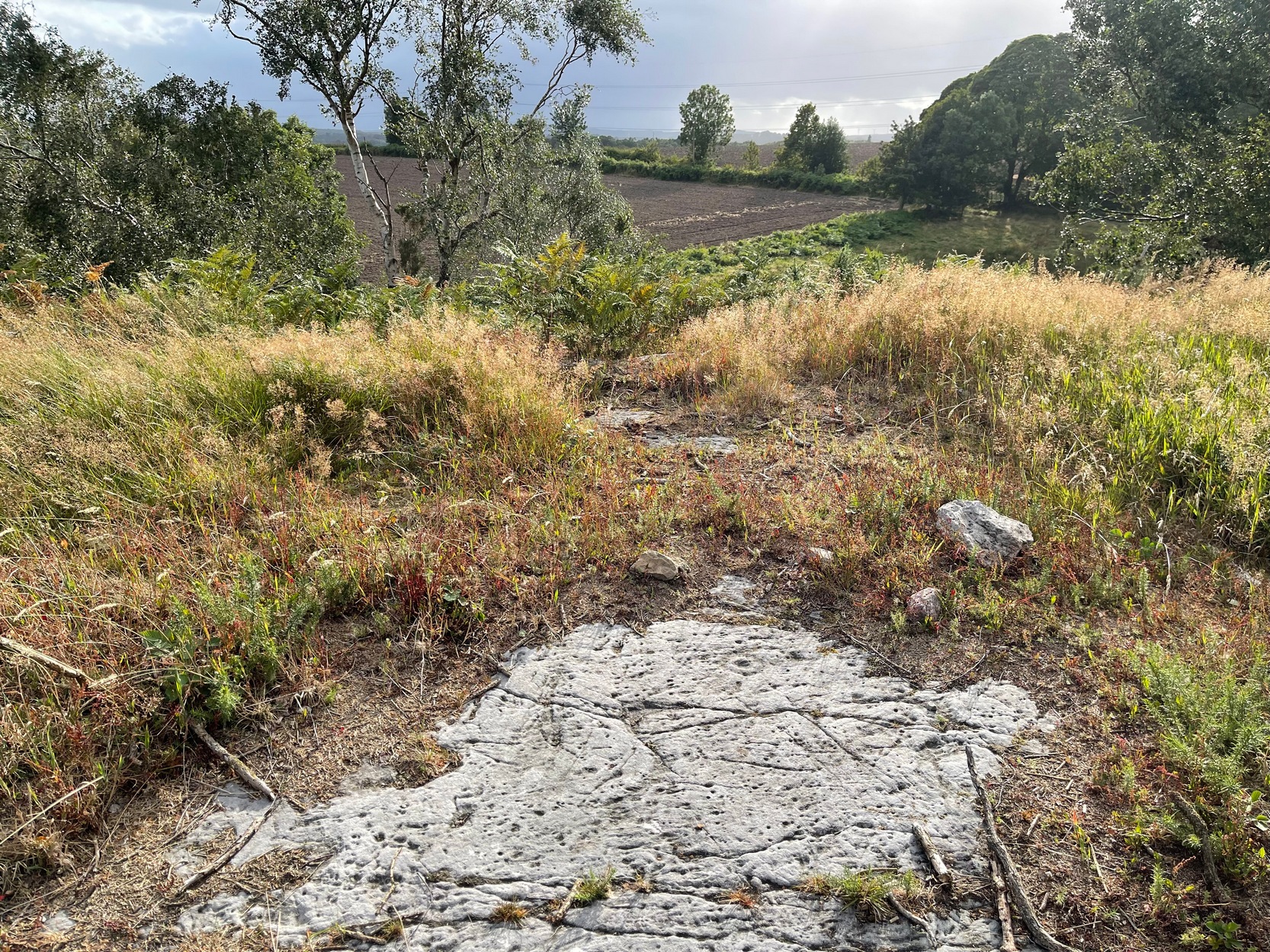
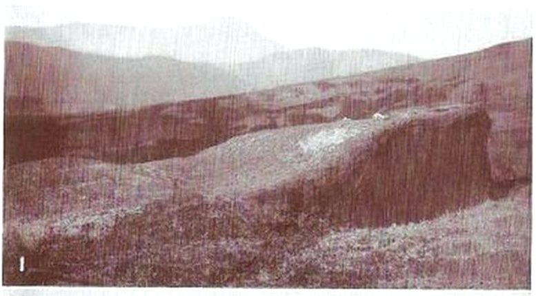
If you start from the Castleton (2) carving, in the first small birch copse closest to the road, walk to its southeast side where there’s a small break before the next small birch copse begins which runs along the raised rocky crag to the southeast. Walk along the back lower east-side of these birches for about 100 yards until you reach a break in the copse (the next lot of trees are another 30-40 yards further on) and from here walk up the slope onto the first flat piece of rock on the crag itself. Zigzag hereabouts until you’re about two or three yards from the edge.
Archaeology & History
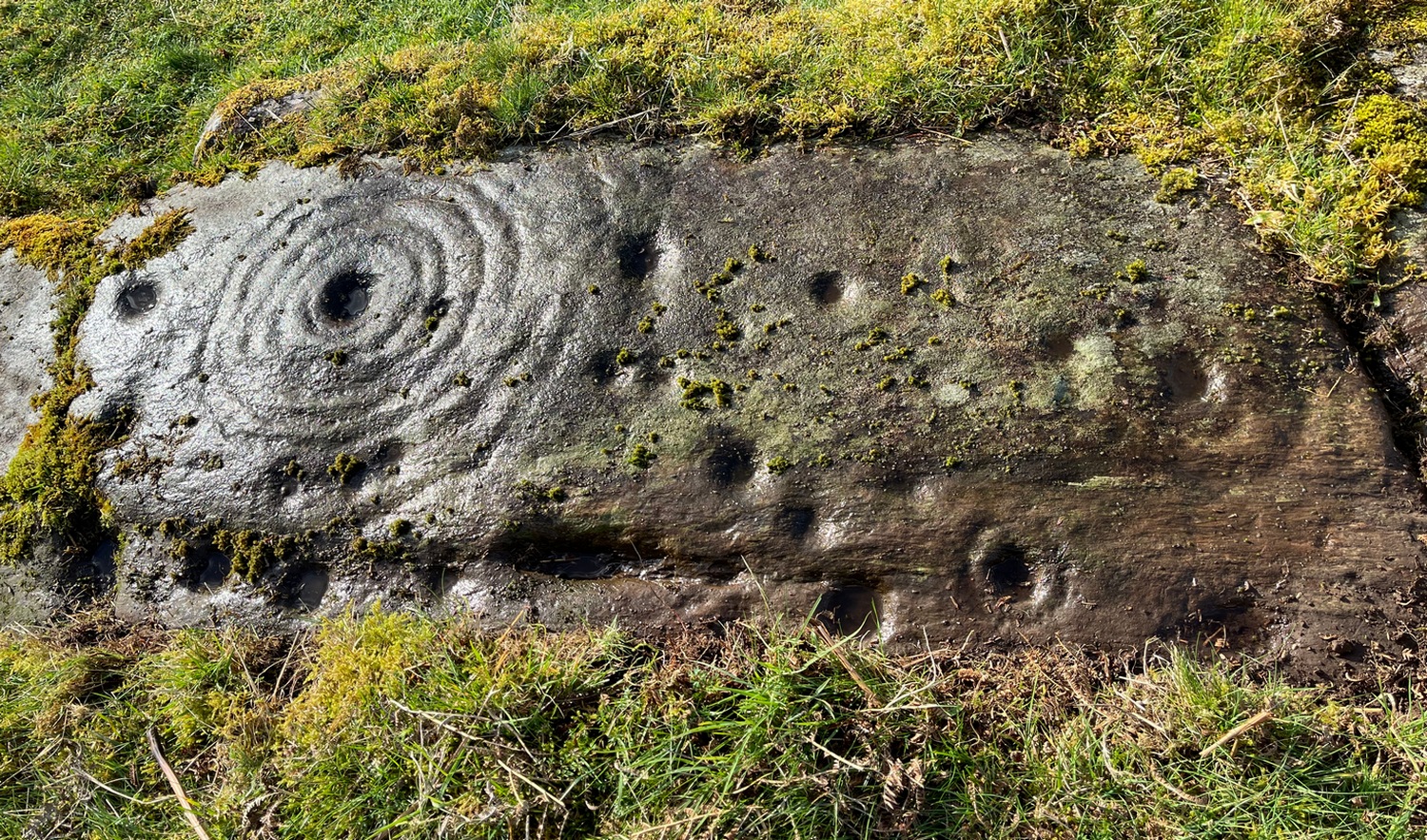
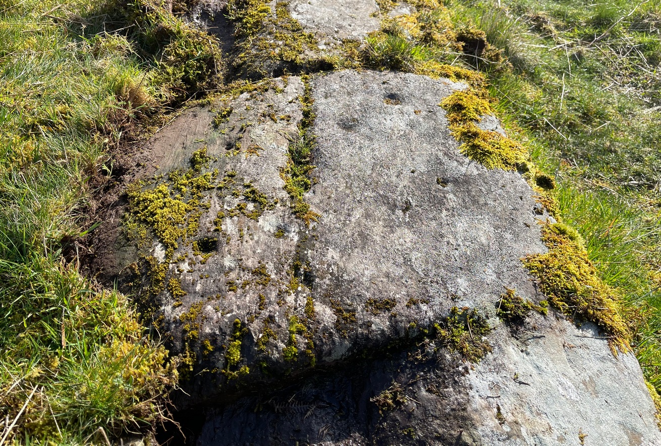
Single cup-and-ring
Once this rock surface is covered again by Nature’s carpet, you’ll struggle to find it. Unlike many of its more ornate neighbours, this seems to be a lonely solitary cup-and-ring design, cut near the edge of a large level piece of otherwise blank rock. Numerous geological nicks and scratches scatter the same surface, but the carved element is easy enough to see, as the photos here show. It was rediscovered in the 1980s by Morris & van Hoek (1986) who described it simply as “a single cup and one ring, 8cm in diameter on horizontal rock.” There may well be additional elements to this design beneath the soil.
References:
Morris, Ronald W.B. & van Hoek, Maarten, “Stirling District: Castleton 4d; Castleton 5e,” in Discovery & Excavation, Scotland, 1986.
Acknowledgments: Massive thanks to Thomas Cleland for helping to make this site visible again.
Start from the Castleton (2) carving, in the first small birch copse closest to the road and walk to its southeast side where there’s a small break in the trees before the next small birch copse begins, which runs along the raised rocky crag to the southeast. Walk to the front or western side of the trees there and along the very edge of the low crag. About thirty yards along, right on the edge of where the rocks begin, look for the smooth sloping earthfast boulder (about 20 yards before the mighty nine-ringer of Castleton 7). Rummage around and you’ll find it.
Archaeology & History
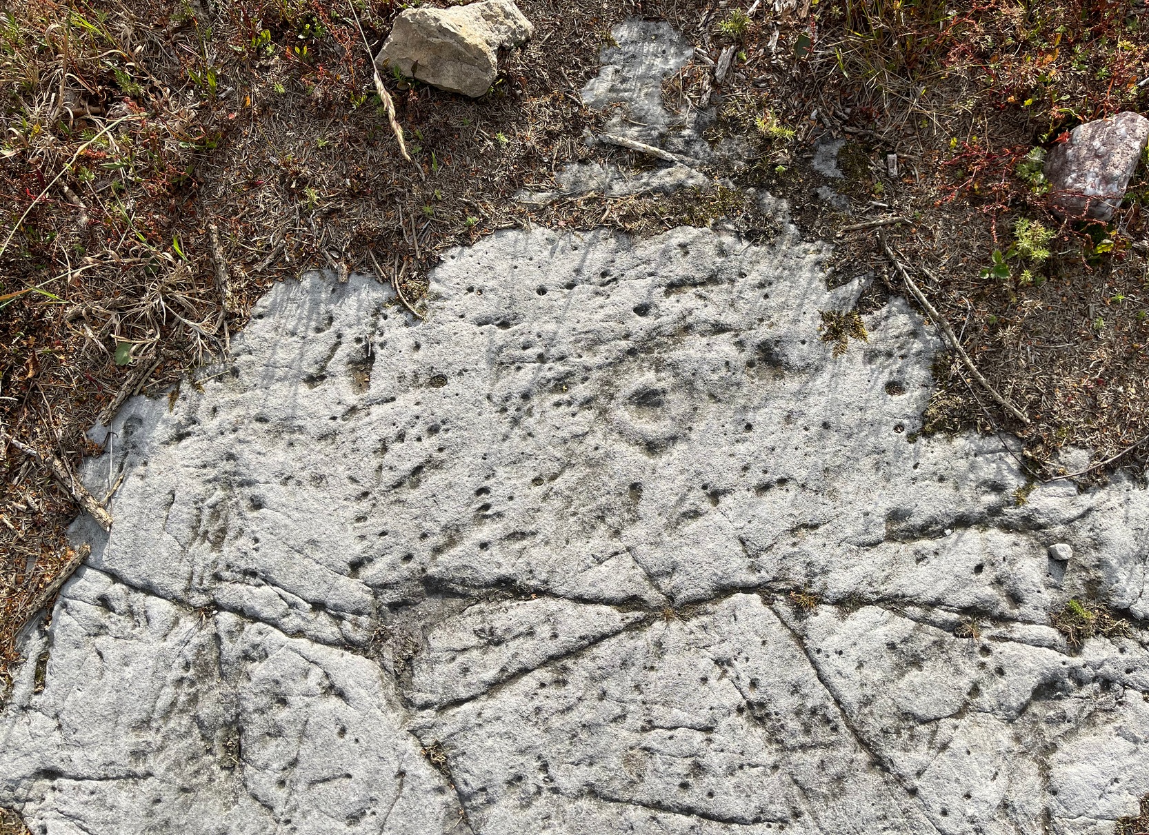
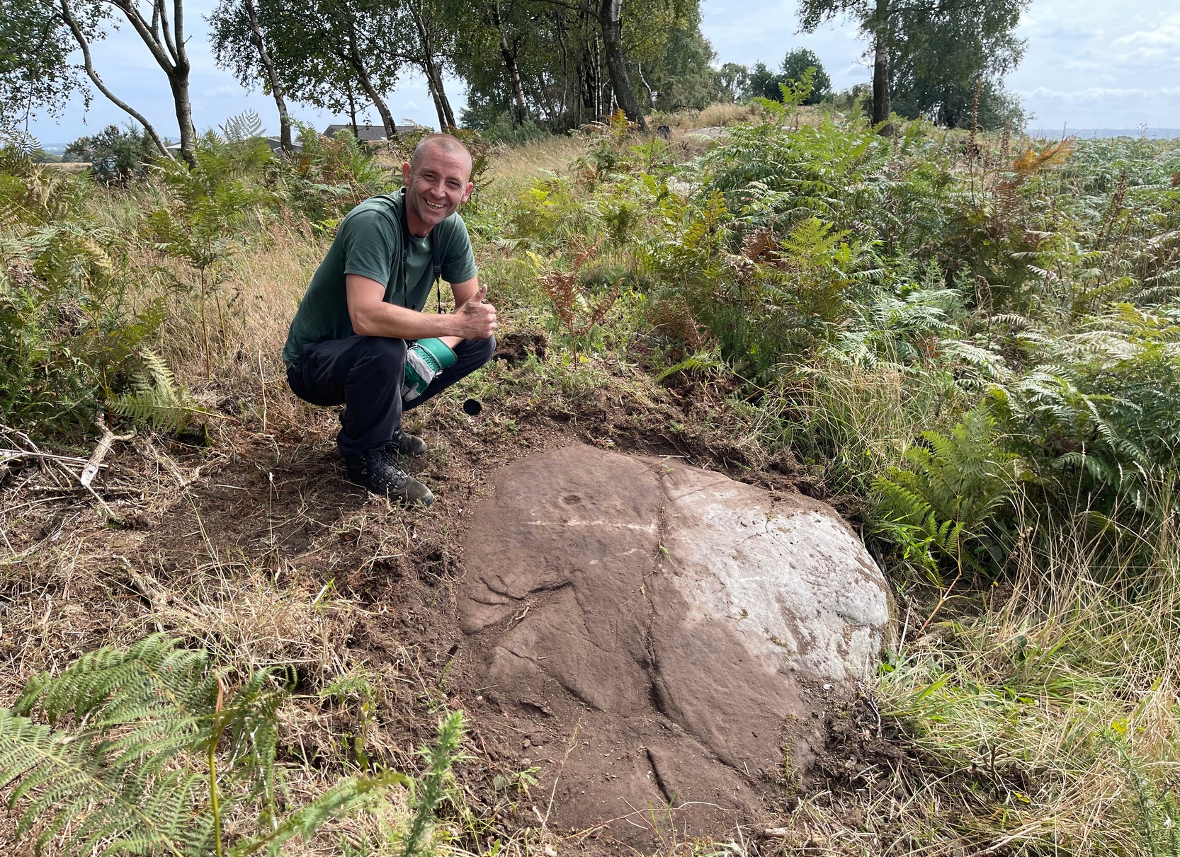
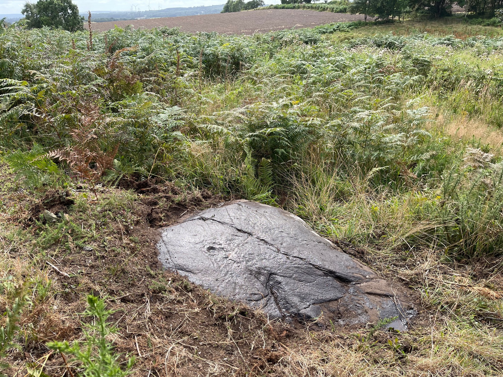
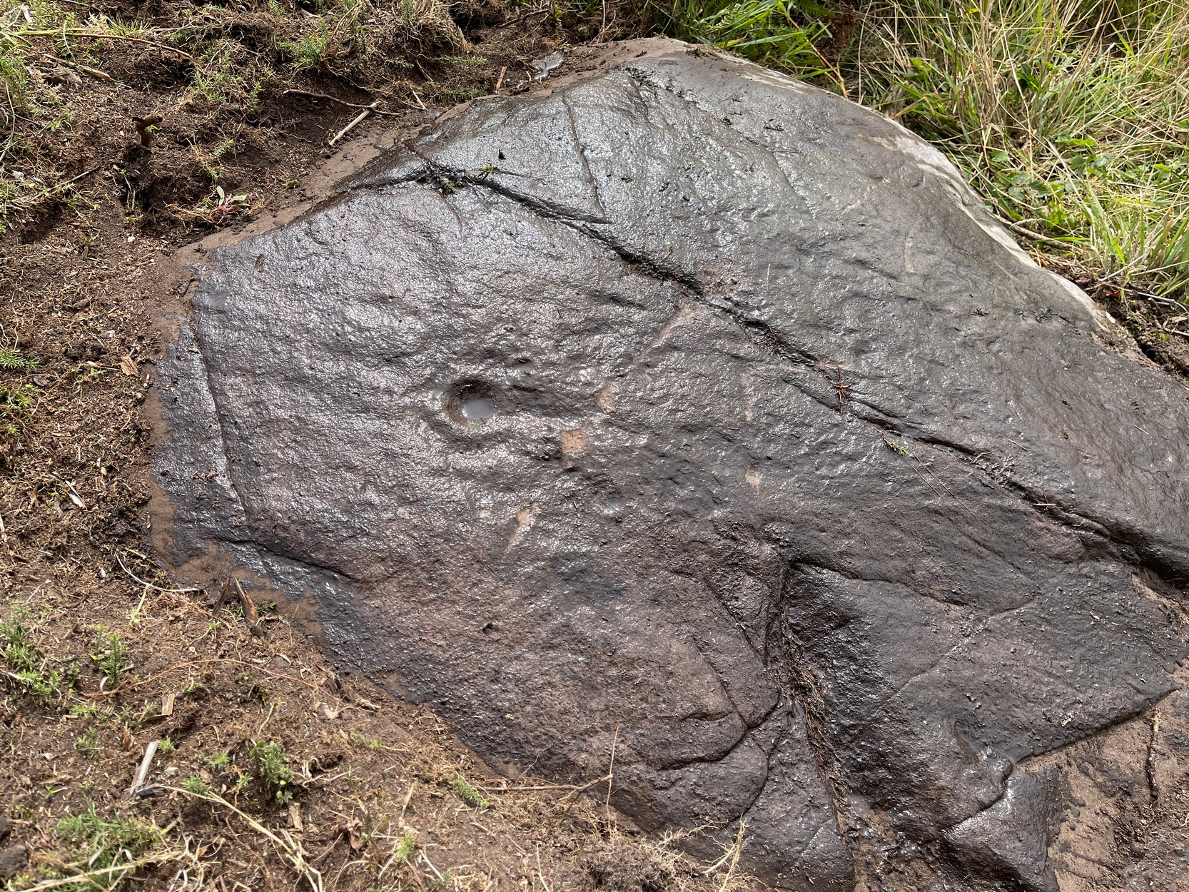
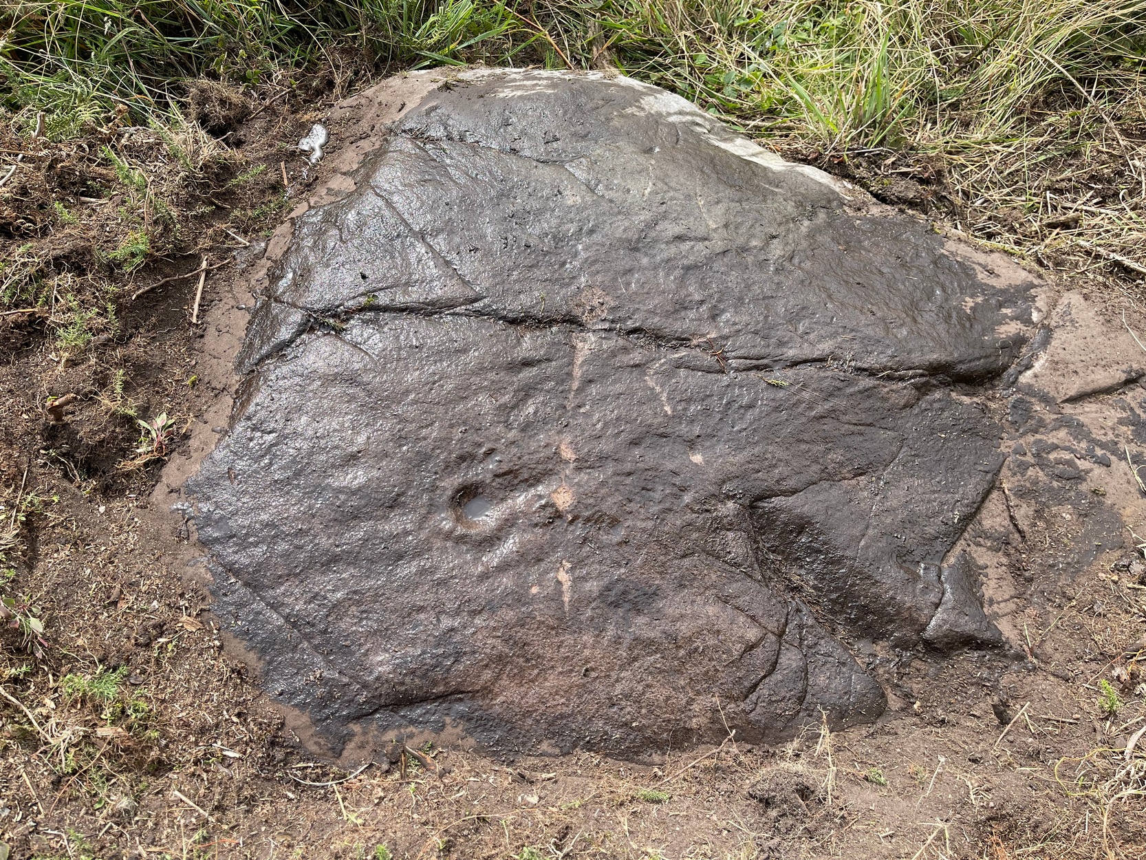
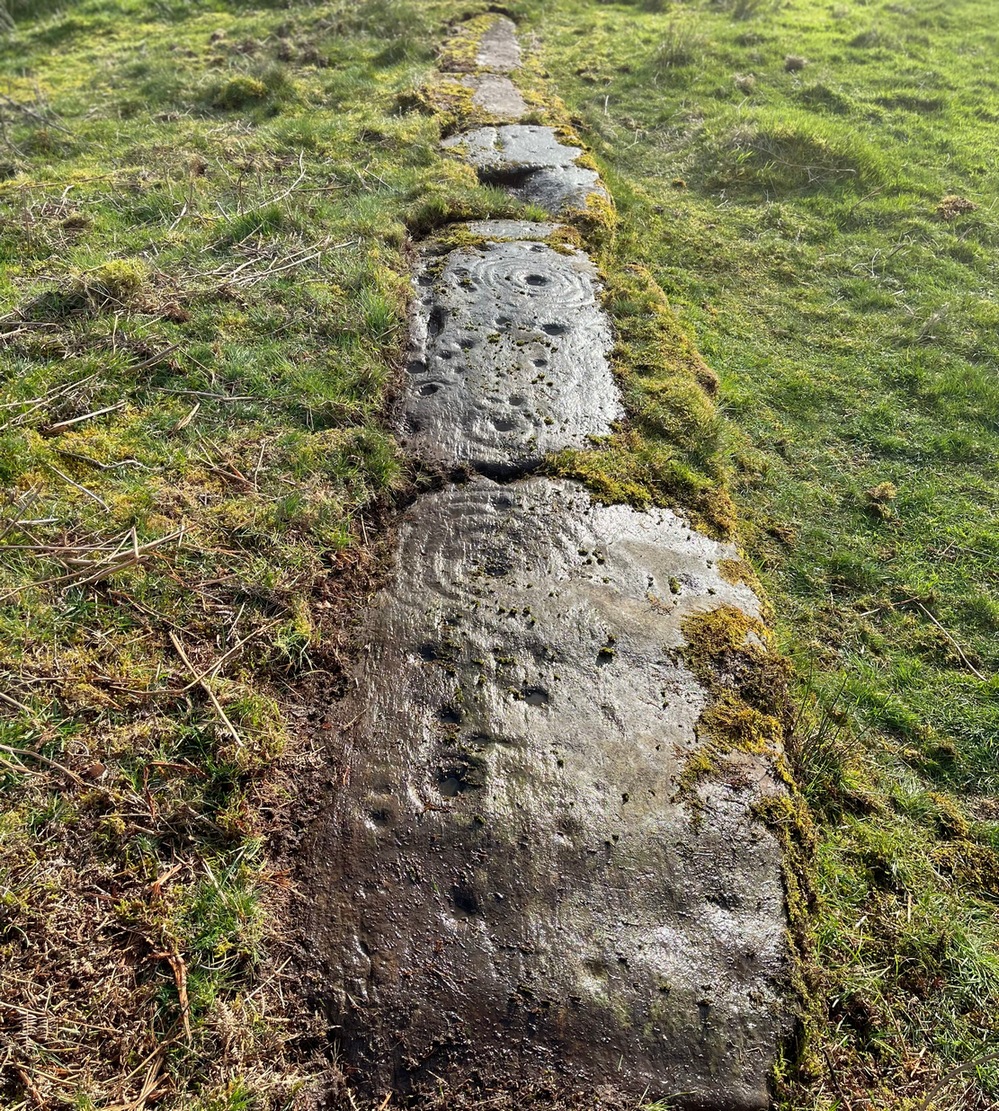
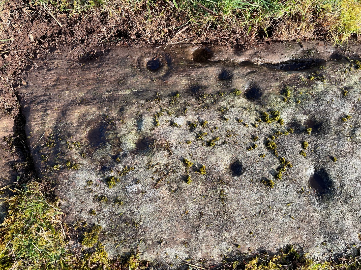
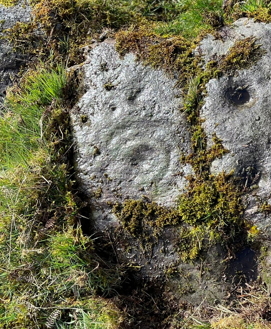
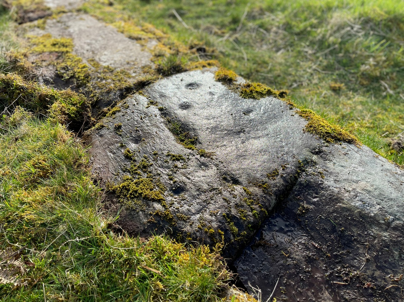
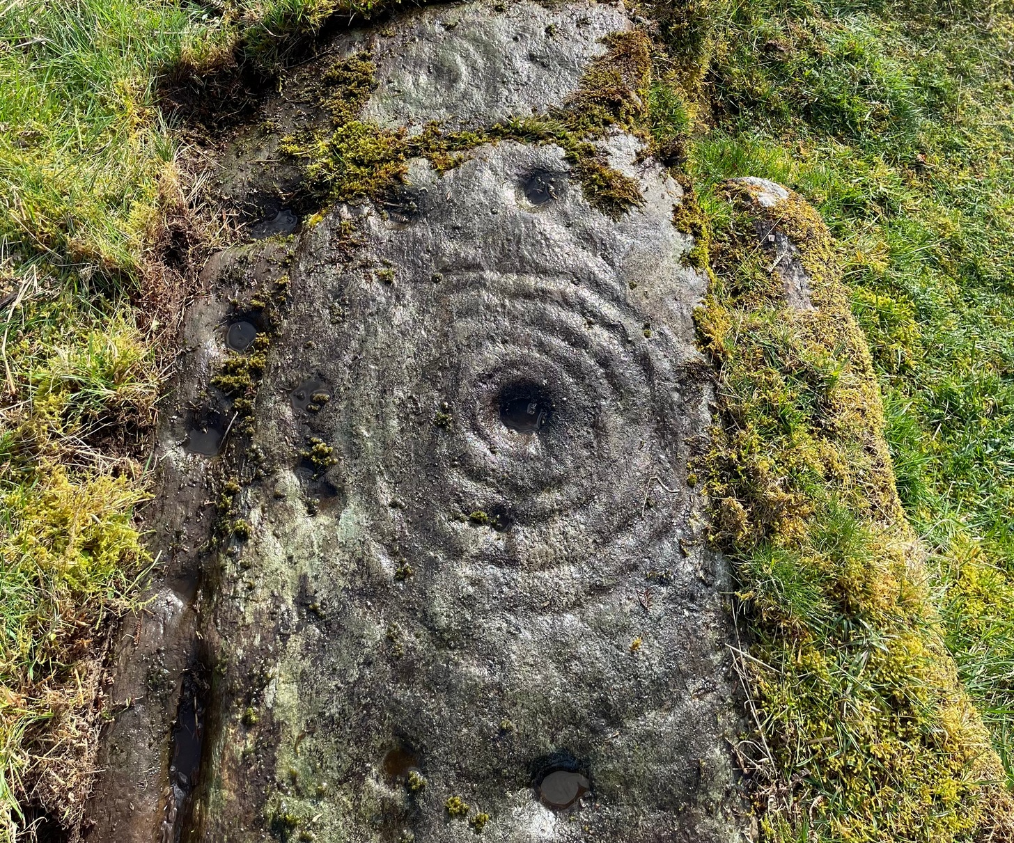
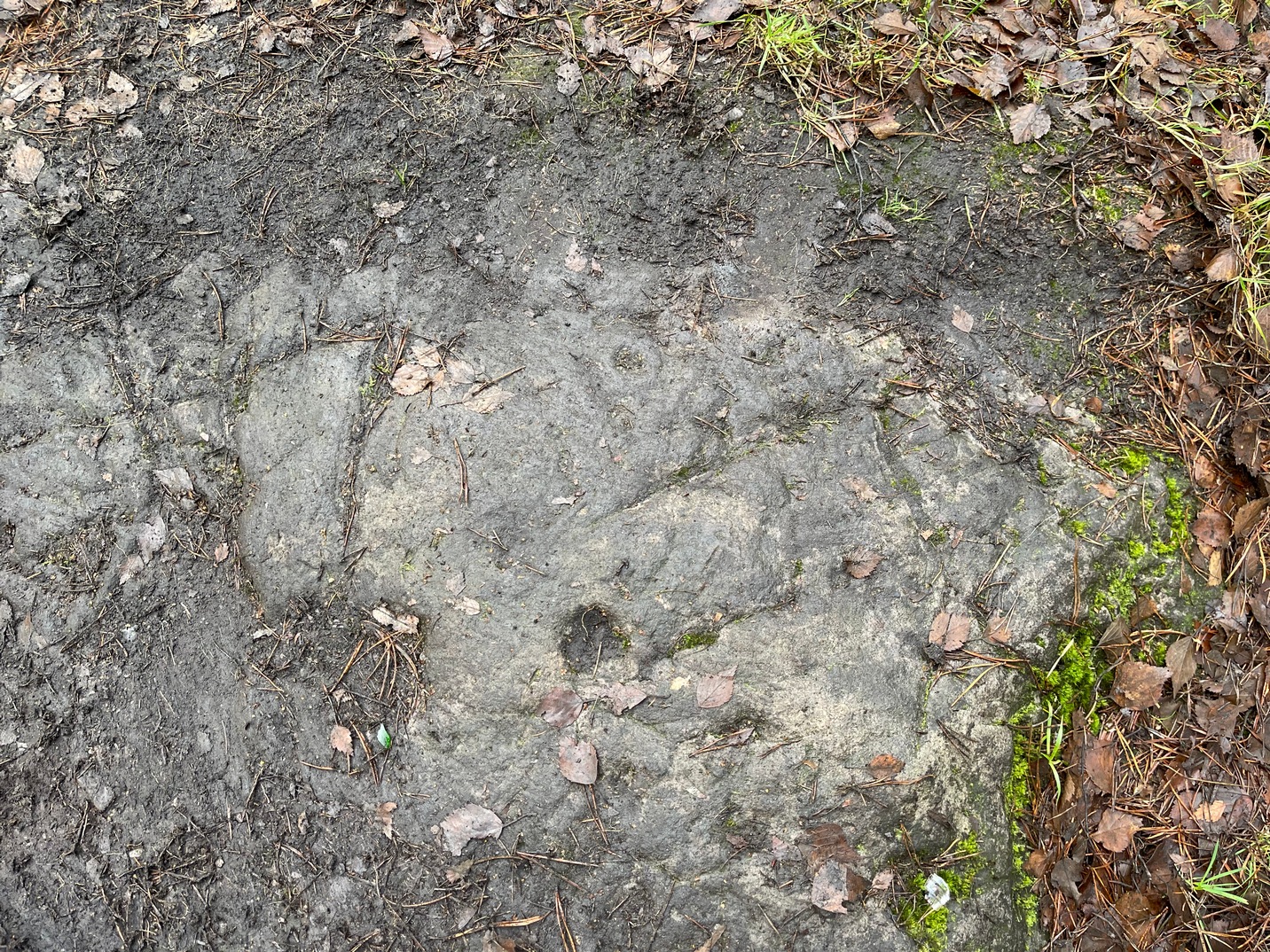
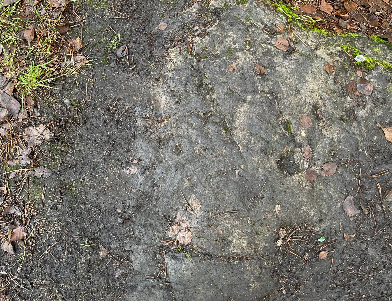
Castleton (7e) carving
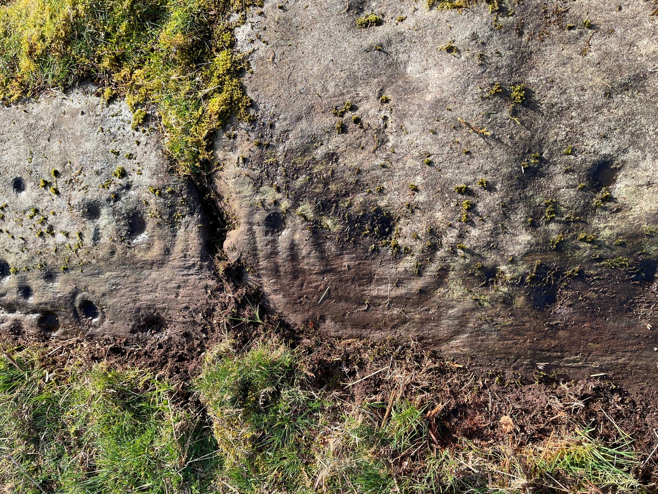
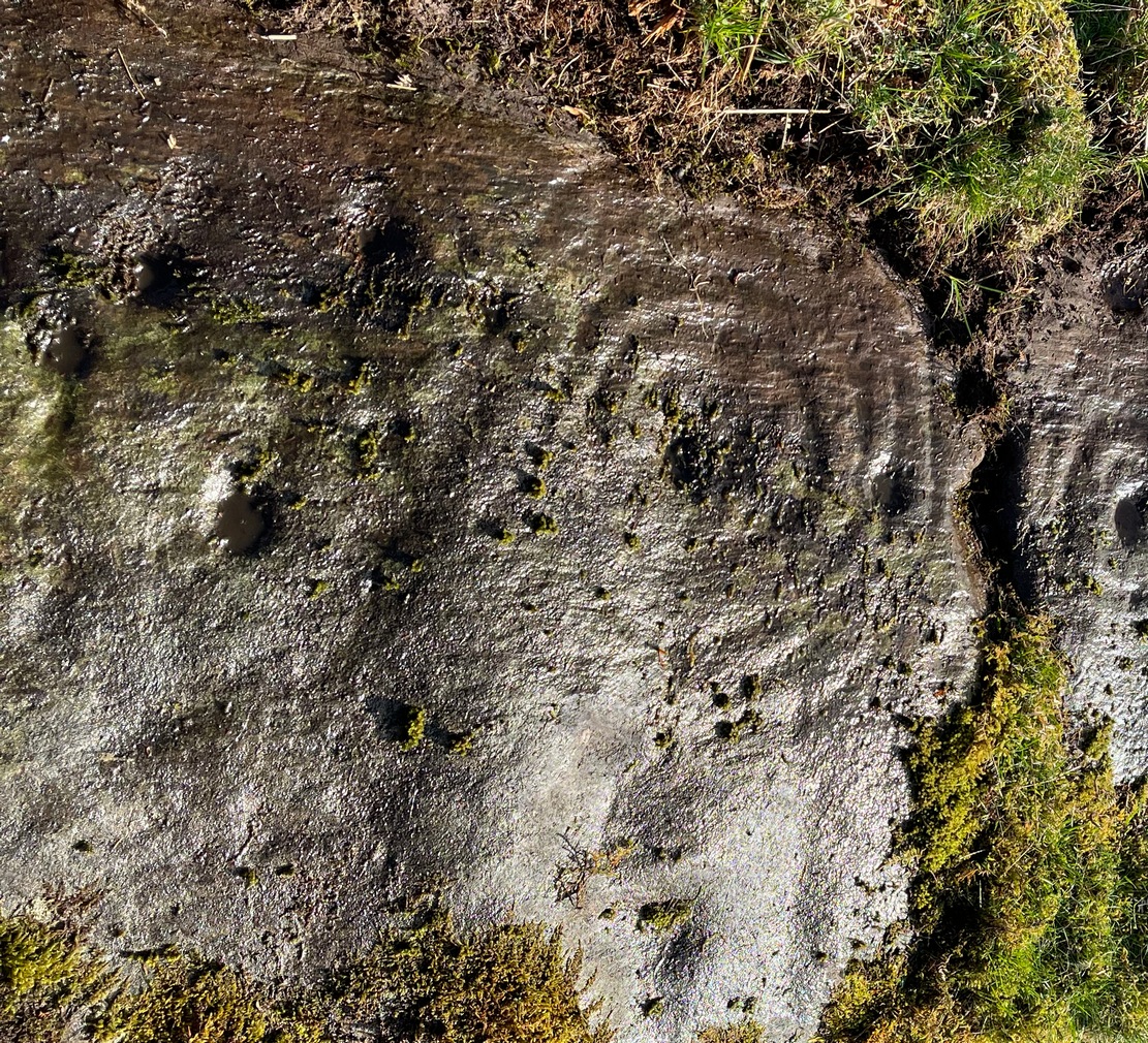
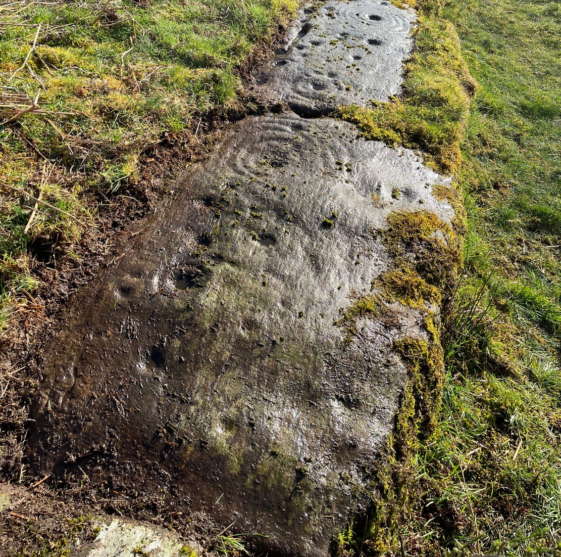
This newly recorded petroglyph was rediscovered by Thomas Cleland on August 6, 2025. Initially it was thought to consist of just a single cup-and-ring with an opening from which a carved line ran outwards; but, once wet, there seemed to be the beginning of an outer second-ring on its left-side. You can see it clearly in the photos. And, the more we looked, the more it seemed there were one or two other very faded elements.
Above the main cup-and-ring is a faint, shallow cup-marking and surrounding this appears to be an incomplete dumb-bell-shaped ‘ring’ that you can only just make out in the photos. It’s very faded and would seem to pre-date the primary design by some considerable time (unless, of course, it was merely ‘outlined’, so to speak and never completed).
Cup & ring & faint ‘bell’Cup & ring & faint ‘bell’
Both Tom and I are convinced that there’s more to this carving than is presently visible. The rock is covered in deeply compacted soil and it would require a lot of work to uncover the rest of it. A job for the future maybe…..
Note to self: This carving and all the others in the Castleton complex need to be fully re-catalogued as their indexing is haphazard through various academic tomes and websites.
Acknowledgements: Massive thanks to Thomas Cleland for locating this carving, for the first time in millenia. 🙂
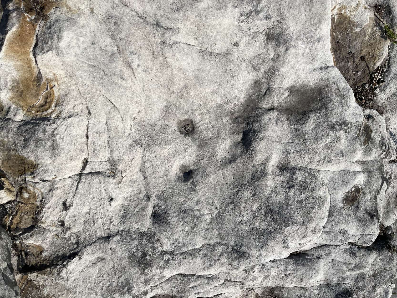
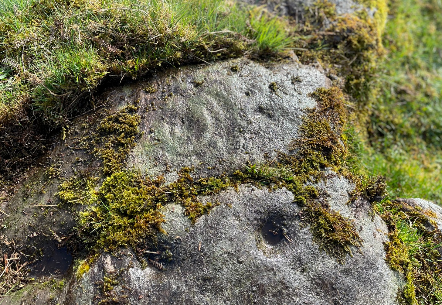
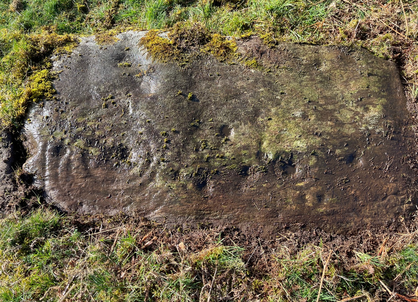
Follow the directions as if you’re visiting the impressive multi-ringed design of the Castleton (10) carving. Once there, walk south-east along the geological ridge for 45 yards where the small cliff drops down to the field. Just where this drop occurs, on a lower horizontal level of the rock face (only a small section) you’ll notice two distinct “cups”. You can’t really miss it!
Archaeology & History
This very basic cup-marked stone was, until recently, covered in dense gorse, making access to the site almost impossible. But following a fire that happened here not too long ago, the smoldering remains needed to be cleared and, once the job was done, we were able to see the two distinct ‘cups’ that were first described in Maarten van Hoek’s (1996) survey. But the cups that he described are, most likely, little more than Nature’s handiwork. I’m somewhat skeptical of them as being the real deal. In the same survey, he added another site, which are just natural bowls in the rock just over 100 yards southwest of here as being cup-marks — which they’re not!
References:
van Hoek, M.A.M.,”Prehistoric Rock Art around Castleton Farm, Airth,” in Forth Naturalist & Historian, volume 19, 1996.
In Miss Maitland’s (1935) article on the Ledard Stone carving, she also made a brief mention of “another cup-marked stone (that) lies on the edge of the burn, beyond the one described, above Loch Ard.” She gave no further information about this second stone. It remains lost and sounds to be only a short distance further uphill and on the west-side of the burn. If any local explorers are able to find this carving please let us know and, if possible, add some info and photos of it on our Facebook page. (the grid-reference for this site profile is an approximation)
References:
Maitland, Mrs, “Cup Marked Stones”, in The Scottish Country Woman, 1935.
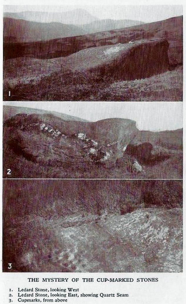
This carving hasn’t seen the light of day, seemingly, since it was first reported by a local lady, a Miss Maitland in the 1930s—and who, it transpires, uncovered a number of petroglyphs in this neck of the woods. She found it on one of her many forays in the mountains hereby and took some old photos of it—although they’ve not reproduced too well for the sake of the site profile. (apologies)
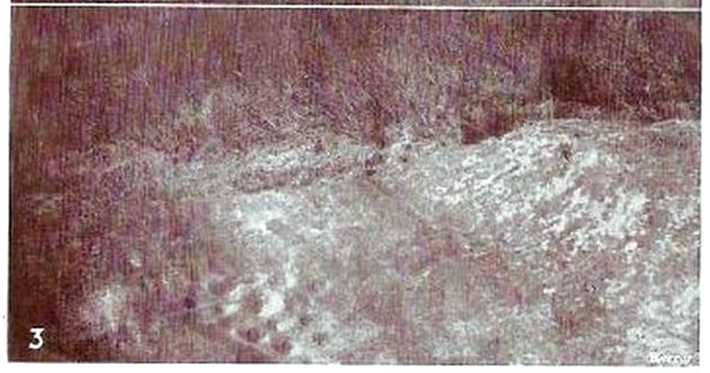
Since Miss Maitland’s days, the hillside has been covered in forestry plantation, making it extremely difficult to locate the carving. However, due to the reasonably large size of the stone, it should still be there (smaller cup-and-ring stones have been damaged and destroyed by forestry over the years); and as we can see in the middle photo, a long thick vein of quartz runs roughly along the middle of the stone—an ingredient which may have been significant for the people who carved the stone. In her article in the Scottish Country Woman magazine, Miss Maitland told:
cup-marks, bottom left
Ledard Stone
“On the hill directly behind Ledard, on the north side of Loch Ard, a little to the west of the burn and a little to the east of the first grouse-butt, exactly 700 feet above sea level, lies a large boulder. Ice has smoothed and fashioned it and on the worn surface may be seen twenty-one, or so, small round hollows, varying in size and depth. The pattern made is roughly diamond-shaped, pointing directly east and west. I saw them for the first time as the sun was setting on New Year’s Eve, 1932. It was a solemn moment, for as far as I know no one else had looked upon them with such joy, and even awe, for perhaps a thousand years!”
She may have been right. And by the sound of her words, she’d certainly caught the petroglyph bug!
Anyhow, the carving doesn’t appear to have been seen since then. A “cup-marked boulder” was noted in the Royal Commission’s (1979) listings, but with no further details. We assume it must be the same carving, although they never visited it. It’s also possible that they were referring to another lost cup-marked stone a short distance further up the hill from here. If any local explorers are able to re-locate the carving, please let us know, and maybe add some info and photos of it on our Facebook page.
References:
Maitland, Mrs, “Cup Marked Stones”, in The Scottish Country Woman, 1935.
Royal Commission Ancient & Historical Monuments of Scotland, Archaeological Sites and Monuments of Stirling District, Central Region, Society of Antiquaries of Scotland 1979.
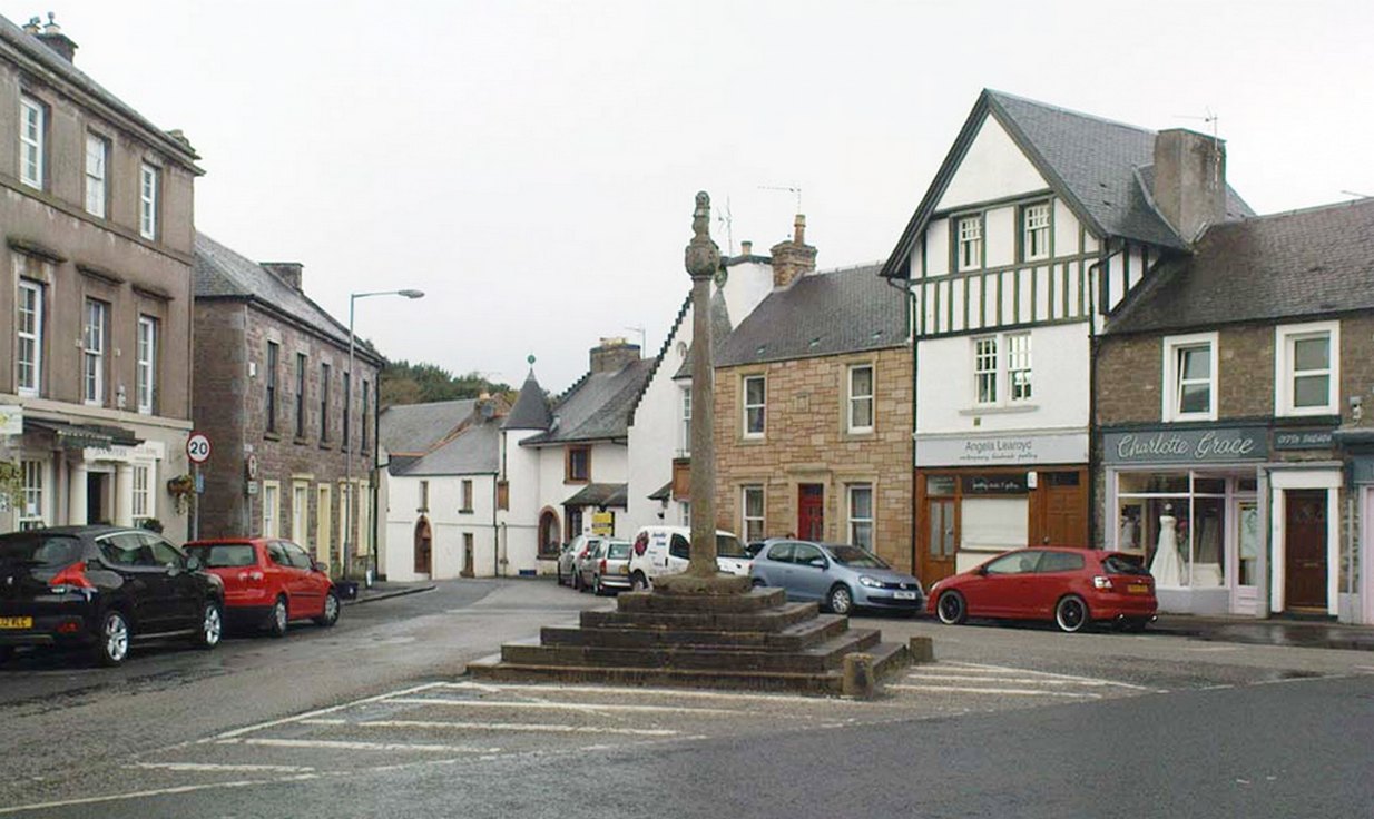
Easy to find: get into the middle of the village where the shops are in the main street and where another road veers off, the cross sits there in the middle in the traffic island. The photo here shows its location clearly.
Archaeology & History
Doune’s Mercat Cross
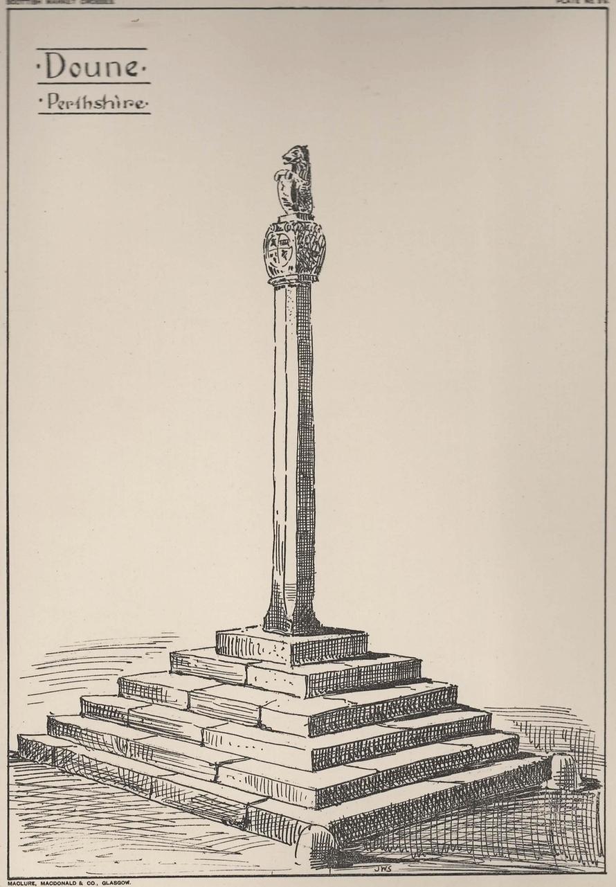
Found at the meeting of the roads in the centre of this old lovely village, the Mercat Cross in its present state was, according to Act of Parliament, erected a few years prior to 1696. Set on a square base of six steps in traditional pyramidal fashion, near the top of the 12-foot tall shaft are carvings on the sides of the stone. On the east-face was carved the Moray arms, and on the west face were carved sundials. John Small (1900) told how the top of the cross is crowned by the figure of a lion, “holding in its paws a circular shield or escutcheon, surrounded by a ribbon enclosing he Moray crest, and bearing the motto, ‘Salus per Christum.’
John Small’s 1900 sketch
It has been damaged a few times over the years. Sometime around 1800, Moray Mackay (1953) told that “the lion fell of and was damaged”, but was repaired shortly afterwards by a local man. He also told, with considerable indignation, how the local authorities were responsible for damaging what used to be “four short pillars which stood at the corners of the base,” when they were “smashed off and removed , impairing the balance of the whole (cross) for the sake of six inches more traffic room”! There are two such short pillars at the edges, but these aren’t the original stones. There used to be a water pump in front of the cross, but this was removed many years ago.
Cup-Marked Stone (lost): OS Grid Reference – NN 4808 0140
Archaeology & History
On the south-side of Loch Ard, just a few yards from the entrance to Rob Roy’s Cave (one of several), right by the water’s edge are the natural upstanding pillars known locally as Gog and Magog. In Peter Joynson’s (1996) work on Aberfoyle, this site is listed as one in a number of unrecorded cup-and-ring stones in the area. Discovered by a local lady—”the late Mrs Maitland”—here we have,
“two huge stones about 30ft high known as Gog and Magog situated at the mouth of Blan Ross Bay. They have numerous cup marks, but sadly have disappeared from view as they have been covered by forestry planting.”
This is an increasingly annoying problem that many rock art students are having to contend with! When we visited the site, the tops of these huge stones were, indeed, covered in depths of mosses and pine needles and the carving is hidden from sight. When the trees are felled, let’s hope someone can find it!
Folklore
These natural rocks were said to have been two giants that were turned to stone, the story of which seems to have been forgotten…
References:
Joynson, Peter, Local Past, privately printed: Aberfoyle 1996.
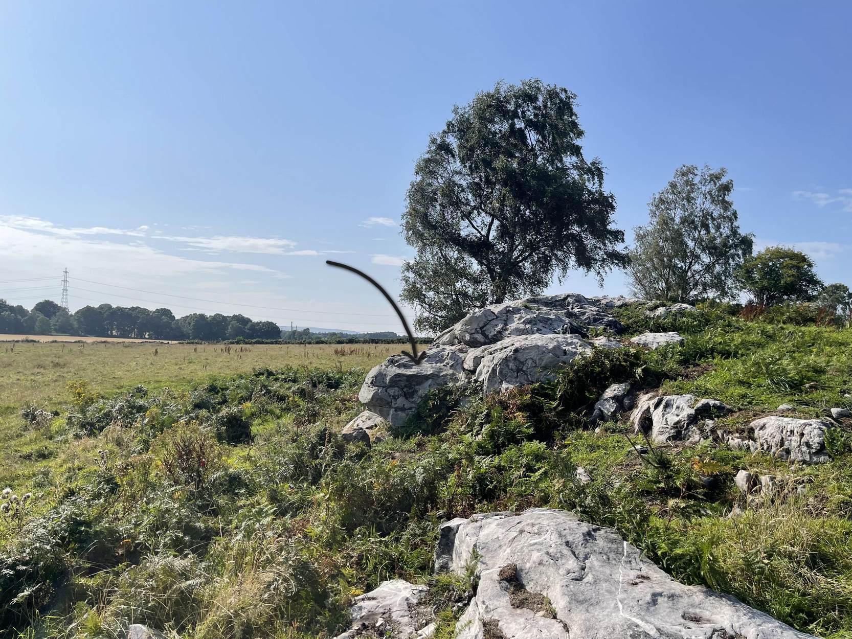
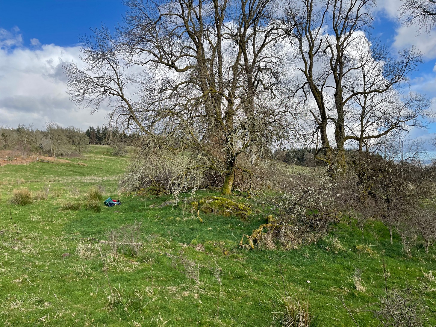
On the A81 road from Aberfoyle to Strathblane, about a mile south of Aberfoyle take the tiny right turn (keep your eyes peeled!) to Gartmore. Along the tiny curving road for exactly 1km (0.61 miles), where the road has straightened out there’s a small dirt-track with a parking spot along it. A few hundred yards along there’s a crossroads of dirt-tracks: walk to your left (SW) for nearly a mile (or exactly 1.5km) keeping your eyes peeled for a small distinct footpath leading down-slope on your left. Walk along this undulating path for just over 200 yards till you go through the gate, then walk immediately to your right down the side of the fence in the field for about 20 yards. Y’ can’t miss it!
Archaeology & History
Blarnaboard (3), NE-SW
Located on the land of the early bards of Gartmore, we could speculate that those early orators told tales of, and from this old stone—but that’s all it would be: dreamy speculation. Instead, passing that aside, the petroglyph itself brings us a feast to drool over!
Made up of four distinct carved sections of almost interconnecting rock, this flat thin line of stone is covered with an impressive array of cups and multiple rings. Running downhill in a northeast to southwest line, it would appear to have been written about for the first time by Lorna Main (1988) who subsequently described it in the usual archaeological shorthand, simply telling that,
“There are at last 28 cups, 3 cup and one ring, 4 cup and two rings, 2 cup and three rings, 1 cup and five rings and 1 cup and seven rings.”
Multiple ringed element
Section 1 overview
…But, as usual, there’s much more to be said of it than that. Of the four sections, we’ll start at the uppermost northeastern section and work down the sloping ridge, looking at the respective symbols as we go. Section 1 has the largest surface area, but isn’t the most decorated of the bunch. Nonetheless, what we find here is impressive. About a dozen single cup-marks of various ages are scattered over the surface in what initially seems to be no recognizable order; these are accompanied by two single cup-and-rings: one of which could be said to be of standard size and form, whilst the other has a much larger and broken ring, near the middle of the rock, about 12 inches across. This larger ring has two or three of the cup-marks incorporated into its outer edges. The most impressive element of Section 1 is the large multiple-ringed design, five in all, radiating outwards or funneling inwards (depending on what was intended) around a central cup. The outer ring of this is incomplete.
Impressive cup & 7 rings
Scatter of cups & rings
Section 2 is the most visually impressive of all the Blarnaboard (3) carvings: almost an evolutionary development of what we see on the first part. A 2-dimensional panorama shows off a distinct cup-and-ring close to the edge of the soil, and there’s a somewhat wonky incomplete cup with double-ring below it. A very clear cup-mark to the right of this has another faint incomplete double-ring round it—but this is hard to see. The same cannot be said of the cup with seven concentric rings surrounding it! (the outer two of these are incomplete) As I walked round and round this section, drooling somewhat, it became obvious that a number of well-defined cup-marks had been carved around the outer edges of the rings, deliberately creating an eighth ring comprised purely of cup-marks. It gave me the impression of it representing heavenly bodies revolving around the central Pole Star; but also of it defining the movement of the Moon through the heavens during a calendar year. (the astronomy of my youth still comes through at times!)
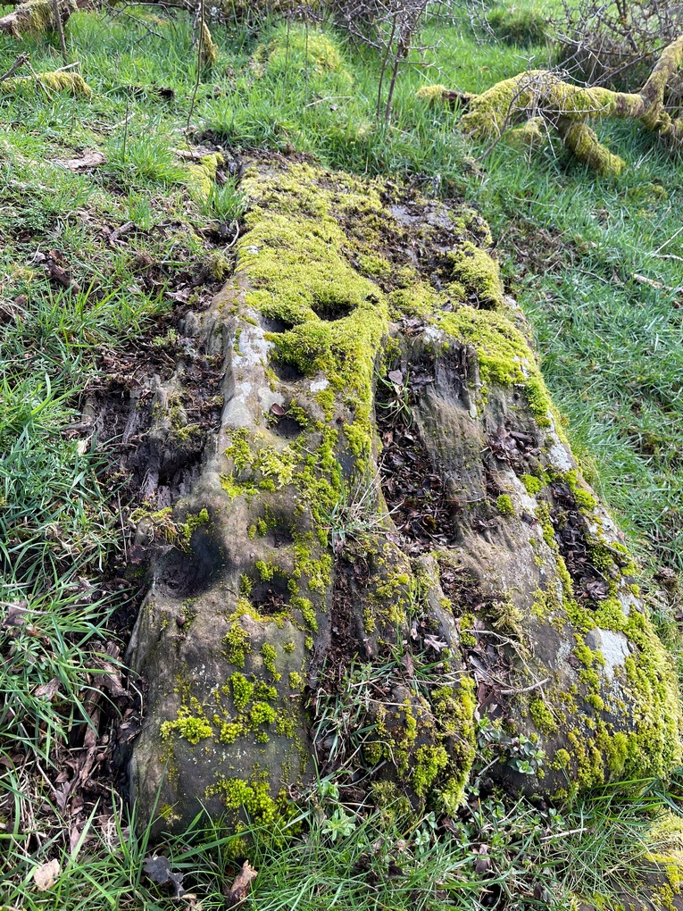
Section 3 carving
Faint double cup-and-ring
By comparison, the third and smallest section of Blarnaboard (3) almost pales into insignificance, possessing a mere cup-and-double-ring—and a very faint one at that. From a certain angle it looked like it possessed a third ring, but this was probably more to do with me wanting to see more than there is! Just below this double-ring, a single cup has what might have once been another incomplete ring round it—but we’d need the computer graphic students among you to suss that bit out! You can’t make it out on the photos here, sadly…
Section 4 carving
Faint double-arc, lower cup
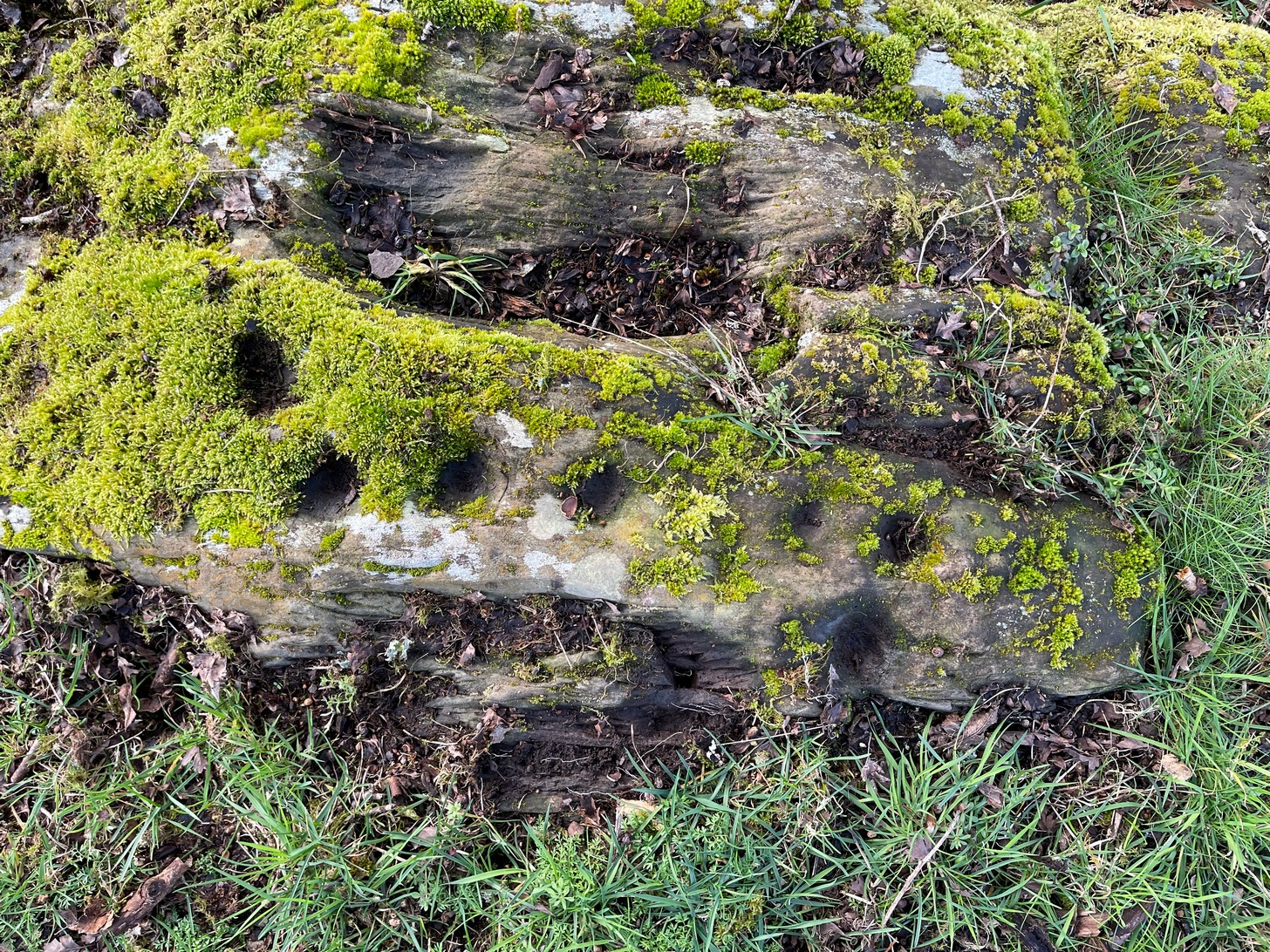
The fourth section is the most visually unimpressive of the entire cluster and was probably carved much later than the rest. The poor little fella has just five single cup-marks, with a sixth at the top-corner or northeastern part with what seems to be a small carved double-arc, or partial lozenge, that was started and never finished.
A couple of other exposed sections of stone running a few more yards further down the same line have no carvings on them—but there may well be more to this petroglyph hiding beneath the turf, which covers quite a large area. I have no doubt that other unrecorded carvings exist in close by, but due to excessive forestry plantations all around here, they’ll either be covered over or will have been destroyed. Don’t let this put you off looking for others though!
Cup-and-five-rings
Cup-and-seven rings
An interesting feature of this long line of stone is its potential alignment. When we were photographing the site, a local man came over and got chatting with us. He knew of the carving and had been here many times and told us that his wife had looked at this one and found it aligned with another cup-and-ring on the south-side of Blarnaboard farm and another one (officially unrecorded) even further along. I checked this when I got home and found that this long line of petroglyphs did indeed line up with the Blarnaboard farm carving, perfectly. Whether this was intentional and/or possesses an astronomical function, we might never know. The third carving along the line has yet to be located. I must emphasize however, that the relationship between earthfast petroglyphs and alignments is very rare and, where found, is little more than fortuitous. But when we find cup-markings on alignments of standing stones and other prehistoric monuments, the relationship seems to be much more intentional and would have had a specific mythic function.
If y’ follow the fence-line from this carving down to the small burn, on the other side is the much less impressive Blarnaboard (2) cup-marked stone.
Folklore
Prior to Lorna Main’s (1988) short note on this petroglyph, local people had long known about the carving. As late as the 20th century, people with fevers were brought to this stone in the early morning to be cured of the illness. The idea was that medicinal herbs were collected and placed in some of the cup-marks, which were used like a mortar and pestle to prepare the plants. This healing magick, spoken of by some of the old folk in Aberfoyle, was known to them as children, who’d been told of this by their elders and, of course, by the elders before them.
There is also a tradition that some of the stone that makes up the curious moondial (not sundial) that can be seen at the back of the church in Gartmore village nearly a mile to the southeast, originally came from here.
References:
Main, L., “Blarnaboard (Aberfoyle parish), Cup and Ring Marked Outcrop,” in Discovery & Excavation Scotland, 1988.
Acknowledgements:Huge thanks for use of the Ordnance Survey map in this site profile, reproduced with the kind permission of the National Library of Scotland.
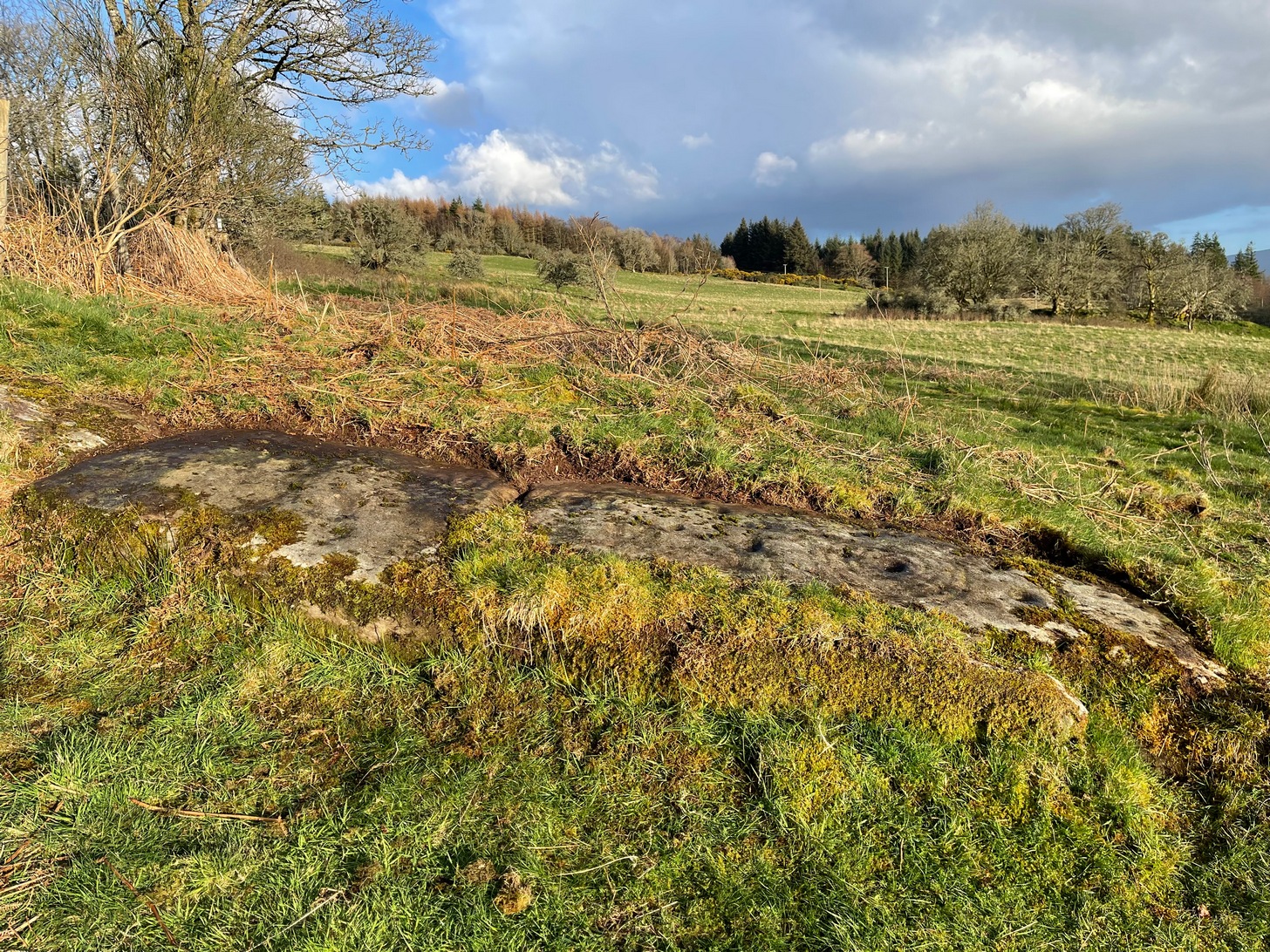
Anyone who’s going to visit this carving will be doing so as a result of visiting the impressive Blarnaboard (3) cup-and-ring stone, 115 yards (105m) away. From Blarnaboard (3), walk down the slope on your right (west), cross the tiny burn and go round to the other side of the small rocky hawthorn-topped hillock just a few yards in front of you. Fumble about and you’ll find what you’re looking for!
Archaeology & History
It’s possible that there’s more to this carving than meets the eye. On the west-side of this small rocky rise, along a thin elongated raised section in the stone, a gently meandering line of nine deep cups runs roughly northeast to southwest. You can’t really miss them as they average some 2 inches across and 1 inch deep, strongly suggesting that they were cut and reworked over and over for a long period of time.
Line of cups, from above
Rough NE-SW alignment
It was first described in distinct brevity by Lorna Main (1988) who told that, “over a length of 60cm on a north-east facing outcrop are 9 cup marks.” And, whilst all of the cups are clearly visible, one of them at the edge of the stone has been cut or worked into a natural curved hollow. You’ll see what I mean when you visit the site (it’s pretty clear in the photos).
Beneath the roots and soil there may well be other cup-markings that are still hiding away on this rocky dome. I have no doubt that other unrecorded carvings exist in this area, but due to the excessive forestry plantations all around here, they will be covered over or have been destroyed.
References:
Main, L., “Blarnaboard (Drymen parish), Cup Marked Rock,” in Discovery & Excavation Scotland, 1988.
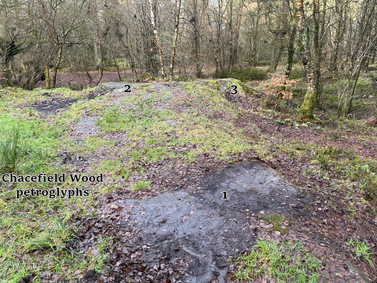
We took the A872 road on the south-side of Denny to Dennyloadhead and Longcroft, but a few hundred yards before you go under the M876, keep your eyes peeled for Drove Loan on your left. Go down here for literally ¼-mile (0.4km) where there’s a footpath into the woods on your left. Walk on the path into the trees and you’ll reach a track that heads to your right (east). Less than 200 yards on, you’ll see a pond on your right and above here is a small quarried rock outcrop. This carving’s up top, on the gently sloping rock behind carvings no.2 and no.3.
Archaeology & History
Half-covered in mud and vegetation, the first thing you’ll notice on this sloping smooth surface is what looks to be a standard cup-marking, all on its own. But it has company—albeit quiet and faint. A single incomplete cup-and-ring can be seen about 18 inch above (north-ish) this single cup-mark, which may itself be natural. You can make out the cup-and-ring pretty clearly in the photos.
When we found this, we began to clear the rest of the stone but stopped pretty quickly as a scatter of broken glass was mixed into the mud and I was lucky not to cut my hand open. Some kids have evidently been getting pissed here and have left their mess on the rock. But there may well be more symbols beneath the mulch, so if any local folk want to clean it, please make sure to wear some good gardening gloves to protect your hands! And if you find any other hidden elements, please let us know! 🙂