Cupar Stone Circle, St. Martin’s, Perthshire

Stone Circle (ruins):  OS Grid Reference – NO 15958 31227

Also Known as:

  1. Canmore ID 28632

Getting Here

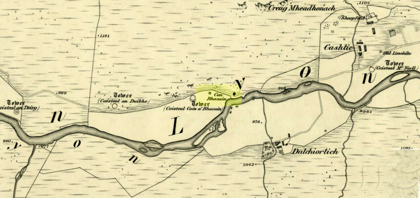
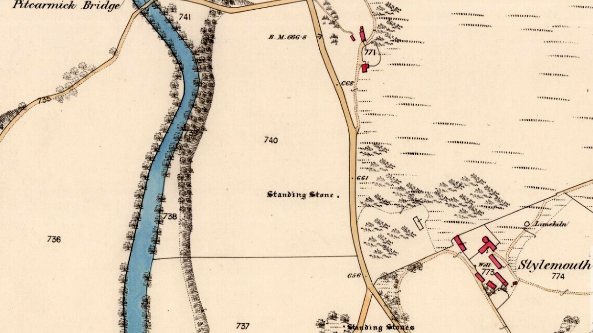
The stone circle on 1867 map

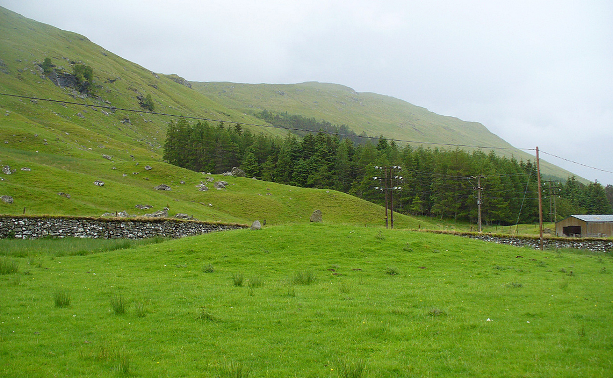
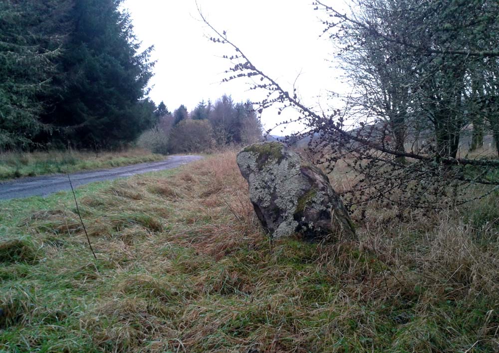
Follow the same directions as if you’re visiting the Witches Stone of St. Martin’s.  On the way up the long dirt-track, just where the track has levelled out above the slope, keep your eyes peeled on the left (west) for a line of large long boulders on the other side of the barbed-wire fence, laid down, just at the edge of the field.  That’s what’s left of the place!

Archaeology & History

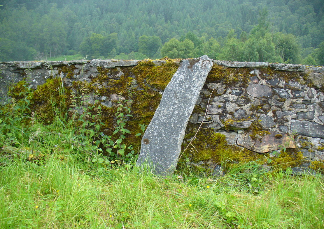
This site is in a sad state of affairs and no discernible ‘stone circle’ of any form can be seen here.  The stones that constituted the megalithic ring were uprooted and dumped at the side of the huge field sometime in the latter-half of the 20th century.  The site is shown clearly on the early OS-maps but at some point in more recent years, the land-owner here (I presume) uprooted the stones and dumped them at the field-side, where they remain. Not good.

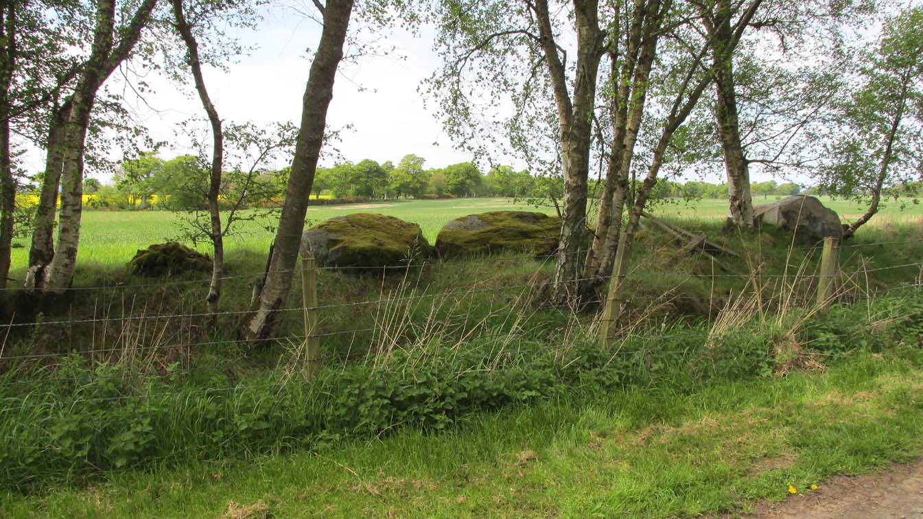
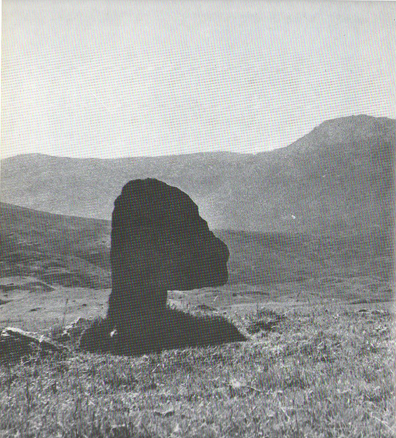
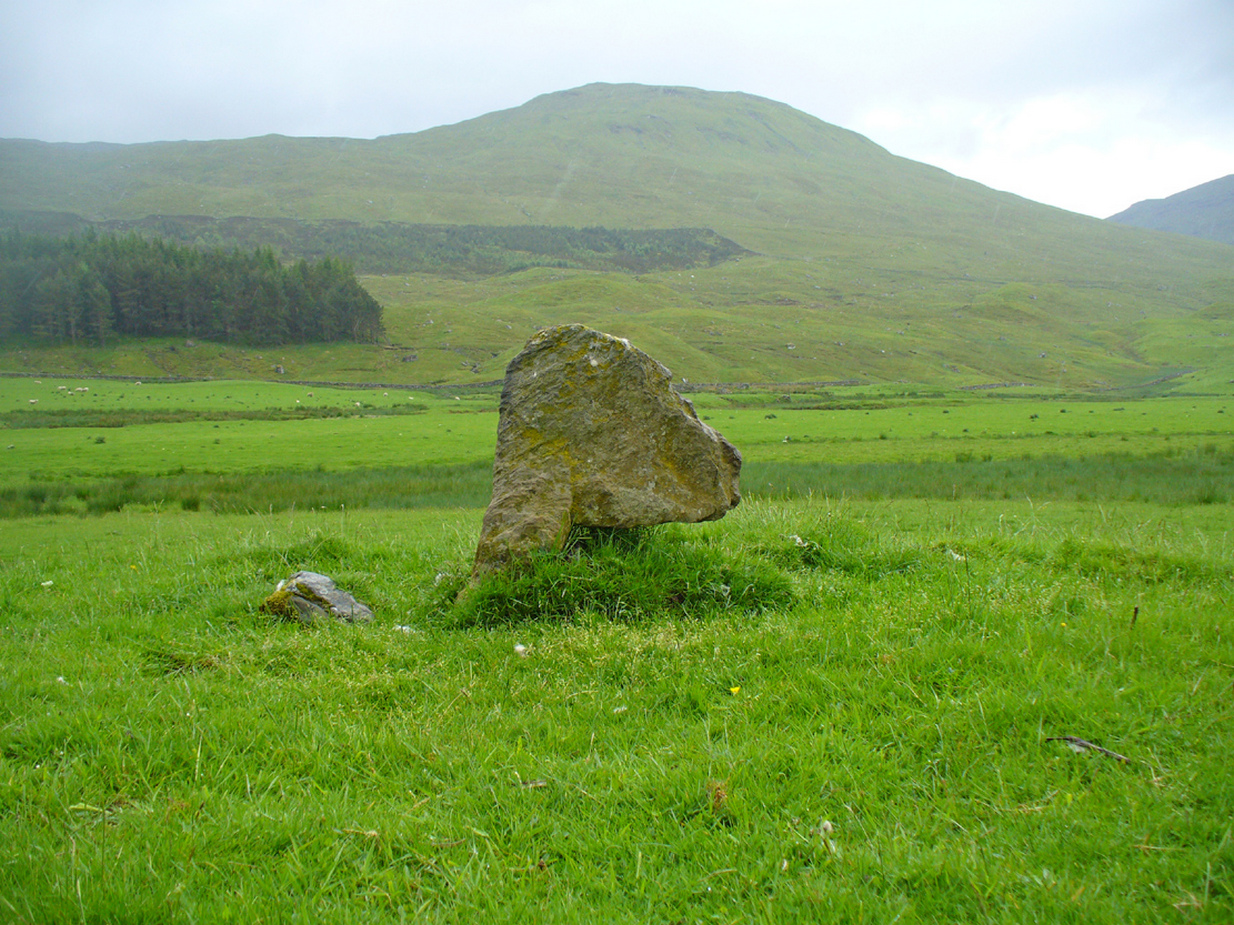
Cupar Stones from the track

One of the stones here bore the curious name ‘Cupar’, which probably relates to it being a place where criminal trials were held, or justice dispensed. (Grant 1952)  Traditions such as this were enacted at other megalithic rings and ancient sites in earlier times.

The first mention of the circle I can find is in the old Name Book of 1865, which informs us:

“Three large boulders set up edgeways, and part of a circular earthen bank.  There is no local tradition regarding the stones but the Rev Park believes them to be the remains of a Druidical Temple. The name Cupar Stone is not well known locally but still appears on the estate map.”

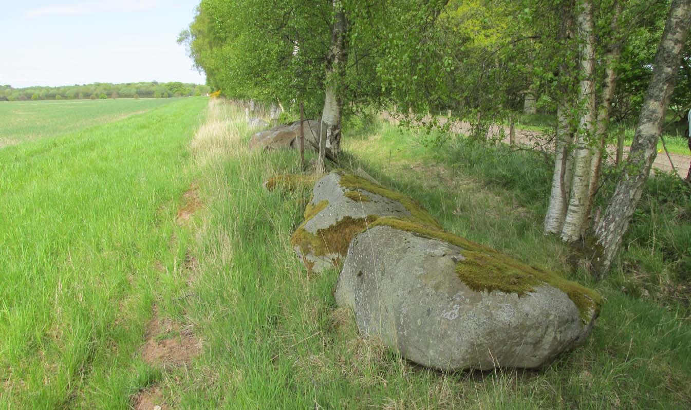
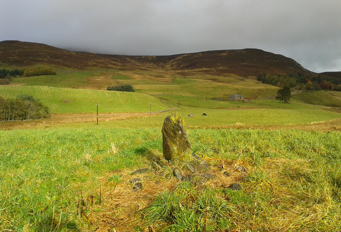
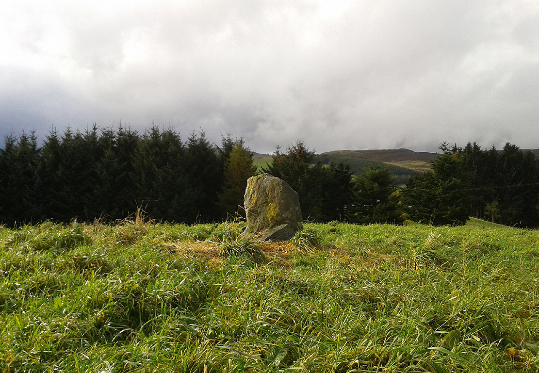
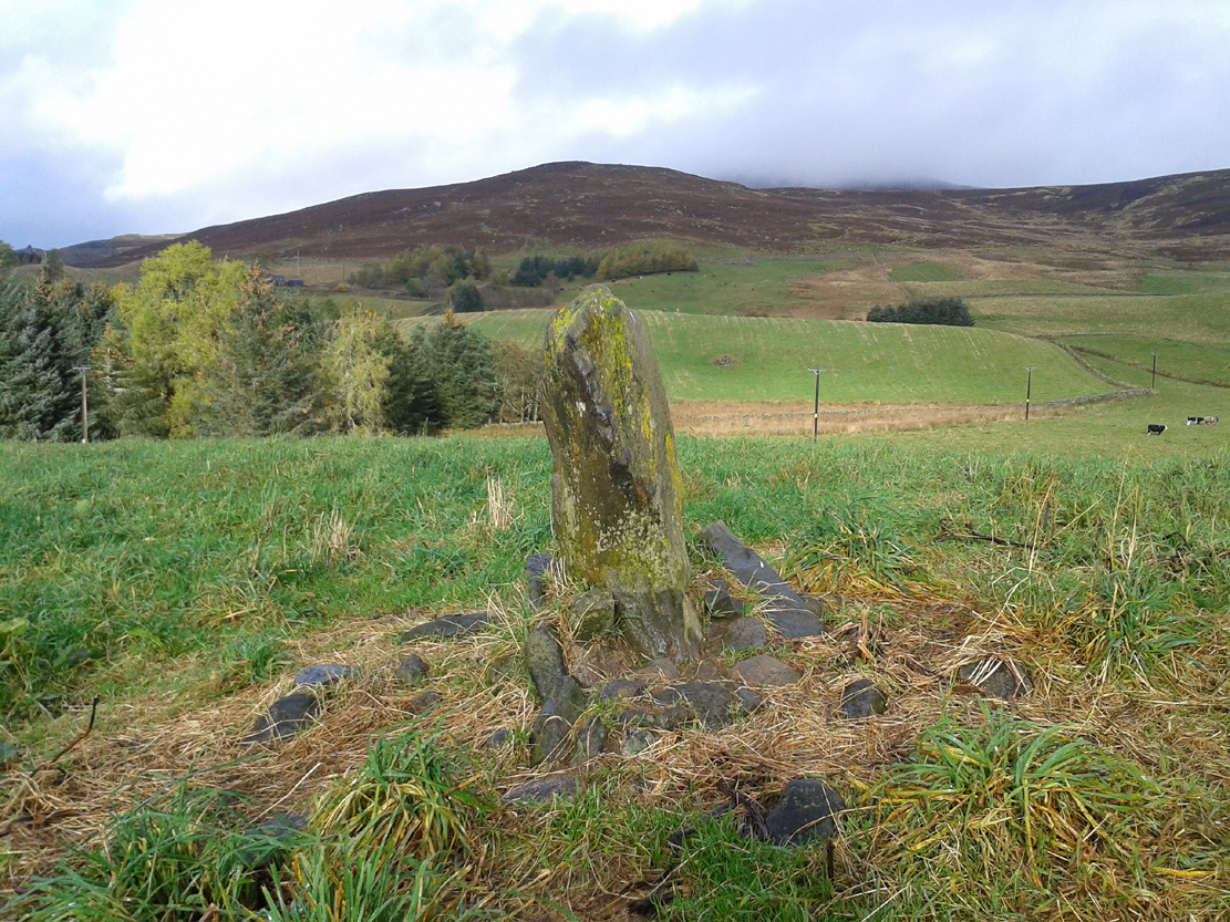
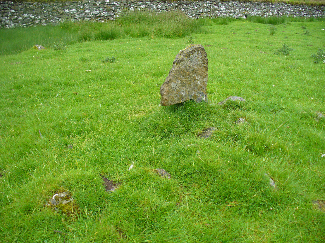
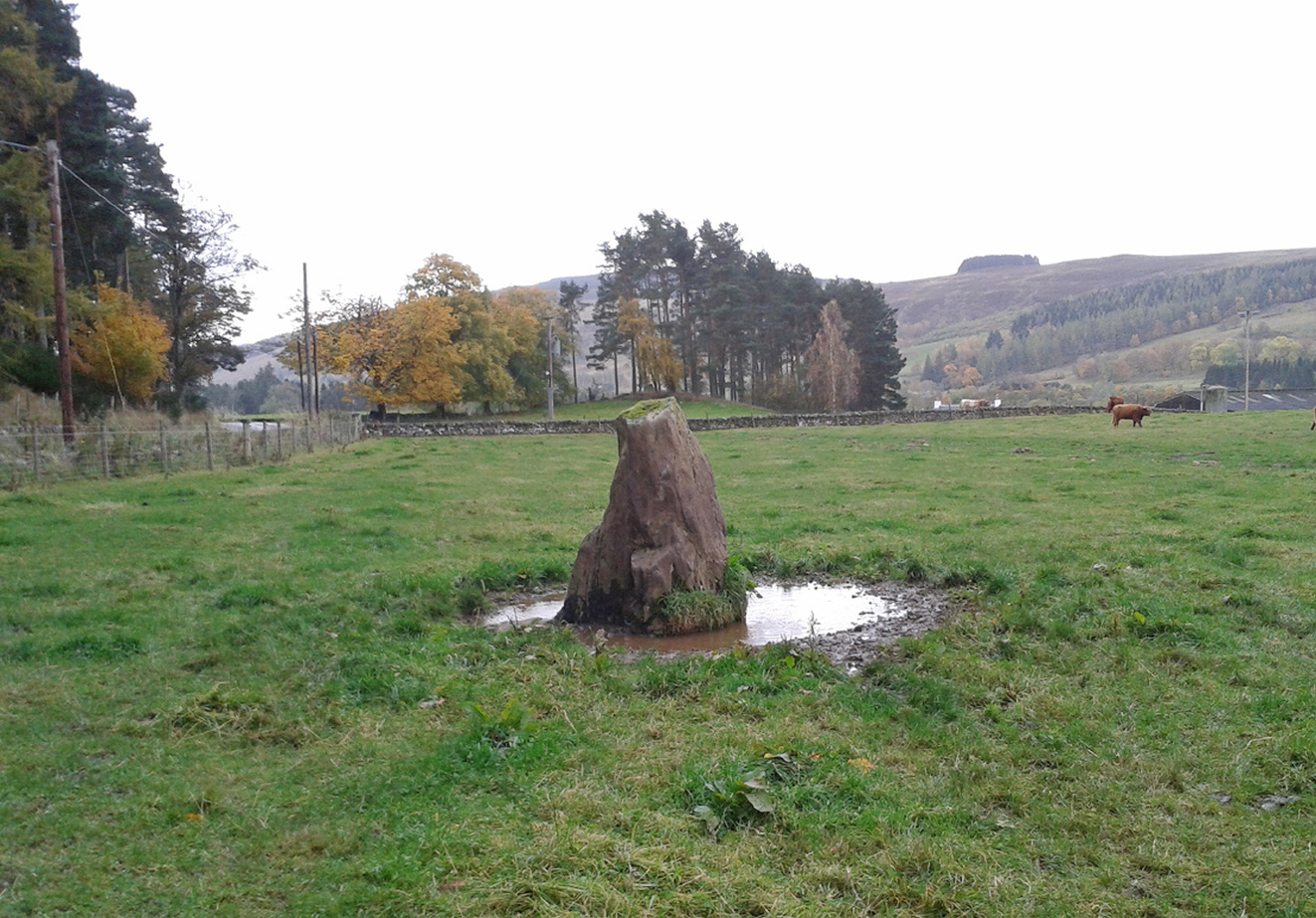
Cupar Stones at field-edge

It originally stood on the edge of the large flat plateau, just at the point where the land slopes down to the south, with the curious Witches Stone of MacBeth on the same level plateau just over 400 yards to the north.  This small monolith may have been a deliberate outlier from the ring, perhaps relating to the calendrical airt of death (the direction ‘north’ commonly denotes Death in pre-christian cultural cosmologies).  But we know little else about the ring.  In Margaret Stewart’s (1965) notes about the site, she indicated that some of the stones were still standing when she saw them, saying how the “largest remaining stones are to the south and west.”  They’re not anymore!

Postulating it as a possible ‘four-poster’ stone circle (a dubious one, he said), Aubrey Burl (1988) told us:

“In the south corner of a partly cleared wood…there are three large stones, two of them fallen. They are in a roughly straight line running NNE-SSW.  Nearby is a fourth prostrate stone in a boundary wall.  Stewart (1965:21) suggested that they had once formed a ring approximately 24ft 6in (7.5m) in diameter. Different opinions have been that if there had been a circle, it was probably larger.”

In light of the near-complete destruction of the Cupar stone circle, I feel that note should be made of a somewhat worrying trend, not only here, but many other prehistoric sites in the country.  In the site profile Canmore has given the Cupar stone circle, its destruction and vandalism has been termed “agricultural improvement”, as if to sound ‘acceptable’ and that it’s OK to destroy stone circles – which it plainly is not!  If you or I were to do such a thing, we’d be arrested!  We need to make sure that, as individuals and organizations, we treat what some term “agricultural improvement” for what it is: vandalism (usually by rich tory land-owners who give back-handers, or similar things, to make sure the official paperwork looks OK).  I know a lot of archaeologists agree with this too, but cannot speak out for fear of losing their jobs.

References:

  1. Barnatt, John, Stone Circles of Britain (2 volumes), BAR: Oxford 1989.
  2. Burl, Aubrey,  The Stone Circles of the British Isles, Yale: London 1976.
  3. Burl, Aubrey, Four Posters: Bronze Age Stone Circles of Western Europe, BAR 195: Oxford 1988.
  4. Burl, Aubrey, The Stone Circles of Britain, Ireland and Brittany, Yale University Press 2000.
  5. Grant, William & Murison, David D., The Scottish National Dictionary – volume 3, SNDA: Edinburgh 1952.
  6. Royal Commission on the Ancient & Historical Monuments Scotland, South-east Perth: An Archaeological Landscape. RCHAMS: Edinburgh 1994.
  7. Stewart, Margaret E.C., “Excavation of a Circle of Standing Stones at Sandy Road, Scone, Perthshire“, in Transactions & Proceedings Perthshire Society Natural Science, volume 11, 1965.

© Paul BennettThe Northern Antiquarian


Clachaig, Glen Lyon, Perthshire

Stone Circle (destroyed):  OS Grid Reference – NN 583 468

Also Known as:

  1. Canmore ID 24237
  2. Kerrowmore

Archaeology & History

Upright slab in graveyard

Upright slab in graveyard

In a discussion about the ancient chapel to St. Eonan (the local name in these parts for Adamnan) that once existed near the Bridge of Balgie in Glen Lyon, the local historian Duncan Campbell (1886) informed us that,

“St. Eonan built his chapel near the only stone circle in Glenlyon.  The stones of this circle have been removed within my memory.  The place is called Clachaig.”

The same writer (Campbell 1888) later told how its remains were still visible around 1848 CE.  Campbell’s (1910) later memoirs also mentioned his childhood recollections when the stone circle was in situ, telling that the

“place above the churchyard to Clachaig, named so, the Place of Stones, (was) because the old Druidic stone circle was there.”

We don’t know exactly where the megalithic ring stood; and although modern analysts think the site may have been underneath the invading forestry commission plantation, local lore puts it closer to the graveyard above Kerrowmore.

Enhanced image of curious near-circular form close by

Enhanced image of curious near-circular form close by

A local dowser thinks that the upright slab in the graveyard at Kerrowmore may be the one remaining stone left here after the circle’s destruction.  A quick meander back and forth on a rainy day here, on the geological ridge at the back (south) of Kerrowmore, found only a curious near-circular earthwork that might have been the original site, but it may be fortuitous. A nearby rock outcrop known as “Coill a’ Bhaird” may have been related to the circle.

Folklore

A local man (thanks Tom) said how tradition tells that some of the stones from this circle were taken and used in making the drive to Meggernie Castle last century.

References:

  1. Campbell, Duncan, The Lairds of Glenlyon, Cowan: Perth 1886.
  2. Campbell, Duncan, The Book of Garth and Fortingall, Northern Counties Newspaper: Inverness 1888.
  3. Campbell, Duncan, Reminiscences and Reflections of an Octogenarian Highlander, Northern Counties Newspaper: Inverness 1910.
  4. Stewart, Alexander, A Highland Parish; or, The History of Fortingall, Alex MacLaren: Glasgow 1928.

© Paul BennettThe Northern Antiquarian


Borland, Blacklunans, Alyth, Perthshire

Standing Stone: OS Grid Reference – NO 15361 60677

Also Known as:

  1. Borland Stone
  2. Canmore ID 29401

Getting Here

The Borland Stone, looking NE

The Borland Stone, looking NE

From Blairgowrie, take the A93 north road, ensuring that when you reach the Bridge of Cally after 5½ miles (9km), you take the right-turn up Glenshee (the Valley of the Faerie folk) and not the A924 Strathardle road. After about 5 miles, turn right up the small lane to Blacklunans after, once you’ve weaved past the River Shee and started uphill, a few hundred yards on keep yer eyes peeled on the fields to your left. If you hit the Glenshee EcoCamp, you’ve gone too far.

Archaeology & History

Borland Stone, looking west

Borland Stone, looking west

This small, out-of-the-way standing stone is set amidst a small mass of rounded stones—as if once part of a cairn—at the top of a small hillock that can easily be passed by if your nose isn’t working properly.  Curiously isolated, the monolith seems more of an outlier to the Mount Blair hills immediately north and east; or perhaps the large settlement less than a mile south.

Very little seems to have been said about the stone, in literary terms at least.  The Royal Commission (1990) lads merely told us that,

“This stone, which stands on the summit of a prominent knoll 300m SE of Borland farmhouse, measures 0.7m by 0.3m at the base and 1m in height.”

Stone aligned NNE to Tom Bealaidh

Stone aligned NNE to Tom Bealaidh

Nowt else!  Although the stone was marked on the early 1900 OS-map, the small mass of loose stones at its base are more recently-worked than anything prehistoric and may simply be field clearance.  The monolith itself could do with assessment to positively ensure its prehistoric veracity.

References:

  1. Meikle, James, Places and Place-Names around Alyth, Alexander Gardner: Paisley 1925.
  2. Royal Commission on the Ancient & Historical Monuments of Scotland, North-East Perth: An Archaeological Landscape, HMSO: Edinburgh 1990.

© Paul BennettThe Northern Antiquarian


The Bhacain, Cashlie, Glen Lyon, Perthshire

Standing Stone:  OS Grid Reference – NN 48367 41706

Also Known as:

  1. The Bhacan
  2. Canmore ID 23977
  3. Cona Bhacain
  4. Testing Stone of the Fianna

Getting Here

The Bhacain in its setting

Whether you take the road west from Fortingall, or over the heights from Loch Tay, when you reach Meggernie Castle just keep going west for a few more miles.  Keep going past the large Stronuich reservoir on your left and you’re getting close.  Go past Caisteal Mhic Neill and the trees at Cashlie House for another 5-600 yards and where the track crosses the river Lyon, park up just past it.  Ahead of you in the field on the left of the road, nearer the riverside, is where you need to look.

Archaeology & History

One of the most peculiar and unique sites in the British Isles is this remote small upright stone, known locally as The Bhacain.  Standing upon a small mound in the field immediately east of one of Finn’s legendary ‘forts’ (a dun or a broch) called Caisteal Cona Bhacain, this curious monolith, less than two feet tall, has a thin upright stem with a much enlarged rounded end to it.  Some might even ascribe it as phallic—although local traditions of the stone relate it as a truth-sayer of a young girl’s virginity!

The Bhacain on 1867 map
Mound of The Bhacain

Its position on top of the small mound is intriguing, giving it the impression of being atop of a tumulus; and there is also the scatter of small stones surrounding the upright just beneath the surface (as evidenced in one of the photos), making it possible that the stone is an ancient burial marker.  If this is ever shown to be true, the likelihood is that the stone marks the grave of a hound, as the tradition of this spot implies.  No excavation has ever occurred here, so the precise nature of the stone (and the mound) has yet to be ascertained; but knowing the longevity of some oral traditions in these Highland glens, the idea of it being the burial-place of a dog is anything but far-fetched.

If the stone is contemporaneous with the associated ‘duns’ close by, this would be a late standing stone, probably erected in the Iron Age.  We can certainly see, quite plainly from the erosion on the stone, that this is not neolithic or Bronze Age in origin.  A decent examination of the important sites hereby is long overdue…

Folklore

The Bhacain & its stony pile

The folklore and traditions attached to this site are numerous when you consider how small it is.  Much of this relates to the fact that animistic cosmologies in the Highlands were retained until very recently, stretching way back.  Accounts from the 19th and 20th centuries tell of people still frequenting this and other sites, at sunrise, or full moons, as such things were still very much integral parts of rural life.  When the local historian Duncan Fraser (1973) wrote about The Bhacain in his fine work on this area, he told much about the traditions of the great warrior King Fionn and his activities hereby:

Duncan Fraser’s old photo
The Bhacain, looking S

“Another traditional link with the warrior King is the Bhacain, on a mound beside the road, far up the glen.  Only a stone’s throw from one of the forts, it is about two feet high and shaped like the head of a dog.  This is said to have been the stake to which the Fians tethered their staghounds with leather thongs, when they returned from the chase.  And there were times, no doubt, when Fionn’s own dog, Bran was among them, with its yellow paws and its black flanks and its chain of pure gold.  It was the best hunting dog that ever lived.  And there was its brother, the dreaded Grey Hound, that used to roam on its own in the Great Glen, tearing its victims limb from limb, until it too abandoned its wildness and became one of the hounds of the Fians.  They say that the dogs’ food was thrown to them from the top of Caisteal Coin-a-bhacain, the castle of the dog’s stake, upwards of seventy yards to the west.  And any dog that failed to catch its supper was turned out of the pack.

“Time did not allow the Bhacain to become inanimate like other stones.  Even in comparatively recent times it was still regarded with superstitious awe.  A retired schoolmaster of Fortingall recorded eighty years ago that it was said to have a mysterious effect on those who crept under its head.  And old folk in the glen will tell you that those who did so were girls.  It had become the glen folk’s yardstick of virginity.  In the late eighteenth century, when the girls returned from gathering the harvest in the ungodly Lowlands, under the stone they went.  It was better than all your modern pills.”

In Hilary Wheater’s (1981) fine work on the history of the region, he told that “no youth was permitted into the fighting body of the Clan until he could lift the Bodach Stone onto the boulder beside it.”  This tradition gave the Bhacain another name, the Testing Stone of the Fianna.

References:

  1. Burke, Peter, Popular Culture in Early Modern Europe, Scolar Press: Aldershot 1994.
  2. Fraser, Duncan, Highland Perthshire, Standard Press: Montrose 1973.
  3. McKerracher, Archie, Perthshire in History and Legend, John Donald: Edinburgh 1988.
  4. Stewart, Alexander, A Highland Parish; or, The History of Fortingall, Alex MacLaren: Glasgow 1928.
  5. Wheater, Hilary, Aberfeldy to Glenlyon, Appin Publications: Aberfeldy 1981.

© Paul BennettThe Northern Antiquarian


Balnabroich, Kirkmichael, Perthshire

Standing Stone:  OS Grid Reference – NO 09175 56752

Also Known as:

  1. Canmore ID 27267

Getting Here

Stone shown on 1867 map

Take the A924 road north of Blairgowrie, between Pitlochry and Bridge of Cally and, about 4.6 miles (7.5km) along, roughly halfway between Ballintuim and Kirkmichael, in the field by the roadside immediately west, you’ll see this conspicuous upright stone standing all alone – unless the cattle are meandering slowly around it! Y’ can’t really miss it.

Archaeology & History

This single monolith that stands today as a cattle rubbing post, may at one time in its distant past have been related to the present pair of standing stones hiding in the small remain of trees 148 yards (135.5m) to the south; although neither Aubrey Burl (1993) nor Alexander Thom (1990) ascribe the stone such an association in their relative tomes on aligned stone rows.

When the great standing stone lover Fred Coles (1908) came here, he was as reliable as ever in his subsequent exposition of the place – and despite getting his measurements slightly out he told us, almost liltingly, like an antiquarian Uncle Monty stroking his megaliths, that

Balnabroich stone, looking S
The old stone, looking NW

“At a point almost 176 yards due north of (the) two stones is a tallish and unshapely monolith standing but a few yards west of the main road.  Its most notable feature is the extreme irregularity of its shape.  If any proof were needed to show how uncritical were the people who raised such stones, how totally devoid of any regard for symmetry or neatness of contour in the monoliths they set up, surely the ground-plan of this block of rent and riven quartz-veined whinstone, fissured and uncouth in all its parts, would supply it.

“The contour here shown was measured by laying down an irregular rhomboidal figure, and from each of its sides measuring by offsets to the depths 0f the curves which are so prominent on the north, the northwest and the southeast sides.  The ground-plan this obtained shows that, taken between their prominent angles, the four sides measure almost exactly 3 feet each, and the main long axis of the stone which lies due east and west and measures 4 feet 6 inches.  The monolith stands 5 feet 8 inches above the ground and…appear to have been unconnected with circles, so far at least as it was possible to glean any information.”

References:

  1. Coles, Fred, “Report on Stone Circles Surveyed in Perthshire – Northeastern Section,” in Proceedings of the Society of Antiquaries of Scotland, volume 42, 1908.
  2. Royal Commission on the Ancient & Historical Monuments of Scotland, North-East Perth: An Archaeological Landscape, HMSO: Edinburgh 1990.

Acknowledgements:  Huge thanks for use of the Ordnance Survey map in this site profile, reproduced with the kind permission of the National Library of Scotland

© Paul BennettThe Northern Antiquarian


Dumgoyach Stones, Strathblane, Stirlingshire

Standing Stones:  OS Grid Reference – NS 53269 80727

Also Known as:

  1. Canmore ID 44605
  2. Dungoiach
  3. Duntreath

Getting Here

Approaching Dumgoyach Hill

Approaching Dumgoyach Hill

You can either find your way to Duntreath Castle on the western edges of Strathblane and walk SW straight up the steep grassy slope next to the wooded Dumgoyach Hill; or… From Carbeth, north along the A809, turn right up the B821 Ballachalairy Yett road for 1km and park where the path of the West Highland Way runs onto the hills. Follow this path for nearly ½-mile and where the path splits, bear left.  Keep walking downhill for a few hundred yards, then go off-track towards the copse of trees. Climb over the gate and onto the grassy plain between this copse and the huge rounded Dumgoyach Hill.  The stones are very close indeed…

Archaeology & History

This is a truly stunning site – not as much for the megaliths that are here, but for the setting in which they’re held.  “Magnificent” is the word that rolled out of my mouth a number of times; whilst respected activist and ‘Organic Scotland’ creator Nina Harris said, quite accurately, “it’s Caras Galadhon in Lothlorien!” (or words to that effect) – and she hit the nail much better than I did!

Royal Commission 1963 sketch

Royal Commission 1963 sketch

Dumgoyach Stones (by Nina Harris)

Dumgoyach Stones (by Nina Harris)

A short line of large standing stones remains here, both upright and leaning, running NE-SW for 7 yards: seemingly a part of some other much larger monument in times long past—although very little else remains.  The stones are set upon a rise of land, quite deliberately in front of Dumgoyach Hill (or Lothlorien, as Nina called it) almost as a temple or site of reverence.  You’ve gotta see it to appreciate what I’m saying!  Like some gigantic tree-covered Silbury Hill, the standing stones on this ridge possess an undoubted geomantic relationship with this rounded pyramid, all but lost in the sleep of local myths and land.  A few yards away from the line of stones there is a slight rise in the land, seemingly giving weight to the idea that something else was living here: an architectural feature that Aubrey Burl (1993) thinks might have been “the facade of a chambered tomb” (neolithic in origin) and not merely a megalithic alignment.  He may be right…

Close-up of the megaliths

Close-up of the megaliths

Described briefly in J.G. Smith’s (1886) magnum opus on the Strathblane parish, antiquarian accounts of this impressive site seem curiously rare.  One of the earliest recognised accounts was done by the Royal Commission (1963) lads who measured the site up with their usual diligence.  Although getting the alignment of the stones wrong, the rest of their survey seems pretty accurate. They told that,

“There are five standing stones (A-E) arranged in a straight line… Three of the stones (A, B and C) are earthfast, while the other two (D and E) are recumbent.  Stone A is of irregular shape and leans steeply towards the N.  The exposed portion measures 4ft in height, 2ft 6in in breadth and 1ft 2in in thickness.  Stone B stands upright, 6ft NE of A.  It is a pillar of roughly rectangular section with an irregularly pointed top, and measures 5ft in height by about 2ft 6in in thickness.  Stone C, also irregular in shape, 11ft 6in NE of B, is inclined so steeply to the NNE that it is almost recumbent.  It measures 4ft 4in in height, 2ft 6in in breadth and 1ft in thickness. The remaining two stones lie on the ground between B and C.  Stone D measures 5ft 5in in length, 3ft in breadth and 1ft 6in in thickness while stone E, which rests partly on D, measures 7ft 10in in length, 3ft 9in in breadth and 3ft in thickness.”

Aubrey Burl’s (1993) description of the site—which he called Blanefield—is another good synopsis of what is known historically and astronomically about the site.  Assessing them in his detailed work on megalithic alignments, he said that,

“At Blanefield near Strathblane in Stirling a big stone, its longer sides aligned east-west, stands at an angle amongst a southwest-northeast line of four others, fallen, of which one just off the line seems to have been added this century.  The setting has been presumed a collapsed four-stone row.  Known also as Duntreath and Dumgoyach, the setting is slightly concave.

“‘This ruinous alignment indicates notches to the northeast and these show approximately the midsummer rising sun.’ ‘The standing stone has a flat face exactly aligned on a hill notch to the east,’ quite neatly in line with the equinoctial sunrises.  These astronomical analyses would seem to confirm that Blanefield was undoubtedly a row set up by prehistoric observers to record two important solar events.

“Excavation in 1972 discovered signs of burning, flints and charcoal that yielded a C-14 assay of 2860±270 BC (GX-2781), c. 3650 BC, a time in the Middle Neolithic when chambered tombs were still in vogue, but an extremely early date for any stone row.  This, coupled with Blanefield’s isolated position for a row in central Scotland, raises doubts about its origins.

“It is a lonely megalithic line, those nearest to it being over forty miles (64km) to the west in Argyll.  Straddling a ridge overlooking the Blane Water it is arguable that the stones are relics of the crescent facade of a Clyde chambered long cairn with an entrance facing the southeast….”

Dumgoyach Stones, with Dumgoyne to the North

Dumgoyach Stones, with Dumgoyne to the North

However, there was once another stone row close by, known as the old Stones of Mugdock.  Burl then cites the proximity of four nearby neolithic long cairns not too far away, with the Auchneck tomb just 3½ miles (5.6km) to the west; although it seems that Nina Harris may have discovered another one, much closer still.

Folklore

Local legend reputes that King Arthur was up and about in this part of the world, fighting in a battle nearby.  And in J.G. Smith’s (1886) excellent work on the parish of Strathblane, he told that,

“The standing stones to the south-east of Dungoyach probably mark the burial place of Cymric or Pictish warriors who fell in the bloody battle of Mugdock.”

References:

  1. Burl, Aubrey, From Carnac to Callanish, Yale University Press 1993.
  2. Feachem, Richard, Guide to Prehistoric Scotland, Batsford: London 1977.
  3. Heggie, Douglas C., Megalithic Science: Ancient Mathematics and Astronomy in Northwest Europe, Thames & Hudson: London 1981.
  4. MacKie, Euan W., Scotland: An Archaeological Guide, Faber: London 1975.
  5. Ritchie, J.N.G., “Archaeology and Astronomy,” in Heggie, D.C., Archaeoastronomy in the Old World, Cambridge University Press 1982.
  6. Royal Commission on the Ancient & Historical Monuments Scotland, Stirling – volume 1, HMSO: Edinburgh 1963.
  7. Smith, John G., The Parish of Strathblane, James Maclehose: Glasgow 1886.
  8. Thom, Alexander, Megalithic Sites in Britain, Oxford University Press 1967.
  9. Thom, A., Thom, A.S. & Burl, Aubrey, Stone Rows and Standing Stones – volume 1, BAR: Oxford 1990.

Acknowledgements:  A huge thanks to Nina Harris, of Organic Scotland, for both taking me to these stones and sharing her photos for this site profile.  Cheers Nina!

© Paul BennettThe Northern Antiquarian


Auchnafree, Glen Almond, Perthshire

Standing Stone:  OS Grid Reference – NN 8225 3336 

Getting Here

Auchnafree Stones, looking east

Auchnafree Stones, looking E

Walk up the long track of beautiful Glen Almond, past the East Conichan circle and past the giant tomb of Clach na Tiompan.  After about 4.2 miles (6.8km), the track diverges: take the one directly west, over the old bridge, and less than 100 yards past here, note the gate on your right.  Go into the field and start walking uphill until you’re at the highest point a few hundred yards up.  You’ll find the stones in front of you.

Archaeology & History

Auchnafree Stones, looking NW

Auchnafree Stones, looking NW

Somewhat reminiscent in style and form to the standing stones at Dumgoyach, north of Glasgow, this one upright monolith and its seemingly fallen companion have not previously been recorded by archaeologists—but it is quite a distance away from anywhere. The upright stone is about one metre tall and its lumbered companion about four feet long.  The remains of a small stone, probably broken from the larger mass, extended beyond the long stone.  Another unrecorded standing stone can be found on another hillock a few hundred yards from here.

© Paul BennettThe Northern Antiquarian


Auchingarroch, Muthill, Perthshire

Standing Stone:  OS Grid Reference – NN 78732 19579

Also Known as:

  1. Canmore ID 24795
  2. Roman Stone

Getting Here

Auchingarroch stone

The Auchingarroch stone

Take the B827 road south out of Comrie as if you’re heading towards Braco, and after a mile or so, as you start going uphill, turn left to go to the Wildlife Centre.  Go along the track and park up at the buildings.  The monolith is round the back of the first building (ask at the Centre, where the people there are very helpful).

Archaeology & History

F. Coles 19l1 sketch

F. Coles 19l1 sketch

Shown on the earliest Ordnance Survey map of the region as one of several ‘Roman Stone’ sites, this prehistoric upright is similar in size and feel to the other standing stones in the highly impressive Dunruchan complex close by.  The big fella stands on a raised piece of ground more than 8½ feet tall and, said Fred Coles (1911) has “a basal girth of 12ft 8ins.”  Quite a big stone!  A dubious large cup-mark is visible on the thin western face and three faint ones on its east.

The monolith is surrounded all along the southern landscape arc with forested moorland and low mountains, with the primary extended views reaching mainly into the north and western arc.  Although a rounded hillock immediately southwest of the stone looks promising, no calendrical or astronomical alignments have been found here.

Folklore

Auchingarroch, looking SW

Auchingarroch, looking SW

As with the other standing stones in this region, legend ascribes it as marking the resting place of a Roman soldier who fell in a great battle close by with our local heathens, in what was known as “battle of Mons Grampius.”

References:

  1. Coles, F.R., “Report on stone circles in Perthshire principally Strathearn,” in Proceedings of the Society of Antiquaries, Scotland, volume 45, 1911.
  2. Finlayson, Andrew, The Stones of Strathearn, One Tree Island: Comrie 2010.
  3. Hunter, John, Chronicles of Strathearn, David Phillips: Crieff 1896.

Acknowledgements:  Thanks to Paul Hornby for the journey here; and more especially a different sorta thanks to Linzi Mitchell for her influence whilst the site profile of this megalithic erection was being written. Who sez that men can’t do two things at the same time?!

© Paul BennettThe Northern Antiquarian


Giant’s Stone, Tweedsmuir, Peeblesshire

Standing Stones:  OS Grid Reference – NT 0953 2398

Also Known as:

  1. Canmore ID 48527
  2. Menzion Farm

Getting Here

The small Giant's Stone

The small Giant’s Stone

Take the long long A701 road betwixt Moffat and Penicuik, and in the middle, somewhere, keeps your eyes attentive to the Tweedsmuir hamlet, across the small bridge almost lost in the expanse of old hills.  Once over the bridge, park up by the edge of the forest.  Walk along the small road that follows the riverside – and after a few hundred yards you’ll see, either side of the small road, three stones. Our “giant” is the tallest of the smallests here, right by forestside.

Archaeology & History

Giant's Stone & Grave on 1865 OS-map

Giant’s Stone & Grave on 1865 OS-map

Hiding away in the Back-of-Beyond, amidst a small cluster of other small megalithic remains, sleeps this quiet standing stone and its companions – three of them altogether, almost lost to anyone but old locals, whose tongues have sadly all but died.  Very little has been written about the place in any archaeology tomes and the earliest mention of the site seems to have been in the Second Statistical Account of 1845, when the surveyors told:

“Close by the road leading from the church to Menzion House, there are the remains of a Druidical temple or Pictish court of justice. Only one stone is left of a number similar in appearance and size which stood together, and which have been removed for the purpose of dike-building, &c. It is called the Standing Stone, and is five feet above the surface of the earth.”

Stone 2, across the road

Stone 2, across the road

More than a century later, the Royal Commission (1967) lads got round to checking the place out, but there seems to be some slight confusion as to what they recorded and the situation as it stands today.  The present Royal Commission lads reports the existence of what they call the Menzion Stones: quite separate standing stones—although ‘fallen’—just a short distance from the Giant’s Stone (Canmore ID 48561), citing them as described in the Peeblesshire (1967) survey which, oddly, neither includes nor names the Giant’s Stone which is only yards away.  It seems safe to assume that the respective Royal Commission inspectors have made erroneous judgements here, brought about due to the repositioning of the original Giant’s Stone when the Forestry Commission afflicted the place and, it seems, damaged the site.  It’s difficult to say with any certainty—but there are definitely some official errors in the description of this site.  Anyway, if we assume that the ‘Menzion’ standing stones in the Peeblesshire Inventory were actually the Giant’s Stone and its companions, this is how they reported it following a visit here in 1956:

“A quarter of a mile NE of Menzion farmhouse, the road to Tweedsmuir passes between two standing stones. The more northerly stone, situated 10 yds W of the roadway measures about 2 ft. 3 in square at ground level and stands to a height of 2 ft 6 in. The other stone is 25 yds SE of the first and 12 yds E of the roadway. It, too, is almost square on plan, measuring about 2 ft 2 in along each side at ground level, and stands to a height of 2 ft.”

Even more peculiar is that today we have three standing stones at this spot!  Like those at Perthshire’s Tigh nam Bodach, perhaps the metamorphosized spirit of the site is reproducing!

Folklore

In the very same Second Statistical Account (1845) was recounted the folklore of the largest stone, which had obviously been told them by local folk.  Twas said that,

“From behind it, a person of diminutive stature, known by the name of Little John, discharged an arrow at the head of a freebooter of formidable dimension who greatly annoyed the peaceful inhabitants, and who, though on the opposite side of the Tweed, was unable to elude the deadly stroke.”

Folklorists Janet & Colin Bord narrated a variation on the above story, telling that,

“This stone and the two nearby mark the place where Jack the Giant Killer despatched his last victim. Jack hid behind the Giant’s Stone to shoot, but unfortunately the mortally wounded giant managed to get a punch in and Jack was himself killed. The stone now acts as his gravestone.”

All three stones together

All three stones together

Invariably, references to “giants” in folklore—be it in mountains or standing stones—indicates early Creation Myth stories that tell about the origin of the given site.  In the case of this standing stone and its companions, and the related Giant’s Grave tomb 320 yards WNW across the River Tweed, it would seem to indicate a folk memory of the hero-figure or giant who was buried here thousands of years ago, and whose spirit inhabits the stone.  This motif is widespread and very archaic.

References:

  1. Bord, Janet & Colin, Atlas of Magical Britain, Sidgwick & Jackson: London 1990.
  2. Eliade, Mircea, A History of Religious Ideas – volume 1, University of Chicago Press 1978.
  3. Johnson, Walter, Folk Memory, Oxford University Press 1908.
  4. Maclagan, David, Creation Myths, Thames & Hudson: London 1977.
  5. Roberts, Anthony, Sowers of Thunder, Rider: London 1978.
  6. Royal Commission on the Ancient & Historical Monuments, Scotland, Peeblesshire – volume 1, Aberdeen University Press 1967.

© Paul BennettThe Northern Antiquarian


Giant’s Grave, Tweedsmuir, Peeblesshire

Tumulus (destroyed):  OS Grid Reference – NT 0925 2410

Also Known as:

  1. Canmore ID 48535

Archaeology & History

Giant's Grave & Stone on 1865 OS-map

Giant’s Grave & Stone on 1865 OS-map

Marked on the 1865 OS-map as a “tumulus”, it was destroyed by some idiot in 1818 due to some basic lacking; but we can see from the old map how close it was to the Giant’s Stone on the south-side of the River Tweed, to which it may have had an archaeological connection with.  When it was destroyed, the New Statistical Account in 1845 described there being a six-foot long stone coffin (cist) beneath the tumulus, containing the usual burial urn.

Folklore

When the 18th century writer Alexander Pennecuik (1715) wrote about this old tomb, he narrated the tradition of the site as told him by the local people, telling:

“….upon the head of a burn on the south side of Tweed, stands the old-house of Hawkshaw, belonging (to) Porteous, from a numerous race of Ancestor’s Chiefs of that surname.  Over against the foot of Hawkshaw-Burn in a Kairn beside the High road is the Giants Grave, so called from a huge and mighty Fellow, that robbed all on the way, but was at length from a Mount in the over side of the River supprised and shor to Death as Tradition goes.”

References:

  1. Pennecuik, Alexander, A Geographical, Historical Description of the Shire at Tweeddale, John Moncur: Edinburgh 1715.
  2. Royal Commission on the Ancient & Historical Monuments, Scotland, Peeblesshire – volume 1, Aberdeen University Press 1967.

© Paul BennettThe Northern Antiquarian