Cup-and-Ring Stone: OS Grid Reference – SE 12719 46272
Also Known as:
- Carving no.124 (Hedges)
- Carving no.282 (Boughey & Vickerman)
Getting Here
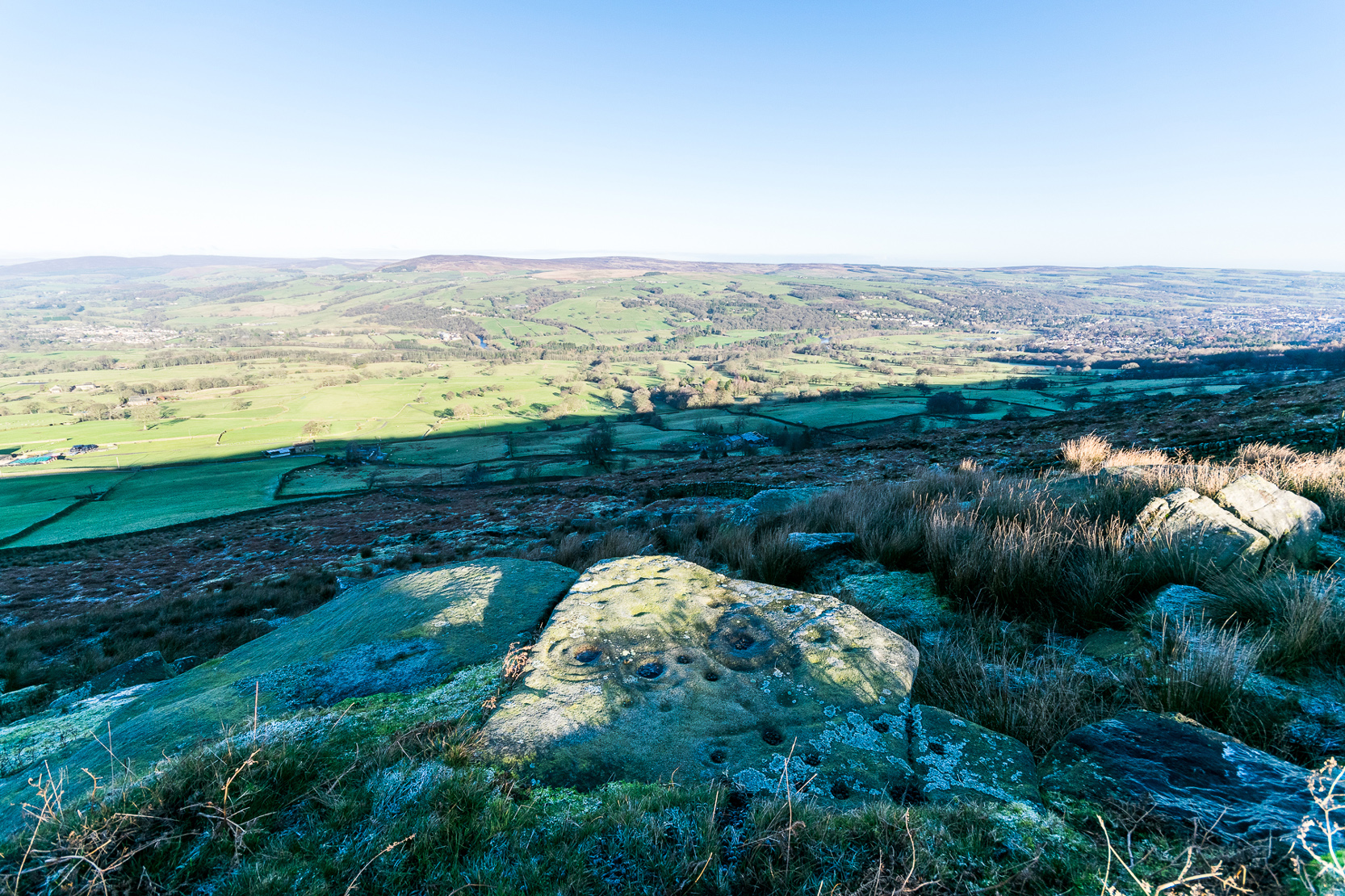
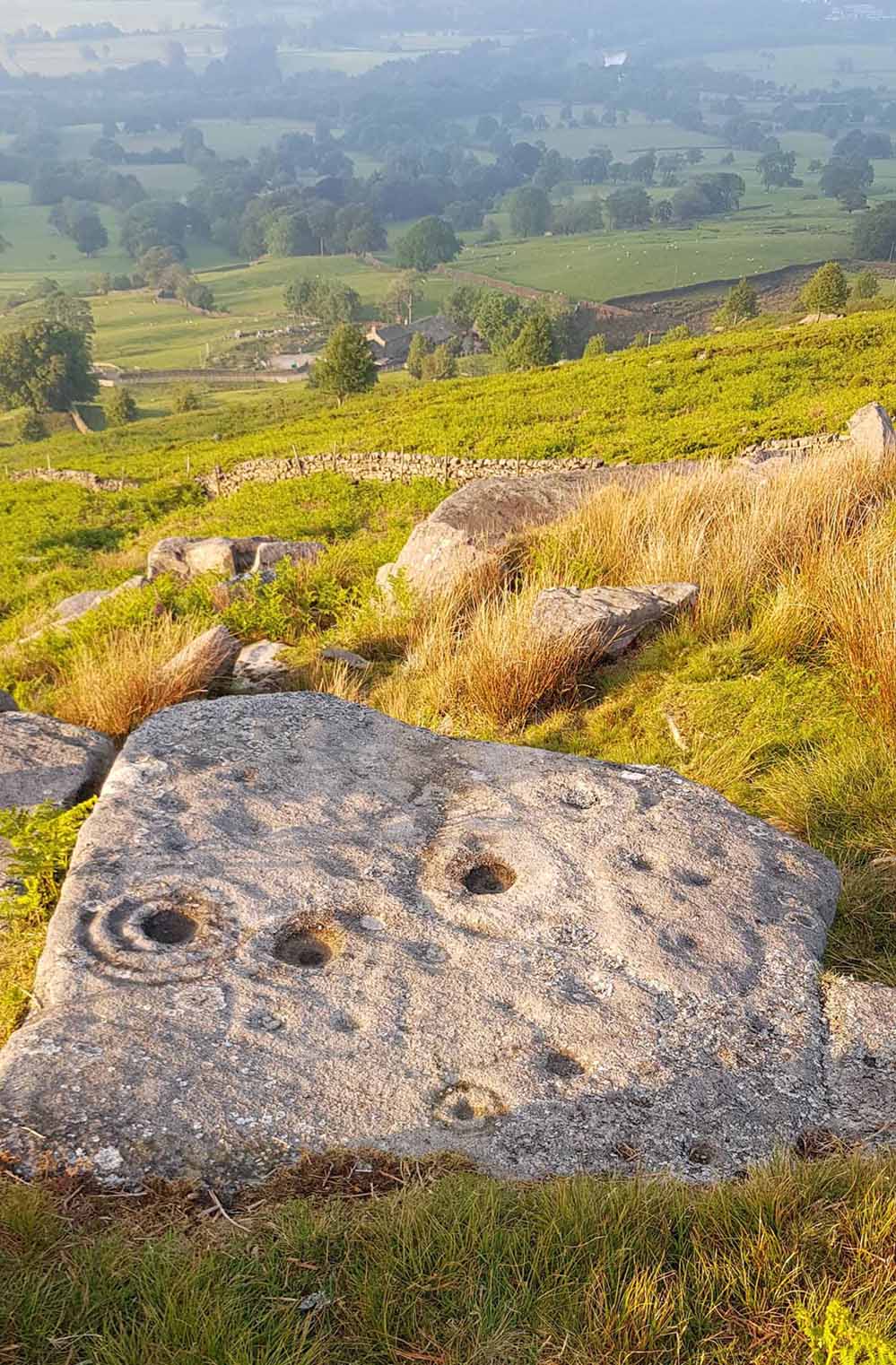
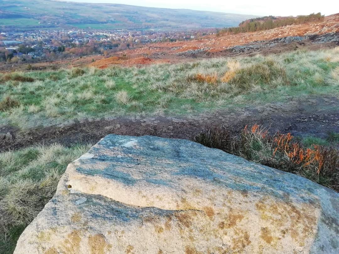
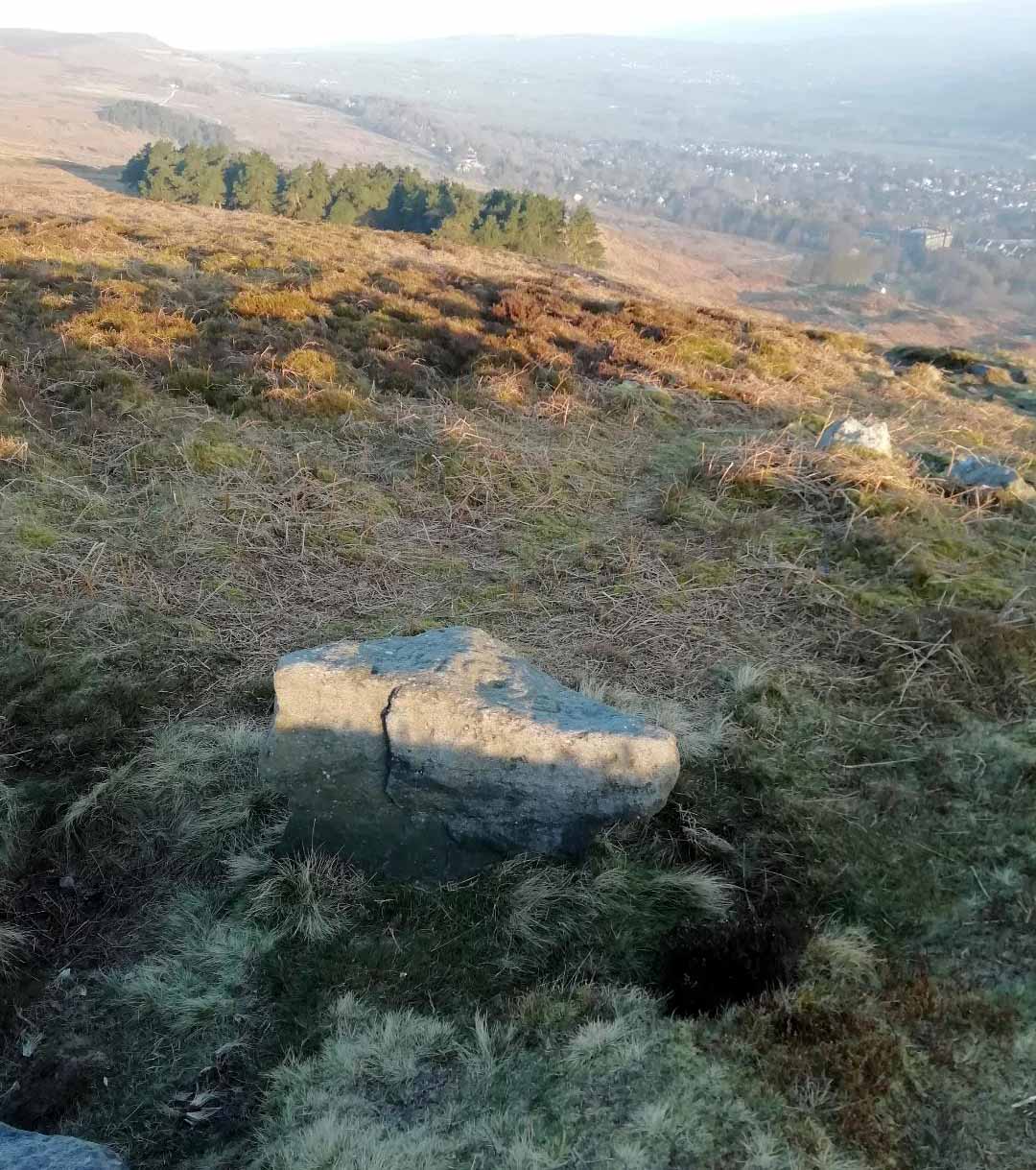
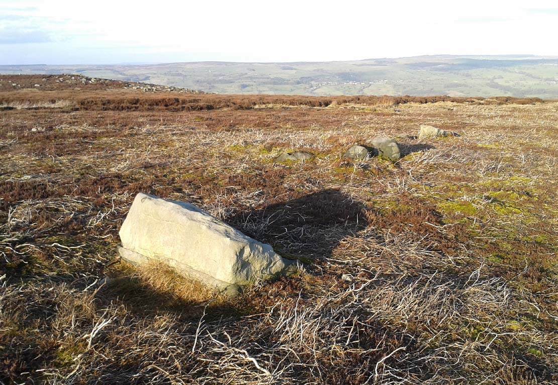
Various ways to get here, but probably the easiest is to start from Cow & Calf Rocks, walking up the steep slope onto the moor-edge. Paths veer left and right once you’re on the level, but you wanna head straight forward, west(-ish), for about 350 yards till you reach the stream. Cross over and then take the path that runs parallel with the stream, uphill. Nearly 200 yards up, where the moor begins to level out, you cross a path running east-west; keep going past this for about another 50 yards (as if you’re heading to the Backstone Circle) and you’ll notice some small sheep-paths leading you into the heather to your right and, some 40-50 yards into the heath you’ll see this large flat stone!
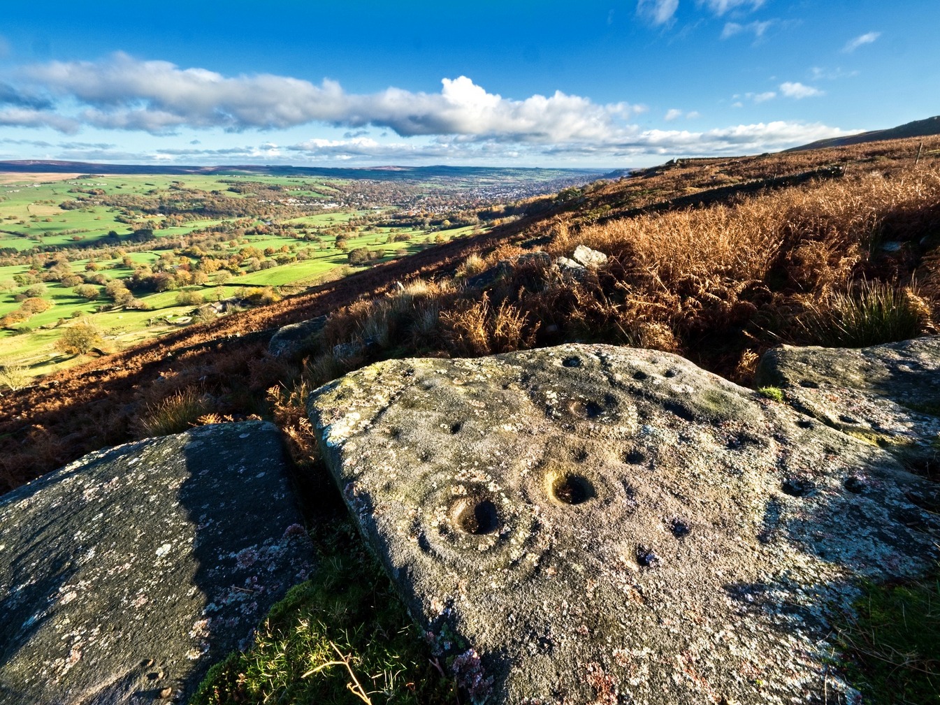
Archaeology & History
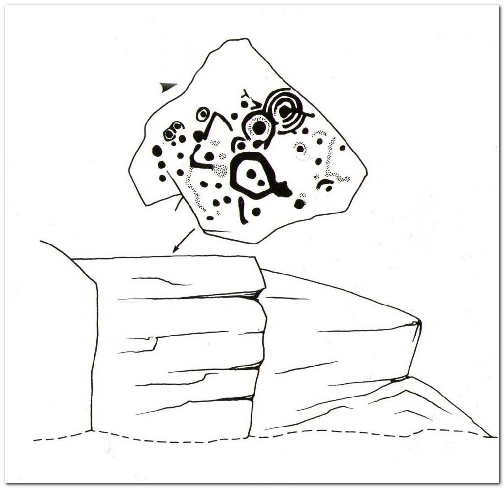
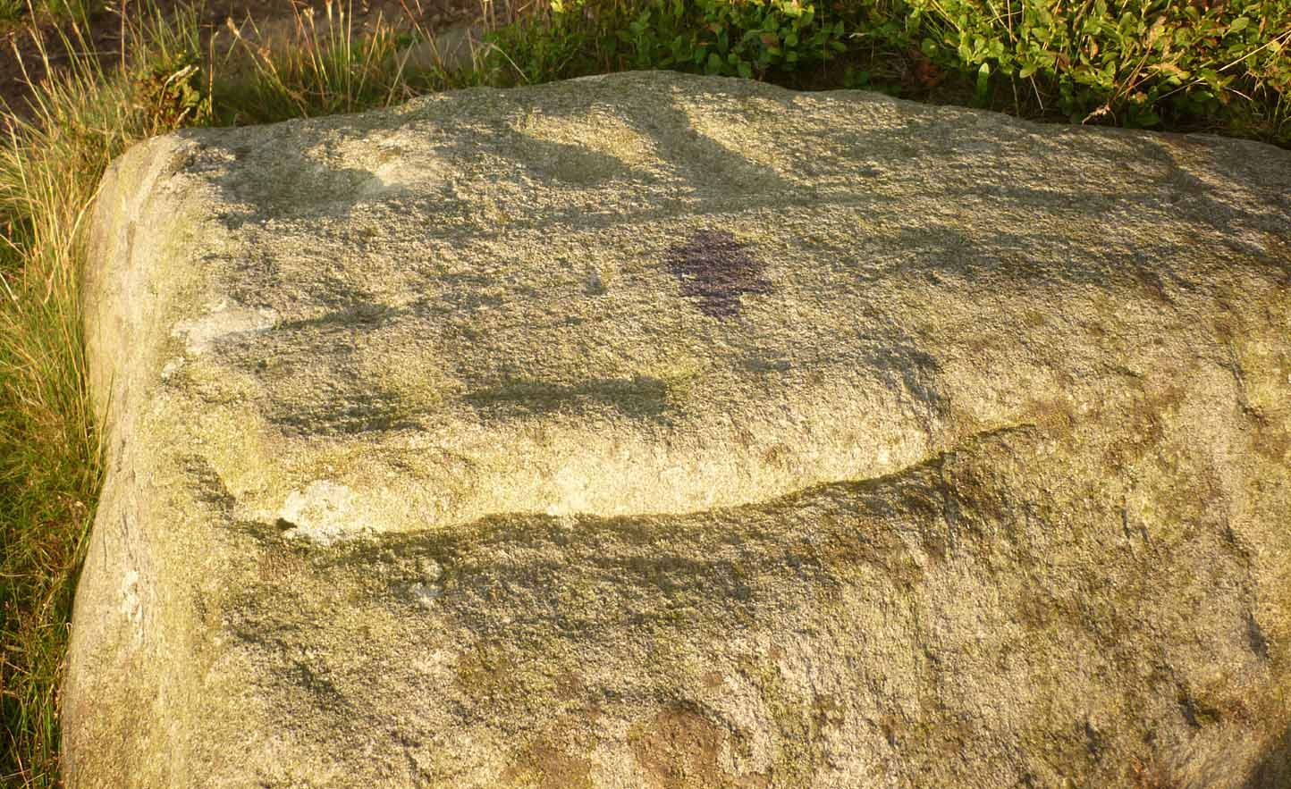
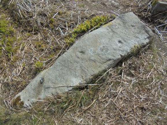
This carving seems to have been rediscovered in the 1950s by Michael Walker and Stuart Feather. They were amongst a small group of people who visited this and some other carvings in June 1956, when the first (known) sketch of the carving was done by Mr Walker. His sketch of the stone is somewhat more elaborate than the one in John Hedges’ (1986) later archaeological survey. Indeed, in some ways the two drawings seem to show little resemblance to each other. (not uncommon with these things!)
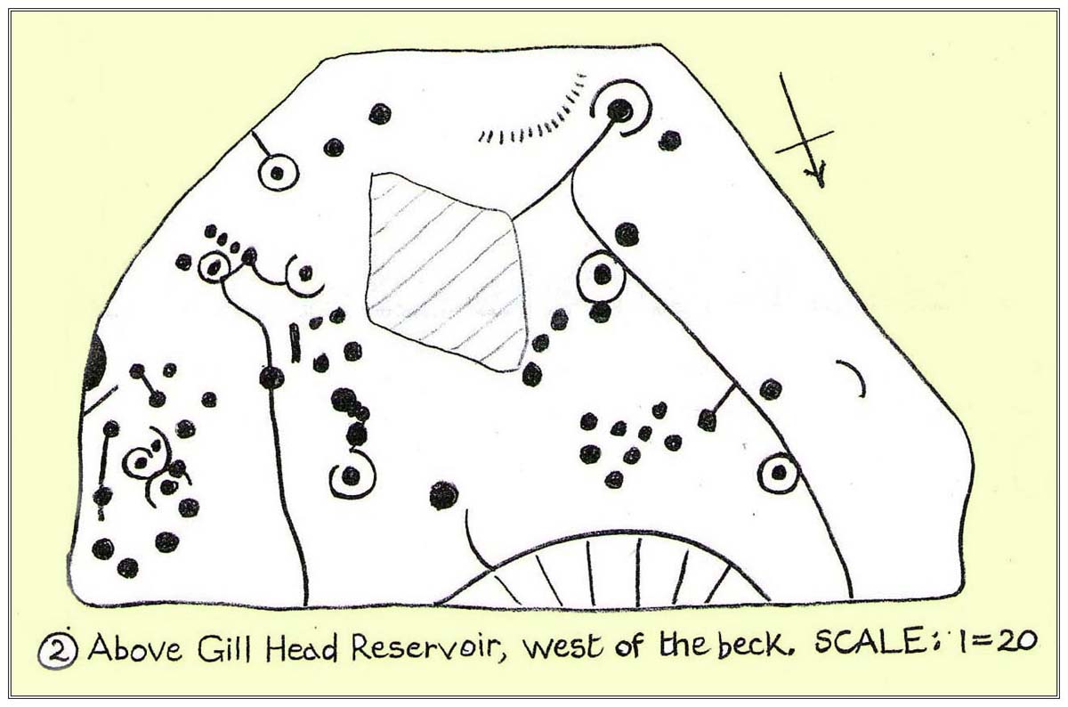
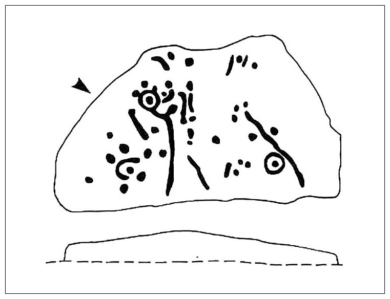
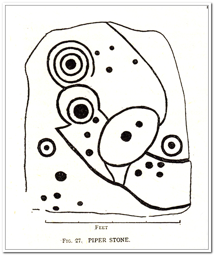
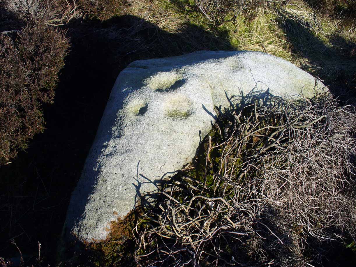
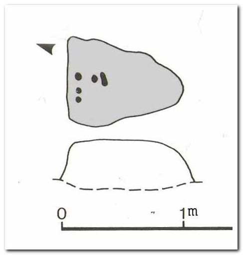
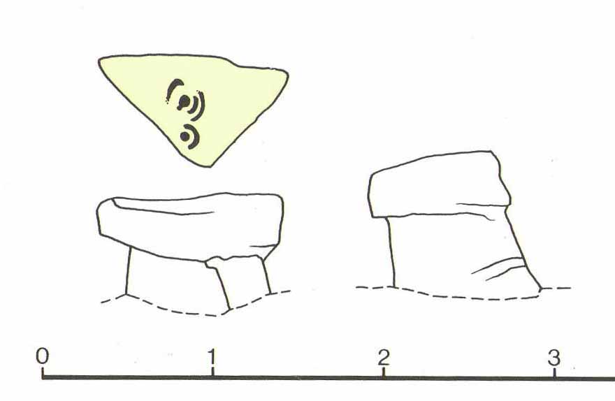
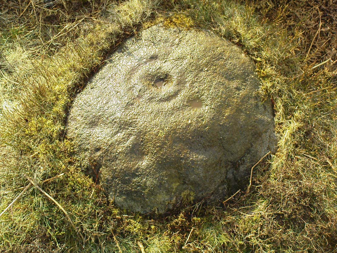
Walker shows nine cup-and-rings in various states of completion, with several clusters of singular cups at different places on the rock—more than forty in all, some of which are connected to each other by short lines. This is in contrast with the later archaeological description, which saw far fewer of the primary symbols. When John Hedges (1986) described the carving in his inventory, he informed the reader:
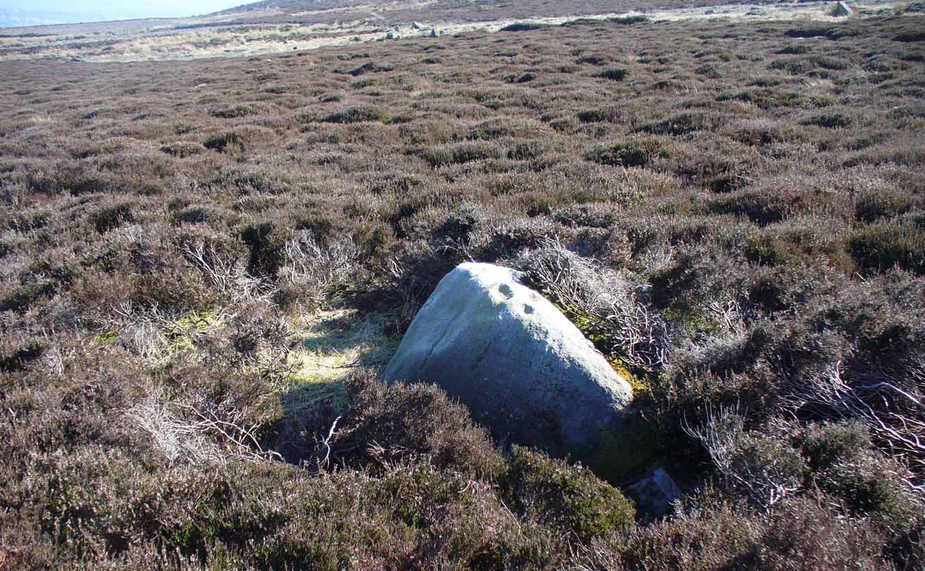
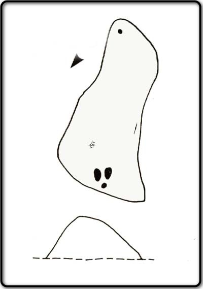
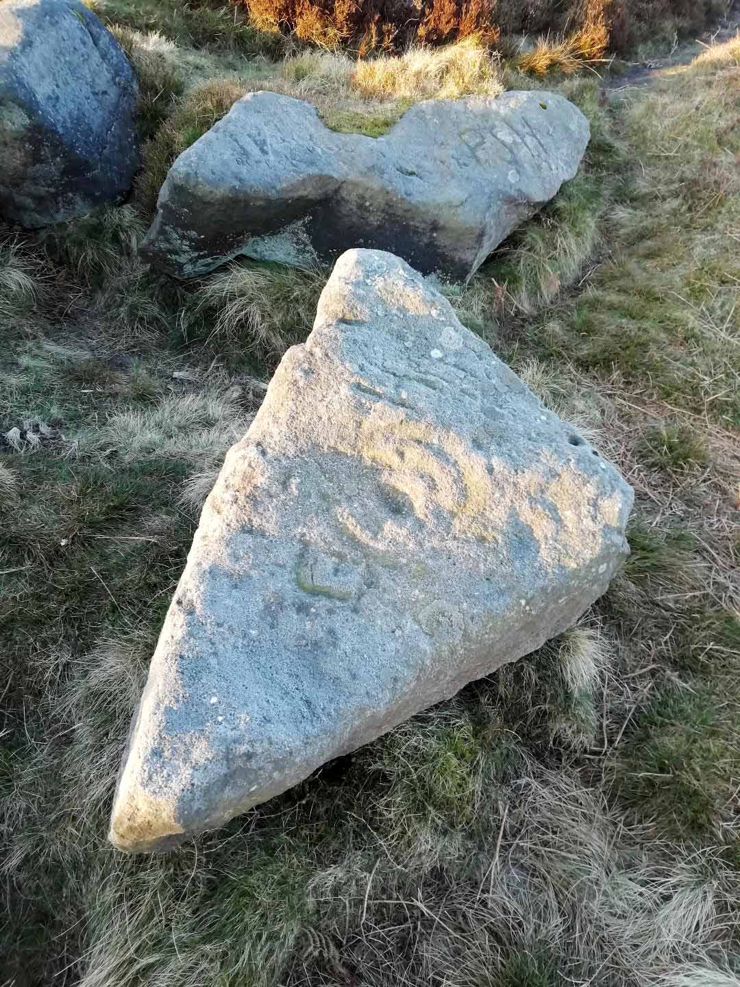
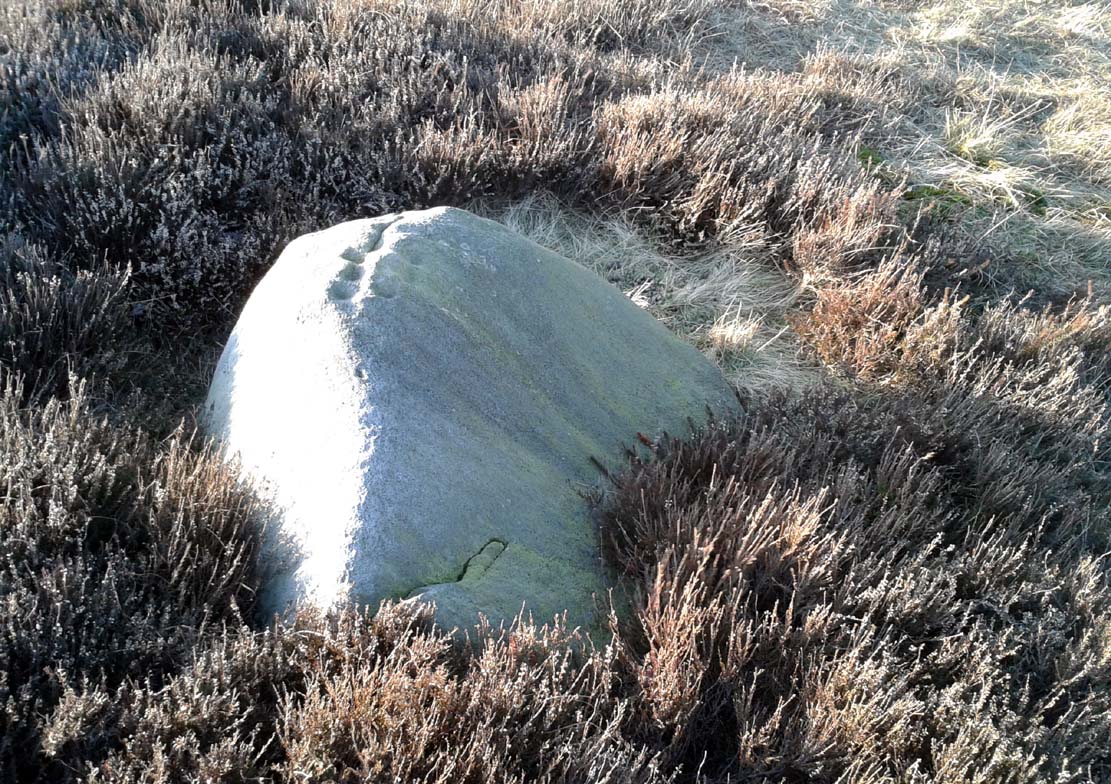
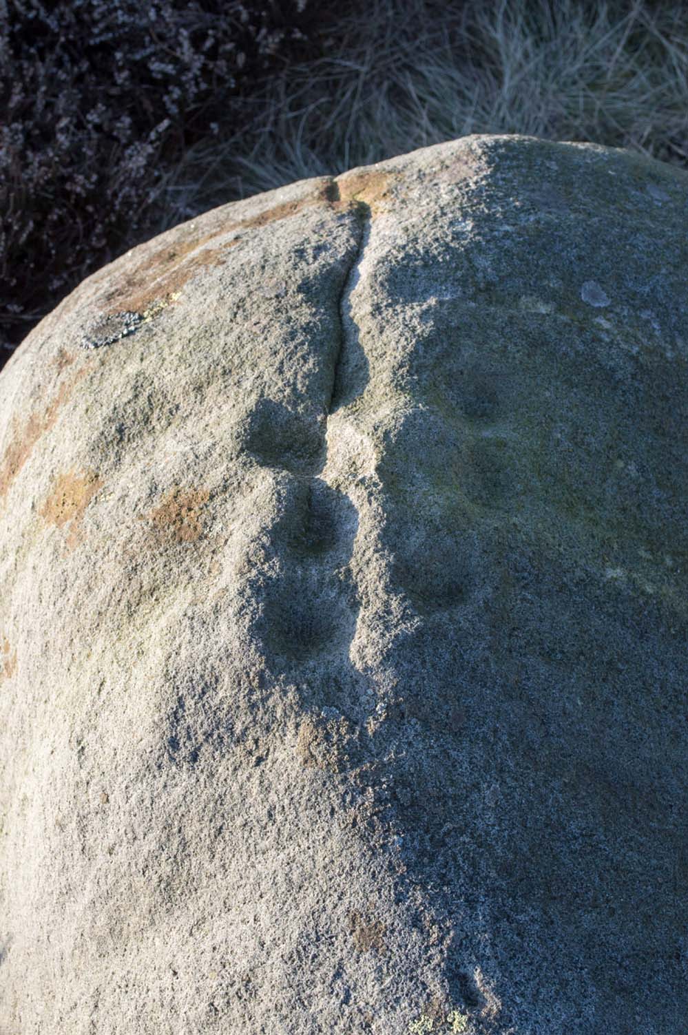
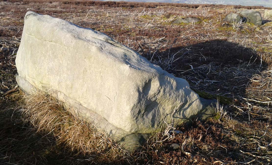
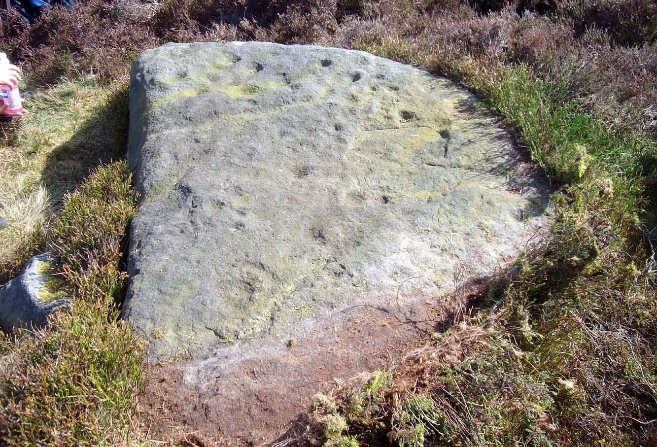
“Fairly smooth, medium sized grit rock standing up in heather, crowberry and grass, sloping SW to NE with the hill, its almost triangular flat top covered with carvings, some very clear, interesting patterns. About thirty-five cups, seven surrounding a small ring with cups on the circumference and at centre. Two long grooves with a cup at one end, running down to the edge of the rock. ‘Peck’ marks noticeable in one groove and in one ring round a cup. Three other grooves going half round cups, or leading from a cup. Slice of rock apparently removed.”
Boughey & Vickerman (2003) added nothing new in their later survey.
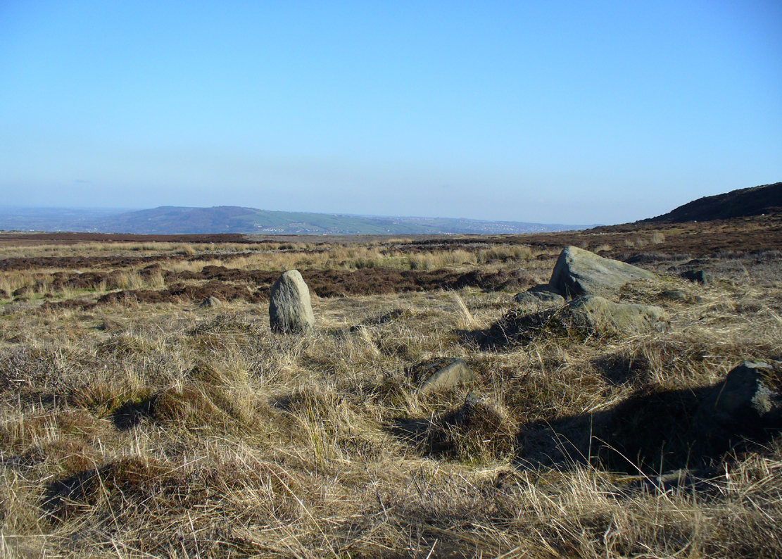
Although we have an uninterrupted open view of the landscape to the north and west from here, it might not have been like this when the carving was done 4-5000 years ago. The scattered woodland covering these heaths may have impeded the views. However, immediately west of this carving are the broken remains of a small Bronze Age settlement, some of whose walling is traceable some 100-150 yards away and any tree cover that may have been here may have been cut back. We may never know for sure…

References:
- Boughey, K.J.S. & Vickerman, E.A., Prehistoric Rock Art of the West Riding, WYAS: Leeds 2003.
- Hedges, John (ed.), The Carved Rocks of Rombald’s Moor, WYMCC: Wakefield 1986.
- Jackson, S. & Walker, Michael J., “Ilkley Boulders Tour,” in Cartwright Hall Archaeology Group Bulletin, 2:1, 1956.
© Paul Bennett, The Northern Antiquarian