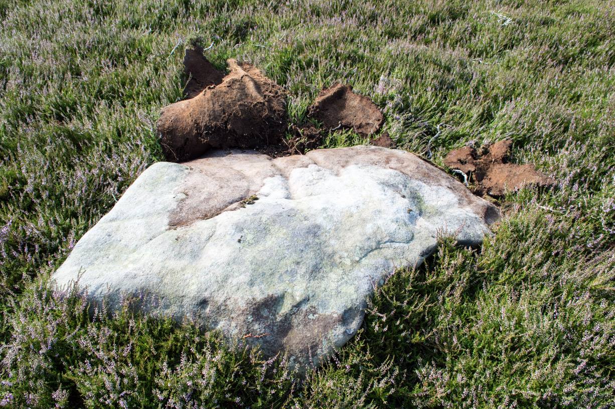
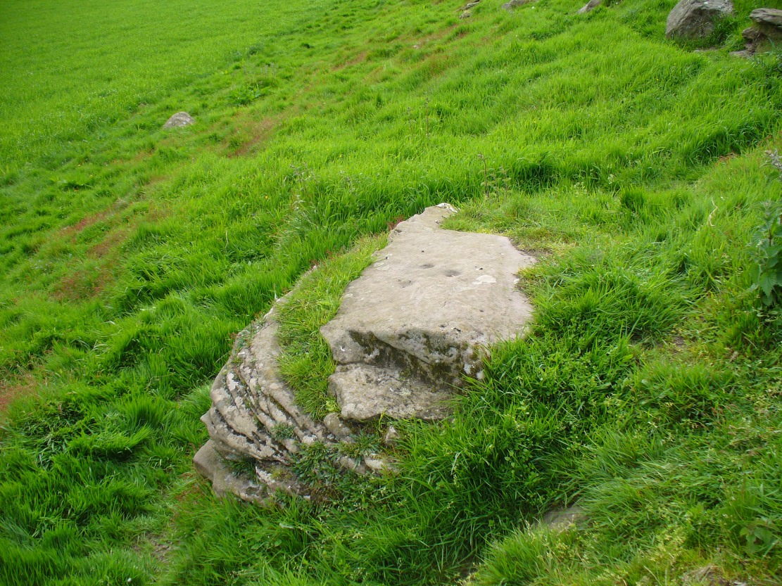
Take the same directions as if you’re visiting any of the upper Ballochraggan petroglyphs, but 100 yards before the carvings, out in the open on the grasslands, below the reach of the forest, you’ll see the leaning stone if you wander about. You can’t really miss it!
Archaeology & History
Not included in any of the Canmore, Royal Commission or Ordnance Survey records, this standing stone appears to have eluded official records until now. Found close to the petroglyph-rich arena of the Ballochraggan complex, with attendant tombs to the east, there is the possibility that this large leaning stone was itself, once, a part of a long-gone cairn, as Paul Hornby suggested. The small cluster of stones around its base certainly adds to that idea (similar to the incredible Dunruchan cluster, more than 17 miles (28km) northeast).
The stone leans at a considerable angle from a previously upright position. When standing it would have been nearly five-feet tall and measures nearly as wide. The stone is roughly triangular in shape, above ground. What appear to be two faint cup marks on its topmost surface are very probably due to conglomerate rock erosion and not the handiwork of humans.
Park by the entrance to Ballochraggan, which is set back off the A81 between Aberfoyle and Port of Mentieth. Walk up the track, and just before you reach the cottage, notice the large boulder on your left, about 50 yards away. That’s it.
Archaeology & History
The Ballochraggan 1 Stone
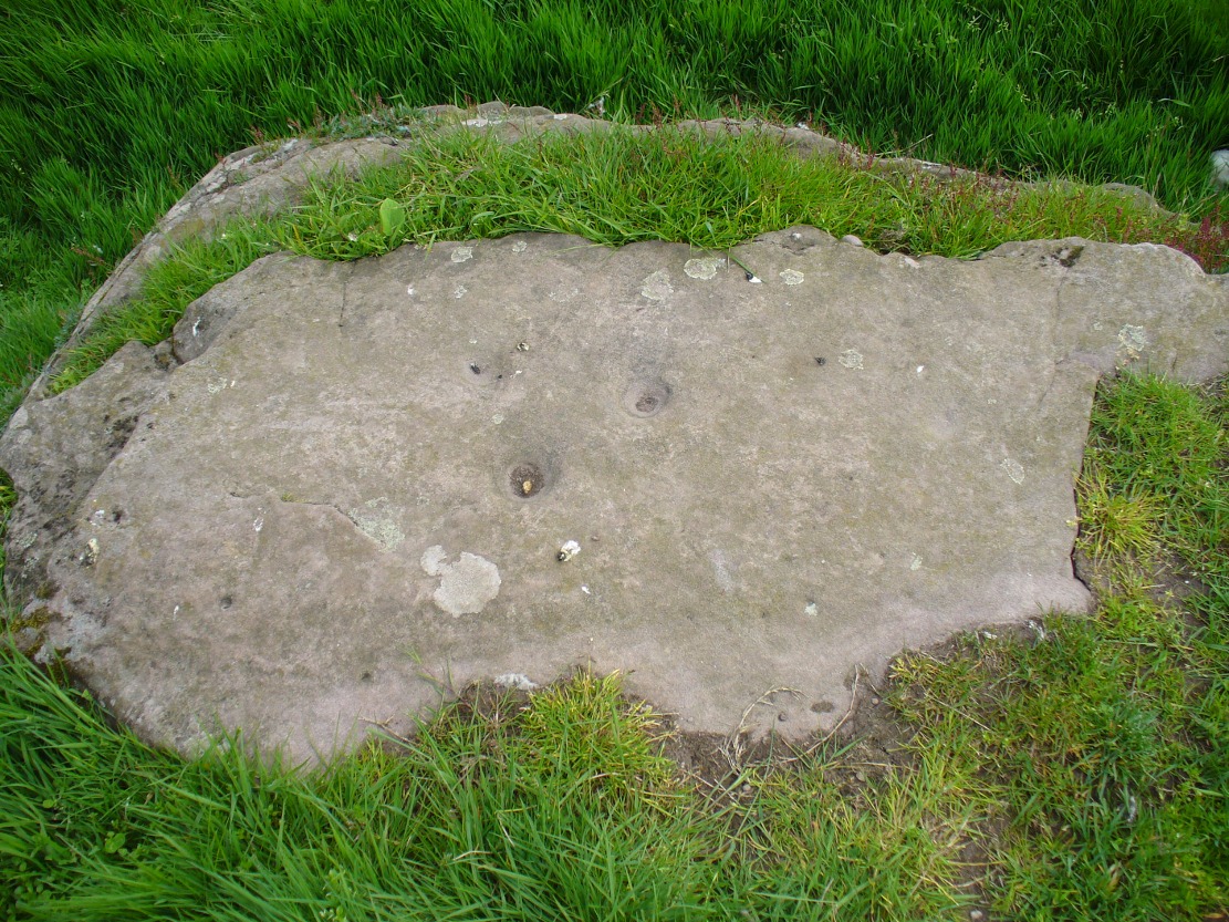
This large dolmen-capstone-like boulder in front of the old cottage, was reported by Maarten von Hoek (1989) to possess about 10 faint cup-markings, with a large one near the centre of its upper surface. When Paul Hornby and I visited the site yesterday, several ‘cups’ were visible, but these were purely geological in nature; and even the large cup in the middle seemed somewhat dubious. The markings are the product of conglomerate rock, where smaller softer types of stone that are embedded in the boulder fall away, leaving cupmark-like indentations and other hollows. There are a lot of conglomerate rocks in these hills and it is essential that all students make themselves aware of the difference between the geological ‘cups’ and those forged by humans. In many cases this can be difficult, so apply the rule: if in doubt, kick it out—and err on the side of caution.
Some carvings in this region (and elsewhere in the country) possess conglomerate marks that have been enhanced and possess additional rings and carved lines. On this particular stone, such marks do not seem to exist. A dodgy example indeed…..
References:
von Hoek, Maarten, ‘Menteith (Port of Menteith parish): Rock Art Sites’, in Discovery & Excavation Scotland, 1989.
Acknowledgements: Huge appreciation to Paul Hornby for his photo and assessments.
Takes some finding this one! We parked up by the entrance to Ballochraggan on the A81 between Aberfoyle and Port of Mentieth. Walk up the track, then up the burnside past the house. Keep to its right-side and head uphill towards the very top of the forestry edge, staying in the grasslands. As you near the very top NE corner of the grassland boscage (NOT into the forest), about 100 yards before it, zigzag about through the gorse and keep your eyes peeled. It’s there!
Archaeology & History
This is a small, flat, smooth piece of stone with a simple carving clearly visible, in a region replete with highly impressive multiple-ringed petroglyphs. Very little has been said of this design and even the Canmore lads tell us only that the carving “includes one cup and ring marking and two cups within an oval ring.” And that’s that! However, other faint lines are evident on the surface of the stone, with the single cup-and-ring appearing to have another partial second-ring encircling a section of it. Outlying this are very shallow worn lines that seem to bear the hallmarks of human interference, but they were difficult to see with any certainty and our camera didn’t pick up additional elements with any real clarity. What seemed to be another cup-and-half-ring (not visible in the photos) was just beneath the edge of the grass where the rock fell back into the Earth.
Ballochraggan12, under cloud
The most catching element of the design is the very obvious ‘eye’ symbol peering up at us as we look down. Whether this symbol was deliberate or not, we can be sure that the old archaeologist O.G.S. Crawford (1957) would have loved it and added it to his old dreams of eye goddesses!
Other carvings nearby will blow your head off! The recently discovered Mask Stone, right next to this Ballochraggan 12 carving, being just a taster of the things to come.
Crawford, O.G.S., The Eye Goddess, Phoenix House: London 1957.
Naddair, Kaledon, et al, ‘Menteith (Port of Menteith Parish): Rock Ccarvings’, in Discovery & Excavation Scotland, 19, 1992.
Royal Commission on the Ancient and Historical Monuments of Scotland, The archaeological sites and monuments of Stirling District, Central Region, HMSO: Edinburgh 1979.
Acknowledgements: Huge appreciation to Paul Hornby for use of his photos. Cheers mate!
From Marske village, take the road west and uphill to the villages of Fremington and Reeth. At the top of the hill where the fields open up, several hundred yards along on your right, past the field with the track, a footpath sign points you up onto the moor. Go up the field till you hit the wall that goes right to the top of the moor. Where the four walls meet, go straight across and then walk northwards along the line of walling for 2-300 yards, keeping your eyes peeled for a solitary stone on its own, 100 yards west. You’ll find it.
Archaeology & History
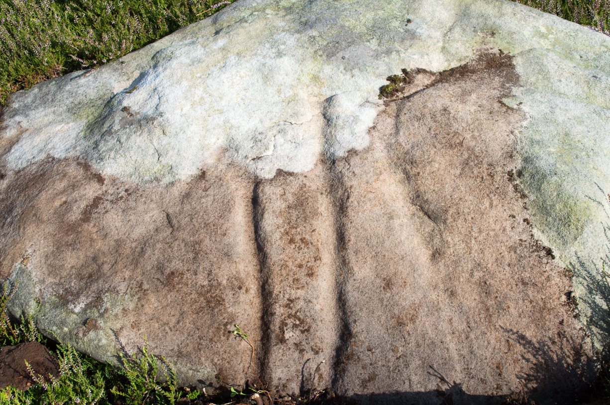
Deep carved line features
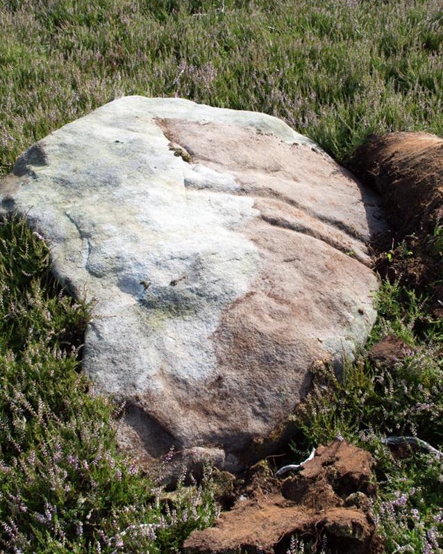
A pretty basic petroglyph located within a massive arena of prehistoric sites dating from the neolithic and continuing through the Bronze Age period and beyond. Found a few hundred yards northwest of the once giant cairn of Cock Howe, this design is characterized mainly by the two large deep channels deliberately cut into the stone that run from the middle of the upper surface down to ground level. One of them emerges from a single cup-marking, at an angle; whilst the other comes from the edge of a natural crack in the rock. The channels are wide and flattened. Other faint lines can be discerned too, which may have originally been carved. We need to explore this design in different lighting conditions to see if there are additional features here.
Looking east-ish
An archetypal cup-marking can seen on the vertical edge of the stone and three other faint ones scatter the top. Another small ‘cup’ is along the southern vertical face of the rock which, when we found it, thought was natural; but a photograph of the stone by James Elkington seems to show a ring surrounding much of the cup-mark. We need to go back and take another look at the place.
A number of other carvings described in Paul and Barbara Brown’s (2008) survey can be found in the region.
References:
Brown, Paul & Barbara, Prehistoric Rock Art in the Northern Dales, Tempus: Stroud 2008.
Cup-Marked Stone (missing): OS Grid Reference – SE 16940 87301
Archaeology & History
A prehistoric carving that is missing and possibly destroyed since being rediscovered in 2001 by Barbara Brown (2008) and subsequently described in her book on North Yorkshire petroglyphs. She told it to be in “Thornton Steward field hedge bottom” and was a simple glyph, being a
“rectangular slab (with) single cup-mark located in hedge bottom part of old walling.”
When she revisited the site with her husband in 2006, the old hedge and wall had been removed, with “new hedging in place.” The carved stone may be buried within a pile of clearance stones adjacent to the hedgerow, but it has yet to be relocated. If anyone finds it, please let us know! It was one of several cup-marked stones that exist in the wider neighbourhood.
References:
Brown, Paul & Barbara, Prehistoric Rock Art in the Northern Dales, Tempus: Stroud 2008.
Access to these stones has, over recent years been pretty dreadful by all accounts. It’s easy enough to locate. Go into Calderstones Park and head for the large old vestibule or large greenhouse. If you’re fortunate enough to get one of the keepers, you may or may not get in. If anyone has clearer info on how to breach this situation and allow access as and when, please let us know.
Archaeology & History
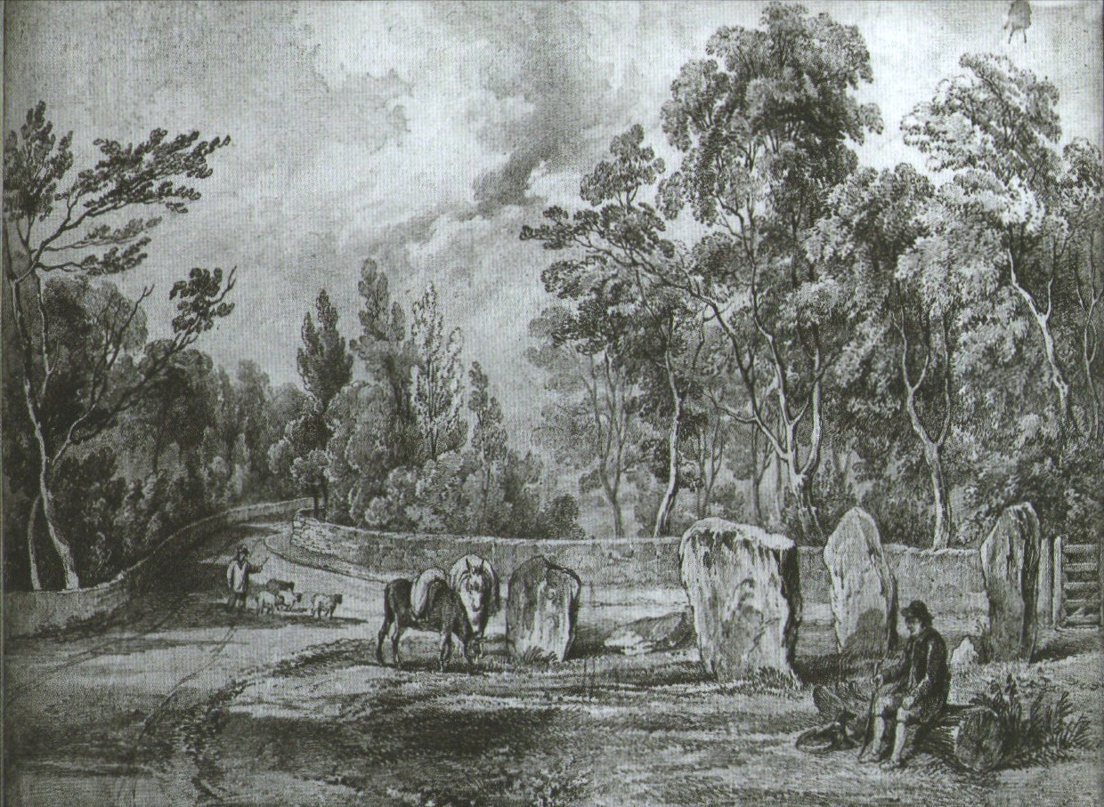
Earliest known drawing from 1825, showing the carvings
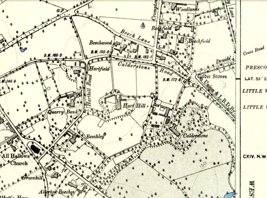
Marked on the 1846 Ordnance Survey map in a position by the road junctions at the meeting of township boundaries, where the aptly-named Calderstones Road and Druids Cross Road meet, several hundred yards north of its present site in Harthill Greenhouses in Calderstones Park, this is a completely fascinating site whose modern history is probably as much of a jigsaw puzzle as its previous 5000 years have been!
Thought to have originally have been a chambered tomb of some sort, akin to the usual fairy hill mound of earth, either surrounded by a ring of stones, or the stones were covered by earth. The earliest known literary reference to the Calderstones dates from 1568, where it is referenced in a boundary dispute, typical of the period when the land-grabbers were in full swing. The dispute was over a section of land between Allerton and Wavertree and in it the stones were called “the dojer, rojer or Caldwaye stones.” At that time it is known that the place was a roughly oval mound. But even then, we find that at least one of the stones had been taken away, in 1550.
Little was written about the place from then until the early 19th century, when descriptions and drawings began emerging. The earliest image was by one Captain William Latham in 1825. On this (top-right) we have the first hint of carvings on some of the stones, particularly the upright one to the right showing some of the known cup-markings that still survive. By the year 1833 however, the ‘mound’ that either surrounded or covered the stones was destroyed. Victorian & Paul Morgan (2004) told us,
“The destruction first began in the late 18th or early 19th century when the mound was largely removed to provide sand for making mortar for a Mr Bragg’s House on Woolton Road. It was at this time that a ‘fine sepulchral urn rudely ornamented outside’ was found inside.”
The Calderstones in 1840
The same authors narrated the account of the mound’s final destruction, as remembered by a local man called John Peers—a gardener to some dood called Edward Cox—who was there when it met its final demise. Mr Cox later wrote a letter explaining what his gardener had told him and sent it to The Daily Post in 1896, which lamented,
“When the stones were dug down to, they seemed rather tumbled about in the mound. They looked as if they had been a little hut or cellar. Below the stones was found a large quantity of burnt bones, white and in small pieces. He thought there must have been a cartload or two. He helped to wheel them out and spread them on the field. He saw no metal of any sort nor any flint implements, nor any pottery, either whole or broken; nor did he hear of any. He was quite sure the bones were in large quantity, but he saw no urn with them. Possibly the quantity was enhanced by mixture with the soil. No one made such of old things of that sort in his time, nor cared to keep them up…”
But thankfully the upright stones remained—and on them were found a most curious plethora of neolithic carvings. After the covering cairn had been moved, the six remaining stones were set into a ring and, thankfully, looked after. These stones were later removed from their original spot and, after a bit of messing about, came to reside eventually in the curious greenhouse in Calderstones Park.
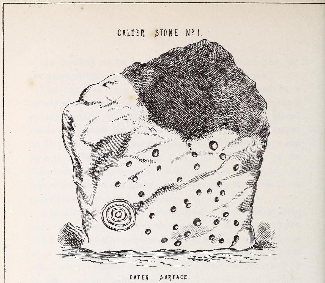
Simpson’s “Stone 1” outer faceSimpson’s “Stone 1” inner face
The carvings on the stones were first described in detail by the pioneering James Simpson. (1865) I hope you’ll forgive me citing his full description of them—on one of which he could find no carvings at the time, but he did state that his assessment may be incomplete as the light conditions weren’t too good. Some things never change! Sir James wrote:
“The Calder circle is about six yards in diameter. It consists of five stones which are still upright, and one that is fallen. The stones consist of slabs and blocks of red sandstone, all different in size and shape.
“The fallen stone is small, and shews nothing on its exposed side; but possibly, if turned over, some markings might be discovered on its other surface.
“Of the five standing stones, the largest of the set (No. I) is a sandstone slab, between five and six feet in height and in breadth. On its outer surface—or the surface turned to the exterior of the circle— there is a flaw above from disintegration and splintering of the stone; but the remaining portion of the surface presents between thirty and forty cup depressions, varying from two to three and a half inches in diameter; and at its lowest and left-hand corner is a concentric circle about a foot in diameter, consisting of four enlarging rings, but apparently without any central depression.
“The opposite surface of this stone, No. 1, or that directed to the interior of the circle, has near its centre a cup cut upon it, with the remains of one surrounding ring. On the right side of this single-ringed cup are the faded remains of a concentric circle of three rings. To the left of it there is another three-ringed circle, with a central depression, but the upper portions of the rings are broken off. Above it is a double-ringed cup, with this peculiarity, that the external ring is a volute leading from the central cup, and between the outer and inner ring is a fragmentary line of apparently another volute, making a double-ringed spiral which is common on some Irish stones, as on those of the great archaic mausoleum at New Grange, but extremely rare in Great Britain. At the very base of this stone, and towards the left, are two small volutes, one with a central depression or cup, the other seemingly without it. One of these small volutes consists of three turns, the other of two.
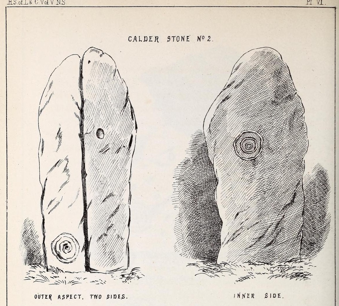
“The next stone, No. 2 in the series, is about six feet high and somewhat quadrangular. On one of its sides, half-way up, is a single cup cutting; on a second side, and near its base, a volute consisting of five rings or turns, and seven inches and a half in breadth ; and on a third side (that pointing to the interior of the circle), a concentric circle of three rings placed half-way or more up the stone.
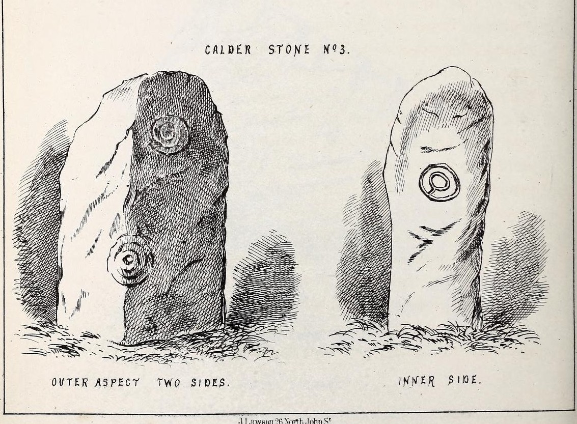
“The stone No. 3, placed next to it in the circle, is between three and four feet in height; thick and somewhat quadrangular, but with the angles much rounded off. On its outermost side is apparently a triple circle cut around a central cup; but more minute examination and fingering of the lines shews that this figure is produced by a spiral line or volute starting from the central cup, and does not consist of separate rings. The diameter of the outermost circle of the volute is nearly ten inches. Below this figure, and on the rounded edge between it and the next surface of the stone to the left, are the imperfect and faded remains of a larger quadruple circle. On one of the two remaining sides of this stone is a double concentric circle with a radial groove or gutter uniting them. This is the only instance of the radial groove which I observed on the Calder Stones, though such radial direct lines or ducts are extremely common elsewhere in the lapidary concentric circles.
“The stone No. 4 is too much weathered and disintegrated on the sides to present any distinct sculpturings. On its flat top are nine or ten cups ; one large and deep (being nearly five inches in diameter). Seven or eight of these cups are irregularly tied or connected together by linear channels or cuttings…
“The fifth stone is too much disfigured by modern apocryphal cuttings and chisellings to deserve archaeological notice.
“The day on which I visited these stones was dark and wet. On a brighter and more favourable occasion perhaps some additional markings may be discovered.”
It wasn’t long, of course, before J. Romilly Allen (1888) visited the Calderstones and examined the carvings; but unusually he gave them only scant attention and added little new information. Apart from reporting that another of the monoliths had carvings on it, amidst a seven-page article the only real thing of relevance was that,
“Five of the Calderstones show traces, more or less distinct, of this kind of carving, the outer surface of the largest stone having about thirty-six cups upon it, and a set of four concentric rings near the bottom at one corner. One of the stones has several cups and grooves on its upper surface.”
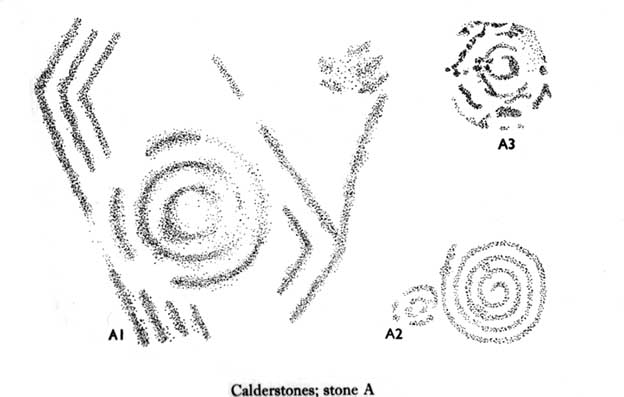
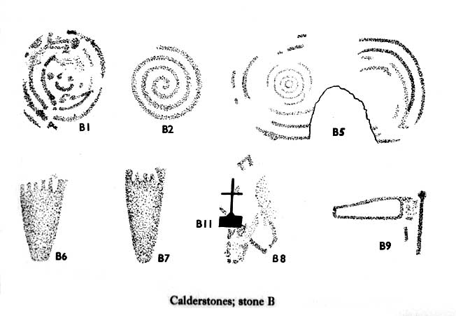
Carvings on Stone A (after Forde-Johnson)Carvings on Stone B (after Forde-Johnson)
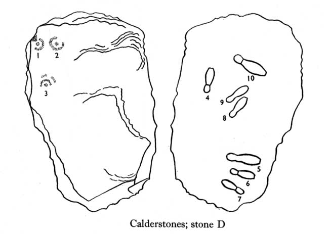
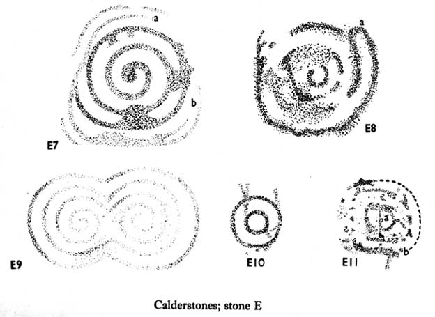
Unusual for him! The major survey of the Calderstone carvings took place in the 1950s when J.L. Forde-Johnson (1956; 1957) examined them in great detail. His findings were little short of incredible and, it has to be said, way ahead of his time (most archaeo’s of his period were simply lazy when it came to researching British petroglyphs). Not only were the early findings of Sir James Simpson confirmed, but some fascinating rare mythic symbols were uncovered that had only previously been located at Dunadd in Argyll, Cochno near Glasgow, and Priddy in Somerset: human feet – some with additional toes! Images of feet were found to be carved on Stones A, B and E. A carved element on Stone C may even represent a human figurine—rare things indeed in the British Isles!
Carvings on Stone DCarvings on Stone E
The detailed sketches here are all from Forde-Johnson’s 1957 article, where five of the six stones were found to bear petroglyphs (the sixth stone has, more recently, also been found to also possess faint carvings of a simple cup-mark and five radiating lines).
Elements on Stone C (after Forde-Johnson)More elements on Stone C (after Forde-Johnson)
The date of the site is obviously difficult to assess with accuracy; but I think it is safe to say that the earlier archaeological assumptions of the Calderstones being Bronze Age are probably wrong, and the site is more likely to have been constructed in the neolithic period. It’s similarity in structure and form to other chambered tombs—mentioned by a number of established students from Glyn Daniel (1950) to Frances Lynch—would indicate an earlier period. The fact that no metals of any form have ever been recovered or reported in any of the early accounts add to this neolithic origin probability.
There is still a lot more to be said about this place, but time and sleep are catching me at the mo, so pray forgive my brevity on this profile, until a later date…
Folklore
Curiously, for such an impressive site with a considerable corpus of literary references behind it, folklore accounts are scant. The best that Leslie Grinsell (1976) could find in his survey was from the earlier student C.R. Hand (1912), who simply said that,
“They were looked upon with awe by the people about as having some religious significance quite beyond their comprehension.”
There is however, additional Fortean lore that has been written about these stones and its locale by John Reppion (2011).
Ashbee, Paul, The Bronze Age Round Barrow in Britain, Phoenix House: London 1960.
Baines, Thomas, Lancashire and Cheshire, Past and Present – volume 2, William MacKenzie: London 1870.
Beckensall, Stan, British Prehistoric Rock Art, Tempus: Stroud 1999.
Beckensall, Stan, Circles in Stone: A British Prehistoric Mystery, Tempus: Stroud 2006.
Cowell, Ron, The Calderstones – A Prehistoric Tomb in Liverpool, Merseyside Archaeological Trust 1984.
Crawford, O.G.S., The Eye Goddess, Phoenix House: London 1957.
Daniel, Glyn E., The Prehistoric Chamber Tombs of England and Wales, Cambridge University Press 1950.
Faulkner, B.M., “An Analysis of Three 19th-century Pictures of the Calderstones,” in Merseyside Archaeological Journal, volume 13, 2010.
Forde-Johnson, J.L., “The Calderstones, Liverpool,” in Powell & Daniel, Barclodiad y Gawres: The excavation of a Megalithic Chambered Tomb in Anglesey, Liverpool University Press 1956.
Forde-Johnson, J.L., “Megalithic Art in the North West of Britain: The Calderstones, Liverpool,” in Proceedings of the Prehistoric Society, volume 23, 1957.
Grinsell, Leslie, Folklore of Prehistoric Sites in Britain, David & Charles: Newton Abbot 1976.
Hand, Charles R., The Story of the Calderstones, Hand & Co.: Liverpool 1912.
Herdman, W.A., “A Contribution to the History of the Calderstones, near Liverpool,” in Proceedings & Transactions of the Liverpool Biological Society, volume 11, 1896.
Morgan, Victoria & Paul, Prehistoric Cheshire, Landmark: Ashbourne 2004.
Nash, George & Stanford, Adam, “Recording Images Old and New on the Calderstones in Liverpool,” in Merseyside Archaeological Journal, volume 13, 2010.
Picton, James A., Memorials of Liverpool – 2 volumes, Longmans Gree: London 1875.
Simpson, James, Archaic Sculpturings of Cups, Circles, etc., Upon Stones and Rocks in Scotland, England and other Countries, Edmonston & Douglas: Edinburgh 1867.
Taylor, Isaac, Words and Places, MacMillam: London 1885.
Stewart-Brown, Ronald, A History of the Manor and Township of Allerton, Liverpool 1911.
Acknowledgements: With huge thanks to the staff at Calderstones Park; thanks also to the very helpful staff at Liverpool Central Library.
Follow the same directions as if you’re looking for the Doo’cot Woods carving; but, in the field that you have to cross before entering the trees, about 50 yards down from the top of the field, a geological ridge of stone runs along into the trees themselves. The carving is along this ridge in the field. Walk along and you’ll find it! (the grid-reference for this carving is slightly off-centre and needs correcting)
Archaeology & History
Cup-marks from above
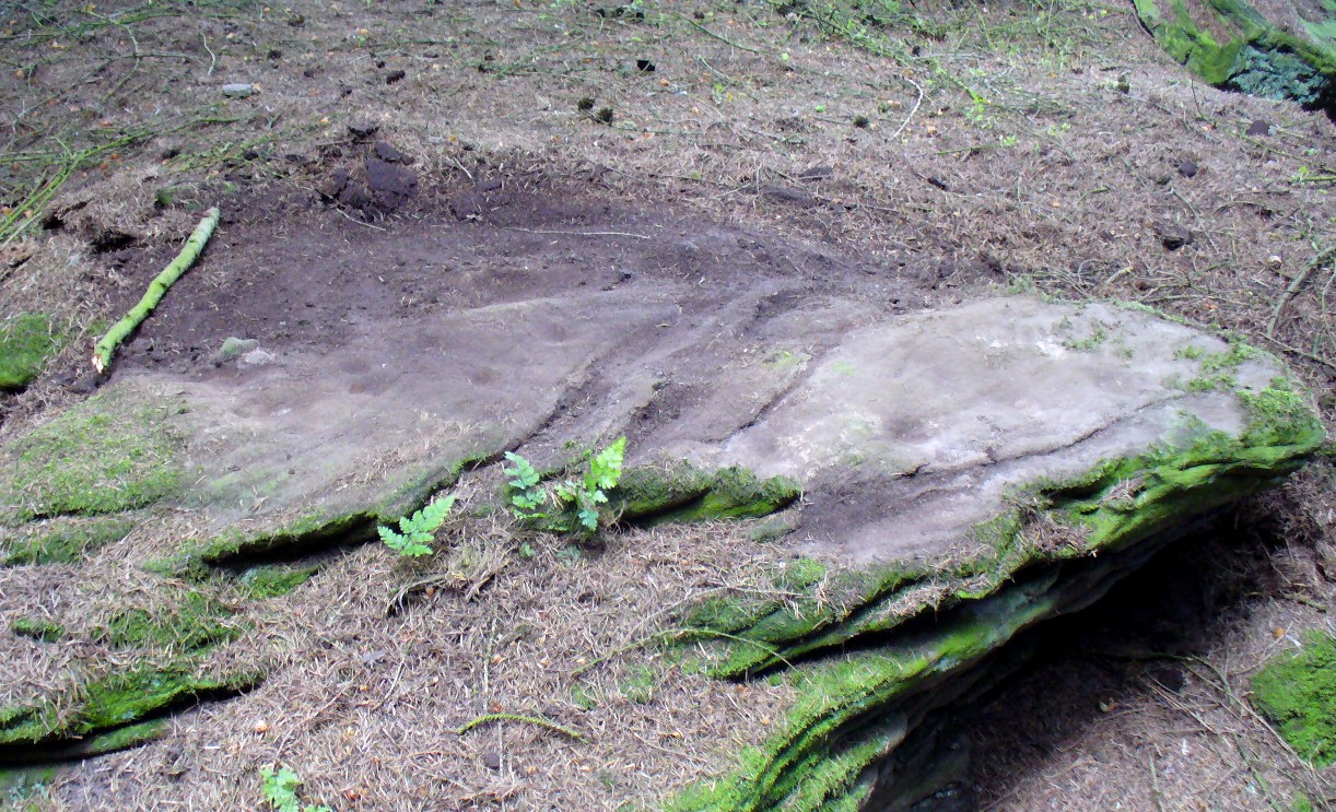
Not described in earlier surveys, this is one of two cup-marked stones close to each other along this long ridge of stone reaching across the field. The carving has three distinct cups, as shown in the photos, and another two more faded ones. No other features seemed visible when we were here. We must, however, be careful with this and other ‘cup-markings’ in the area, as a lot of the stone is conglomerate and nodules of differing forms of rock (visible on nearby stones) fall away, leaving cup-like impressions where the softer stone erodes. Some of the cup-markings listed in John Sherriff’s (1995) survey of this region seem to be purely geological in nature and not man-made. Several more visits are needed here so we can ascertain the valid carvings from the geological features.
A tricky venture, best approached along the B9113 eastwards out of Forfar, towards Rescobie Loch. Just a coupla hundred yards past the lochside, go up the track that leads you to the farmhouse called West Mains of Turin, below Turin Hill on the left-hand side of the road (north). Go up through and past the farm, up the track until you hit the gate that takes where the old quarries appear. Looking right, a copse of woods appears. Go into it and about two-thirds way up, a slight rise marks a long ridge of rock cutting across the woodland. The carving is near the very eastern end of this ridge at the far side of the trees. Good luck!
Archaeology & History
Cup-markings, faintly visible
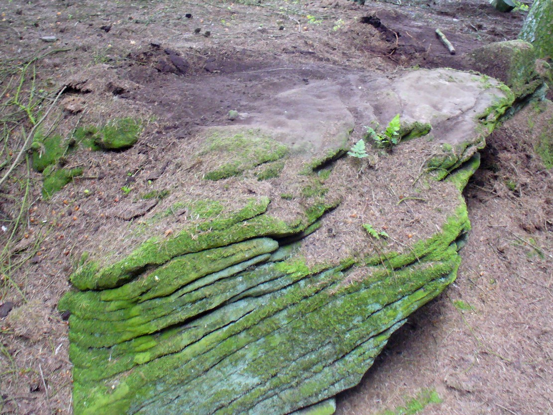
Not included in John Sherriff’s (1995) survey of Angus petroglyphs, this “carving”, like many in his survey, may be deemed slightly debatable and require the attention of qualified geologists to ascertain the veracity, or otherwise, of a number of supposed cup-marked stones that he describes. This one, found in the woodland beneath the undergrowth of years of pine needles and such things (hence the poor quality photos), has between 9 and 11 cup-markings etched on the southern sides of a large earthfast stone found in the woodland. There may be more cups on this rock, beneath the compressed vegetation, but we didn’t spend too much time here to find out (bad boys that we are!).
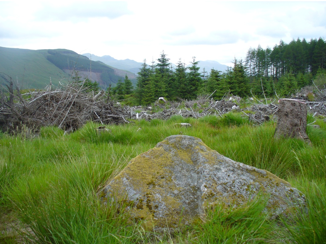
As you go along the road between Lochearnhead and Crianlarich, about 200 yards before reaching the turning to Killin, stop at the Mid Lix dirt-track. Cross the road and walk back uphill for about 75 yards, then walk into the denuded remains of the forest. There are several notable rocks peeking up from the wood, one of which has many well-formed cup-markings on, about 25 yards from the roadside. If you look around here, you’ll find it.
Archaeology & History
Mr Cash’s 1912 drawing
This seemingly isolated petroglyph, still in a very good state of preservation, was first reported in the 19th century by a Mr Haggart (1883), who described it in a letter to the late great J. Romilly Allen. He wrote:
“I have also, since you last wrote to me, discovered another cup-marked stone at the farm of Mid Lix, near Killin. It is a very good specimen, with between sixteen and twenty marks, well cut and distinct. I was passing the farm three weeks ago, and I thought, from the name Lix — which is a Gaelic word corrupted from Lie, the plural of Leac, a tomb-stone or flagstone — that it was very likely to have stones with marks, and I asked John Little, farmer, to keep a look out for such. He did so, and found the one mentioned within twenty yards or so of the road leading to Killin Railway Station, and between the farm and the roadway, due west of the farm-house.”
Subsequently, thirty years later Mr Cash (1912) visited and described the petroglyph in more detail in his survey of sites around Killin. He told that,
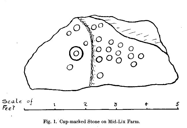
“In 1882 or 1883 this was reported to Mr Allen by Mr Haggart; it was shown to me by Mr Haggart. It lies about 100 yards south of the railway, and 20 yards east of the Glen Ogle road. It is a low triangular pyramid; the cups are on the west face, which lies at an angle of about 35°, and measures 5 feet across its base, and just over 3 feet along its median line. It carries twenty-one cups, as shown in the figure. One cup has round it a ring 6½ inches in diameter. The cups vary in diameter from 2¼ to 3 inches, and in depth from ¼ to ¾ inch. In his paper on “Cup-marked Stones near Aberfeldy,” read in 1884, Dr Macmillan said that he did not know a single example of a concentric ring round a cup on the stones found on the shores of Loch Tay or in Glendochart or Glen Lochay.”
Cluster of cups, close up
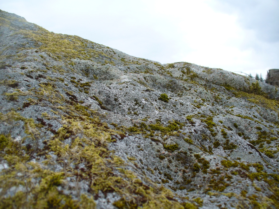
When we visited the site earlier, the grey clouds prevented us getting good images of the carving and made visibility of the design more troublesome (typical rock art dilemma!); but we counted a minimum of 23 cup-marks on the stone. There is a small cluster of small rounded stones around the west and north-western base of the stone, but whether these are collected rubble or the denuded remains of a cairn could not be discerned upon our visit.
Morris, Ronald W.B., The Prehistoric Rock Art of Southern Scotland, BAR 86: Oxford 1981.
Royal Commission on the Ancient and Historical Monuments of Scotland, The Archaeological Sites and Monuments of Stirling District, Central Region, HMSO: Edinburgh 1979.
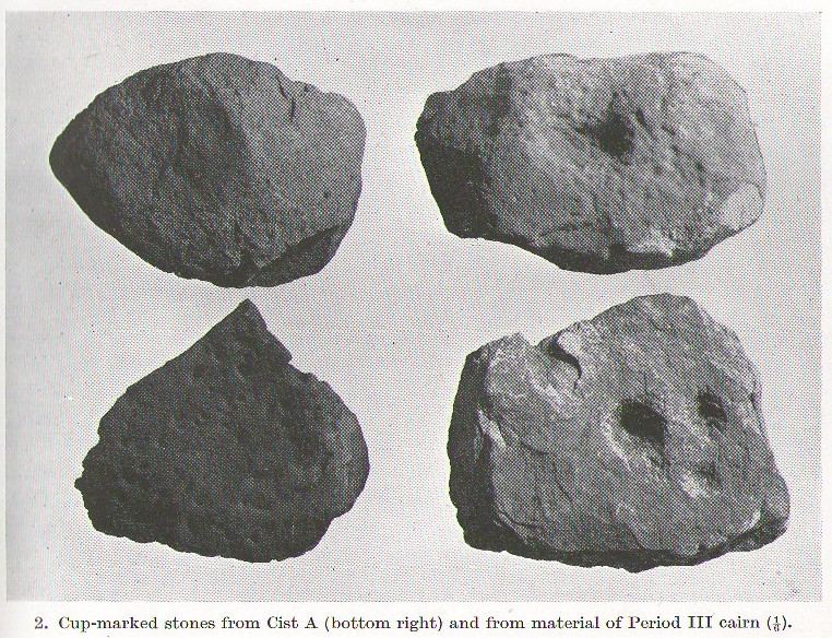
A profile of two seemingly trivial cup-marked stones is called for, out of memory for the carvings and also because they are now hidden in some vault somewhere, out of view in one of the Scottish museums I presume. In visiting the impressive Cairnpapple Hill the other day, I thought that the carvings should really be in situ, where they belong, and not in a box somewhere for the eyes of just a privileged few.
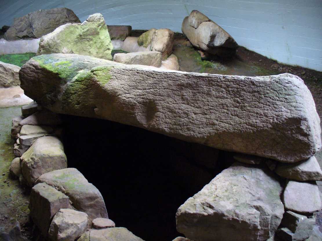
Cairnpapple Cist A
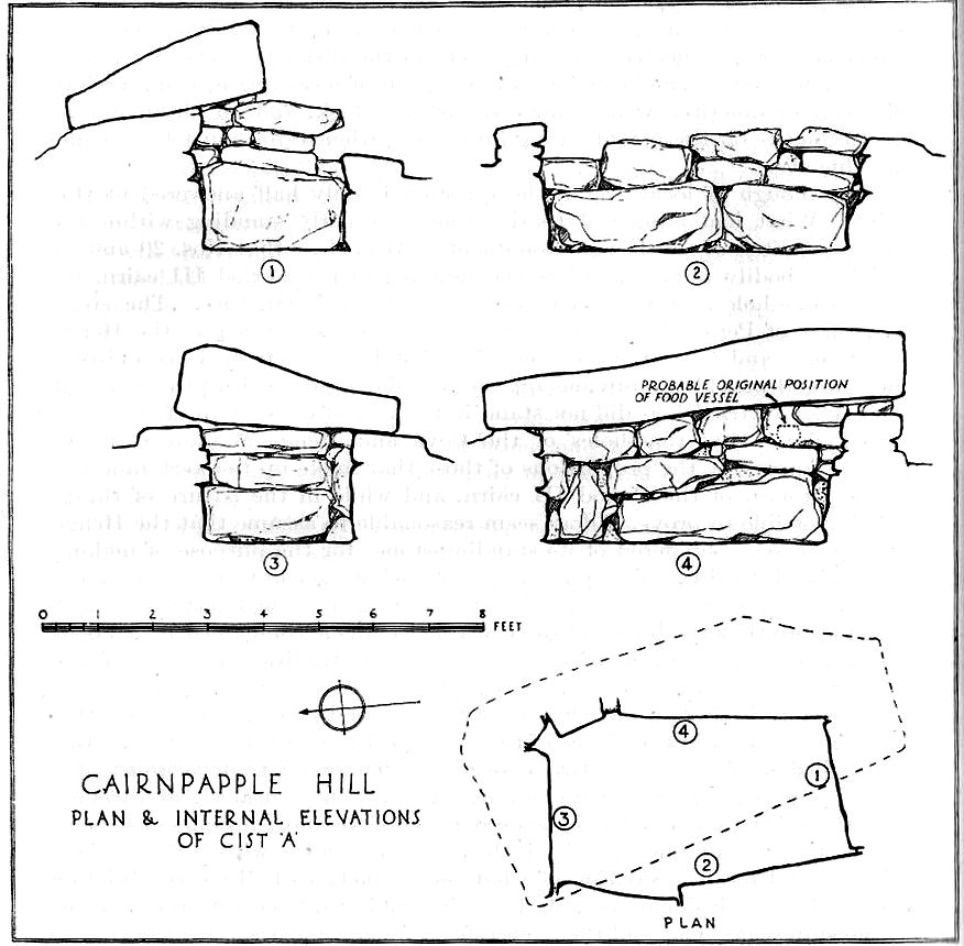
Two small, single, almost portable-sized stones—not unlike other cup-marked rocks found at sites like the Little Skirtful of Stones and elsewhere—were unearthed during the primary excavation of Cairnpapple by Stuart Piggott in the late-1940s. Although there are many stone-lined cremation pits and graves at Cairnpapple, only one of the tombs seemed to possess any carvings—and these were found only in the western walling in one of the larger of the two tombs that are now housed inside the modern covering tumulus, in what Piggott (1950) called ‘Cist A’. (Curiously in all sketches of the tomb, he didn’t show where the carvings were found, typical of some archaeologists of that period who saw little importance in these relics.)
Cist A capstone, with large cup
The giant stone roof or covering stone to Cist A also has a large worked cup-marking on its western side. There are also what seems to be other faint rectangular etchings on the same rock-face, but the age and nature of these elements need to be assessed with some caution.
References:
Cox, Adrian, Cairnpapple Hill, Historic Scotland: Edinburgh 2010.