Cross (destroyed): OS Grid Reference – SD 6573 9212
Archaeology & History
More than 150 years ago outside St. Andrew’s Church in Sedbergh, A.E. Platt wrote (1876) that,
“there was a cross standing in the Market Place adjoining the churchyard on the north, but the last remains of it, and the stone steps it stood on, were taken away some years since by private persons, and may now be seen used as gateposts to a farmyard, some ten miles from their original position.”
Intriguing stuff! Does anyone know which farmyard might still possess these old relics? When the legendary Harry Speight (1892: 443) ventured by here fifteen years later he knew little about their new location, but simply echoed what Platt had previously written. It would be good to know what has become of them…
References:
Platt, A.E., The History of the Parish and Grammar School of Sedbergh, Yorkshire, Atkinson & Pollitt: Kendal 1876.
Speight, Harry, The Craven and Northwest District Highlands, Elliot Stock: London 1892.
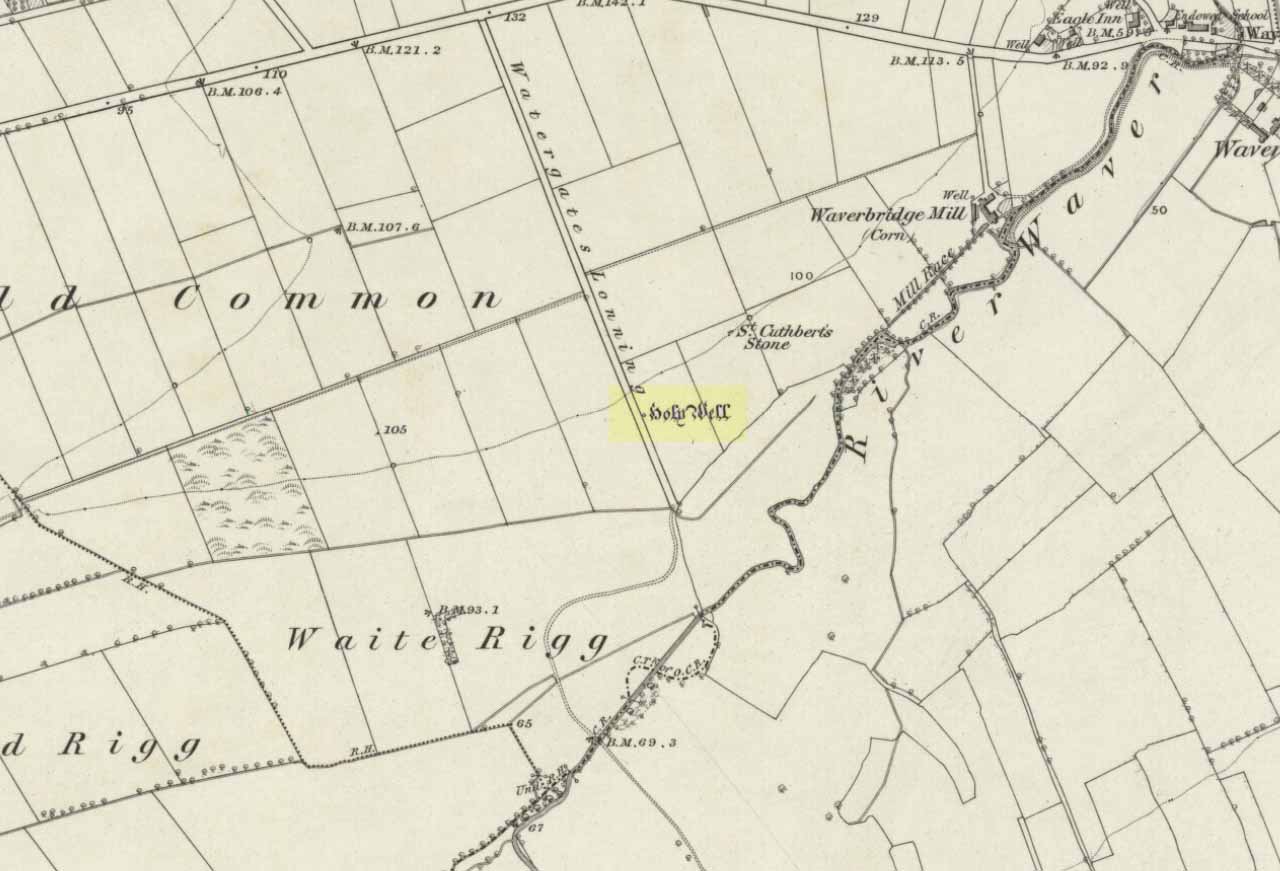
A mile east of Waverbridge, turn down the track called Watergates Lonning. Before you reach the bottom, on the left side of the straight track is a spring of water. This is the old holy well.
Archaeology & History
Although much used in bygone times, very little of it can be seen nowadays. When John Musther (2015) wrote about it recently, he told that although it was
“Once known for its copious amount of remarkably pure and sweet water, it is now only a trickle by a tree.”
Nearly three hundred yards away across the fields northeast of this small spring of water, was once seen “a pretty large rock of granite, called St. Cuthbert’s Stone“, whose mythic history will have been intimately tied to the holy well.
Folklore
In the second volume of William Hutchinson’s History of the County of Cumberland (1794), he tells that the St. Cuthbert’s Well,
“is a fine copious spring of remarkably pure and sweet water which…is called Helly-well, i.e. Haly or Holy Well. It formerly was the custom for the youth of all the neighbouring villages to assemble at this well early in the afternoon of the second Sunday in May, and there to join in a variety of rural sports. It was the village wake, and took place here, it is possible, when the keeping of wakes and fairs in the churchyard was discontinued. And it differed from the wakes of later times chiefly in this, that though it was a meeting entirely devoted to festivity and mirth, no strong drink of any kind was ever seen there, nor anything ever drunk but the beverage furnished by the Naiad of the place. A curate of the parish, about twenty years ago (c.1774), on the idea that it was a profanation of the Sabbath, saw fit to set his face against it; and having deservedly great influence in the parish, the meetings at Helly-well have ever since been discontinued.”
References:
Hutchinson, William, The History and Antiquities of the County of Cumberland, volume 2, F. Jollie: Carlisle 1794.
Musther, John, Springs of Living Waters: The Holy Wells of North Cumbria, J.Musther: Keswick 2015.
Stone Circle (destroyed): OS Grid Reference – SD 714 978
Archaeology & History
This is yet another stone circle that’s been destroyed. It seems to have been described first by Nicolson & Burn (1777) — as “a circle of large stones, supposed to be a monument of druid worship” — but a century later when Reverend Nicholls (1877) came to describe it, he was talking of it in the past tense, saying:
“Fifty years ago there was a circle of stones on the high road leading from Kirkby Stephen to Sedbergh, near Rawthey Bridge, supposed to be a monument of Druid worship. These stones, I have been informed by Mr. William Alderson of Brigg, were blocks of limestone, about three feet high, and were inconsiderably removed for the purpose of helping to build the abutment on the Ravenstonedale side of the present bridge which spans the Rawthey, and bears (the) date 1822. The holes in which the stones stood are, however, yet visible, although overgrown with grass. Collectively they form a circle.”
One writer later (1967) told that the site “seems to have stood on the moor to the left of the road opposite the confluence of the Sally Beck with the Rawthey.” As far as I’m aware, little more is known of the site. Omitted from Burl’s magnum opus, it was included in Waterhouse’s (1985) fine survey of Cumbrian megaliths, but with no further details. But another Victorian writer (Thompson 1892) thought it more likely that the ‘circle’ here was, in fact, more likely a barrow or grave-mound. Sadly, we’ll probably never know…
References:
Anon., Sedbergh, Garsdale and Dent, Reeds: Penrith 1967.
Nicholls, Rev. W., The History and Traditions of Ravenstonedale, John Heywood: Manchester 1877.
Nicolson, J. & Burn, R., The History and Antiquities of the Counties of Westmorland and Cumberland, London 1777.
Thompson, Rev. W., Sedbergh, Garsdale and Dent, Richard Jackson: Leeds 1892.
Waterhouse, John, The Stone Circles of Cumbria, Phillimore: Chichester 1985.