Standing Stone: OS Grid Reference – NO 36332 38305
Also Known as:
- Canmore ID 31871
- The Standing Stone of Balkello
Balkello Stone, W of Tealing
From the little village of Kirkton of Auchterhouse, take the winding road uphill east as if you’re heading to Tealing. About 1⅓ mile along, where the road has straightened out, keep your eyes peeled on your right (to the south) where—if the vegetation isn’t too high—you’ll see a tall upright stone in the field. You’ll have to walk along the roadside until you find a gate into the overgrown field. Good luck!
Archaeology & History
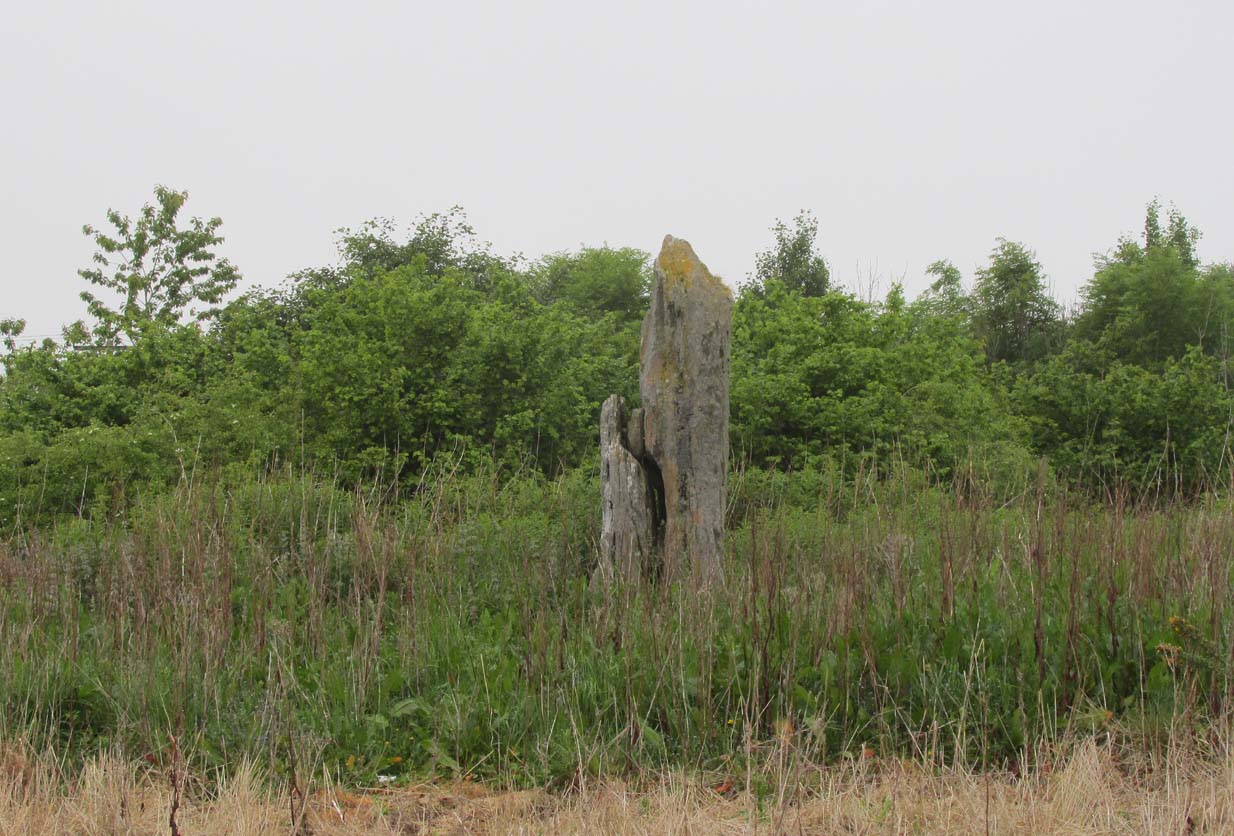
Not to be confused with the legendary Martin’s Stone of Balkello ⅘-mile to the southeast, this is a little-known standing stone hiding above a mass of boscage ‘pon a quiet ridge that fades focus away from the world. It’s a bittova giant, all but forgotten it seems, and with little history to speak of in literary terms at least. When we visited the place a short while ago, summer nettles and willowherbs obstructed our initial contact—but we got to the fella eventually.
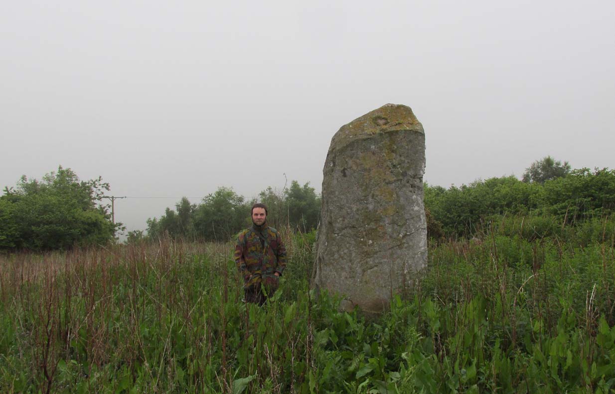
This dood lives & sleeps at the stone!
Looking east
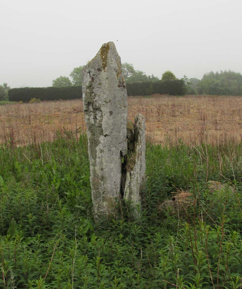
Standing more than nine feet high and about five feet across, it’s quite a slender monolith that has seen better days. Its southern face is crumbling away and a large section of it is close to splitting off completely (surely a case for Historic Scotland to fix?). As you can see in the photos, upper portions of the stone have fallen into the widening crack that promises to fell the stone at some time in the not-too-distant future. Let’s get it sorted —before it collapses!
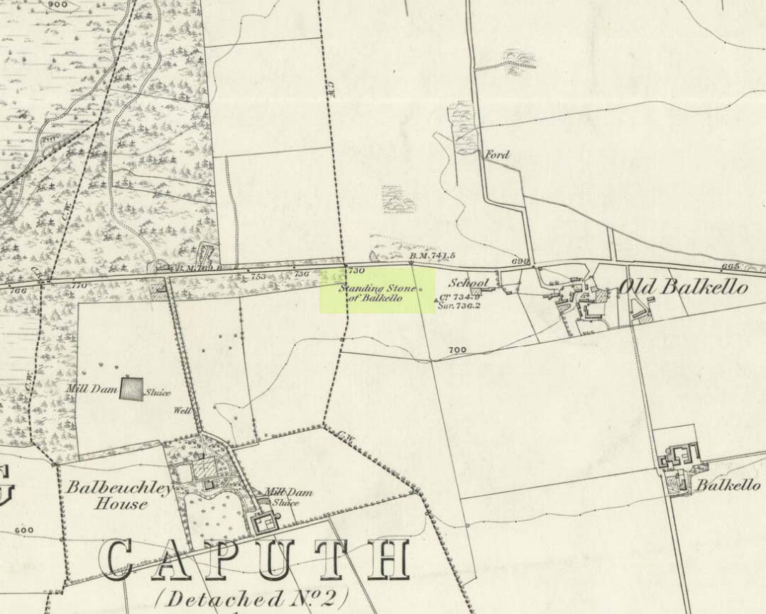
Balkello Stone on 1865 map
It was highlighted on the first OS-map in 1865 as the Standing Stone of Balkello, although without antiquated lettering. But unless there is excellent reason to suggest this was erected in recent times (it wasn’t), its ‘prehistoric’ status needs activating—cos it’s surely prehistoric! We all thought so anyhoo… It’s well worth checking out when you’re in the area!
Folklore
When the Ordnance Survey lads first visited the site in 1861, local people informed them that the stone was said to be,
“in Connection with some others in the Parish (and) are supposed to have (been) used to point out the Roads as they were then, merely beaten paths.”
Alfred Watkins students take note!
Acknowledgements: Huge thanks as always to Paul Hornby, Nina Harris & Frank Mercer for their assistance in our visit here.
© Paul Bennett, The Northern Antiquarian