Simply what the term suggests: upright singular or multiple sets of stones plonked there thousands of years back (traditionally betwixt neolithic to Iron Age) for various uses. Some relate to burial; others to land-markers (tribal boundaries, etc); some may be alignment-markers (solar and lunar); others simple meeting spots (moots). They are closely related to stone circles, tombs, and many of them are outliers to such sites.
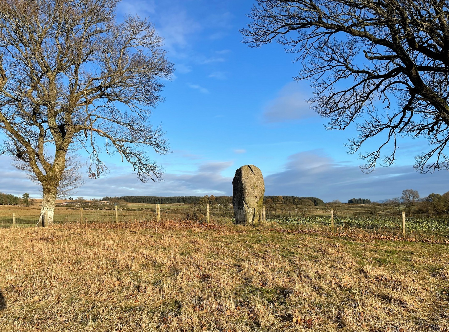
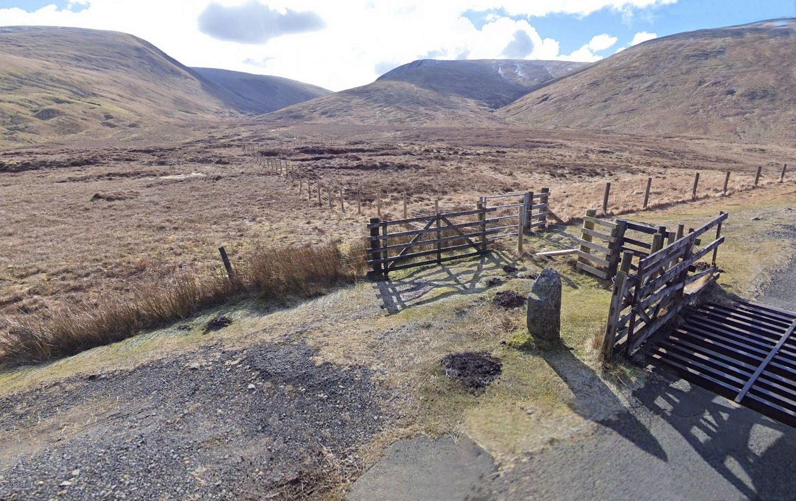
Take the tiny long winding B8063 road that runs west off the A9 at Luncarty, meandering eventually to the entry of the Sma’ Glen. If you’re coming via Luncarty, after going west for 8 miles (12.9km) you pass the hamlet of Harrietfield and just a few hundred yards further a dirt-track on your right goes uphill to Milton. If you’re coming via Crieff/Sma’ Glen direction, along the B8063 road, cross the Bridge of Buchanty and after nearly 3 miles (4.7km) just past a bit of a hairpin, you’ll see the track up to Milton on your left. Walk up, past all the newly modernised houses and go through the gate, bearing right where, in the field on your right (thru another gate) you’ll see this big fella standing alone 200 yards to the east along the fence-line.
Archaeology & History
Looking N to Crochan Hill
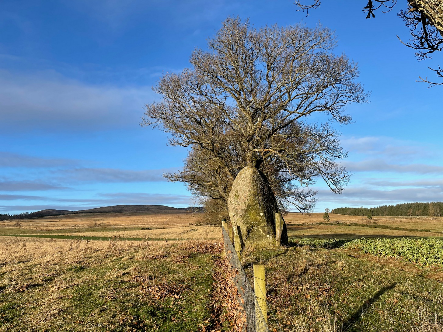
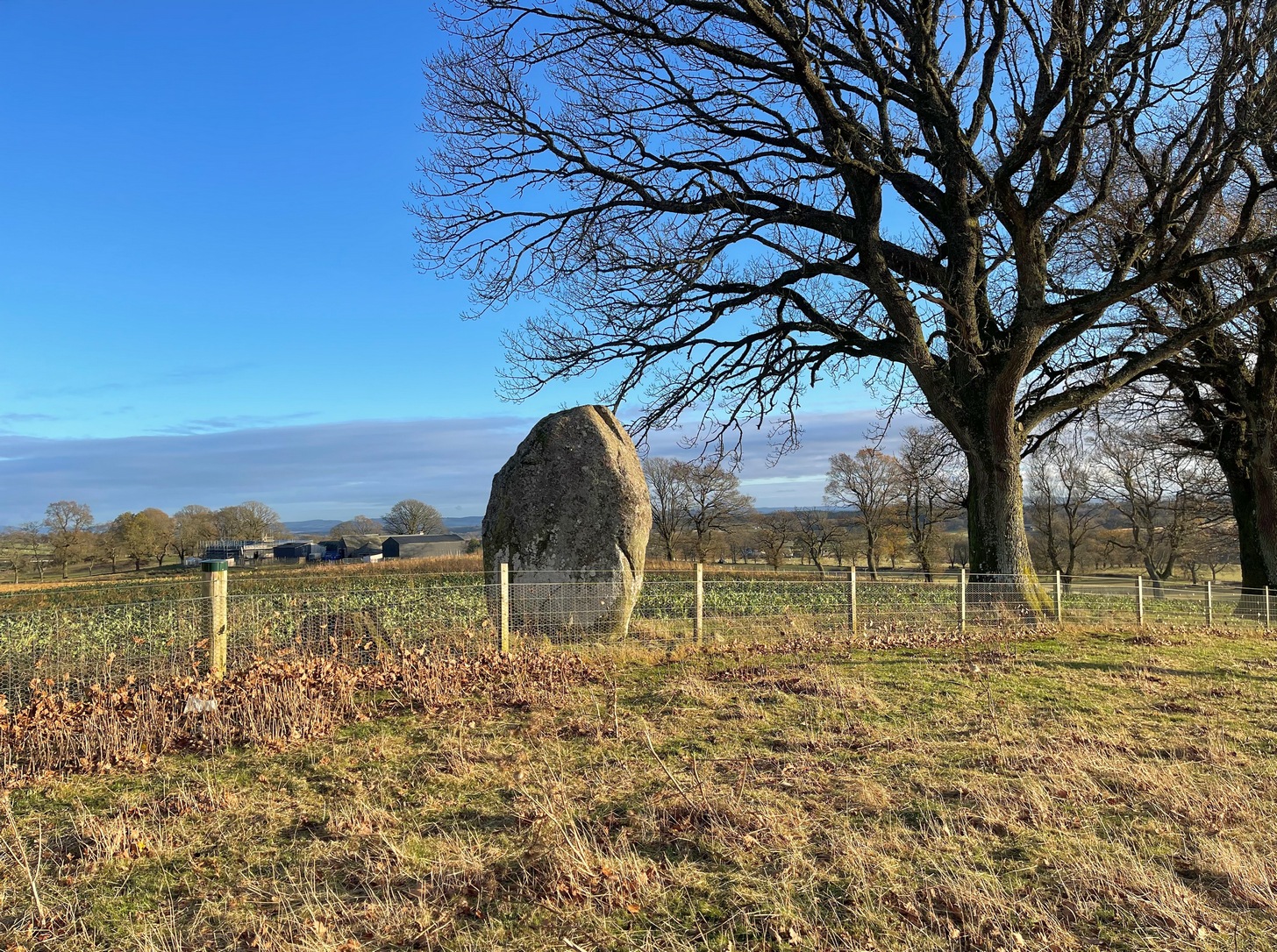
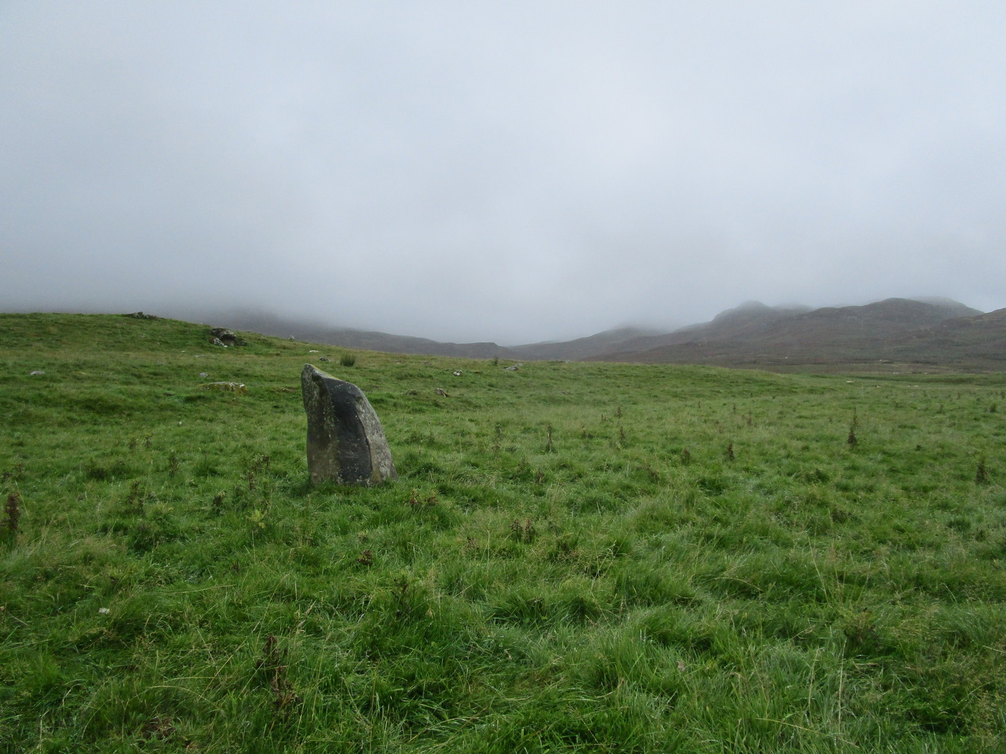
This is a bit of a hidden beauty! Standing nearly ten feet tall on the crest of an elongated ridge with the land ever so gently declining either side of its proud stand, it beckons the impression of partners long since gone (or something truly olde)… and so it proved to be. Very little has been written about the place, despite its impressive stature. It seems to have been described firstly in J.W. Thomson’s essay on the local parish in April 1837 (subsequently published in the NSA in 1845) where, ascribing it as usual to the druids of olde, he told that,
“at the western extremity of Logiealmond, there is one remarkable block about 12 feet high and 18 feet in circumference, standing upon its narrow end, with three other stones in its immediate vicinity. It is commonly called the Kor Stone.”
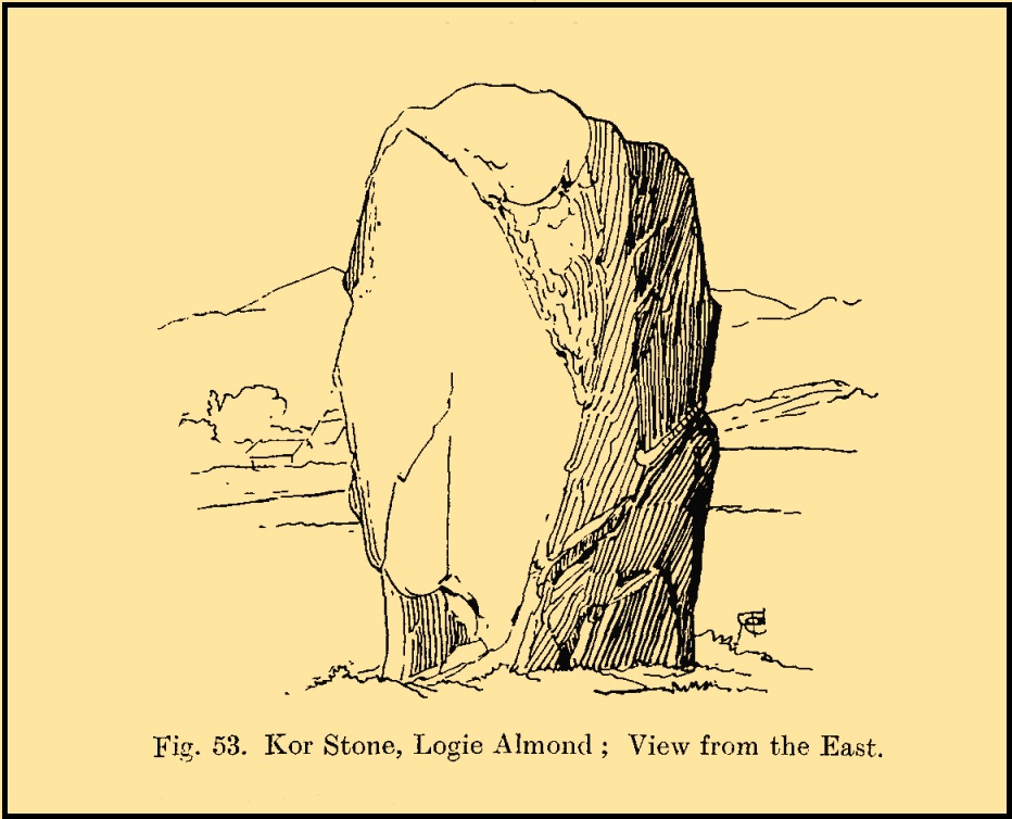
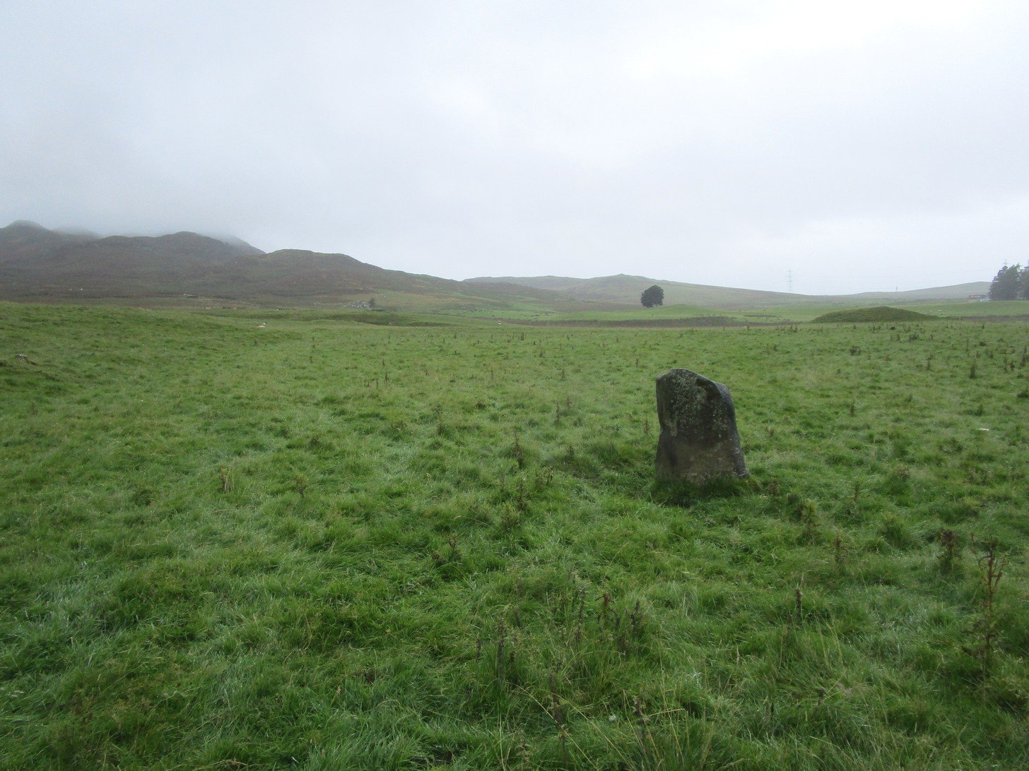
Kor Stone, looking SEFred Coles’ 1911 sketch
William Marshall (1880) also mentioned these three additional standing stones, saying that they were “apparently part of a row.” But they are long gone and we know not what became of them. They were probably uprooted and included in some of the nearby walling or buildings (quite a lot of suspicious-looking stones scatter the edges of many fields around Logiealmond). If we look closely at the surface of our Kor Stone, in earlier times someone has fixed metal loops into the monolith to make it part of an early fence or gate.
The stone was highlighted on the 1867 OS-map of the area and described in the accompanying Name Book,
“Carse” Stone on 1867 map
“A stone about ten feet high, supposed by some people to be the remains of a Druidical Circle, by others to be a mark on a division of lands: in support of the latter supposition they bring forward the fact of a large stone at Dunkeld and one near Fowlis – both similar to this one – and The Carse Stane being in the same straight line.”
The great Fred Coles (1911) also gave the place his attention, but apart from a brief description of its size and position, he found no additional lore about the other three stones, telling us simply:
“It is an imposingly large and erect block of rugged whinstone, 9 feet 9 inches in height, with a basal girth of 15 feet 10 inches, but at about midway of its height the girth increases to fully 17 feet. The view…shows the Stone as seen from the east.”
In truth, the location of this giant stone on the ridge strongly suggests it was once part of a much greater megalithic neolithic monument. But whatever that might have looked like, we may never know. It’s an awesome site though. Well worth checking out if you’re in the area.
Finlayson, Andrew, The Stones of Strathearn, One Tree Island: Comrie 2010.
Marshall, William, Historic Scenes in Perthshire, William Oliphant: Edinburgh 1880.
Thomson, J.W., “Parish of Moneydie,” in New Statistical Account of Scotland – volume X: Perth, William Blackwood: Edinburgh 1845.
Acknowledgements:Huge thanks for use of the Ordnance Survey map in this site profile, reproduced with the kind permission of the National Library of Scotland.
This curiously-named and barely frequented Megget Stane has seen better days. Found in the middle of a veritable nowhere, when Duncan Fraser (1901) first wrote about it there was only a solitary pathway running between these uninhabited glens, with this old stone standing as a solitary sentinel—albeit a not very grand one! It’s present position at the roadside was given it following a forced removal into a nearby ditch, when the old Edinburgh District Water authority who built the Talla Reservoir a couple of miles away all but destroyed it! On one of Mr Fraser’s many visits, in August 1899, he found what he called his “old friend…lying among the heather broken into three pieces.”
“I frankly confess that this wanton act of vandalism filled me with the deepest indignation,” he wrote—and so he sought to redress the situation and find out who’d damaged the old stone. It transpired that,
“The Edinburgh District Water Trust had a few months before this time purchased from Lord Wemyss the ground at the head of Meggat, which slopes down to Talla. In marking off their new possession, the Trust had run a strong five-barred wire fence along the march, and as Meggatstane stood on the line, why, Meggatstane was bound to go!”
He contacted a local farmer and, between them, they protested to the water company who, eventually, fixed the pieces of the stone back together and erected it in the position that we see today, very close to its original spot. Prior to it being damaged, Fraser told that it stood four feet tall, but when cementing it all back together again, some of its original size was lost.
Its history and legends had been forgotten even in his day and despite enquiries with other local wanderers, all that was ever told of it were variants on it standing hereby since time immemorial. For my part, I’m somewhat sceptical about it having a prehistoric provenance, despite the Royal Commission (1957) lads suggesting a Bronze Age origin—but that’s just my own feeling on the place. I’m more inclined to see this as an early mediaeval stone—but would love to be wrong. It may, perhaps, even date from Viking times…..
Fraser told us an intriguing note when the stone was eventually re-assembled,
” I was interested to learn that when they dug to the bottom of the stone, they found the part underground covered with certain runic-like characters.”
These don’t appear to have been seen since.
References:
Fraser, Duncan, “Meggatstane – An Incident in a Riverside Ramble,” in Border Magazine, volume 6, no.70, November 1901.
Royal Commission Ancient & Historic Monuments, Scotland, An Inventory of the Ancient and Historical Monuments of Selkirkshire, HMSO: Edinburgh 1957.
Acknowledgements:Huge thanks for use of the Ordnance Survey map in this site profile, reproduced with the kind permission of the National Library of Scotland.
Standing Stone (destroyed): OS Grid Reference – NN 8655 2079
Archaeology & History
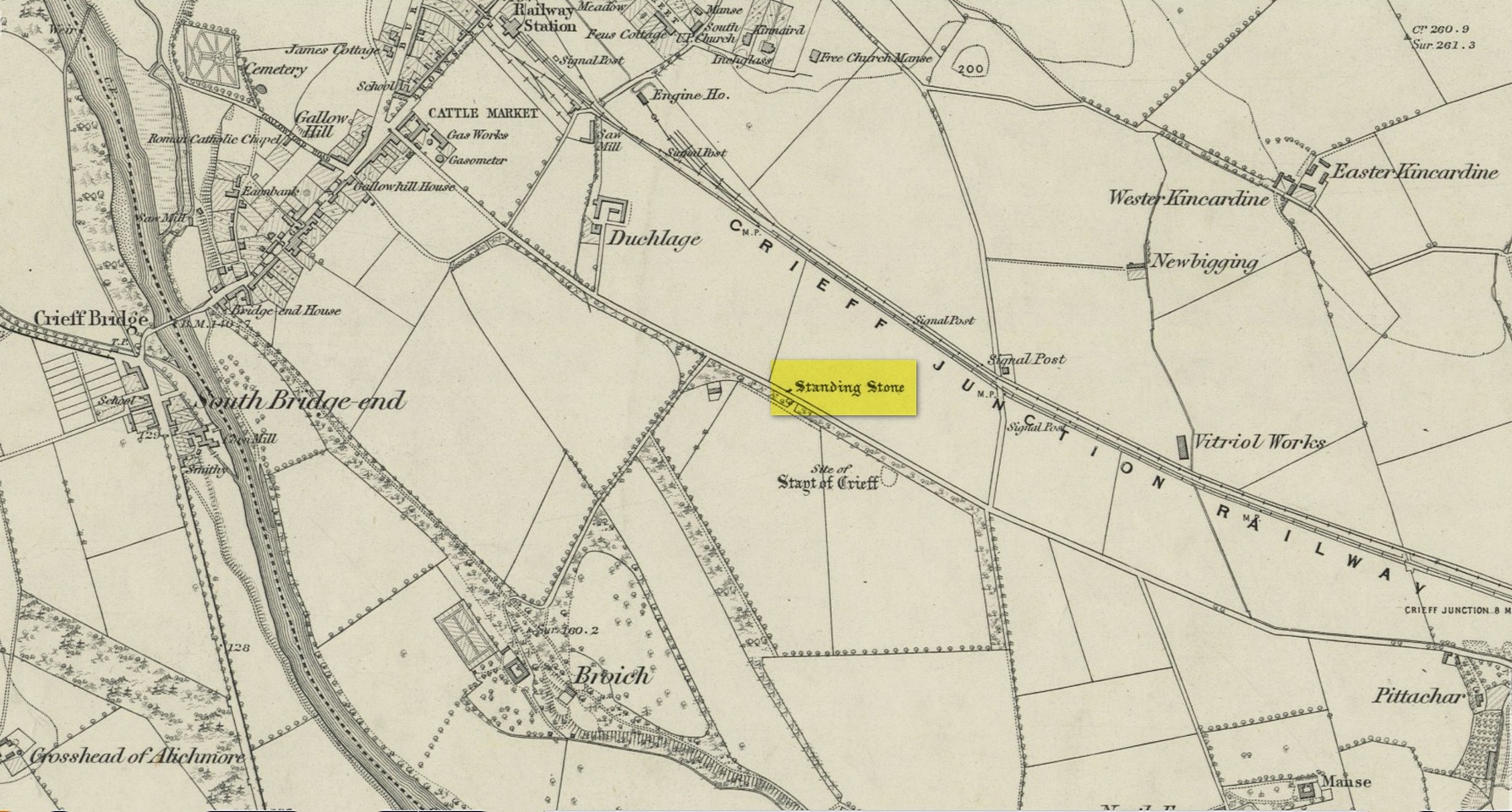
Site on the 1866 map
There is seemingly no trace left of this once impressive tall, slender standing stone that had lived for thousands of years on the south-side of Crieff. It was destroyed by some retard in the middle of the 20th century (anyone know their name?). Highlighted on the 1866 Ordnance Survey map of the area, it was visited and described by the late great Fred Coles (1911) when it still stood at the side of the road. He told that it was,
“In shape a narrow rhomboid at the base, this Stone rises to an acute angle at a height of 6 feet. Its longer axis is E.S.E. 52° by W.N.W. 52°, and in basal girth it measures 8 feet 11 inches.”
Coles’ 1911 sketch
Some 200 yards to the south-east there used to be the curiously-named Stayt of Crieff burial mound which had been used as a court hill for many centuries. This outlying standing stone may have been the “witness” on which oaths were sworn before the court. Sadly the history of the Stayt of Crieff mound is also somewhat sparse and it too has, appallingly, been destroyed. The destruction of these antiquities and their ancient traditions is nothing short of a fucking disgrace.
Finlayson, Andrew, The Stones of Strathearn, One Tree Island: Comrie 2010.
Acknowledgements:Huge thanks for use of the Ordnance Survey map in this site profile, reproduced with the kind permission of the National Library of Scotland.
On the west side of Lochgilphead, at the roundabout where the A83 Ardrishaig road meets the A816 Oban road, cross the road and walk up the sloping drive to the Crinan canal crossing less than 100 yards up. From here, walk straight across along the “Private” drive where, after a few hundred yards, you’ll reach the large old manor house. Ask the good people there to direct you to the stone, which is a bit further round the track at the back of the house, standing up against some old disused office buildings. You’ll find it.
Archaeology & History
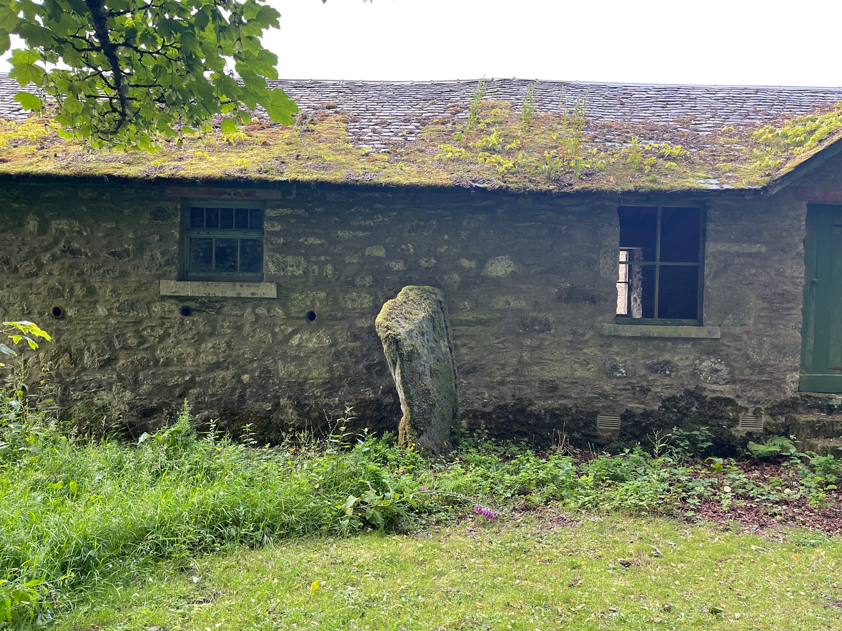
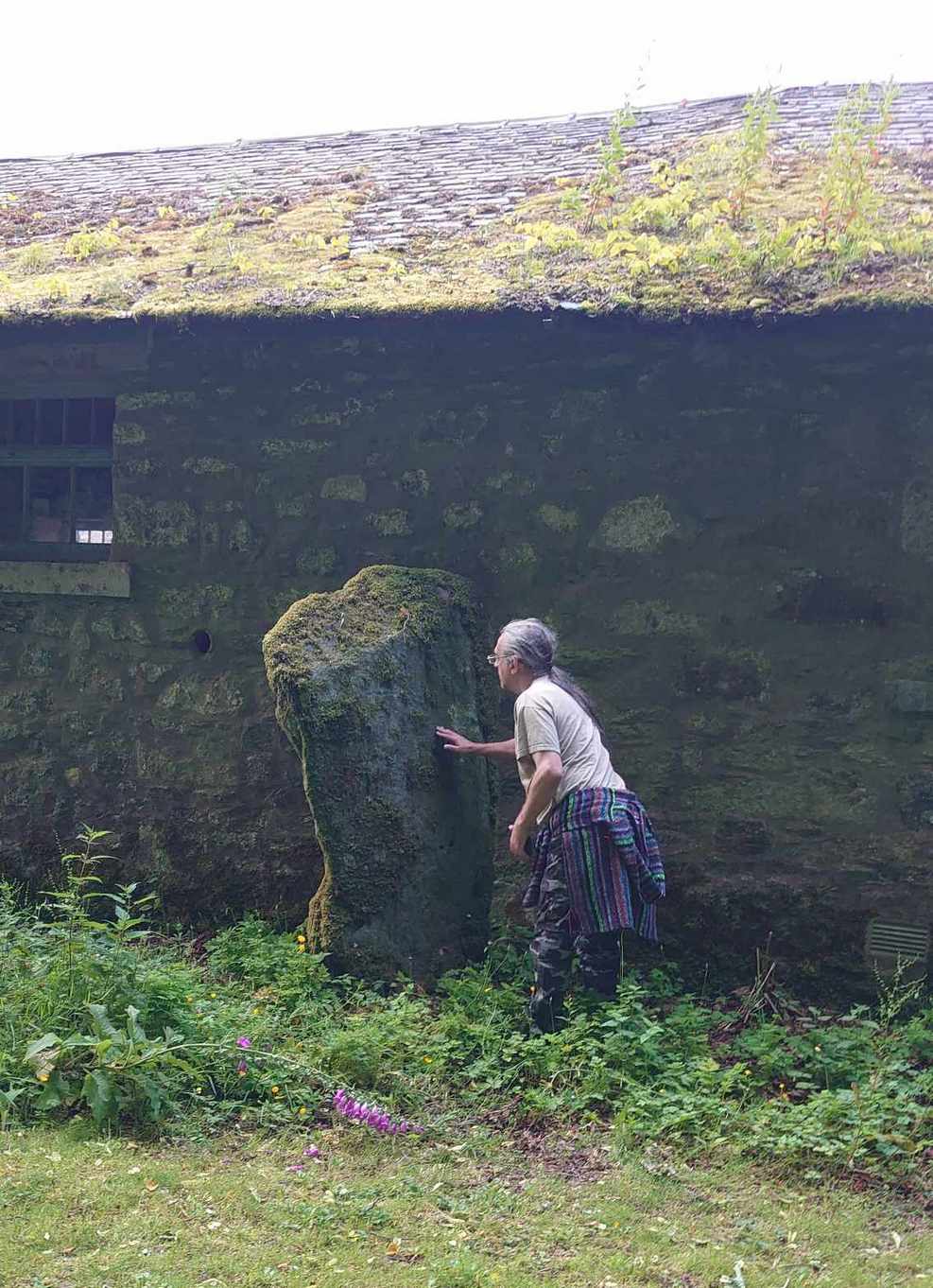
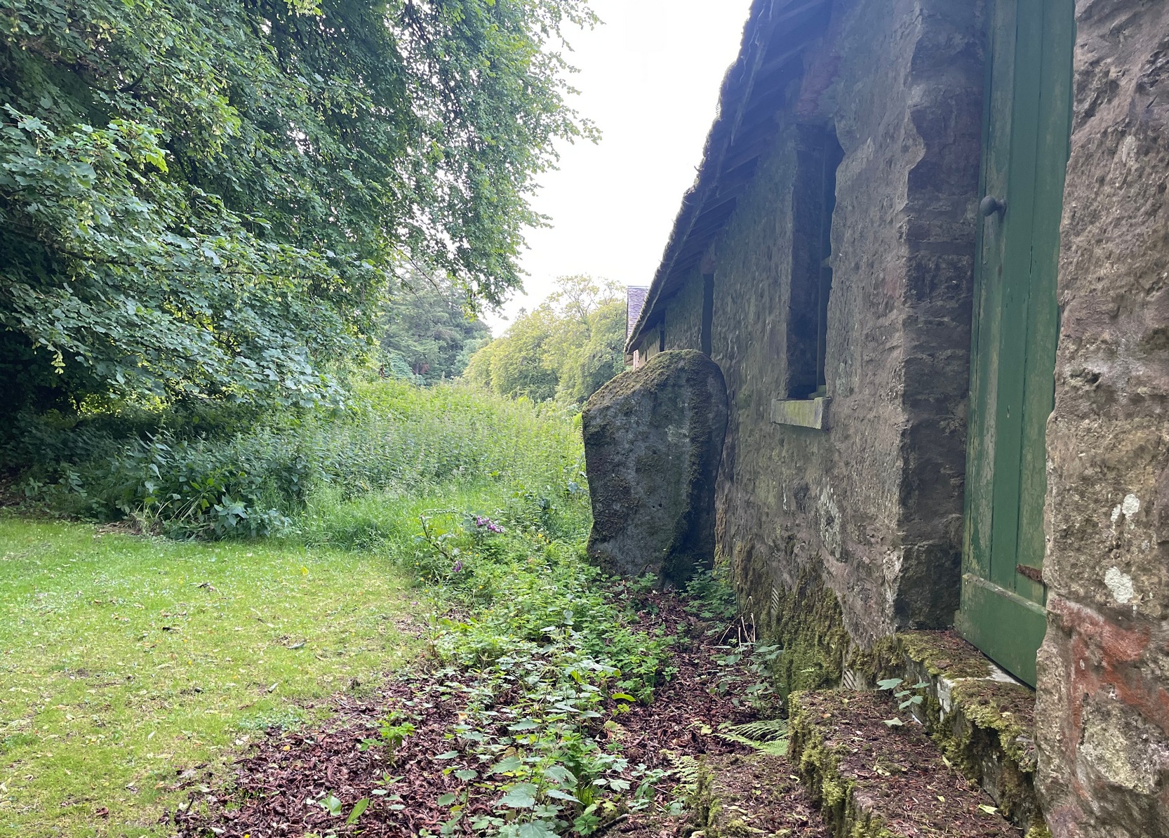
There’s something about this stone, rarely visited these days (perhaps that’s the thing!), nestling quietly against an old building. For some reason, an odd reason obviously—a “superstitious” reason probably—it’s been left standing upright against the old walls, untouched by those who made the much more recent structure. Usually you’d expect such old stones to be destroyed, or at least incorporated into the more modern building — but not this one.
Feeling Nature’s cupsStanding against the wall
Standing nearly six feet in height, the first written records I have of this are from Colin Leitch’s (1904) local history work, where he refers to it as an ancient “Celtic stone” set up against the wall of the dairy (as it was back then). It is described in the standard Royal Commission (1988) report and local surveys of Marion Campbell (1964; 1984), who give us the respective dimensions of the stone—1m x 0.23m at the base, aligning WSW by ESE—and curiously it seems that little else is known of it. There are several “cup-marks” on the stone (you can see me fondling them in the photo), but these are Nature’s handiwork and not man-made. Early 20th century accounts told of two other standing stones near this old fella, but they were seemingly the remains of old gateposts, long since fallen.
Standing Stone (destroyed): OS Grid Reference – NO 5404 6892
Archaeology & History
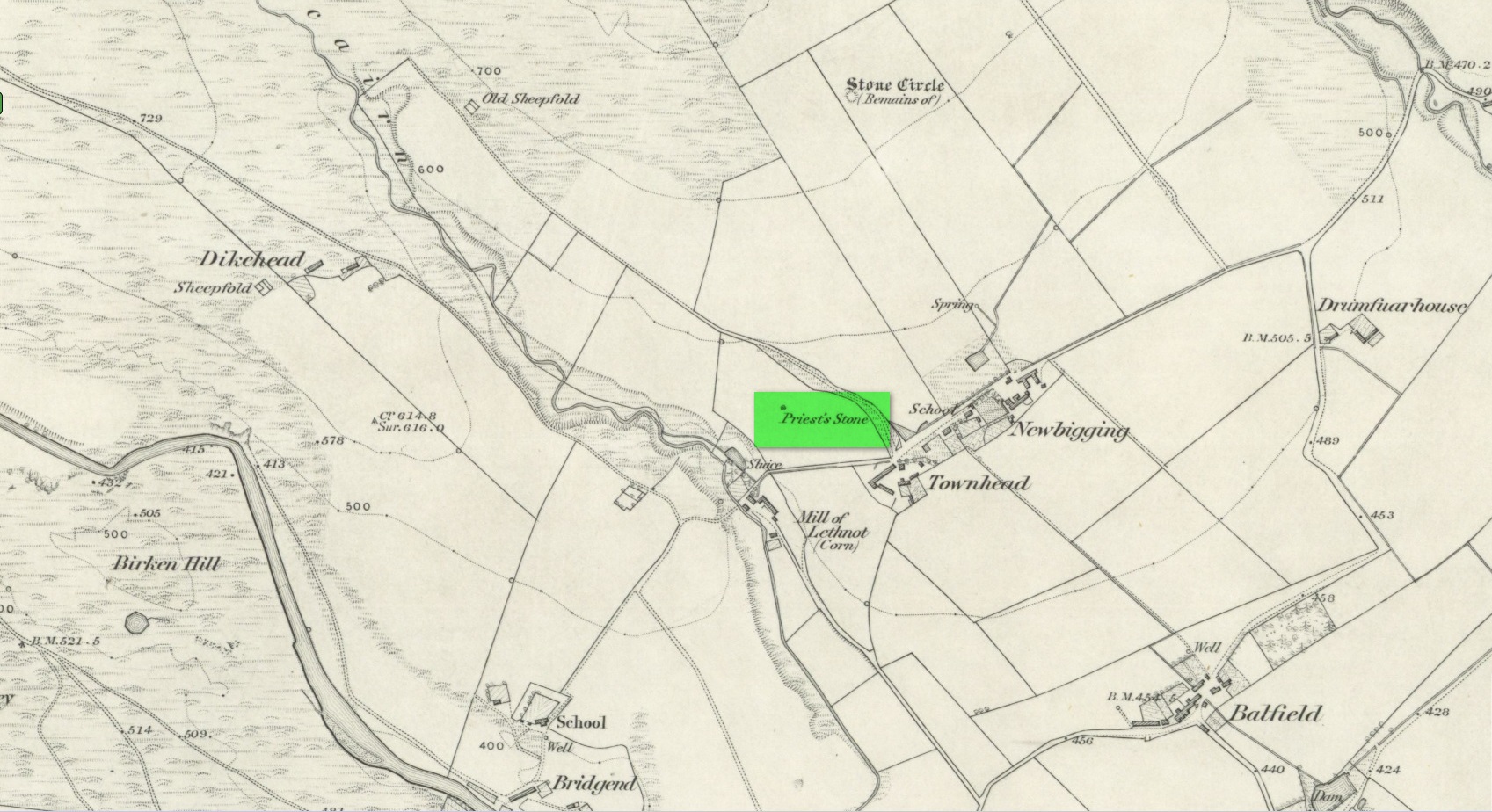
Priest’s Stone on 1865 map
Despite being shown on the early OS-maps of the area, I can find few references of this place. The Ordnance Survey lads themselves, when visiting here in 1863, merely told that this it was “a standing stone of which nothing is known except the name. It is 3 feet high, three feet in diameter at base, and a foot and a half at top.” Even in Cruikshank’s (1899) definitive survey of this township he could add little more, merely telling:
“About a quarter-of-a-mile north of Bellhill is a field known as “the Priest’s Field.” There is a large right stone in the middle of it, called “the Priest’s Stone,” and it is so given on the Ordnance Survey map. not simply because such is the local name, but also because the skilled surveyors after examining it concluded that it had been used for sacrifice. It stands just behind the site of the old farm steadying of Upper Argeith, or vulgarly, Townhead.”
Quite what he meant by saying that “it had been used for sacrifice,” god only knows! But the writer was the local minister and so would have been possessed by the usual delusions. Anyhow, the stone was uprooted and destroyed by the farmer at Newbigging, sometime prior to 1958. Idiot!
A half-mile north of this could once be seen a stunner of a site: a double-ringed giant tomb from where hundreds of cartloads of stone were taken. It too no longer exists!
References:
Cruikshank, F., Navar and Lethnot: The History of a Glen Parish in the North-east of Forfarshire, Black & Johnston: Brechin 1899.
Royal Commission on the Ancient and Historical Monuments of Scotland, The Archaeological Sites & Monuments of Central Angus, Angus District, Tayside Region, HMSO: Edinburgh 1983.
Acknowledgements:Huge thanks for use of the Ordnance Survey map in this site profile, reproduced with the kind permission of the National Library of Scotland.
Standing Stone (destroyed): OS Grid Reference – NO 483 603(approximation)
Archaeology & History
In an area once teeming with megaliths, this is but one that lost its life in the 19th century. It would seem that the only reference of its existence—and demise—comes from the pen of the great regional historian Andrew Jervise (1853) who, in a description of the nearby holy well of St Ninian, in a field near Wellford,
“within the last half century there were two or three large rude boulders nearby, which were called Druidical stones.”
References:
Jervise, Andrew, The History and Traditions of the Land of the Lindsays in Angus and Mearns, Sutherland & Knox: Edinburgh 1853.
Standing Stone (destroyed): OS Grid Reference – NT 074 698
Archaeology & History
A few hundred yards west of the commemorative Wallace Stone monolith could once be seen a standing stone of considerable size. It was described by James Primrose (1898) in his description of the standing stones of the Strathbrock region; but even in his day, remains of it were fragmentary. He wrote:
“On Drumshoreland Moor, within the grounds of Pumpherston Oil Company, there is a stone, popularly styled Bucksides — its correct designation being Backsides — from its position at the backside of Pumpherston. This stone, a huge whinstone boulder about 12 feet long and 8 feet broad, was blasted in 1888, to make room for the site of a bench of retorts; a few fragments of the stone, however, yet remain by the roadside. The ancient name of this stone was Ballengeich — apparently the Gaelic for “the township towards the wind”, — as if a croft once stood here, near Pumpherston Mains, in an exposed and windy situation.”
A visit to the local history department of the local library might prove fruitful in giving us more information about this place—that’s assuming the filthy tory central government’s theft of taxpayer’s money doesn’t close it! (does that sound a bit harsh? 😁 )
Folklore
The same historian told of a “tradition…that round this stone in days gone by the Broxburn folks, along with their neighbours, used to assemble at Fair time, in the month of August, in order to witness their favourite sport of horse-racing; but whether there was any more ancient custom associated with it, we have never learned.”
References:
Primrose, James, Strathbrock; or, the History and Antiquities of the Parish of Uphall, Andrew Elliot: Edinburgh 1898.
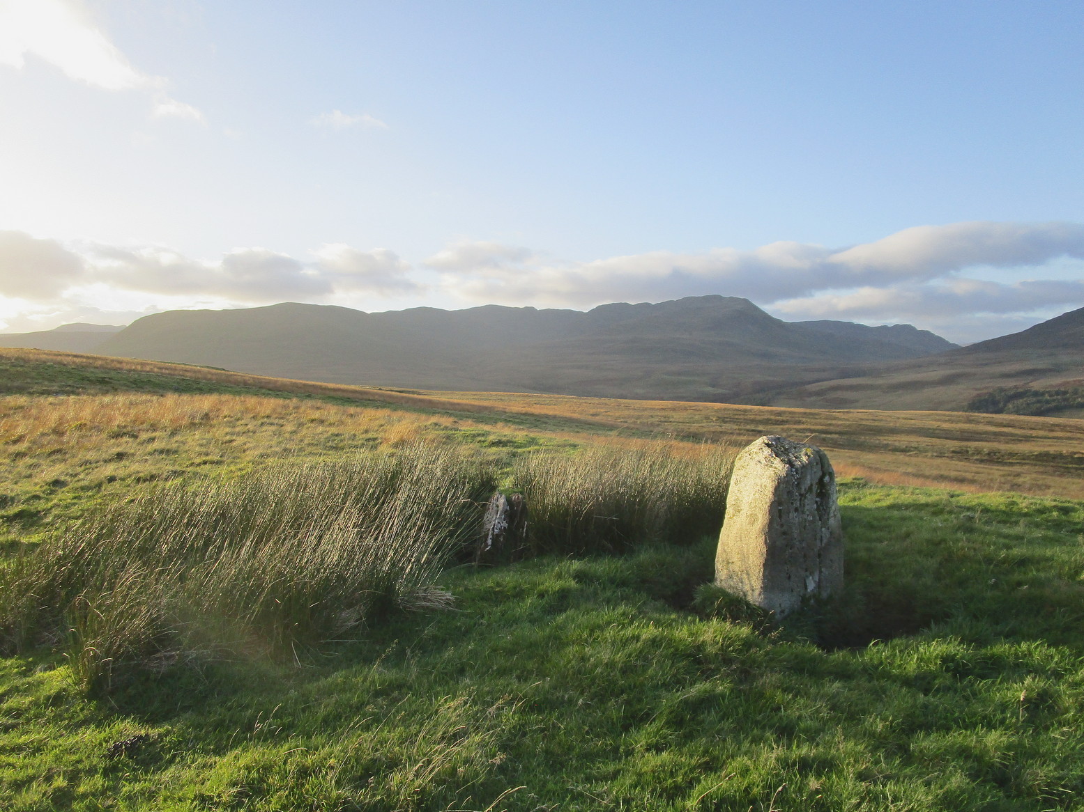
Make a day out of this one, visiting several old places on the way. From Comrie take the B827 road to Braco, turning right at the tiny Glen Artney road a half-mile along (easy to miss). 3 miles along, pass the derelict Dalness cottage, you can follow the directions to get to the Mailer Fuar (2) cup-and-ring stone; and from here go up the field past the Mailer Fuar (1) carving, through the gate and follow the fence to your right. Keep going till your reach the Allt na Drochaide cup-and-ring stone. From here you’re heading (south) towards the rounded crags of Cnoc Brannan. It’s boggy as fuck in parts so cautiously zigzag through this section up towards the small grassy rise about 350 yards from the cup-and-ring stone. You’ll find it!
Archaeology & History
From the old stone, gazing S
On one of the gentle rises below the northern slope of Cnoc Brannan we find this sturdy old fella, 3-4 feet tall (I didn’t measure it), looking across the stunning landscapes north, east and west along Glen Artney. Not previously recorded and seemingly isolated from other prehistoric remains, he looks all alone at first sight, but laid down in the grassy rushes (Juncus conglomeratus) to his side, is a slender seven-foot long stone which may have stood upright in the not-too-distant past, giving us another double stone setting in this area (at least two others existed in this area—the closest being at Craggish, 3.7 miles northeast). I have little doubt that other undiscovered prehistoric remains are hiding in the area. (there are a number of single cup-marked stones in the locale, although I tend to leave such examples off the catalogues as they can be somewhat dubious [and many are]. I mention this just in case any rock art students want to forage the area.)
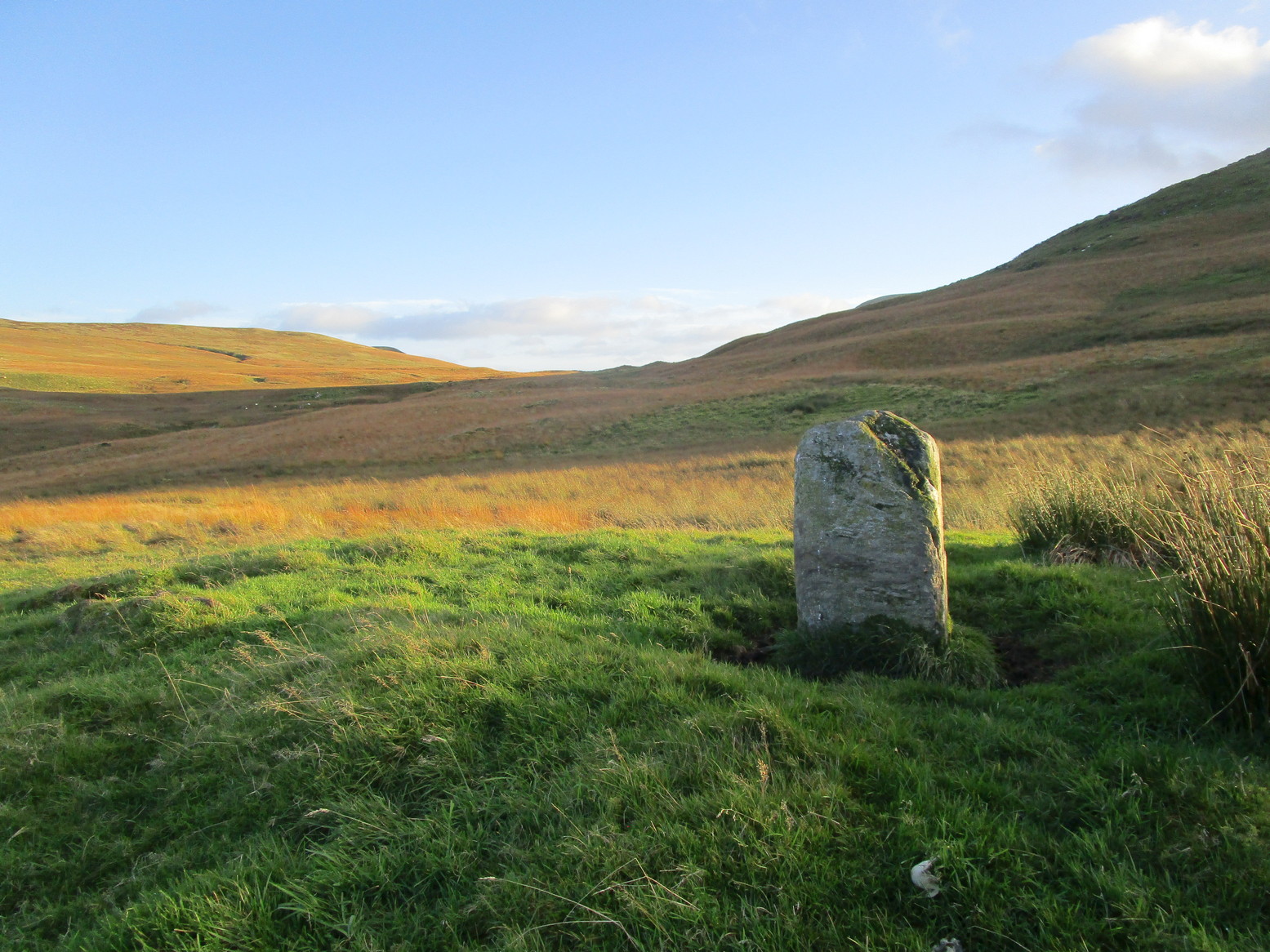
Take the A822 road to the northeast of Crieff and head 4-5 miles along until you enter the Sma’ Glen. You go past Ossian’s Stone and after crossing the river past the Newton Bridge enclosure, the road starts to go uphill. Nearly 2 miles up, the road levels out and at the left-side of the road is a small thin car-parking spot. Keep your eyes peeled out for it! From here, walk back down the road for nearly 250 yards until your reach a gate into the fields on your right. By now you should already be able to see the stone in the field, barely 100 yards away to the southwest.
Archaeology & History
The old stone, looking N
Standing within the impressive landscape of the Perthshire mountains, this 4-foot-tall monolith is a seemingly solitary fella, sliced almost straight down one side—like so many of its regional compatriots—not far from the edge of General Wade’s military road. Not much more can be said of the old thing. The petroglyphic cluster of Corrymuckloch begins less than half-a-mile to the north; and, in all likelihood, other prehistoric sites will exist close by that aren’t yet in the archaeological registers…
Acknowledgments: Thanks to my long-suffering daughter Naomi, for taking me up for a quick break to see this old stone…
The only real way to get here is via Kirriemuir. Head north to the hamlet of Cortachy and past it, as you enter Glen Clova, where the road splits make sure you bear to the left-hand (western) side. Nearly 5½ miles along, keep your eyes peeled on your right where you can’t really miss it. The stone’s less than 100 yards into the field. …It may perhaps be a bit easier if you take the eastern road of the glen all the way to Clova village. Turn right from there, over the small river bridge and as it curves to go back down the glen, a half-mile along you pass Caddam house. Keep going for another 500 yards and you’ll notice it in the field.
Archaeology & History
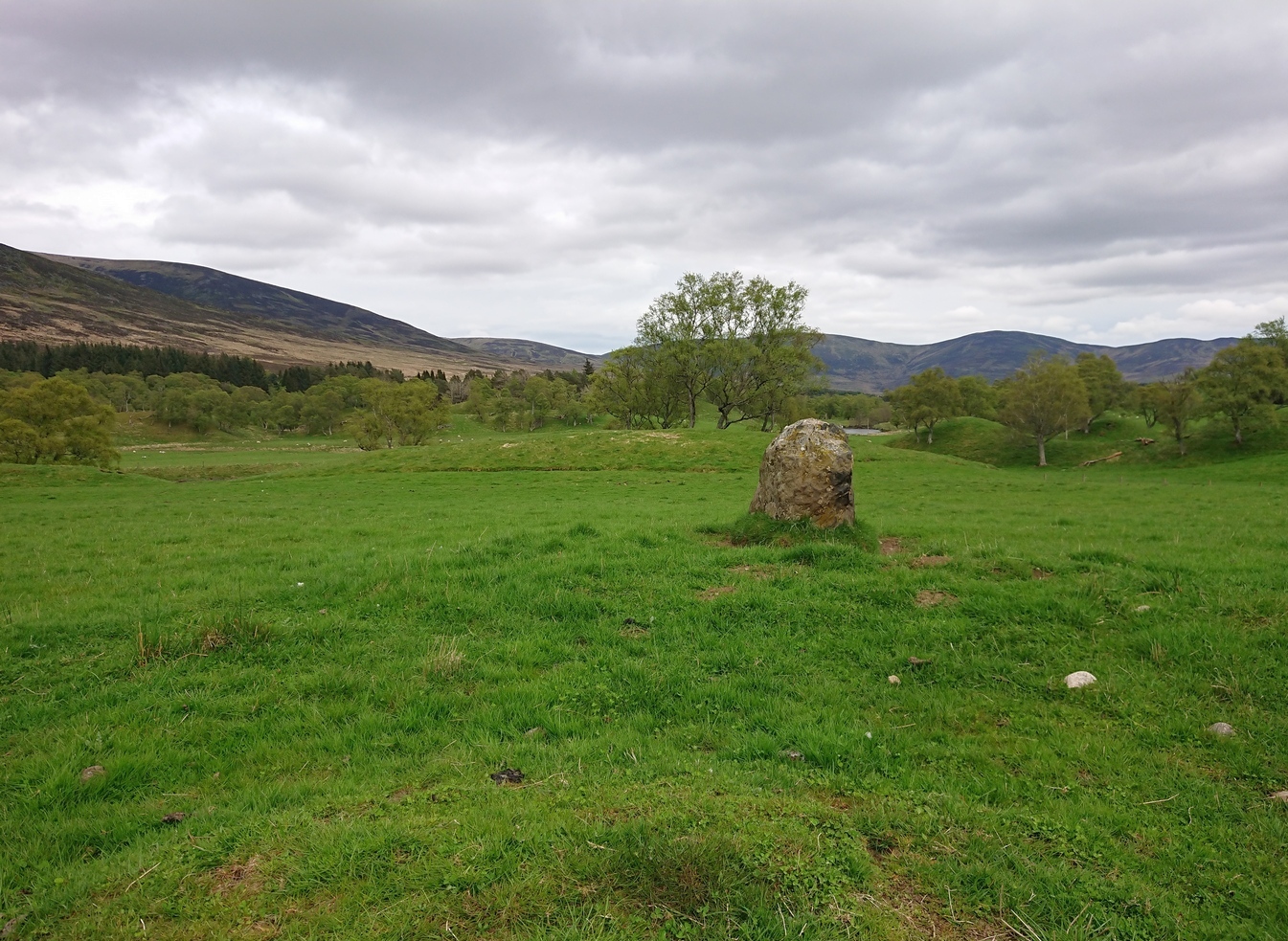
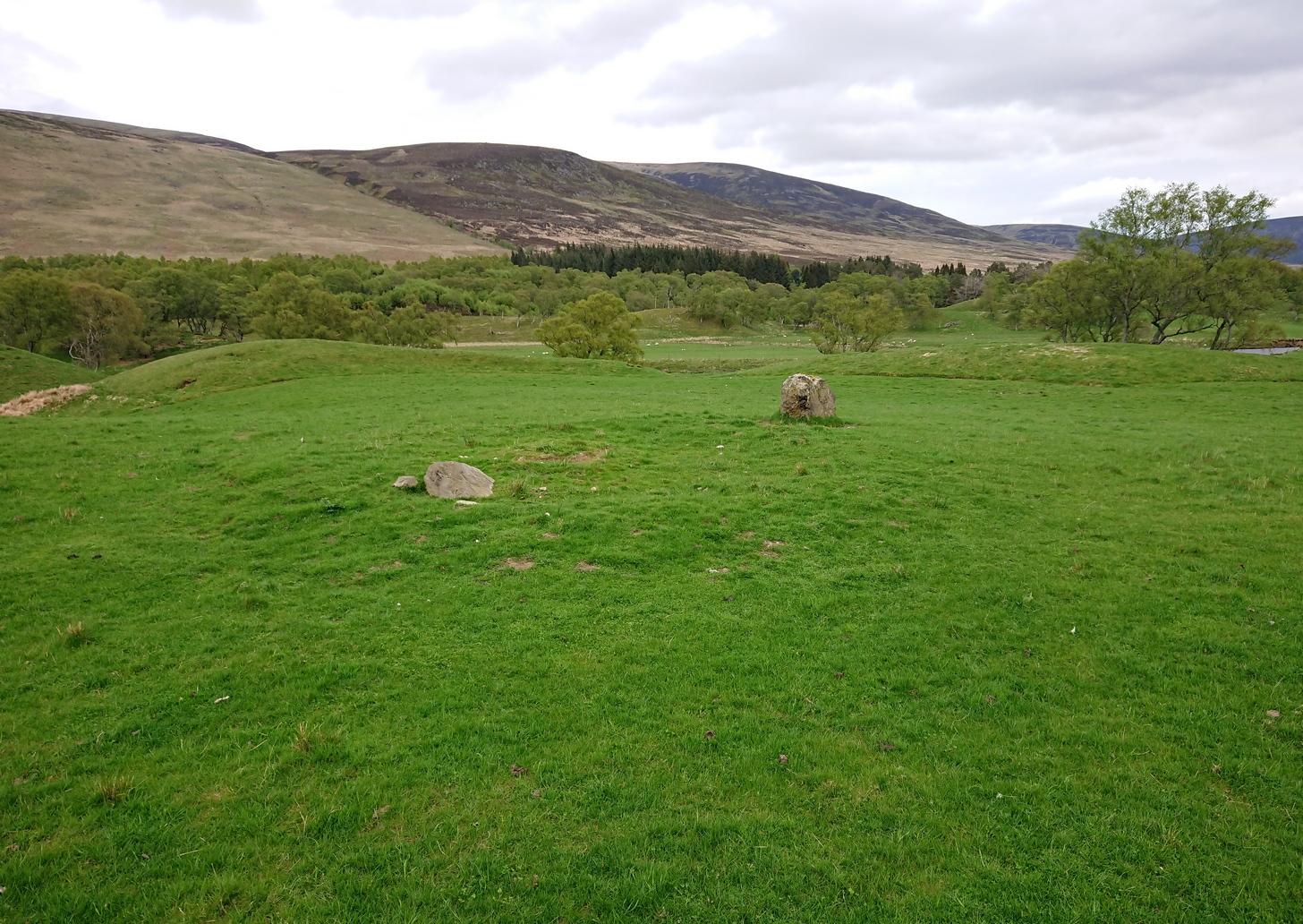
Stone and its hut circle
Not to be confused with the ruined stone circle of the same name 10 miles to the south, this small standing stone—only some three feet in height—is at the eastern edge of a small overgrown hut circle measuring some 3 yards by 4 yards across. You can just make out the overgrown low walling in the second photo (right). The stone probably had some architectural relationship with the hut circle, but without an excavation we can’t know for certain what that relationship might have been. A settlement of much larger hut circles can be found on the other side of the river, near Rottal, two miles southeast of here.