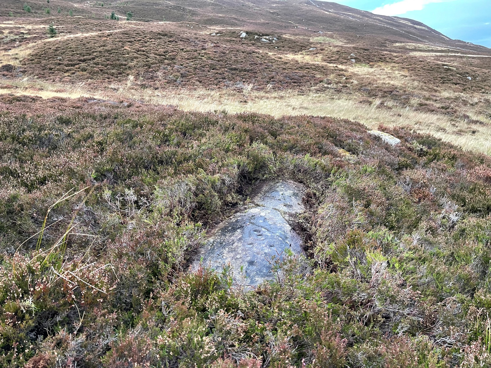
Like many of the Craig Hill carvings, this takes some finding when the heather’s deep… If you can locate the Craig Hill hut circle (there are actually several of them close to each other), face uphill (looking at the trees) and then from the hut circle walk diagonally to your right (northeast) and walk up the slope for 30-40 yards. A large boulder is in front of you and, just past it at the edge of a small rock-face, a fallen tree is your marker. Just a few yards above and past this is an earthfast elongated stretch of rock. You’ll find it…
Archaeology & History
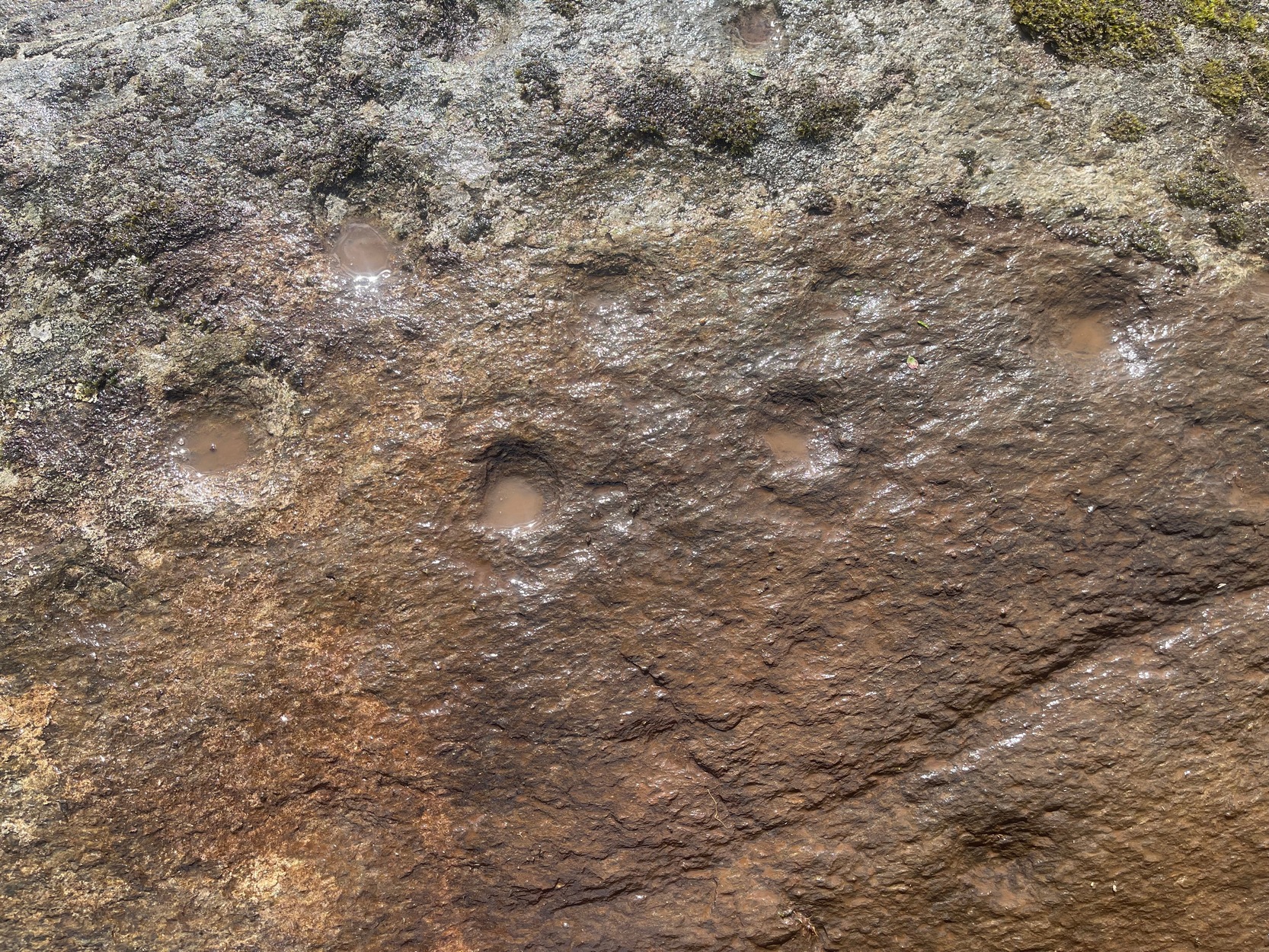
Some cups & 2-in-a-ring
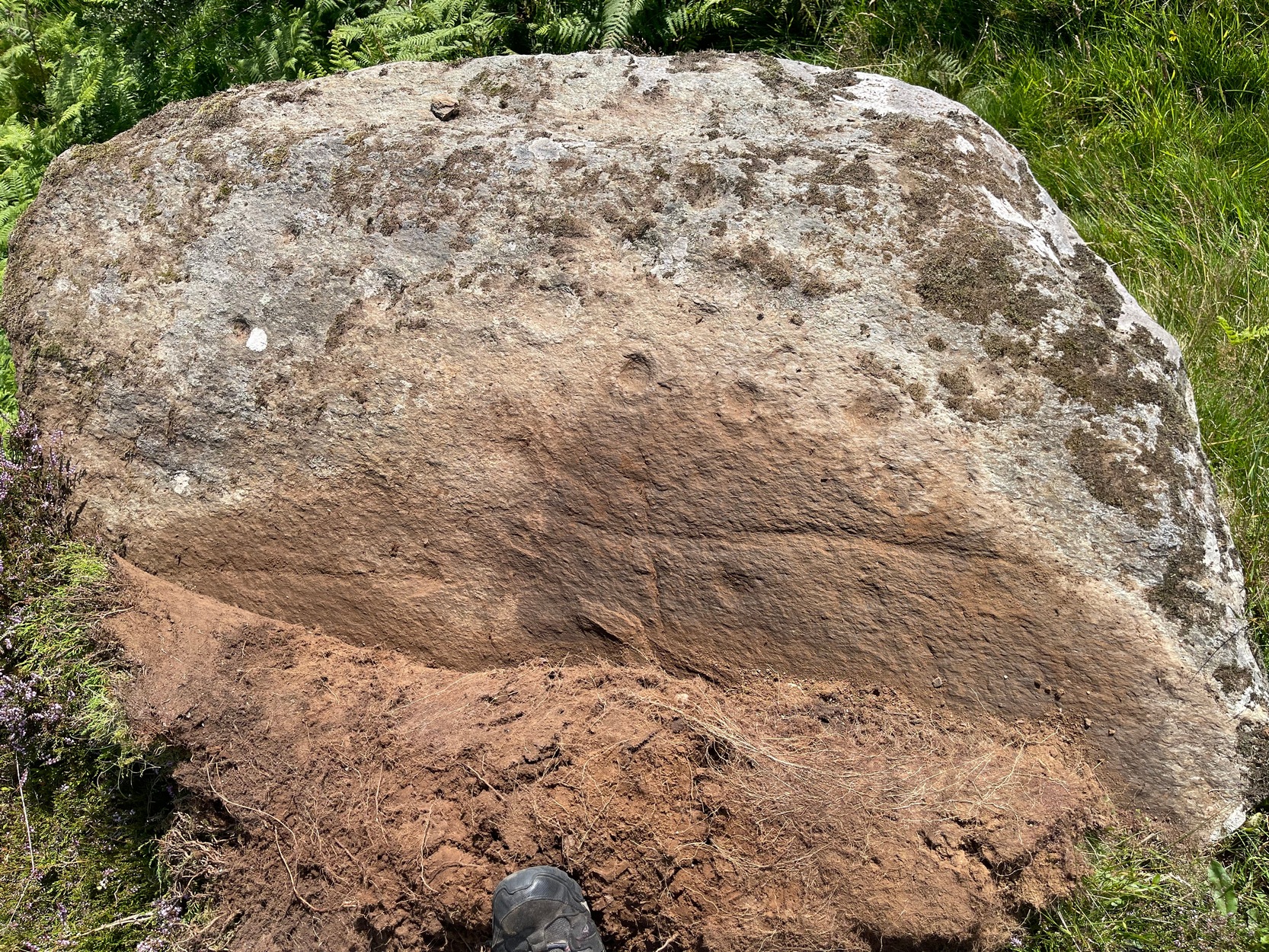
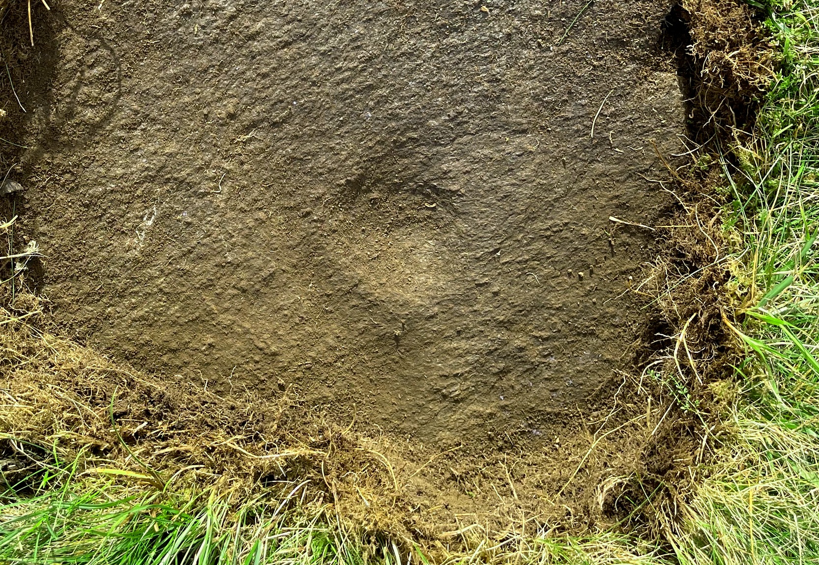
On my visit to this carving I arrived near the end of the day. Within the hour, beneath an already cloudy grey sky, night had fallen; and so, obviously, my assessment of this carvings design was somewhat hampered…
It’s one of several quite separate petroglyphs that almost collide with each other on adjacent rock faces. Etched across this, an elongated slightly convex stone, we find a series of cup-marks in no particular order, mainly running along the topmost section of the stone. Others fall away at the edges, with what seemed like one or two at the more northeastern end of the stone. However, due to the poor lighting when I came here, I struggled to make out the full design and so probably missed some important elements. I’ll update this if/when I visit it again – or if a fellow antiquarian visits the spot and sends in some good images.
From Kenmore village, just as you’re going out of the village towards Aberfeldy (A827 road), turn right as if you’re going on the minor road on the south-side of Loch Tay. Almost immediately on this road, turn left and take the tiny, steep road uphill towards Amulree. After 2½ miles uphill, the road begins to level out and a small loch is on your left (north). Just past it, on the same side, a track runs onto the moors. Walk along here for nearly a mile where the track splits: keep to your left and the track follows the line of walling. Now’s the hard bit: after literally ⅔-mile, walk downhill and cross the burn (stream), then less than 50 yards up the slope on the other side, zigzag around…
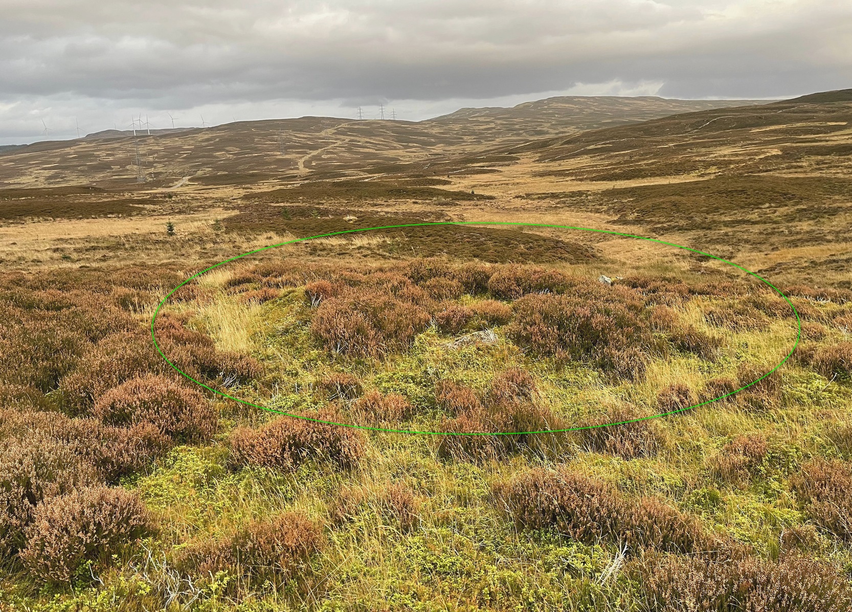
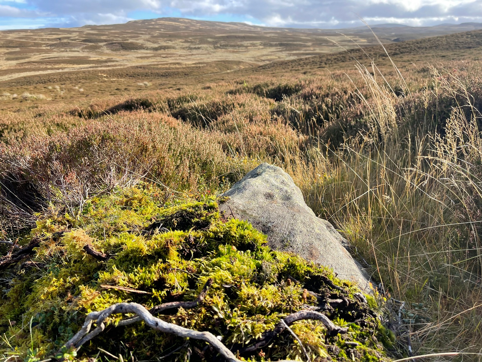
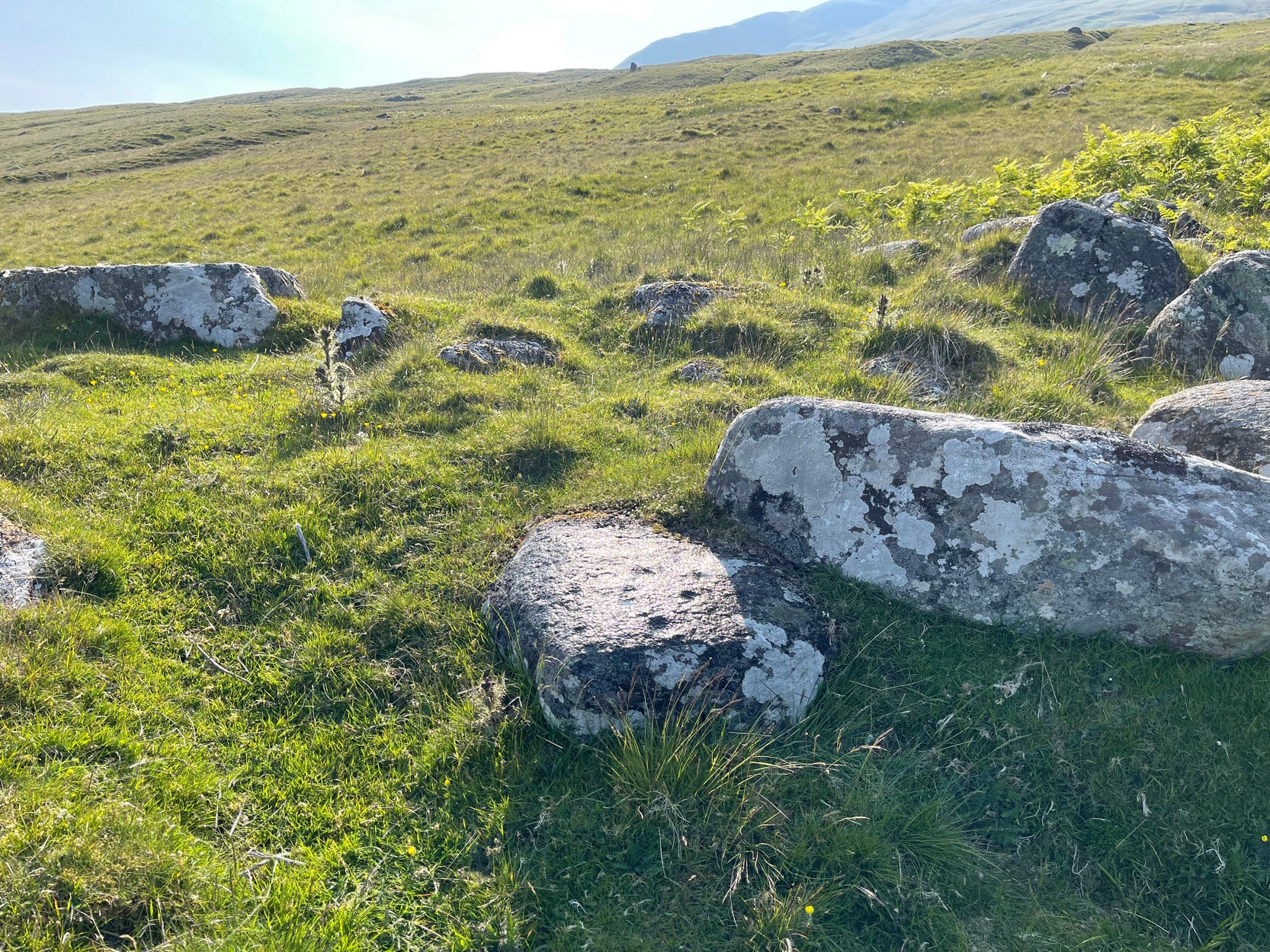
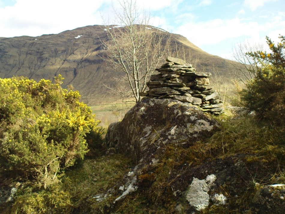
Archaeology & History
Craig Hill circle looking SW
Overlooking a small (unnamed) burn immediately to the right and a large wide marshy hollow to the front, is this small and seemingly singular hut circle, in a good state of preservation, surrounded by the scattered mass of cup-and-ring stones—some complex, some very plain—all over this moorland slope. It’s a very long journey to take just to visit a single hut circle, but I’d assume that you’d be wanting to see the petroglyphs surrounding it too—so mebbe have a look at this whilst you’re fondling the rock art!
Internally this is quite a small circle, measuring barely 5 yards (east-west) by 6 yards (north-south), seemingly with its entrance on the north. Its small size suggests it was constructed for the use of just one person; two at the very most. The structure is still in very good condition considering its age (possibly Bronze Age), with minimal damage apart from Nature’s wind and weathering. The circle is made up primarily of a number of large rocks with many filling stones, with the walling being a yard or so wide all round. In all likelihood, the rest of the building would have been made of timber, with a typical tented roof. It’s an excellent spot to base yourself to explore all the cup-and-ring stones on these slopes. Perhaps, just perhaps, this might have been a shaman’s hut, looking over the ancestral images on the rocks hereby…. ♥
Take the long steep zigzag road from Kenmore to Amulree, and just where the road begins to level out, park up near the isolated hut by the roadside at the side of the lochan. Just past here, a track on your left takes you onto the moors, past the lochan. Nearly a mile along the track splits: bear to the right, uphill slightly, then it’ll wind downhill and you’ll pass another track on your right. Ignore it, keep walking along and where you find a grassy little passing-place on your right—stop! Now walk uphill, onto the moor, through the heather for 175 yards and the land has levelled out. Look around!
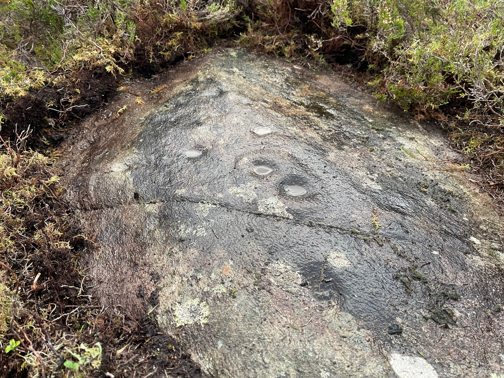
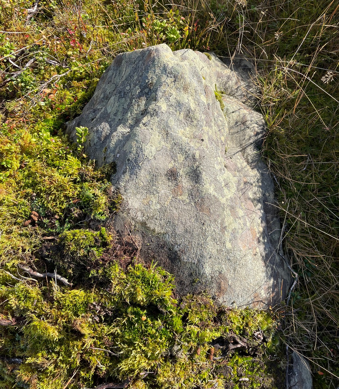
Archaeology & History
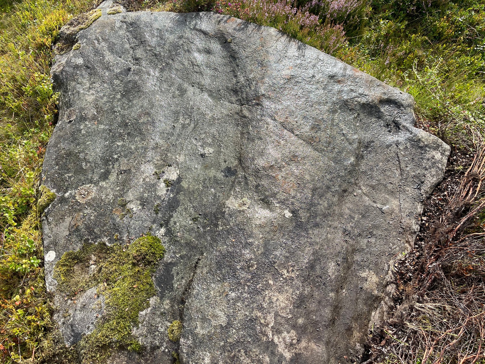
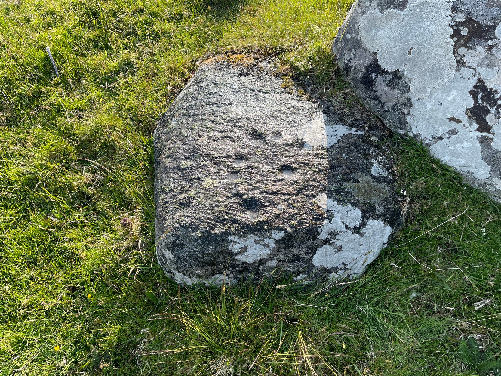
Cupmarks from above
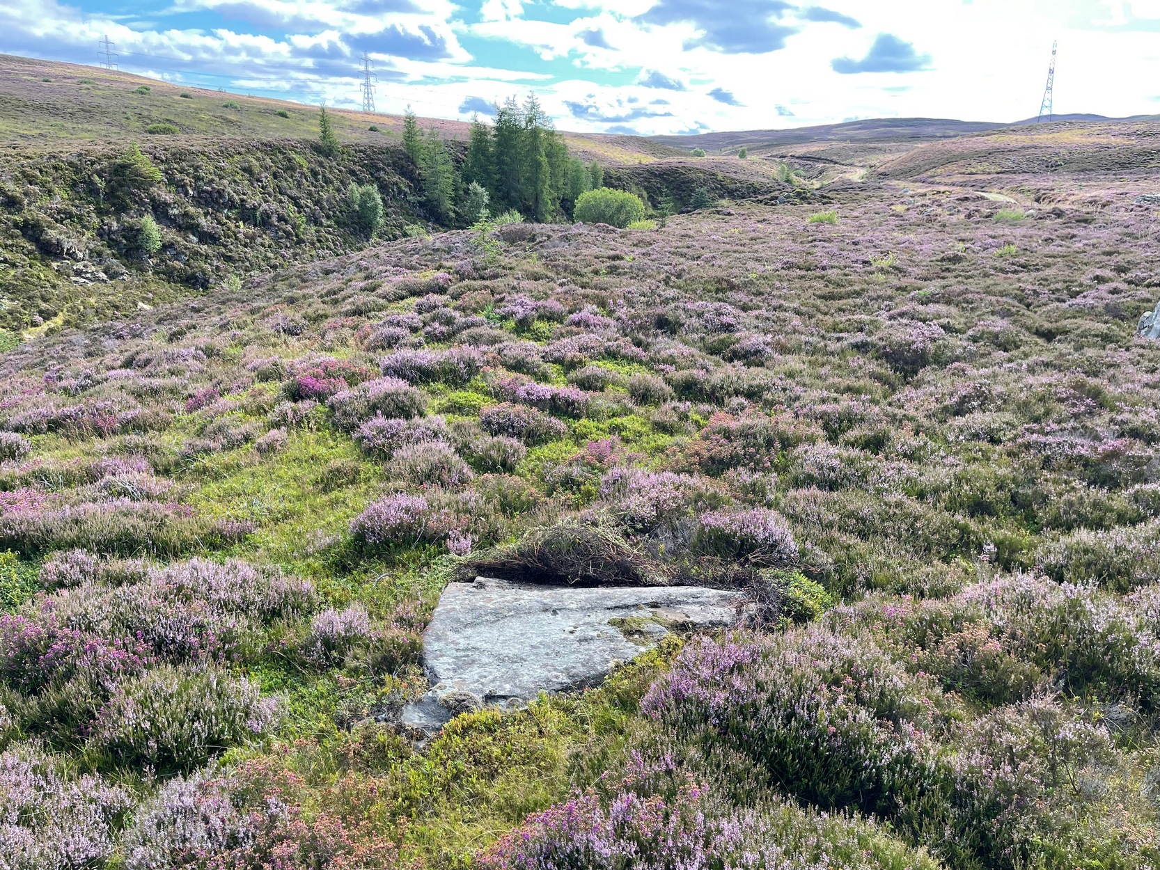
I came across this very basic carving when checking out a couple of others close by and found that it hadn’t been recorded before. It’s nothing special to look at, but is an outlier of the main Craig Hill cluster of carvings a few hundred yards to the west. The design consists of at least two cup-marks that have been etched near the top of the rock, although when I wet the stone it seemed as if a third one was next to the other two, as if in a line. The sun was at its peak when I found it, which meant that I couldn’t get any decent photographs to illustrate this—even when I watered the olde thing! It’s another carving that will only be of interest to the real petroglyph fanatics amongst you.
Cup-Marked Stone (destroyed?): OS Grid Reference – NN 8575 4901
Also Known as:
Clachmore
Archaeology & History
The Clach Mhor, or the Big Stone, is all but forgotten as an antiquarian relic in Aberfeldy. It’s history is somewhat piecemeal. First described in Hugh MacMillan (1884)’s essay on local cup-and-ring stones, he told that:
“A short distance above the village of Aberfeldy, where General Wade’s old road emerges from the houses, a huge stone, called the Clach Mhor, lies on the left-hand side in a slanting position half erect, as if supported by the garden wall of which it forms a part. …In all likelihood it originally stood erect, and formed one of a group of similar stones, its companions having been broken up in the formation of the road. …On the upper face there are some small cup-markings, not quite so well formed as usual, owing to the hardness of the material… The fact that they occur on only one side of the stone, and are scattered indiscriminately all over its surface, are sufficient to convince any one who is skilled in the subject that they are genuine specimens of prehistoric sculpture.”
Nearly thirty years after this initial description, MacMillan (1901) found that it had previously been a part of The Tullich stone circle, and following its destruction the Clach Mhor was moved and used as “part of a garden wall on the old military road passing along its base.”
More than fifty years later, the Aberfeldy historian N.D. Mackay (1954) told that up to 1910 the Clach Mhor was a conspicuous object, standing “as it were overlooking and to some extent overhanging the roadway down near the Square.” However, it
“was blasted and broken up in 1910 in the course of road widening operations, but a considable part of it was built into, and still forms the lower corner of, the garden boundary wall, nearest The Square, of the house which bears its name, ‘Clachmhor’. Its present position is slightly east of the site it occupied when I first knew it and, unless Wade’s men did actually move it, the site it occupied for centuries.”
Mackay also mentioned what he called the “indentations” on the stone which MacMillam deemed as cup-marks, but he pointed out that one Rev. John MacLean “believed they were made by the levers, jacks, etc, of (General) Wade’s men” when they cut the road into Aberfeldy in the 18th century, whilst
“A third solution was given by the son of a one-time local strong man called Big Robert, “What a strong man my father was,” he said, “he lifted that stone. Don’t you see the marks of his fingers on it?””
It’s not known what became of the Clach Mhor and whether it remains hiding in some walling, or whether it has met its demise….
References:
Mackay, N.D., Aberfeldy Past and Present, Town Council: Aberfeldy 1954.
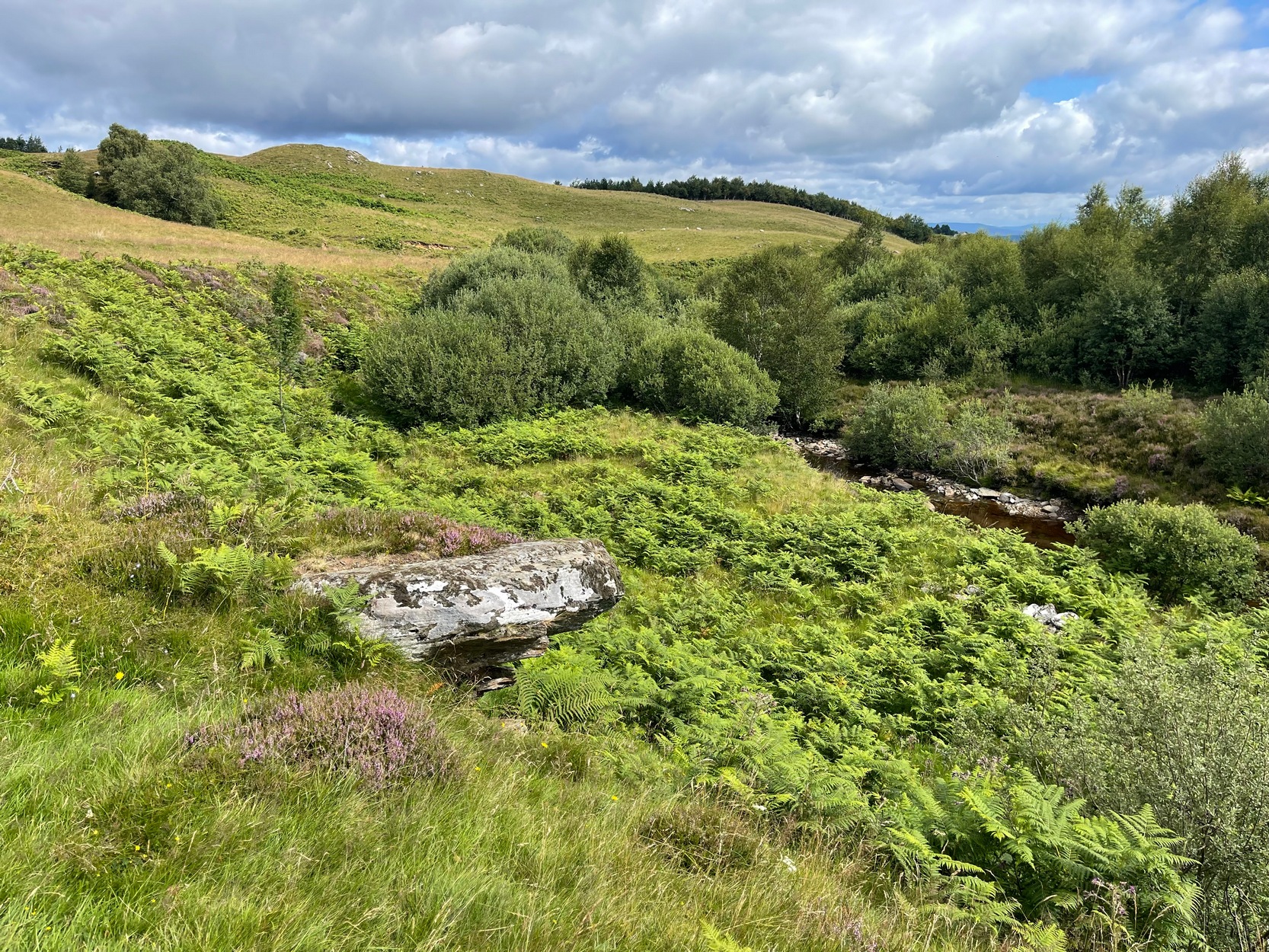
Take the A826 Crieff Road uphill for 275 yards then turn right up the Urlar Road. It’s a long uphill walk from here, up the private road, through and past Urlar Farm and along the track; making sure you keep to the west-side of the burn – don’t cross over it! Beyond the farm, the fields open up ahead of you into the distant hills. Keep along the track until, after a few hundred yards, on the left by the waters, the first small copse of trees appears. (if you reach the bothy, you’ve gone way to far) Here, walk towards the waters and you’ll see good-sized boulder sticking out of the ground and overlooking the burn below. That’s it.
Archaeology & History
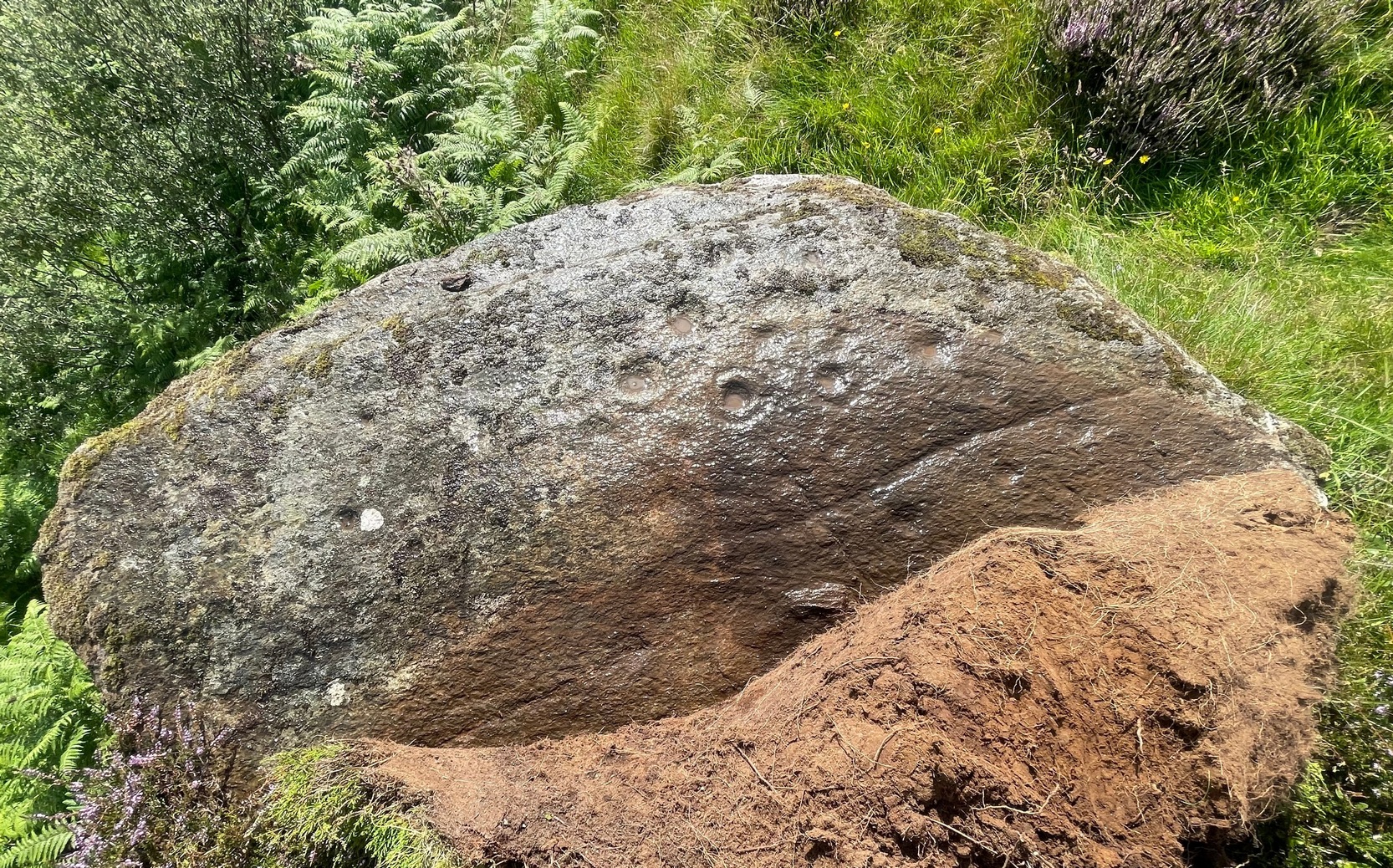
This faded but decent cup-and-ring design, cut into an overhanging rock where you’d sit and dangle your legs, was first described by George Currie (2009) who, in his typically minimalist style told that it “bears 17 cups, 4 of which have single rings.” There may be more to it, but some of the stone is heavily covered in vegetation and on my visit here, the summer heat overwhelmed my ability to gain a complete picture of the surface.
The Urlar Burn (4) carvingFaded design in bright sun
Most of the design is near the western earthfast end of the stone. A long natural scratch in the rock, seemingly enhanced by the hand of man, separates at least three shallow cup-marks on one side (north) from the greater mass of the design on the other —which is where all the cup-and-rings can be seen. One of the rings is incomplete, whilst another has a natural crack running up to its outer edge, which may have been played around with slightly when the carving was first made.
I liked it here – and spent an hour or so under the bright sun before the heat pushed me away, to bathe in the pool below for a while…. Check it out when you’re looking at the other carvings in the neighbourhood
Folklore
Some cup&rings close-up
Although there’s nothing specific about this stone, the burn to the side of the carving was haunted by an old urisk in times gone by: an elemental creature from Scottish fairy lore who inhabited lonely streams and waterfalls. The urisk of Urlar Burn was known as Brunaidh an Easain (his brother, Peallaidh, of greater renown, lived in the gorge of Moness close to Aberfeldy) and this spot may have been one of his abodes. Urisks are associated in some places with cup-marked stones, in which offerings of milk were given to placate them — and this is a good site for any urisk to look over his winding waters….
References:
Currie, George, “Perth and Kinross: Dull: Urlar Burn 1-4,” in Discovery & Excavation Scotland (new series), volume 10, 2009.
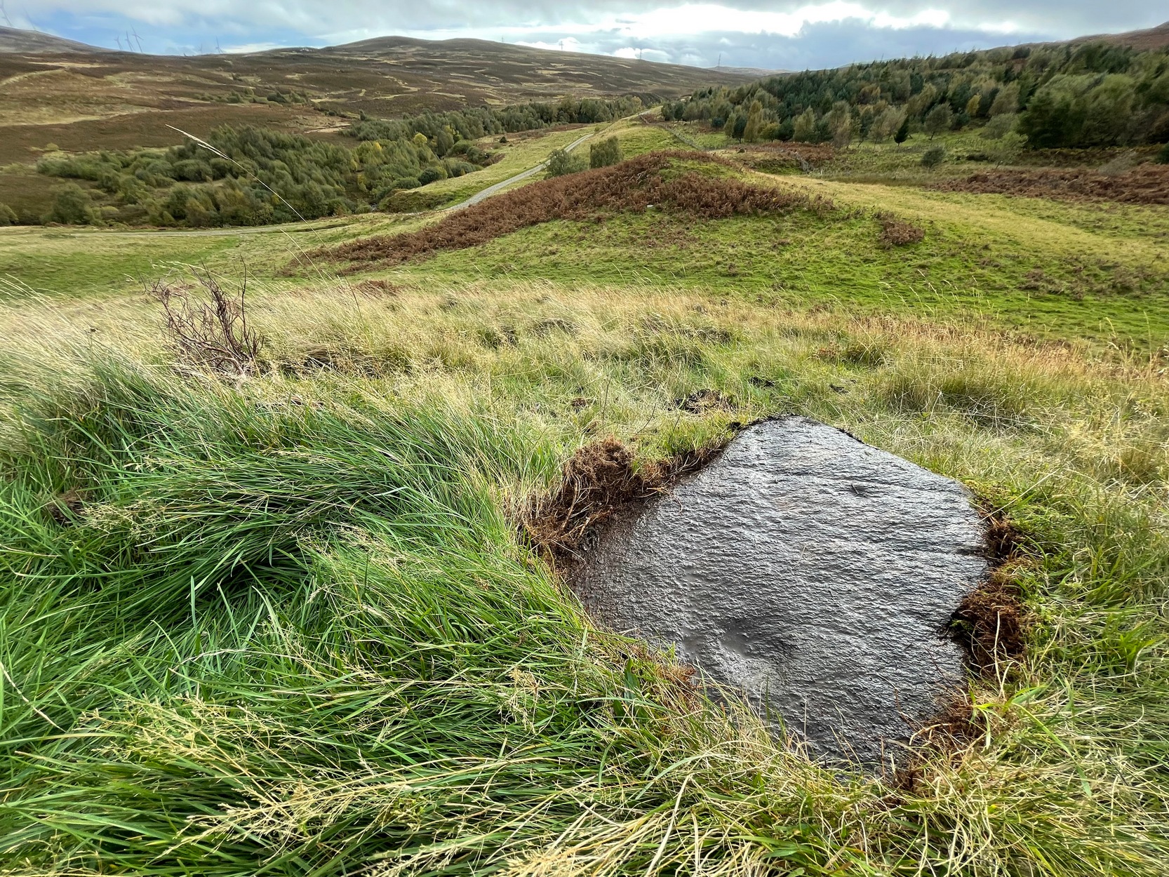
Take the A826 Crieff Road uphill for 275 yards then turn right up the Urlar Road. It’s a long uphill walk from here, up the private road, through and past Urlar Farm and along the track (keeping to the west-side of the burn), past the impressive Urlar Burn (8) carving, until you eventually reach the bothy, 3¼ miles (5.2km) up from where you first turned off the A826. Walk 70 yards past the bothy then into the heather on your left where a large couch-shaped boulder stands. The carved rock is a couple of yards on the floor in front of you.
Archaeology & History
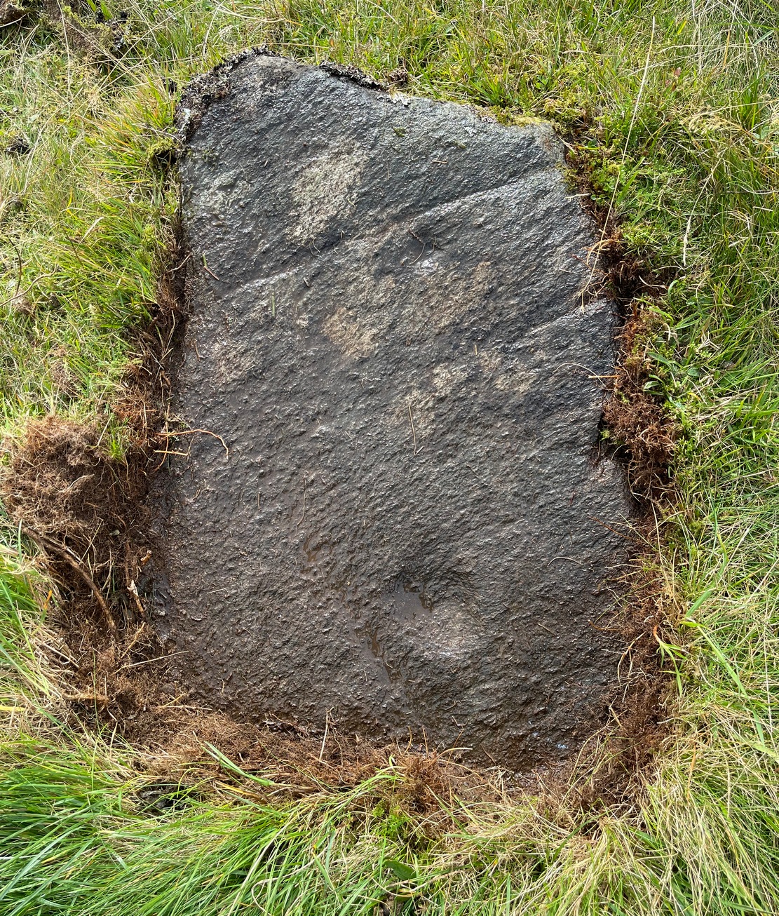
An unimpressive faint cup-marked stone consisting of between two and five shallow cups that are difficult to make out unless lighting conditions are good – and even then they’re troublesome! It was first noted by George Currie (2009) how described it simply as: “a rock 2.0 x 1. x 0.2m between Urlar Burn and Hill Park track bears five cup marks.” There are much more impressive carvings in this neck o’ the woods that you’ll want to see ahead of this one!
Folklore
Shallow cups: top-middle; centre-middle
Although there’s nothing specific about this stone, the burn to the side of the carving was haunted by an old urisk in times gone by: an elemental creature from Scottish fairy lore who inhabited lonely streams and waterfalls. The urisk of Urlar Burn was known as Brunaidh an Easain (his brother, Peallaidh, of greater renown, lived in the gorge of Moness close to Aberfeldy) and was likely to have lived further downstream from here. They are associated in some places with cup-marked stones, where offerings of milk were given to placate them.
References:
Currie, George, “Perth and Kinross: Dull: Urlar Burn (3),” in Discovery & Excavation Scotland (new series), volume 10, 2009.
Along the A827 Loch Tay road, halfway between Fearnan and Lawers just beyond the forestry, a track goes up into the fields across from Feadan house (big shed above you in field). Careful, or you’ll miss it. Go up here and head all the way up the steep winding track for 700 yards (as the crow flies) until, where the land starts levelling out, you hit the long straight line of old walling. Go over it and walk to your right (northeast) for a few hundred yards until it bears sharp left (NW), keep walking along it for another 45 yards and, where the fence turns down to the water, just keeping walking up the slope to the scatter of rocks. Look around!
Archaeology & History
Looking down at the cups
When you consider there are multiple-ringed carvings close by on the same geological ridge as this carving, there’s little wonder this fella hardly gets any attention: the design here is nothing special compared to its close neighbours. That aside: on this small flat surface we have six or seven simple cup-marks; most of them quite small, with the largest of the lot having what looks like a small carved arc around one side of it—although I couldn’t make my mind up one way or the other to be honest. A few more visits might prove more conclusive.
Folklore
The stream at the side of this carving and others nearby—the Allt Coire Phadairlidh, or Padderlie’s Burn—was the haunt of an urisk, who gave his name to the waters. He lived a little further up on the knoll. Several other carvings are just below here. Urisks were plentiful in this area. They are variously described as demonic creatures, referred to by Alexander Carmichael as “a monster, half human half goat, with abnormally long hair, long teeth and long claws.” (teeth aside, that sounds like me! 🙂 ) They mainly live by lonely waterfalls and a small beautiful fall is very close by. They are associated in some places with cup-marked stones, where offerings of milk were made to placate them. In truth, these nature spirits seem to be folk remnants of solitary shaman figures cast into the edges of hills. A local lady who lived in this area said she’d met an urisk near here and he was anything but the fearful creatures they are made out to be…
References:
Currie, George, “Kenmore: Allt Coire Phadairlaidh (AP1): Cup-Marked Rock,” in Discovery & Excavtion Scotland, vol. 9 (new series), 2008.
Follow the same directions as if you’re going to the Black Burn (2) carving (which you’ll obviously be looking at if you’re checking this one out!); and from there, walk two or three steps southwards down the slope – and you’re just about stood on it!
Archaeology & History
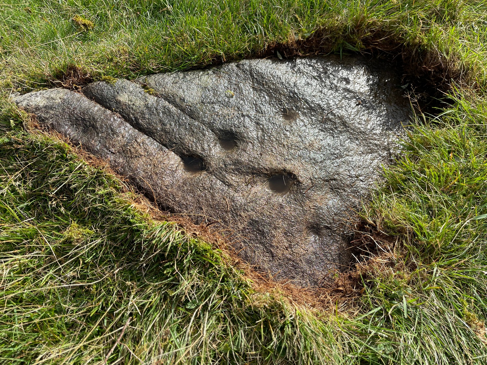
This, at first sight, seems little more than two cup-marks: one rather small, and the other somewhat larger than usual. I walked round it, crouched down and fondled it, poured water on it and heightened the carving… and noticed what seemed to be a carved arc around the western side of the large cup. But I couldn’t make my mind up whether this was natural or not. And then as laid down and looked across the stone, it seemed as if a very faint triangle completely enclosed the large cup! I crawled round it at ground level and the shape appeared and disappeared as the light altered. So I took a few more photos and wondered whether or not the shape would become obvious in them. And it did!
An eye in the triangle?Cup and faint triangle, or a trick of the mind?
It’s unusual – and I’m still not sure whether it’s natural or not. The carving needs more attention, in better daylight. Or perhaps the computer-tech kids might have a look at it and see if this really is an eye-in-the-triangle style design we’ve got here. It would be damn good! Anyhow, the carving was first mentioned by George Currie (2005), who told of it being two metres south of the Black Burn (2) cup-and-ring and, plainly, that it “has two cups: 60 x 15mm and 25 x 8mm.” It overlooks the urisk-haunted Urlar Burn, a creature known in some places for having milk and other offerings poured into cup-marks to appease it and gain good fortune.
References:
Currie, George, “Perthshire: Black Burn (Dull Parish) – Cup and Ring Marked Rocks”, in Discovery & Excavation Scotland, volume 6 (new series), 2005.
Take the A826 Crieff Road uphill for 275 yards then turn right up the Urlar Road. It’s a long uphill walk from here, up the private road, through and past Urlar Farm and along the track, making sure to go right where the track splits, keeping to the west-side of the burn. (don’t cross over it!) From here, the fields open up ahead of you into the distant hills. Keep along the track until, after a few hundred yards a small copse of trees is on your right. Walk past the bottom of this and then walk immediately up to the top of the large rounded knoll, or Tom, on your right. Once at the top, look for the triangular stone on its southwestern edge.
Archaeology & History
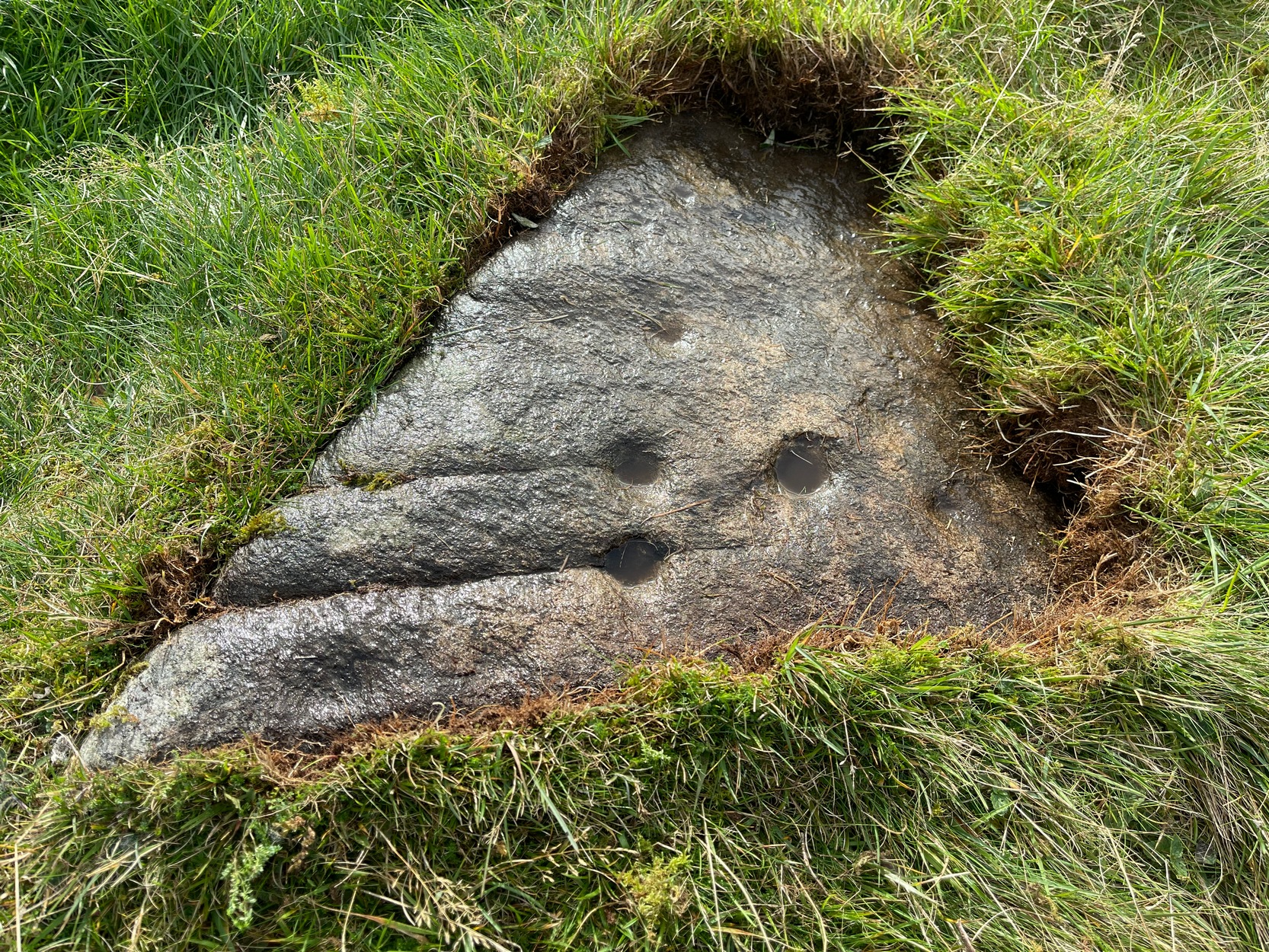
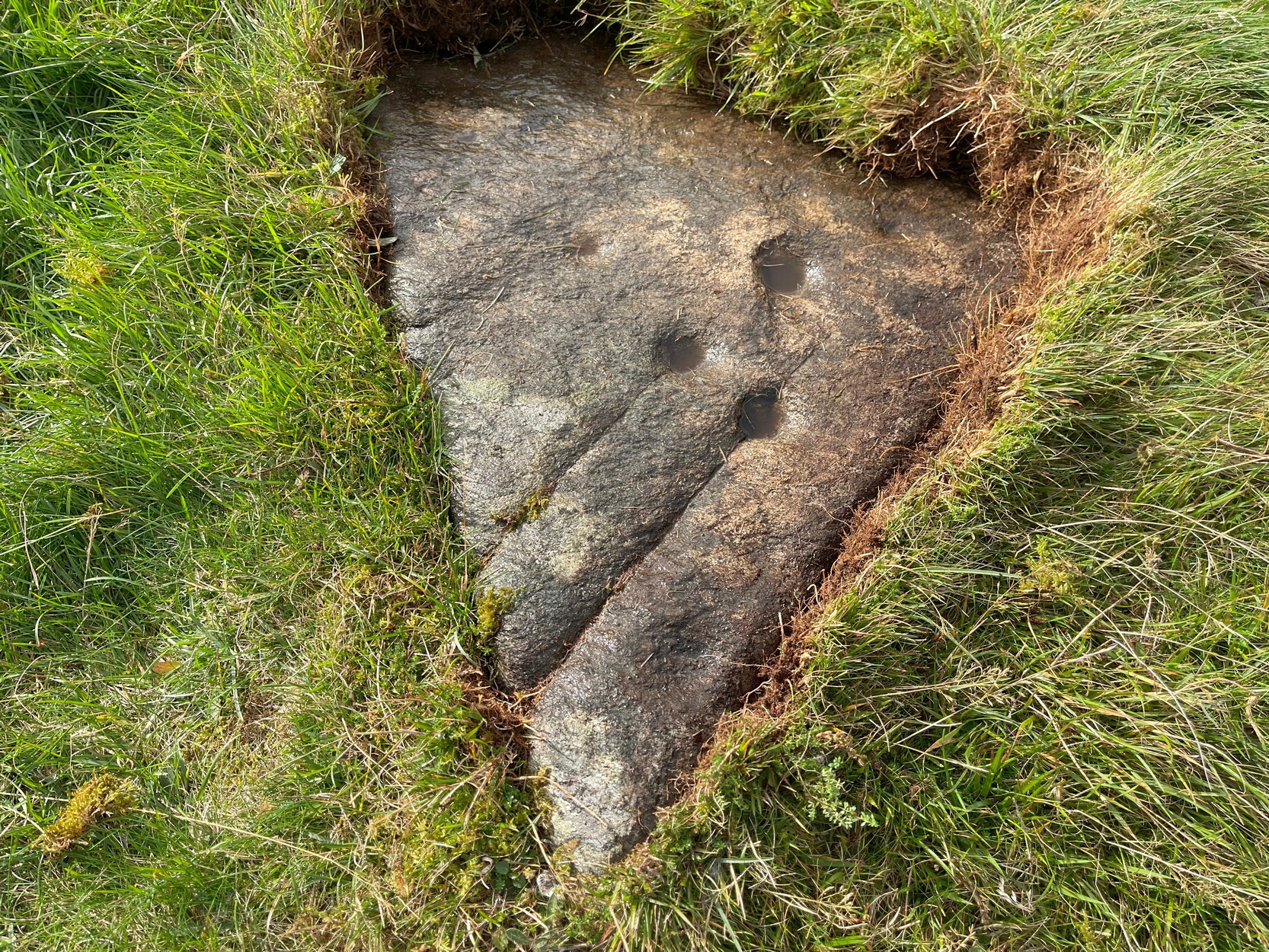
Upon this rounded tom, beloved of faerie folk and overlooking the urisk-haunted Urlar Burn, is this small flat triangular-shaped stone, embedded in the ground, possessing an unusual set of seven, possibly eight cup-markings (not five as Currie [2005] initially described) of varying depths and age, carved into straight geological fissures in the rock which, I hasten to add, were probably intended as part of the original design. Such elements are not unusual in carvings in other parts of the world, tending to relate to some spirit or ancestral ingredient. Whether that was important here, we might never know.
Black Burn (2) carvingBlack Burn (2) carving
But in addition to the cups on their geological cracks, a large faint wonky incomplete ring has been carved around the centre-most cup-mark, seemingly stopping where it meets the natural crack. You can just make it out in the photos. One side of this ring may continue onto the top of the longer crack, but it was difficult to see in the cloudy daylight and another visit is necessary.
The carving was first described by George Currie (2005), who told, in his usual minimalist manner:
“On W side of large knoll, triangular-shaped rock, 0.7 x 0.7m, flush with ground; five cups, largest being 50 x 20mm and smallest, 25 x 8mm.”
Two or three yards away, just slightly down the slope to your south, is another cup-marked stone: the Black Burn (3) carving.
References:
Currie, George, “Perthshire: Black Burn (Dull Parish) – Cup and Ring Marked Rocks”, in Discovery & Excavation Scotland, volume 6 (new series), 2005.
Acknowledgements:Huge thanks for use of the Ordnance Survey map in this site profile, reproduced with the kind permission of the National Library of Scotland.
From Fortingall, get to the standing stone of Adamnan’s Cross a few miles down the stunning Glen Lyon. Barely 100 yards before you reach the stone, notice the overgrown gorse-covered rocky rise across the road, just past Craigianie Farm. As you climb to the top of this small rocky rise, you’ll see a cairn of stones on its top. Just below it, into the solid rock, you’ll see a footprint-shaped hollow etched into the stone. If it seems hidden, just keep looking – you’ll find it…
Archaeology & History
St. Palladius Stone, Glen Lyon
When Ratcliffe Barnatt (1944) visited Glen Lyon in the 1940s, this legendary rock was one of his stopping points. “When we have passed by Ruskich and Slatich,” he wrote, “we come to that sacred spot, Craig Dianaidh, the Rock of Safety, where, until about 1480, solemn and judicial meetings were held.” The old rock was known through recent ages, “as a preaching hill, a motehill and a justiciary court,” said Hilary Wheater (1981), and upon its top is the curious ‘footprint’ which Nature’s blood would fill on all but the hottest of summers. It is this geological feature that gave the stone is name, long ago.
Of known historical events here, Wheater further told:
“It was on this rock…that the Baron Courts of Glenlyon were held. Law and order was kept by regular courts held by the Chief or Landowner. The Baron-Bailiary of each area was appointed by Royal Charter. Fifteen men were chosen as a jury and the laird or his baile presided. To this court were brought all the problems and grievances of the people. Here the miller accused several men of refusing to take part in the compulsory ‘hamganging’ of a new millstone; here a man was fined for brewing ale without a license; here a neighbour was accused of putting the ‘evil eye’ on the cow of the croft next door so it produced no milk; and here a man was prosecuted for ‘taking of ane sore horse of his to Rannoch in the summer of 1629 and putting on him ane great burder of timber, and letting him go through the wood where he stuck between two trees all night and the timber on his back.’ However, he was acquitted when he was able to prove that the horse was fit enough after this for another man to be able to take it to Edinburgh soon after.”
St Palladius Footprint
As well as being a moot site, it is more than probable that this footprint, like the one near the top of Dunadd in Argyll—and others scattering the Highlands and beyond—was an initiation stone, perhaps for local tribal elders or ancient kings. Janet Bord (2004) writes about them as places of ritual inauguration in her survey of such places.
Folklore
The legendary site, looking south
This legendary rock would probably have had earlier mythic association than the one ascribing it to St. Palladius—but as yet I have found no written lore telling the nature of such a spirit, so would only perhaps discern the original genius loci by lengthy encounters with the rock in question, through mist and storm and wintry months, alone. It is known in local folklore that Palladius was in fact an urisk: a solitary spirit of steep streams that few humans encounter due to their lonely habits amidst hidden abodes in dark and ancient gorges. Such urisks dwelt in numbers amongst many of the steep falls in this landscape — and still do, if the words of old locals are to be believed. Here,
“St Palladius was a goblin saint, an urisk that dwelt in a mountain burn and was sanctified by the people.”
…and some rocks by the stream up the mountain immediately above this “footprint” was one of the places the urisk was known to dwell.
…to be continued…
References:
Barnatt, T. Ratcliffe, The Road to Rannoch and the Summer Isles, John Grant: Edinburgh 1944.
Bord, Janet, Footprints in Stone, Heart of Albion Press 2004.
Fraser, Duncan, Highland Perthshire, Standard Press: Montrose 1969.
Wheater, Hilary, Aberfeldy to Glenlyon, Appin Publications: Aberfeldy 1981.