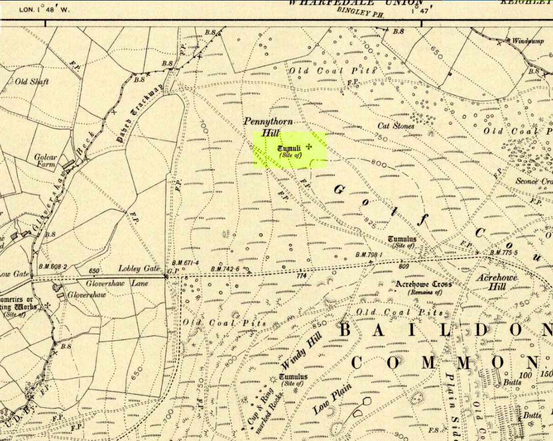
Cup-and-Ring Stone: OS Grid Reference – SE 13703 39616
Getting Here

Take the road up alongside and past Shipley Glen, taking the turn to go to Crook Farm caravan site. Go right to the very end of the car-park, then walk up the footpath through the trees on your left. Keep going uphill about 100 yards by the field-wall until the land begins to level out – and shortly before the first gate into the field (on your right) keep your eyes peeled for the triangular stone in the ground, barely 10 yards away from the walling. Alternatively, from the entrance into the Dobrudden caravan park walk to the far-end of the level area in front of the little cafe and walk along the footpath that crosses the grassland to the walling nearly 300 yards away (south). Follow the wall down below the gate and zigzag about. You’re damn close!
Archaeology & History
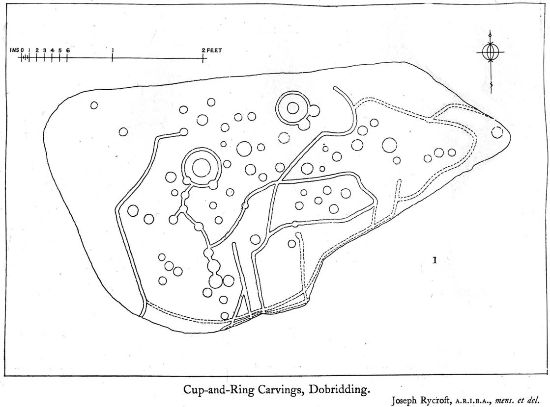
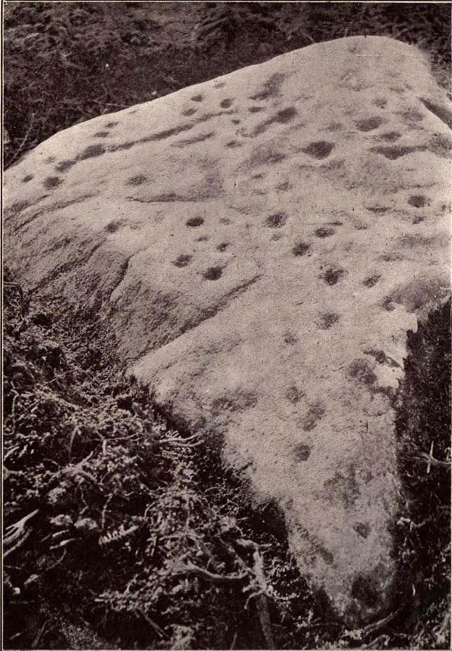
For some reason this has always been one of my favourite cup-and-ring stones on Baildon Moor and it’s well worth checking out if you visit the area! It was rediscovered by the Bradford historian W.E. Preston, who photographed the carving around 1912. Shortly afterwards he took fellow historians Joseph Rycroft and W. Paley Baildon to see this (and others he’d located) and subsequently both a drawing and Mr Preston’s photo of the site was included in Mr Baildon’s (1913) magnum opus the following year.
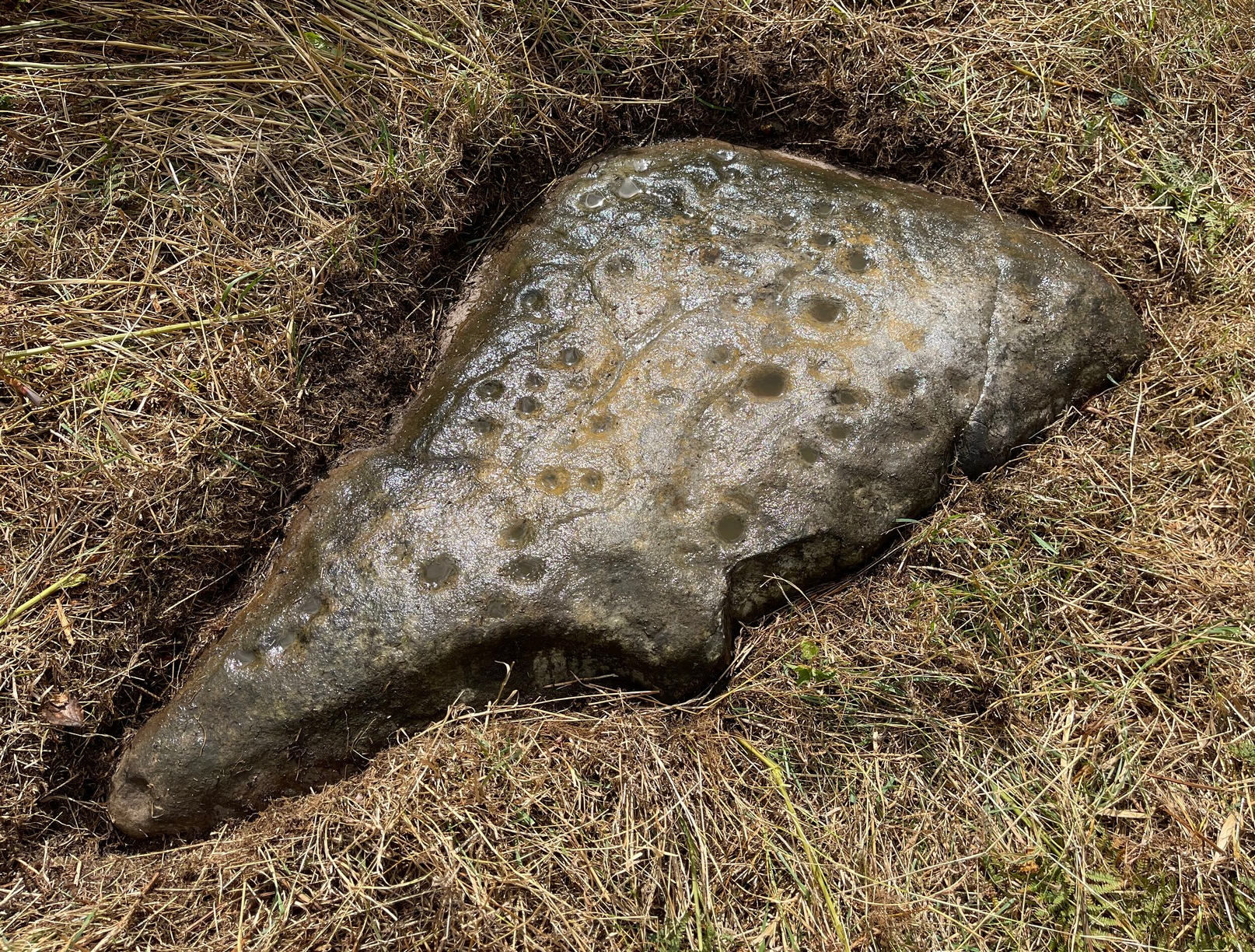
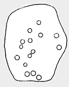
As you can see from the relative photos—with literally 100 years between them—erosion hasn’t taken too much toll and this neolithic or Bronze Age carving remains in very good condition.
Covered with upwards of fifty cup-markings, there are also two cup-and-rings and numerous carved lines meandering around and enclosing some of the many cups. One cup-mark was cut into the narrow end or ‘nose’ of the stone.
It’s a fascinating design, with another ‘Cassiopeia’ cluster of cups in one section, beloved of archaeoastronomers who explore these stones. Mr Rycroft’s drawing of the design (left) is perhaps the best one, to date.
Along this same ridge there are remains of other prehistoric sites, more cup-and-rings, remains of prehistoric walling and what may be a small cairn circle (to be described later).

References:
- Baildon, W. Paley, Baildon and the Baildons – parts 1-15, Adelphi: London 1913-1926.
- Bennett, Paul, Of Cups and Rings and Things, unpublished: Shipley 1981.
- Bennett, Paul, Megalithic Ramblings between Ilkley and Baildon, unpublished: Shipley 1982.
© Paul Bennett, The Northern Antiquarian


")


")

")


")