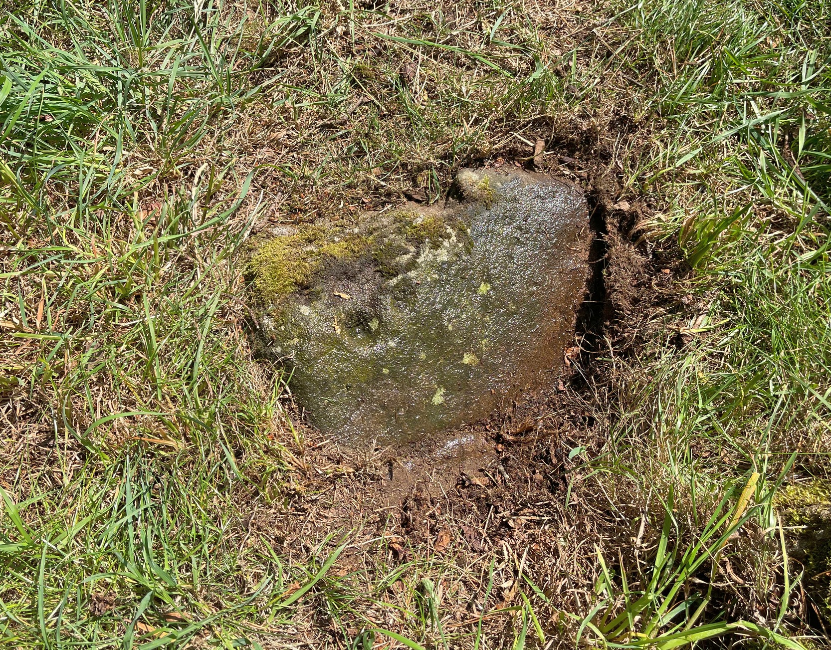
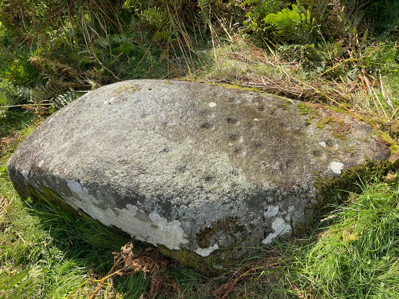
Found barely 12 inches east of the Tormain (7) carving, this ‘cup-marked stone’ is another somewhat dubious design in the Tormain cluster, but which I’m adding here for the sake of completeness. It’s designated as authentic by the Scottish Rock Art Project—but I’m not convinced. Consisting of just two cup-marks, Romilly Allen (1882) was the first to notice them and described them respectively as, “one 1 inch in diameter and the other 1½ inch across.” The smaller of the two, I’m pretty sure, is geophysical in nature.
In Lochearnhead village start walking up the Glen Ogle road and, just past the last house on the right, a dirt-track bends down to an old building. Just before the building, keep your eyes peeled for the small footpath that runs down to the river. Walk along here and cross the river-bridge, then bear diagonally to your left and walk up the singular footpath. It snakes through the trees for a few hundred yards then opens out into a field. About 75 yards along the path in the field the land levels out. From here, walk through the grasses to your right about 20 yards. Zigzag about – you’ll find it.
Archaeology & History
Main cluster + v.faint ring
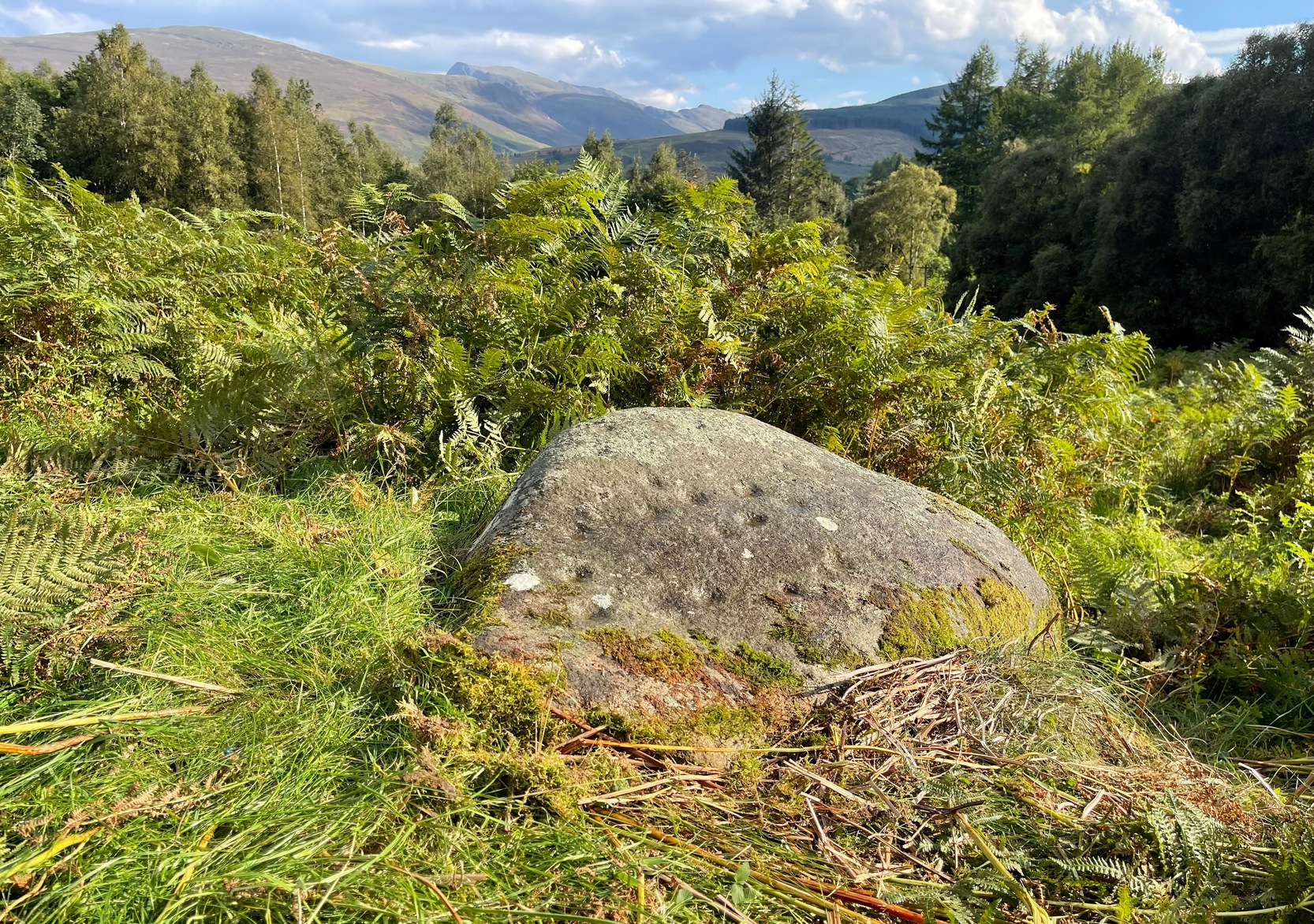
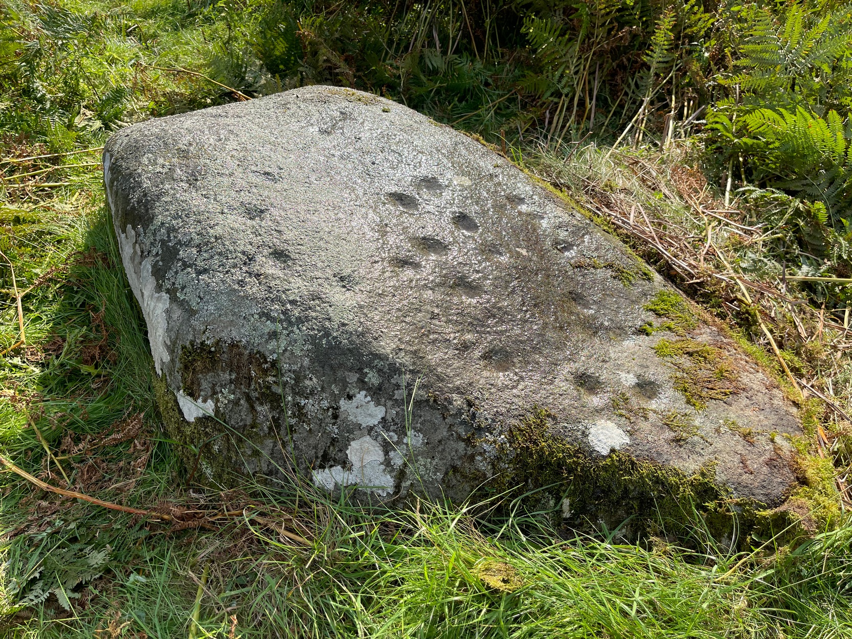
The setting of this carving is, like many of Perthshire’s petroglyphs, quite beautiful. It was made when the ‘artist’ carving the stone was crouched or sat on the ground, gazing at the southern landscape and heights around Ben Vorlich, whose mythic nature may have been part of the design.
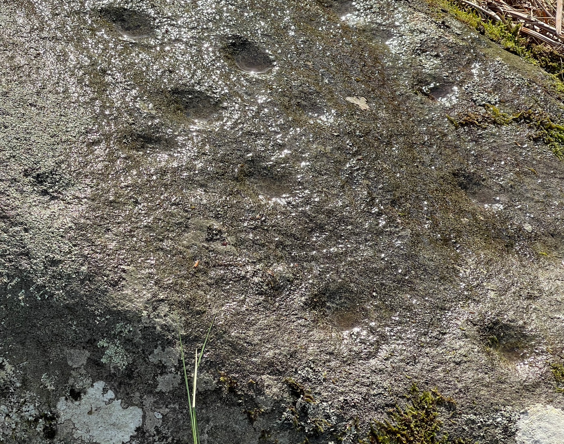
Comprising of a cluster of typical cup-marks, there are two, perhaps three very faint rings in the design, which seems to have been described for the first time in George Currie’s (2012) typically short minimalist way. He told that in the field,
“50m E of the Ogle Burn is a boulder 2.1 x 0.9 x 0.5m, which bears 21 cup marks, 2 of which have single rings.”
Cup and faint ringFaint cups on the crown
Much of the original design is difficult to see in full unless the lighting is good. We spent several hours here and counted 25 cup-marks and found rings around three of them—but these proved difficult to photograph and some more visits are needed to capture them. “Officially” at least, there are no other carvings close to this one. But that’s obviously not going to be the case. Well worth checking out when you’re in the area.
References:
Currie, George, “Stirling: Balquhidder, Glen Ogle – Cup-and ring-marked rock”, in Discovery & Excavation Scotland, volume 13 (New Series), 2012.
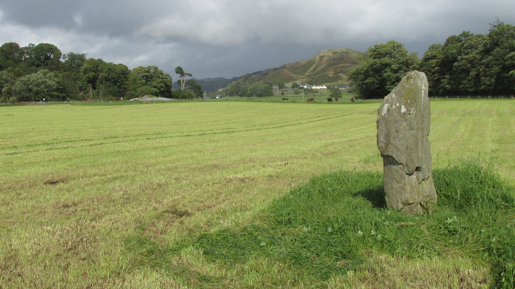
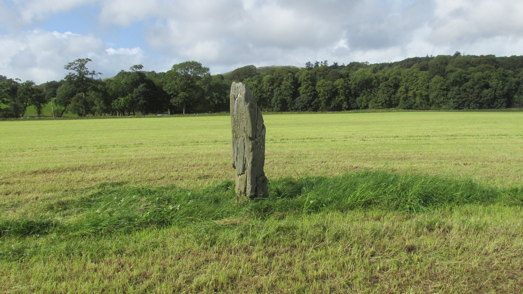
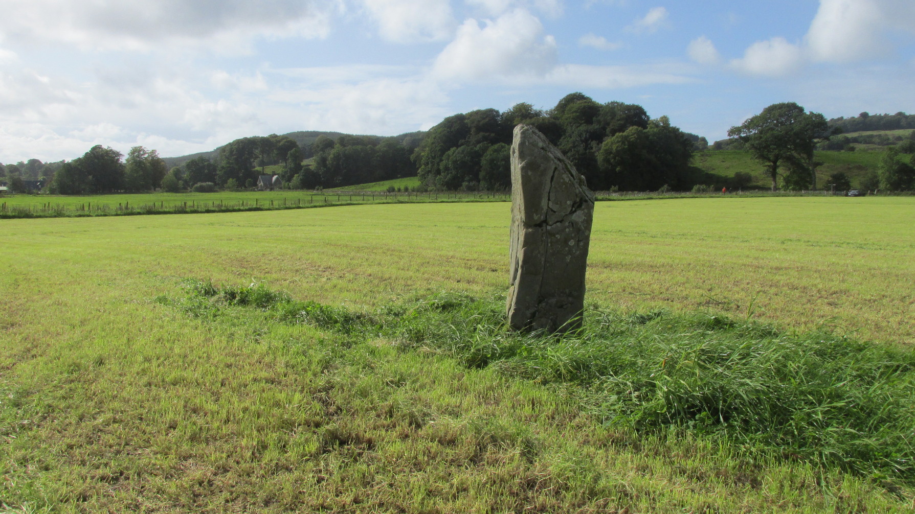
Along the A816 road, just less than a mile south of Kilmartin, take the right-turn on the B8025 Tayvallich road. Barely 50 yards along here, park up on the left-side of the road. Cross the road and walk along the well-marked footpath to the mighty megalithic Kilmartin ‘X’. The path continues to Temple Wood but you’ll see, in the field to your right, this single standing stone. (you’ll see the mighty Netherlargie South cairn in the field beyond)
Archaeology & History
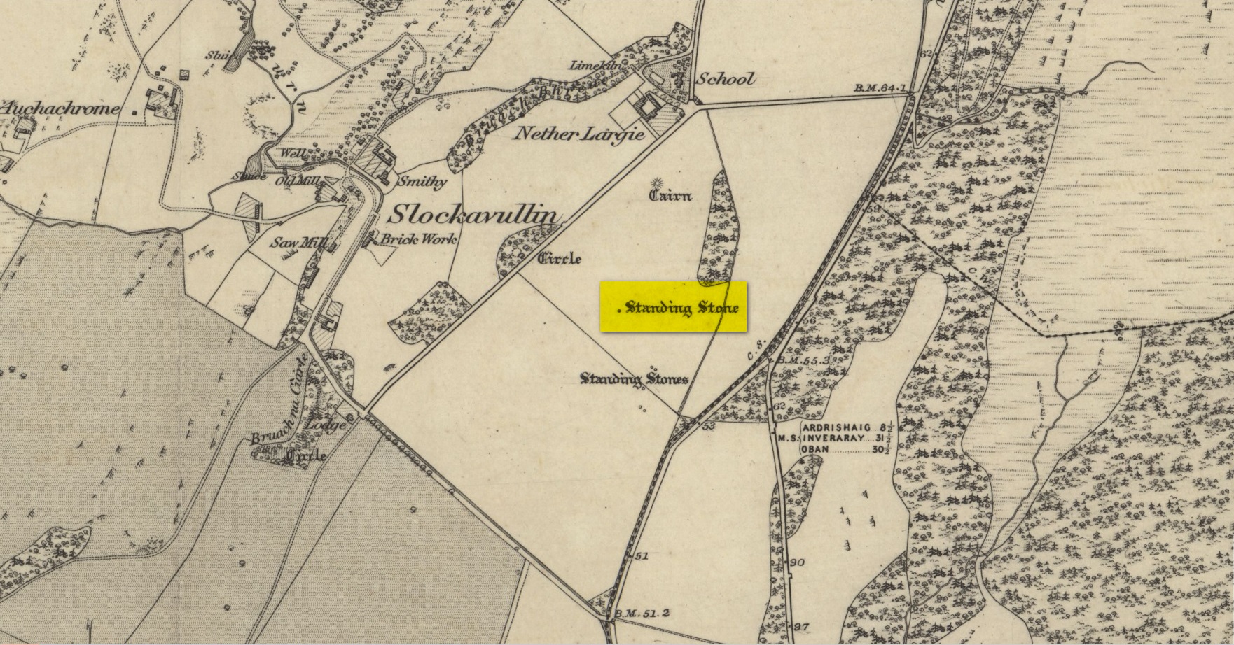
Stone on the 1874 OS-map
First illustrated on the 1874 Ordnance Survey map, this solitary stone (though it may once have had companions) stands some 200 yards south-east of the Temple Wood circle and 355 feet north-west of the northernmost stone in the Kilmartin ‘X’ megalithic complex. When Alexander Thom surveyed this area, despite finding astronomical alignments at many of the standing stones nearby, he could find no heavenly association at this solitary monolith. Its function remains hidden for the time being, although everyone assumes it had some relationship with the giant tombs close by. It makes sense.
Looking W to Temple WoodLooking to the southwest
Despite being referenced in a number of prehistoric surveys, archaeological circles say very little about it. When the Royal Commission lads (1988) visited here they told how it was, at the time, leaning to the south-east. It fell over a few years afterwards but has thankfully been resurrected. When the archaeologists fondled around the base of where it had stood, apart from a few packing stones at one side of the monolith, nothing was found.
Pearson, Jane, Kilmartin – The Stones of History, Famedram: Alexandria 1975.
Ritchie, Graham, The Archaeology of Argyll, Edinburgh University Press 1997.
Royal Commission on the Ancient & Historical Monuments of Scotland, Argyll – Volume 6: Mid-Argyll and Cowal, HMSO: Edinburgh 1988.
Ruggles, Clive, “The Stone Alignments of Argyll and Mull,” in Records in Stone (ed. C.L.N. Ruggles), Cambridge University Press 1988.
Thom, Alexander, Megalithic Lunar Observatories, Oxford University Press 1971.
Acknowledgements:Huge thanks for use of the Ordnance Survey map in this site profile, reproduced with the kind permission of the National Library of Scotland.
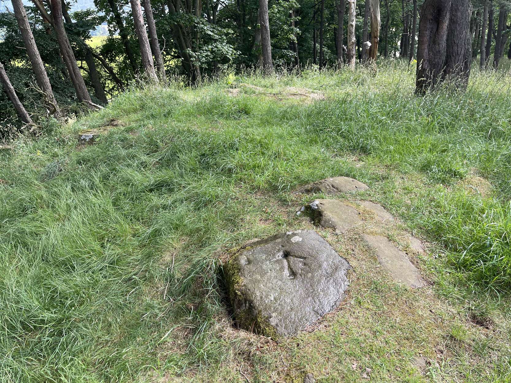
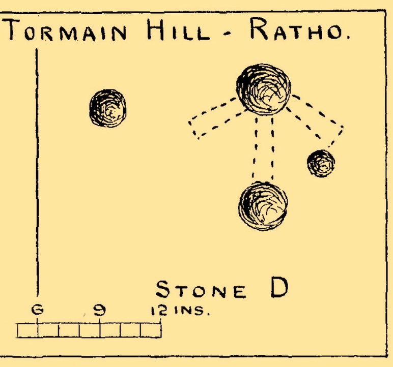
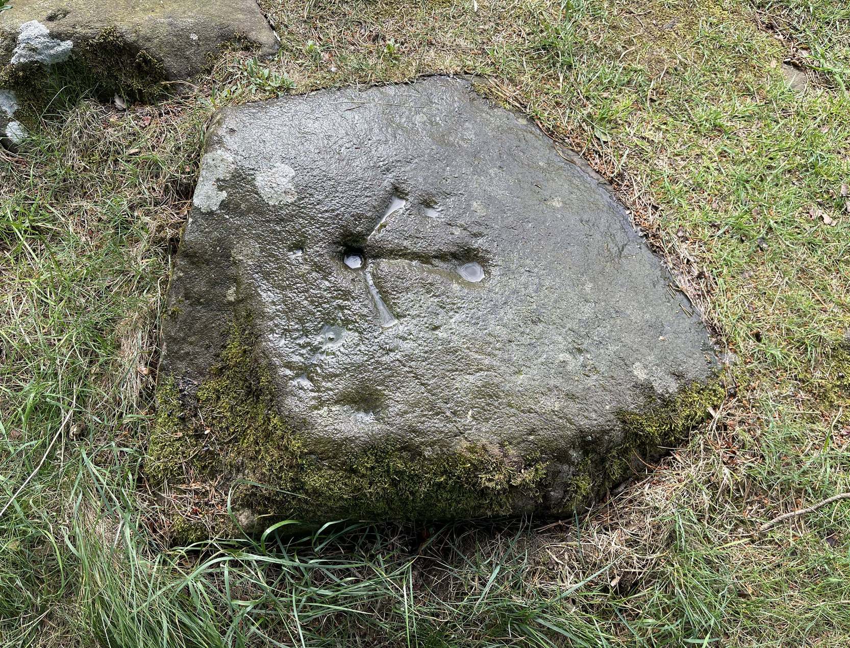
Take the same directions as if you’re visiting the impressive Tormain (1) carving. About ten yards before you reach it, just at the top of the hill itself, almost the first flat stone you come across is the one you’re after. You’ll find it easily enough.
Archaeology & History
This is a notable design by virtue of the Ordnance survey lads marking it with an unusually large benchmark, utilizing at least one of the prehistoric cup-marks on their much more modern symbol. You can clearly see it in all the photos. The stone itself may have had a section of it cut or split from a once larger piece, probably in the 19th century when a lot of quarrying was being undertaken round here.
This carving was first described, albeit briefly, in John Smith’s (1874) piece on the nearby Witch’s Stone, where he told:
Allen’s 1882 sketch
“there is a group of three cup-like hollows near the highest summit of the hill; this last has, however, been altered in our own day by the officials of the Government Ordnance Survey combining them into one figure, by drawing from cup to cup their well-known and characteristic mark of the Queen’s ‘broad arrow.’”
To be honest, there’s not much more that can be said of it. A few years later when Romilly Allen (1882) surveyed all the Tormain stones, he simply wrote that,
“Stone D…lies 30 feet from stone A, and is the most northerly of the group; it is also the highest as regards level, and has an Ordnance bench mark cut on it… Round the bench mark will be found four cups, varying in diameter from 1 to 2½ inches.”
Not all of the cup-marks on this stone are prehistoric, as is obvious when you look at them close-up. Two, perhaps three of them are OK, with at least one of those that are attached to the Ordnance Survey mark widened and deepened when they came here in the 19th century.
Morris, Ronald W.B., “The Cup-and-Ring and Similar Early Sculptures of Scotland; Part 2 – The Rest of Scotland except Kintyre,” in Transactions of the Ancient Monuments Society, volume 16, 1969.
Morris, Ronald W.B., The Prehistoric Rock Art of Southern Scotland, BAR: Oxford 1981.
Royal Commission Ancient & Historical Monuments of Scotland, Inventory of Monuments and Constructions in the Counties of Midlothian and West Lothian, HMSO: Edinburgh 1929.
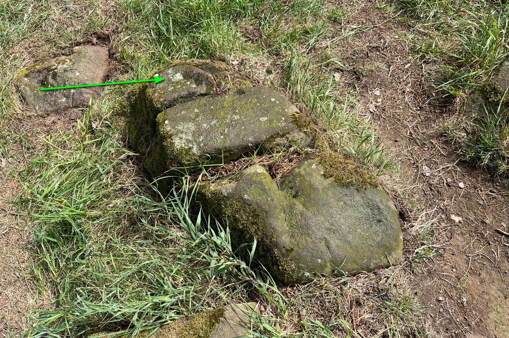
Two or three yards from the impressive Tormain (1) carving you’ll see this elongated stone, cracked into three separate pieces. Its sloping southeastern section is possessed of a single cup-marking, an inch or two across, which, if you found it anywhere else, you’d just shrug your shoulders and walk on by. It’s only due to this stones proximity to the more impressive carvings that it’s received any attention (ordinarily I wouldn’t even have added this to the database). It was first noticed when Romilly Allen (1882) visited the area. The Royal Commission’s (1929) survey of Tormain Hill mentioned “a single cup on one boulder,” but didn’t specify which of the three examples up here they were referring to.
Royal Commission Ancient & Historical Monuments of Scotland, Inventory of Monuments and Constructions in the Counties of Midlothian and West Lothian, HMSO: Edinburgh 1929.
Cup-Marked Stone (dubious): OS Grid Reference – NT 12908 69669
Also Known as:
Tormain ‘F’ (Allen 1882)
Archaeology & History
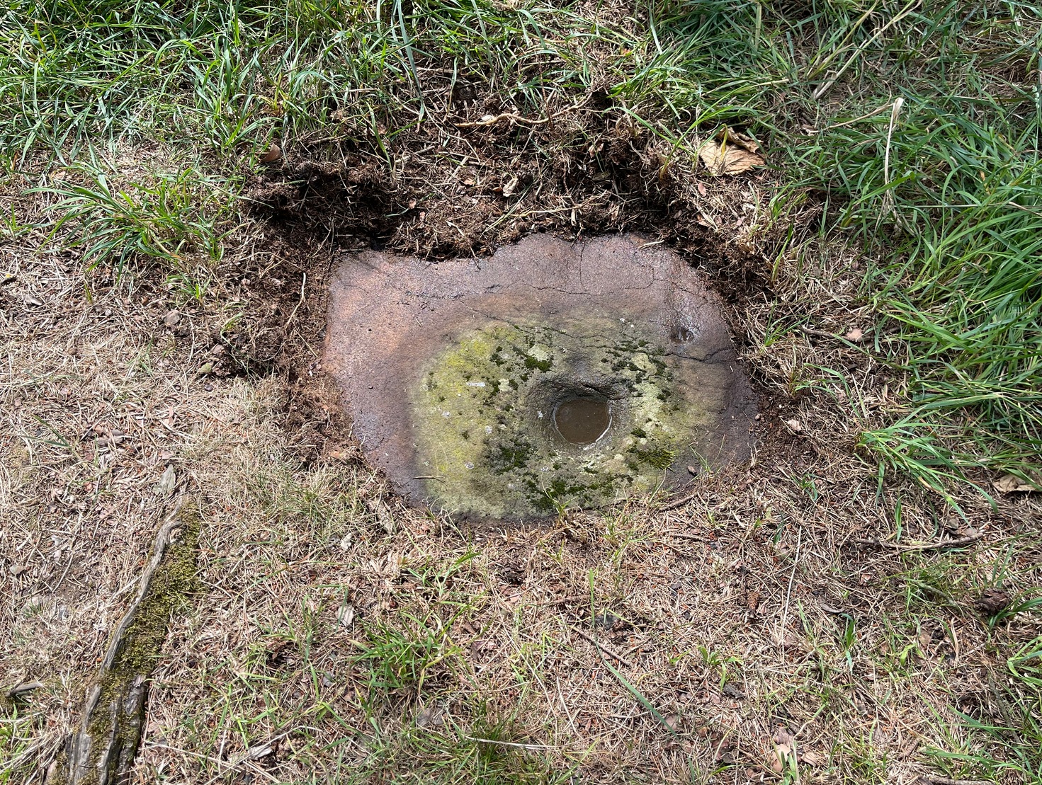
Tormain 6 (left of centre)
On the small rock right next to the plain Tormain (7) cup-marking is this, the least impressive and least likely candidate as an authentic cup-marked stone. Its existence was first added to the Tormain Hill cluster by Romilly Allen (1882) following his visit here. The carving has been maintained as the real deal, even by the Scottish Rock Art Project, but I have severe doubts as to the archaic nature of this marking. It seems to be geophysical in nature and there are innumerable marks such as the one found here that I’ve dismissed on my countless petroglyphic excursions over the years. I’d like to be wrong though. (the “carving” is so unimpressive that I didn’t even waste time taking a decent photo of it —so my apologies to those who wanted greater image clarity) When the Royal Commission (1929) surveyed Tormain Hill, they mentioned “a single cup on one boulder,” but gave no indication which of the three single cup-marked stones they meant.
Royal Commission Ancient & Historical Monuments of Scotland, Inventory of Monuments and Constructions in the Counties of Midlothian and West Lothian, HMSO: Edinburgh 1929.
Follow the same directions to get to the Tormain (1) carving, but take a few steps backwards from it and it’s on a small flat earthfast stone to your right (west). You’ll see it.
Archaeology & History
Tormain bullaun stone
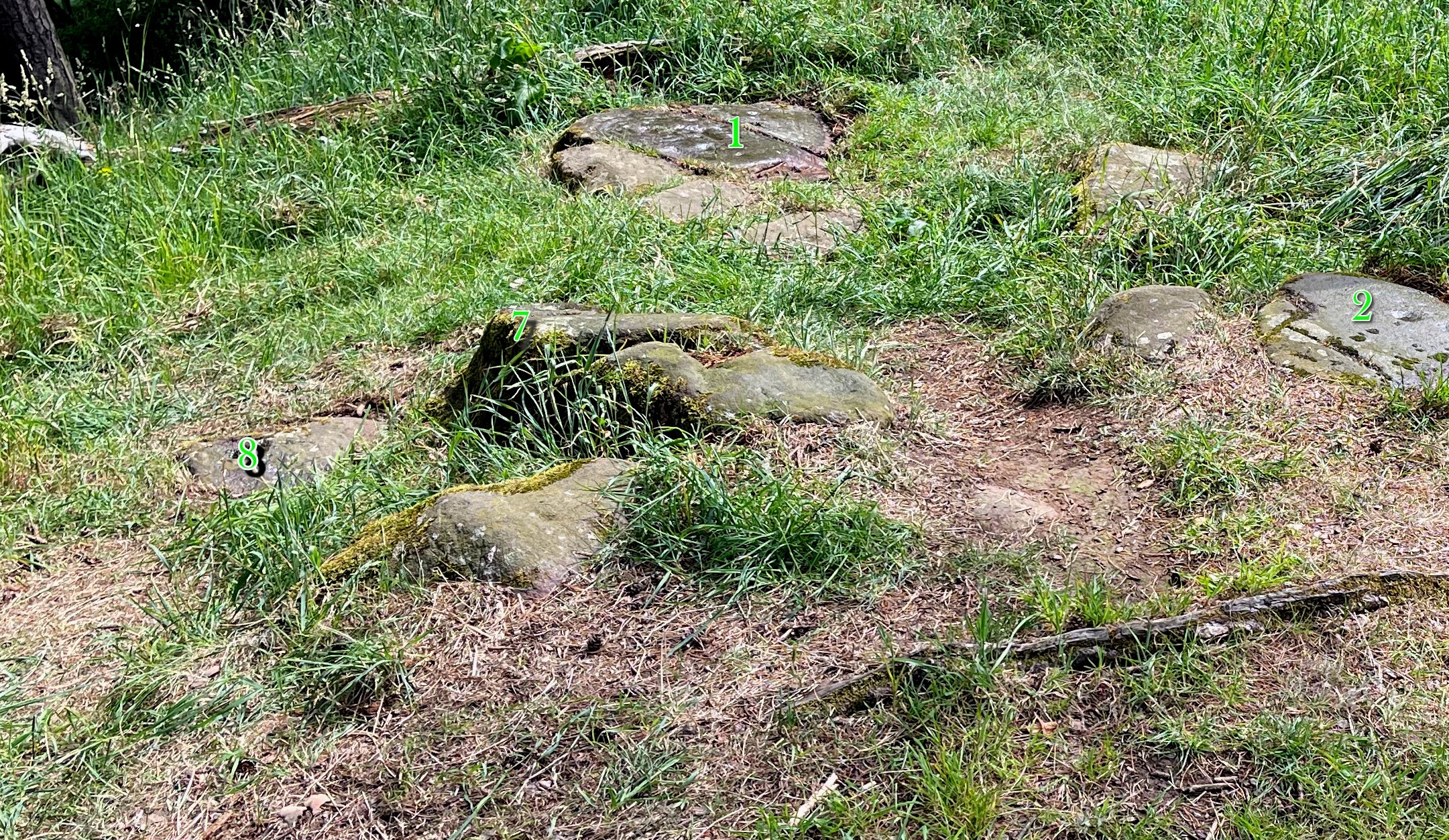
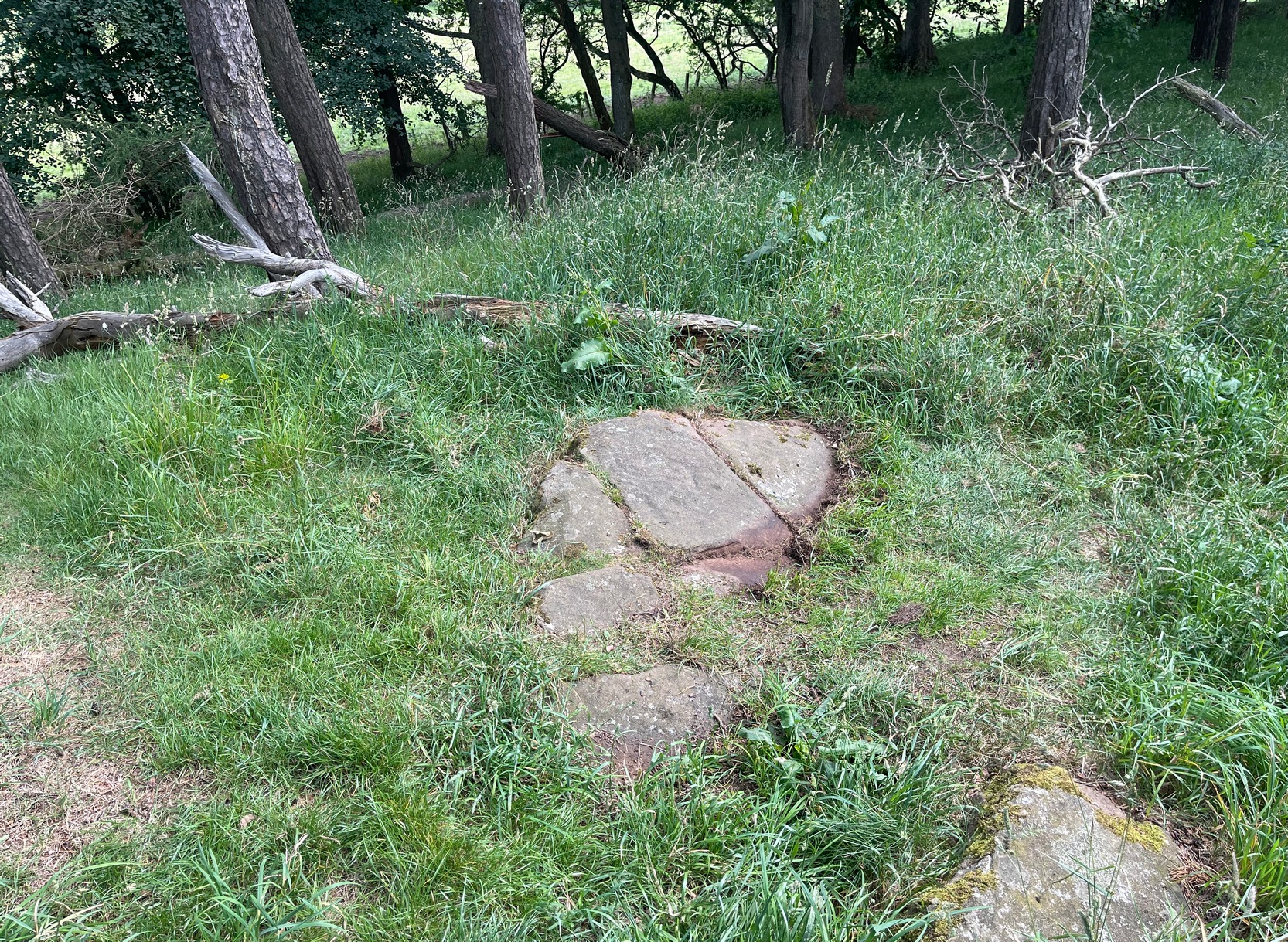
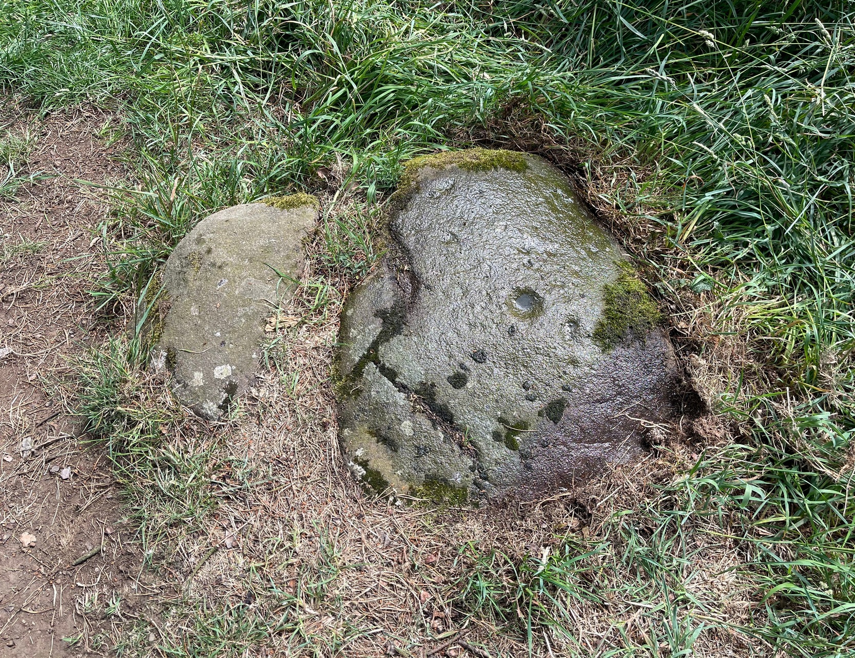
Just a stride or so away (north) from the dubious Tormain (2) cup-marking we find a much more likely prehistoric contender in front of us. It’s notably different from the others on the hill in that it possesses a very large wide and deep ‘cup mark’ which, if it was found in Ireland, would undoubtedly be classed as a bullaun stone. That was the first thing I exclaimed to myself when I clapped eyes on it! A bullaun can be a man-made or natural hollow or basin cut into outcropping rock, boulders or small portable stones and used for various pragmatic and ritual purposes – many with traditions and folklore attached. Sadly, no such folklore is remembered here.
There are four other smaller standard sized cup-marks, at various distances from the primary bullaun, one of which may be Nature’s handiwork. They were illustrated by the great Romilly Allen (1882) when he first wrote about the carving. One of the cups may have a faint carved line running from it, but this would require the attention of the computer imagery dudes to confirm or deny this. It wasn’t seen by Allen, who simply said of it:
“The carvings on it consist of a bowl-shaped depression, 6 inches in diameter and 2 inches deep, and four cups near it varying in diameter from 1 to 1½ inches.”
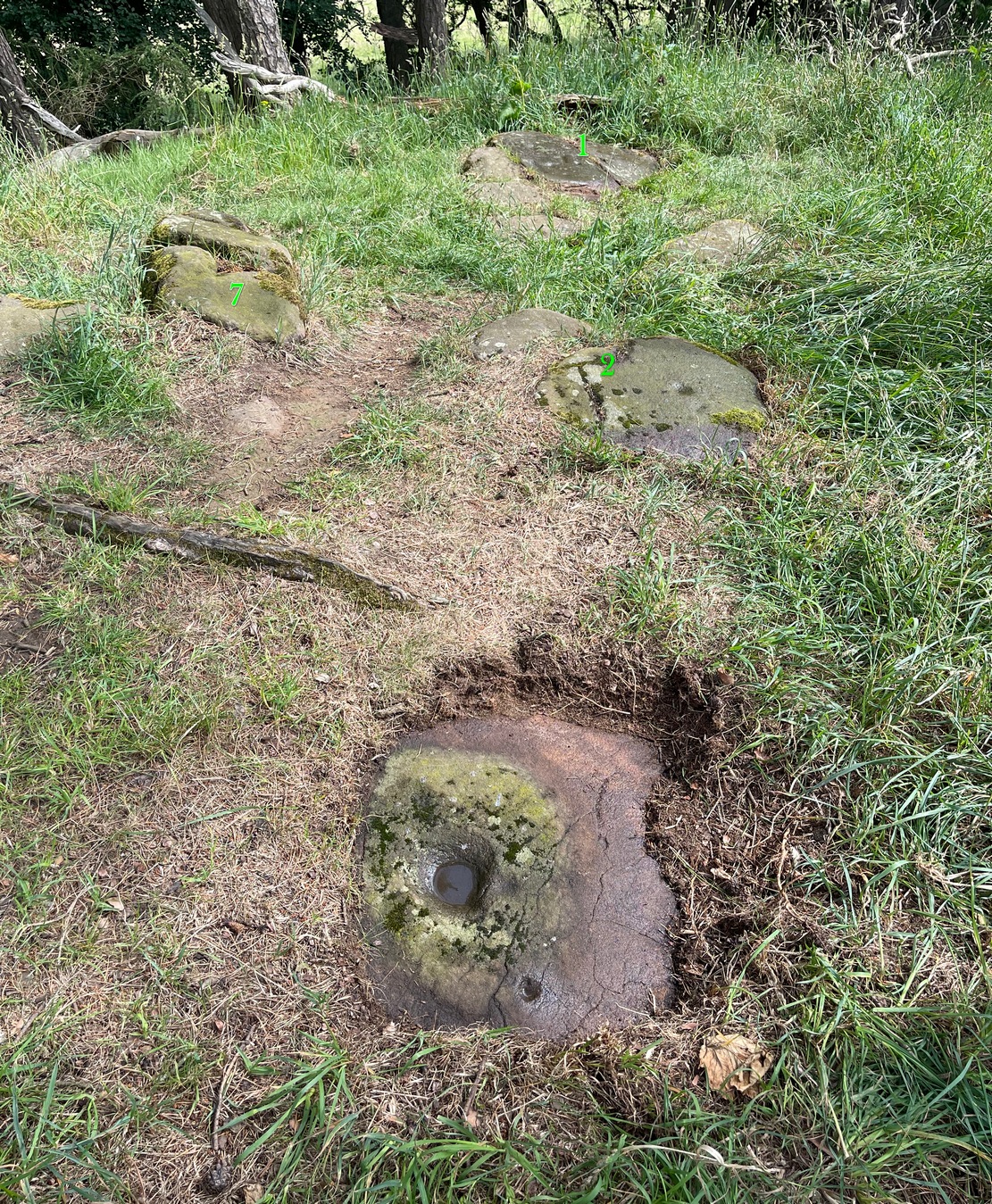
Tormain 3 carvingTormain 3 (with 1, 2 & 7 marked)
The fact that bullauns possess a number of practical uses implies the large ‘bowl’ may have been used in a pragmatic sense for something, with the proximity of the impressive Tormain (1) carving just yards away almost appealing for ceremonial association of one form or another. We find similar bullaun/petroglyph associations at a number of other recognized rock art sites: the Mixing Stone in North Yorkshire being just one example. Large bowl-shaped hollows have been used in some cultures like mortar and pestles to macerate herbs, used in medicines and paints, both of which may have been applicable here.
Best approached from Ratho village, head up Main Street towards Bonnington Mains. Shortly after the last road in the village (Halicroft Park, on the right) a small line of trees appears on the left and about 250 yards on a footpath takes you therein. Follow this for 250 yards (it runs parallel to the road) and the path then slopes uphill alongside the field. Go all the way to the top (roughly 500 yards) where the small copse of trees crowns the summit. On the ground there are a number of both small and medium-sized flat earthfast stones. You need to walk to the one at the end, just where the hill begins to slope back down. You’ll find it!
Archaeology & History
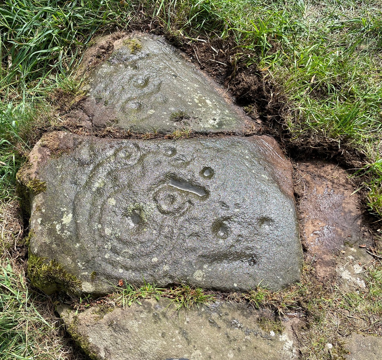
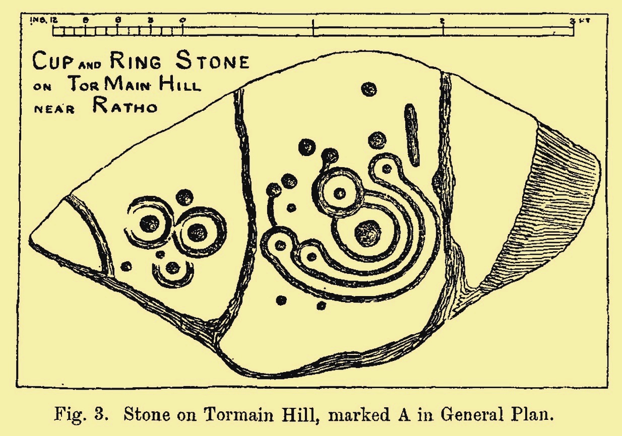
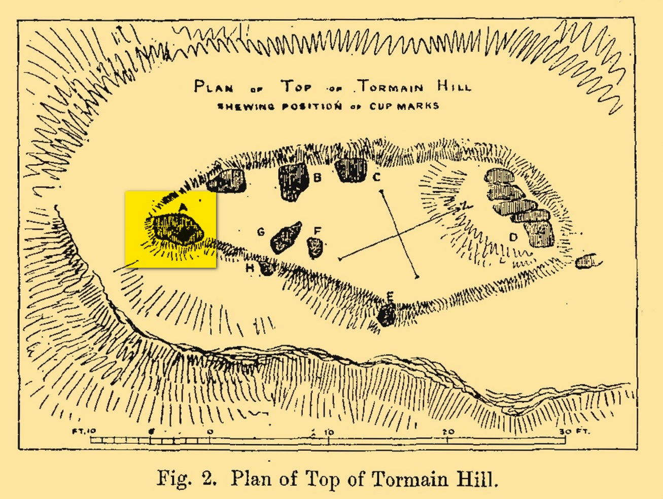
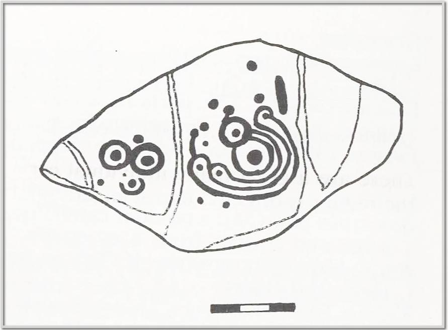
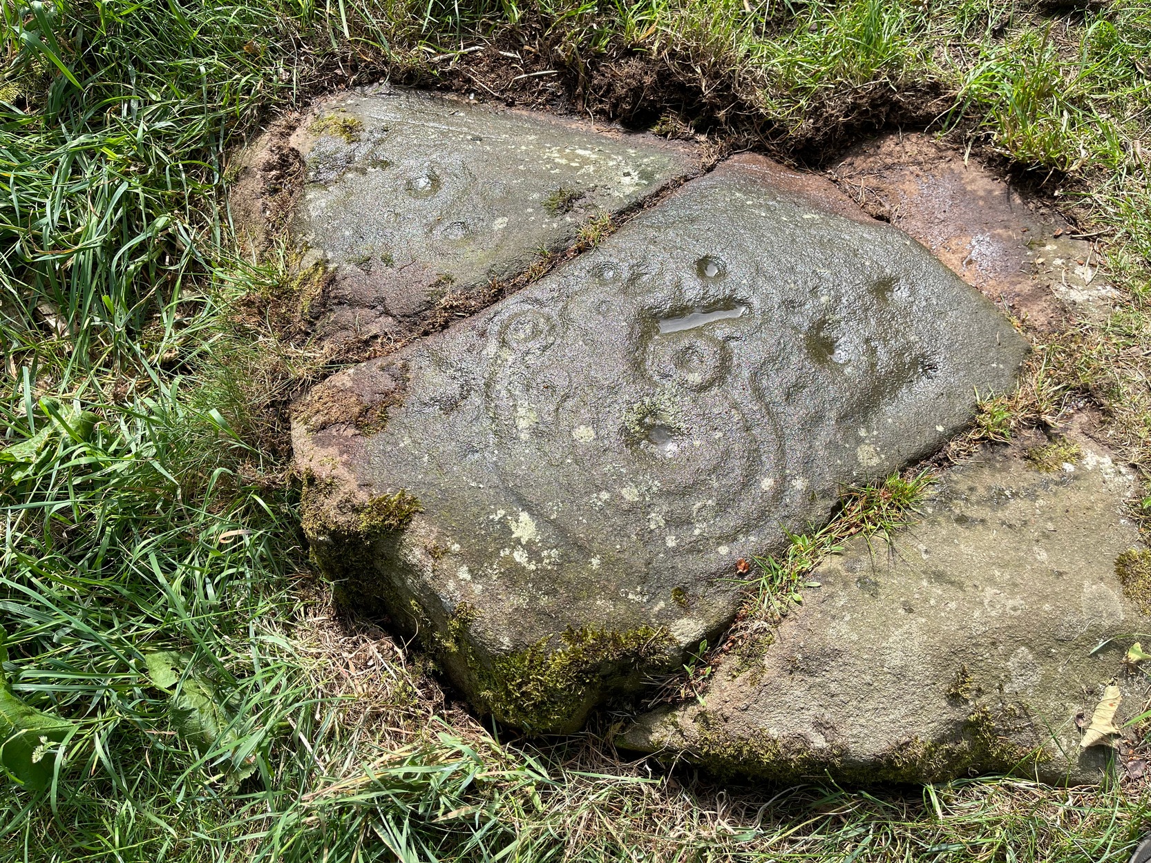
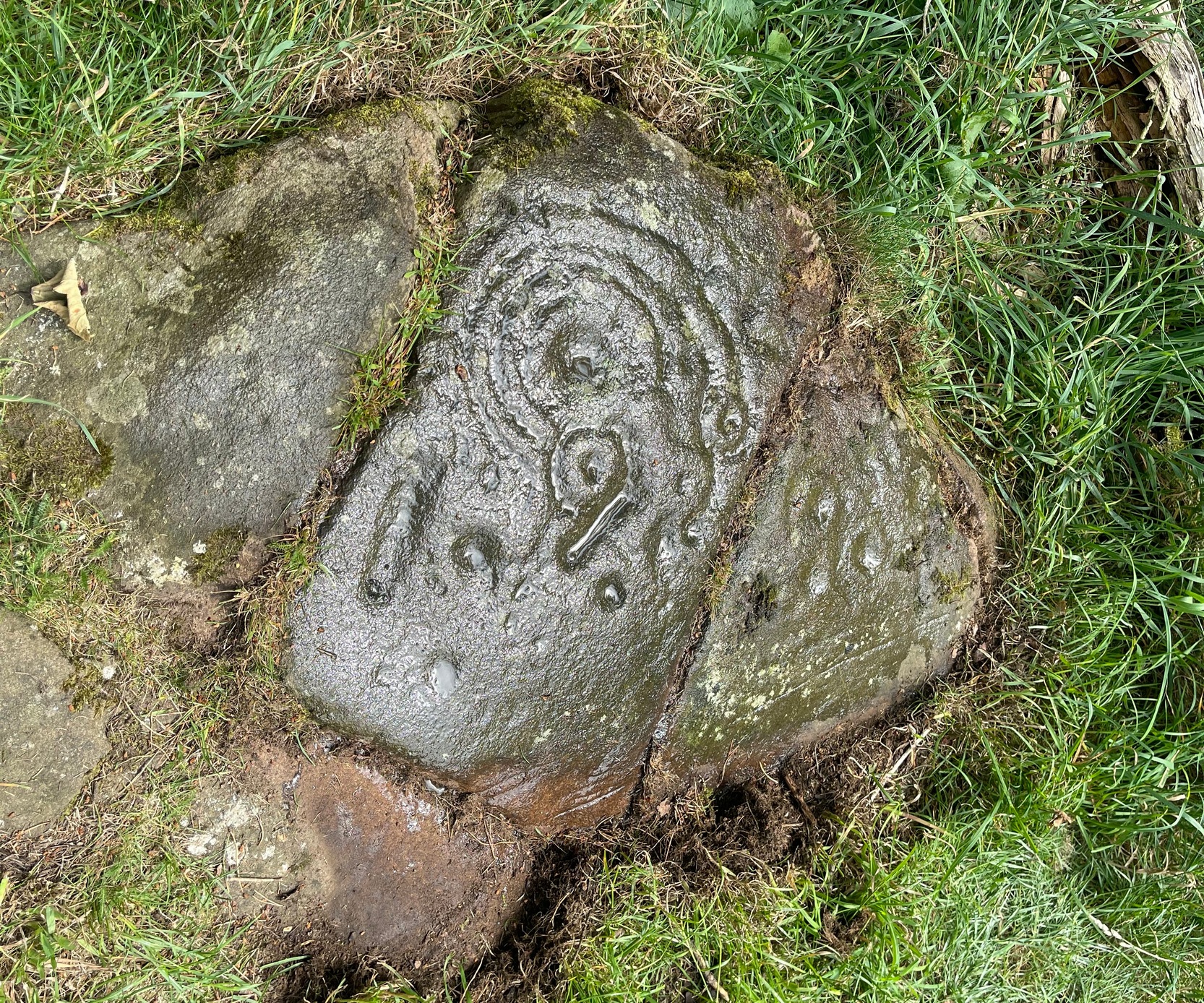
Tormain Hill, or the hill of stones (Harris 1996), has an interesting cluster of petroglyphs on its top, with this one in particular being the most impressive. It’s the southernmost stone in what’s been designated as a cluster of eight carvings—although we need to be slightly sceptical of one or two of them. Not this one though!
Regarded by Ron Morris (1981) as being “one of the best cup-and-ring designs in Scotland”, it was first mentioned by John Smith (1874) who visited the site with the local farmer James Melvin, who’d discovered the carving some years earlier. Initially he only noticed cup-markings, but when he visited the place with the pioneering rock art researcher Sir James Simpson, upon “removing the shallow soil or turf from the rock on the summit of Tormain Hill” this impressive multiple-ringed design came to light: “one cup (and) four concentric circles .”
A few years later another rock art pioneer, J. Romilly Allen (1882) visited Tormain and found quite a bit more upon this hill. This particular carving, he told,
Allen’s 1882 sketchTormain ‘A’ site (Allen 1882)
“is much the finest and most remarkable in every way. It is the most southerly of the whole group, and is a piece of natural rock projecting from the side of the hill about 9 inches above the turf, and measures 4 feet 3 inches long by 2 feet 3 inches wide. Its upper surface is flat, of oval shape, and slopes slightly towards the hill. It is intersected by two parallel cracks of natural formation. The sculptures consist of twenty cups varying in diameter from three quarters of an inch to 2 inches in diameter. Seven of the cups are surrounded by a single ring, and one by four concentric circles. These latter are not complete, but form loops round terminal cups. Three of the cups with single rings are arranged in the form of a triangle. In addition to the cups and rings are two long grooves, one cutting off the corner of the stone, and the other parallel to one of the natural cracks.”
Beckensall’s 1986 version
More then forty years later the Royal Commission (1929) dudes visited the Tormain stones. It had become so overgrown by then that only two of the eight carved stones were visible: “but a search beneath the turf revealed the other sculpturings,” they told. It would seem that they chose a bit of a grey day when they came here as they told how the carving appeared “so much worn that the concentric rings are, in particular, difficult to follow.” So they did a rubbing of the stone—a common practice of rock art students over the last century or two. In doing so they were able to discern the following:
“The boulder is fractured in two places by natural agencies, but it shows traces of twenty cup-marks, varying from little more than half-an-inch to fully two inches in diameter, and there are two separate gutters. Seven at least of the cups are surrounded by single rings, and in two instances the rings are connected by shallow gutters to simple cup-marks. The largest cup-mark on the stone is encircled by one complete ring with three additional concentric arcs linking up four of the other rings. Another group consists of three cups, each surrounded by a ring, which are closely set in the form of a triangle, with three other smaller cup-marks in close proximity.”
Impressive stuff! In more recent times the site has gained the attention of fellow rock art explorers like Kaledon Naddair, Stan Beckensall and others—but we’re still none the wiser what it means!
Its position in the landscape was probably an important element. Pinus sylvestris (the ley-hunter’s favourite tree) grows spaciously, as it is wont, atop of the hill and, in bygone centuries, would have been much more prevalent before farming enveloped the land hereabouts. It was likely clear of trees on top of Tormain when the stone was carved, giving uninterrupted 360° views of the hills, high and low, as far as the eye can see. The legendary prehistoric Cairnpapple Hill stood out due west from the carving and other notable hilltops in the Pentlands would have had mythic relevance. Sadly, all oral tradition has long long faded and so whatever narratives that were told here have long ago been lost. It strikes me as a tribal gathering place: a moot hill perhaps. The bullaun stone adjacent to this fine carving would be a receptacle for paints, herbs, elixirs to be macerated and used by the people….
Check it out. Have a feel of the place. But spend a few hours here and listen to the wind…
Beckensall, Stan, Rock Carvings of Northern Britain, Shire: Princess Risborough 1986.
Beckensall, Stan, British Prehistoric Rock Art, Tempus: Stroud 1999.
Feachem, Richard, Guide to Prehistoric Scotland, Batsford 1977.
Hadingham Evan, Ancient Carvings in Britain: A Mystery, Garnstone: London 1974.
Harris, Stuart, The Place-Names of Edinburgh: Their Origins and History, Gordon Wright: Edinburgh 1996.
MacLean, Adam, The Standing Stones of the Lothians, Megalithic Research Publications: Edinburgh 1977.
Morris, Ronald W.B., “The Cup-and-Ring and Similar Early Sculptures of Scotland; Part 2 – The Rest of Scotland except Kintyre,” in Transactions of the Ancient Monuments Society, volume 16, 1969.
Morris, Ronald W.B., The Prehistoric Rock Art of Southern Scotland, BAR: Oxford 1981.
Royal Commission Ancient & Historical Monuments of Scotland, Inventory of Monuments and Constructions in the Counties of Midlothian and West Lothian, HMSO: Edinburgh 1929.
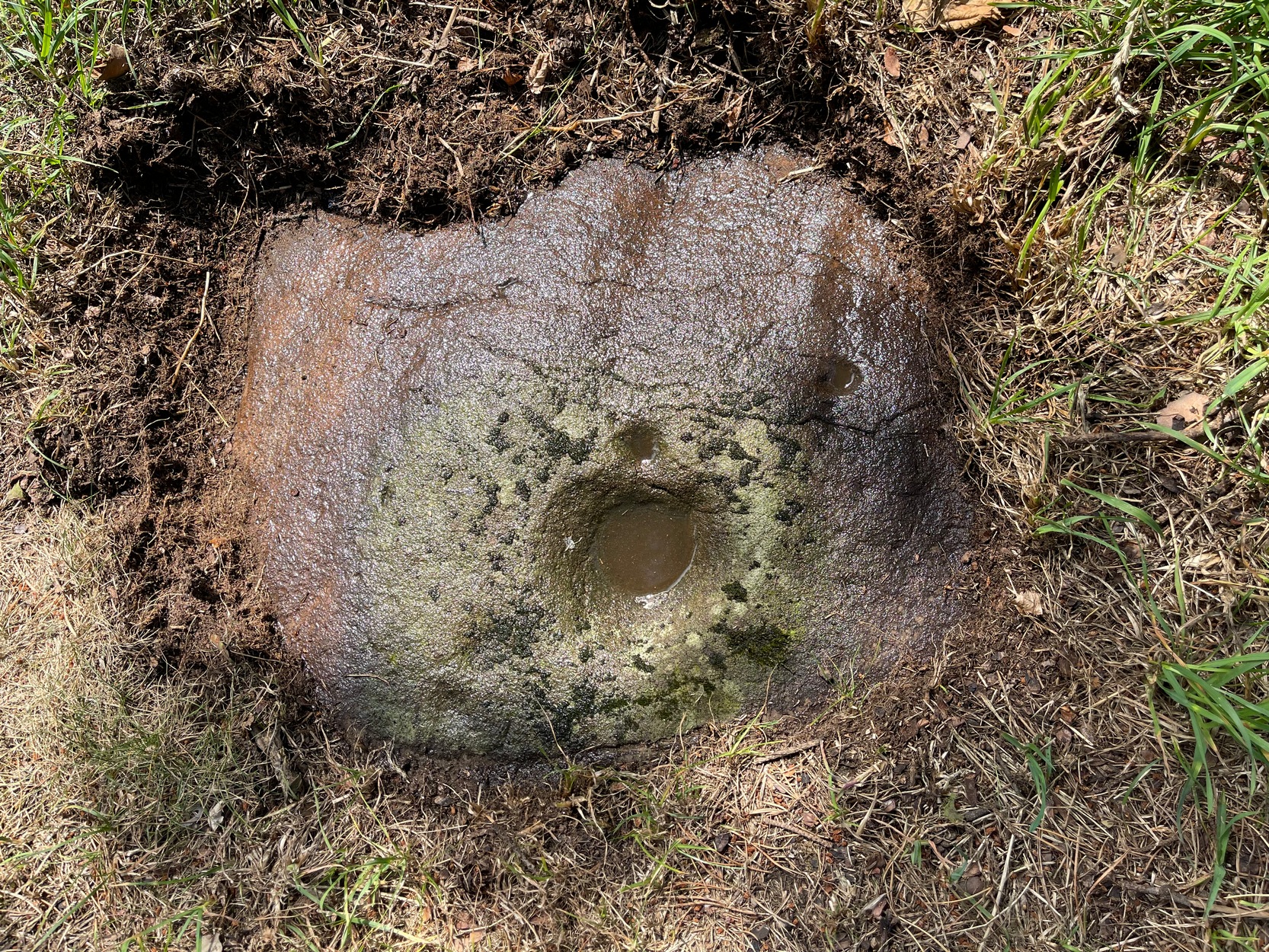
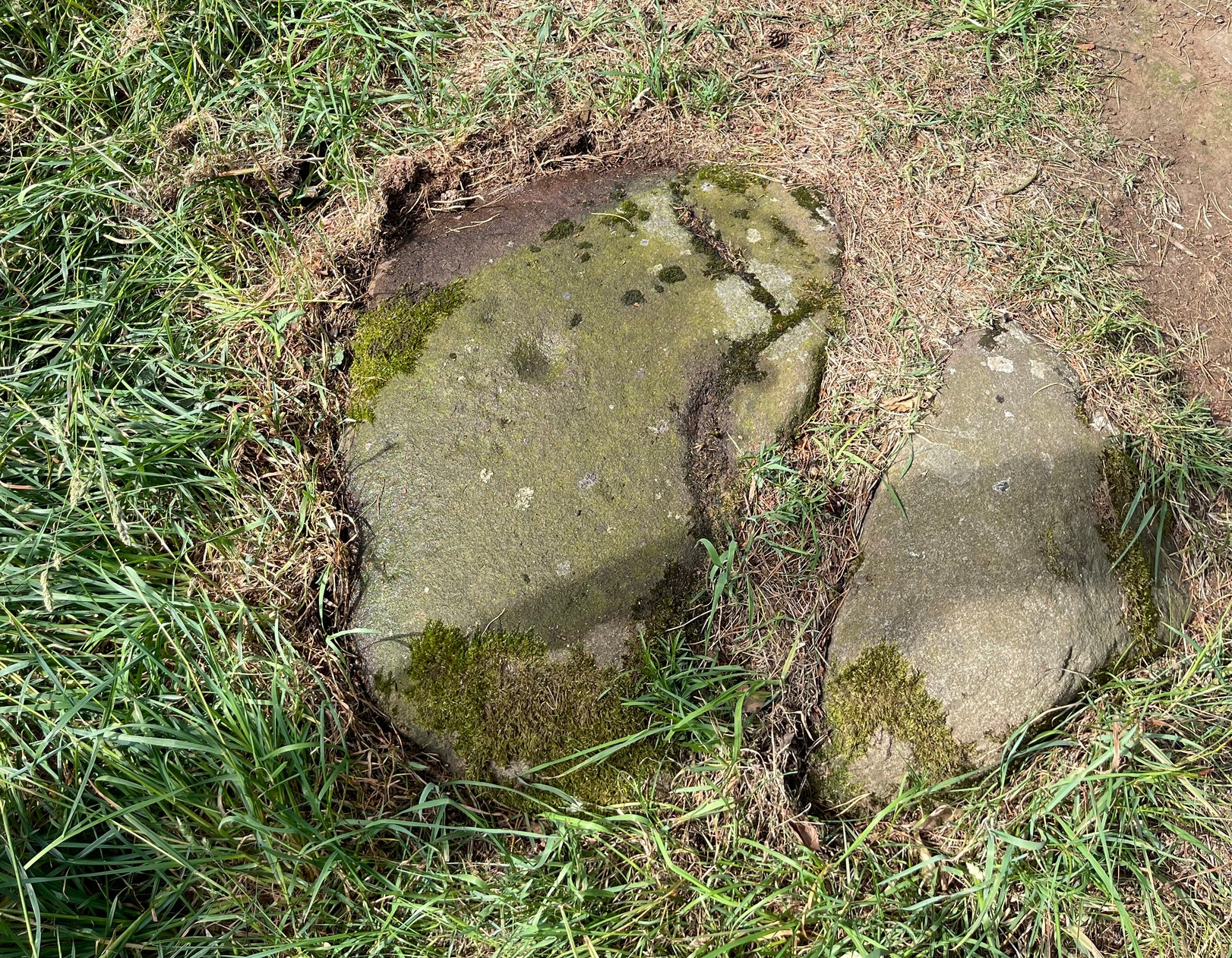
Found just a few strides away from the most impressive cup-and-ring stone at Tormain, is this quite un-impressive example and can easily be ignored. This simple cup-marked stone, first mentioned in Romilly Allen’s (1882) survey as “Stone B”,
“…lies 10 feet 3 inches to the north of stone A, and measures 4 feet by 2 feet 3 inches. It has a single cup cut on it.”
Tormain 2 “carving”Tormain 2 “carving”
Despite this being included in archaeological surveys as prehistoric, I’m unsure regarding the archaic authenticity of this single cup-mark and wonder whether it was just the result of idle dabblings by one of the quarrymen here in the 19th century. The lack of erosion leads me to suspect this. It has the appearance of cup-marks that have been carved by students at several different places in Britain (South Yorkshire, West Yorkshire, Perthshire, Renfrewshire, etc) over the last forty years. I’m quite happy to be wrong though! When the Royal Commission (1929) survey mentioned “a single cup on one boulder,” this may have been the one they were referring to.
Royal Commission Ancient & Historical Monuments of Scotland, Inventory of Monuments and Constructions in the Counties of Midlothian and West Lothian, HMSO: Edinburgh 1929.
From the Port Appin ferry onto the northern tip of the island, go along the B8045 road for literally 3.5km (2.17 miles) and, shortly after passing Achuaran, a single small white house is on your right. Just yards before here is a small raised rocky knoll. …Or from the Achnacroish ferry, up the road for nearly a mile, then turn right along the B8045 road to Clachan. A half-mile past the hamlet, go past the old School House, then past Mountain View cottage, and the next small white house on the left has a rocky knoll just past it. Just over the wall from the road, a sign points out the legendary Chair that you’re seeking!
Archaeology & History
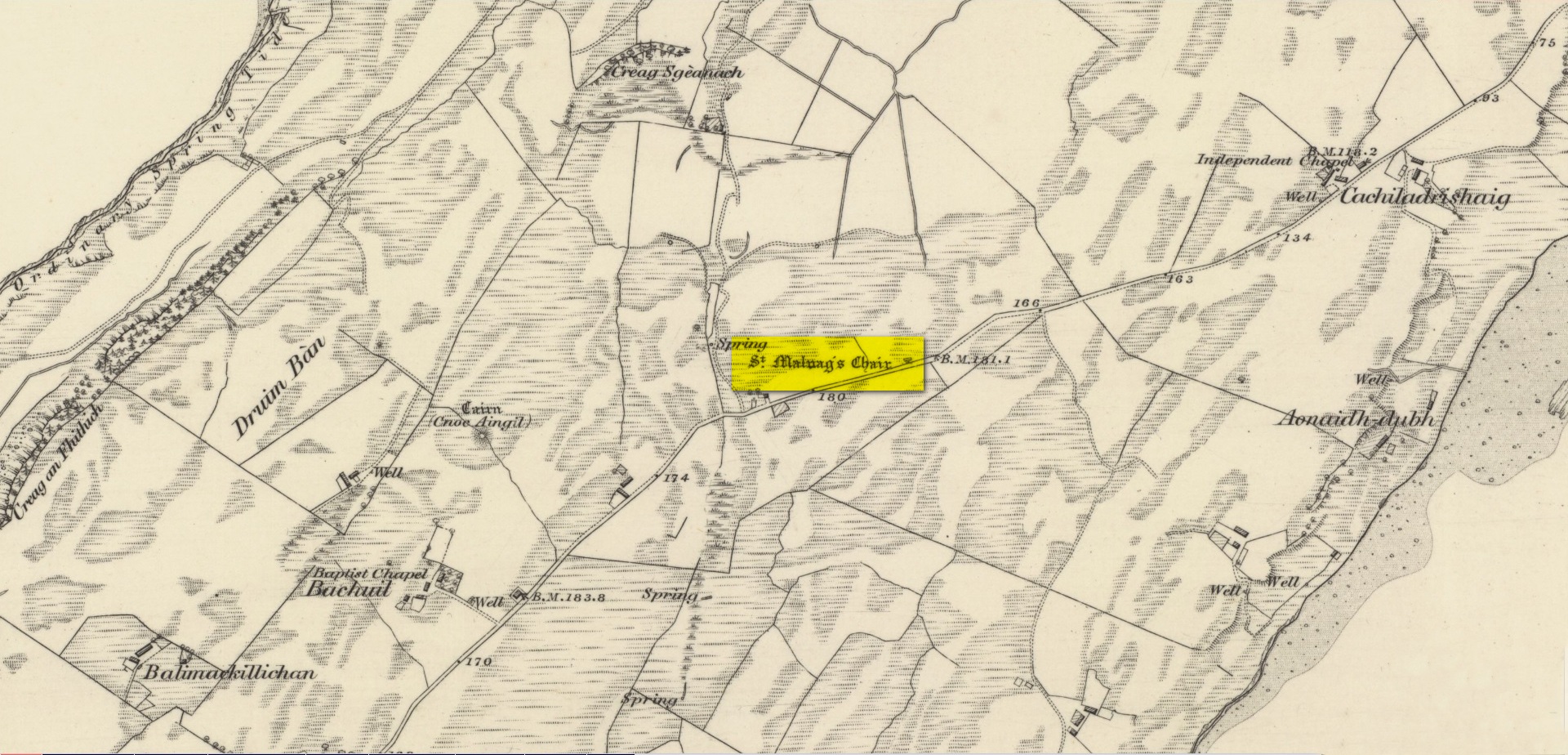
Site shown on 1875 map
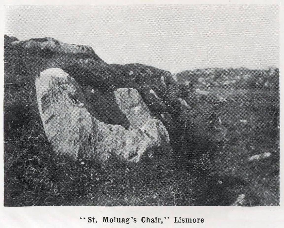
St Moluag, a contemporary of the renowned St Columba, was a 6th century Irish saint who came to reside on Lismore—“the sacred isle of the western Picts”—and here taught the early christian doctrines, fused with indigenous animistic traditions. He used sites of Nature as places of reflection and meditation and this chair-shaped boulder came to be a place renowned as one of his ritual sites, not far from his church. It was described in Frank Knight’s (1933) huge work as possessing healing properties:
“To sit in it used to be considered a sovereign remedy for rheumatism.”
The site was highlighted on the earliest Ordnance Survey map of the island and its lore was remembered by local people of the time. The chair had wider ‘arms’ until the beginning of the 20th century when in widening the road, they were accidentally broken off by one of the workmen.
References:
Knight, G.A. Frank, Archaeological Light on the Early Christianizing of Scotland – volume 1, James Clark: London 1933.
Acknowledgements:Huge thanks for use of the Ordnance Survey map in this site profile, reproduced with the kind permission of the National Library of Scotland.