Silver Well, Ilkley Moor, West Yorkshire

Sacred Well (covered):  OS Grid Reference – SE 10425 46701

Archaeology & History
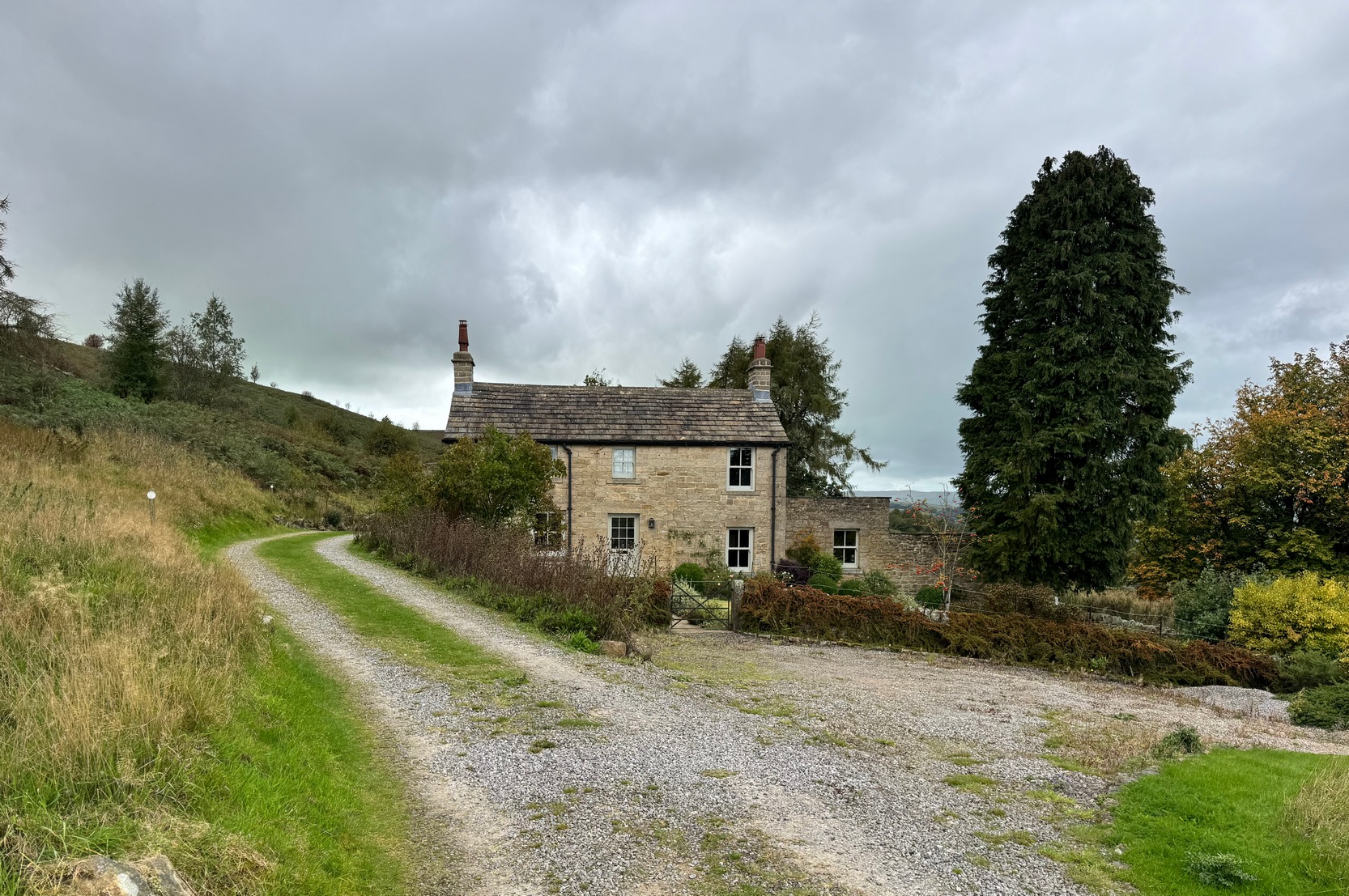
Silver Well cottage

Highlighted on the earliest of the Ordnance Survey maps, this spring of water supplied the old cottage here for many a year.  Nowadays it has been covered—and has been like that for upwards of fifty years—although it was said to be in constant flow by those who lived here in earlier times.  When the Yorkshire holy wells writer Edna Whelan (1989) came here in the 1980s, the running water could still be heard beneath a pile of large stones that covered its source.  Today, stone slabs cover it over—but the water is still running below.  It had a reputation of never running dry, even in droughts.  I spoke with a local doctor in the late-1980s who told us that he was confident the Silver Well would always keep running and its water were fine to drink.  It’s a pity the source of the spring is covered over and, surely, is a case for being exposed and open for folk to use once again…
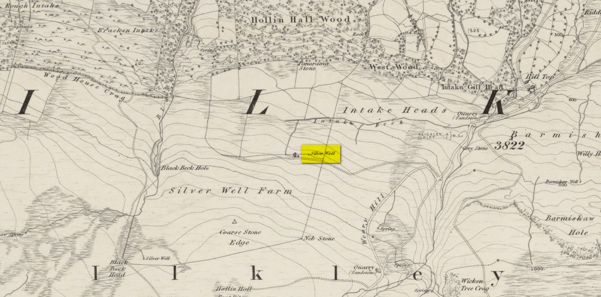
Silver Well on 1851 map

In Collyer & Turner’s (1885) magnum opus on Ilkley, they thought the Silver Well “was probably a holy well” —and it probably was something along those lines, depending on how precisely we define the word ‘holy’.  The notion that it may have been a place where, in earlier times, silver coins and other offerings were given to the spirit of the well in exhange for good health and fortune (as is found at springs and wells all over the world) was given a boost when, in the 1960s, a short distance east of Silver Well, was found a clutter of very old silver coins dating from the periods of Kings Edward I and II (13th and 14th Century).  The coins were donated to the British Museum where, I presume, they still live.  But they may have either come from this well, or were being deposited here.  We’ll probably never know for sure.  A number of other Silver Wells in Britain possess so-called holy associations.

References:

  1. Collyer, Robert & Turner, J.H., Ilkley: Ancient and Modern, William Walker: Otley 1885.
  2. Whelan, Edna & Taylor, Ian, Yorkshire Holy Wells and Sacred Springs, Northern Lights: Dunnington 1989.

Acknowledgements:  Huge thanks for use of the Ordnance Survey map in this site profile, reproduced with the kind permission of the National Library of Scotland.

© Paul Bennett, The Northern Antiquarian 
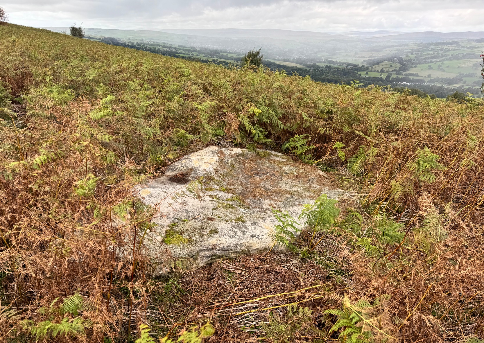
Silver Well (1), Ilkley Moor, West Yorkshire

Cup-Marked Stone:  OS Grid Reference – SE 10252 46583

Also Known as:

  1. Carving no.60 (Hedges)
  2. Carving no.225 (Boughey & Vickerman)

Getting Here

Overgrown but visible

From Ilkley central, go up Wells Road and, several hundred yards past the cattle-grid, keep your eyes peeled and turn left up the small moorland road for a half-mile and park-up at the start of the track to Silver Well cottage. Walk along here and, on the way, you may as well pass the cup-and-ring marked Weary Hill Stone, and the other Silver Well carvings further west through the heather.  From the Silver Well (3) cup-marked stone, follow the walling uphill for nearly 100 yards until your reach the small gate.  Go through it and stick to the footpath for 200 yards and then keep your eyes peeled for a large wonky ovoid stone less than 20 yards to your right.  It’s a big thing, so you’ll find it easily enough.

Archaeology & History

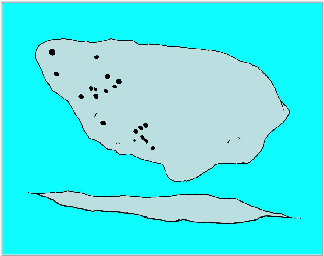
Hedges 1986 sketch

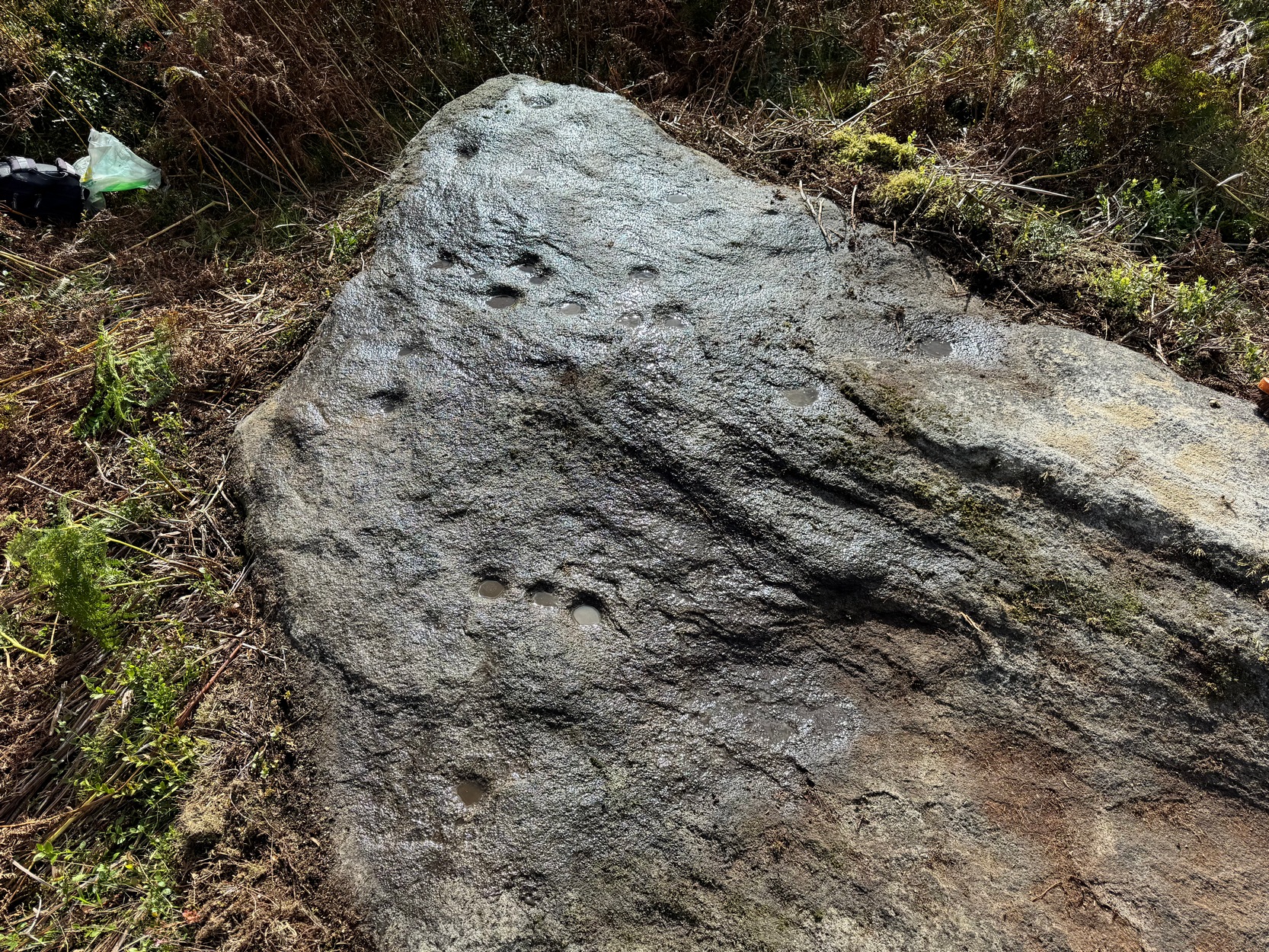
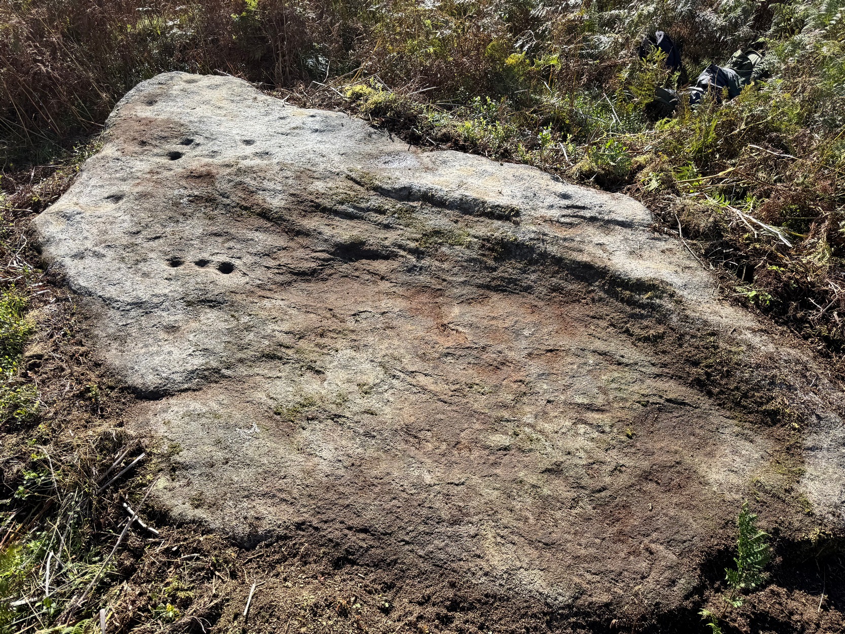
Although this is primarily a cup-marked stone (a faint ring is possible around one of them), it’s a good design.  It does it for me  anyway!  Sitting on a ridge at the top of a slope overlooking the Wharfe valley, from here the landscape opens up for many miles ahead of us looking mainly to the north, although the horizons both east and west also call our attention as the rising and setting sun would speak around the equinoxes.  But it’s the airt of north which mainly calls from here.  A scatter of cups splatter the rock surface, all of them on one half of the stone acting out in usual disorderly conduct apart from one spot where there are three deep cups in a line: this is the most notable part of the carving.  At the top (southern) nose of the stone is a triangle of them and they then becoming increasingly disordered as you move along the stone.  There are seemingly twenty of them altogether (perhaps more) with one of them having a short groove oozing out of it which can be difficult to see when the light isn’t quite right.

Silver Well (1) carving

It was first described in Hedges (1986) survey, where he told it to be a “large flat rock in bracken with sixteen clear cups, four other possible cups, grooves and one basin”—although at the same time somehow, erroneously, he thought the carving may have been uncovered by Stuart Feather in 1970, confusing this stone with two more complex petroglyphs 300 yards to the west of here.  Give it your attention when you’re walking on this ridge, before walking to the two others 300 yards to the west.  It’s certainly worth looking at.

References:

  1. Allen, J. Romilly, “Notice of Sculptured Rocks near Ilkley,” in Journal of the British Archaeological Association, volume 38, 1882.
  2. Anonymous, Walks Around Cup and Ring Stones, ITIC: Bradford n.d. (1995)
  3. Boughey, K.J.S. & Vickerman, E.A., Prehistoric Rock Art of the West Riding, WYAS: Leeds 2003.
  4. Hedges, John (ed.), The Carved Rocks of Rombald’s Moor, WYMCC: Wakefield 1986.
  5. Morris, Ronald W.B., “The Prehistoric Rock Art of Great Britain: A Survey of All Sites Bearing Motifs more Complex than Simple Cup-marks,” in Proceedings of the Prehistoric Society, volume 55, 1989.

Acknowledgements:  Big thanks to the petroglyphic hands of Graeme Chappell and Tom Cleland for the work at this stone.  Huge thanks for use of the Ordnance Survey map in this site profile, reproduced with the kind permission of the National Library of Scotland.

© Paul Bennett, The Northern Antiquarian