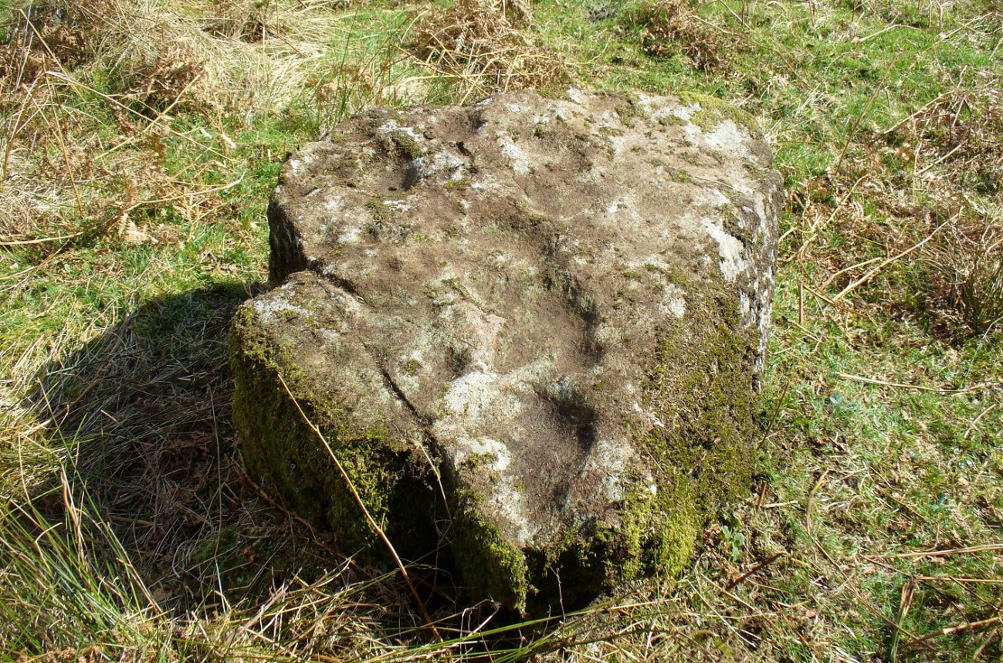
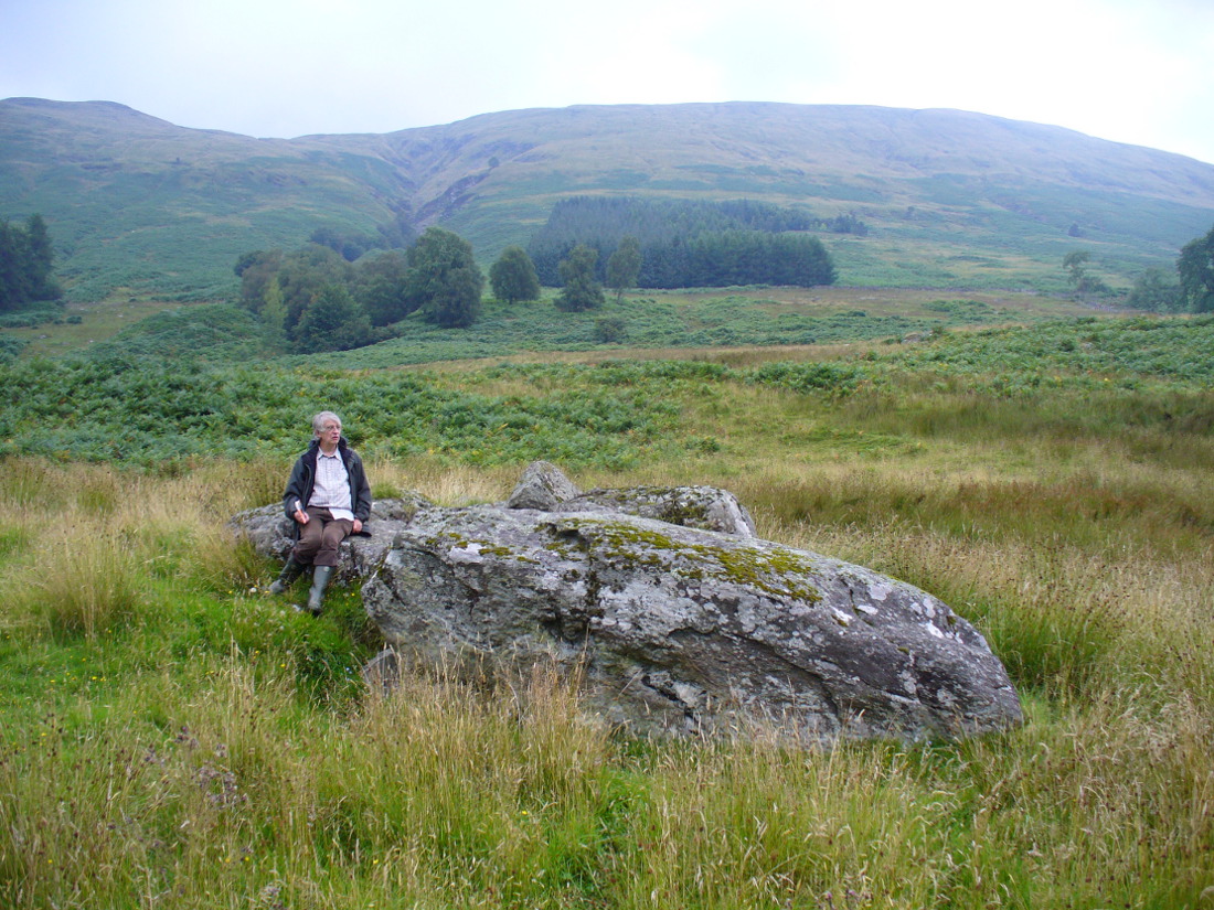
Follow the same directions described to reach the Druidsfield 1 and 2 carvings. This one is the larger upright block right next to them!
Archaeology & History
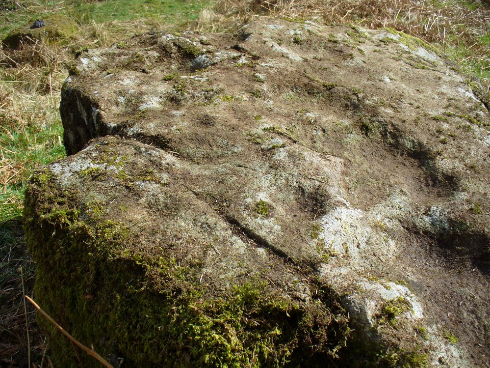
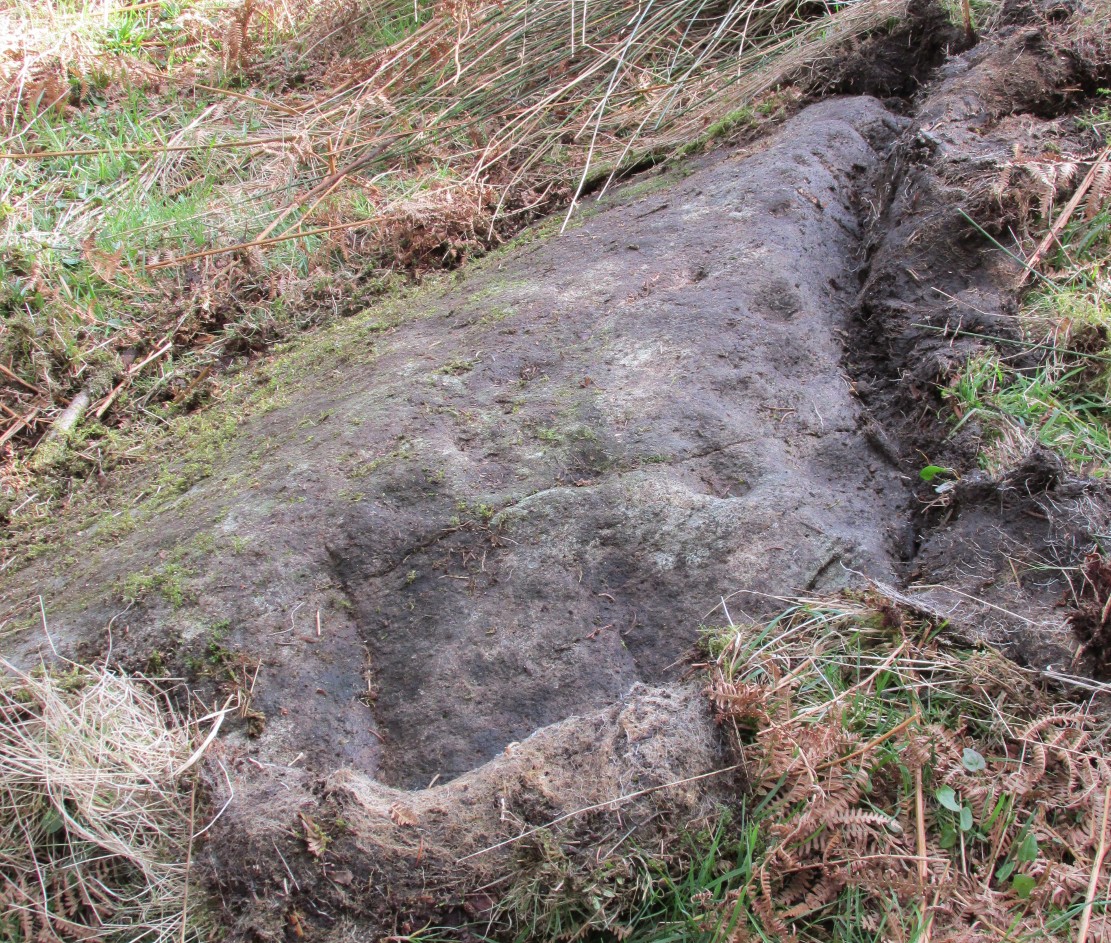
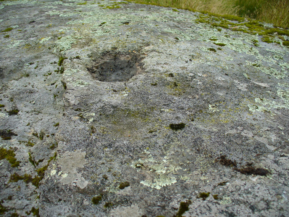
Several of the faint cups visible
Contextually relevant to the two adjacent carvings, this is the largest of the three stones and comprises of a number of natural deep marks associated with between eight or ten man-made cup-markings. They’re not all immediately apparent, but stand out more as and when natural lighting conditions change. All of them are on the north and northwestern section of the stone, and measure between 1-3 inches across. This is the least visually impressive of the stones in this petroglyph cluster.
Folklore
The carvings here were said by one of the locals to have been part of a “druid’s circle, which we played in as children, and were always told had been a special place of the druids in ancient times.”
Haggart, D., “Notice of the discovery of a stone cup and cup-marked stones at Lochearnhead,” in Proceedings of the Society of Antiquaries, Scotland, volume 22, 1888.
Acknowledgements – Huge thanks to Paul Hornby for help and use of his photos.
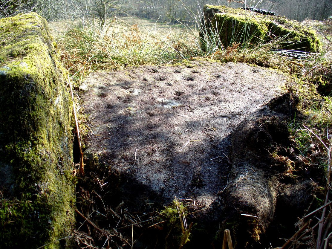
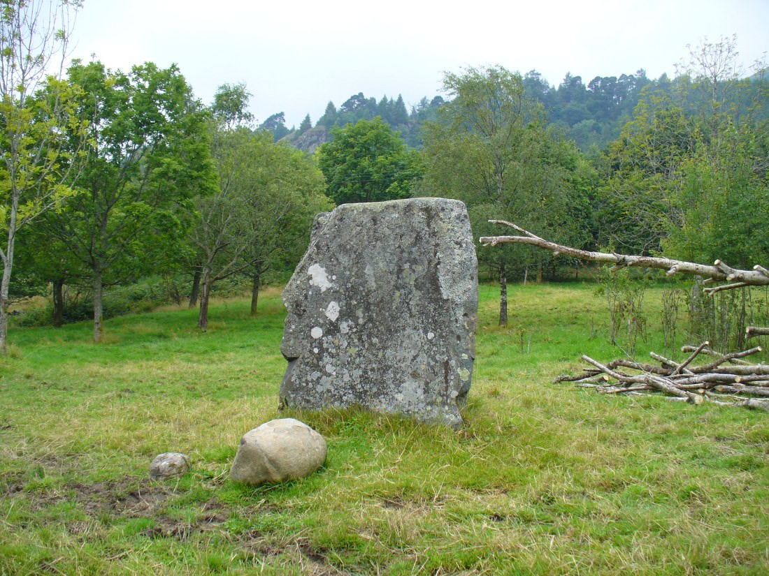
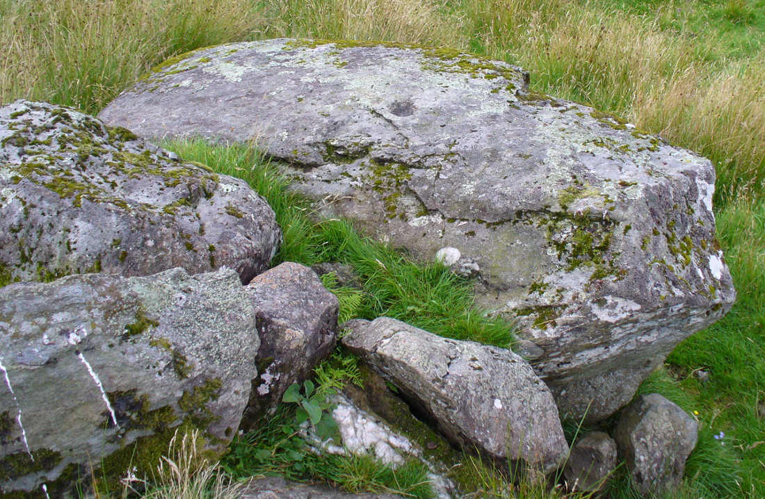
Follow the same directions as if you’re going to the much overgrown, earthfast Druidsfield 01 carving. Adjacent is an upstanding block of large rock, right next to which is the flat surface of this Druidsfield 2 carving. If it’s overgrown, rummage around. You can’t miss it!
Archaeology & History
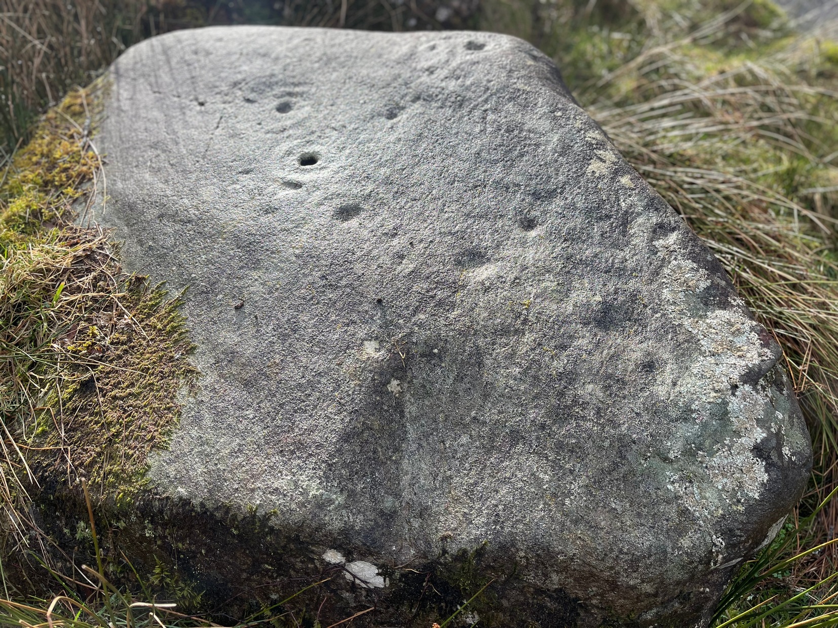
This carving and its compatriots have almost been forgotten about it seems. Buried beneath rolls of vegetation, this long flat rock covered in cup-markings seems to have played a part in some larger megalithic structure—but whatever it was is difficult to work out. As you walk around the place it gives the distinct impression that some form of tomb was once in evidence, which may have been the case. The Scottish archaeology giant Audrey Henshall is said to have found no evidence of a chambered tomb, but this may have been something smaller, less impressive.
When Mr Haggart (1888) wrote about this carving, he too thought that the carvings had been part of a tomb—this being the horizontal surface at the bottom. He wrote that,
“the one forming the floor area of the dolmen being a square-shaped boulder of diorite, having fifty cups, varying from three and a half inches to an inch in diameter, the outlines of which look as fresh as if chiselled a year or two ago.”
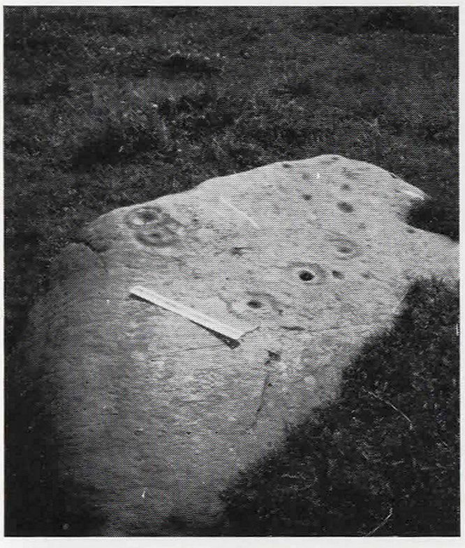
The main cluster of cups
This indicates it had only recently been uncovered. There are lots of other archaeological remains scattered all round here, from different periods of history; but the other Druidsfield 1 and 3 carvings are found right next to each other, indicating this very spot was some site of neolithic or Bronze Age importance. An accurate excavation of the site and the adjacent Druids Circle would be worthwhile. I counted at least 44 cups on this rock when we visited last week, many of which are still quite clear.
The most recent Royal Commission (1979) briefing of the stone added nothing of relevance. They listed the site but it seems they never visited the place.
The portable bullaun-like deep-cut rock known as the Druid’s Stone is kept in private grounds nearby. When members of Scottish heritage came to visit an adjacent site a few years ago, the lady of the house told how they walked right past it without giving it any notice. “They didn’t even see it under their noses,” she said. Nowt new there!
Folklore
The carvings here were said by one of the locals to have been part of a “druid’s circle, which we played in as children, and were always told had been a special place of the druids in ancient times.”
References:
Coles, F.R., “Report on stone circles in Perthshire principally Strathearn,” in Proceedings of the Society of Antiquaries, Scotland, volume 45, 1911.
Royal Commission on the Ancient & Historical Monuments of Scotland, Archaeological Sites and Monuments of Stirling District, Central Region, Society of Antiquaries of Scotland 1979.
Acknowledgements – Huge thanks to Messr Paul Hornby for help and use of his photos.
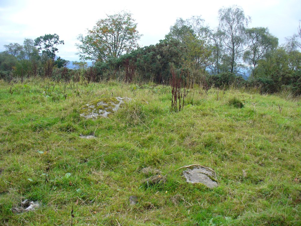
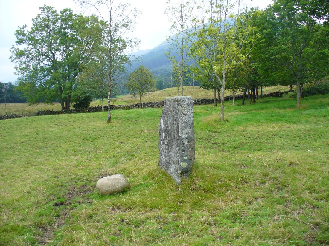
From Lochearnhead village going south along the main A84 road to Callander or Stirling, take the very last road on the right just as you’re going out of the village, up o Craggan and park up by St. Angus’ Church. Walk back down onto the A84, turning right and walk along for 100 yards. Then go back up into a boggy field, where you’ll notice some walling above you. Head to the top right of this, up to the edge of a garden. Hereby is a cluster of rocks in a jumble. That’s your spot!
Archaeology & History
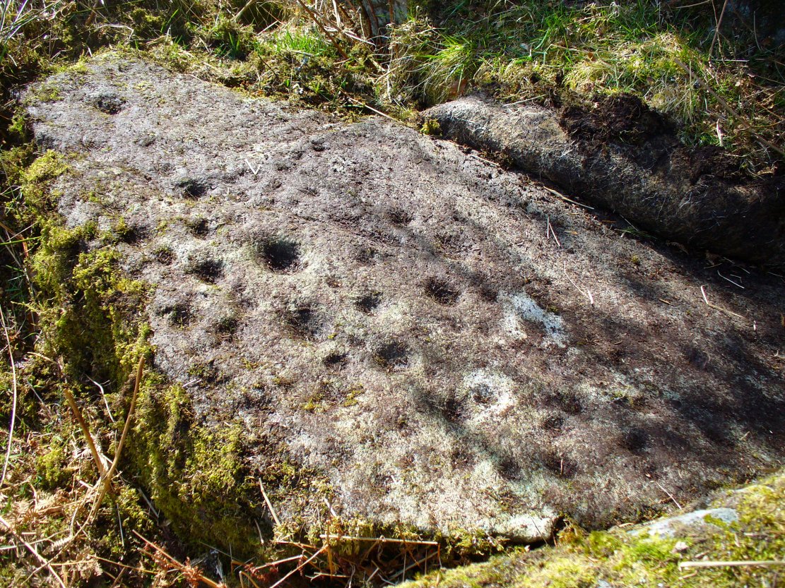
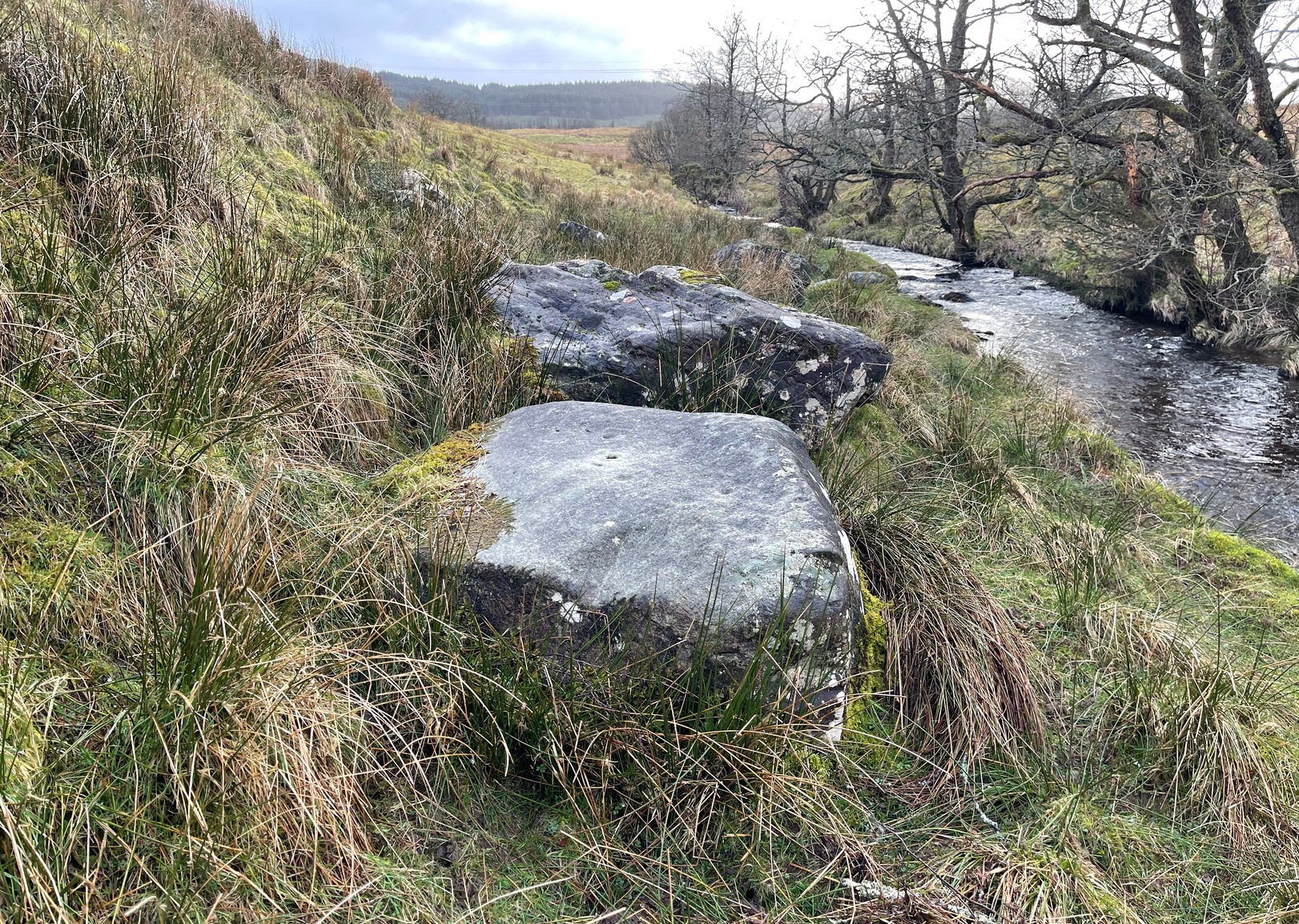
Cup-marks along the edge and bottom of the stone
This takes a bit of finding in the undergrowth and is best checked out at the end of Winter. Once overgrown it truly takes some finding. But beneath the vegetation is a slender earthfast rock with a long ridge, a little bit like a spine, running from one end of the stone to the other. Along this topmost spinal column we find a cluster of ten cup-markings, getting smaller in size the further along the spine we travel. It’s a curious feature. At the widest end of the rock where the widest and deepest cup-marks occur, another four cups have been etched into the northeastern sloping face below the largest cups.
When we came here, the sunlight was blocked by the surrounding trees, so we were unable to see if other elements had been carved onto the stone. It is found in conjunction with two other rocks—Druidsfield 2 and 3 carvings—right next to each other, with designs of quite different visual structures, seemingly unconnected in any linear sense. There also seemed to be a possibility that this was once part of a prehistoric tomb. Later we found that both D. Haggart (1888) and Fred Coles (1911) had made similar comments, with Haggart specifically telling there to have been a collapsed tomb here in the 19th century. He may have been right. Extensive walled structures abound hereby−including one which old locals told us were remains of a Druid’s Circle, which we found close by.
Folklore
The carvings here were said by one of the locals to have been part of a “druid’s circle, which we played in as children, and were always told had been a special place of the druids in ancient times.”
Haggart, D., “Notice of the discovery of a stone cup and cup-marked stones at Lochearnhead,” in Proceedings of the Society of Antiquaries, Scotland, volume 22, 1888.
Acknowledgements – Huge thanks to Messr Paul Hornby for help and use of his photos.
On the A81 road from Aberfoyle to Strathblane, about a mile south of Aberfoyle take the tiny right turn (keep your eyes peeled!) to Gartmore. At the end of the village, turn right at the T-junction. Just over a mile along the tiny road, just over the tiny road-bridge, turn right again up up the dead straight road to Drymen for nearly a mile and park up. A dirt-track is on your right: walk along here for ¾-mile (1.2km) and in a large field on your left a huge rock sits (no carvings on it). Keep walking on the track and where the field ends, a path to your left runs above a small burn. Naathen, 150 yards along here, look down at the waters and there’s a clump of large rocks. Check ’em out!
Archaeology & History
Morris’ old photo (from PSAS 1967)
This stone and others were mentioned in MacNair’s (1973) essay in the popular history guide to the region, after it had seemingly been rediscovered a few years earlier by Ron Morris (1967; 1969), who listed it in his petroglyph catalogues. It was originally located at the top of the slope above the burn, but was rolled down here shortly after Morris discovered the cup-and-rings on it. The farmer at the time had made a bore-hole into the rock with the intention of blowing it up, but Morris found it just in time and the stone managed to survive!
Faint CnR’s just visible
It’s a large rock with a decent ornate design that was clearly visible when Morris surveyed it (see photo, right). It comprises of, “a cup-and-two-rings, 18cm (7in) diameter, 6 cups-and-one-ring (2 of which are tangential) and at least 8 cups. All rings are complete. Greatest carving depth 2cm (¾in).” There also appears to be a line of four or five small cup-marks running in a short line by one of the lower cup-and-rings, but these are very faint indeed. The double cup-and-ring mentioned by Morris is the one at the top-centre in my photo, but the next cup-and-ring down may also be a double-ring. At the top-right of the photo is where two cup-and-rings are conjoined.
Since being rolled down the slope to the side of the burn, the carving’s much more in the shadows and is more difficult to work out. Sadly on the day when I visited here, Nature bestowed on me a wet and cloudy firmament, so the design was even more difficult to see, as my photos illustrate.
Morris (1981) told that “other stones in the immediate vicinity bear possible cup-marks,” and one of these may exist just a couple of stones away (Corrie 2), leaning up into the grasses: this is another rock that has been pushed down the slope and has curious natural cup-markings on it, with one or two that could be man-made, but we need a geomorphologist to have a look at it and tell us one way or the other.
References:
Edlin, Herbert L. (ed.), Queen Elizabeth Forest Park, HMSO Edinburgh 1973.
MacNair, A.S., “History,” in Edlin’s Queen Elizabeth Forest Park, HMSO 1973.
Morris, Ronald W.B., “Stirlingshire: Corrie Farm (Gartnabrodnaig) – Cup Marks,” in Discovery & Excavation, Scotland, 1967.
Morris, Ronald W.B., “The Cup-and-Ring and Similar Early Sculptures of Scotland; Part 2 – The Rest of Scotland except Kintyre,” in Transactions of the Ancient Monuments Society, volume 16, 1969.
Morris, Ronald W.B., The Prehistoric Rock Art of Southern Scotland, BAR: Oxford 1981.
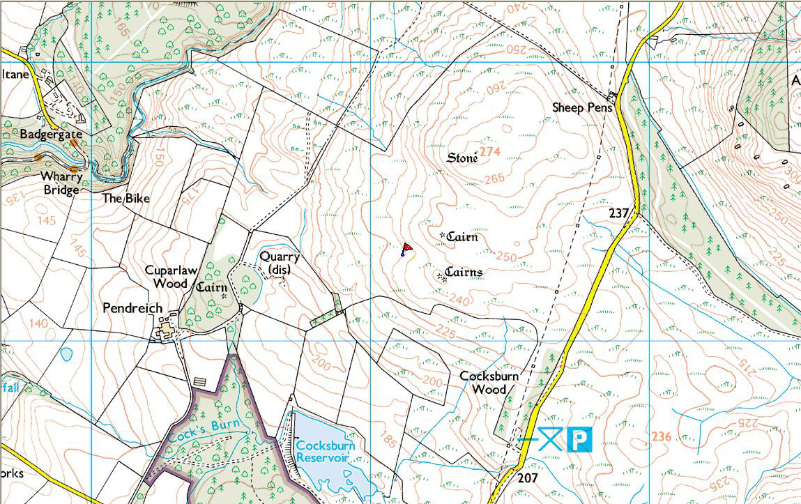
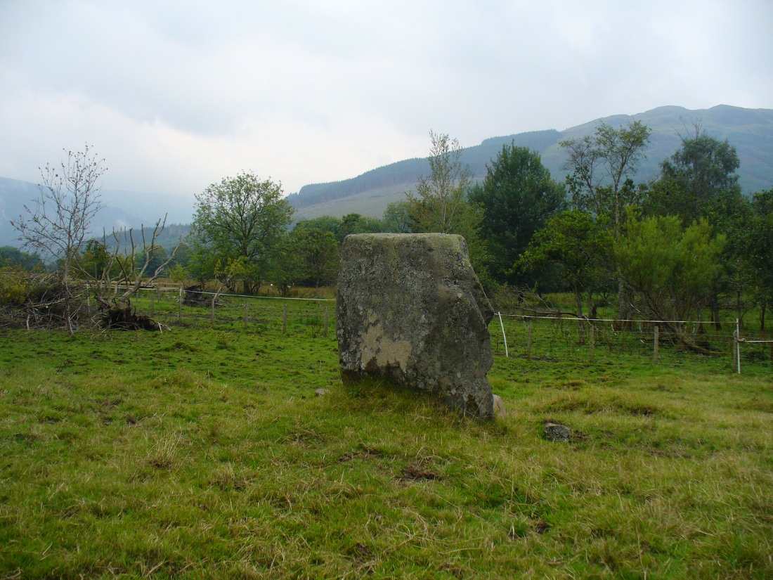
Take the same directions as if you’re gonna find the Pendreich Moor cairn up the hills behind and north of Stirling University (there are 2 very close to each other). Once upon the cairned hill, walk dead straight WNW for 100 yards or so, or down the slope into the small valley, then westwards. You’ll hit an overgrown length of very old walling. Keep walking along here and, below it, you’ll find these stones laying down in the shallow grasses on the south-side of the all-but dried stream. The large Cuparlaw Wood cairn is 0.4 miles west of here.
Archaeology & History
The Split Stone, Pendreich
This is something of an anomaly. There is no previous written history about the place (that I can find) and archaeologists and historians on The Prehistoric Society and CBA forums can offer no other explanation when asked: is this a standing stone that, many centuries ago, was cut and prepared to be erected, but never made it into the intended monument? (wherever that might have been) And so, I offer it onto TNA and ask the same of any readers, geologists or archaeo’s who might have an explanation for this curious, large split piece of stone, that lays silently on the western moorland edges of the Ochils, asking the same question.
When I first came across this site I was simply perplexed as to the why’s and wherefore’s of who had cut such a large rock into approximate halves. I must have walked around it many times, puzzling what the purpose would have been of doing such a thing, and how long ago the ‘split’ had been performed. About a year later I ventured up again and, when leaving to head back into Stirling, found no resolution to my puzzlement. It had me truly stumped!
It wasn’t until I visited the prehistoric Witches’ Stone about 15 miles away near Monzie Castle last year, that one of those ‘eureka!’ events occurred. The last thing on my mind was the curious split rock above Bridge of Allan. Fellow antiquarian Paul Hornby and I were taking photos of the Witches’ Stone, when one of us remarked how unusually flat and smooth one face of this upright standing stone was – in fact, incredibly flat and smooth – and that’s when it hit me! As I walked round and round the Witches’ Stone, the similarity between this upright example and the one laid on the ground about 15 miles away got stronger and stronger.
The Split Stone, looking east
A week or two later, archaeology student Lisa Samson and I went back to the Split Stone to have another look at it. Without doubt, the appearance and size and type of rock were one and the same. The only real difference between the Witches Stone and this Split Stone on the edge of Pendreich Moor, is that one stands upright and the other is laid down.
As you can see from the photos, we have a large rock, 5-6 feet long, which was, at some time many centuries ago, split almost straight down the middle, following a natural line of weakness or mineral deposit running through the stone. In all probability this was a standing stone prepared and ready to be used in some neolithic or Bronze Age monument not too far way—but for some reason it never made the journey to its intended spot.
The age of this split rock needs assessing correctly by geologists. Walking around the earthfast halves, it is difficult to see any recent evidence of mason marks that might help us determine when the rock was cut like this. In looking at erosion marks on cut-and-dressed quarried stone from post-medieval periods, we find no equivalent scars on this Split Stone. There is what may be faint evidence of some cuts into the stone at the top and side, but these are very debatable; and very probably it seems that the stone must have been cut a very long time ago, thousands of years back, in order to erode all obvious mason marks. But it would be good to get a geologist to have a look and confirm or deny such things.
…And, as if this isn’t a mystery unto itself: walk across the dried stream and go up the slope right in front of you immediately north. There’s a small, almost level ridge you’ll reach after 30 yards up, before the hill then rises further. If you notice, in the grasses and heather around you, there’s much more of the overgrown ‘walling’ here along this ridge—and some of it, with dips here and there and about three feet tall in places, is in a circle! It’s man-made, it’s a ring of stones, you can see it on GoogleEarth pretty clearly, and it’s not in any official record books.
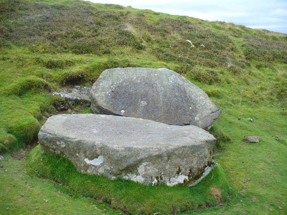
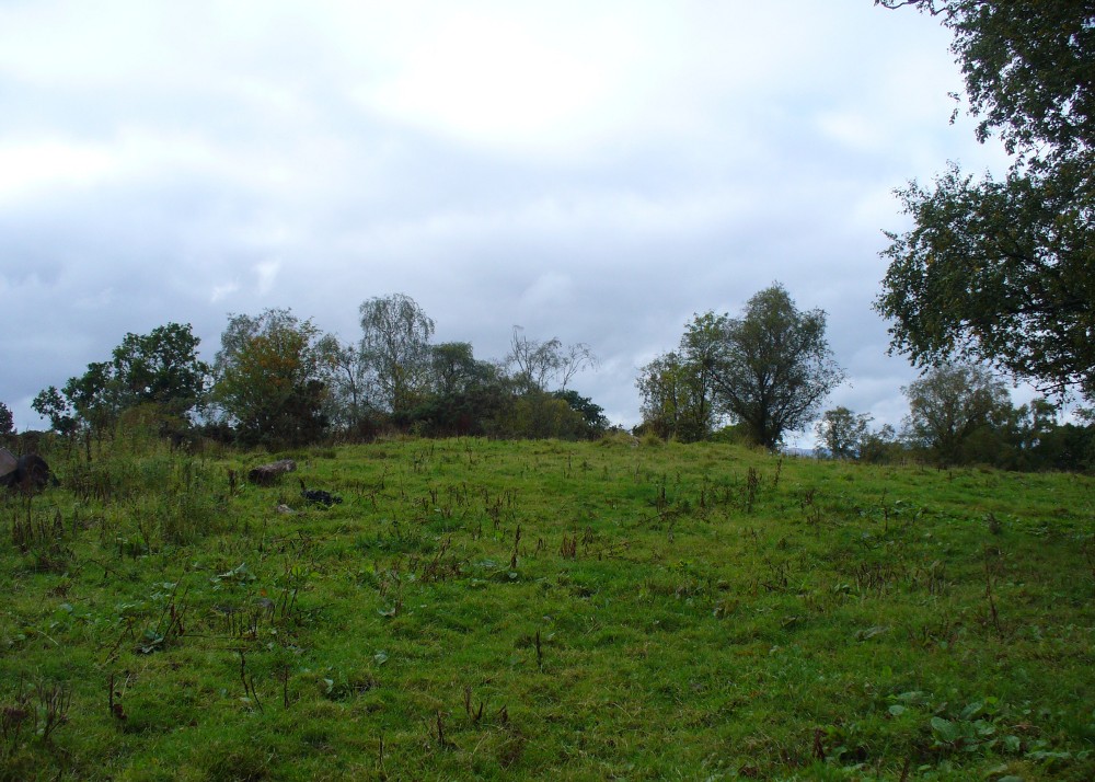
From Bridge of Allan go down the main A9 road towards the University, but turn left up the Sheriffmuir road, 100 yards up turning right to keep you on track up the steep narrow dark lane, turning left at the next split in the road. Follow this for a mile or two all the way to the very end where the tell-tale signs of the unwelcoming english incomers of ‘Private’ now adorns the Pendreich farm buildings. There’s a dirt-track veering uphill diagonally right from here. Go up here and as it bends slightly left, look into the open copse of trees to the highest point here less than 100 yards to you right. That’s it!
Archaeology & History
Lisa gives an idea of scale
The remains of this prehistoric tomb sits right on the very crown of the hill round the back of Pendreich, covered on its western edges by old gorse bushes. Its eye speaks with the nearby sites of the Fairy Knowe to the south, the fallen standing stone of Pendreich Muir to the northeast, the associated cairns to the east, and the Pictish fortress of Dumyat behind them. When I came up here for the first time last week with local archaeologist Lisa Samson, we found that the land upon which the cairn now lives is fertile with a variety of edible (Boletus, Amanita, etc) and sacred mushrooms (Panaeolina, Psilocybes, etc). And, despite being told by locals and the archaeology record as a place where very little can be seen, I have to beg to differ.
Fallen stone at the cairn edge
The crowning cairn is of course much overgrown and has been dug into in earlier years, but just beneath the grassy surface you can feel and see much of the stone that constitutes this buried site. The cairn itself rises a couple of feet beneath the grass and is clearly visible as you walk towards it. At its edges there seems to be the fallen remains of a surrounding ring of stones. Inside of this ring we can see and feel the overgrown rocky mass and open cists sleeping quietly, awaiting a more modern analysis to tell us of its ancient past. When the site was visited by the Royal Commission lads in the 1960s, they went on to tell us the following about the place:
“This cairn is situated on the summit of a low knoll within a felled wood, 170 yards ENE of Pendreich farmhouse at a height of 600ft OD. It consists of a low, grass-covered mound which measures 40ft in diameter and stands to a maximum height of 1ft 6in. The surface is disfigured by pits caused in 1926 when the cairn was opened and three cists were uncovered. Two of these contained no relics; in the third there were fragments of bones and a broken beaker, some sherds of which are preserved in the Smith Institute, Stirling.”
Although we find the scattered remains of old farm equipment lying round the edge of this tomb, it’s still a good site to visit and, I’d say, worthy of further archaeological attention.
References:
Royal Commission on the Ancient & Historical Monuments Scotland, Stirling – 2 volumes, HMSO: Edinburgh 1963.
Royal Commission on the Ancient & Historical Monuments of Scotland, Archaeological Sites and Monuments of Stirling District, Central Region, Society of Antiquaries of Scotland 1979.
Watson, Angus, The Ochils – Placenames, History, Tradition, Perth & Kinross District Libraries 1995.
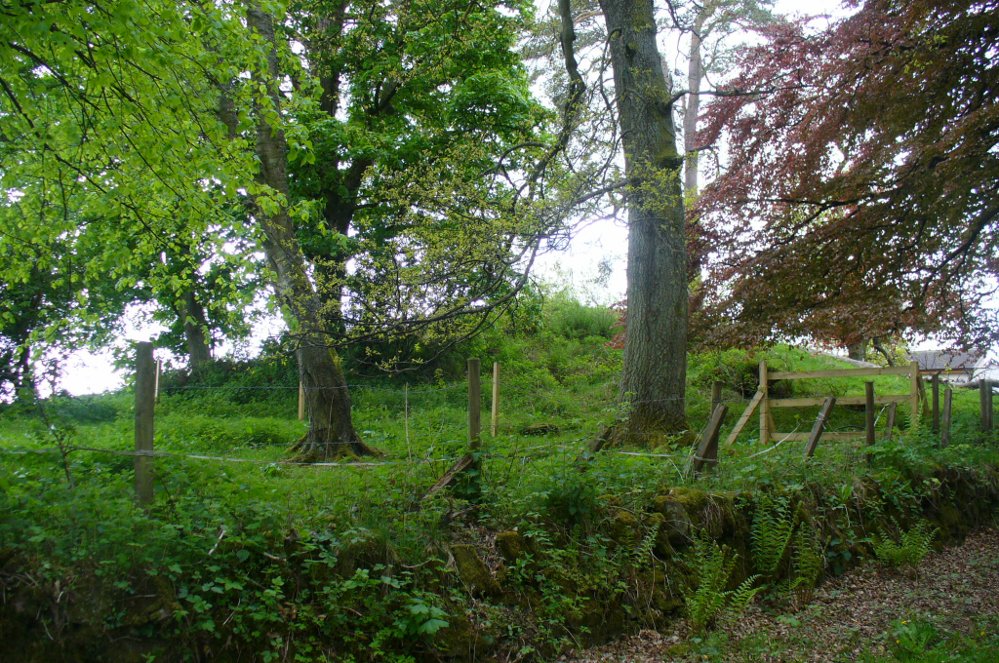
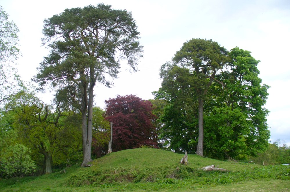
Head out of Doune village and take the A84 to Stirling. Just a few hundred yards along, over the old river bridge, take the first right along the B8032 (don’t head into Deanston). Barely 500 yards along on the left-hand side, between the farmhouse and a small group of houses, note the large tree-lined mound in the middle, just over the fence. It’s quite a big fella – you can’t really miss it.
Archaeology & History
The mound and its trees
This is an almost archetypal fairy mound of a monument—and a mighty one at that!—living quietly in the field with its olde trees for company. Despite its size, it has brought little by way of archaeological attention and has, to my knowledge, never been excavated. Probably a Bronze Age burial mound, the tomb stands more than 15 feet high and is some 30 yards across east-west and 35 yards north-south. The Royal Commission (1979) listing of the mound says simply that “this large cairn measures 34m in diameter and up to 5m high.”
References:
Royal Commission on the Ancient & Historical Monuments of Scotland, Archaeological Sites and Monuments of Stirling District, Central Region, Society of Antiquaries of Scotland 1979.
From Balquhidder village, take the road east towards Auchtubh as if you’re gonna visit the Priest’s Stone, just past the house of Tom na Cruich on the right-hand side of the road. When you get to the house, if you ask the owners there how best to get to the stone, they are very friendly and very helpful in pointing you in the right direction.
Archaeology & History
This solitary standing stone first seems to be mentioned in J.W. Gow’s (1887) essay on the prehistoric antiquities of this part of Rob Roy’s country. Found below the house and hillock where the old gallows used to be, he told:
“On the level ground below (Tom na Croich) …there is a prominent monolith, standing about 4½ feet above ground, quite flat, on the top. It is shaped like a wedge, with the edge to the east, and is famous in Balquhidder as the place where trials of strength took place.”
Note the stones in next fieldPuidrac Stone, looking N
Below the standing stone is a small rock, whose predecessor played an important part in some local traditions relating to this site. (see ‘Folklore’ below) Also, due west of here in the next field, you will be able to see a couple of seemingly upright stones in the tall reeds 200 yards away, which early records say were part of a stone circle—now much in ruin—known as Clachan Aoraidh or the Worshipping Stones. There is the possibility that this single stone was an outlier to the circle. It’s astronomy might be worth checking….
Folklore
When we visited the stone last week, the owners of the house above asked if we’d managed “to lift the stone”—and I wondered what they meant at first, until they told us the folklore about the site. They narrated the tale almost exactly as it had been described first of all in J.W. Gow’s (1887) essay, which said the following:
A new ‘lifting stone’ in front of Puidrac
“It is shaped like a wedge, with the edge to the east, and is famous in Balquhidder as the place where trials of strength took place. A large round water-worn boulder, named after the district, ‘Puderag’, and weighing between two and three hundredweight, was the testing stone, which had to be lifted and placed on the top of the standing stone. There used to be a step about 18 inches from the top, on the east side of the stone, on which the lifting stone rested in its progress to the top. This step or ledge was broken off about thirty years ago, as told to me by the person who actually did it, and the breadth of the stone was thereby reduced about 8 inches. This particular mode of developing and testing the strength of the young men of the district has now fallen into disuse, and the lifting-stone game is a thing of the past. A former minister of the parish pronounced it a dangerous pastime. Many persons were permanently injured by their efforts to raise the stone, and it is said that he caused it to be thrown into the river, but others said it was built into the manse dyke, where it still remains. There were similar stones at Monachyle, at Strathyre, and at Callander, and no doubt in every district round about, but the man who could lift ‘Puderag’ was a strong man and a champion.”
The present stone that is positioned on the ground below the standing stone was put here in much more recent times.
References:
Gow, James M., “Notes in Balquhidder: Saint Angus, Curing Wells, Cup-Marked Stones, etc”, in Proceedings of the Society of Antiquaries Scotland, volume 21, 1887.
Acknowledgements: To Kenny and Laura for their help and guidance here. Huge thanks!
From Balquhidder village, take the road east towards Auchtubh as if you’re heading to the Clach nan Sul or Wester Auchleskine cup-marked stones. Before reaching either of these sites, a few hundred yards on the road as you pass Tom na Cruich on the right-side of the road, you need to look in the next field past this house. About 40 yards past here in the field, and less than 10 yards from the wall, you can see the large rock from the roadside. If not, you’re damn close! Ask the owners of the adjacent house, who are very friendly and helpful.
Archaeology & History
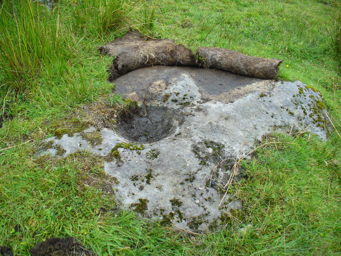
This curious, large, man-made cup-marking or bowl was first described in J.M. Gow’s (1887) essay on Balquhidder antiquities. He wrote:
“Regaining the high road, and still going east, about 40 yards from the cottage of Mr Macdiarmid, there lies just inside the road dyke a large five-sided stone, about 8 feet long by 5 feet broad at the broadest part, and about 2 feet above ground. It is called “Basan an Sagairt” (the Priest’s Basin). When the present road and dyke were made, its name must have saved it. The hollow or basin is 18 inches in diameter and 6 inches deep, and is unmistakably artificial. The stone is the mica slate of the district, hard and granitic.”
Looking down on the basin
The large bowl here was also deemed to be artificial by members of Ordnance Survey and Royal Commission archaeologists who have inspected the site. It is thought to have been a healing stone of some sort, or at least possessed some religious function, but we have no records stating this with any certainty. In examples similar to this, the water which collects in the carved bowl is deemed to have curative properties. It may have been a christian attempt to take locals away from magickal healing stone practices enacted at the Clach nan Sul, or Stone of the Eyes, just a couple of hundred yards along the road east of here. Or it may have being a stone used by indigenous medicine men for other medicinal purposes.
Carved stone in one of the fields across the road
On the other side of the road from here, in the field immediately past Wester Auchleskine farm, as you go through the gate just ahead of you is a rounded earthfast stone with a similar man-made circular impression like the Priest’s Basin carved upon it. (NN 5451 2089) However, this carving doesn’t appear to have been finished. Whether it has any mythic relationship to the Priest’s stone or the cupmarked rocks at Wester Auchleskine in the same field, is not known.
References:
Gow, James M., “Notes in Balquhidder: Saint Angus, Curing Wells, Cup-Marked Stones, etc”, in Proceedings of the Society of Antiquaries Scotland, volume 21, 1887.
From Balquhidder village, walk eastwards along the road for a few hundred yards until you reach Auchleskine Farm on your left. A short distance past here there’s a gate taking you into the rough field on the left. Go through here and note a large clump of rocks diagonally up the slope about 100 yards away. That’s your spot!
Archaeology & History
Very little has been said of this large cup-marked stone, just up from the road near Balquhidder. It was first found and described in J.M. Gow’s (1887) fine essay on the local antiquities of the area, where he told:
“About 400 yards directly east from the farm-house there is a group of three large water-worn boulders of coarse mica-schist, with veins of quartz, the largest of which is about 15 feet long, 7 feet broad, and nearly 5 feet above ground. On the top of this stone there are seven cup-marks of various sizes. The largest are 5 inches in diameter and 2 inches deep; the smaller ones are shallower and from 1½ to 2½ inches in diameter. There may have been more marks on this stone, as a portion of the top near the marks has been broken off, and there are several other faint hollows, but, in my opinion, not sufficiently pronounced to indicate that they ever were cups.”
Cupmarks on top of the rockThe carving from above
Although his caution on the number of cups on the stone is to be commended, it was obvious during our visit to the site a few days ago that there are at least 18 cup-marks on the surface of this large rock. There may be more (the grey cloudy day and misty light wasn’t good in allowing us to see the carving clearly). The most pronounced of the cups are on the very top of the stone, whilst others were carved mainly on the eastern slope of the rock.
At least two other cup-marked stones occur at the farmhouse itself, whilst on the road immediately below was once the cup-marked healing stone known as Clach nan Sul. It’s likely that other carvings are hiding away in the hills hereby…
References:
Gow, James M., “Notes in Balquhidder: Saint Angus, Curing Wells, Cup-Marked Stones, etc”, in Proceedings of the Society of Antiquaries Scotland, volume 21, 1887.