Hagg Woods, Thongsbridge, Holmfirth, West Yorkshire

Cairns:  OS Grid Reference – SE 1493 1026

Getting Here

Take the A6024 road south out of Huddersfield for about 4 miles, past the turnings to Honley, and when you reach a section where the road runs through a nice bitta woodland, stop! Go into the woods on the western side of the road near the bottom end where a footpath runs up to Haggs Farm. The cairnfield is about 100 yards up into the woods, evidenced by small overgrown heaps in a small cluster.  Good luck!

Archaeology & History

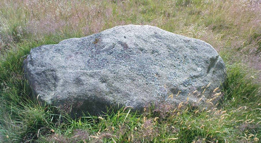
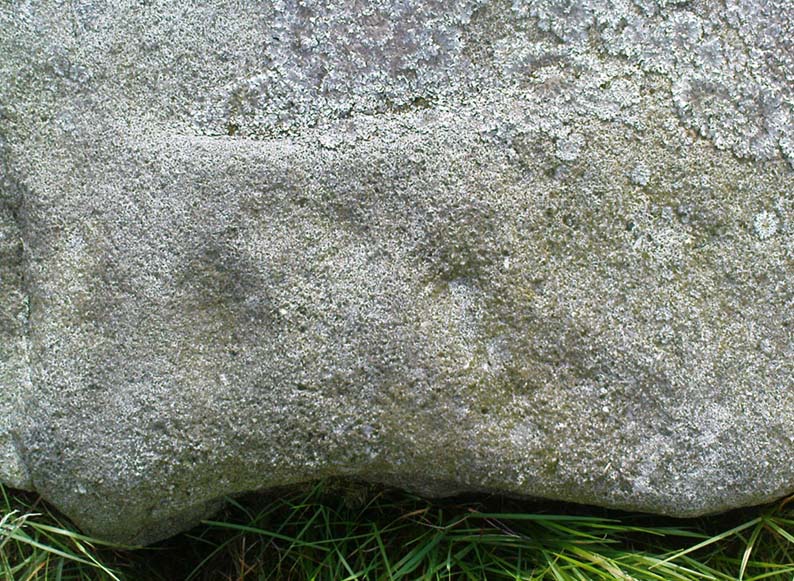
These are pretty difficult to locate even when the vegetation isn’t covering them!  But if you’re diligent and enjoy a good foray in searching for archaeological remains, you might uncover summat.  For here are the scattered remains of what was once a group of seven cairns with adjacent ring-banks, last excavated in the early 1960s by Neil Lunn and other members of the Huddersfield & District Archaeology Society.  Little by way of datable material was found, although one of them did “reveal features typical of some Bronze Age barrows.” Beneath this one they found “the remains of a hut or shelter with a succession of small hearths and a group of stone-packed postholes.”

It would be nice to find out the precise status of this area as few other remains seem in evidence, which can’t be right surely?

References:

  1. Barnes, B., Man and the Changing Landscape, University of Liverpool 1982.
  2. Lunn, N., ‘Account of Recent Fieldwork in the Honley Area,’ Hudds Dist. Archaeo. Soc., 13, 1963.

© Paul Bennett, The Northern Antiquarian


Esholt Lane Carving, Esholt, Bradford, West Yorkshire

Cup-Marked Stone:  OS Grid Reference – SE 1743 3975

Also Known as:

  1. Carving no.10 (Boughey & Vickerman)

Getting Here

Seemingly not visible anymore, but directions given by a Miss N. Hutchinson in the early 1960s worked for me and Dave Pendleton when we checked this out at the end of our teens.  We had to look around till we found it, based on the following directions.  The carving was found “on top of a low dry wall on Esholt Lane, Esholt…on the stretch of road from the junction of Gill Beck with the River Aire to the stone-built barn on the left-side of the road, that is, going towards Esholt.”

Archaeology & History

Esholt Lane Carving, Bradford

First described by Miss Hutchinson in a letter she sent to Sydney Jackson (1964), editor of Bradford Archaeology group newsletter.  When we first found this small carving (not far from where we grew up) we were at the end of our teens, and followed the directions cited in the Cartwright Hall Archaeology Group Bulletin (see above).  The carved design was typical of the primary arcs found in many of the Baildon Moor cup-and-ring carvings a bit further up the hill, but with two other small faint cup-markings on it.  According to Boughey & Vickerman (2003), the carving’s now been hidden in a section of walling that’s been rebuilt.  The drawing here is from one of my unpublished notebooks. (1984)

References:

  1. Bennett, Paul, Ramblings of Archaeological Remnants in West Yorkshire, unpublished: Shipley 1984.
  2. Boughey, Keith & Vickerman, E.A., Prehistoric Rock Art of the West Riding, WYAS 2003.
  3. Jackson, Sydney, ‘Cup-Marked Rock – Esholt Discovery,’ in Bradford Cartwright Hall Archaeology Group Bulletin, 9:4, 1964.

© Paul Bennett, The Northern Antiquarian


Line Stone, Skyreholme, Appletreewick, North Yorkshire

Cup-Marked Stone:  OS Grid Reference – SE 0732 6251

Also Known as:

  1. Carving no.401 (Boughey & Vickerman)

Getting Here

Skyreholme 401 carving (photo © Richard Stroud)

Along the B6265 Pateley Bridge-Grassington road, roughly halfway between Stump Cross Caverns and the turn down to Skyreholme and Appletreewick (New Lane) is a dirt-track on your right-hand side called Black Hill Road. Walk along here for a few hundred yards till y’ reach the gate on the right. A track meanders downhill to the psilocybin-rich pastures of Nussey Green. Several hundred yards down, to the right-hand side of the track, we find this stone and its several nearby companions. Look around – you’ll find it!

Archaeology & History

I like this carving — I think because of the initial impression it gave, which was one of numeracy and linearity: an unusual quality for a cup-and-ring stone. Those of you with an astronomical or mathematical slant may have a similar response.

Line Stone Carving, Skyreholme

The stone was first described in one of Stuart Feather’s (1964) many short notices.  Its existence then remained dormant until it was eventually listed in Boughey & Vickerman’s (2003) survey on the West Riding rock-art, where they catalogued it as ‘stone no.401.’  The carving comprises of two parallel lines—one quite deep—with cup-marks at either end; one of the lines having another 2 cups along it. A third line at an angle has one or two cups along it aswell.  Several other single cups scatter the rock (forgive my crap drawing of it!).

References:

  1. Boughey, Keith & Vickerman, E.A., Prehistoric Rock Art of the West Riding, WYAS 2003.
  2. Feather, Stuart, ‘Appletreewick (WR),’ in Yorkshire Archaeology Journal 41, 1964.

© Paul Bennett, The Northern Antiquarian


Skyreholme Wall Stone, Appletreewick, North Yorkshire

Cup-and-Ring Stone:  OS Grid Reference – SE 0772 6231

Also Known as:

  1. Carving no.413 (Boughey & Vickerman)

Getting Here

Skyreholme Wall Carving
Skyreholme Wall Carving (after Boughey & Vickerman)

Various ways here, but for the sake of newcomers I’d say it was best following directions from Burnsall.  From here, take the Appletreewick road thru the village, past the left turn a few hundred yards along, and another 500 yards or so there’s a split in the road: take the one on your right!  Follow this up, keeping right (don’t turn into Perceval Hall, tempting though it may be!) and park-up where the road turns into a track.  Walk up the track, past the haunted junction, bearing left uphill up Black Hill Road until you reach the very peak of the track where, in the walling on your left, you’ll see this big boulder.  If you can’t see it, you’re bloody close!

Archaeology & History

This is at the very peak of Black Hill Road, with excellent views of Simon’s Seat climbing to the immediate south, the prominent and rounded Nursery Knot Hill immediately north, and grand views to peaks east and west. It is very likely this position had something to do with it being deemed worthy of relevance.  The rock itself defines a point along the old boundary line.

Skyreholme Wall Boundary carving

One peculiarity on this boulder is the deep cup-mark with a strange ‘lip’ to it, which has been mentioned by others in the past.  This is surrounded by at least five others cups — not dissimilar to some of the ‘rosary-designs’ of cup-and-rings further north.

The rock art student’s Boughey & Vickerman’s (2003) drawing of this design is pretty accurate — where they call it stone 413 — though it doesn’t actually give this carving the justice it deserves.  They also erroneously tell that some of the cups here are doubtful.

Check it out for y’self.  This is an excellent stone for cup-and-ring lovers! (with plenty of other sites scattered about all round here)

References:

  1. Boughey, Keith & Vickerman, E.A., Prehistoric Rock Art of the West Riding, WYAS 2003.

© Paul Bennett, The Northern Antiquarian


Currer Woods Stone, Steeton, West Yorkshire

Cup-and-Ring Stone:  OS Grid Reference – SE 0251 4384

Getting Here

On the opposite side of the road (B6265) from Airedale General Hospital, Steeton, you’ll notice a footpath going up the field into some woods.  Go up here.  Once you come out the top of the woods, follow the dodgy path on your right (west) along the rocky edges for 250 yards, following the edges of the field walling.  You’ll eventually reach the field with lots of rocks in it.  It’s the field before this one, close to the walling.  Look around!

Archaeology & History

I’ve been a little cautious about putting this carving on TNA simply because it seems to be an isolated example and was a little unsure about its veracity.  If I’d have found the stone on the edges of Ilkley Moor, Rivock Edge, or the heights above Askwith, I wouldn’t have hesitated.  The fact that no other carvings occur nearby has been my main trouble.  But I suppose if the carving turns out to be nowt of the sort, I can discard it at a future date and, of course, make sure that a lot of other cup-and-ring stones are disregarded at the same time (there are a number of other designs much less defined than this one which have been okayed by archaeo’s who’ve been into this subject for much shorter periods of time than myself).  But less of the waffle!

Currer Wood Carving, Steeton

When we first found this, in April 2009, I was out looking for the remains of an old well (called Jane Well, a few hundred yards west of here).  The heaven’s opened and I ended up in the woodland and then found the field full of large rocks, some seemingly used by man in more recent centuries, atop of the woods, and so had to check them out!  But this was one of the first stones we found.

Currer Woods Stone
Currer Woods Stone

The rock itself, as the photo shows, appears to have had one end of it split or broken off (not unlike one edge of the Hanging Stones, Ilkley Moor) at some time in the past, intruding on the arc, or line, beneath which are two distinct ‘cups’.  A possible third cup-marking and other linear aspects seem apparent, with the design giving the distinct impression of a face.  I keep meaning to go back and get a rubbing of the carving, but aint got round to it yet.  When (if!) I gerrit done, I’ll add it onto this profile.

And although there are said to be no other prehistoric remains close to this old carving, the fields a coupla hundred yards west used to be called the Barrow Fields, where tombs were once found; and a little further along the same geological ridge atop of the excellent Kirk rocks, possible cup-markings scatter the edges of two sections — but they’re a little dubious; then there’s the Dragon Stone and associated cup-marked stone not far away.  In the adjacent woods are the remains of old walling, but I’ve not found other carvings hereabouts.  However, the rule tends to be: “where there’s one, there are more!”

Watch this space!

© Paul Bennett, The Northern Antiquarian


Addlebrough (1), Thornton Rust Moor, North Yorkshire

Cup-Marked Stone:  OS Grid Reference – SD 948 879

Getting Here

This takes a bitta getting to and won’t really be worthwhile unless you’re a rock-art nut!  I s’ppose if you’re looking at the other decent cup-and-ring stones on the summit of Addlebrough, it might be worth looking at.  In which case, walk a coupla hundred yards southeast towards where the walling meets and climb over.  The walk a little further in the same direction and once you’ve gone less than 100 yards, look around.  You can’t really miss it if you potter about.

Archaeology & History

Single cup-marked stone (photo by Richard Stroud)

This possible single cup-marked stone appears to have been discovered before me ‘n Richard Stroud got to the spot, by none other than Stan Beckensall himself — or at least it’s in Stan’s Prehistoric Rock Art of County Durham, Swaledale and Wensleydale book, where he describes it as it only can be done: “a single possible cup-marked stone…SSE of the summit cairn”, which is where you find this. (Another single cup-marked stone found nearby by Barbara Brown aint the same one as this.)

References:

  1. Beckensall, S. & Laurie, T., Prehistoric Rock Art of County Durham, Swaledale and Wensleydale, County Durham Books 1998.

© Paul Bennett, The Northern Antiquarian


Pathway Stone, Holden, Silsden, West Yorkshire

Cup-Marked Stone:  OS Grid Reference – SE 07021 44884

Also Known as:

  1. Rough Holden CR-9

Getting Here

Pathway Stone, Holden, Rivock

Follow the footpath running from the Rivock TV mast northwest, where it cuts diagonally across the field, heading towards the drystone wall.  About 200 yards before the walling – stop! It’s just to your right-hand side, very close by!

Archaeology & History

First discovered in July 2009 when Keighley volunteer, Michala Potts of Bracken Bank, did further ramblings amidst the long grasses hereabouts.  Its name comes from the fact that it’s found just next to the footpath that cuts across Rough Holden from the TV mast beneath Rivock.  The carving’s a very simple plain design, as the photos show, with just three faded cup-markings etched onto the stones northeast face.

Close-up of cup-markings

This stone aint too far from the cup-marked Dump Stone and the nearby Rough Holden design, but all across the Holden Rough grasslands are the faded remains of old pit-workings.  It makes you wonder just how many other carvings once existed across this flatland.  The fact that this and the other ones nearby still remain is damn fortunate!

© Paul Bennett, The Northern Antiquarian


Dump Stone, Holden, Silsden, West Yorkshire

Cup-Marked Stone:  OS Grid Reference – SE 0705 4490

Getting Here

Top view of cup-marks

Follow the same directions as to reach Holden’s Buttock Stone, then north over the field and through the gate towards the Rough Holden Carving.  As you approach here, keep your eyes peeled for a clump of boulders a little further down the field which stand out.  That’s where you wanna be!

Archaeology & History

Found by the old Keighley volunteer, Michala Potts of Bracken Bank, a few weeks back (Friday, June 12, 2009), this previously undiscovered cup-marked boulder is amidst a scatter of boulders piled-up with each other following a field-clearance in recent years.  It doesn’t seem to be in its original position, but obviously came from the fields hereby.

Cup-Marks on vertical face
Side view of cup-marks

The first view we got indicated 2 or 3 cup-markings on its upper surface; but then as we wandered round it and the adjacent rocks, it seemed that several others appear to have been etched on the vertical face, as shown in one of the photos.  The light wasn’t too good by the time we found this (it was one of those days where cloud and sun kept the cup-marks hidden at times!) and then a drizzle came along and stopped a sketch of the stone.  But it’s obvious there are 3-4 cup-markings on the upper surface and at least 3 carved on its side.  Next time up there we’ll hopefully get better light!

One of the land-owners or tenant farmers hereby has little respect for the prehistoric remains in this area and, in all honesty, I’d expect a number of the petroglyphs to be destroyed in the coming years.

© Paul Bennett, The Northern Antiquarian


Robin Hood’s Stone, Riddlesden, West Yorkshire

Legendary Rock:  OS Grid Reference – SE 06228 44470

Getting Here

Marked on the 1853 OS-map

Dead easy!  If you come from Silsden, take the Holden Road up onto the moor edge, all the way up the wooded hill.  As you reach the top, keep your eyes peeled for the stone in the slope to your left.  Otherwise, coming from Riddlesden, take the moor road upwards (to Silsden Road) as if you’re gonna visit Peggy Mawson’s Well, the Baldwin Stone or some of the Rivock carvings.  Keep on the road to where you see the microwave tower on Pinfold Hill to your right.  It’s just below it!

Archaeology & History

Robin Hood’s Stone from above

Flints have been found on the slopes above here, but records of this stone only go back — as far as I’ve found — to 1850 (this seems to typify records around the Keighley district, which only seems to record anything post-1500 AD).  In mid-Victorian times, plans were afoot to use the rock for building material, but local people objected and so the stone kept its position overlooking the valley.  There are a number of very defined ‘cups’ on the sloping face of the stone, but several (though not all) of these have all the likeness of the holes dug into the rock by climbers — though why climbers would even think to cut foot-holes into this easy rock beggars belief!

Folklore

One of several sharp well-defined 'cups' on the rock
One of several sharp well-defined ‘cups’ on the rock

Not too surprisingly, folklore tells that this stone was one of the places where our old hero Robin Hood sheltered, when being chased by god-knows-who in one of his many exploits.  We’ve no way of proving this of course, but the sparse woodland remains above here also bear the hero’s name.  What seems to be a more modern piece of industrial folklore alleges that this stone was actually put here by workers in the Victorian times!  The boulder allegedly lived near Barden, Bolton Abbey, but was blocking construction work, so was uprooted and moved all the way to where it now sits!  In bygone times the rock was a local meeting place – perhaps around Beltane, in line with Robin Hood festivities.

References:

  1. Gray, Johnnie, Through Airedale from Goole to Malham, Elliot Stock: London 1891.

© Paul Bennett, The Northern Antiquarian


Robin Hood’s Wood (3), Silsden, West Yorkshire

Cup-Marked Stone:  OS Grid Reference – SE 06530 44898

Also Known as:

  1. Holden CR1

Getting Here

Follow the same directions to reach the Robin Hood’s Wood Stone, but head from there to the dirt-track about 30 yards away.  This stone is just 10-15 yards on the south-side near the bend in the track.  Look around!

Archaeology & History

Holden Cup-Marked Rock

If you can find this stone, the 2-cupped Robin Hood’s Wood Stone carving is only about 15 yards SW.  But this poor example is a mere single cup-mark sitting near the centre of a large flat rock, half-covered in vegetation like its nearby compatriot.  There’s a faint possibility of a second cup-mark on the rock, but it’s pushing it a bit!  Thanks to the vegetation cover on the majority of the rock, the cup’s in a good state of preservation.  Nowt much to shout about unless you’re a real cup-and-ring nut!

© Paul Bennett, The Northern Antiquarian