Holy Well: OS Grid Reference – NS 69441 94687
Lady Bettys Well, nr Leckie
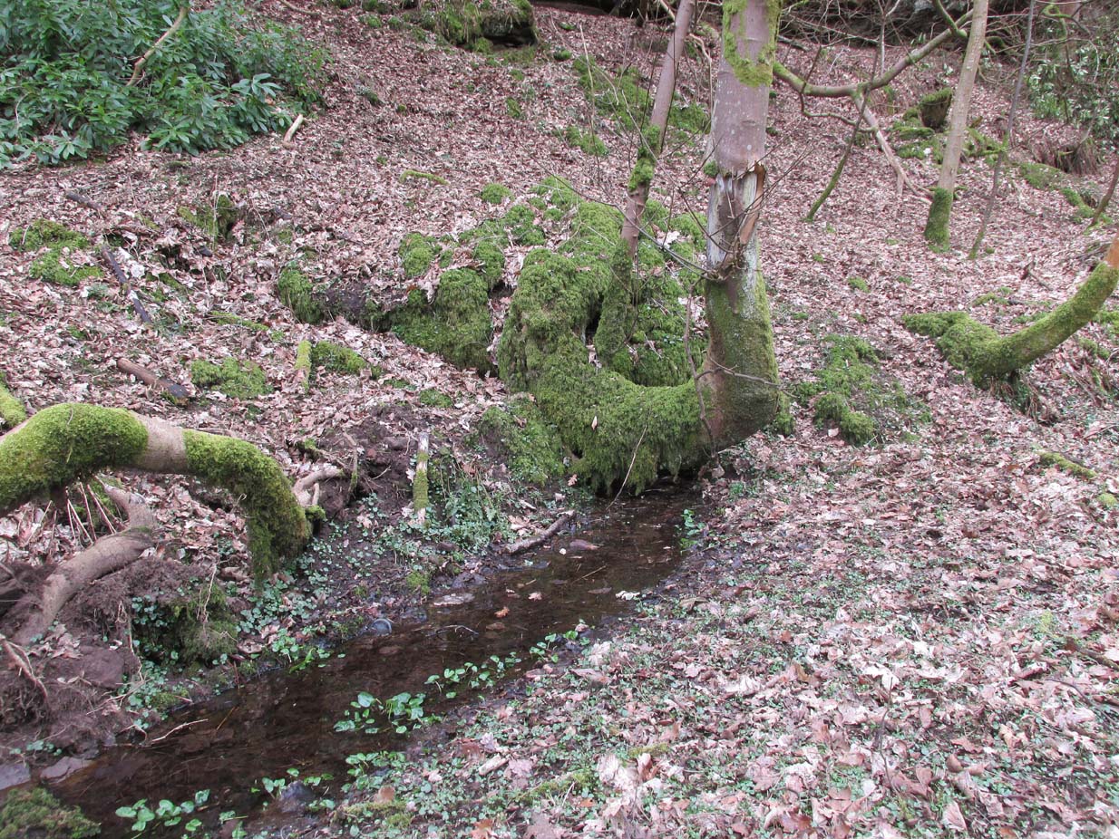
From Gargunnock village, take the road west towards Leckie, and then just before the right-angled bend in the road down towards the A811, bear sharp left, and then immediate right below the farmhouse along what looks like a private road taking you onto the Watson House mansion. About 500 yards along, with trees either side of you, look down the small steep slope where a small burn (stream) is visible. Get down there and, where the waters bend away changing direction to head north, look carefully for a small spring of water emerging, just a few yards south of the stream itself, beneath a young tree.
Archaeology & History
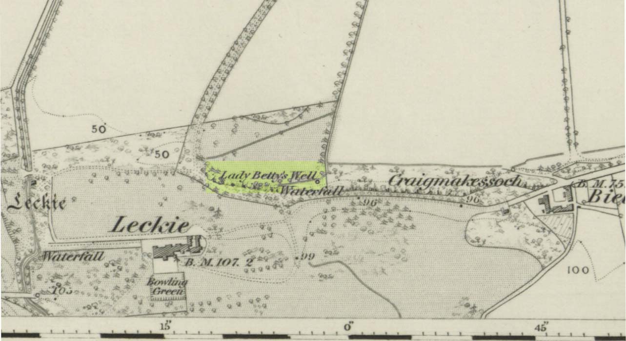
Lady Bettys Well on 1860 map
This all-but-forgotten water source is, thankfully, still running with clear waters below the wooded slopes. It is highlighted on the first OS-map of the region in 1860, 50-60 yards east of a small but once-picturesque waterfall (now spoiled by a mass of industrial waste, dumped hereby). Little seems to be known about its mythic history and, quite possibly, may have had something to do with our old cailleach. May have…. I say this purely in relation to what was said about the site by the Ordnance Survey lads at the end of the 1850s when they visited the site and enquired as to its name and nature. They told:
“A Small Spring issuing from under a rock like the mouth of a drain having no appearance of a Well. It took its name (Betty) from an old woman who lived adjacent some two hundred years ago; there is no tradition or Antiquity connected with it – nothing more nor less than an Old woman’s well, but is well known in the neighbourhood by the name. Situated at the base of Craigmakessoch and about 10 chains north west of Leckie house.”
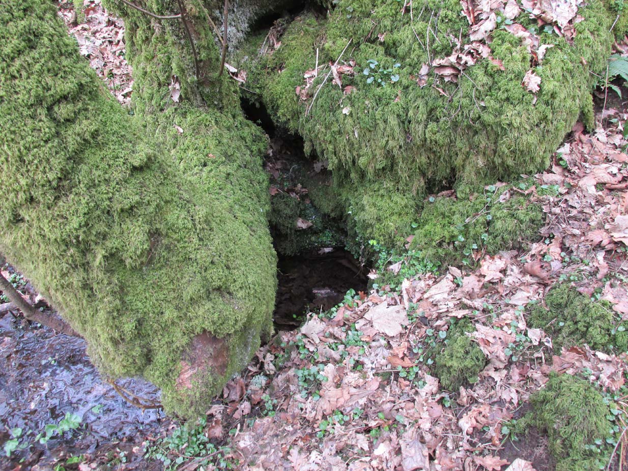
Water emerging by the roots
Although ‘Betty’ is obviously a shortening of Elizabeth, it’s the Old Woman’s bit that brings up the cailleach element, which may or may not be valid. The small crag beneath which the spring still rises is known as ‘Craigmakessoch’, which Prof Paul Hornby thought might derive from a forgotten attribution to the little-known St. Makessog or Kessog. (are there any local folk who can clarify things?)
Were it not for the pollution due to the dumping here (in an otherwise beautiful place), it looks like the waters would still be drinkable – but we all decided to give it a miss…
© Paul Bennett, The Northern Antiquarian