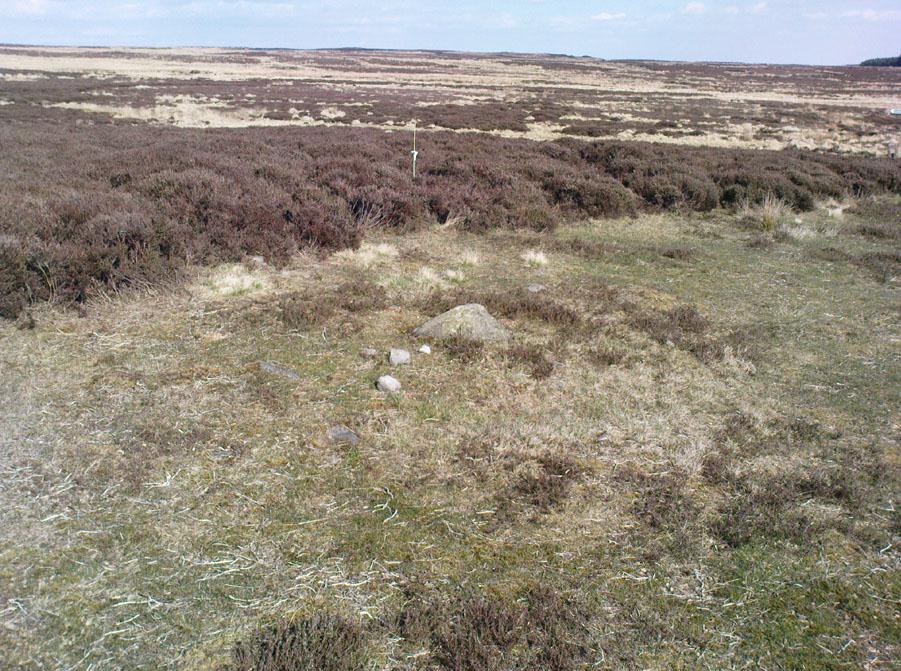
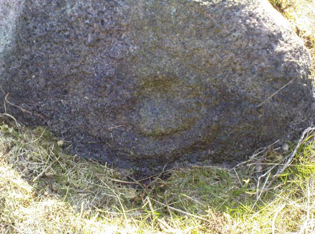
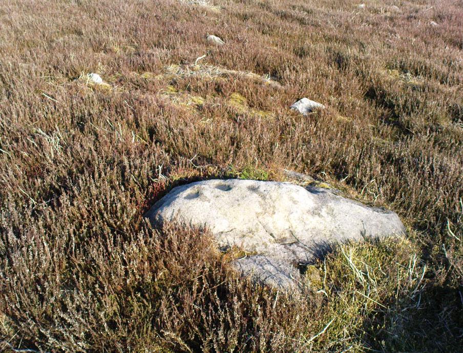
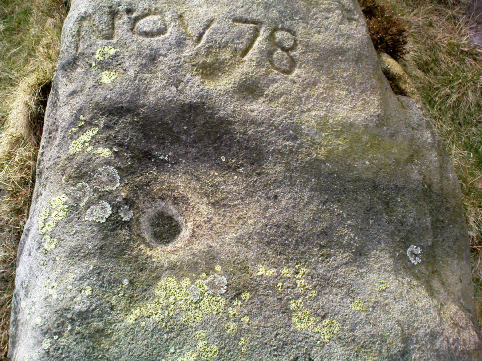
Middleton Moor Carving (445), North Yorkshire

Cup-Marked Stone:  OS Grid Reference – SE 10917 51299

Getting Here

Follow the same directions to find Middleton Moor’s 441 carving.  Then, go across the small stream a bit further down the slope and up up the slope until you’re on the level.  Once on this small rise in the land, look up the slight slope where approaching the the fenced area.  You’re close!

Archaeology & History

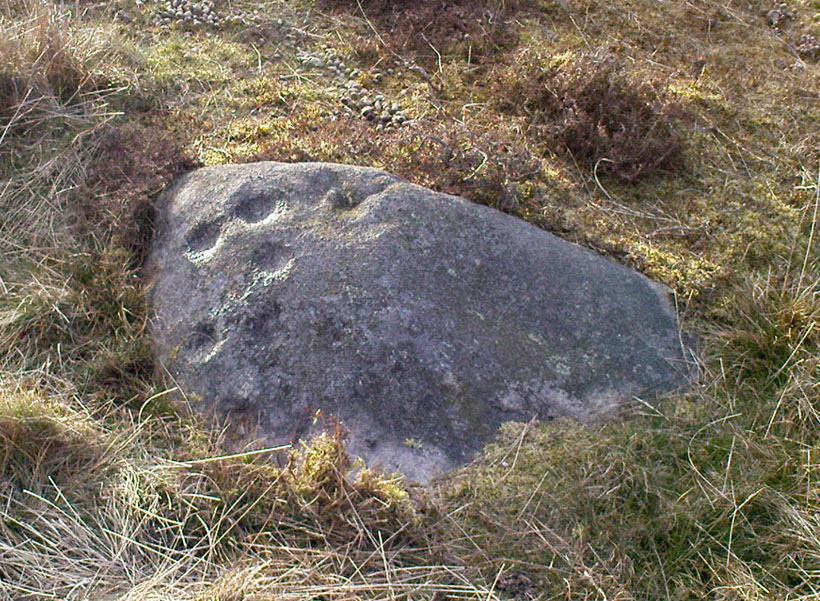
Middleton Moor carving 445

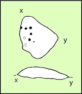
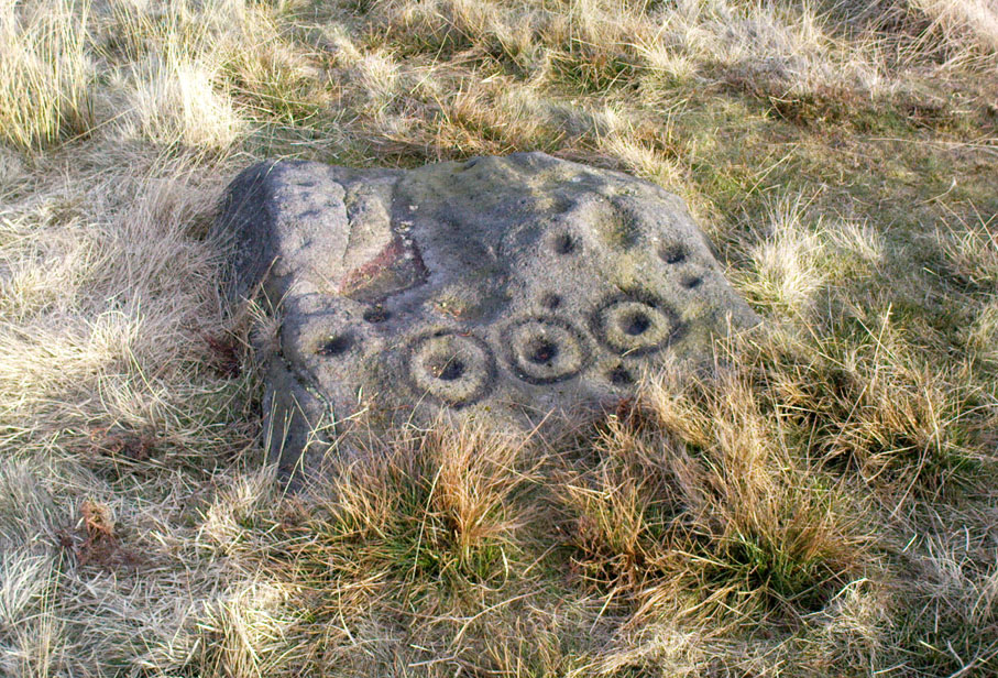
On the Middle Ridge between the streams of Delves Beck and Dryas Dike, this small rounded triangular-shaped carved stone has eight simple cup-markings eroded, but notable on its smooth surface.  Boughey & Vickerman (2003) suggest some may be gunshot marks, which has to be considered at several of the seeming ‘cup-markings’ on this moor. (particularly at Carving no.440 less than 100 yards away)  Archaeo-astronomers amongst you will note the Cassiopeia-like central design on this design — though this is probably coincidental (it might have tickled mi fancy when I was going thru my astroarchaeology phase many years back, but not anymore).

References:

  1. Boughey, Keith & Vickerman, E.A., Prehistoric Rock Art of the West Riding, WYAS 2003.

© Paul Bennett, The Northern Antiquarian
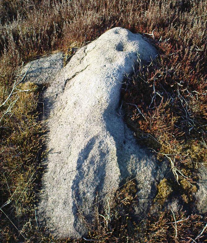

Pike Hill, Stamfordham, Northumbria

Cup-and-Ring Stone:  OS Grid Reference – NZ 0774 7048

Archaeology & History

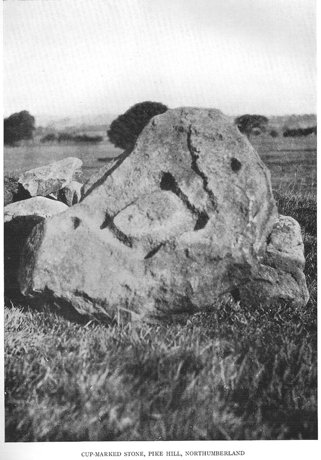
1928 photo of carving

Found inside a prehistoric tomb that was excavated in the late 1920s “by Messrs R.C. and W.P. Hedley at Pike Hill, near Stamfordham,” this fascinating-looking carving was found on a stone that “was overlying the primary burial” cist in the middle of the tumulus, measuring “2 feet 9 inches long by 2 feet wide and 12 inches deep, with an orientation on the longer axis of NE.”  As we can see in the old photo that accompanied Mr Hedley’s (1928) short article in Antiquity journal, four single cups are arranged in a rough square and are joined with each other by a single line, running from cup to cup, outlining a clear quadrilateral formation.  Two other single cups are outliers on the left and right side of the ‘square.’

A second smaller cist was also found inside the same mound and on the central inner face of this was another, more simplistic carving described as “a very fine cup-mark 1½ inch in diameter and ¾-inch deep.”  These carvings are no longer in situ (I think they’re in Newcastle Museum) and apparently this second single cup-marked stone can no longer be located.

References:

  1. Beckensall, Stan, Northumberland’s Prehistoric Rock Carvings, Pendulum: Rothbury 1983.
  2. Beckensall, Stan, Prehistoric Rock Motifs of Northumberland – volume 2: Beanley to the Tyne, Abbey Press: Hexham 1992.
  3. Hedley, R. Cecil, “Ancient British Burials, Northumberland,” in Antiquity Journal, volume 2, December 1928.

© Paul Bennett, The Northern Antiquarian
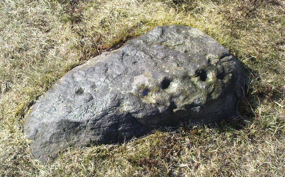

Bowl Stone, Steeton, West Yorkshire

Cup-Marked Stone:  OS Grid Reference – SE 03593 43673

Also Known as:

  1. Crater Stone
  2. Little Snowden Cup-Marking

Getting Here

From Steeton go to the top of Mill Lane, turning left up High Street. After about 200 yards, turn right (opposite Falcon Cliff street) and go down past the end of the row of terrace houses, to the end of the dirt-track past the allotments.  Then cut up the fields to the rocky crags a coupla hundred yards above you on the left.  Over the wall at the top, look out for the single tree in the field by the walling where there’s a small cluster of stones.  That’s it!

Archaeology & History

The little Crater Stone and its more ornate companion, below

Hiding away on private land, this lovely simple carving was first located on Wednesday, April 7, 2010 (in the fine company of the Great Guru).  Our initial assessment found it to be just a simple cup-marked stone with 4 normal cup-marks, plus two large ‘bowls’ just where the rock goes into the ground.  When we found it the other day, Steve pulled a little bit of the earth back to get a better look at the stone, but we need to return here to unearth the rest of the stone (we didn’t have utensils with us this day, as we were just playing out).

The position of the stone in the land is excellent for views, looking down on the greater-looking Dragon Stone carving just a few yards away, but also looks across the Aire Valley and onto the moorland heights above Rivock, and the south-side of Ilkley Moor.  I’ll update and add further notes and clearer images when we go back to the site (hopefully) in the next week (aswell as hopefully conjure up a more respectable title!).

© Paul Bennett, The Northern Antiquarian
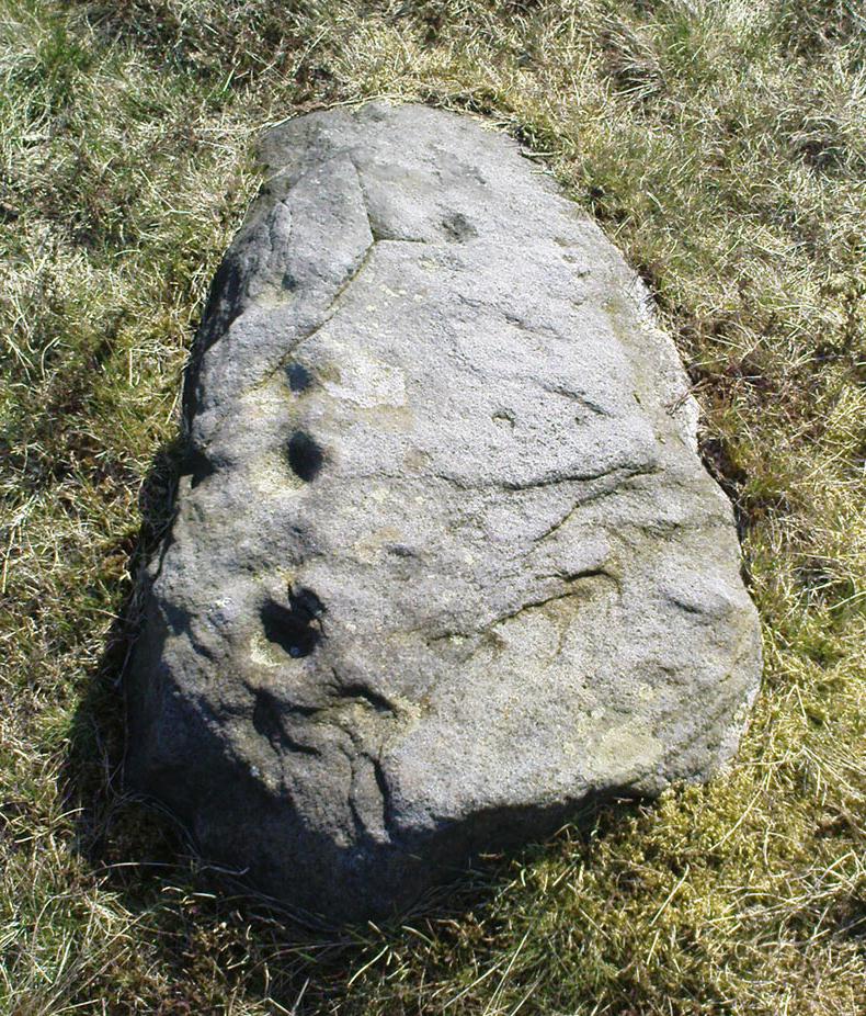

Wray Stone (314), Ilkley Moor, West Yorkshire

Cup-Marked Stone:  OS Grid Reference – SE 13173 46585

Also Known as:

  1. Carving no.150 (Hedges)
  2. Carving no.314 (Boughey & Vickerman)

Getting Here

Take the road up across from Ilkley train station uphill towards the moor until you reach great rocks on your right.  From here, the Cow & Calf Stones car park (packed with tourists and litter everywhere these days), go up the steep footpath onto the moor.  As you level out looking across the first moorland ridge, to your left is a rounded hillock.  Go into the heather there and near its small peak and you’ll find what you’re looking for.

Archaeology & History

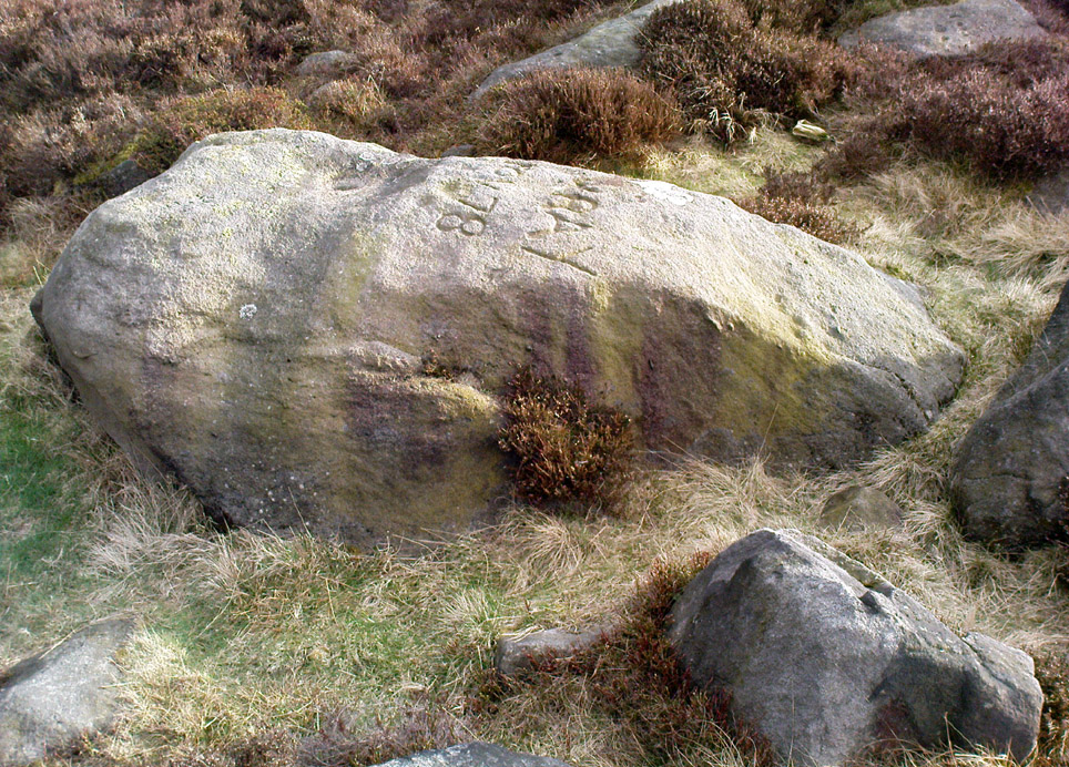
This is a nice big stone, found amidst a clump of other stones, that gives the distinct impression of once being a large cairn or similar artificial prehistoric feature.  But that’s wishful thinking on my behalf…  This long fat 10-foot long rock has the distinct signature of someone who thought it a good idea to carve his little name on the carving in 1978, as the name of the rock tells: “Wray Nov 78” — vandalism which the local Ilkley Parish Council and local businessman Tom Lonsdale validate as little more than “twenty-first century informal unauthorised carving.”  Beneath the great artist’s signature we find two distinct cup-marks above a large rounded bowl, inside of which seems to be the impression of an old ring, but this seems due to the actions of water and lichen.  There are perhaps another two faded cup-markings alongside those distinctly visible.  In Hedges (1986) survey he described the “top flat surface has three cups and one basin” — so let’s play safe and go with that!

Close-up of cups, bowl & modern etching

It’s a good stone, sat upon a fine ridge with distinctive views for miles both east and west along the valley of the Wharfe, and north to the ancient settlements and burial grounds of Middleton Moor on the other side of the River Wharfe.  From here, behind and up onto Ilkley Moor, unfolds its greater mythic history, scattered and hidden over differing ages.  In years past, this site was a fine one for reflection and insight.  Today, one must venture further and to other sites for such quiet realities. Close by you can find the double-ringed carving of stone 318 and other faded cup-mark stones nearby.

References:

  1. Boughey, Keith & Vickerman, E.A., Prehistoric Rock Art of the West Riding, WYAS: Wakefield 2003.
  2. Cowling, E.T., Rombald’s Way: A Prehistory of Mid-Wharfedale, William Walker: Otley 1946.
  3. Hedges, John (ed.), The Carved Rocks on Rombalds Moor, WYMCC: Wakefield 1986.

© Paul Bennett, The Northern Antiquarian

Counter Hill Carving, Silsden, West Yorkshire

Cup-Marked Stone:  OS Grid Reference – SE 0463 4995

Also Known as:

  1. Carving no.31 (Boughey & Vickerman)

Getting Here

Cowling’s 1946 drawing

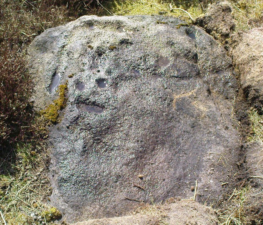
From Silsden go up the long hill (A6034) towards Addingham until the hill levels out, then turn left on Cringles Lane (keep your eyes peeled!) for a half-mile where you need to veer right along Banks Lane and go 100 yards past Moorcock Farm Hall where the footpath takes you into the fields on your right.  Walk down the line of the wallings, thru the gate, and keep following down until you reach a cluster of large rocks.  Stop here and look over the wall where you’ll see one of the boulders poking its head out on the other side.  That’s it!

Archaeology & History

First discovered by Eric Cowling in the late 1930s during one of his explorations of the immense Counter Hill earthworks (thought to be Iron Age), whose remains can still be seen encircling the peaked hill close by.  The stone is found in the edge of the walling halfway down the field towards the Marchup enclosure and is just inside the outer edge of the Counter Hill ditched enclosure surrounding the hill above you. (on the other side of the wall from the carving, you can make out the remains of the faint line of the ditch running pretty straight up towards the next wall)

Cluster of cups by walling
Counter Hill carving from above

At the top eastern edge of the stone is a clear cluster of 3 cup-markings, just as the rock meets the walling.  A much more faint group is visible to the left.  Cowling (1946) suggesting that the three-cup-cluster “shows the final form of the fylfot symbol,” i.e., the three-armed swastika.  Boughey & Vickerman (2003) meanwhile suggest that one of the two clusters are “doubtful (possibly recent?).”

When we came to this site yesterday, the day was overcast and cloudy.  But it seemed there may be more to this carving than has previously been recorded.  What may be a faint ring seemed possible near the middle of the stone, with a natural crack running through it (you can just about make it out in the photo on the right).  There also seemed to be other faint lines on the rock, but until we’ve been here again with better lighting conditions, the two groups of 3-cups is the symbolic state of play for this stone!

References:

  1. Boughey, Keith & Vickerman, E.A., Prehistoric Rock Art of the West Riding, WYAS: Wakefield 2003.
  2. Cowling, E.T., Rombald’s Way: A Prehistory of Mid-Wharfedale, William Walker: Otley 1946.
  3. Hedges, John (ed.), The Carved Rocks on Rombalds Moor, WYMCC: Wakefield 1986.

© Paul Bennett, The Northern Antiquarian

Low Snaygill Stone, Skipton, North Yorkshire

Cup-and-Ring Stone:  OS Grid Reference – SD 9940 4973

Also Known as:

  1. Carving SK1 (Hedges)
  2. Carving no.16 (Boughey & Vickerman)
  3. Snaygill Farm Stone

Getting Here

Stone by the roadside

Not too far from the High Laithe cup-and-ring stone.  Along the A6131 out of Skipton, park up at the Rendezvous hotel and go up the road on your left, over the canal.  As you approach the second house up, note the rock on the right-hand side of the tiny road, perched on the edge above the stream, with ivy creeping up one side of it.  That’s it!

Archaeology & History

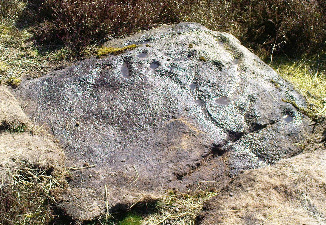
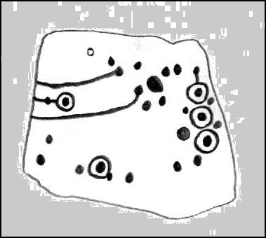
This stone was moved to its present position a few decades back, sometime before Hedges (1986) first recorded it in his Carved Rocks work.  It’s a reasonably large boulder, resting on the slope above the drop to the stream below, and will probably drop into the waters in the not-too-distant future.  Whether the stream had any initial relationship with the cup-markings etched on its surface, we’ll probably never know (a number of rock art students love the water-stone relationship — and this one is no doubt in their listings!).  Its first literary appearance by Hedges described it thus:

“Large fairly smooth grit rock sloping down to stream at E and into ground and grass at W.  Eleven cups, circle of nine very small cups at one end, groove from depression, one other groove and possible cup.”

Lower half of CR-016

Which just about does it justice.  When we visited the place yesterday, the cluster of small cups at the top of the rock were difficult to see clearly in the grey daylight; but what seems to be another 2 cups (not in Hedges, nor Boughey & Vickerman’s [1986] survey) may be on the lower-half of the stone, and can be seen in the photo here.  We need to go back again on a bright day and catch the stone in a different mood to suss out whether we were just seeing things.

References:

  1. Boughey, Keith & Vickerman, E.A., Prehistoric Rock Art of the West Riding, WYAS: Leeds 2003.
  2. Hedges, John (ed.), The Carved Rocks on Rombald’s Moor, WYMCC: Wakefield 1986.

© Paul Bennett, The Northern Antiquarian

High Laithe Stone, Skipton, North Yorkshire

Cup-and-Ring Stone:  OS Grid Reference – SD 9952 4991

Also Known as:

  1. Carving SK2 (Hedges)
  2. Carving no.17 (Boughey & Vickerman)

Getting Here

High Laithe cup-and-ring stone

Worth the short trek if you like your cup&rings!  On the Aire Valley Keighley-to-Skipton road (A629), as you approach the southern outskirts of Skipton, take the turning at the roundabout as if you’re going into the town up the A6131. Go over the next roundabout a coupla hundred yards on, then 200 yards further on note the right-turn up over the canal (big hotel just here, where you could park up).  Walk over the canal up the tiny country lane. Ignore the first left turn and walk up, bearing next left uphill and onto the footpath. Walk up the hillocky quarried bit until you reach the stile in the wall.  Once on the other side, look in the walling 20 yards uphill.  You can’t miss it!

Archaeology & History

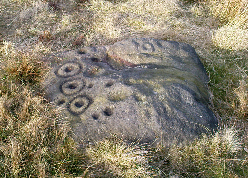
First described by Messrs Hartley and Radley in the Yorkshire Archaeological Register of 1968, this small “standing stone”, less than three-feet tall, has a distinct cup-and-double- ring carved onto its upright north-facing edge.  The outline of the carving is visible even in bad light, though you might wanna rest and gaze for a minute or two for yourself and the lighting to adjust if it’s a grey day.  There’s another cup-marking below the bottom right of the double-ring, with another ‘possible’ just above ground-level.

References:

  1. Boughey, Keith & Vickerman, E.A., Prehistoric Rock Art of the West Riding, WYAS: Leeds 2003.
  2. Hedges, John (ed.), The Carved Rocks on Rombald’s Moor, WYMCC: Wakefield 1986.

© Paul Bennett, The Northern Antiquarian

Clach na Sithean, Strathtay, Perthshire

Cup-Marked Stone:  OS Grid Reference – NN 895 531

Also Known as:

  1. Balendune
  2. Ballinduin

Folklore

This large cup-marked stone was known by local people as the Clach na Sithean, or the stone of the fairies.  Its smooth surface and well-cut grooves was said to be due to the fairies sharpening their knives upon it, and the straight cuts or grooves were tests of the keenness of their blades.

In addition to the fairies having hold over this stone, a brownie creature also roamed between here and the burn of Allt Mor.  Although a dutiful creature, he commonly used to scare the women when they returned from the ceilidhs by chasing them and screaming a curious noise at them. But as well as this, he would also enter the local houses and farms after nightfall and, when the local folk were asleep, would clean the supper dishes and put them in their rightful places. But if there was no work to be done once he had entered their homes, he would take the dishes out and place them on the floors where they would be found in the morning by perplexed householders.  Then they’d know that the brownie had visited. Sometimes he was a great help to the housewives, other times a nuisance.  He became known to local people as Puddlefoot, or Cas an Lubain, but so offended was he by the name when he heard it, that he let out an almighty scream and vanished, never to be seen again.

References:

  1. Kennedy, James, Folklore and Reminiscences of Strathtay and Grandtully, Munro Press: Perth 1927.

© Paul Bennett, The Northern Antiquarian

Clach na Buidseach, Strathtay, Perthshire

Cup-Marked Stone:  OS Grid Reference – NN 916 541

Also Known as:

  1. The Witchcraft Stone
  2. Witches Stone

Folklore

In Mr Kennedy’s book (1927) on the folklore of Strathtay, he informed that this Witches Stone was examined and taken to Edinburgh sometime in the 19th Century, but returned to its home by a local man called Mr McNaughton who lived at Bail-an-eas.  The stone was restored close to the walls in which it was first found.  He also told us the following:

“In bygone days the witches of Strathtay amd Grandtully had their great meeting place at Tulliepourie. There the Witches’ Stone…with its round bowl-shaped holes, is still in evidence. Satan attended and assumed the shape of a he-goat; but going to the meeting he is said to have rolled along in the shape of a large cart-wheel – gyrating and describing the figure eight. This must have been an exceedingly interesting site! The orgies that ensued at these meetings were disgustingly wicked!”

The fairy folk, whose main home was the hill of Craig Scriadlain further uphill from here, would also have their revelries here.  Many of the other sites near here were also used by the same little people of Scriadlain.

References:

  1. Kennedy, James, Folklore and Reminiscences of Strathtay and Grandtully, Munro Press: Perth 1927.

© Paul Bennett, The Northern Antiquarian

Glovershaw Quarry Stone, Baildon Moor, West Yorkshire

Cup-Marked Stone:  OS Grid Reference – SE 13044 40093

Also Known as:

  1. Carving BM5 (Hedges)
  2. Carving no.122 (Boughey & Vickerman)

Getting Here

Follow the same directions as those to reach the small Central Design Stone up past the top-end of Shipley Glen.  You’ll notice the small disused quarry just a few yards away, and this partly-covered flat stone lies right at the very edge of the quarry itself.

Archaeology & History

Faint cups on CR-122
Plan of CR-122 (after Hedges)

Unless you catch this stone in good light, many of the cups on this design are difficult to make out; but defocus for a bit and they’ll come to you.  Around 13 cups have been counted on this stone, with a couple of grooves: one of which descends just by the small arc (a common local feature on Baildon’s carvings), near the eastern side of the stone.  A larger basin below this, covered by earth, may or may not be natural.  Two of the cups here may have been carved sometime in the late 19th or early 20th century, probably around the time the quarrying was being done.

As is common in some parts of Britain, this carving (and others nearby) was found in association with a small cairn-field, much of which has long since gone.

It’s very probable that there were other petroglyphs close to this one, but which have subsequently been destroyed as a result of the quarrying operations here.

References:

  1. Baildon, W. Paley, Baildon and the Baildons – parts 1-15, Adelphi: London 1913-1926.
  2. Bennett, Paul, Megalithic Ramblings between Ilkley and Baildon, private manuscript: Shipley 1982.
  3. Boughey, Keith & Vickerman, E.A., Prehistoric Rock Art of the West Riding, WYAS: Leeds 2003.
  4. Jackson, Sidney, “Cup-Marked Boulder near the Glovershaw Footpath,” in Cartwright Hall Archaeology Group Bulletin, 2:17, 1957.
  5. Hedges, John, The Carved Rocks on Rombald’s Moor, WYMCC: Wakefield 1986.

© Paul Bennett, The Northern Antiquarian