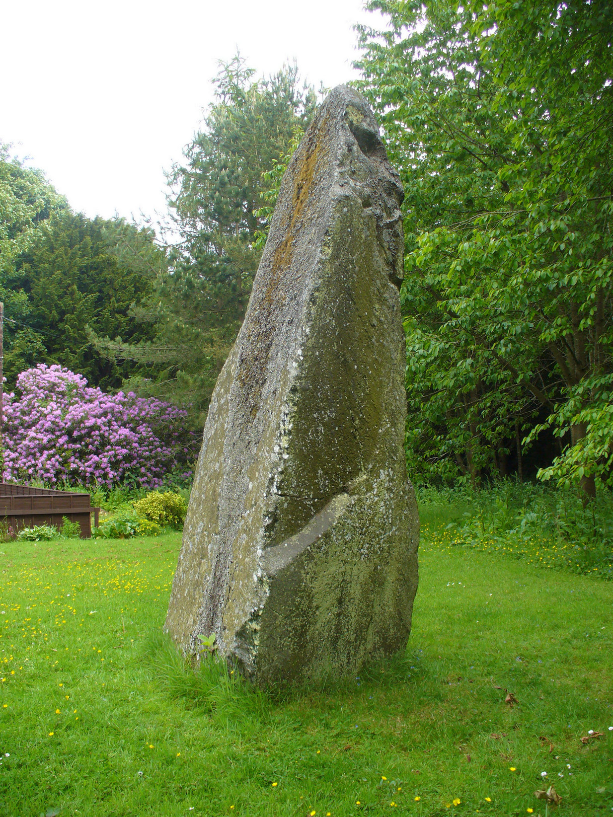
Standing Stone: OS Grid Reference – NS 60889 87739
Also Known as:
- Canmore ID 45305
- Knockcraich
Knockraich standing stone
From Fintry village take the B822 road towards Kippen. Only half-a-mile (0.8km) along, take the track on your left to Knockraich Farm and cafe. Go all the way through the farm along the track and out the other side then follow the fence downhill across the field. At the bottom, go through the gate towards the stone which you’ll already be able to see ahead of you, in the next field. Y’ can’t miss it!
Archaeology & History
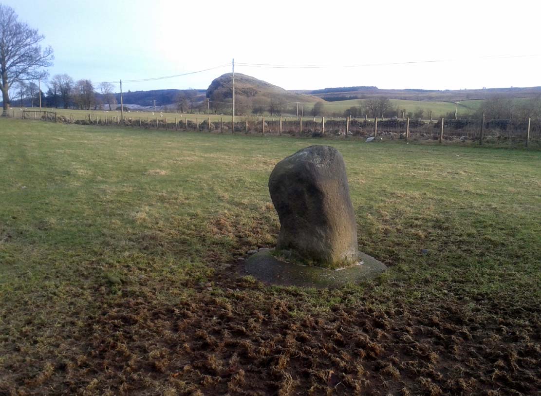
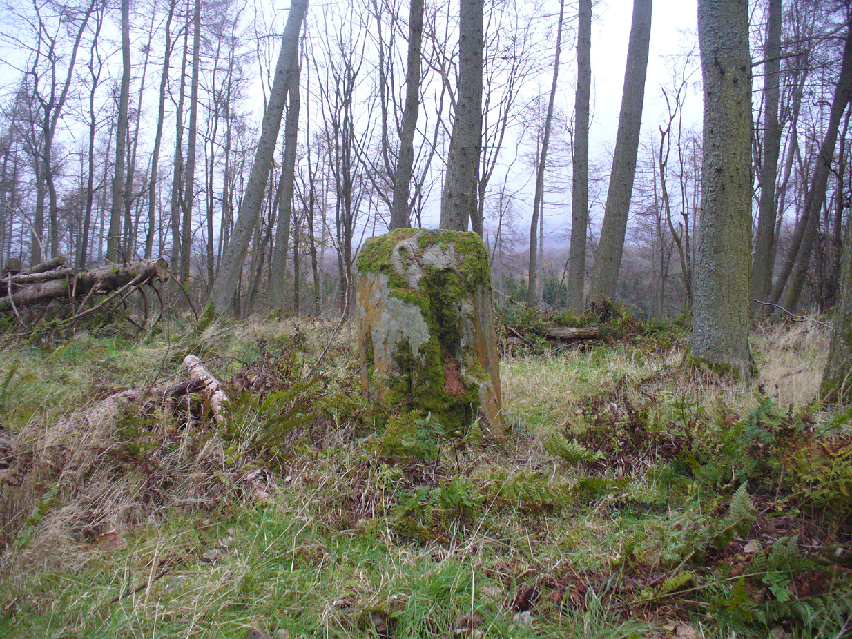
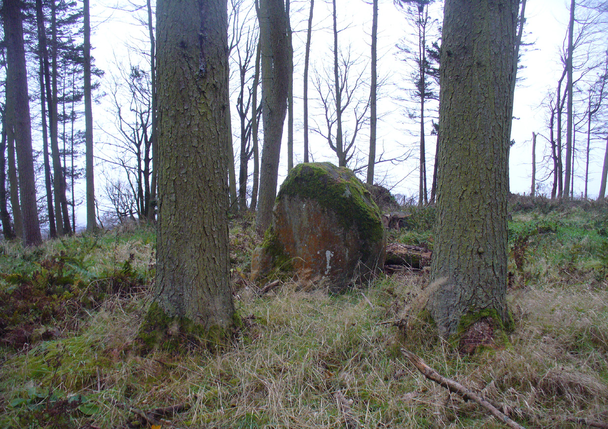
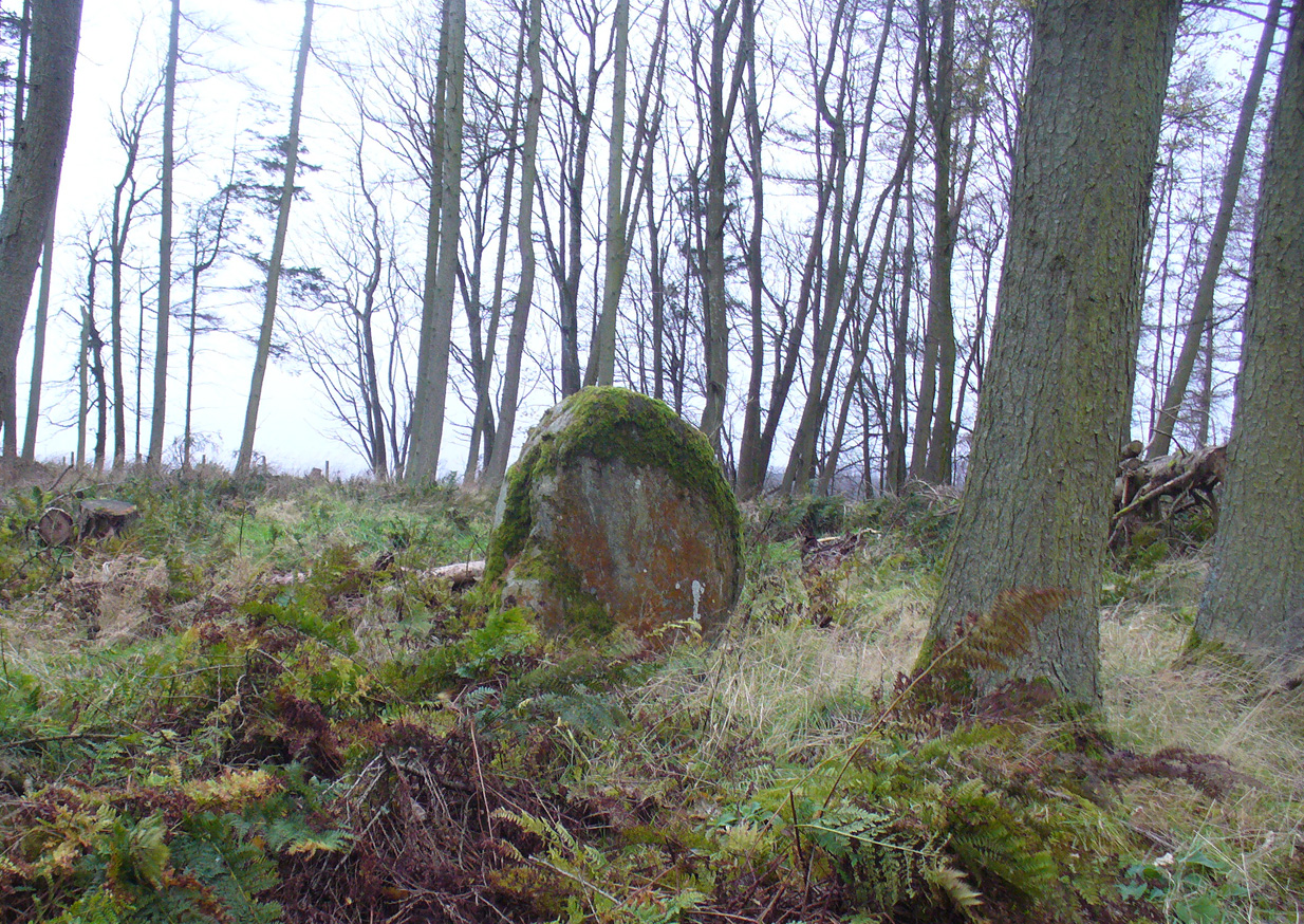
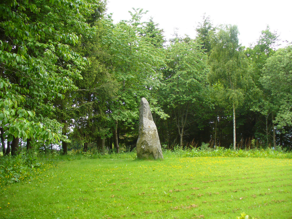
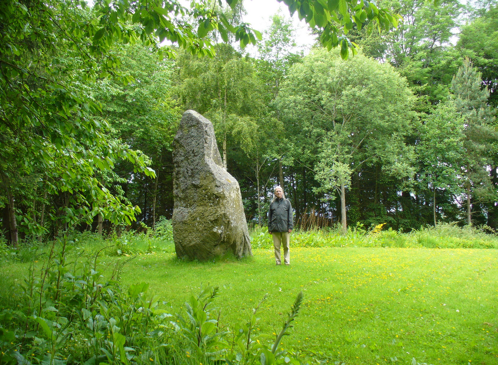
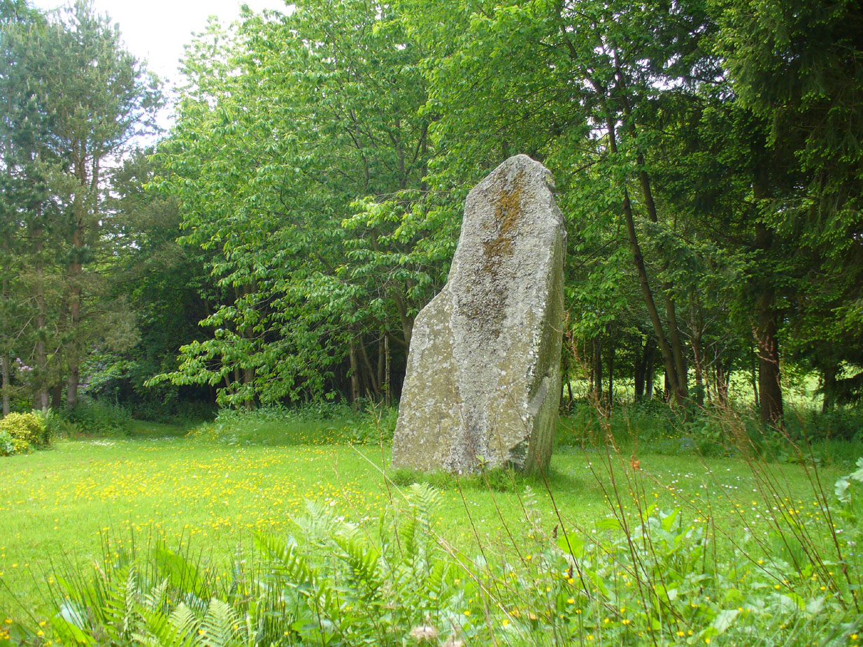
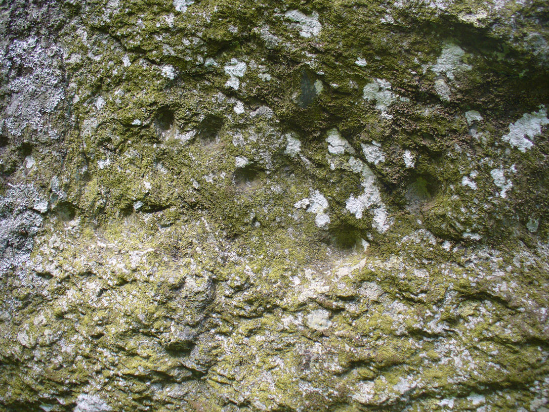
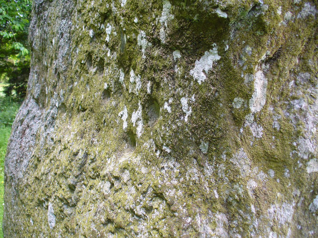
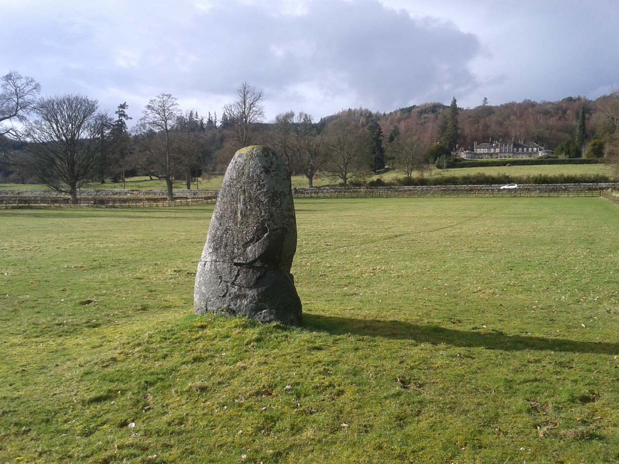
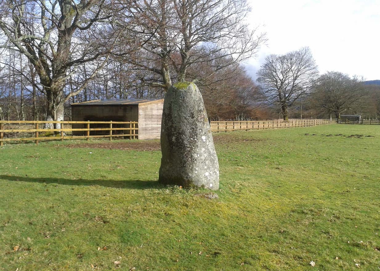
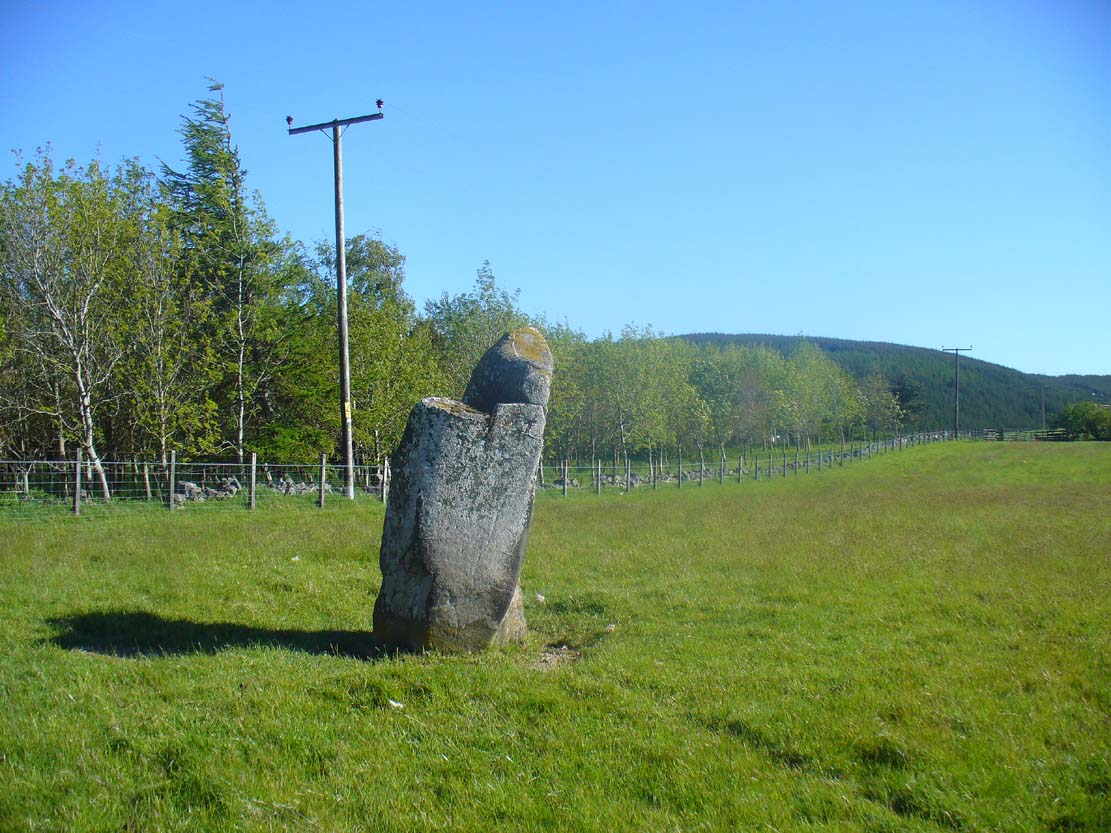
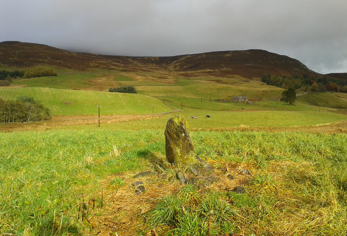
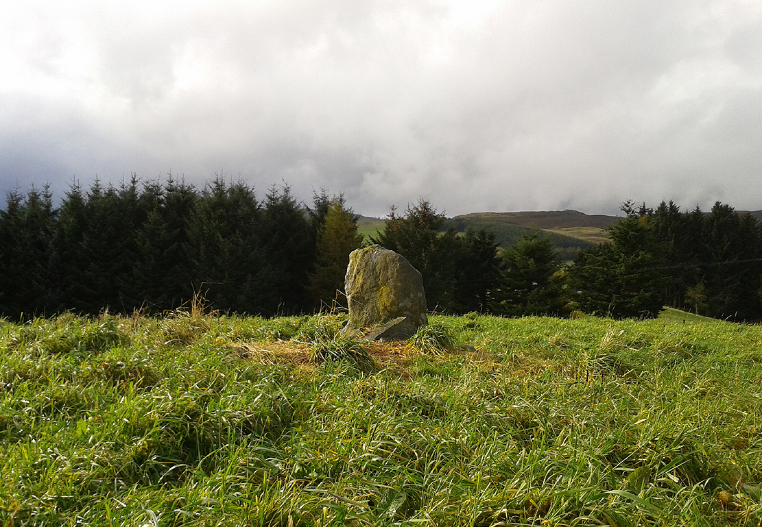
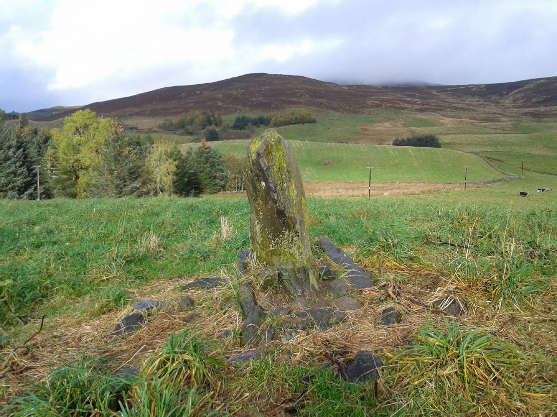
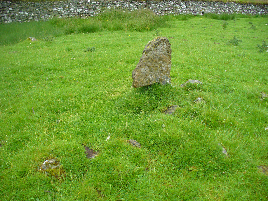
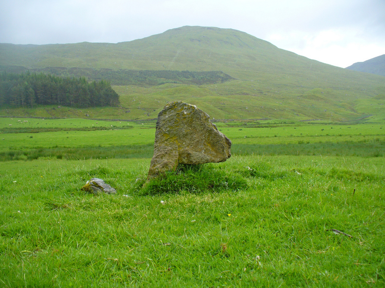
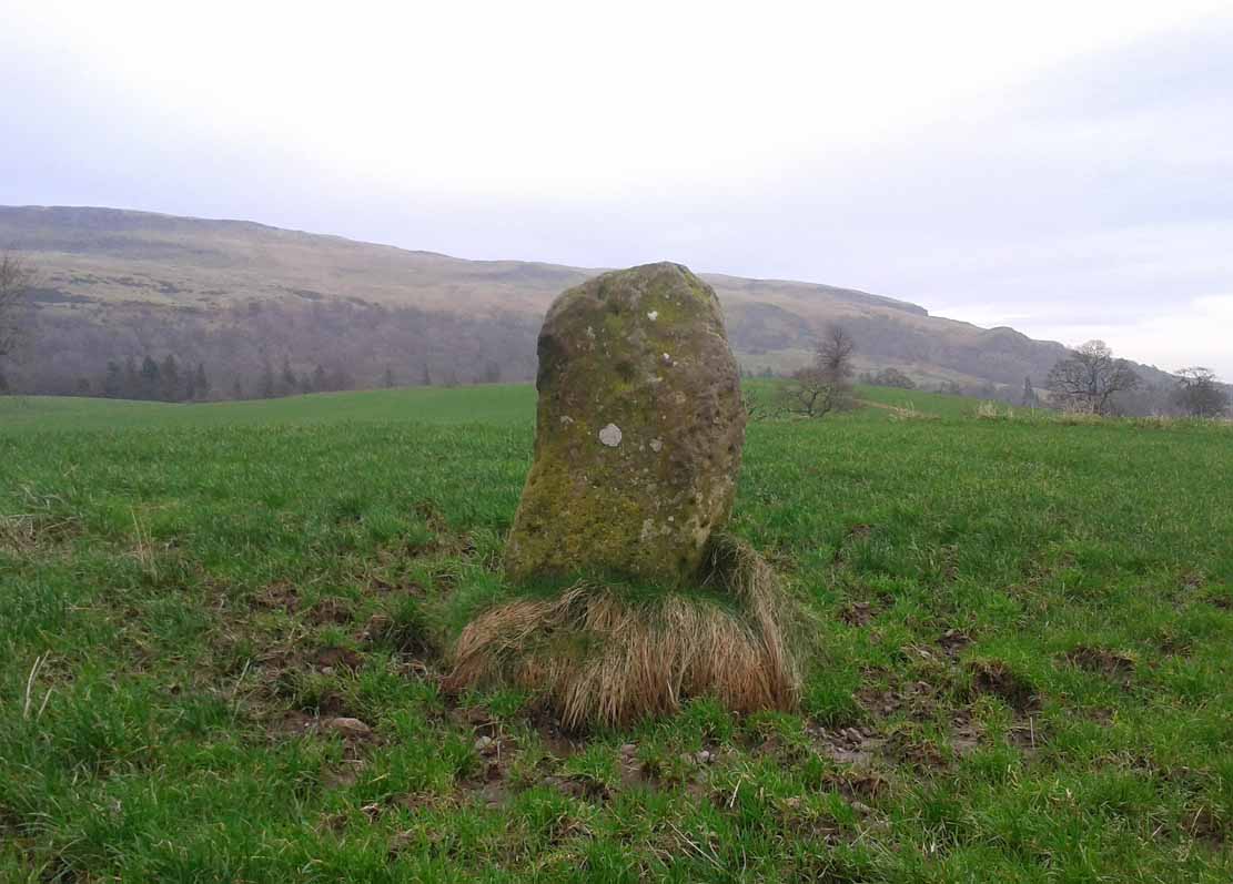
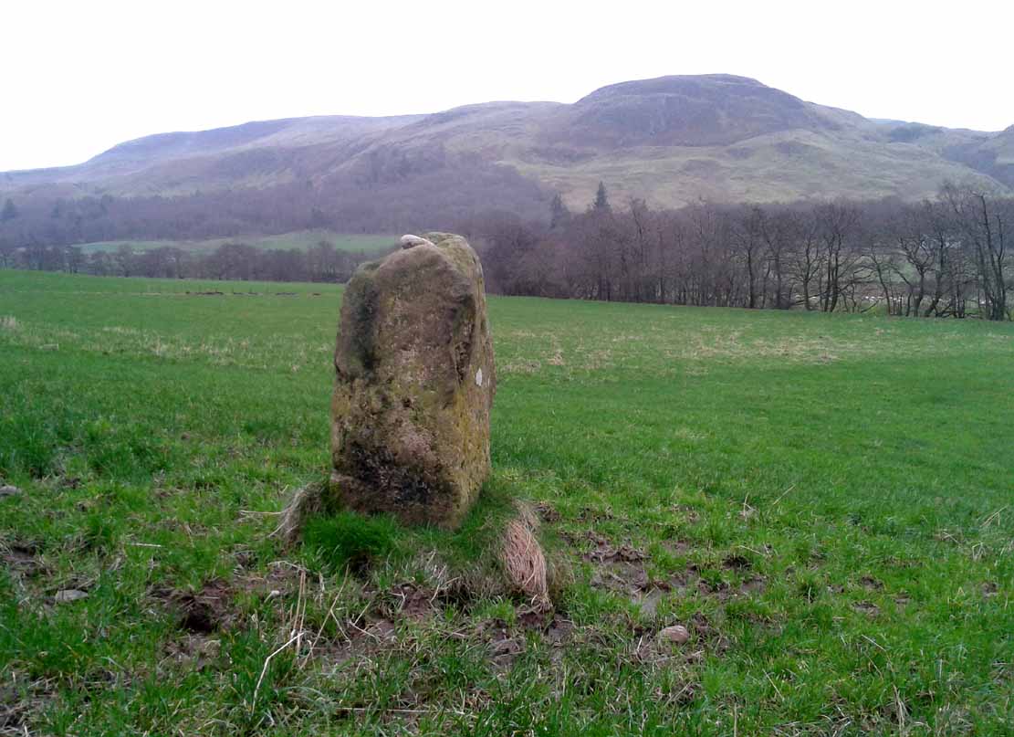
This little-known four-foot tall monolith standing alone in the fields northwest of Fintry, just above the River Endrick, is a fascinating little fella! It stands at the western end of an elongated rise in the land, almost as if mimicking an ancient long barrow. But more intriguingly (for me at least) are the cup-markings that adorn each of its four sides.
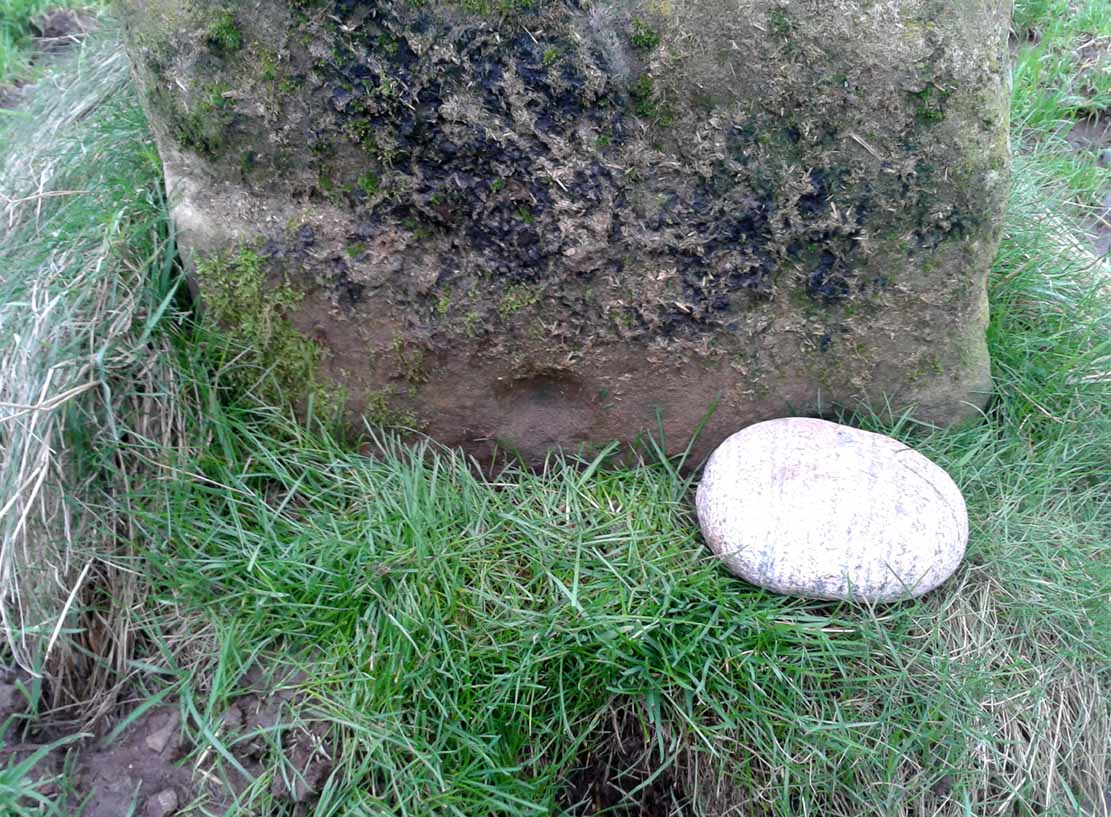
Cup-mark at base of the north side
Cup-mark near top of west face
Upon first glance it seems that there are a number of such cup marks on the stone, but further inspection shows that only one occurs on each of the four faces. Near the very bottom of the stone on its north and south sides a single large cup-mark has been etched; and on its east and western faces, the cup-mark has been carved further up towards the middle of the stone, with the east-facing side having a groove running from near the top and stopping at the cup-mark. On top of the stone is a large ‘bowl’ (possibly natural, possibly man-made—it is difficult to say with any certainty) and a single cup-mark next to it. When Nina, Paul and I visited here a few days ago, a palm-sized smooth stone was resting in the large bowl on top, akin to the healing and divination stones found placed in bullauns in Ireland and other parts of the world.
The first description of any length was cited in A.F. Hutchinson’s (1893) paper on the standing stones of Stirlingshire in which he wrote:
“This stone…is placed on the bank rising up from the river. In shape it is approximately square—the two sides facing nearly east and west, measuring each 1ft 7in, the north face 1ft 6in, and the south 1ft 3in. These dimensions are uniform from top to bottom. The total girth is therefore 5ft 11in, while the height is 3ft 8 in. Orientation 225º. There are a number of cupmarks both on the top and side, as well as having several incised lines and other markings, some of which, however, give evidence of recent sculpture.”
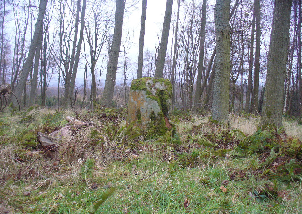
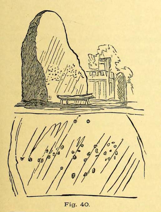
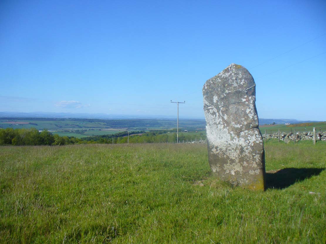
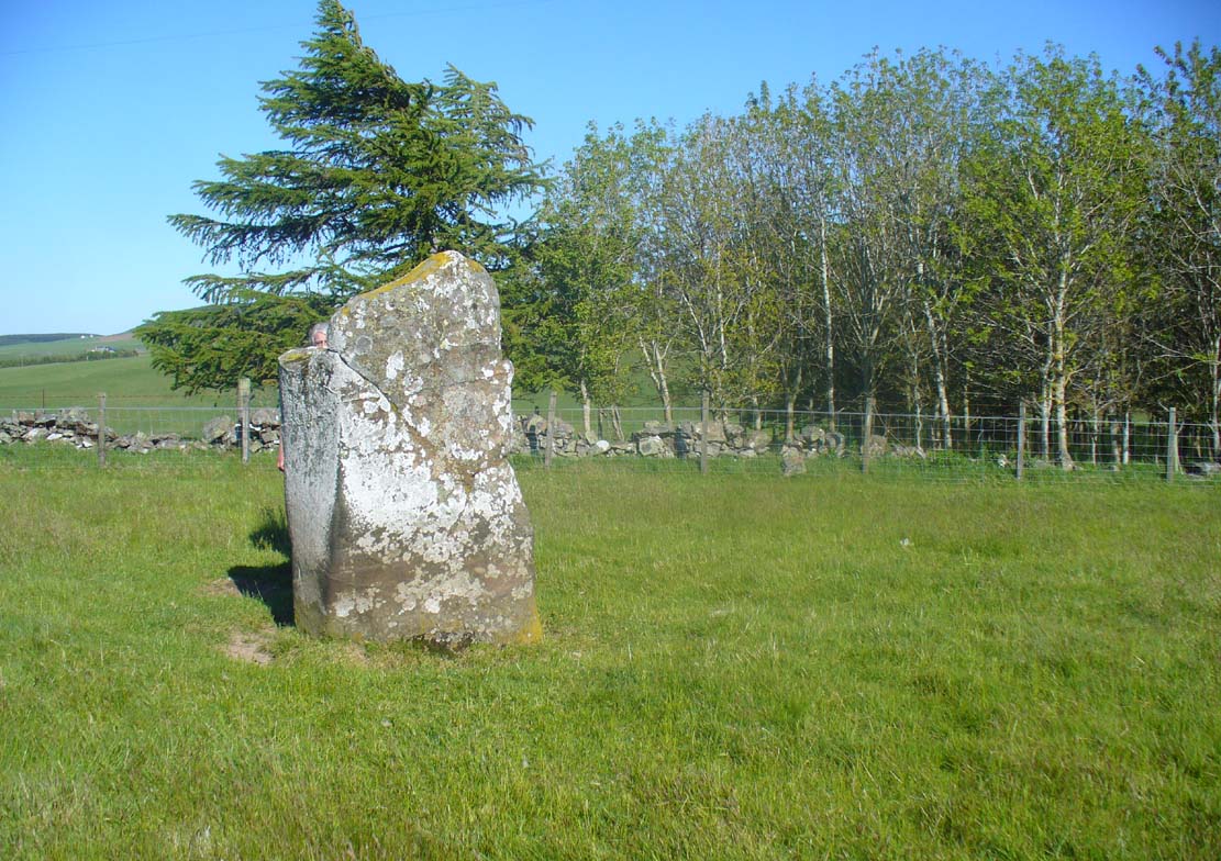
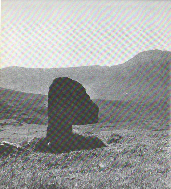
Knockraich stone, looking south at Dunmore hillfort

Cupmark, hollow & stone on top
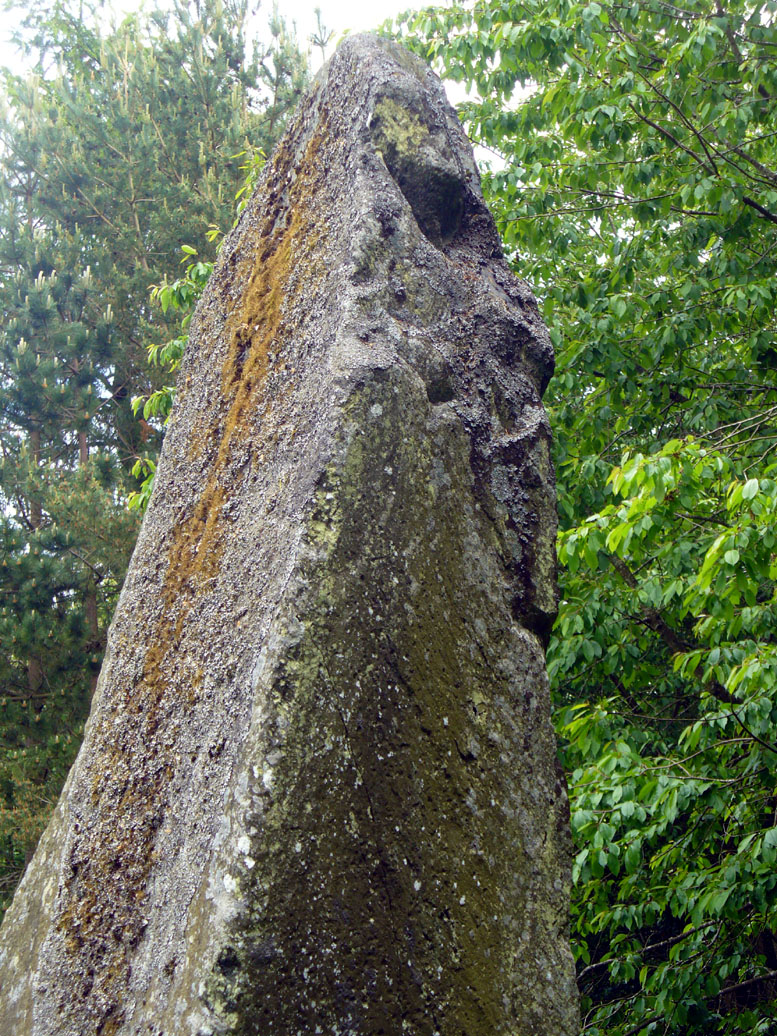
The more modern or “recent sculpture” was that of a human figure, now very faint, etched onto the most western face of the stone, beneath a large solitary cup-mark. When the site was visited and described by the Royal Commission (1963) lads, they gave a lengthier description of the carved elements on the stone, telling us that:
“On the top, which has been brought to an irregularly rounded point, there is an almost circular hollow measuring 5½in to 6in across and 2½in in depth; it is difficult to suppose that this is other than artificial, although its bottom shows differential weathering. The SE side of the stone shows several natural cavities, and a deep and wide vertical groove which is also presumably natural. The NW face seems to have been flattened to a certain extent, a slight ridge which is visible along part of either margin probably representing a survival of the original surface. On this face, 12in above the ground, a human figure has been outlined in pocked technique. It is in full-face, the features being indicated by pocked marks; the arms are extended jut below the level of the shoulders and the legs are widely spread with the feet turned outwards. The lower edge of a tunic or short kilt seems to be indicated by a single line between the legs. The figure is 8in heigh and measures 7in in breadth between the hands and 7½in between the feet. This face of the stone also shows a number of small natural cavities, together with a shallow cup which has a somewhat artificial appearance; this cup is in the centre of the face and 2ft 4½in above ground level, apparently at the upper margin of the flattened area. The figure lacks any distinctive characteristics which might afford evidence of date, but it may be relatively modern…”
Folklore
Mr Hutchinson (1893) told that,
“The stone seems to have brought down through the ages a tradition of sanctity in connection with it, as there is a legend to the effect that any attempt to move it is attended by convulsions of Nature and evil consequences to the rash disturber.”
Whether the position of the water-worn smooth rock found in the bowl on top of this standing stone has any ancient tradition, records seem silent on the matter.
References:
-
Hutchinson, A.F., “The Standing Stones of Stirling District,” in The Stirling Antiquary, volume 1, 1893.
- Royal Commission on the Ancient & Historical Monuments Scotland, Stirling – 2 volumes, HMSO: Edinburgh 1963.
- Royal Commission on the Ancient & Historical Monuments of Scotland, Archaeological Sites and Monuments of Stirling District, Central Region, Society of Antiquaries of Scotland 1979.
- Smith, H. Guthrie, Strathendrick and its Inhabitants from Early Times, James Maclehose: Glasgow 1896.
Acknowledgements: Many thanks to Nina Harris and Paul Hornby for their help and attendance at this old stone.
© Paul Bennett, The Northern Antiquarian