Dun Chonallaich, Ford, Argyll

Hillfort:  OS Grid Reference – NM 8544 0366
Getting Here

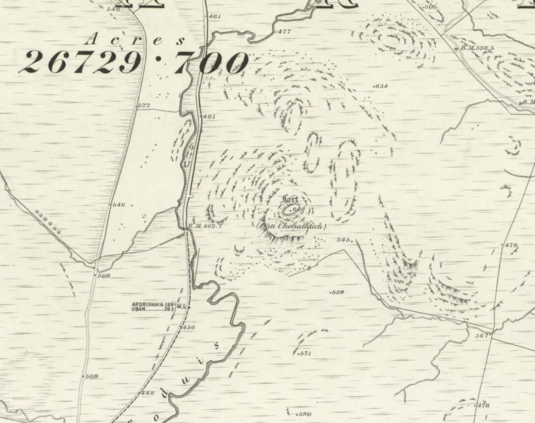
Dun Chonallaich on 1875 map

There’s two real ways to get up here: one from the Oban-Kilmartin roadside; the other from Ford village. I’d go for the latter as it avoids the traffic. Walk up the track to Salachary from the village centre, heading west. It’s a gradual uphill climb and after about half-a-mile (past six or seven cup-marked rocks) the great hill rises to your left.  Dun Dubh is to your right.  Climb over the fence and head for the hilltop.

Archaeology & History

It’s my opinion that this fort, above all others in the region apart from Dunadd, was of paramount importance to our prehistoric ancestors.  The reason being that it’s the great pyramidal hill to which the line of tombs in the Kilmartin Valley align, three miles to the south.  This prehistoric alignment was quite intentional (if you’ve got your doubts, gerrup there & have a look for y’self — you’ll soon change yer mind).
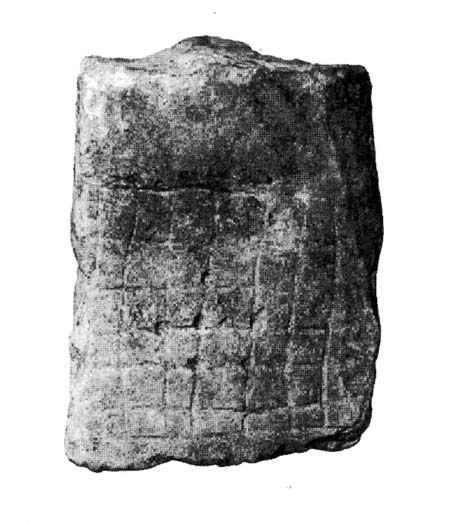
Curious carved stone found here

The main part of the structure is an irregularly-shaped construction with walling on all sides, measuring about 40 yards by 20 yards.  Much of it is pretty well defined – though has been vandalized by various doods in the past: one bunch being a film-crew who used the site in the early 1980s!  Inside the main walled fortress are several ruins.  The Royal Commission (1988) report told:

“Much of the interior is occupied by a rock spine which is surmounted by a modern cairn, but the NW half is relatively level and it contains, in addition to the modern round-house…and and an S-shaped structure associated with film-making, a number of ruined stone foundations.  On the north side there is a rectilinear building, and between the modern round-house and this rectilinear building, there is a further structure…an arc of walling, but its precise shape cannot now be determined without excavation.”

Dun Chonallaich means “the fort of King Connal’s people,” and although much denuded, is well worth the clamber for a short archaeological day out. A curious “gaming-board” was found here (see photo). A portable cup-marked stone in the fort’s southern wall is a modern artifact.

It’s a lovely view from up here too.  This is one of many places I’ve sat during a raging thunderstorm.  One helluva buzz, believe me!

References:

  1. Gillies, H. Cameron,The Place-Names of Argyll, David Nutt: London 1906.
  2. Royal Commission for Ancient & Historic Monuments, Scotland, Argyll – volume 6, HMSO 1988.

© Paul Bennett, The Northern Antiquarian
Drumderg (3), Tullymurdoch, Perthshire

Cup-Maked Stone:  OS Grid Reference – NO 18488 55054

Getting Here

Drumderg (3) petroglyph

Go up the A93 road from Blairgowrie, after 5 miles turn right at the Bridge of Cally and up Glen Shee.  After another 3½ miles, keep your eyes peeled for the iny road on the right signposted to the Drumturk Cheese farmshop.  Go up this long tiny winding road, a mile up past the cheese place (which are gorgeous btw!) and onto the open moors.  Keep on this road for another 2¼ miles where you can park up near the entrance to the huge wind-farm.  Walk up the track to the windmills, bearing right at the first junction, then right again at the next one.  From here, walk to the second windmill and from its base walk down, east, into the heather for about 80 yards. You’re damn close!

Archaeology & History

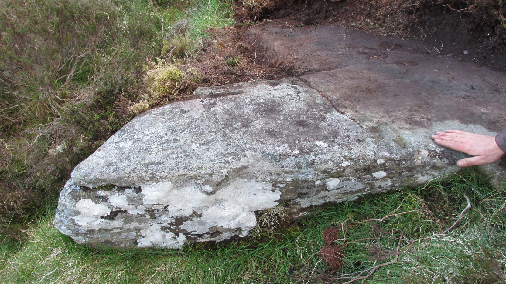
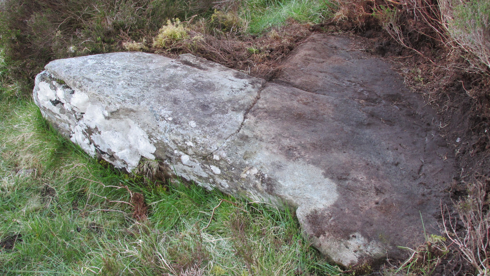
Drumderg (3) carving

On this T-square-shaped earthfast stone, a hundred-and-twenty yards north of the impressive Drumberg (2) petroglyph and just 10 yards below the remains of an impressive hut circle, we find this somewhat plain cup-marked design.  It was covered pretty deeply beneath the heather when we came here and it took some time before we could see what we were looking at.  The grey skies and poor daylight didn’t help matters either, as the cups were difficult to make out at first, but, thankfully, you can just about see them in the photos.

There are between five and seven shallow but distinct cup-markings on the flat surface, one of which may have a faint ring around it.  In truth, this carving’s only gonna be for the real geeks amongst you.

© Paul Bennett, The Northern Antiquarian
Druimyeonbeg, Isle of Gigha, Argyll

Cist (destroyed):  OS Grid Reference – NR 6463 4958

Also Known as:

  1. Canmore ID 38525

Archaeology & History

An old stone-lined burial cist could once be seen in this locale: reported in 1953 to have been “discovered in the southwest corner of a field south of Druimyeonbeg farmhouse.”  When it was uncovered by the farmer, the covering capstone was missing.  Any relics that may have been there were destroyed and there’s now no trace of anything.

References:

  1. Royal Commission on the Ancient & Historical Monuments of Scotland, Argyll – Volume 1: Kintyre, Glasgow 1971.

© Paul Bennett, The Northern Antiquarian

Machuim, Lawers, Loch Tay, Perthshire

Stone Circle:  OS Grid Reference – NN 68201 40156

Also Known as:

  • Lawer’s Mill

Getting Here

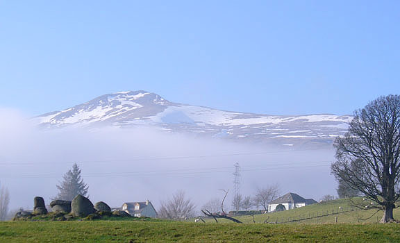
From the north-end of Loch Tay at Kenmore, follow the road (A827) round down the lochside, through the village of Fearnan and then another 4 miles down.  If you park up at the pub at Lawers, walk back up the road for ½-mile, keeping your eyes peeled up the slope on the left where you’ll see the circle visible from the road.

Archaeology & History

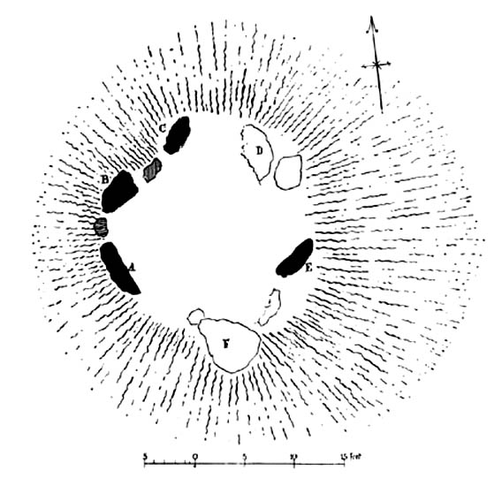
Much has been said of this fine old place – also known as Lawer’s Mill – which seems to have been first described by Thomas Pennant in his rambling Tour in Scotland (1772).  The local writer William A. Gillies (1938) told that after

“a recent examination of the ground around the circle…suggests that at one time there was an outer circle of stones concentric with the existing one. Most of the stones were removed in order to make more of the field available for cultivation, but there are still large stones buried within a few inches of the surface.”

Folklore

In J. McDiarmid’s Folklore of Breadalbane (1910) he tells of a man from Killin who, on passing by this old circle, heard haunting fairy music.  Being inquisitive, he walked up to see what was going on and walked into the circle where the little people were playing.  He was obviously lucky and the faerie-folk enjoyed his company, for when he left he was given the gift of a strong, fast, white steed.

Solar folklore may be…?

References:

  1. Gillies, William A., In Famed Breadalbane, Munro Press: Perth 1938.

© Paul Bennett, The Northern Antiquarian

Dalineun Isle, Loch Nell, Argyll

Crannog:  OS Grid Reference – NM 88350 26628

Getting Here

Take the A816 south from Oban and after 2 miles at the hamlet of Kilmore, turn left.  Follow the road for nearly a mile and as the loch appears ahead of you, stop!  The small island crannog is close by the bottom of the loch in front of you.

Archaeology & History

Curiously omitted from the Scottish Royal Commission inventory for Lorn (1974), when R. Angus Smith and his friends explored this artificial island in the 1860s and ’70s, he told:

“it is nearly round, not much larger than a good-sized cottage. It is surrounded by stones large enough to be difficult to lift, and in some places showing themselves to have been put together by art. It would appear as if there had been a pretty firm wall all round – very firm it could not be without mortar or heavier stones. Three or four feet within the range of stones is a raised turf-mound, as if this had been the wall of a house; the centre of the space was rather higher than the rest, and there we expected a fire-place to be found.”

Once they’d got onto the old crannog, Smith and his associates started digging, saying,

“by digging about three feet and a half, the ashes of peat were obtained, bones, charcoal and nuts. A very small hole was made, as we had not then received liberty to dig. We were satisfied that this had been a lake-dwelling, and that it had been defended by a wall. Advantage seems to have been taken of a shallow place, and stones must have been carried to it. It may turn out that there is a wooden foundation. It is not easy to see by what means the covering of earth now over the floor was so much raised. The water of the lake forms little or no deposit in summer; art rather than natural circumstances may have raised the soil. The bones here were split, as at the lake-dwelling in the moss.”

References:

  1. Smith, R. Angus, Loch Etive and the Sons of Uisneach, Alexander Gardner: London 1885.

© Paul Bennett, The Northern Antiquarian

Crooked Stane, Elvanfoot, Lanarkshire

Standing Stone:  OS grid reference – NS 96590 15333

Also Known as:

  1. Canmore ID 47316

Archaeology & History

Described by Tam Ward and Douglas Graham (1989) as “the only surviving standing stone in Clydesdale” (which isn’t quite true), this lovely looking monolith, leaning to one side, appears to have several cup-markings on its surface, but they’re actually Nature’s handiwork. The stone aligns to the hill a short distance north, Bodsbury Hill, upon which a fortress was later built sometime in the Iron Age.

I must have a wander round this region sometime: there’s some very attractive place-names nearby crying out for archaeo-attention to rub myself up and down upon!

References:

  1. Royal Commission on the Ancient & Historic Monuments of Scotland, Lanarkshire: An Inventory of the Prehistoric and Roman Monuments, HMSO: Edinburgh 1978.
  2. Ward, Tam & Graham, Douglas, Ancient Monuments of Clydesdale, CDC: Lanark 1989.

© Paul Bennett, The Northern Antiquarian


Creag a’ Chapuill, Ford, Kilmartin, Argyll

Hillfort:  OS grid reference – NM 8555 0244

Getting Here

Dead easy!  From Kilmartin go north towards Oban and turn right a mile onwards, to Ford and Loch Awe.  Keep on the tiny road for about 2 miles and if you hit the small Loch Ederline, you’ve gone too far.  To your left is a small hill-cum-small-mountain, scattered with trees and a great rocky face.   That’s it!  Whichever way you wanna approach its height is entirely up to you!

Archaeology & History

I clambered up and down this steep ‘crag of the horse’ many-a-times when I lived below here at the old farmhouse at Auchinellan.  Tis a grand old hill with good views all round.  The hillfort however has little left worth seeing, much of the stone being nicked by locals for drystone walls and barns. The best preserved section seems to be at the northeast side of the old hill. Archaeologists think that the mass of rubble nearby was also part of the fort walls in bygone days. Not being much of a hillfort fanatic, I can’t really comment!

On a decidedly mycological note, the magickal fungus of legendary repute, ergot (Claviceps purpurea), grows like the plague at the bottom of the hill (opposite the Creagantairbh standing stone). I wonder if our ancestors used it for owt in particular…?

References:

  1. Royal Commission on the Ancient & Historic Monuments of Scotland, Argyll – volume 6, HMSO: Edinburgh 1988.

© Paul Bennett, The Northern Antiquarian


Connel, Oban, Argyll

Standing Stone (destroyed):  OS Grid Reference – NM 9169 3408

Also Known as:

  1. Canmore ID 23281

Archaeology & History

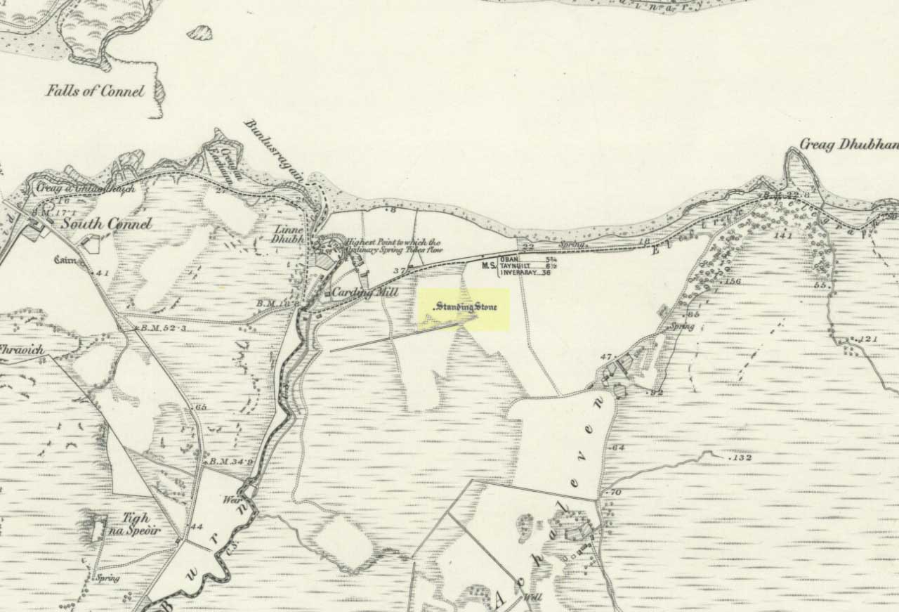
Connel stone on 1871 map

The Royal Commission for Historic Scotland (1974) recorded this “stone that formerly stood within the area now occupied by Connel Station,” which was thought to have been destroyed shortly before construction of the said building.  Thankfully the Ordnance Survey lads recorded its position on their cartographic ventures here in 1871.  Mr R.A. Smith (1874) also mentioned the site, albeit briefly, in his fine series of essays on the antiquities of Loch Etive, telling us:

“Above Connell Ferry we come to a small brook called Lusragan, and a few houses with a mill called Clachaleven. To the east, in a  field above the road, is a large standing stone, and around it marks where others, well remembered, lately stood.”

But sadly it seems, these have all gone.

References:

  1. Royal Commission for Ancient & Historical Monuments, Scotland, Argyll – volume 2: Lorn, HMSO: Edinburgh 1974.
  2. Smith, R. Angus, “Descriptive List of Antiquities near Loch Etive, part 3,” in PSAS, 10, 1874.

© Paul Bennett, The Northern Antiquarian


Cnoc na Croise, Ardminish, Gigha, Argyll

Cairns:  OS Grid Reference – NR 6439 4828

Also Known as:

  1. Canmore ID 38549

Archaeology & History

In Thomas Pennant’s A Tour in Scotland and Journey to the Hebrides, 1772 (1790:226), he described there being three prehistoric cairns about four-hundred yards west of Ardminish, or a couple or hundred yards north of the Achamore Standing Stone, on Cnoc na Croise, but they seem to have been destroyed.  At least two of them were between 4 and 5 yards across and contained cists.  A search for the site by the Royal Commission lads in the 1960s found nothing—although they may have been looking in the wrong place (the grid reference given above is an approximation).  Does anyone know anything more about these seemingly lost sites?

References:

  1. Royal Commission for Ancient & Historical Monuments of Scotland, Argyll – volume 1: Kintyre, HMSO 1971.

© Paul Bennett, The Northern Antiquarian


Cnoc na Carraigh, Gigha, Argyll

Standing Stone (destroyed): OS grid reference – NR 6426 4817

Also Known as:

  1. Canmore ID 38540

Archaeology & History

The Scottish Royal Commission (1971) reported a very large

“standing stone that stood 185m NNW of Achmore House (that) was removed at the beginning of the 19th century. It was reported that is measured 4.9m in height (16ft), 1.2m in breadth and 0.2m in thickness.”

A prehistoric cairn seemed to have accompanied this monolith—as reported by Thomas Pennant in 1772—but it too has been destroyed.  Pennant told us how the monolith was,

“a great rude column, sixteen feet high, four broad and eight inches thick.”

Not bad at all!  It was still extant, although leaning to the southwest in the year 1790 (OSA 1791-9); appearing to have been removed about 1800.  No trace of it remained when the Ordnance Survey lads looked here in 1869.

References:

  1. Royal Commission for Ancient & Historical Monuments of Scotland, Argyll – volume 1: Kintyre, HMSO 1971.

© Paul Bennett, The Northern Antiquarian