From the Askwith Moor car-parking spot, walk up the road (north) for 350 yards and go thru’ the gate on the left-side of the road, up along the track onto Askwith Moor. To get to it, walk on the footpath towards the trig-point on Shooting House Hill from the Askwith Road. Between 50-100 yards before the trig, walk into the heather to the right. Just 5-10 yards off the footpath, it’s there! If the heather’s grown back, don’t even bother looking for the place!
Archaeology & History
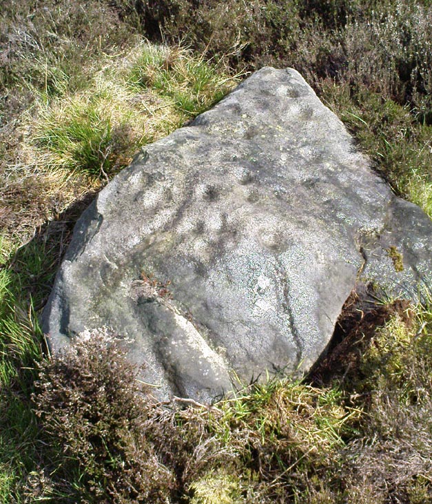
Although I add this as the remains of a small Bronze Age or neolithic settlement — which was found on August 3, 2005, in the company of Richard Stroud — subsequent walks up hereabouts in the surrounding heather has shown that, far from being a small independent site, it was part and parcel of a much greater prehistoric landscape all round here: with the remains on High Low Ridge immediately west; the cairnfields of Askwith Moor and Snowden Crags south and east; and numerous cup-and-ring stones scattered all over the place here. It’s a veritable minefield of archaeological remains, from the mesolithic to the Iron Age all over these moors!
Barely visible remains of wallingMore of the walling
We came wandering up here looking for another of Eric Cowling’s “lost circle” sites described in 1946, near Shooting House Hill, which Graeme Chappell and I looked for ten years previously without success. But on the August 2005 visit, much of the heather had been burned away. Instead of the lost circle however (which remains unfound, though something suspiciously like it is close by) we came across a well-defined, though small settlement complex. The walling of two well-defined near-rectangular structures emerge either side of a reasonably large boulder. Beyond these is further walling and what seems a well-defined hut-circle less than 10 yards away. Like many other sites on these moors, the walling seem to have been pretty much robbed for building grouse-butts. (hence the pictures here looking a bit sparse of stone!) Subsequent investigation found more neolithic walling which ran into the deeper heather — so it has been difficult to work out the full scale of it all.
The landscape from here stretches way off. To the eastern horizon (not far away) is the legendary Almscliffe Crag, with the rising hills of Rombald’s Moor due south; whilst far to the sunsetting west rises the great contours of Pendle Hill, to which legend relates some of the witches of the Fewston Valley, a mile below…
References:
Cowling, Eric T., Rombald’s Way, William Walker: Otley 1946.
Follow the directions to find the Tree of Life Stone, then follow the main footpath uphill from it. Once on the level, look out for a couple of large rocks abaat 100 yards to your left. Check ’em out, cos it’s on one of ’em!
Archaeology & History
This is another decent carving living on these prolific moors. Found near the end of a lengthy line of prehistoric walling that runs east-west over this part of the moor, the general Rorsharch-response to this carving is of some sorta skull or screaming face. My impression of it the other day was, “it looks like a pig!”
Although mentioned by numerous writers, the first description of it was in Eric Cowling’s (1937) essay on the cup-and-ring stones north of Otley, saying:
“On an isolated table stone, situated at the upper end of the shallow valley which drains Snowden Carr, the writer found a marking having a strangely skull-like appearance, but which is really a group of three large cups which are linked by inter-turning curved grooves.”
Close-up of main designThe Death’s Head Rock
He then strives to make links between this carving and the design on the Swastika Stone above Ilkley — which in some way is a little similar, i.e., as a three-armed triskele swastika; but the notion is perhaps as accurate as saying it represents a cloud, or a tree, or bird-flight, or any number of other natural phenomena. Beckensall’s (1999) brief note of the stone — despite getting his grid-ref off by a few hundred yards — described it as “four cups linked and enclosed by grooves, unconvincingly suggesting a skull to some people.” With Boughey & Vickerman (2003) saying:
“Fairly large, upstanding rock with surface sloping down to N. Figure of four cups linked by and enclosed by grooves: entire pattern resembles a skull, hence the name ‘Death’s Head Rock.'”
References:
Beckensall, Stan, British Prehistoric Rock Art, Tempus: Stroud 1999.
Boughey, Keith & Vickerman, E.A., Prehistoric Rock Art of the West Riding, WYAS 2003.
Cowling, Eric T., “Cup and Ring Markings to the North of Otley,” in Yorkshire Archaeological Journal, part 131, 33:3, 1937.
Cowling, Eric T., Rombald’s Way: A Prehistory of Mid-Wharfedale, William Walker: Otley 1946.
Get to the Fence Stone carving and walk up to the top of the hill about 50-60 yards away. Once on the long flat rock, walk less than 20 yards WNW until you see the stone in the picture.
Archaeology & History
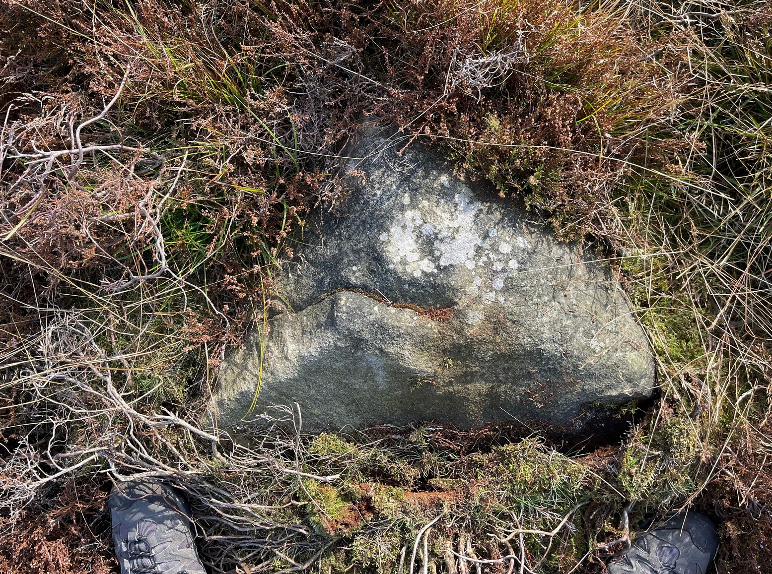
So named due to it being shaped like a little singular step on a stone, this cup-marked carving was first found in the middle of May, 2010, around the same time Michala Potts located the Snowden Crags cairn circle.
Step Stone, Snowden CragsClose-up of the cups
First described and illustrated on the Avebury Forum on June 3, 2010, this cup-marked rock is found in association with a number of (as yet) unexcavated prehistoric remains, close to some Iron- or Bronze Age walling and a distinct hut circle, close to one of the D-shaped enclosures 20 yards away.* When I first found it there seemed to be just two simple cups on it, but upon viewing it several times over the last few weeks in differing lighting conditions, it seems there may be as many as 4 cups on the southwestern face of the rock. In one of the images here, you get the impression that there could actually be five cups — but I’m gonna play safe and just say there are three such cups here.
* At least 3 large, prehistoric, D-shaped enclosures have been isolated on these moorlands, with diameters ranging between 15 and 80 yards. None of these have yet to receive serious archaeological attention!
From the Askwith Moor Road car-parking spot, walk up the road (north) for 350 yards and go thru the gate on your left. Once thru it, keeping walking up and along the edge of the fence following the line of the road until the path goes downhill. Near where it levels out, walk into the moor proper for about 150 yards or so. You’re close!
Archaeology & History
Cup-and-slight-ring stone, Askwith Moor
First found by Messrs Dave Hazell and Paul Hornby on the afternoon of Thursday, June 3, 2010, amidst scouring operations on the moors hereby. This large stone has one conspicuous cup on its south-facing slope with faint remains of a half-ring on its eastern side. A distinct arc above the immediate top of the cup joins up with the pecked quarter-ring section and may have been added to by human hands aswell, certainly giving it a half-ring effect. There are a couple of decent natural cups along the top-edge of the stone aswell.
A brief discussion then began as to why someone would only carve half a ring, or less, surrounding the cup-marking. But the fella doing this could have easily been distracted by a boar, a wolf, or even worse – his northern wife!
A little further west, barely 100 away, rising up the edge of the slope, Geoff, Dave and Paul found several more examples of what seem to be distinct remains of prehistoric cairns on the edges of High Low Ridge. Like Dave and Paul’s Boomers Stone, they aren’t in any previously published archaeological surveys either.
Same direction as for cup-and-ring carving 581. This small pyramidal stone (easily missed if you aint careful) is a yard or two away beneath the heather. You might have to scrabble round on the ground, but you’ll find it.
Archaeology & History
Faint cup-and-ring
The first description of this little stone was by Boughey & Vickerman (2003). Found amidst the cairnfield first mentioned by Cowling (1937), he missed this in his early days — but it’s easily done! All we have here on the very top of the stone is a “cup with a gapped ring”, fading away beneath elements and poor light conditions. As you can see in this photo, it’s hard to make out (so if you can get a good photo or two stick it on our Facebook group).
References:
Boughey, Keith & Vickerman, E.A., Prehistoric Rock Art of the West Riding, WYAS 2003.
Cowling, Eric T., “Cup and Ring Markings to the North of Otley,” in Yorkshire Archaeological Journal, part 131, 33:3, 1937.
From Askwith village go up the Moor Lane and at the crossroads go straight across, down and along Snowden Carr Road until the road levels out and, watch carefully, for a small crag of rocks in the fields above on your left. Keep a keen eye out for the gate into the field immediately below these rock, right by the roadside (it’s easily missed). This carving is the large rock sticking out on the slope in front of you thru the gate (carving 613 is lower down to the right).
Archaeology & History
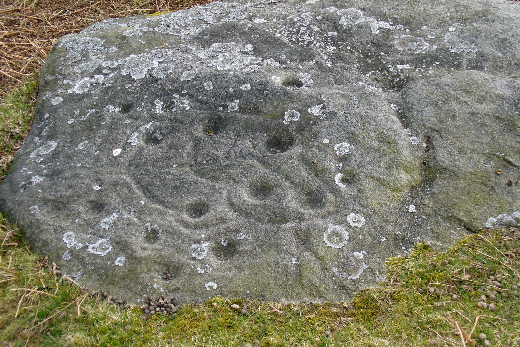
When seen in the right light, this carving’s a beauty! What you could call, an archetypal cup-and-ring stone. But the toll of time has played its part — on the uppermost section of the rock in particular. It seems as if the top, higher section of the boulder has always been exposed to the elements, whereas the slightly lower part of the rock has only been unearthed and exposed to the elements in more recent decades — perhaps by Stuart Feather, who made notes of some carvings in this region in 1973. This assumption is especially apparent when we look at the excellent, well-preserved multiple ringed design near the southern edge of the stone…and from where the carving gets its title, the Naked Jogger Stone.
Faint cup-and-ringsBoughey & Vickerman’s sketch
But let’s deal with the uppermost section of the stone first. There are various natural undulations and cracks over its surface and, at first sight, they can interfere or confuse some of the man-made carved aspects to this stone. But the main feature here — which becomes more and more noticeable the more you gaze and look — are at least two very faded multiple-rings surrounding faded central cups. It’s unknown whether or not these rings ever completely surrounded the cups, or whether they were actually left deliberately unfinished. The more faded of these two multiple-rings has between three or four cups around the outer ring at selected intervals (visible in the photo here). A few feet away from this we can also make out the faded remains of another cup-and-half-ring design. Several other cups have also been carved along this upper portion of the stone. When you sit above and look across this from the grass to the side, one may be forgiven for adding a solar interpretation to this section of the carving!
Lower section of carvingJogging male with large erection?
But another, more extrovert interpretation can be forgiven for the most notable aspect of this cup-and-ring stone. Near the southern edge of this large rock is the well-preserved multiple-ring design, surrounding a single cup. It’s impressive! And when you first see this you get the impression that it was uncovered in the very recent past (turf dug away obviously) as it is in such an excellent state of preservation. But there are other, odd-looking aspects below this primary feature: of cracks and lines and deep cups along this same level of the rock. The majority of the cups and lines on this part of the stone are in a much better state of play than the artistic elements on the upper layer of the stone. And one section of the carving in particular here gave me at least (pervert that I am!) the impression of a man running, with a distinctive hard-on sticking out in front as he’s jogging away! Keep looking at it in the photo here and see if that’s what you see as well. Note that the torso section of the ‘body’ (between his cock and the multiple-ringed head) is made-up primarily of a natural crack in the rock, but this should not be seen as unusual; for in rock art across the world, many of the natural cracks and markings on stones are regularly utilized. We know that such ‘cracks’ in rocks have been used by shamans as entrance points for their spirit to enter the rock itself.
Early carvings of humans in other parts of the world show bloke’s with hard-ons, either dancing or hunting — so why not here aswell, in deepest Yorkshire!? (check Dennis Slifer’s Serpent and the Sacred Fire for many North American examples) It could, of course, be little other than my very simple minds response to non-linear etchings in the old Rorscharch ink-blot style. Either way, it doesn’t really matter — unless of course you’re some academic or witchy character who’s after isolating early prehistoric fertility carvings for your thesis or religion. Oh – and there’s the more renowned Tree of Life carving a bit further up this hill, about 150 yards away: alleged in folklore to have been a place for Beltane rites—wholehearted fertility no less!
In the important archaeo-academia files, little has ever been written of this fine, ornate petroglyph. It was described by Boughey & Vickerman (2003) thus:
“About twenty cups, two very large, one cup having three rings and two more also having traces of three rings, with at least four others having parts of single rings, all very worn.”
Simple and to-the-point I suppose. But this old carving has much more grace and mythic history embedded within its scarred surface. It clearly speaks to other aspects of the landscape (as do some of the other carvings further up the hill, where oracular aspects predominate), but much more work is needed here before any archaeoholistic framework can be moulded. Nonetheless, this is an excellent meditation site!
References:
Boughey, Keith & Vickerman, E.A., Prehistoric Rock Art of the West Riding, WYAS 2003.
Slifer, Dennis, The Serpent and the Sacred Fire: Fertility Images in Southwest Rock Art, Museum of New Mexico Press: Santa Fe 2000.
From Askwith village go up the Moor Lane and at the crossroads go straight across, down and along Snowden Carr Road until the road levels out and, watch carefully, for a small crag of rocks in the fields above on your left. Keep a keen eye out for the gate into the field immediately below these rock, right by the roadside (it’s easily missed). This carving is the first rock on your right 10 yards through the gate.
Archaeology & History
Cup-marks on CR613
This relatively large, two-tier rock, has simple cup-markings on the topmost level of the stone: thirteen of them according to Boughey & Vickerman (2003). We looked at this last week, in poor daylight and were unable to ascertain how many cups were on the stone; and again yesterday when the conditions were excellent, and found there are at least fifteen cups carved on the rock. However, we didn’t really give this stone too much attention (bad of us, I know) as the calling of the adjacent Naked Jogger carving was sticking out demanding our attention!
References:
Boughey, Keith & Vickerman, E.A., Prehistoric Rock Art of the West Riding, WYAS 2003.
Follow the directions to reach cup-and-ring Carving 581 and this small stone is about 10 yards above it, up the slight slope amidst the heather. You might have to look around a bit though, as it’s a small flat stone and gets easily overgrown.
Archaeology & History
Broken cup-and-ring stone
Founds amidst a cluster of what Eric Cowling called “a barrow group,” or a cluster of cairns, is this excellent little carved stone, with a number of cup-and-rings close to what is now the northern edge of the rock. But this small stone has blatantly been split off from a larger piece (perhaps split in half), but a brief scramble in the heather here couldn’t locate the other part of the stone — which is a great pity. For although we have four or five cup-and-rings linking onto each other, where the stone has been split, one of the cups has been cut away and it seems obvious that there was more carved onto the other lost section of the stone — wherever it may be! There is the possibility that this stone was thrown down from a nearby cairn and was broken in the course of its movement; but we might only find this after the heather’s been burnt back in the near future. Anyway, Boughey & Vickerman (2003) discerned this as a
“small square rock with smooth level surface. Six cups, five with incomplete rings and some running into one and other.”
It’s a good one (despite what my poor photos may infer) and well worth a look at if you’re into your rock art!
References:
Boughey, Keith & Vickerman, E.A., Prehistoric Rock Art of the West Riding, WYAS 2003.
Cowling, Eric T., Rombald’s Way: A Prehistory of Mid-Wharfedale, William Walker: Otley 1946.
From Askwith village go up the Moor Lane and at the crossroads go straight across (Snowden Moor is to your left). Go down and along Snowden Carr Road until the road levels out and, watch carefully, about 500 yards on from the crossroads on your left you’ll see a small crag of rocks in the fields above. Stop and go through the gate walking up the field. At the top is a gate: go thru this and turn right, up the footpath for 100 yards, keeping your eyes peeled! You’re damn close!
Archaeology & History
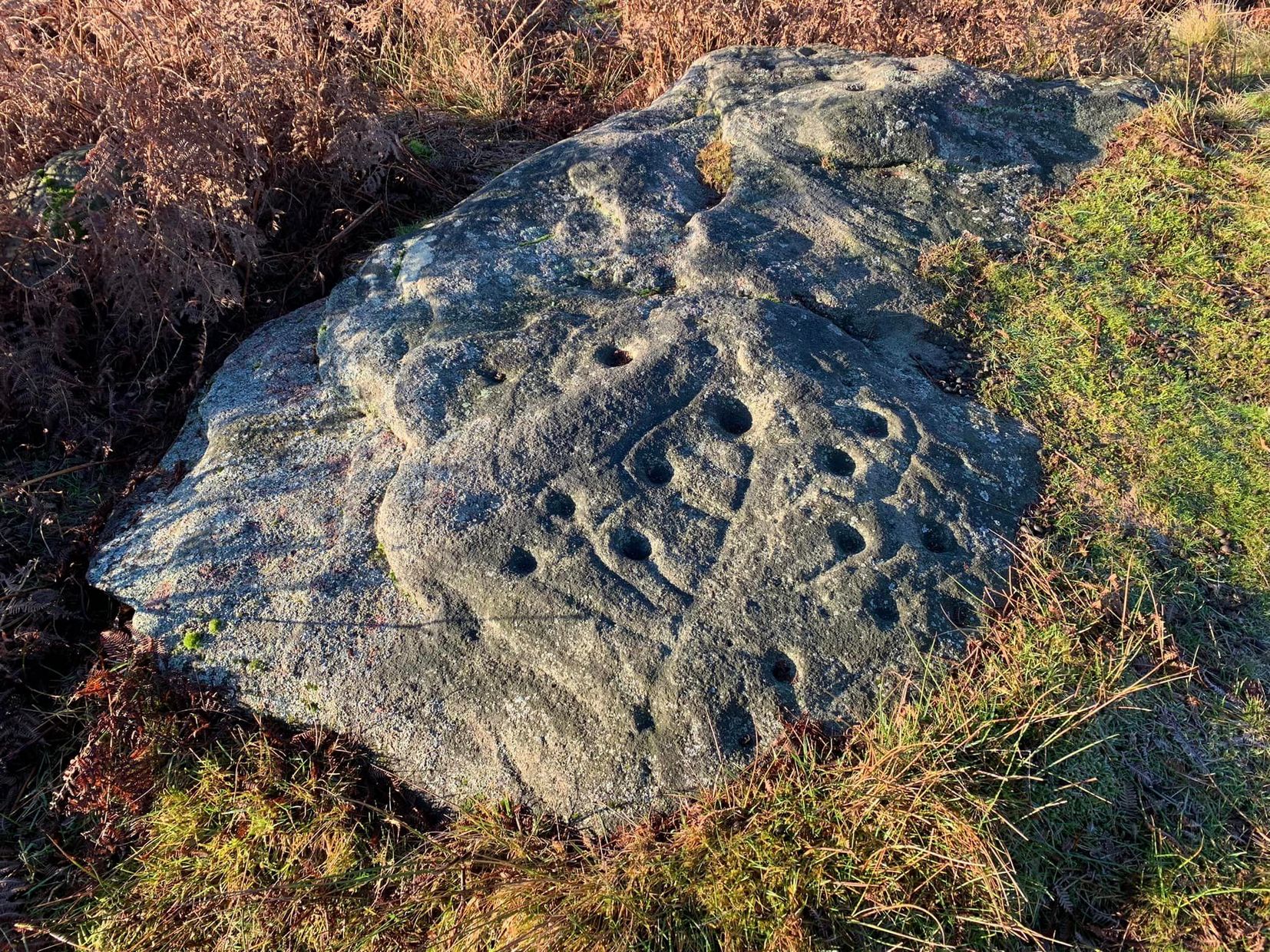
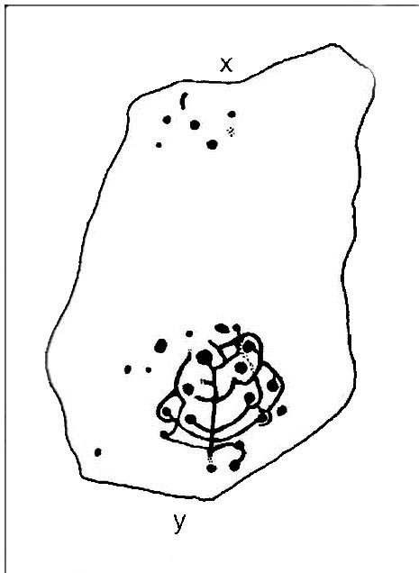
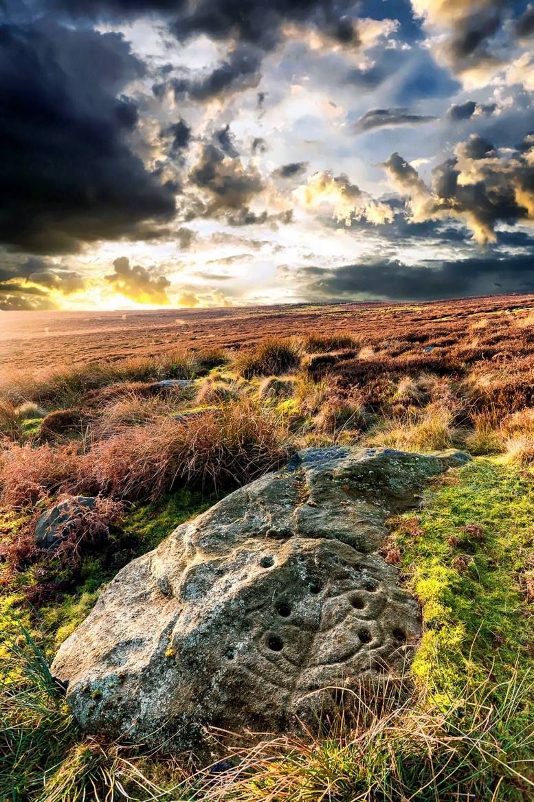
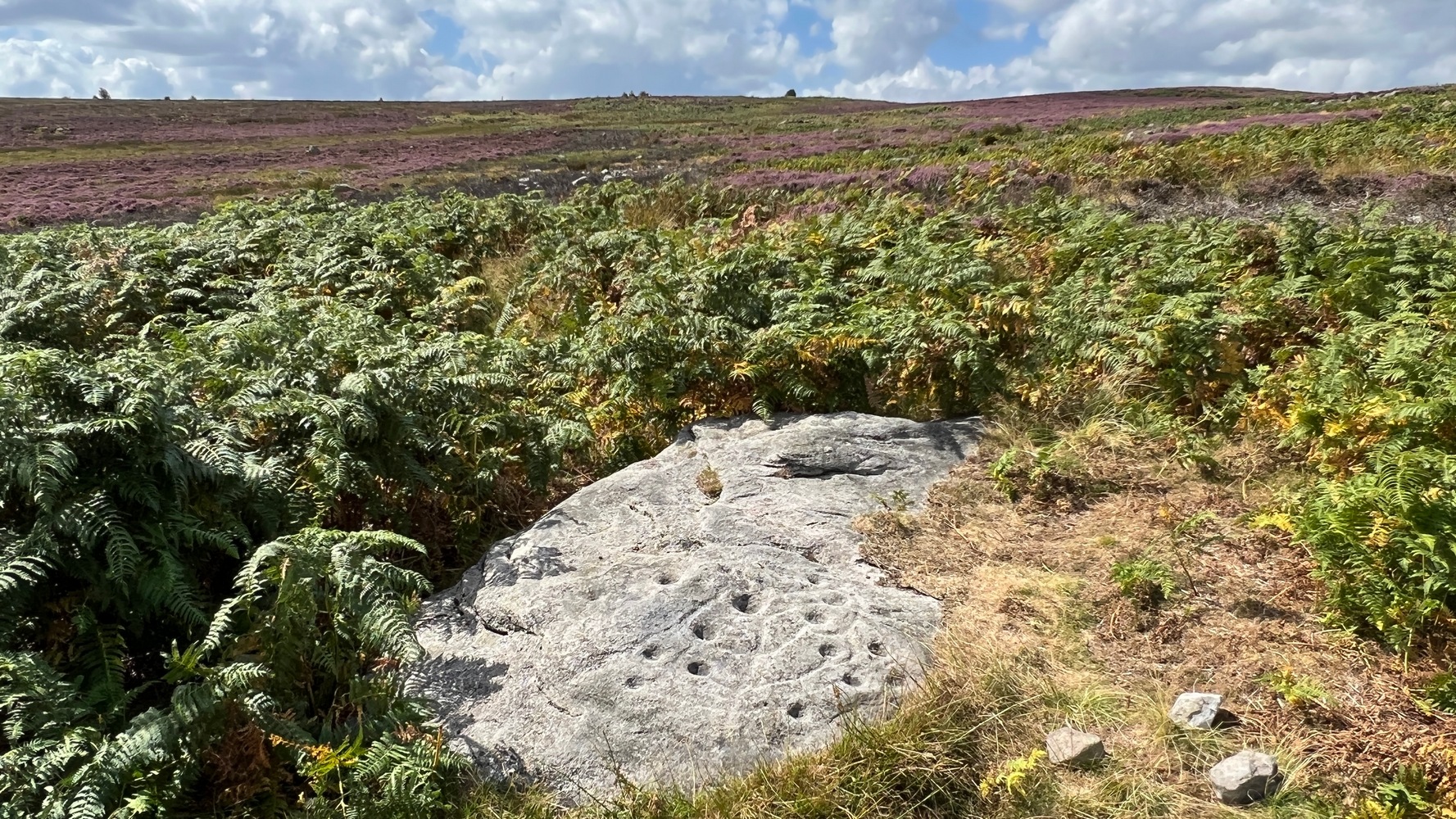
The most well-known and one of the more decorative of all the carvings in and around the Snowden Moor region is the Tree of Life Stone. In the 1930s, Eric Cowling first reported how, “this fine marking is the only one which appears to be known to the people of the district,” due in part to it being a site of local social activities (though nothing is said of this place in William Grainge’s [1895] survey). Cowling (1937) described the carving thus:
close-up of main featuresEric Cowling’s sketch
“This stone lies alongside the bridle path which skirts the southwest corner of the enclosed moorland above the hamlet of Low Snowden. A large flat rock surface at ground level has a number of cups joined together by a series of curved grooves, which in their turn are connected to a central straight groove. Immediately above the design, a broad groove has been cut across a raised central area as though to isolate the markings from several scattered cups which are to be found on the remaining surface.”
The modern surveyors Boughey & Vickerman (2003) tell us that this highly ornate stone comprises of,
“about 25 cups, with a group at the highest…end and a few isolated, but most in complex design with enclosing grooves suggesting a tree in fruit: hence the name ‘Tree of Life Rock.'”
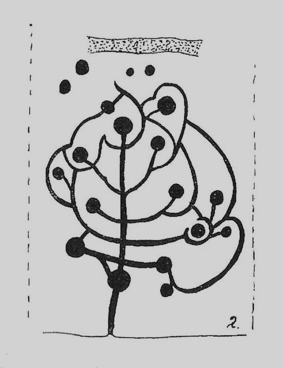
The Tree of Life StoneBoughey & Vickerman’s sketch
The Coped Stone carving is just a few yards away and, on the slopes below here — as well as on the moor stretching above you — there is an excess of prehistoric remains: enclosures, hut circles, lengths of walling, cairns, other cup-and-ring stones — the vast majority of which has yet to be excavated in any formal sense (are any rich doods out there reading this who might wanna get things going…?). It appears that both the Coped Stone and the Tree of Life carving may have been linked by some ancient walling that appears to run between them.
Another possible variant on the Tree of Life Stone has recently been uncovered on the outskirts of Ilkley; but on this newly-discovered example we find the central ‘trunk’ of the ‘tree’ is a natural crack that runs up the middle of the rock. Up the ‘trunk’ are several short branches with cup-marks on either side, not unlike apples on a tree. Altogether there are at least 12 cups and one ring, with several curious lines, some of which seem geophysical in nature. After several visits to the site, it’s obvious that the ‘tree’ design is more obvious and there are additional faint carved sections on the stone which weren’t visible when it was discovered in heavy rain and poor light.
This is one of very few cup-and-ring stones with folklore attached. Cowling (1937; 1946) reported it to be site of early morning Beltane (May 1) gatherings. The title of the stone, the Tree of Life, was one he heard local people call this site, but “no reason is offered”, he said. About 100 yards below this we find a curious erectile, fertility image on the impressive carving 612, which (he says tenuously!) may (and that’s a dodgy “may”!) relate to the Beltane rites at the Tree of Life.
Tree of Life in situ
In more modern folklore, the old earth mysteries writer Guy Ragland Phillips (1976) suggested the Tree of Life Stone to be an important focal point along one helluva highly speculative ley line: running from the Irish Sea, across land and the Tree of Life stone, continuing way east until hitting the North Sea! If this old ley did have any validity (it doesn’t!), the Tree of Life’s carved partners east and west of here — the Coped Stone and carving no.597 — would have also been on the same line.
References:
Boughey, Keith & Vickerman, E.A., Prehistoric Rock Art of the West Riding, WYAS 2003.
Cowling, Eric T., “Cup and Ring Markings to the North of Otley,” in Yorkshire Archaeological Journal, part 131, 33:3, 1937.
Cowling, Eric T., Rombald’s Way: A Prehistory of Mid-Wharfedale, William Walker: Otley 1946.
Phillips, Guy Ragland, Brigantia — A Mysteriography, RKP: London 1976.
Acknowledgements: Many thanks to James Elkington and to Yorkshire Daz for use of their photos.
Take the same direction as for cup-and-ring carving 582 from the Askwith Moor Road parking spot, walk up the road (north) 300 yards until you see the disused quarry on the moor to your right. From here, head down onto the moor, straight down past the quarry for about 200 yards, angling slightly to your right. You’ll notice some overgrown scattered mass of rocky ‘lumps’ in the heather — a cairnfield no less! — go just below these and watch out for some rocks emerging from the heather. This carving (and its neighbours) is on one of ‘em!
Archaeology & History
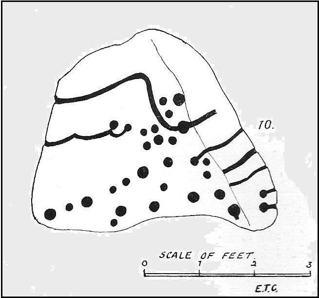
This impressive carving is one of a cluster of petroglyhs that are very close to each other, in the ruins of a cairn-field (though there’s some debate as to whether it’s medieval, prehistoric, or just quarry-spoil). Peppered with many cups on the upper surface of the stone, we also have carved lines and cup-marks along the east-facing edge of the rock aswell. I think it was Eric Cowling (1937) who was the first person to describe this stone (where he listed it as stone no.10 in his Otley survey), telling us that close to the Snowden Carr 582 carving,
“On the rise above No.9, is a cope-shaped boulder which is almost covered with cup markings and winding grooves. One broad groove winds from the ridge, rising from a cup, and is continued to the margin. Two cups are linked by a curve which is continued to the same edge. The eastern side of the stone is almost upright and bears two cups with grooves running to ground level.”
Due to the similarities in design on this stone and that of carving no.618 in Fewston valley bottom a half-mile away, Cowling thought that it likely that the same person did both carvings. Well….y’ never know!
References:
Boughey, Keith & Vickerman, E.A., Prehistoric Rock Art of the West Riding, WYAS 2003.
Cowling, Eric T., “Cup and Ring Markings to the North of Otley,” in Yorkshire Archaeological Journal, volume 33, 1937.
Cowling, Eric T., Rombald’s Way: A Prehistory of Mid-Wharfedale, William Walker: Otley 1946.