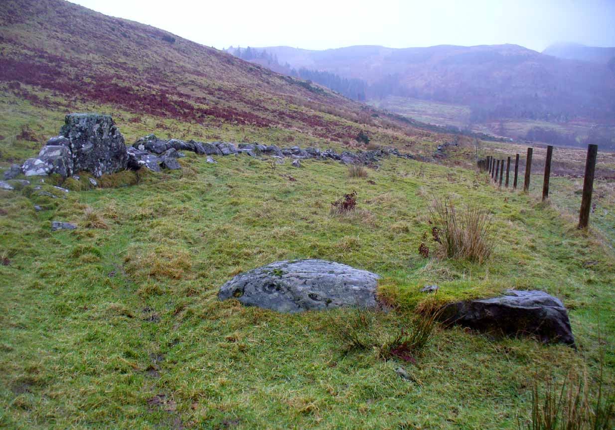
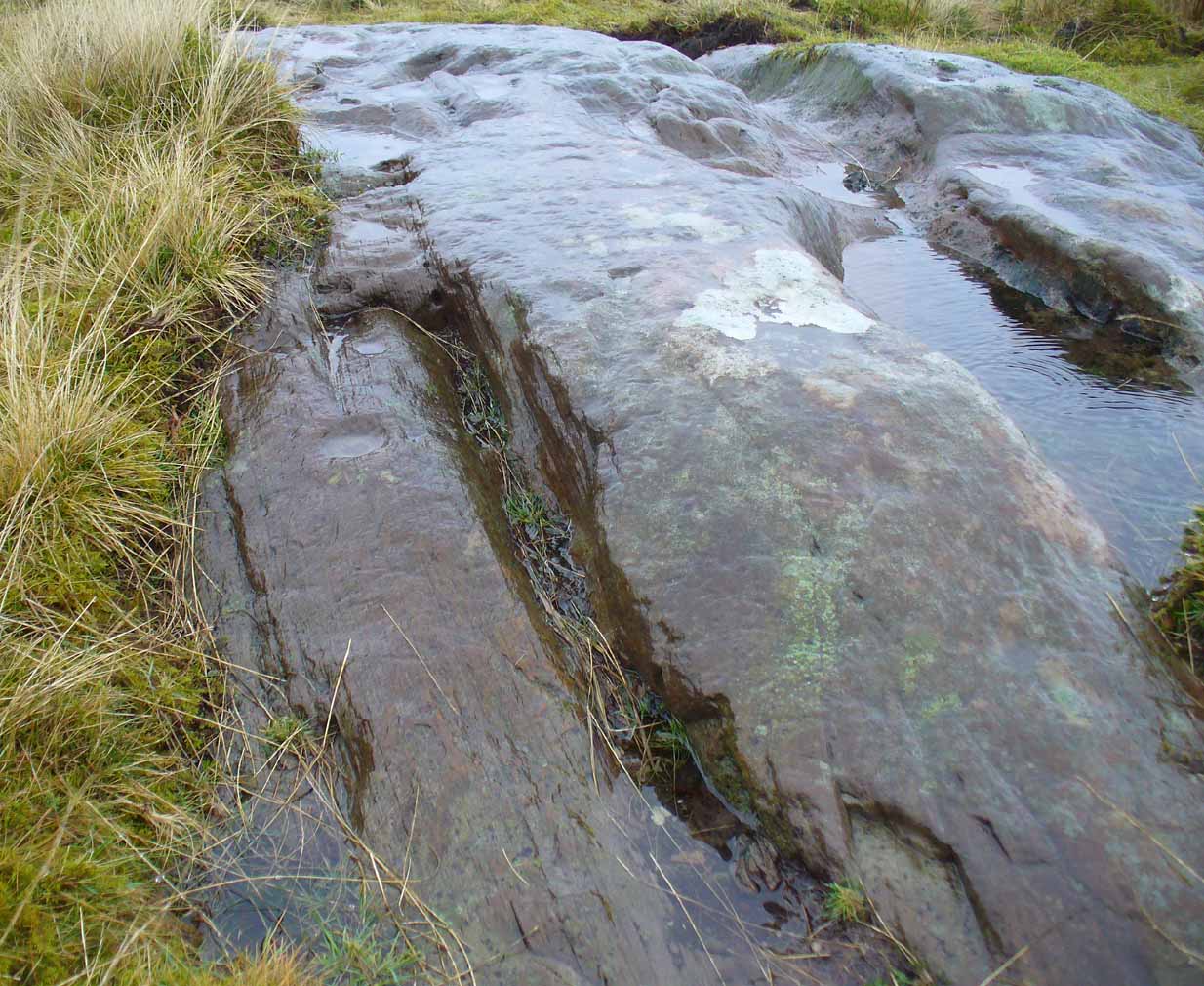
The easiest way to see this is to reach the Nether Glenny 2 Cairn, looking north to the slope a coupla hundred yards away, where you can see a long rock halfway up. If you can’t see it from here, walk to the impressive Nether Glenny 35 Carving, where the large long slab is much more obvious on the hillside. Walk through the gates to the Nether Glenny 37 carving and then diagonally up to the rock itself. You can’t really miss it.
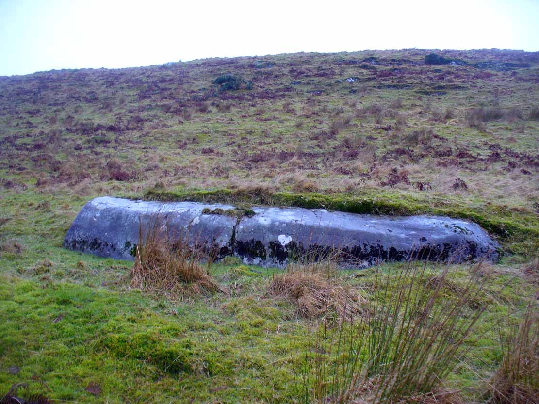
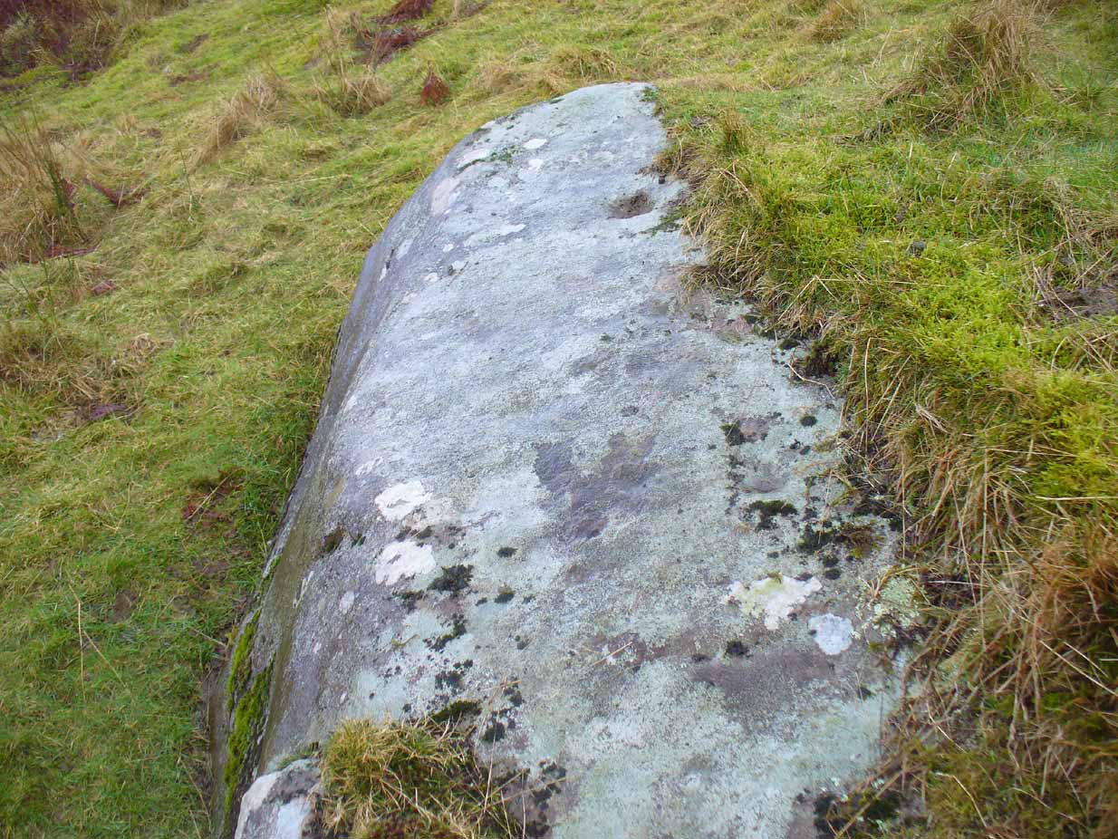
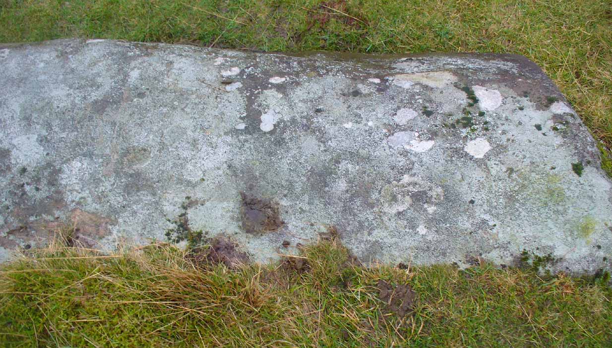
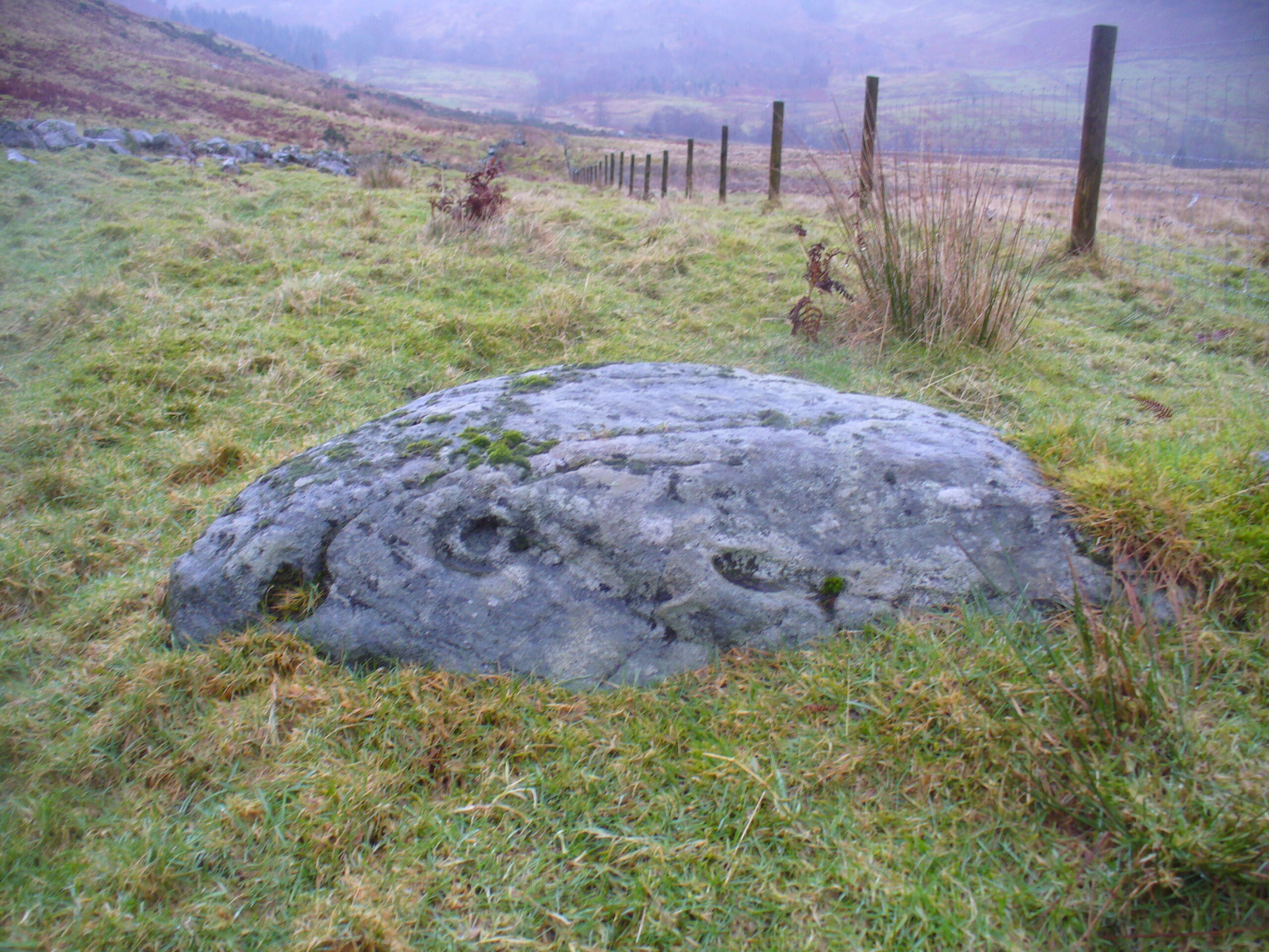
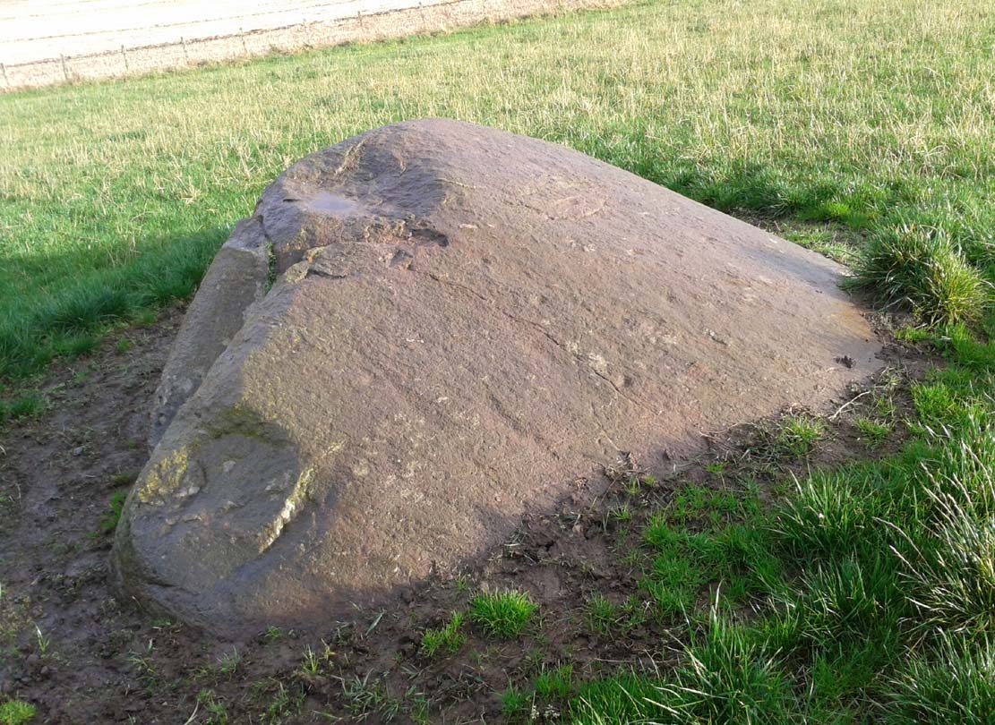
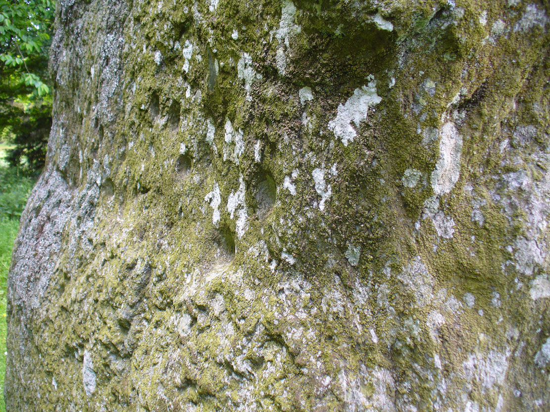
This 15-foot long stone halfway up the slope was said by the Royal Commission lads to have “four possible cup-marks” on it, whereas there are at least nine of them and maybe as many as eleven! Most of them are dead certs as prehistoric etchings, not just ‘possibles’.
Small faint cluster of cupsSome of the faint cups
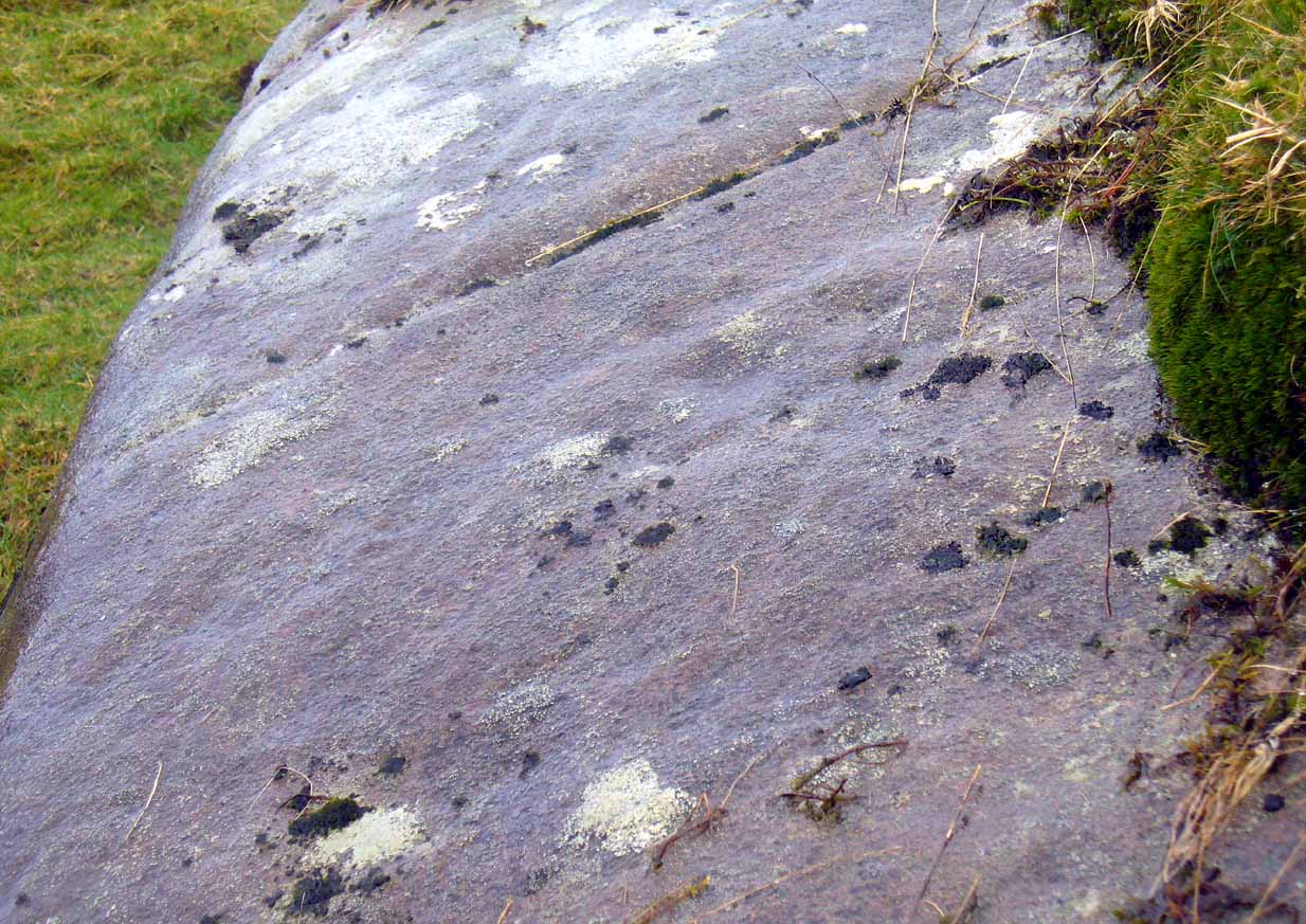
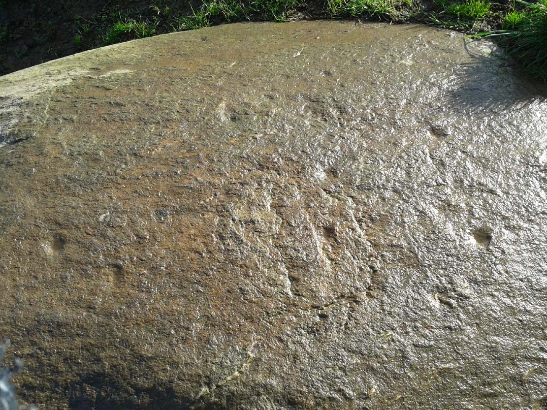
The more visible cup-marks here are found on the more western end of the stone, just below the grass-line. The cups here are quite distinct, measuring some two-inches across and nearly half-an-inch deep in two of them. The others in this section are a little smaller and further down the slope of the rock. Seemingly not noticed for a long long time however is a small cluster of very faded cups, gathered like a very faint 4-star Pleiades cluster more than halfway along out in the photo here (I hope!).
The biggest of the cups
This entire area is covered with cup-and-ring stones, possessing one of the greatest densities of carvings anywhere in Scotland.When we visited the place last week, Nature was pouring with rain, so we weren’t able to sketch the design. Something that we’ll hopefully amend in the near future!
About 1 mile west of where the B8034 meets the A81, between the Port of Menteith and Aberfoyle, a small road on the right (north) at Portend takes you up the single-track road to Upper Glenny. Go 2-300 yards up past Mondowie Farm and take the next track, left. Walk up through the gate for nearly 300 yards, going through the gate on your left and onto the fields. Follow the fence for 300 yards then go through the gate into the next field—past one of the Nether Glenny cairns—and walk across it until you reach an open gate at the far side, just where the hillside goes up. It’s nearly under your feet!
Archaeology & History
Close-up of the cup&ring
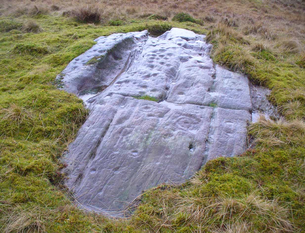
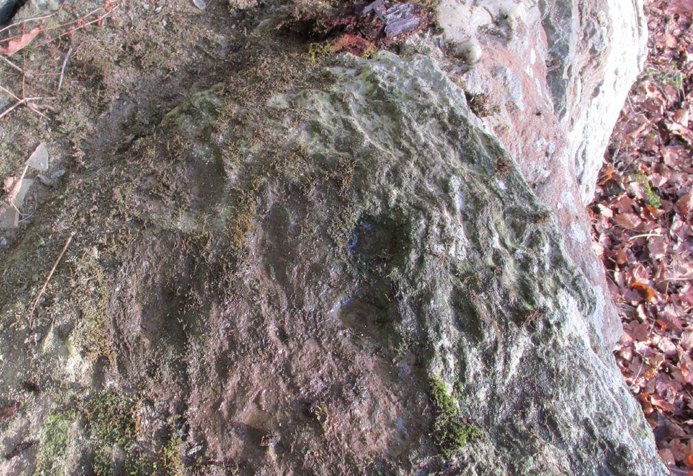
This single cup-and-ring carving, found amidst the massive cluster of both simple and highly complex petroglyphs between Ballochraggan and Upper Glenny, doesn’t seem to have been included in any previous surveys. It was located during the incredible rains yesterday on Sunday 7 February, wetting this and other rocks, enabling better visibility of otherwise invisible symbols faintly remaining here and on other stones. The carving appears to have been etched into naturally occurring notches and fissures. Certainly worth looking at when exploring the other incredible carvings on this hillside.
Take the same directions as if you’re visiting the nearby Nether Glenny 2 cairn. Once here, walk less than 100 yards further down into the same field, north, roughly parallel with the fencing. You’ll reach several large rocks, and the elongated one on the slight rise closer to the fence is the one you’re after. You’ll find it!
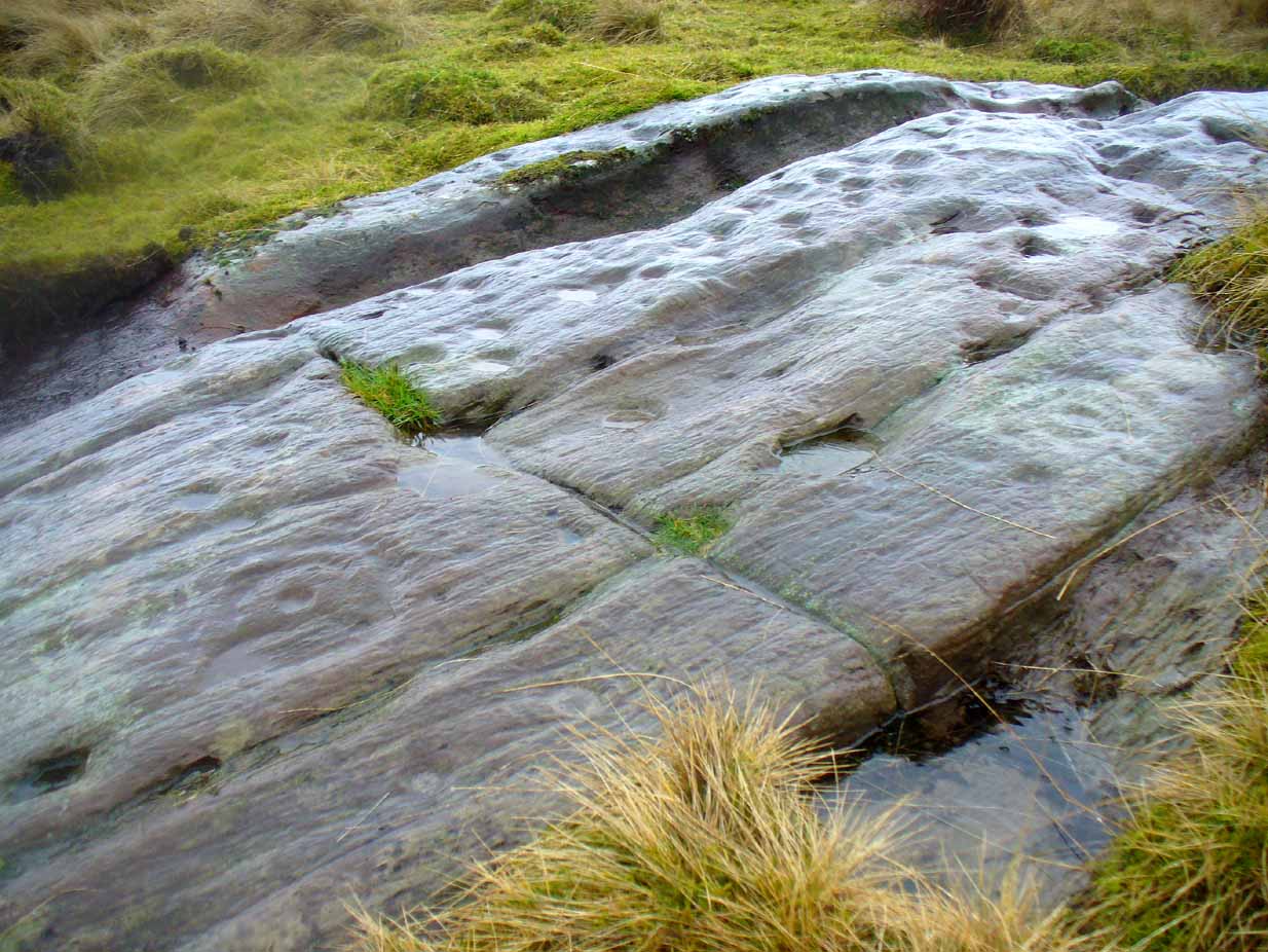
This is one in a number of impressive cup-and-ring stones scattered along this grassy ridge overlooking the Lake of Menteith and the Gargunnock Hills to the south. Petroglyph lovers amongst you will love it! And it seems that with each and every analysis, the carvings gives up more and more of its ancient symbolism. When it was first described (in a literary sense) by Maarten van Hoek (1989) he told it to be:
“Irregular outcrop with at least 72 single cups; 3 cups with 2 rings; 6 cups with 1 ring and 2 possible horse-shoe rings only.”
But when Kaledon Naddair (1992) visited the site a few years later he amended this initial description, telling us how,
“Further temporary turf removal extended the total to 124 solo cups, and 9 cups with 1 ring, and 5 cups with 2 rings.”
Cups & rings & cups….Western side of carving
Naddair’s description is closer to our own inspection, although I think that a small number of the ‘cups’ are natural. Other features that we’ve found occur on the more western side of the rock. A faint partial-double-ringed cup is accompanied a few inches away by a carved element that seems to have been unfinished. An initially indistinct circle, faintly pecked, has internal lines at the quadrants, akin to an early cross form. A line emerges from this symbol which also seems to have been slightly worked.
Subsequent investigations of this carving has uncovered much more which, to be honest, requires almost an entire re-write of this profile……
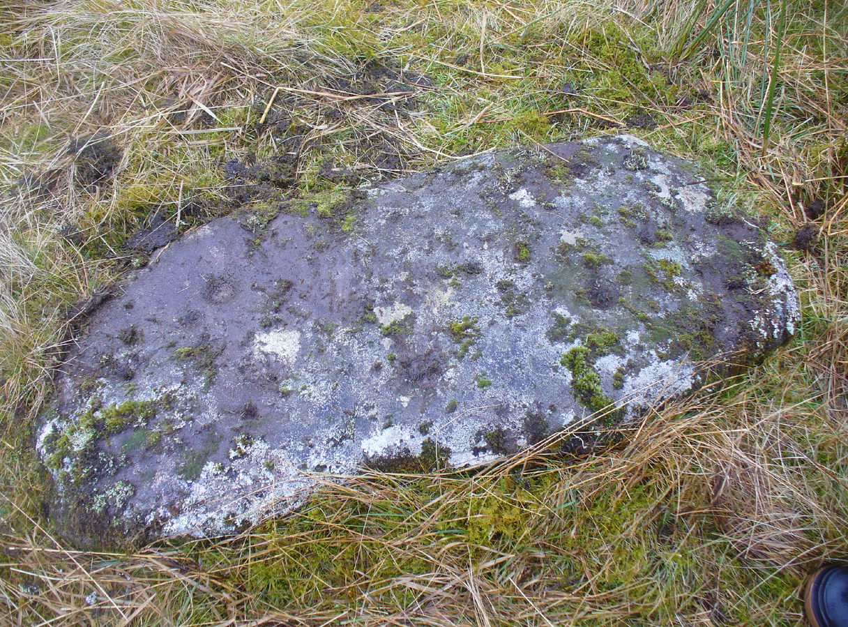
Take the same directions to reach the Nether Glenny cairn (about 1 mile west of where the B8034 meets the A81, between the Port of Menteith and Aberfoyle, up a small road on the right [north] at Portend) and walk to its companion cairn 100 yards north. From here, walk west across the field towards the nearby forest. Nearly 20 yards from the wall and about 35 yards from the corner of the field where it meets the forest, this elongated stone lies amidst the grasses and reeds. You’ll find it.
Archaeology & History
…and from another angle
Looking somewhat like a small fallen standing stone (the Royal Commission list just such a stone nearly 200 yards east), this slim elongated rock was first described in Maarten van Hoek’s Menteith (1989) survey where he told it to be a “loose slab north of the…burn, bears at least thirteen cups.” But of the “thirteen cups”, only five of these (seven at the most) appear to be man-made. The others are, quite distinctly, geophysical in origin (and in all probability, the other cups were forged from the geological nicks and dimples). One of them may have the faint remains of a ring around it, but this is uncertain. When we visited the site yesterday, the light was poor and although this ‘ring’ seems to show up on a couple of photos, I’m erring on the side of caution.
van Hoek, Maarten, “Menteith (Port of Menteith parish) Rock Art Sites,” in Discovery & Excavation Scotland, 1989.
Acknowledgements: Huge thanks to Paul Hornby and Nina Harris for their help and endurance at this site, amidst healthy inclement Scottish February weather! Another damn good day!
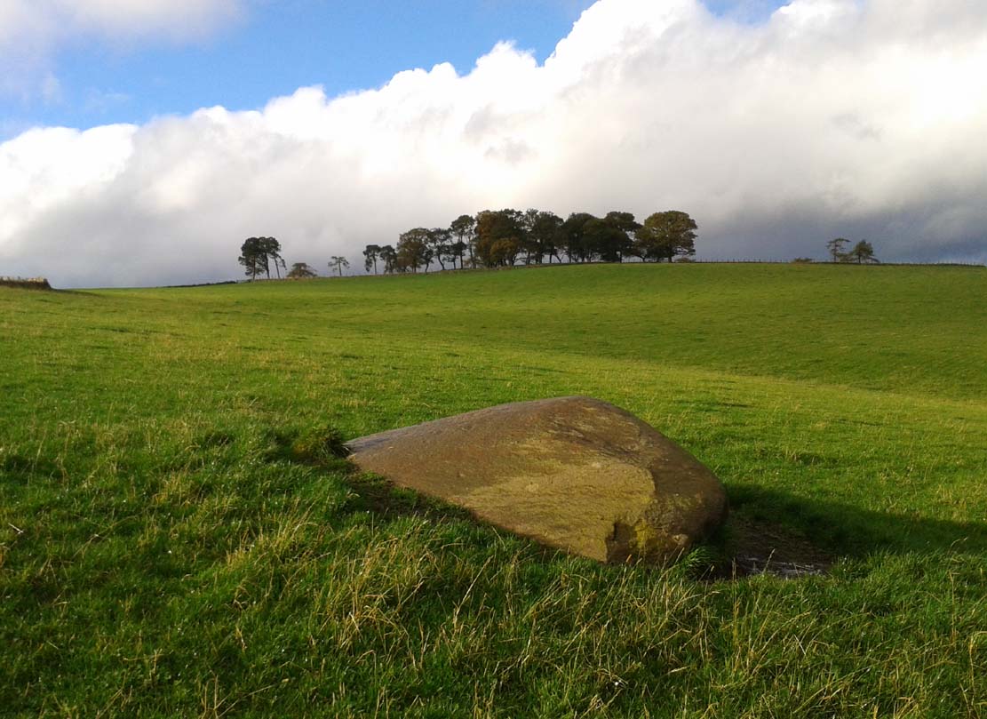
Take the A93 road north out of Blairgowrie for 5 miles or so to the Bridge of Cally, making sure you do NOT drive up the A924. Keep on the A93 for a coupla hundred yards, just as you come out of the village take the right turn on the minor road to Drimmie. When you hit the dead straight section of road, turn left near its end. The follow this bendy moorland road for 1½ miles (2½km) where a small copse of trees appears on the nearby hillock on your left. In the next field past this, close to the roadside, you’ll see a large boulder.
Archaeology & History
A large rock in the large field 350 yards (320m) SSE of the lovely Park Neuk stone circle which was described by the Royal Commission (1990) lads as being a “cup-and-ring” stone is, sadly, not as impressive as it sounds. The carving was initially rediscovered and described by Mrs Lye (1982) who told:
“A large glacial erratic boulder with ten cup marks scattered over its surface lies in a field one sixth of a mile SSE of the ‘four poster’ and ruined stone circle at Heatheryhaugh. The boulder is garnet mica schist and is 3m long, NS, by 2.70 wide, EW, with a circumference of 9m at ground level.”
When the Royal Commission visited the carving in 1987 they found that it had,
“on its sloping W face at least fifteen weathered cupmarks, two cups with single rings and one cup with a possible ring; the cupmarks average 50mm in diameter by 15mm in depth.”
Cup-marks faintly visible
Close-up of cups – some natural, some enhanced
But some of these ‘cups’ are, without doubt, geological in origin – and when Paul Hornby and I visited the stone in near perfect weather conditions, there was only one ring very faintly discernible, with a possible arc on the top-edge of another ‘cup’. You can see from a couple of the photos how some of the cupmarks are geophysical in nature. The cups with greater veracity were very probably etched from the natural cut in the stone (as found at Stag Cottage and many other cup-and-rings).
References:
Lye, Mrs D., “Heatheryhaugh: Cupmarked Stone,” in Discovery & Excavation in Scotland, 1982.
Royal Commission on the Ancient & Historical Monuments of Scotland, North-East Perth: An Archaeological Landscape, HMSO: Edinburgh 1990.
From the centre of Meigle village, you need to head along the country lane south-west towards the village of Ardler (do not go on the B954 road). About three-quarter of a mile (1.25km) along—past the entrance to Belmont Castle—you’ll reach a small triangle of grass on your left, where a driveway takes you into the trees. Walk down the drive and past the very first house—behind which is the stone in question. A small path takes you through the trees allowing you to get round to it. You can’t really miss it!
Archaeology & History
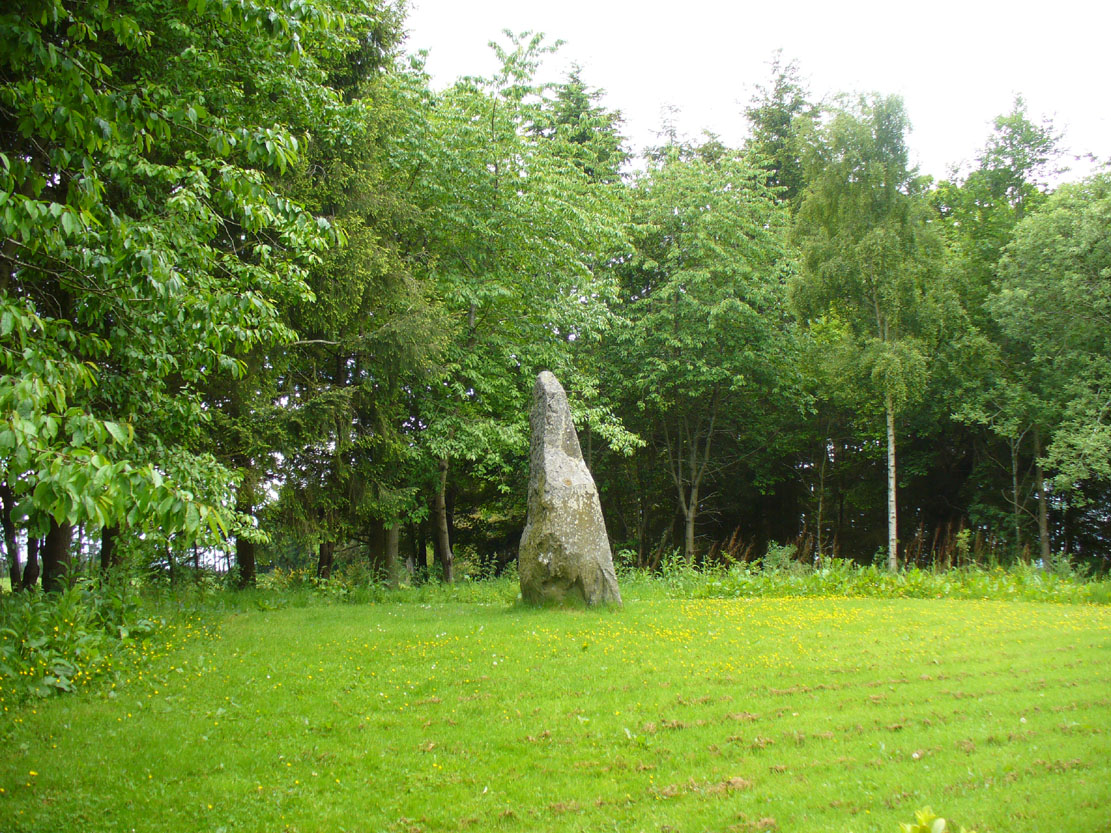
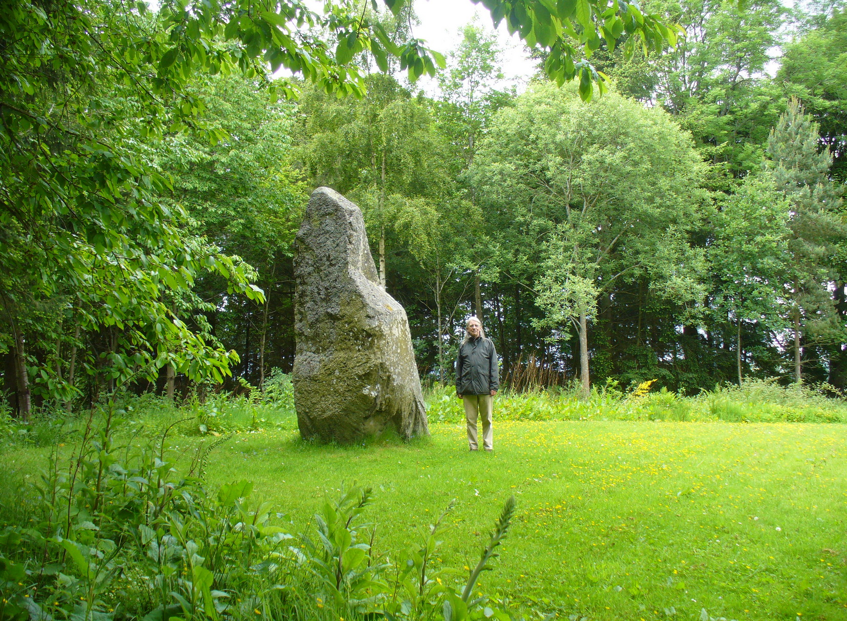
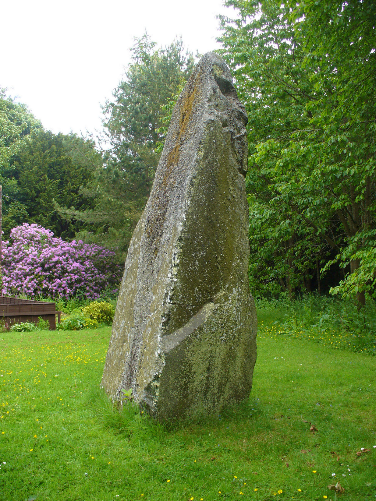
This is a magnificent site. A giant of a stone. Almost the effigy of a King, petrified, awaiting one day to awaken and get the people behind him! It has that feel of awe and curiosity that some of us know very well at these less-visited, quieter megalithic places. Its title has been an interchange between the Scottish King MacBeth and the witches who played so much in his folklore, mixed into more realistic local traditions of other heathen medicine-women of olde…
The first account of this giant standing stone came from the travelling pen of Thomas Pennant (1776) who, in his meanderings to the various historical and legendary sites of Meigle district, wrote that
“In a field on the other side of the house is another monument to a hero of that day, to the memory of the brave young Seward, who fell, slain on the spot by MacBeth. A stupendous stone marks the place; twelve feet high above ground, and eighteen feet and a half in girth in the thickest place. The quantity below the surface of the Earth is only two feet eight inches; the weight. on accurate computation amounts to twenty tons; yet I have been assured that no stone of this species is to be found within twenty miles.”
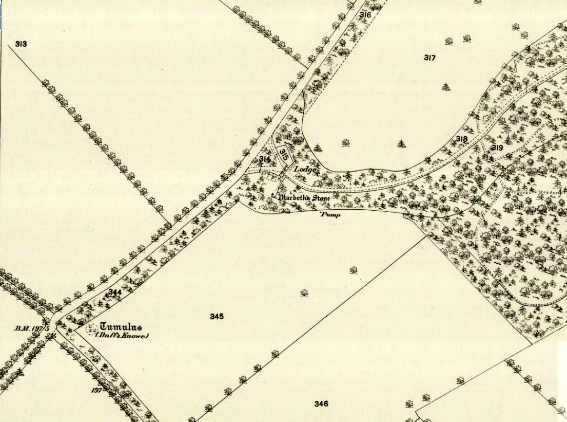
Site shown on 1867 mapA human & MacBeth!
It was visited by the Ordnance Survey lads in 1863, several years after one Thomas Wise (1855) had described the monolith in an article on the nearby hillfort of Dunsinane. But little of any substance was said of the stone, and this is something that hasn’t changed for 150 years, despite the huge size of this erection! Local historians make mention of it in their various travelogues, but the archaeologists haven’t really given the site the attention it deserves. Even the Royal Commission (1994) report was scant; and apart from suggesting it to have a neolithic provenance, they merely wrote:
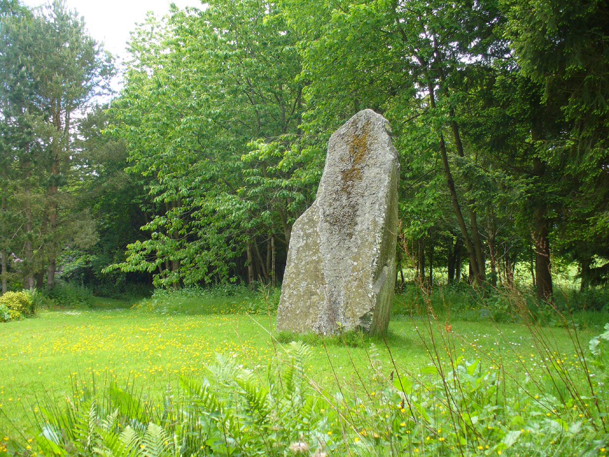
“Rectangular in cross-section, the stone tapers to a point some 3.6m above the ground; each of its sides is decorated with cupmarks, as many as forty occurring on the east face and twenty-four on the west.”
East face of MacBethMacBeth Stone (Wise 1884)
Thankfully, the fact that there are cup-markings on the stone has at least given it the attention it deserves amongst the petroglyph students. The first account of the cup-markings seem to have come from the pen of Sir James Simpson (1867) who mentions them, albeit in passing, in his seminal work on the subject. A few years later however, the same Thomas Wise visited MacBeth’s Stone again, and not only described the carvings, but gave us our first known illustration in his fascinating History of Paganism (1884). He told it to be,
“A large boulder, some 12 tons in weight, situated within the policies of Belmont Castle, in Strathmore, Perthshire…is supposed to have been erected on the spot where MacBeth was slain. Two feet above the ground this boulder has a belt of cups of different sizes, and in irregular groups. None of these cups are surrounded by incised circles or gutters. This boulder was probably intended for some sacred purpose, as it faces the SE.”
Running almost around the middle of the standing stone, on all four sides, are the great majority of the cup-markings (no rings or additional lines are visible). They were very obviously etched into the stone after it had been erected, not before. This is in stark contrast to the cup-and-rings found on the standing stones at Machrie, Kilmartin and elsewhere, where we know the carvings were done before the stones were stood upright.
Cup-marks on west sideCup-marks on west face
On the northern face of the stone is one possible cup-marking, and three of them are etched onto its south face; but the majority of them, forty, are on its western face, and twenty-five on its eastern side. The great majority of them on the east and west sides occur roughly in the middle of the stone, almost like a ‘belt’ running across its body. Those on the eastern face are difficult to discern as a thick layer of lichens covers this side, so there may be even more beneath the vegetation.
One of the notable features of the monoliths across this region, and echoed again here, is that one side of the standing stone is smooth and flat—and here in the case of MacBeth’s Stone, the flat face is the eastern one. Whether this feature was deliberately intended (it seems to have been) and what it might imply, we can only guess. It might simply relate to the geophysics of the stone, making it easy to crack horizontally….
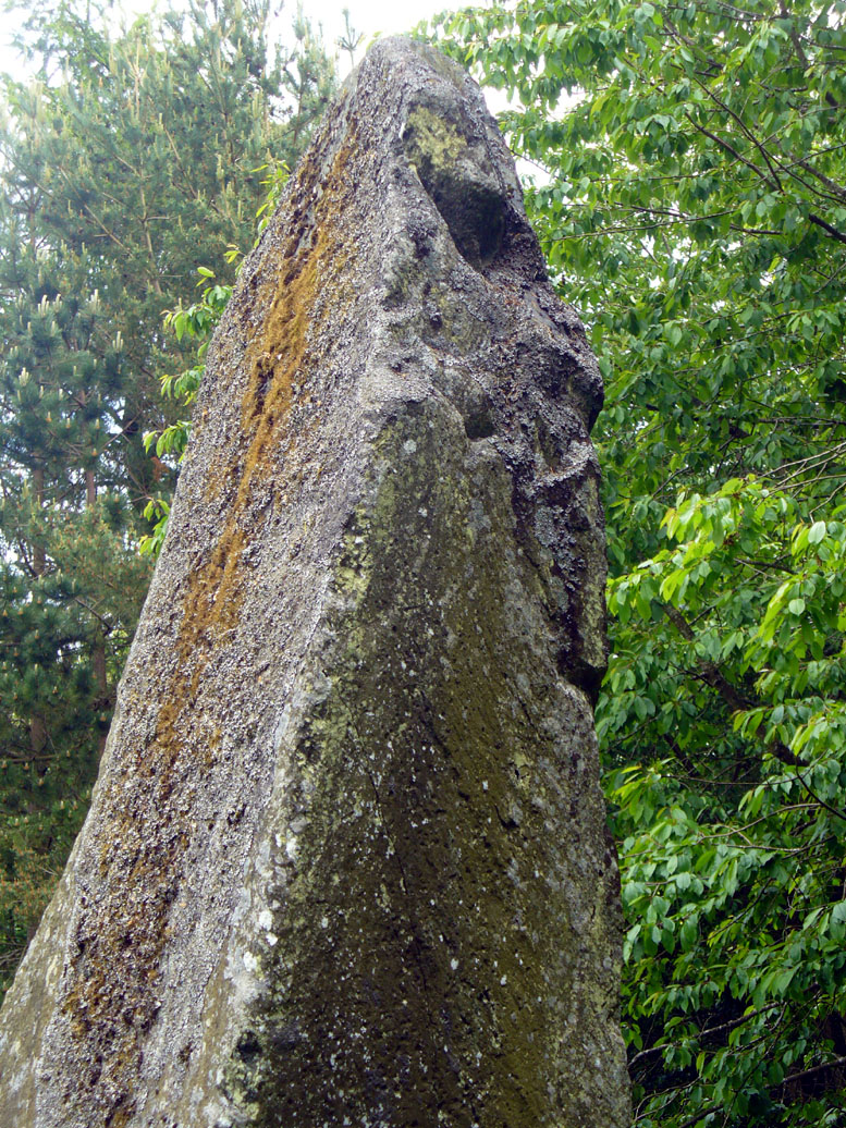
The ‘face’ in the top of the stoneClose-up of Macbeth’s face
Another fascinating feature at this site was noticed by Nina Harris of Organic Scotland. Meandering around the stone in and out of the trees, she called our attention to a fascinating simulacra when looking at the upper section of the stone on its southern side. At first it didn’t seem clear – but then, as usual, the more you looked, the more obvious it became. A very distinct face, seemingly male, occurs naturally at the top of the stone and it continues as you walk around to its heavily cup-marked western side. It’s quite unmistakable! As such, it has to be posited: was this simulacra noticed by the people who erected this stone and seen as the spirit of the rock? Did it even constitute the reason behind its association with some ancestral figure, whose spirit endured here and was petrified? Such a query is neither unusual nor outlandish, as every culture on Earth relates to such spirit in stones where faces like this stand out.
But whatever your opinion on such matters, when you visit this site spend some time here, quietly. Get into the feel of the place. And above all, see what impression you get from the stony face above the body of the stone. Tis fascinating…..
Folklore
Known locally as being a gathering place of witches, the site is still frequented by old people at certain times of the year, at night. The stone’s association with MacBeth comes, not from the King himself (whose death occurred many miles to the north), but one of his generals. In James Guthrie’s (1875) huge work on the folklore of this region, he told that this giant
“erect block of whinstone, of nearly twenty tons in weight…(is) said to be monumental of one of his chief officers”,
which he thought perhaps gave the tale an “air of probability about it.” But Guthrie didn’t know that this great upright was perhaps four thousand years older than the MacBeth tradition espoused! However, as Nick Aitchison (1999) pointed out in his singular study of the historical MacBeth,
“another MacBeth was sheriff of Scone in the late twelfth century and it is possible that he, and not MacBeth, King of Scots, is commemorated in the name.”
He may be right. Or it the name may simply have been grafted onto the stone replacing a more archaic relationship with some long forgotten heathen elder. We might never know for sure.
When Geoff Holder (2006) wrote about the various MacBeth sites in this area, he remarked that the folklore of the local people was all down to the pen of one Sir John Sinclair, editor of the first Statistical Account of the area—but this is a gross and probably inaccurate generalization. Nowhere in Holder’s work (or in any of his other tomes) does he outline the foundations of local people’s innate subjective animistic relationship to their landscape and its legends; preferring instead, as many uninformed social historians do, to depersonalise the human/landscape relationships, which were part and parcel of everyday life until the coming of the Industrial Revolution. Fundamentally differing cultural, cosmological and psychological attributes spawned many of the old myths of our land, its megaliths and other prehistoric sites. It aint rocket science! Sadly, increasing numbers of folklore students are taking this “easy option” of denouncement, due to educational inabilities. It’s about time researchers started taking such misdirected students to task!
References:
Aitchison, Nick, MacBeth – Man and Myth, Sutton: Stroud 1999.
Coutts, Herbert, Ancient Monuments of Tayside, Dundee Museum 1970.
Royal Commission on the Ancient & Historical Monuments of Scotland, South-East Perth: An Archaeological Landscape, HMSO: Edinburgh 1994.
Simpson, James, Archaic Sculpturings of Cups, Circles, etc., Upon Stones and Rocks in Scotland, England and other Countries, Edmonston & Douglas: Edinburgh 1867.
Acknowledgements: With huge thanks to Paul Hornby for his help getting me to this impressive monolith; and to Nina Harris, for prompting some intriguing ideas.
Along the A826 road south out of Aberfeldy, make your way towards the impressive giant Carn Ban of Glen Cochill. Nearly a mile past the cairn further down the road, keep yer eyes peeled for the straight line of walling reaching up onto the moors. About 100 yards before the wall, go over a ruined metal gate by the roadside up and onto the moor. Walk straight uphill for barely 50 yards until you’re on the level, then walk left for 50 yards or so again. Yer damn close!
Archaeology & History
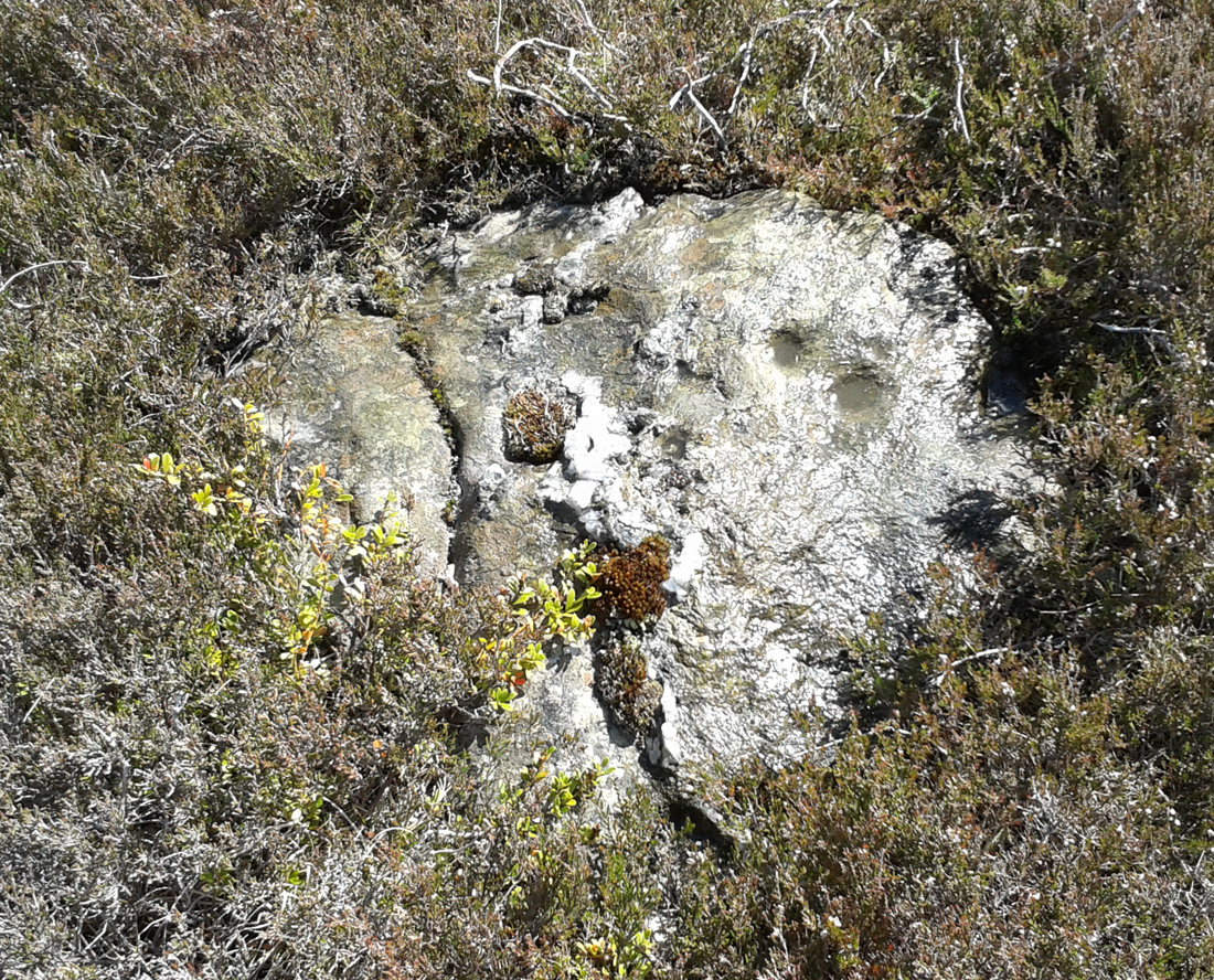
3rd cupmark visible at bottom
Although this is a seemingly isolated carving, difficult to find and nowt much to look at, it is located in a region with massive amounts of prehistoric remains – much of it inadequately surveyed or not surveyed at all. Amidst a collection of more than a dozen unexcavated Bronze Age cairns, this small flat earthfast stone bears two standard cup-markings, with a possible third at its edge. It is not immediately connected with any of the nearby cairns.
Going out of Killin towards Kenmore on the A827 road, immediately past the Bridge of Lochay Hotel, turn left. Go down here for just over 2 miles and park-up where a small track turns up to the right (half-mile before the impressive Stag Cottage carvings), close to the riverside and opposite a flat green piece of land. Notice a small cliff-face just over the fence by the road and a small ledge about 3 feet above ground level. That’s yer spot!
Archaeology & History
Deep & shallow cups together
Rediscovered by rock art student George Currie in 2004, this small, little-known and unimpressive cup-marked site was carved onto a rocky ledge just off the roadside down Glen Lochay. Comprising of at least three very distinct cup-marks—two next to each other on the far-right of the ledge and the other on the nose of the rock—at least another three more shallow cups are on the same surface. What looks like an unfinished cup, or deliberately etched crescent-Moon-shaped cup, has been cut into the same ledge a yard to the left of the prime cluster.
In Currie’s (2004) brief description of the site, he told:
“Ledge, 1m above ground level on a rock face; four cups, 50 x 25mm, 45 x 15mm and two at 40 x 10mm.”
Looking down at rock surface
Curious crescent-shape ‘cup’
It’s unusual in that the cups have been carved onto a small ledge that’s too small to stand upright on. Whilst not without parallels, it’s an odd position to find petroglyphs and begs the question, “why here?” when there are other rocks close by that are easier and more accessible.
References:
Currie, George, “Falls of Lochay (Killin parish): Cup-Marked Rocks”, in Discovery & Excavation Scotland, volume 5, 2004.
Along the A827 road between Killin and Kenmore, park-up at the Tombreck entrance and cross the road, taking the long track which eventually zigzags up the slope of Ben Lawers. Keep your eyes on the copse of trees a few hundred yards east that runs up the slopes. Head towards this, past the multiple-ringed Allt a’ Choire Chireinich stone, then AaCC 2 and AaCC3 carvings, then notice on the other side of the stream a couple of large boulders. That’s the spot!
Archaeology & History
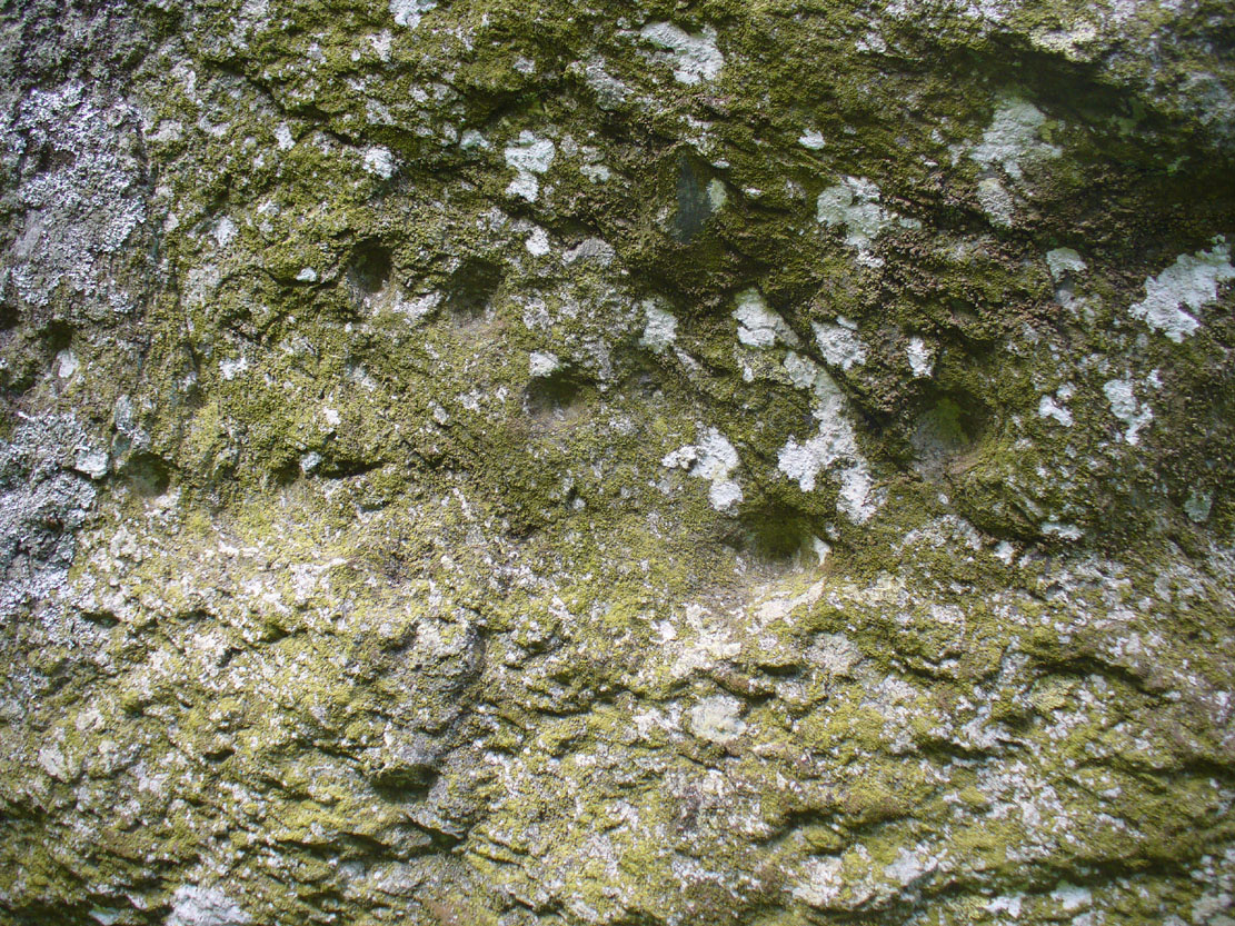
This faint but intricately carved petroglyph is one in a cluster of three carvings, right next to each other—and it’s the best of the bunch by a long way. A single cup-marking is found on the flat stone beneath this one (AaCC5); whilst the large egg-shaped boulder in front has perhaps a half-dozen cups on it (AaCC6).
Alex Hale’s sketch of the carving
Faint remains of concentric rings
The large flat-topped boulder of AaCC4 however, possesses at least seventeen plain cup markings, along with twenty-four cup-and-rings, six cup-and-double-rings, three cup-and-three rings, three cup-and-four rings, and one cup-and-five rings! There are some carved lines that emerge from several of the cups, with all of the three cup-and-four rings having a carved pathway emerging from the central cup and going out of the concentric system. It’s quite a beauty! And it sits upon the ridge next to the clear drinking waters of the burn, gazing out over Loch Tay and the mountains all around in a quite beautiful landscape.
Immediately above and below the carvings are a number of settlement spots or shielings, known to have been used until recent centuries. They were quite ideal living quarters and some of the old folk here, in bygone days, would have known old customs and stories of this petroglyph.
References:
Hale, Alex, “Prehistoric Rock Carvings in Strathtay,” in Tayside and Fife Archaeological Journal, 2009.
Yellowlees, Sonia, Cupmarked Stones in Strathtay, Scotland Magazine: Edinburgh 2004.
Acknowledgments: Huge thanks to Lisa Samson, Fraser Harrick and Paul Hornby for their help reaching this site and exploring still further.Let’s do it again sometime before I vanish forever up into the far North!
Take the same directions to reach the large rounded Allt a’ Choire Chireinich 02 carving. Walk 65 yards (60m) northwest diagonally uphill to another large rounded stone of similar size. That’s the one!
Archaeology & History
A large cup-marked boulder, not previously recognised, was rediscovered on the afternoon of May 15, 2015. The great majority of the rock surface is covered in aged lichens, but at least three well-defined cup-markings were noted on the upper rounded surface of the stone: one near the middle of the stone; one near the centre-north; and another towards the top northwest section of the stone. The cups are more than an inch in diameter and eighth-of-an-inch deep. Others may be in evidence beneath the vegetation.