Cnoc a’ Chuirn Mhoir, Jura, Argyll

Cairn:  OS Grid Reference – NR 68298 94211

Archaeology & History

This ‘hill of the big cairn’ is near the top end of the island, past the cup-marked stones of An Carn, just beneath the top of the prominent knoll, a half-mile east of the track.  It’s about 200 yards from the summit on the southern side of the hill.  More than 50 feet across and about 3 feet high, what may be kerb-stones can be seen on the west-side of the tomb.  The Royal Commission (1984) lads tell us that,

“its northern edge is buried under field-gathered stones, and a small enclosure of comparatively recent date overlies the cairn.”

References:

  1. Royal Commission on the Ancient & Historical Monuments of Scotland, Argyll: volume 5 – Islay, Jura, Colonsay and Oronsay, HMSO: Edinburgh 1984.

© Paul Bennett, The Northern Antiquarian


Barnhill, Jura, Argyll

Cairn:  OS Grid Reference – NR 7057 9700

Archaeology & History

Very close to being at the top of the island.  If you do manage to get here take a gander at the legendary Gulf of Corryvreckan: one of the largest whirlpools on Earth, where the cailleach swirled her stuff when angry! This is the ‘hill where sorrel grows,’ and where George Orwell wrote 1984 – but more important for us is where the Royal Commission for Historic & Ancient Monuments of Scotland (Argyll, vol.5) designated that,

“a stony mound about 5.5m in diameter and 0.5m high, situated on the crest of the ridge east of Barnhill, appears to be a prehistoric burial cairn.”

Sadly I never managed to check this out when I was last up here as I didn’t know it was here!

References:

  1. Royal Commission on the Ancient & Historical Monuments of Scotland, Argyll: volume 5 – Islay, Jura, Colonsay and Oronsay, HMSO: Edinburgh 1984.

© Paul Bennett, The Northern Antiquarian


Ardtalla, Islay, Argyll

Standing Stone:  OS Grid Reference – NR 4657 5456

Also Known as:

  1. Canmore ID 38056

Getting Here

Takes a bitta getting to this one, right at the far end of the road, leading to nowhere – so those of us who like Scotland for its vast expanses of ‘middle o’ nowhere’ should like it! From Port Ellen, travel along the A846 eastwards, all the way to the where it ends in Ardbeg. But the smaller track road continues up the coast. Keep going – and keep going all the way up; past the ‘stone circle’ of Ardilistry, past the standing stone of Trudernish, right to the very end where the track leads you to the farmhouse of Ardtalla. Once here, you’ll see the stone about 20 yards west of the farm.

Archaeology & History

This old stone is only 4-foot-tall, leaning slightly, but—as I recall from many years back—”it’s cute!” (sad aren’t I?!)  All the way up here to see a small monolith!  Even the Royal Commission (1984) lads didn’t have much to say about it, merely:

“This standing stone is situated 18m NW of the SW gable of Ardtalla farmhouse.  Leaning slightly to the SSE, it measures 0.48m by 0.48m at the base and 1.25m in height.”

But if you like walking, the rest of the route up the coast is excellent. Stick yer tent in the small woodland by the fort a mile or two further north, then bring your attention to the legendary Beinn na Cailleach, if the heathen within you stirs…

References:

  1. Royal Commission on the Ancient & Historical Monuments of Scotland, Argyll – volume 5: Islay, Jura, Colonsay and Oronsay, HMSO: Edinburgh 1984.

© Paul Bennett, The Northern Antiquarian


Neriby, Bridgend, Islay

Standing Stone (destroyed):  OS Grid Reference – NR 3595 6053

Also Known as:

  1. Canmore ID 37722

Archaeology & History

This is another standing stone whose days are seemingly long gone.  It was last recorded in 1878 as being about 300 yards northwest of the old farmhouse at Neriby.  The old stone stood more than six-feet tall, but appears to have gone.  Anyone journeying this way might wanna scour the ground to see if the fella’s remains can be seen lying around anywhere – though the fact that an old quarry was dug hereabouts doesn’t bode well for a successful hunt.  If we’re lucky, the stone may have been buried or laid into  nearby walling.  There is, however, remains of an old tumulus a bit further up the way…

References:

  1. Royal Commission on the Ancient & Historical Monuments of Scotland, Argyll – volume 5: Islay, Jura, Colonsay and Oronsay, HMSO: Edinburgh 1984.

© Paul Bennett, The Northern Antiquarian

Ardminish, Gigha, Argyll

Cist:  OS Grid Reference – NR 6495 4890

Also Known as:

  1. Canmore ID 38528

Archaeology & History

When the Scottish Royal Commission lads came here in 1963, they reported seeing

“the remains of a short cist…set into the west side of a small turf-covered knoll some 18 metres north of the schoolhouse at Ardminish.”

It was first found during quarrying operations here, and was thankfully kept pretty well preserved, apart from the western slab, which was dislodged and fell to the foot of the knoll. The cist aligns roughly north-south (the airt, or cardinal virtue of ‘death’ is north) and measured about 3 feet long by 2 feet wide.

References:

  1. Royal Commission on the Ancient & Historical Monuments, Scotland, Argyll: volume 1 – Kintyre,  HMSO: Edinburgh 1971.

© Paul Bennett, The Northern Antiquarian

Dun Gallain, Colonsay, Argyll

Hillfort:  OS Grid Reference – NR 3486 9314

Getting Here

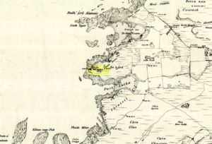
Dun Gallain on 1878 map

Bittova trek this one.  Once on Colonsay, head out onto the B8086 road west of Scalasaig until you, past Machrins, and onto the gold course. Take the footpath across it (south), until you hit the little airstrip where you need to veer right (west) right onto the spur of the coast about 800 yards away.  Your damn close!

Archaeology & History

Highlighted on the 1878 OS-map of the region, this site occupies a prominent position.  Its summit is surrounded by a line of oval walling enclosing an area of about 90 square yards.  There are also remains of of outer walling to the eastern and southern sides.  The ‘cairn’ on the highest spot in the middle of the hillfort is a modern construction.

Folklore

The great Scottish folklorist A.A. MacGregor (1947) narrated the tale behind this denuded fort on the western edge of the island. According to the islanders who told him the tale, they alleged it Norwegian in origin, though the fortress is much older than that. MacGregor told that, “in this fort there once lived an elderly and voluptuous tyrant named Grey Somerled, who is said to have been related to the first of the Lords of the Isles.

“Grey Somerled came to Colonsay, they say, in the capacity of factor. But he neglected his duties, imposed penalties and hardships on the innocent and defenceless tenants, and generally made himself so disagreeable that at last it was decided to take revenge upon him, previous warnings having been no deterrent.

“Like Rory Mor of Dunvegan, who slept best when he was within hearing of his ‘nurse’, the waterfall, Grey Somerled was wont to be lulled to sleep by the grinding noise of a quern placed near his head. When he retired for the night, one of the servants had to turn the quern-stone by his pillow, and keep on turning it, lest he woke.

“It was recognised that any attempt to surprise Grey Somerled during daylight was foredoomed to failure. So, a plot was laid to circumvent him during the night-time. His enemies entered into a conspiracy with one of the servants that she should allow them to invade Dun Gallain after he had fallen asleep. When they arrived, one of their number relieved the woman at the quern, and proceeded to turn the stone without intermission. But he was not too skillful at the turning; and his harsh and irregular grinding soon woke the sleeper. Ere Gey Somerled had had time to consider the matter of resistance, his foes were upon him. They carried him away from Dun Gallain; and tradition in the islands of Argyll has it that, in great privation, he spent the remainder of his days in a bee-hive house of stone, situated on the farmlands of Machrins.

“One night – so the story concludes – a huge boulder from the roof of the bee-hive fell in, killing its unhappy inmate. So as to identify the spot where this tragedy happened, the islanders raised on it the cairn now indicated on the Ordnance Survey Map as Carn Shomhairle Liath – that is to say, Grey Somerled’s Cairn.”

Interestingly, there is a long-cist burial at Machrins (plus small settlement) a few hundred yards east of the fort, and excavations here found them to date from the Viking period; though the Scottish Royal Commission thought that although the “small finds associated with the burial suggest that it is Viking, the plan-form of the houses is perhaps more likely to indicate a native tradition.”

References:

  1. MacGregor, Alasdair Alpin, The Peat-Fire Flame, Ettrick Press: Edinburgh 1947.
  2. Royal Commission of Ancient & Historical Monuments, Scotland, Argyll – volume 5, HMSO: Edinburgh 1984.

© Paul Bennett, The Northern Antiquarian


Cnoc na Croise, Ardminish, Gigha, Argyll

Cairns:  OS Grid Reference – NR 6439 4828

Also Known as:

  1. Canmore ID 38549

Archaeology & History

In Thomas Pennant’s A Tour in Scotland and Journey to the Hebrides, 1772 (1790:226), he described there being three prehistoric cairns about four-hundred yards west of Ardminish, or a couple or hundred yards north of the Achamore Standing Stone, on Cnoc na Croise, but they seem to have been destroyed.  At least two of them were between 4 and 5 yards across and contained cists.  A search for the site by the Royal Commission lads in the 1960s found nothing—although they may have been looking in the wrong place (the grid reference given above is an approximation).  Does anyone know anything more about these seemingly lost sites?

References:

  1. Royal Commission for Ancient & Historical Monuments of Scotland, Argyll – volume 1: Kintyre, HMSO 1971.

© Paul Bennett, The Northern Antiquarian


Cnoc na Carraigh, Gigha, Argyll

Standing Stone (destroyed): OS grid reference – NR 6426 4817

Also Known as:

  1. Canmore ID 38540

Archaeology & History

The Scottish Royal Commission (1971) reported a very large

“standing stone that stood 185m NNW of Achmore House (that) was removed at the beginning of the 19th century. It was reported that is measured 4.9m in height (16ft), 1.2m in breadth and 0.2m in thickness.”

A prehistoric cairn seemed to have accompanied this monolith—as reported by Thomas Pennant in 1772—but it too has been destroyed.  Pennant told us how the monolith was,

“a great rude column, sixteen feet high, four broad and eight inches thick.”

Not bad at all!  It was still extant, although leaning to the southwest in the year 1790 (OSA 1791-9); appearing to have been removed about 1800.  No trace of it remained when the Ordnance Survey lads looked here in 1869.

References:

  1. Royal Commission for Ancient & Historical Monuments of Scotland, Argyll – volume 1: Kintyre, HMSO 1971.

© Paul Bennett, The Northern Antiquarian


Clachan Ceann Ile, Ardilistry, Islay

Standing Stones:  OS Grid Reference – NR 4368 4832

Also Known as:

  1. Canmore ID 38030
  2. Stones of Islay

Getting Here

Also known as the ‘Stones of Islay,’ these two old stones can be found on the west side of the road between Port Ellen and Ardtalla, up the steepish wood-covered slope, just south of the conical fairy hill of Cnoc Rhaonastil.

Archaeology & History

In recent years, the Scottish Royal Commission commented that “they do not appear to be of prehistoric date,” yet include it in the Argyll survey (vol.5:65), just in case!  The larger of the two monoliths is nearly 6 feet long (it was on the floor when I came here, many years back), and its smaller companion about 3 feet long (also on the deck!).

Folklore

In 1794, in the Statistical Account of Scotland, it was said that these two curious standing stones marked the grave of Yla or Yula, “a daughter of one of the kings of Denmark,” which is most unlikely. Between these two stones, folklore tells, is known as the Tomb of Yla – a Danish princess whom legend tells gave Islay its name.

The hill above these old stones was long known to be the place of the faerie-folk. Indeed, the Queen of Faerie herself lived here. Otta Swire told a fascinating old folktale of this place, whose nature will be know to some:

“The Queen was much troubled by the stupidity of human women, for in the fairy world wisdom is chiefly possessed by the women, since it is they who hold the Cup. After much thought, She decided to try to improve matters, so she sent out an invitation to all the women of the world to visit Her in Her hall in the knoll on a certain date. The invitation spread over the wide Earth – it was carried by the winds and the sea waves, by birds and by fish, even the leaves of the trees whispered it. And the women of the world were very much interested and they talked eagerly together. Some laughed at it, some said they were wiser by far than the Little People, some held that the Little People were cleverer and more powerful than they and that this might be a trap. Indeed, the word of women ‘heaved like hive of bee or hill of ant or byke of wasp.’ Soon, women from all over the isles began to arrive in Islay. Some came to see, many more to be seen, and a few came truly seeking wisdom.

“When the day dawned the hill opened, and into the wonderful hall within streamed the women. And a very wonderful hall it was, hung with bright cloths woven from nettles and fairy lint and dyed with blood of shell-fish and sap of plants in such colours as only the Little People can achieve. Skins of beasts were spread on floors and seats, a banquet set on shells of pearl lay ready on the many tables of wood and stone, and for each guest there was placed ready a beautiful cup formed from a blue-eyed limpet’s shell. A soft green light pervaded the hall. When all were ready and the watchers saw no more coracles on the waters or maidens climbing the green slope, the doors to the outer world were closed and in walked the Queen Herself. She was smaller than any of Her guests but far, far more impressive. She wore a dress of long ago but it suited well Her gentle, kindly dignity and Her face shone with a strange and lovely light. She carried in Her two hands a wonderful flagon and after her came her maids, each holding a similar one. Other maids hastily distributed the cups of shell and then the Queen walked slowly by, pouring into the cup of each of those who, in her heart truly desired wisdom, a few drops of the precious fluid from Her flagon, which held the distilled wisdom of the world throughout the ages. And as each woman drank those few drops she suddenly grew wise and saw and understood much she had never known before. Some were able to see much, others but a little, yet all benefited in their degree. At last, all who sought wisdom had received it and the elixir was finished. Just as the ceremony ended there came a hammering on the walls and the doors. The Little People looked out and, behold!, their hill was covered with late-comers who had arrived after the doors were closed and so had been unable to enter and were now too late to receive the gift. There is still a saying in Gaelic about a stupid woman: ‘She was out on the knoll when wisdom was distributed.'”

A saying I remember my old grandad telling a few folk a few times when I was young!

References:

  1. Royal Commission on the Ancient & Historical Monuments of Scotland, Argyll – volume 5: Islay, Jura, Colonsay and Oronsay, HMSO: Edinburgh 1984.
  2. Swire, O.F., The Inner Hebrides and their Legends, Collins: London & Glasgow 1964.

© Paul Bennett, The Northern Antiquarian

Clach na h-ealea, Clachan, Lismore, Argyll

Legendary Stone:  OS Grid Reference – NM 8609 4342

Also Known as:

  1. Canmore ID 23090
  2. Clach na h-eala
  3. Stone of the Swan
  4. Swan Stone

Archaeology & History

Although the lads at the Scottish Royal Commission (1974) initially described this site as a ‘Standing Stone’, it is in fact,

“an erratic boulder of granite roughly shaped in the form of a cross… It measures 0.8m in height, 0.6m in width at base, and 0.4m in width at the top…(and) the stone is supposed to have marked a boundary.”

The site was evidently of some mythic importance, as the great Cathedral of St. Moluag was built next to the stone — unless the giant cairn of Cnoc Aingil, 500 yards away, was to blame. A holy well of this saint’s name (an obvious heathen site beforehand) is also nearby.

Folklore

Although this stone was dedicated to swans, I’ve not found the story behind the name.  There were no buried swans here, but local tradition told that this old boulder could give sanctuary to anyone who touched it, or ran round it sunwise.  The Hebridean folklorist Otta Swire (1964) told that,

“anyone who claimed such sanctuary had his case considered by ‘the Elders.’ If they considered his plea justified, they ‘came out and walked sun-wise round the Swan Stone.’ If they did not approve of his right to sanctuary, they walked round it anti-clockwise and the man was then given over, not to his enemies, but ‘to Authority’ to be tried.”

This old tradition derives from well known pre-christian rites. Swire also reported that even in the 1960s here, “at funerals the coffin is always carried round the grave sun-wise before being laid in it.” An old cross placed in the Field of the Cross next to the stone was an attempt to tease folk away from heathen rites of the stone, but failed.

References:

  1. Royal Commission on the Ancient & Historical Monuments of Scotland, Argyll – volume 2: Lorn, RCAHMS: Edinburgh 1974.
  2. Swire, O.F., The Inner Hebrides and their Legends, Collins: London 1964.

© Paul Bennett, The Northern Antiquarian