The spring is in the trees. The roof of the church is visible past the tree
Take the B8062 North from Auchterarder, and turn right immediately after crossing Kinkell Bridge. Continue through the hamlet of Trinity Gask, and take the next turn left. The Well is situated in the wooded area of land to your left, before you reach the church on the right. I tried visiting in summer but was beaten back by the boscage of man high nettles, goose grass and brambles. An autumn visit was made, and access was readily available to the wooded area over a barbed wire fence from the field behind the wood.
Archeology & History
The Canmore description quotes from an August 1967 report by an Ordnance Survey inspector:
“Trinity Well is now dry, and all that remains is an overgrown hollow. A manhole cover nearby suggests the spring is now piped.”
On the day of my 2014 visit, the water was flowing from an issue on the field side of the woodland. There was some low walling on the field side of the enclosure, otherwise no masonry or paving was visible. Any there may have been is now either buried or robbed for building material.
The waters still flow despite a 1967 report to the contrary
The 1796 Statistical Account has this to say: ‘ The most noted well in the parish is at Trinity Gask. It is remarkable for the purity and lightness of its water; the spring is copious and perennial. Superstition, aided by the interested artifices of popish priests, raised, in times of ignorance and bigotry, this well to no small degree of celebrity. It was affirmed, that every person who was baptised with the water of this well, would never be seized with the plague….. But the extraordinary virtue of Trinity Gask well has perished with the downfall of superstition, and the introduction of a free and rational enquiry into nature and religion.’
Walling is visible behind the spring issue
The 1837 New Statistical Account goes on to say: ‘….the Trinity Well, a little to the South of the manse, of great renown in Popish days for the performing of miraculous cures, fortifying against plague, witchcraft and such other evils. The right of bleaching at this well is one of the privileges of the minister’.
The Rev. John Wilson writes, in The Gazetteer of Scotland: ‘…a noticeable object is a well famous in Roman times for alleged thaumaturgic properties…’.
Processions to the Well were made on Trinity Sunday and the first Sunday in June
References:
The (First) Statistical Account of Scotland, 1796, Volume 18, page 487
The New (Second) Statistical Account of Scotland, 1837, Volume 10, page 335
Take the B846 road out of Aberfeldy over the bridge towards Dull and Weem. As you go through Weem, watch closely for the signpost directing you into the trees of Weem Rock and Woods on the right. Follow this tiny road up until you reach the parking circle in the edge of the trees. Follow the directed footpath up into the woods & keep to the winding track, keeping your eyes peeled for the first large rocky crag above you, with a huge tree growing out of the edge. Once you get to the top of the steps and onto these crags, look right in front of you!
Archaeology & History
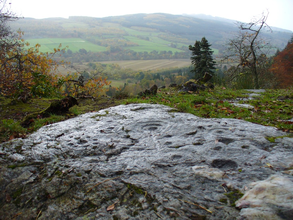
The nearest ‘officially recognised’ cup and ring carvings to the one we’re gonna see here, are those described by Kaledon Naddair (1990) in his brief descriptions of the Glassie Farm carvings a short distance northeast in the same woods. Other than that, I can find no account of the carvings I’m about to describe – other than a couple of short local history walking guides, which tell that one of the carvings here is “modern.” And that much is plainly evident.
Close-up of one section of the main design
There are at least seven carved stones here – all very close to each other on the top of an impressive crag with a large old tree growing out of the edge of the cliff. But the carvings are located on the flat ground above the cliffs and, it would seem, may well be modern. But I thought that since there are no accounts of the site on-line and no remarks in the Canmore registers, they should be mentioned as future students may mistake them as ancient. There is the possibility (unless someone can show us otherwise) that one or two of them are prehistoric, but I think it’s best we surmise that they are all recent additions in the landscape for the time being. And damn good designs they are too!
The triangular rock designs
The first and most notable of the group of seven (at least), is on the large earthfast triangular flat rock, pointing out to the cliff’s edge and the hills across the valley. This is where the greatest cluster of multiple cup-and-rings can be seen. Double- and triple rings surround several of the central cup-markings, with the traditional lines running out from the central cup. There are a great number of single cups scattering the surface; and we also find a typical ‘rosette’ element, comprised of a central cup surrounded by eight singular cups, which some students have interpreted as solar and lunar symbols (amongst other things) when found on other carvings (there is a prehistoric Rosette Stone is known on Ilkley Moor; but similar examples are known in Ireland, Northumberland and elsewhere).
Below this triangular rock (perhaps attached beneath the) is another long piece of earthfast stone, with more carvings on. But when Lindsey Campbell and I came here yesterday, it was obvious that some elements along this section of stone were carved in recent years. Two double-cup-and-rings are at the bottom-left of this section of rock, with a scattering of other cup-marks reaching across its surface. Several of these are obviously quite new.
Another multiple cup-and-ring
The third notable example is to the top-right of the triangular rock. This stone is mainly of quartzite rock, apart from near the top-end, where another multiple cup-and-ring (four, with a possible fifth broken ring fading away) stand out very blatantly. This carving also seems to be not that olde…
From this third quartz carving, look 10 yards (if that!) back towards the trees and there’s a large boulder. On the surface of this is another multiple cup-and-ring that was very obviously new, and several other cup-markings, also quite new. I presume that the other sections carved onto this stone have also been etched by the same modern artists.
Another boulder with new carvings
As I looked back to the main triangular carved stone, I noticed other small pieces of stone peeking up from the ground and, upon closer inspection, found one small rounded triangular piece with another multiple cup-and-ring that just fit onto the rock. And close by this was another long piece of stone which, when I rolled the turf gently back, found three simple cup-markings along the surface.
A seventh carving was found on one of the rocks that is falling slightly down the slope, close to the fourth ‘new’ carving that I described. This was heavily covered in moss and autumn’s fallen leaves, and I wasn’t about to take the moss away just for the sake of my curiosity. But it was obvious that other cup-markings were on the sloping face of this large stone.
We’ll have to venture back here soon and get some better photos and, with any luck, find some old locals who can tell us when the carvings first appeared. It’s quite a superb spot for a bimble, with the healing waters of St. David’s Well and his cave close by—and the woods were, so local legends tell, inhabited by dragons and good heathen creatures in centuries past. But the proximity of the Druid school—formed by the Ionian druids no less—around the 6-7th century, may have thankfully preserved these old tales and relate to some of the many other monuments found in this area. Although some of these carvings (possibly all) are of recent years, this is a gorgeous spot well worth exploring… And if anyone knows precisely when they were done – please let us know!
Legendary Rocks (destroyed): OS Grid Reference – NO 3813 5496
Archaeology & History
Like many rocking stones across the British Isles that were written about by early 18th and 19th century authors, the ones at Kirriemuir have fallen prey to the vandalism of those people (christians, Industrialists and other self-righteous fools) that has so blighted our heritage, and ancestral history, with an intolerance of indigenous beliefs and remarkable geological formations. But, I suppose, at least we have a record of them, which at least in some way gives us the ability to add further our knowledge of the traditional practices of our peasant ancestors and their perception of the landscape.
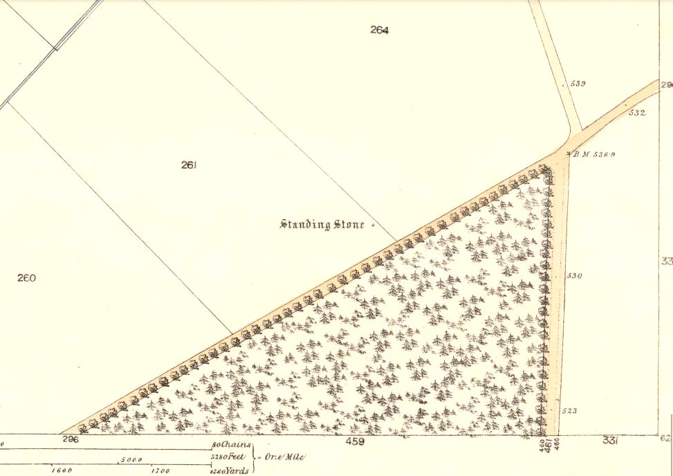
Rocking stones shown on 1865 6-inch OS-mapRocking stones shown on 1865 25-inch OS-map
The exact location of the legendary rocks were highlighted on early Ordnance Survey maps, thankfully; and there were in fact two rocking stones here, very close to each other by the sound of it. Mentioned only in passing by E.S. Valentine (1912), the place was best described in A.J. Warden’s (1884) massive history work on the region. He told that:
“On the top of the Hillhead, Kirriemuir, there were two fine specimens of these interesting memorials, upon which the dwellers in the district looked with wonder and awe. These time honoured monuments of a long past age were, in 1843, blasted with gunpowder, and the shattered pieces used in building dykes and forming drains, to the deep regret of antiquarians, and of the inhabitants of the district. …These stone memorials of a remote age are thus described by the Rev., T. Easton, D.D., in the new Statistical Account of the parish — ‘The one of them is a block of whinstone, nearly oval, and is three feet three inches in height, and four feet ten inches in breadth. The other, of Lintrathen porphyry, is two feet in height, eight feet in length, and five feet in breadth.’ He gives no description of the bases upon which the magic pivots moved, or other details of them.”
About a half-mile east you would have looked across at the large standing stone on Kirriemuir Hill, which legend asserts was once a stone circle (it too, destroyed). If anyone has any further information about these old stones, please let us know…
References:
Valentine, E.S., Forfarshire, Cambridge University Press 1912.
Warden, Alex J., Angus or Forfarshire: The Land and People – Descriptive and Historical – volumes 1 & 4, Charles Alexander: Dundee 1880-1884.
From Kirriemuir centre, take the B956 out of town until you hit the B955. Head north along this road until the houses are behind you. You’ll pass a woodland on your left straight away and as the road starts to bend right, take the first small road on your left. Go along here for about 150 yards and stop. Look into the fields across the road and there it is!
Archaeology & History
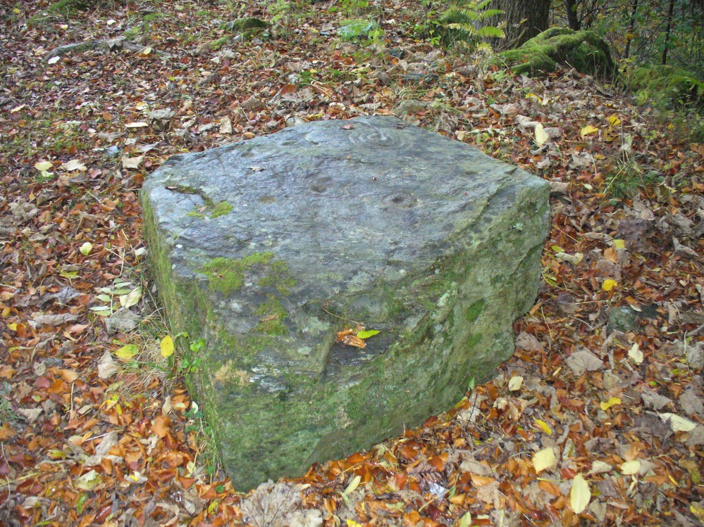
Caddam stone, looking N
The small standing stone we see here today, within in a small fenced enclosure by the wall-side, was highlighted on the 1865 OS-map in exactly this position. However, its earlier history seems much more intriguing – and at least one account tells us how this solitary stone was once part of something much bigger—implying that it was of some considerable important to our ancestors. In A.J. Warden’s (1884) magnum opus on the history of this region he told that,
“A circle of stones was discovered in trenching a field at Caldhame, a little to the north of (Kirriemuir) town. It was over sixty feet in diameter, and in the centre was a large standing stone. The circle was removed, but the centre stone was left.”
Caddam stone, looking SW
Another local writer later reported that there were remains of six stones in the field immediately below the remaining upright, but these have since disappeared. The descriptions seem to imply that the stone was a part of a burial complex of some sort. Sadly, all we see today is this one remaining upright: some 5 feet tall, but looking shorter as it leans to its side, seemingly ready to fall. Do any local people know anything more about this place?
References:
Royal Commission on the Ancient and Historical Monuments of Scotland, The Archaeological Sites & Monuments of Central Angus, Angus District, Tayside Region, HMSO: Edinburgh 1983.
Warden, Alex J., Angus or Forfarshire: The Land and People – Descriptive and Historical – volume 4, Charles Alexander: Dundee 1884.
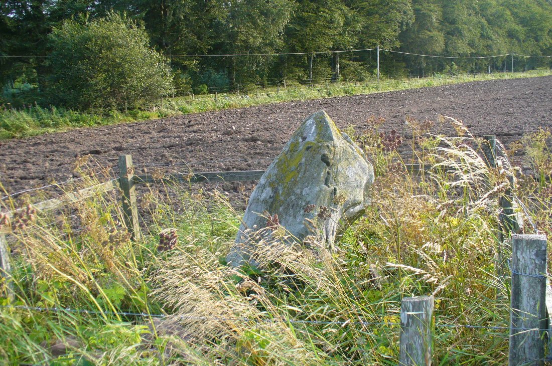
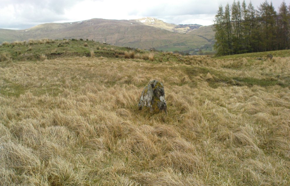
Along the A827 Loch Tay road between Morenish and Lawers, take the track uphill where Carie farmhouse and Tombreck are either side of the road. Walk up this track 2-300 yards till you go through the gate just past the sheep-folds on your left. Ahead of you is a small grassy hillock on your right – go to the top of it, where you’ll find one of them has a row of cup-markings on its northern edge.
Archaeology & History
This is a reasonably large boulder near the top of the hillock above the trackside. Several rocks have what may be single cup-markings on them, but this roughly oblong-shaped block has four or five of them running along the more northern edge of the stone, in a rough line sloping gently down the surface of the rock. No carved rings or other lines were immediately notable here. It’s nothing special to look at and will probably be of interest only to the hardcore petroglyph enthusiasts amongst you. However, there are many more ornate cup-and-rings found further along the ridges close by (which we’ll add as the weeks and months go by); as well as the remains of a prehistoric enclosure about 200 yards southeast. The small standing stone of Carie is roughly the same distance to the south.
Cup-marks visible along the edge…and from above
(Note: although I’ve listed this as the ‘Tombreck 01’ carving, this is likely to be revised in the near future as there is a large gathering of carvings all around this area. The region is still being surveyed and the designations of the petroglyphs will be revised as and when they are recorded more fully, or if/when a detailed published account catalogues them satisfactorily.)
References:
Currie, George, “Kenmore: Tombreck (2-4), Cup-and-ring Marked Rocks,” in Discovery & Excavation in Scotland, New Series volume 10, 2009.
Currie, George, “Kenmore: Tombreck (5-7), Cup-Marked Rocks,” in Discovery & Excavation in Scotland, New Series volume 10, 2009.
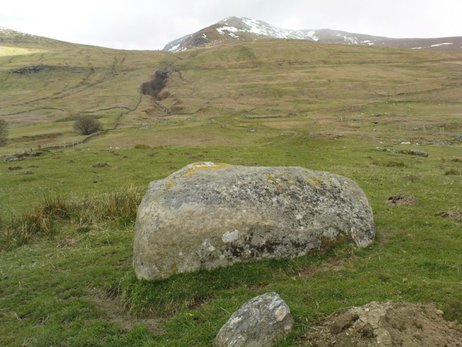
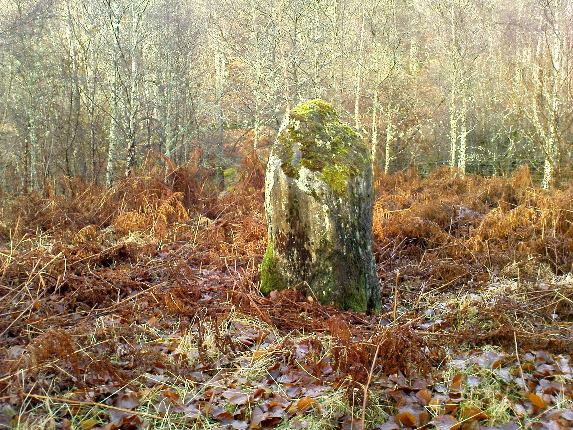
Along the A827 Loch Tay road between Morenish and Lawers, keep your eyes peeled for the Carie farmhouse on the mountain-side of the road (Tombreck is on the other side). The farmer here is very helpful and will let you walk up the land behind his abode if you ask. Go behind the trees round the back of his abode, following the small burn up for a couple of hundred yards until you see the stone in the long grasses on the right. It’s not too difficult to find.
Archaeology & History
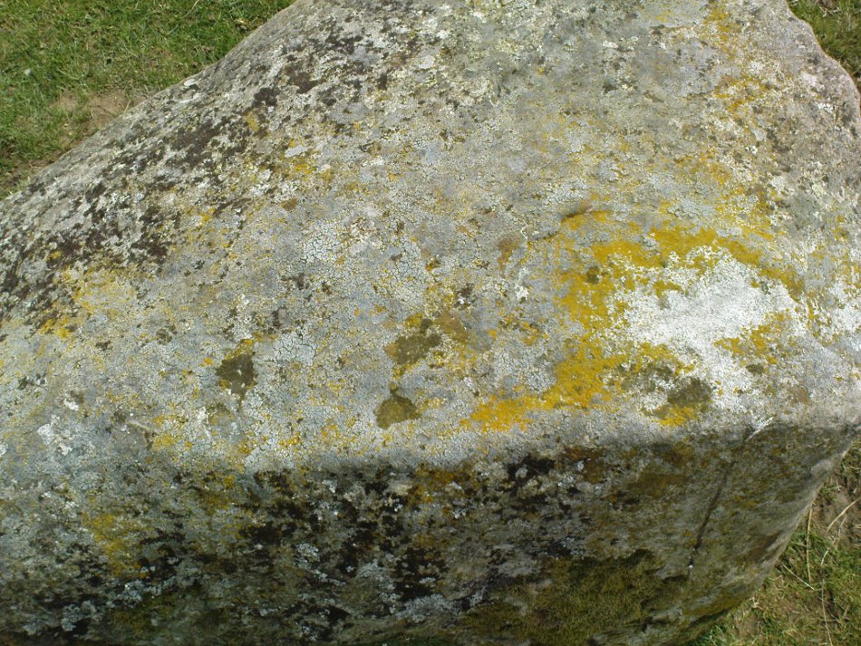
Carie Stone, looking south
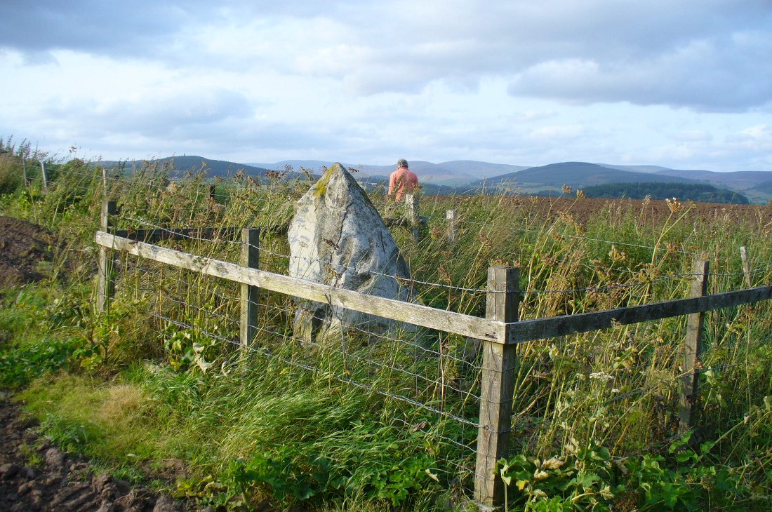
Nothing seems to have been written about this small standing stone, found close to the large cluster of cup-and-ring stones of Ben Lawers. It sits alone in now-boggy ground, in a small dip of land near the stream above Carie Farm. The stone is barely a foot thick, but stands 3½ feet tall and is more than 4 feet wide. Its isolation is curious and makes it difficult to contextualize; but the stone is worth visiting if you’re exploring the rock art on the slopes above.
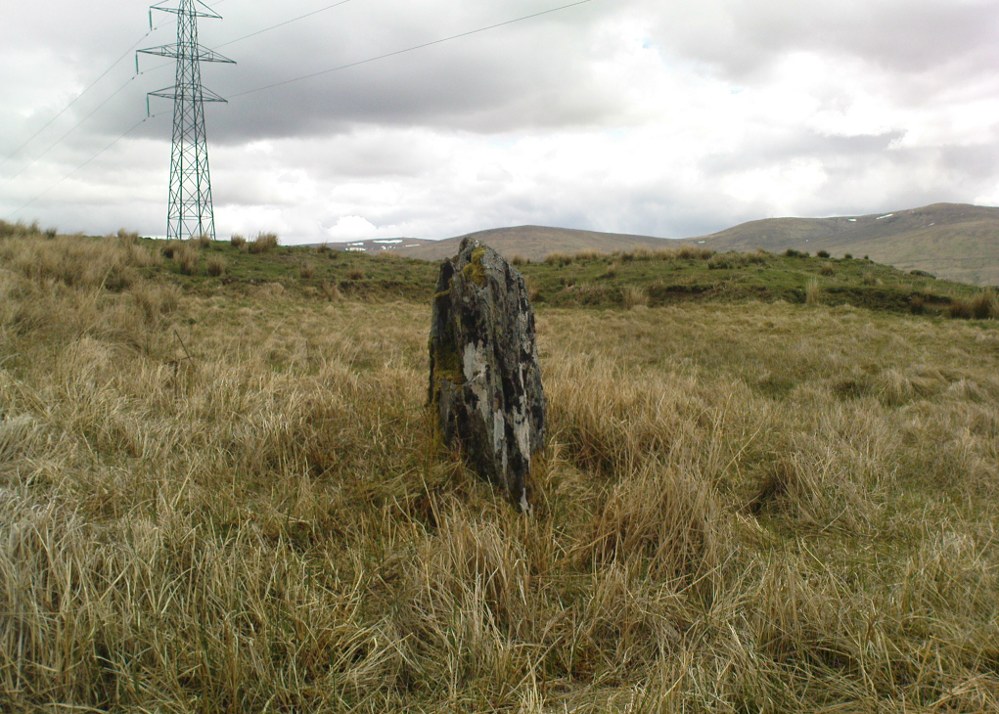
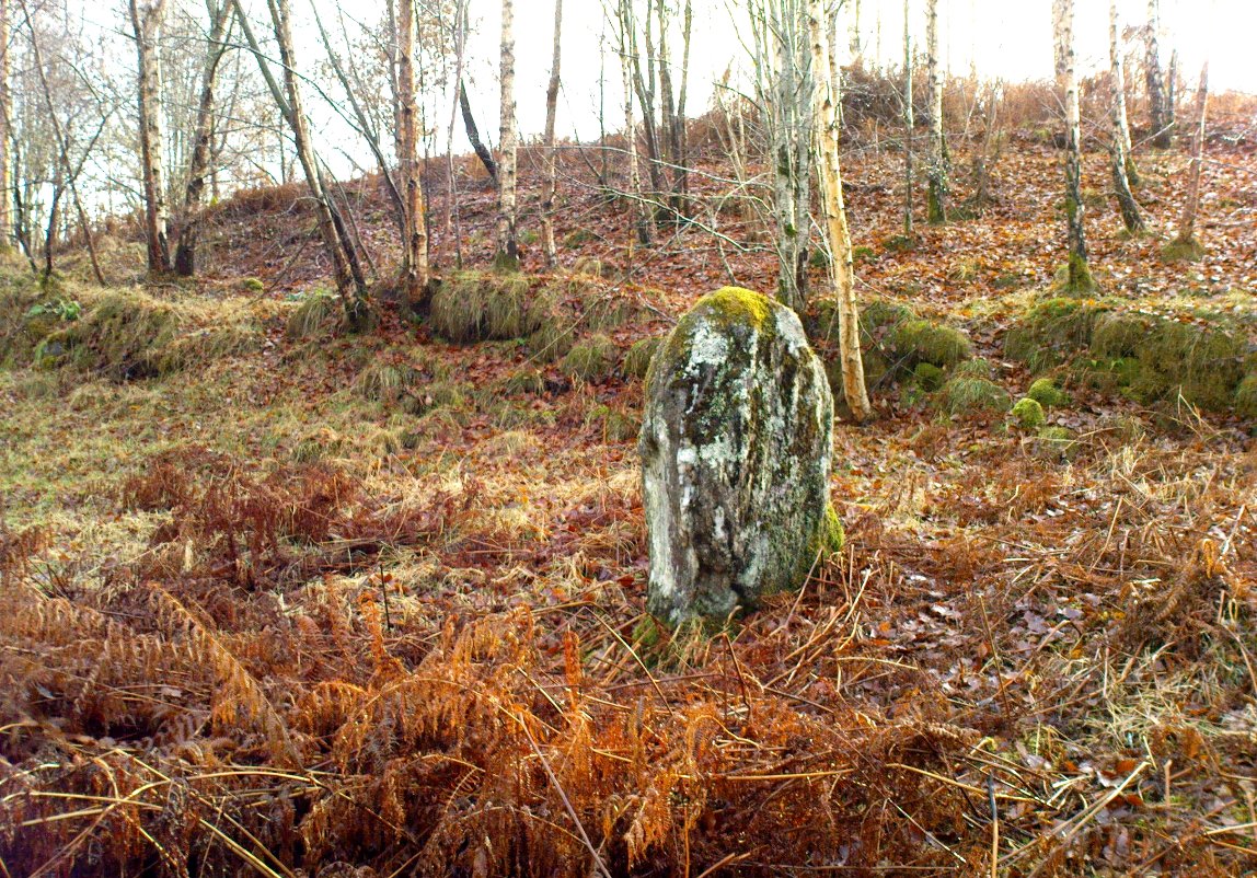
This lovely standing stone can be a pain-in-the arse to get to! Unless you wanna clamber over the excess of increasingly stupid deer fences that are appearing all over the place (old locals aint happy), follow the directions to the Tir Artair cup-marking, then walk across to the fencing and follow it all the way down into the fields until you reach the stream on your right, running in front of the fenced woodland. There’s a large gate here into the trees. Go thru it. In front of you is some overgrown walling into the trees: follow this along, slowly, keeping your eyes peeled for the upright stone about 100 yards in. Good luck!
Archaeology & History
The old mossy stone
In this “land of Arthur”—as the place-name means—we find this beautiful moss and lichen-encrusted standing stone, living alone in remains of mainly birch woodland. It stands less than 5 feet tall, just in front of some old walling encircling one of the many rounded knolls in this area. The stone may have had some megalithic partners in bygone days, as we find, about 25 yards away sleeping amidst overgrown vegetation beside an old oak, a couple of other old stones laid on the ground that seem to have been placed here by human hands. Their antiquarian nature is unknown.
References:
Gillies, William A., In Famed Breadalbane, Munro Press: Perth 1938.
Take the A827 road out of Killin to Fearnan and Kenmore. A mile or so out of Killin, keep going go past the entrance to the Finlarig Power Station for just another 2-300 yards, keeping your eyes peeled for the small track on your right. Go down here. About 100 yards down the track bends, then another 50 yards it bends again – and just here there’s a small clump of trees, right by the bend. You’re looking for the large flat rock therein. You’ll see it!
Archaeology & History
Close-up of cupmark
Although listed by the lads at Canmore, I can find no previous literary reference to this stone — which is a simple thing to be honest: probably of little value to anyone unless you’re a real petroglyph fanatic! The large flat rock has a single large cup-marking on its northern edge, 3 inches across and nearly an inch deep. If you’re gonna visit here, you may as well check out the standing stone further down, in the trees on your right.
Less than 100 yards up the road from the Co-op in Killin, take the footpath on the same side of the road into the park at the back of the buildings. Keep following the footpath round the back of the buildings and you’ll see the stone in front of you soon enough.
Archaeology & History
Another curious site in this quite beautiful mountainous arena. Thought to have originally stood by the rounded fairy knoll a bit further up the hill, no one knows for sure when the stone was moved to its present position—but locals will tell you how the curious knob-end atop of the stone was also a later addition to the fallen original, when it was resurrected in the latter half of the 19th century. C.G. Cash (1912) also found the fairy mound and its companions on the slope above to be of interesting, wondering, as I have, that “they might have been burial mounds.” The local historian William Gillies (1938) said of the stone:
“Both the Old and New Statistical Accounts of the parish of Killin make reference to a site near the village that had been pointed out from time immemorial as the burial place of Fingal, the hero of Celtic folk stories. At this point, which is in the middle of a field immediately behind the schoolhouse, there is a standing stone 2 feet 8 inches high and 5 feet in girth. The stone had fallen, but in 1889 it was re-erected by Mr Malcolm Fergusson, a patriotic native of Breadalbane. Without any reference to the original arrangement, a smaller stone was fixed on the top, and others were placed near it. The lands in the vicinity of Fingal’s Stone used to be called Stix. The name suggests that here, as at Stix between Kenmore and Aberfeldy, there were a number of standing stones, of which this one alone remains.”
And it certainly smells that way… Yet no further monoliths have been found hereby or on the slopes above.
Folklore
Reputed to be a stone that marks the grave of the hero-figure, Fionn. Local historian Duncan Fraser (1973) told that:
“Killin is steeped in history and one of its memorials of the past is a standing stone in a field behind the school, that is said to mark the spot where the mighty Fionn lies buried. He is believed to have died about the end of the Iron Age, in 283 AD.”
Gazing N, to the Cailleach
William Gillies (1938) also reported how tradition said that an early church and graveyard was once to be found at the original site of Fingal’s Stone. Legends of Finn, his magick and his encounters with both faerie and men are found all over the landscape in this neck o’ the woods….
References:
Cash, C.G., “Archaeological Gleanings from Killin,” in Proceedings of the Society of Antiquaries of Scotland, volume 46, 1911-12.
Fraser, Duncan, Highland Perthshire, Standard Press: Montrose 1973.
Gillies, William A., In Famed Breadalbane, Munro Press: Perth 1938.
Wheater, Hilary, Killin to Glencoe, Appin Publications: Aberfeldy 1982.
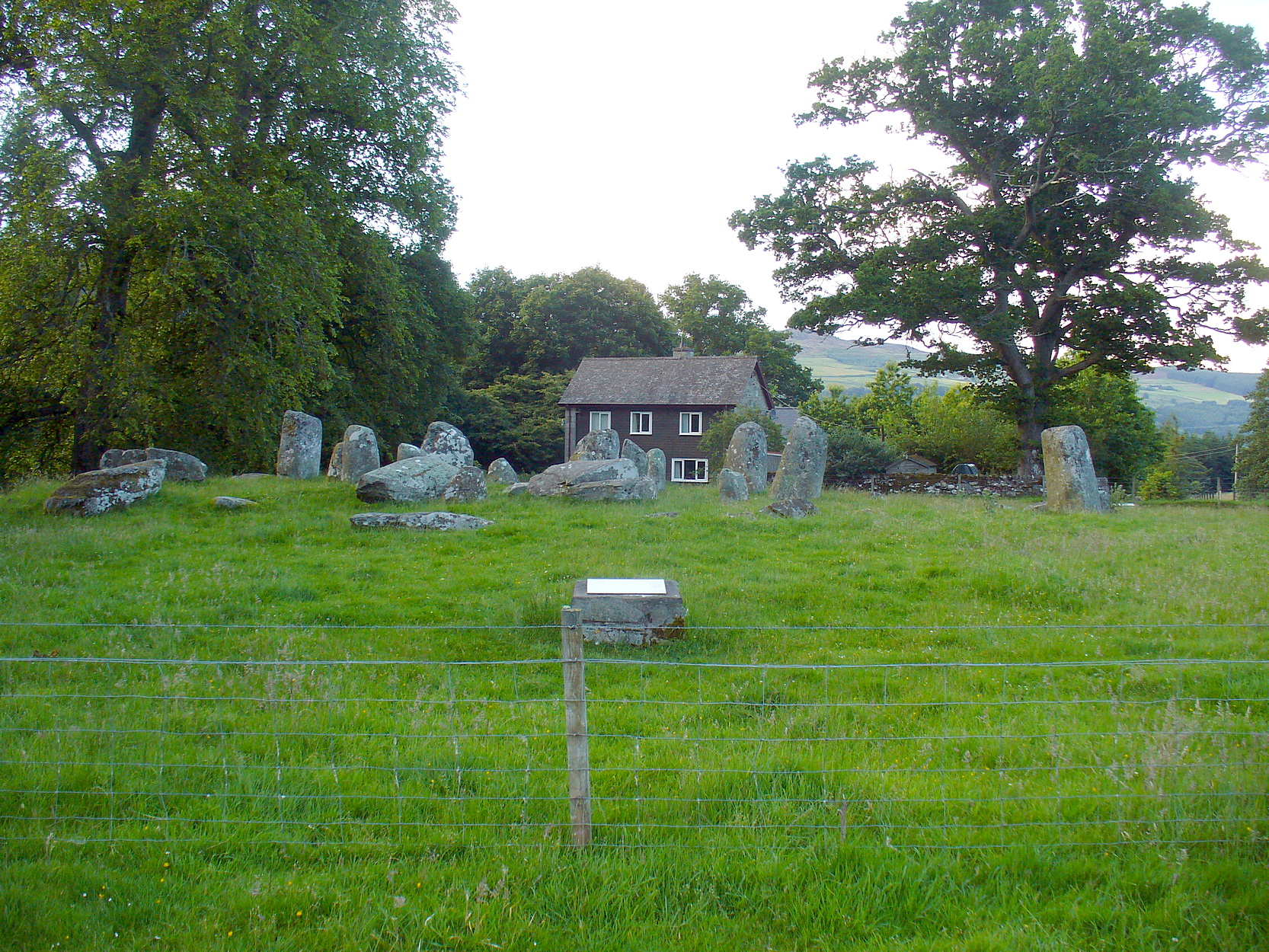
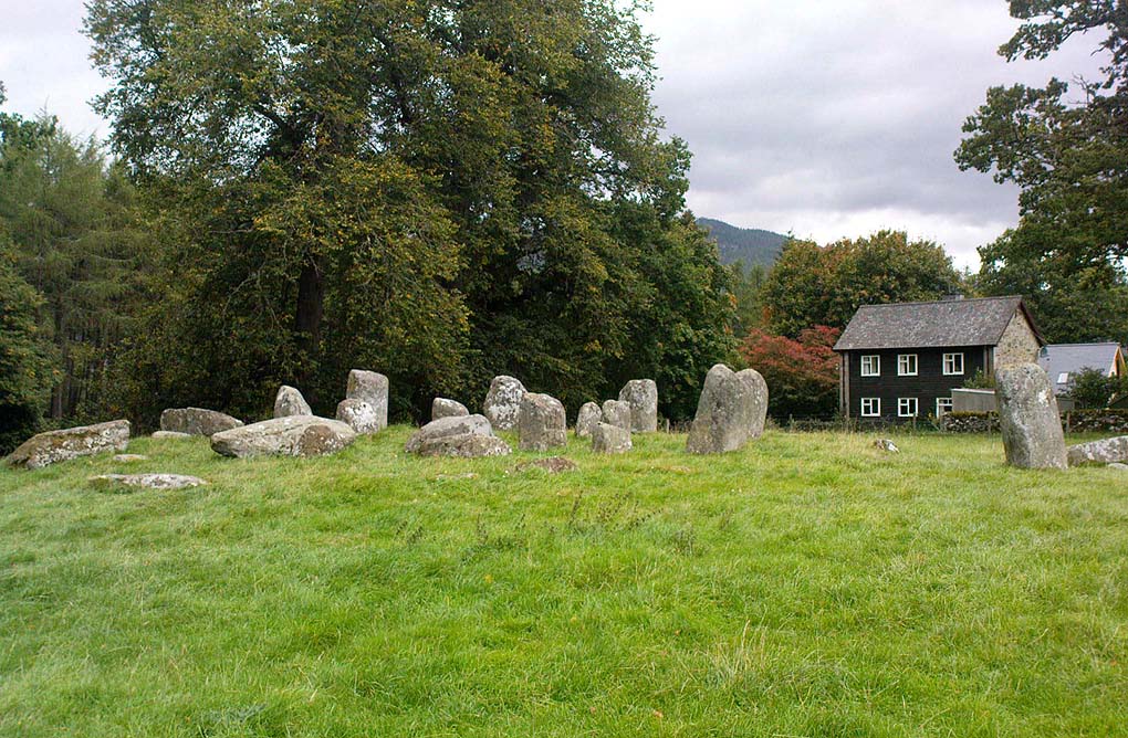
Take the A827 road that runs from Kenmore (top-end of Loch Tay) to Aberfeldy, and about 2 miles outside Kenmore, once you come out of the woodland (past the hidden standing stones of Newhall Bridge) and the fields begin on the east-side of the road, a small dirt-track leads you slightly uphill to the farm and house of Croftmoraig. The stone circle is right in front of the house less than 100 yards up the track (you can see it from the road).
Archaeology & History
A truly fascinating site, whose history is much richer than its mere appearance suggests. It has mythic associations with both moon and sun, a cup-marked stone to the southwest, and an earlier structure that had Aubrey Burl (1979) suggesting was possibly “the dwelling-place of a priest, a witch-doctor, a shaman.” Not bad at all!
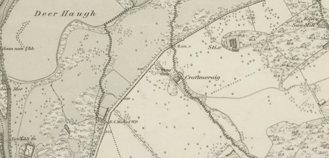
Croft Moraig on 1867 map
The sad thing today is its proximity to the increasingly noisy road to Aberfedly whose begoggled drivers care little for the spirit of place or stones. Here sits a feel of isolation and tranquility broken. But at least the cold information of its architecture is available for tourists and archaeologists alike; at least their depersonalized appreciations are served!
Described first of all (I think) in the old Statistical Account by Colin MacVean (1796), he told Croft Moraig to be one of “several druidical temples” in the area, “perhaps the largest and most entire of any in Scotland,” he thought:
“It is about 60 yards in circumference, and consists of three concentric circles. The stones in the outermost (ring) are not so large as those in the inner circles, and are not, like them, set on end.”
Hutcheson’s 1889 planCroft Moraig, looking N
The first decent archaeocentric evaluation of Croft Moraig was done in the 19th century by Alexander Hutcheson (1889), who gave us not only the first decent ground-plan of the site, but was also the first person to note that there were some faded cup-and-ring markings at the circle. After first directing his antiquarian readers to the site, he described the multiple rings of stones here, that had been built on top of an artificial platform of earth and stones:
“The circles are concentric, three in number, and occupy a little plateau which may be artificial, as the outer circle just covers it, on the gentle slope which here rises towards the south from the public road.
“I have prepared and exhibit a plan of the circles, and for reference have distinguished the stones by numbering them in the plan. The inner circle consists of eight stones all standing, with one exception, No. 3, which presumably has fallen inwards. The next or second circle consists of thirteen much larger stones, nine of which stand erect; Nos. 3 and 5 have presumably fallen in, while Nos. 7 and 9 have fallen outwards. The outer circle is formed by a number of smaller stones placed so as to form a sort of rampart. These are recumbent, and lie generally with their larger axes in the direction of the rampart. The circle measures, over the stones, as follows:
“Inner circle, West to East, 25 ft. 6 ins., North to South, 22 ft. 6 ins.
“Second circle, West to East, 40 ft North to South, 41ft 3in
“Outer circle, West to East, 58 ft North to South, 58ft
The stones are all rounded or water-worn boulders of dolerite, granite, schist, &c. The stones marked A and B are large blocks, 6 feet 6 inches high, 4 feet broad, and 2 feet 6 inches thick, standing upright. C seems to be a large (section) which has fallen from B, and lies flat on the ground.
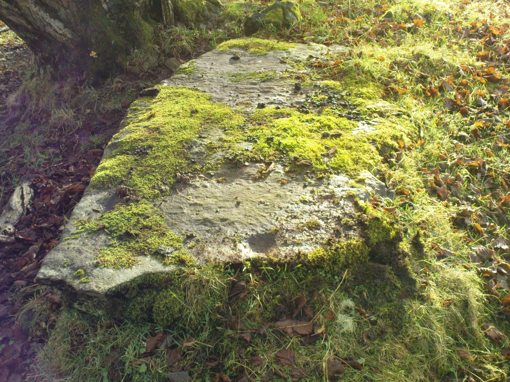
“At the south-west side and in the line of the outer circle lies the cupmarked stone… If, as has been suggested, the two large blocks A and B formed the entrance to the circles, then the entrance faced towards the south-east. The blocks vary in height from 3 feet to 7 feet above ground, while of those which I have supposed to have fallen, their dimensions are, naturally from the ground-hold having to be added, much greater, amounting in one of them to 9 feet 6 inches long. There is a longish low mound of small stones, like an elongated cairn, which might yield something if it were to be searched. It lies just abreast of the cup-marked stone. I have referred to the recumbent stones in the two inner circles as having probably stood at one time erect. This I have presumed for several reasons, the principal being that one end of each of these stones corresponds in position with the circle formed by the standing stones; and while this is the case the recumbent stones do not preserve a uniformity of direction, but lie indifferently outwards and inwards from the lines of circularity, and at differing angles from these lines…”
Fred Coles’ site planOne of the cup-marked stones
Some twenty years later, the legendary northern antiquarian Fred Coles (1910) brought his lucidity to Croft Moraig and with it, even greater attention to detail. In a lengthy description of each and every aspect of the circle that has yet to be equalled he gave the reader the most detailed description we have. I hope you’ll forgive me adding Mr Coles’ prolonged description, but it is most valuable for anyone wanting to explore the site in greater detail. He wrote:
“As will be seen from the plan…the structural portion of Croft Morag consists, first, of a roughly circular, earthen mound (lettered in small type a-t), some 3 feet high, which is marked off by several stones of a more or less slab-like character, set irregularly upon a circumference of, approximately, 185 feet. This outermost setting, or revetment of stones is visible now only at certain fragments of the arcs; i.e., it is well-defined on the SW at a, where a long Stone, 6 feet 5 inches by 2 feet lies flat, and bears numerous cup-marks…; on the S arc there are five small Stones (b, c, d, e, f) all earthfast and flattish; on the SE are three similar Stones (g, h, i); on the E arc, four (j, k, l, m); on the N arc, very slightly to the west, one very large Stone (n) flush with the ground at the edge of the bank and a good deal overgrown with grass, measuring 8 feet 6 inches by 3 feet 3 inches; farther to the NW are five stones more (o, p, q, r, s), the last three having only very small portions visible; and, still farther round, is the last of what I consider to be these ridge-slabs (t) close under the edge of the great fallen sloping stone D. Thus the total number of measurable and separate stones now resting on the outermost ring is twenty.
“The stones of the intermediate ring constitute the imposing feature of the circle. They are thirteen in total number in the present condition of the circle, but they probably numbered eighteen when the circle was complete. Nine of them are the tallest in the whole group; four of these are prostrate on the W arc. By striking a radius from the common centre of the circle through the centres of these great stones which are erect, to the outermost circumference, the following measures are obtained: from centre of E, the NNW stone, to the ridge 14 feet 6 inches; from F, NNE stone to the ridge 13 feet 4 inches; from G to ridge 14 feet 4 inches; from H to ridge 13 feet 4 inches; and from I, the SE stone, only 10 feet 6 inches. The four fallen blocks, lying as shown A, B, C, D, no doubt stood on this intermediate ring, the diameter of which measured from centre to centre is 38 feet. Now, it must be observed that between A and B and A and I there are Stones (shaded in the plan); these two are erect, the one near B measuring 3 feet in length, 2 feet in breadth, and 3 feet 4 inches in height; it is quite vertical, and is undoubtedly in situ. The other small erect Stone midway between A and I has much the same size’ and features. Between B and C there is shown in outline another of these small stones ‘in line’ with the great pillars which remain on the E arc; and it is quite clear that if this remarkable and novel feature of alternating each tall stone with a very small but vertical block was originally carried out all round this intermediate ring, there would have been eighteen stones in all. Without the most arduous and careful excavation in these interspaces however, it would be extremely difficult, if not impossible, to prove that these small blocks did once stand on the eastern semicircle.
“As illustrating the general size of the great stones, when fully exposed to view, the dimensions of the four fallen blocks are here given: A, 7 feet 7 inches by 4 feet 10 inches, and fully 2 feet thick; B, 9 feet 2 inches by 3 feet 9 inches (on the upper face), and 2 feet 9 inches thick; C, 8 feet by 4 feet, and 3 feet fi inches thick; D, 7 feet by 4 feet 6 inches, and 3 feet thick at its vertical outer edge.
“The five upright stones of the intermediate ring measure as follows: I, the SE stone, 5 feet 6 inches in height, and in girth 11 feet; H, the east stone, 5 feet 8 inches in height, pyramidal in contour, and in girth 11 feet 4 inches; G, the NE stone, 5 feet 3 inches in height and 11 feet in girth; the next stone, F, 5 feet 7½ inches in height and 13 feet 6 inches in girth; and stone E, nearest to the north on the W arc, stands 6 feet 3 inches in height and measures round the base 9 feet 3 inches.
“The stones forming the inner ring, which is a broad oval in form, are eight in number, quite erect, with one exception; the fallen one (shown in outline) is due south of one set at the north point and the distance between these two is 23 feet 8 inches. If however, the distance between the N Stone and the E one at the SSE be taken, this diameter is 26 feet, as against one of 21 feet taken between the NW and SE stones. Measured from the centre of the fallen stone a space of 10 feet 3 inches divides that from the centre of the erect stone on the east, and an equal space divides it from the centre of the stone on the west. Between the N stone and that on its southwest an equal space of 11 feet 3 inches exists as between that stone and its SE stone; but between these last two there is a third almost exactly midway. The fallen stone measures 5 feet 10 inches by 3 feet 9 inches; the NW stone is 4 feet 6 inches in height, the SW stone 3 feet 6 inches, the N stone 3 feet 4 inches, the NE one 2 feet 6 inches, and the stone between it and the fallen block 3 feet 4 inches in height.
“In addition to the feature above noticed, of tall stones alternating with much smaller ones, Croft Morag possesses another noticeable arrangement in the presence of two great massive monoliths (U and V on the plan) standing like the remains of a portal, nearly eight feet outside of the boundary ridge on the SE. Neither of these stones is now absolutely vertical, stone U leaning considerably out towards the SE, and V having a very slight lean inwards to the circle. The former is 6 feet 2 inches in vertical height with a basal girth of nearly 12 feet, which is probably an under-estimate, for there are two large fragments (w and x) which appear to have been severed from this stone, the edges of which nearest the fragments are rough and sharp. The latter (V) stands 6 feet 4 inches in height and girths 11 feet 8 inches…
“…Besides its complexity of arrangement and the great number of measurable stones, forty-two in all, this circle is emphasised by the existence of a cup-marked stone set in a portion of its structure…on the SW arc… There are nineteen cups in all, only two of which differ much in diameter and depth from the rest, and there does not appear to be anything in their design to suggest a meaning or lend a clue to their symbolism.”
When the monument was excavated by Stuart Piggott and his mates in 1965, it was found to have been built over many centuries. As Aubrey Burl told:
“The first phase, of the late neolithic, consisted of about 14 heavy posts arranged in a horseshoe shape about 25ft 10in x 22ft 10in (7.9 x 7m) with a natural boulder at its centre. Burnt bone was found near this. Outside was a surrounding ditch and at the E was an entrance composed of 2 short rows of posts.
“In the second phase the timbers were replaced by 8 stones graded in height towards the SSW, also erected in a horseshoe 29ft 10 x 21ft (9.1 x 6.4m). A rubble bank was heaped up around it. On it at the SSW was a prostate stone with over 20 cupmarks carved on it. Other cupmarks were ground into the NE stone.
“Finally a circle of 12 stones, about 40ft (12.2m) is diameter, was erected around the megalithic horseshoe with a pair of stones forming an entrance at the ESE. Graves may have been dug at their bases later.”
Fred Coles mentioned a couple of other local names given to the site, one of which – Mary’s Croft – he thought may point “to a dedication to the Virgin.” Another curious place-name next to the site is called Styx,
“which appears to be the modern abbreviated form of the Gaelic word stuicnean. This, Mr Dugald McEwan affirms, meant ground full of overturned forest-trees; and it is therefore probable that in the remote past all the land surrounding the Stone Circle was a deep forest, and perhaps because of its seclusion, this site was selected as the most fitting for the erection of the principal Circle of the district.”
Alex Thom’s ground-plan
When the engineer and archaeoastronomer Alexander Thom (1967) came to examine Croft Moraig, he found the outlying stones to the southeast could have been solar alignment indicators, albeit poor ones. However, the geometric structure of the ring appeared to further confirm the use of his Megalithic Yard by those who built the circle. Thom’s illustration shows his finding, which he described briefly as follows:
“Two concentric circle and an ellipse. The circle diameters drawn are obviously too large and could be as small as 58.5ft outer circle and 41.0ft inner. Outer circle diameter58.5ft = 21.5 MY. Perimeter 67.5 MY = 27 MR. Inner circle diameter 41.0ft = 15.1 MY. Perimeter 47.3 MY = 18.9 MR. Ellipse drawn has major axis 11 MY, minor axis 8 MY, distance between foci is 7.5 MY. Perimeter is 30.0 MY = 12 MR. This ellipse looks slightly large but the triangle on which it is based and the perimeter are almost perfect.”
Folklore
Old lore told that the standing stones of Newhall Bridge 850 yards away (777m) were once connected with the Croft Moraig circle. William Gillies (1938) told this tradition saying,
“that at one time there was a paved way connecting the circle, of which these stones are the remains, with the great Croftmoraig circle.”
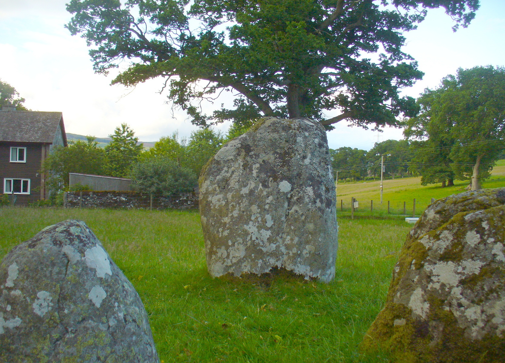
Croft Moraig, looking W
Fred Coles also noted that one of the stones in the circle (stone D in his plan) had “been polished by the sliding of generations of children”. This playful action on stones elsewhere in the UK and around the world sometimes relates to fertility rites (i.e., the spirit of the stone could imbue increased fertility upon the practitioner), but Coles made no mention of such rituals here.
References:
Burl, Aubrey, Rings of Stone, Frances Lincoln: London 1979.
Burl, Aubrey, The Stone Circles of Britain, Ireland and Brittany, Yale University Press 2000.


sm")
sm")
")
